Marazion

Civil Parish in Cornwall

England

Marazion

Rocks in Trenow Cove, looking south
Rocks in Trenow Cove, looking south Credit: David Medcalf

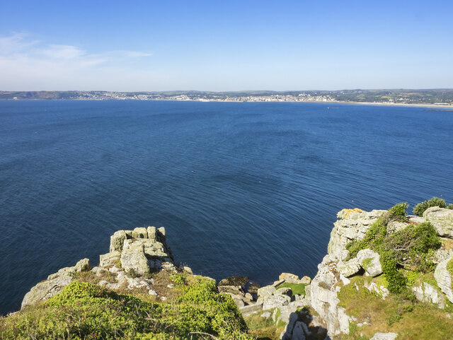
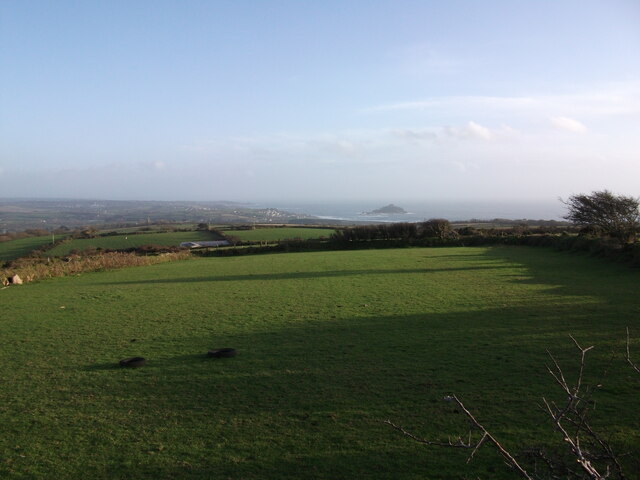
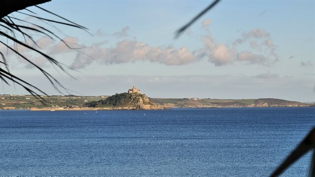
Marazion is a civil parish located in the county of Cornwall, England. Situated on the southern coast of Cornwall, it is a small town that boasts stunning views of St Michael's Mount, a famous tidal island. The town is about 3 miles east of Penzance and has a population of around 1,500 residents.

Marazion is known for its picturesque charm and its rich history. It is believed to have been inhabited since the Bronze Age, with evidence of Roman and medieval settlements in the area. The town's name is derived from the Cornish language, meaning "little market." Today, Marazion is a popular tourist destination, attracting visitors from all over the world.

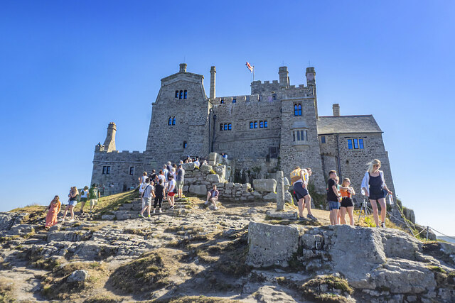
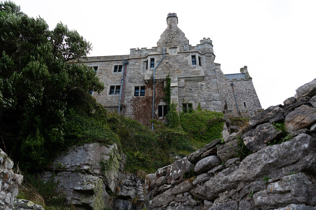
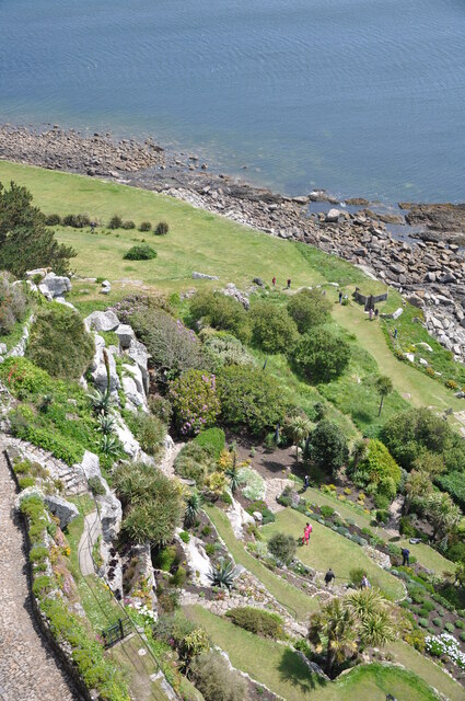
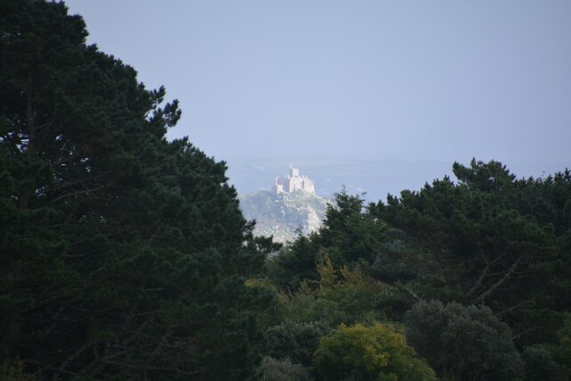
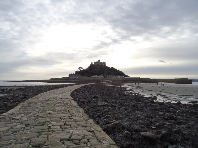
One of the main attractions in Marazion is St Michael's Mount. This iconic island is home to a medieval castle and a small community of residents. During low tide, visitors can walk across the causeway to explore the island, and during high tide, boats are available to transport people to and from the island.

Marazion also offers a beautiful sandy beach, perfect for swimming, sunbathing, and enjoying various water sports. The town itself has a range of shops, cafes, and restaurants, providing visitors with a variety of options for shopping and dining.

In addition to its natural beauty, Marazion hosts various events throughout the year, including the Marazion Carnival and the Marazion Christmas Lights Switch-On. These events contribute to the vibrant spirit of the town and offer entertainment for both residents and visitors.

Overall, Marazion is a charming coastal town in Cornwall, offering a combination of natural beauty, rich history, and a warm community atmosphere.

If you have any feedback on the listing, please let us know in the comments section below.
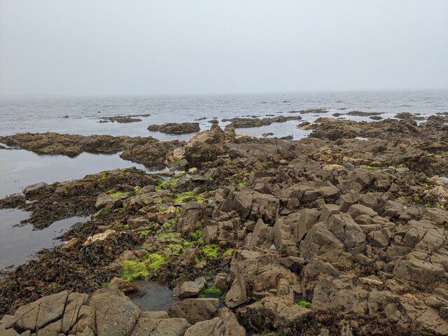
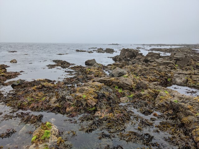
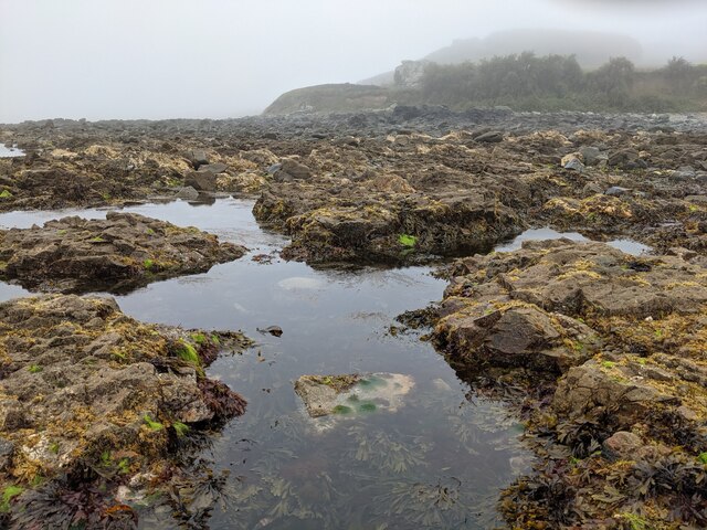
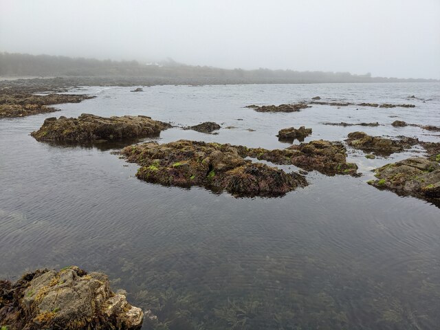
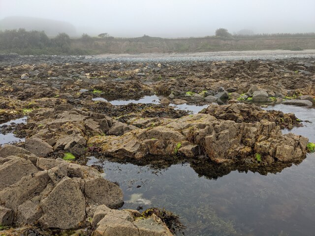
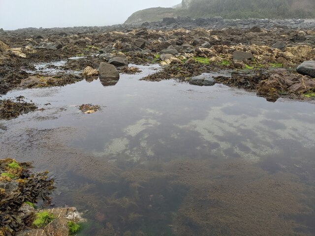
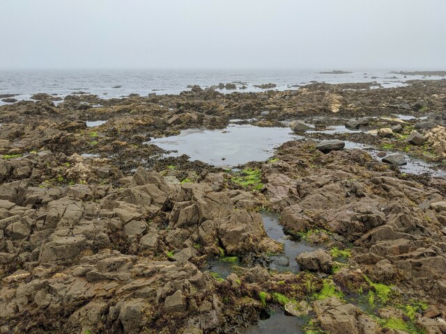
Marazion Images

Images are sourced within 2km of 50.127352/-5.465457 or Grid Reference SW5231. Thanks to Geograph Open Source API. All images are credited.

Rocks in Trenow Cove, looking south
Rocks at Trenow Cove, looking west St Michael's Mount is lost in the mist.
Rocks at Trenow Cove, looking west
St Michael's Mount is lost in the mist.
A great place for rock pooling As long as you watch for the incoming tide!
A great place for rock pooling
As long as you watch for the incoming tide!
The edge of the rock shelf in Trenow Cove
Rock pools and seaweed
Rocks, weed and clear water
Low tide in Trenow Cove
St Michael's Mount Morning visitors gather at the west entrance to the castle on the last warm day of summer 2021.
St Michael's Mount
Morning visitors gather at the west entrance to the castle on the last warm day of summer 2021.
Rocky cliff top View west from below the castle entrance.
Penzance in the distance.
Rocky cliff top
View west from below the castle entrance. Penzance in the distance.
Terrace garden, St Michael's Mount The garden which was designed in 1878 for Sir John St Aubyn.
Terrace garden, St Michael's Mount
The garden which was designed in 1878 for Sir John St Aubyn.
Rocky foreshore, St Michael's Mount
View to St. Michael's Mount from Quarry Hill A view over Mounts Bay to St. Michaels Mount from the junction of Quarry Hill and the B3311 above Penzance.
View to St. Michael's Mount from Quarry Hill
A view over Mounts Bay to St. Michaels Mount from the junction of Quarry Hill and the B3311 above Penzance.
Castle of St Michael's Mount viewed from footpath below
Perranuthnoe, St Michael & St Piran
The gardens at St. Michael's Mount
St Michael's Mount From Penzance
St Michael's Mount
From Penzance
Madron : St Michael's Mount From Trengwaiton Estate looking across to St Michael's Mount.
Madron : St Michael's Mount
From Trengwaiton Estate looking across to St Michael's Mount.
St Michael's Mount Seen across the causeway which is available when the tide is low.
St Michael's Mount
Seen across the causeway which is available when the tide is low.
Show me another place!

Marazion is located at Grid Ref: SW5231 (Lat: 50.127352, Lng: -5.465457)

Unitary Authority: Cornwall

Police Authority: Devon & Cornwall

What 3 Words

///revives.pots.verb. Near Marazion, Cornwall

Nearby Locations

Gwallon Marazion

Related Wikis

Mount Haven Hotel

Mount Haven Hotel is a hotel near the coast on the eastern side of the town of Marazion, Cornwall, England, UK, several miles east of Penzance. It is next...
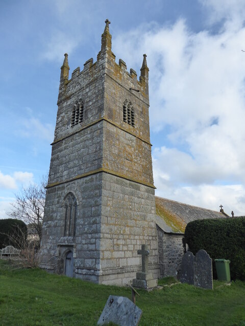
Marazion Town Hall

Marazion Town Hall is a municipal building in the Market Place, Marazion, Cornwall, England. The town hall, which is currently used as a museum, is a Grade...

Marazion Marsh

Marazion Marsh is a Royal Society for the Protection of Birds (RSPB) reserve situated in a shallow river valley, half a kilometre to the west of Marazion...

Marazion

Marazion (; Cornish: Marhasyow) is a civil parish and town, on the shore of Mount's Bay in Cornwall, England, United Kingdom. It is 2 miles (3.2 km) east...

Gwallon

Gwallon is a hamlet in the parish of Marazion, Cornwall, England. It is in the civil parish of St Hilary. == References ==

Red River (Amal)

The Red River (Cornish: Dowr Amal, meaning boundary river) which discharges into the sea to the west of Marazion is one of two watercourses in Cornwall...

St Michael's Mount Tramway

The St Michael's Mount Tramway runs from near the harbour up to the castle which dominates the tidal island of St Michael's Mount, in Cornwall, England...
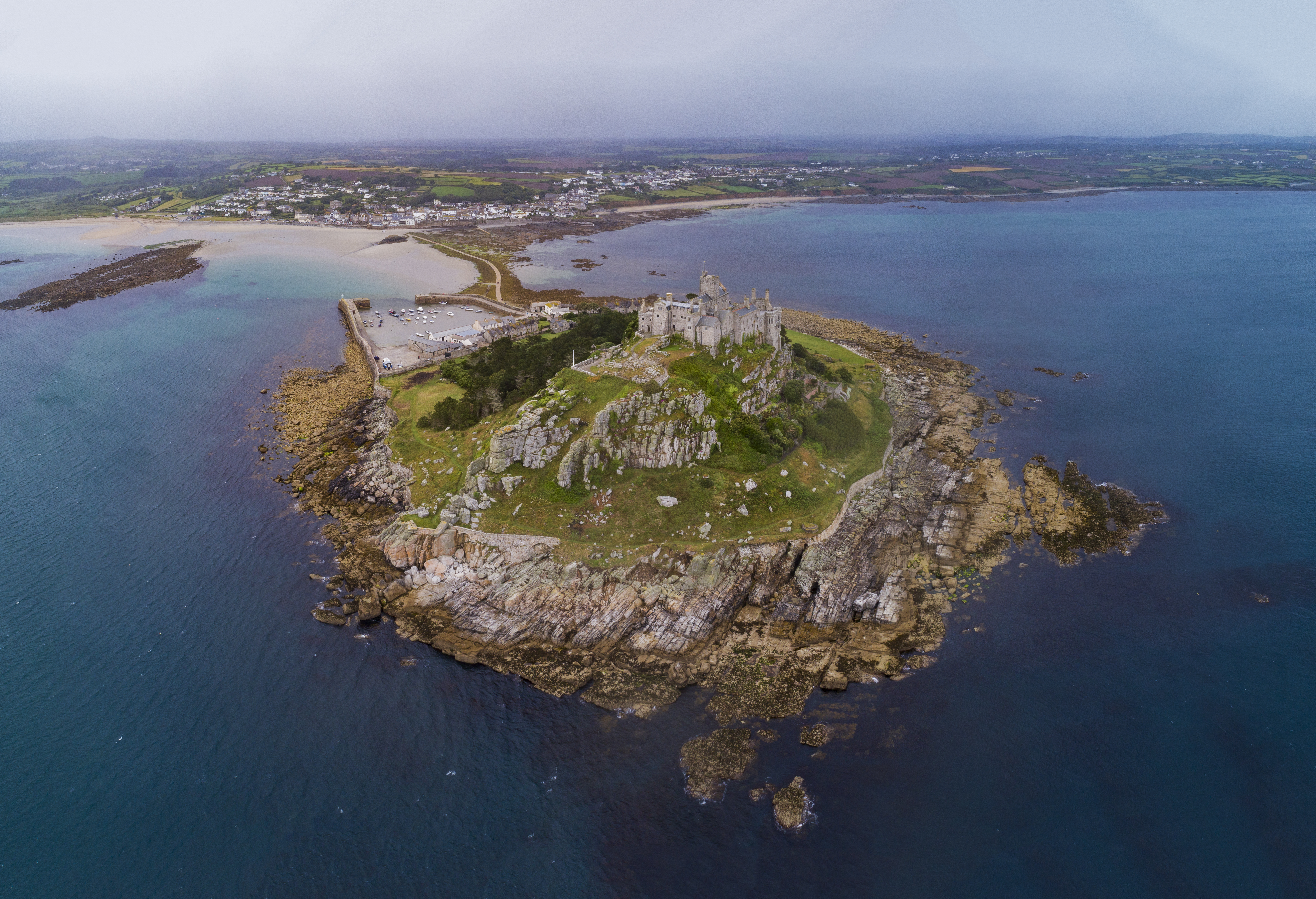
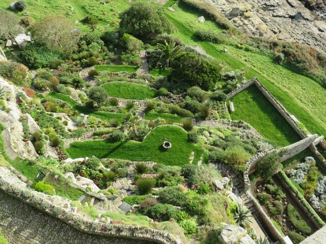
St Michael's Mount

St Michael's Mount (Cornish: Karrek Loos yn Koos, meaning "hoar rock in woodland") is a tidal island in Mount's Bay, Cornwall, England, United Kingdom...

Nearby Amenities

Located within 500m of 50.127352,-5.465457
Post Box
Collection Times: Mo-Fr 09:00; Sa 07:00; Su off
Operator: Royal Mail
Operator Wikidata: Q638098
Post Box Design: 2010_pattern
Post Box Mounting: pier
Post Box Type: lamp
Ref: TR17 29D
Royal Cypher: EIIR
Royal Cypher Wikidata: Q33102113
Source: survey;aerial imagery
Survey Date: 2015-09-30
Lat/Long: 50.1256656/-5.4637745
Telephone
Booth: K6
Covered: booth
Lat/Long: 50.1256138/-5.4635733
Pub
Fire Engine Inn
Addr City: Marazion
Addr Country: GB
Addr Housename: Fire Engine Inn
Addr Postcode: TR17 0BB
Addr Street: Higher Fore Street
Fhrs Id: 996773
Lat/Long: 50.1250596/-5.4640926
Bus Stop
Silverhouse
Bench: yes
Bus: yes
Naptan AtcoCode: 0800COD40552
Naptan Bearing: W
Naptan CommonName: Silverhouse
Naptan NaptanCode: coragjtj
Naptan PlusbusZoneRef: PENZNCE
Naptan Street: Higher Fore Street
Naptan Verified: yes
Public Transport: platform
Shelter: yes
Source: naptan_import;survey
Lat/Long: 50.1250196/-5.4657579
Bus Stop
Silverhouse
Bench: no
Bus: yes
Naptan AtcoCode: 0800COD40554
Naptan Bearing: E
Naptan CommonName: Silverhouse
Naptan NaptanCode: coragjtm
Naptan PlusbusZoneRef: PENZNCE
Naptan Street: Higher Fore Street
Naptan Verified: no
Public Transport: platform
Shelter: no
Source: naptan_import
Lat/Long: 50.1250552/-5.4656967
Bus Stop
Chymorvah
Bench: yes
Bin: no
Bus: yes
Lit: yes
Naptan AtcoCode: 0800COD40555
Naptan Bearing: NW
Naptan CommonName: Chymorvah
Naptan Crossing: Shop Hill
Naptan NaptanCode: coragmap
Naptan PlusbusZoneRef: PENZNCE
Naptan Street: St Levan Road
Naptan Verified: no
Public Transport: platform
Shelter: no
Source: naptan_import
Tactile Paving: no
Lat/Long: 50.1247678/-5.4626672
Bus Stop
Chymorvah
Bench: yes
Bus: yes
Naptan AtcoCode: 0800COD40556
Naptan Bearing: NW
Naptan CommonName: Chymorvah
Naptan Crossing: Shop Hill
Naptan NaptanCode: coragmag
Naptan PlusbusZoneRef: PENZNCE
Naptan Street: St Levan Road
Naptan Verified: no
Public Transport: platform
Shelter: yes
Source: naptan_import
Lat/Long: 50.1248148/-5.4632024
Bus Stop
Trevenner Square
Bus: yes
Naptan AtcoCode: 0800COD40557
Naptan Bearing: E
Naptan CommonName: Trevenner Square
Naptan Crossing: Shop Hill
Naptan NaptanCode: coragjwp
Naptan PlusbusZoneRef: PENZNCE
Naptan Street: Trevenner Square
Naptan Verified: no
Public Transport: platform
Source: naptan_import
Lat/Long: 50.1255892/-5.4634822
Bus Stop
Trevenner Square
Bus: yes
Naptan AtcoCode: 0800COD40558
Naptan Bearing: W
Naptan CommonName: Trevenner Square
Naptan Crossing: Shop Hill
Naptan NaptanCode: coragmad
Naptan PlusbusZoneRef: PENZNCE
Naptan Street: Trevenner Square
Naptan Verified: no
Public Transport: platform
Source: naptan_import
Lat/Long: 50.1255182/-5.4634491
Bus Stop
Wheal Rodney
Bus: yes
Naptan AtcoCode: 0800COX38444
Naptan Bearing: S
Naptan CommonName: Wheal Rodney
Naptan NaptanCode: coragjwm
Naptan PlusbusZoneRef: PENZNCE
Naptan Street: Gwallon Lane
Naptan Verified: no
Public Transport: platform
Source: naptan_import
Lat/Long: 50.1296727/-5.4638193
Bus Stop
Marazion Surgery
Bus: yes
Naptan AtcoCode: 0800COX38445
Naptan Bearing: S
Naptan CommonName: Marazion Surgery
Naptan Crossing: Trevenner Square
Naptan NaptanCode: coragjwj
Naptan PlusbusZoneRef: PENZNCE
Naptan Street: Gwallon Lane
Naptan Verified: no
Public Transport: platform
Source: naptan_import
Lat/Long: 50.1268619/-5.4636442
Bus Stop
Surgery
Bus: yes
Naptan AtcoCode: 0800COX38448
Naptan Bearing: N
Naptan CommonName: Surgery
Naptan Crossing: Trevenner Square
Naptan Indicator: Opp
Naptan NaptanCode: coragjwa
Naptan PlusbusZoneRef: PENZNCE
Naptan Street: Gwallon Lane
Naptan Verified: no
Public Transport: platform
Source: naptan_import
Lat/Long: 50.1268675/-5.4637565
Bus Stop
Wheal Rodney
Bus: yes
Naptan AtcoCode: 0800COY38590
Naptan Bearing: N
Naptan CommonName: Wheal Rodney
Naptan NaptanCode: coragjwg
Naptan PlusbusZoneRef: PENZNCE
Naptan Street: Gwallon Lane
Naptan Verified: no
Public Transport: platform
Source: naptan_import
Lat/Long: 50.1305647/-5.4638162
Traffic Calming: chicane
Lat/Long: 50.1246101/-5.4621925
Blue Horizon Guest House
Source: survey
Tourism: guest_house
Lat/Long: 50.1241401/-5.469143
Post Box
Check Date Collection Times: 2022-05-31
Collection Times: Mo-Fr 09:00; Sa 07:00
Operator: Royal Mail
Operator Wikidata: Q638098
Post Box Type: wall
Ref: TR17 32D
Royal Cypher: VR
Royal Cypher Wikidata: Q33102356
Source: survey
Survey Date: 2022-07-09
Lat/Long: 50.1249058/-5.4680713
St Michael's B&B
Tourism: guest_house
Lat/Long: 50.124198/-5.4695785
Rose Hill
Natural: peak
Lat/Long: 50.1249771/-5.4711753
Shower
Lat/Long: 50.1310873/-5.4654448
Shop: laundry
Lat/Long: 50.1311887/-5.4653791
Access: private
Leisure: swimming_pool
Lat/Long: 50.1311268/-5.4655547
Power: pole
Transformer: distribution
Lat/Long: 50.1283938/-5.4643974
Power: pole
Lat/Long: 50.1274687/-5.4645878
Power: pole
Lat/Long: 50.125756/-5.4711834
Power: pole
Lat/Long: 50.1260105/-5.4701078
Power: pole
Lat/Long: 50.1262461/-5.4691851
Power: pole
Lat/Long: 50.1265144/-5.4681096
Power: pole
Lat/Long: 50.1268892/-5.4665874
Power: pole
Lat/Long: 50.1271471/-5.4655373
Power: pole
Lat/Long: 50.1265419/-5.4600093
Power: pole
Lat/Long: 50.1268755/-5.4617393
Power: pole
Lat/Long: 50.1270577/-5.4627559
Power: pole
Lat/Long: 50.1272211/-5.4637912
Power: pole
Lat/Long: 50.1273776/-5.4646254
Generator Method: photovoltaic
Generator Output Electricity: yes
Generator Source: solar
Generator Type: solar_photovoltaic_panel
Location: roof
Power: generator
Lat/Long: 50.1268173/-5.4630276
Generator Method: photovoltaic
Generator Output Electricity: yes
Generator Source: solar
Generator Type: solar_photovoltaic_panel
Location: roof
Power: generator
Lat/Long: 50.1268483/-5.4631671
Generator Method: photovoltaic
Generator Output Electricity: yes
Generator Source: solar
Generator Type: solar_photovoltaic_panel
Location: roof
Power: generator
Lat/Long: 50.1263599/-5.4632288
Generator Method: photovoltaic
Generator Output Electricity: yes
Generator Source: solar
Generator Type: solar_photovoltaic_panel
Location: roof
Power: generator
Lat/Long: 50.1259971/-5.4631242
Generator Method: photovoltaic
Generator Output Electricity: yes
Generator Source: solar
Generator Type: solar_photovoltaic_panel
Location: roof
Power: generator
Lat/Long: 50.125333/-5.4635364
Generator Method: photovoltaic
Generator Output Electricity: yes
Generator Source: solar
Generator Type: solar_photovoltaic_panel
Location: roof
Power: generator
Lat/Long: 50.1251869/-5.4681525
Generator Method: photovoltaic
Generator Output Electricity: small_installation
Generator Source: solar
Generator Type: solar_photovoltaic_panel
Location: roof
Power: generator
Source: bing
Lat/Long: 50.125192/-5.4681981
Generator Method: photovoltaic
Generator Output Electricity: small_installation
Generator Source: solar
Generator Type: solar_photovoltaic_panel
Location: roof
Power: generator
Source: bing
Lat/Long: 50.1268875/-5.4659021
Generator Method: photovoltaic
Generator Output Electricity: small_installation
Generator Source: solar
Generator Type: solar_photovoltaic_panel
Location: roof
Power: generator
Source: bing
Lat/Long: 50.1258472/-5.46278
Generator Method: photovoltaic
Generator Output Electricity: small_installation
Generator Source: solar
Generator Type: solar_photovoltaic_panel
Location: roof
Power: generator
Source: bing
Lat/Long: 50.1254981/-5.4631931
Generator Method: photovoltaic
Generator Output Electricity: small_installation
Generator Source: solar
Generator Type: solar_photovoltaic_panel
Location: roof
Power: generator
Source: bing
Lat/Long: 50.1253502/-5.4635847
Generator Method: photovoltaic
Generator Output Electricity: small_installation
Generator Source: solar
Generator Type: solar_photovoltaic_panel
Location: roof
Power: generator
Source: bing
Lat/Long: 50.125529/-5.4606329
Generator Method: photovoltaic
Generator Output Electricity: small_installation
Generator Source: solar
Generator Type: solar_photovoltaic_panel
Location: roof
Power: generator
Source: bing
Lat/Long: 50.1268763/-5.4640058
WW2 Gun Emplacement (remains of)
Building: bunker
Bunker Type: gun_emplacement
Military: bunker
Lat/Long: 50.1282545/-5.4719967
Leisure: playground
Lat/Long: 50.125856/-5.46382
Defibrillator
Emergency: defibrillator
Indoor: no
Survey Date: 2022-07-09
Lat/Long: 50.1241044/-5.4699235
Fire Hydrant
Emergency: fire_hydrant
Fire Hydrant Type: underground
Survey Date: 2022-07-09
Lat/Long: 50.1240041/-5.4697326
Waste Basket
Survey Date: 2022-07-09
Lat/Long: 50.1240833/-5.4697359
Fire Hydrant
Emergency: fire_hydrant
Survey Date: 2022-07-09
Lat/Long: 50.1243552/-5.4690908
Fire Hydrant
Emergency: fire_hydrant
Fire Hydrant Type: underground
Survey Date: 2022-07-09
Lat/Long: 50.1251539/-5.4648879
Fire Hydrant
Emergency: fire_hydrant
Fire Hydrant Type: underground
Survey Date: 2022-07-09
Lat/Long: 50.1247932/-5.468339
Bench
Backrest: yes
Survey Date: 2022-07-09
Lat/Long: 50.125087/-5.4672682
Fire Hydrant
Emergency: fire_hydrant
Fire Hydrant Type: underground
Survey Date: 2022-07-09
Lat/Long: 50.1250098/-5.4666927
Fire Hydrant
Emergency: fire_hydrant
Fire Hydrant Type: underground
Survey Date: 2022-07-09
Lat/Long: 50.1248358/-5.4630335
Fire Hydrant
Emergency: fire_hydrant
Fire Hydrant Type: underground
Survey Date: 2022-07-09
Lat/Long: 50.1249951/-5.4675797
Fire Hydrant
Emergency: fire_hydrant
Fire Hydrant Type: underground
Survey Date: 2022-07-09
Lat/Long: 50.1250456/-5.4656465
Bench
Backrest: yes
Survey Date: 2022-07-09
Lat/Long: 50.1248155/-5.4628257
Waste Basket
Survey Date: 2022-07-09
Lat/Long: 50.124634/-5.4626162
Fire Hydrant
Emergency: fire_hydrant
Fire Hydrant Type: underground
Survey Date: 2022-07-09
Lat/Long: 50.1251564/-5.464021
Waste Basket
Survey Date: 2022-07-09
Lat/Long: 50.1250947/-5.4672236
Marazion
Tourism: guest_house
Lat/Long: 50.1243376/-5.4688263
ion
Tourism: guest_house
Lat/Long: 50.1243588/-5.4688574
Power: pole
Transformer: distribution
Lat/Long: 50.1307615/-5.4646012
Power: pole
Lat/Long: 50.1302456/-5.4650572
Power: pole
Lat/Long: 50.1292948/-5.4646978
Power: pole
Transformer: distribution
Lat/Long: 50.1278762/-5.4661891
Power: pole
Lat/Long: 50.1266562/-5.4675338
Location Transition: yes
Power: pole
Transformer: distribution
Lat/Long: 50.1260092/-5.4666323
Location Transition: yes
Power: pole
Lat/Long: 50.1245196/-5.4697913
Power: pole
Lat/Long: 50.1247088/-5.4700246
Power: pole
Lat/Long: 50.1252814/-5.4706255
Power: pole
Lat/Long: 50.126903/-5.471752
Power: pole
Lat/Long: 50.1277335/-5.4721838
The data included in this document is from www.openstreetmap.org. The data is made available under ODbL.

Have you been to Marazion?

Leave your review of Marazion below (or comments, questions and feedback).