Gwallon

Settlement in Cornwall

England

Gwallon

A great place for rock pooling As long as you watch for the incoming tide!
A great place for rock pooling Credit: David Medcalf

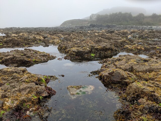
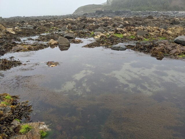
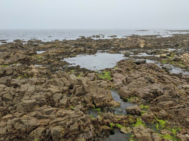
Gwallon is a small coastal village located in the county of Cornwall, in southwestern England. Situated on the rugged and picturesque coastline, Gwallon offers breathtaking views of the Atlantic Ocean and is surrounded by rolling hills and cliffs. The village is known for its natural beauty and is a popular destination for tourists seeking a peaceful and idyllic getaway.

Gwallon has a rich history dating back to ancient times, with evidence of human settlement found in the area. The village retains its traditional charm with its quaint cottages, narrow streets, and a picturesque harbor where fishing boats can often be seen bobbing in the waters.

The village is home to a close-knit community of locals who take great pride in their heritage and the preservation of their surroundings. Gwallon's economy primarily revolves around tourism, with a handful of small businesses catering to visitors. Traditional pubs and restaurants offer a taste of local cuisine, often featuring fresh seafood caught by the village's fishermen.

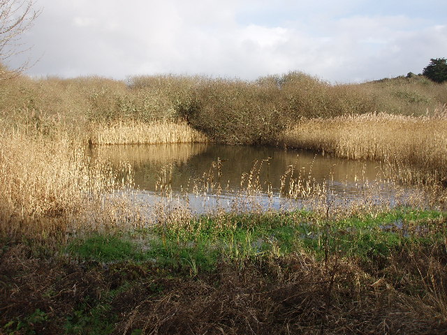
Nature enthusiasts are drawn to Gwallon for its stunning coastal walks, which provide opportunities to explore the dramatic cliffs, hidden coves, and sandy beaches that line the coastline. The village is also situated near several nature reserves, where birdwatchers can spot a variety of indigenous and migrating species.

Overall, Gwallon offers a tranquil retreat for those seeking natural beauty, rich history, and a warm sense of community in the heart of Cornwall's stunning coastal landscape.

If you have any feedback on the listing, please let us know in the comments section below.
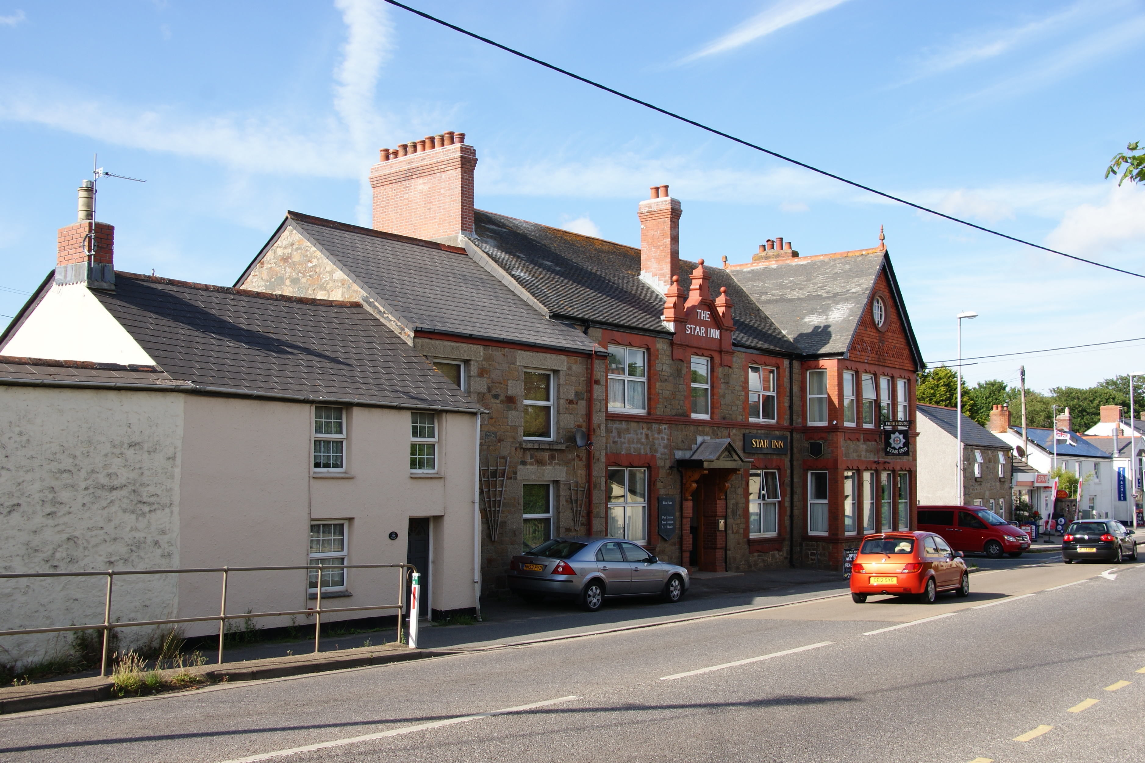
Gwallon Images

Images are sourced within 2km of 50.13539/-5.463519 or Grid Reference SW5231. Thanks to Geograph Open Source API. All images are credited.

A great place for rock pooling As long as you watch for the incoming tide!
A great place for rock pooling
As long as you watch for the incoming tide!
Rocks, weed and clear water
Low tide in Trenow Cove
Trenow Cove Rocky Beach with Big Boulders
Trenow Cove Eastern View Rocky beach with large boulders.
Trenow Cove Eastern View
Rocky beach with large boulders.
St Michael's Mount Called Ictis by the Romans, who used it as a port when trading tin, St Michael's Mount is the "jewel in Cornwall's crown".
St Michael's Mount
Called Ictis by the Romans, who used it as a port when trading tin, St Michael's Mount is the "jewel in Cornwall's crown".
Great Hogus Mounts Bay
Great Hogus
Mounts Bay
St Michaels Mount Harbour and Marazion
Marazion Harbour Built in the late 1920s, this harbour is seldom used as access is very difficult and only available at high tide.
Marazion Harbour
Built in the late 1920s, this harbour is seldom used as access is very difficult and only available at high tide.
St.Michael's Mount Harbour This time with the tide out...
St.Michael's Mount Harbour
This time with the tide out...
Marazion Marsh A bird sanctuary.
Marazion Marsh
A bird sanctuary.
The Market Place, Marazion
Look out from the bridge Having got lost on the way to St Ives, we stopped on a railway bridge to see where we were. Still not sure so used the GPS. Found we were at SW5294633962. This is the view from the bridge toward White Cross a some what small hamlet on the A30.
Look out from the bridge
Having got lost on the way to St Ives, we stopped on a railway bridge to see where we were. Still not sure so used the GPS. Found we were at SW5294633962. This is the view from the bridge toward White Cross a some what small hamlet on the A30.
Tregurtha Downs Mine engine house
Tregurtha Downs Mine engine house Now a house. A great use for these buildings if thoughtfully converted.
Tregurtha Downs Mine engine house
Now a house. A great use for these buildings if thoughtfully converted.
Bird Sanctuary: Marazion Marsh View from the RSPB hide at Marazion marsh.
Bird Sanctuary: Marazion Marsh
View from the RSPB hide at Marazion marsh.
Telegraph Poles on Mine Rubble The mound in the middle of the field marks the position of an old mine shaft and associated buildings.
Telegraph Poles on Mine Rubble
The mound in the middle of the field marks the position of an old mine shaft and associated buildings.
Tregurtha Downs Mine Looking northwards towards the old engine house and chimneys from the road to the west of Goldsithney
Tregurtha Downs Mine
Looking northwards towards the old engine house and chimneys from the road to the west of Goldsithney
Show me another place!

Gwallon is located at Grid Ref: SW5231 (Lat: 50.13539, Lng: -5.463519)

Unitary Authority: Cornwall

Police Authority: Devon and Cornwall

What 3 Words

///clerics.obtain.shepherdess. Near Marazion, Cornwall

Nearby Locations

Marazion Gwallon

Related Wikis

Gwallon

Gwallon is a hamlet in the parish of Marazion, Cornwall, England. It is in the civil parish of St Hilary. == References ==

Mount Haven Hotel

Mount Haven Hotel is a hotel near the coast on the eastern side of the town of Marazion, Cornwall, England, UK, several miles east of Penzance. It is next...

Marazion Marsh

Marazion Marsh is a Royal Society for the Protection of Birds (RSPB) reserve situated in a shallow river valley, half a kilometre to the west of Marazion...

Marazion Town Hall

Marazion Town Hall is a municipal building in the Market Place, Marazion, Cornwall, England. The town hall, which is currently used as a museum, is a Grade...

Marazion

Marazion (; Cornish: Marhasyow) is a civil parish and town, on the shore of Mount's Bay in Cornwall, England, United Kingdom. It is 2 miles (3.2 km) east...

Red River (Amal)

The Red River (Cornish: Dowr Amal, meaning boundary river) which discharges into the sea to the west of Marazion is one of two watercourses in Cornwall...

Crowlas

Crowlas is a village in Cornwall, England, on the A30 about three miles east of Penzance. It forms a small conurbation with Ludgvan within the parish of...

Varfell

Varfell is a hamlet within the parish of Ludgvan, Cornwall, UK. Varfell Farm is the world's largest producers of daffodil bulbs. == History == In 1882...

Nearby Amenities

Located within 500m of 50.13539,-5.463519
Is In: Cornwall, England, UK
Place: farm
Source: NPE
Lat/Long: 50.1395162/-5.460857
Bus Stop
Orillia
Bus: yes
Naptan AtcoCode: 0800COX38442
Naptan Bearing: SW
Naptan CommonName: Orillia
Naptan NaptanCode: coragjwt
Naptan PlusbusZoneRef: PENZNCE
Naptan Street: Unclassified
Naptan Verified: no
Public Transport: platform
Source: naptan_import
Lat/Long: 50.1359765/-5.464219
Bus Stop
Orillia
Bus: yes
Naptan AtcoCode: 0800COY38591
Naptan Bearing: NE
Naptan CommonName: Orillia
Naptan Indicator: Opp
Naptan NaptanCode: coragjwd
Naptan PlusbusZoneRef: PENZNCE
Naptan Street: Unclassified
Naptan Verified: no
Public Transport: platform
Source: naptan_import
Lat/Long: 50.1359531/-5.4643992
Shower
Lat/Long: 50.1310873/-5.4654448
Shop: laundry
Lat/Long: 50.1311887/-5.4653791
Access: private
Leisure: swimming_pool
Lat/Long: 50.1311268/-5.4655547
Power: pole
Lat/Long: 50.1379583/-5.4593951
Power: pole
Lat/Long: 50.1373222/-5.46094
Gwallon
Place: hamlet
Wikidata: Q5623273
Lat/Long: 50.1359641/-5.463236
Power: pole
Lat/Long: 50.1369105/-5.462324
Power: pole
Lat/Long: 50.1346093/-5.4702446
Power: pole
Lat/Long: 50.1356374/-5.4678655
Power: pole
Lat/Long: 50.1361772/-5.4665297
Power: pole
Lat/Long: 50.137495/-5.4641305
Power: pole
Lat/Long: 50.1378242/-5.4630777
Power: pole
Lat/Long: 50.1383451/-5.4614121
Power: pole
Lat/Long: 50.1387955/-5.4600173
Power: pole
Lat/Long: 50.1383829/-5.4597947
Power: pole
Lat/Long: 50.1376798/-5.4610044
Power: pole
Lat/Long: 50.137336/-5.4616213
Barrier: yes
Lat/Long: 50.1386524/-5.4645642
Power: pole
Lat/Long: 50.139007/-5.4669428
Power: pole
Lat/Long: 50.1385712/-5.4660335
Power: pole
Lat/Long: 50.1382514/-5.465367
Power: pole
Lat/Long: 50.1379635/-5.464797
Power: pole
Lat/Long: 50.1365743/-5.4636007
Power: pole
Lat/Long: 50.1367601/-5.4645677
Power: pole
Lat/Long: 50.1378706/-5.4648922
Power: pole
Lat/Long: 50.1383657/-5.4662159
Power: pole
Lat/Long: 50.1387139/-5.4671332
Power: pole
Lat/Long: 50.1366346/-5.4643343
Power: pole
Lat/Long: 50.1367798/-5.4643115
Power: pole
Lat/Long: 50.136632/-5.4641788
Power: pole
Lat/Long: 50.1365133/-5.4642901
Power: pole
Lat/Long: 50.1365787/-5.464042
Power: pole
Lat/Long: 50.1364738/-5.4641452
Power: pole
Lat/Long: 50.1362821/-5.4574934
Power: pole
Lat/Long: 50.1368305/-5.4583651
Power: pole
Lat/Long: 50.1353125/-5.4639789
Power: pole
Lat/Long: 50.136136/-5.4618841
Power: pole
Lat/Long: 50.1370472/-5.4594514
Power: pole
Lat/Long: 50.1376085/-5.4622985
Power: pole
Lat/Long: 50.13774/-5.4629503
Power: pole
Lat/Long: 50.1374348/-5.4636316
Power: pole
Lat/Long: 50.1368864/-5.4638676
Power: pole
Lat/Long: 50.1368013/-5.4639334
Power: pole
Lat/Long: 50.136344/-5.4641667
Give Way
Lat/Long: 50.1338258/-5.465641
Material: wood
Power: pole
Lat/Long: 50.1350586/-5.4692048
Barrier: stile
Stile: stepover
Lat/Long: 50.1371288/-5.4631057
Post Box
Collection Times: Mo-Fr 09:00; Sa 07:00; Su off
Operator: Royal Mail
Operator Wikidata: Q638098
Post Box Design: 2010_pattern
Post Box Mounting: pier
Post Box Type: lamp
Ref: TR20 156D
Royal Cypher: EIIR
Royal Cypher Wikidata: Q33102113
Source: survey;aerial imagery
Lat/Long: 50.1370488/-5.4631803
The data included in this document is from www.openstreetmap.org. The data is made available under ODbL.

Have you been to Gwallon?

Leave your review of Gwallon below (or comments, questions and feedback).