Manaton

Civil Parish in Devon Teignbridge

England

Manaton

Hound Tor A gentle walk from the car park, up a grassy slope, to the granite jointed and weathered Hound Tor (414m amsl) which is popular with rock climbers.
<span class="nowrap"><a title="www.dartmoor.gov.uk" rel="nofollow ugc noopener" href="http://www.dartmoor.gov.uk">Link</a><img style="margin-left:2px;" alt="External link" title="External link - shift click to open in new window" src="https://s1.geograph.org.uk/img/external.png" width="10" height="10"/></span>
Hound Tor Credit: Colin Smith

Manaton is a civil parish located in the county of Devon, England. It is situated on the eastern edge of Dartmoor National Park, approximately 22 miles southwest of Exeter. The parish covers an area of around 17 square kilometers and is home to a population of approximately 400 people.

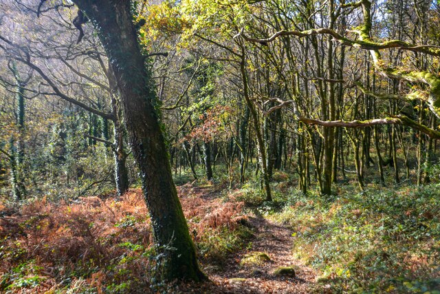
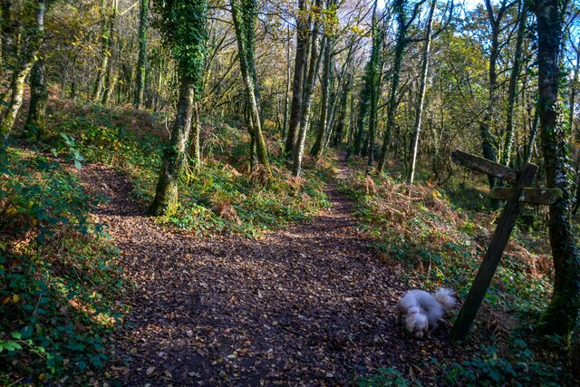
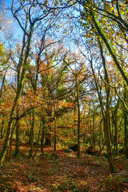
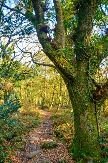
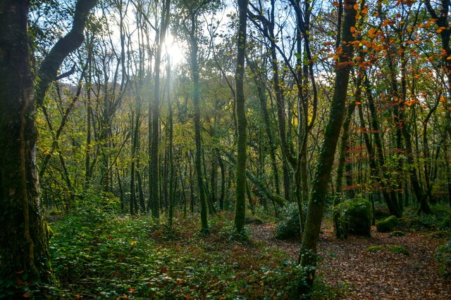
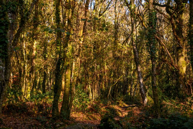
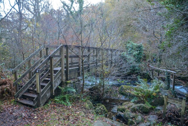
The village of Manaton itself is small and picturesque, with charming thatched cottages and a quaint village green. It is surrounded by beautiful countryside, with rolling hills, wooded valleys, and rivers, making it an ideal location for outdoor activities such as hiking, cycling, and fishing.

One of the notable landmarks in Manaton is the parish church dedicated to St. Winifred. The church dates back to the 13th century and features a striking tower and a collection of interesting architectural details.

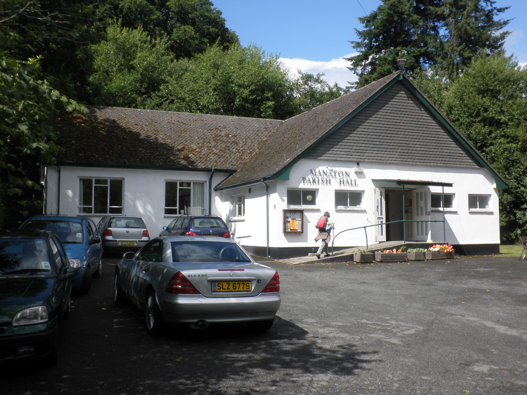
Manaton also has a strong sense of community, with various local organizations and events that bring residents together. The village has a primary school, a community hall, and a pub, providing essential amenities for its residents.

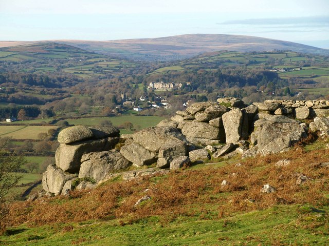
The area surrounding Manaton is rich in history and offers visitors the opportunity to explore ancient archaeological sites, including stone circles and Bronze Age settlements. The nearby Hayne Down is a popular spot for walkers, offering panoramic views of the surrounding countryside.

Overall, Manaton is a charming and peaceful village that offers a tranquil retreat for both residents and visitors, with its stunning natural landscapes, historical sites, and strong community spirit.

If you have any feedback on the listing, please let us know in the comments section below.

Manaton Images

Images are sourced within 2km of 50.612648/-3.765974 or Grid Reference SX7580. Thanks to Geograph Open Source API. All images are credited.

Hound Tor A gentle walk from the car park, up a grassy slope, to the granite jointed and weathered Hound Tor (414m amsl) which is popular with rock climbers.
<span class="nowrap"><a title="www.dartmoor.gov.uk" rel="nofollow ugc noopener" href="http://www.dartmoor.gov.uk">Link</a><img style="margin-left:2px;" alt="External link" title="External link - shift click to open in new window" src="https://s1.geograph.org.uk/img/external.png" width="10" height="10"/></span>
Hound Tor
A gentle walk from the car park, up a grassy slope, to the granite jointed and weathered Hound Tor (414m amsl) which is popular with rock climbers. LinkExternal link
Hound Tor The granite jointed and weathered Hound Tor (414m amsl) is popular with rock climbers.
<span class="nowrap"><a title="www.dartmoor.gov.uk" rel="nofollow ugc noopener" href="http://www.dartmoor.gov.uk">Link</a><img style="margin-left:2px;" alt="External link" title="External link - shift click to open in new window" src="https://s1.geograph.org.uk/img/external.png" width="10" height="10"/></span>
Hound Tor
The granite jointed and weathered Hound Tor (414m amsl) is popular with rock climbers. LinkExternal link
Hound Tor - Rock Climbers The granite jointed and weathered Hound Tor (414m amsl) is popular with rock climbers.
<span class="nowrap"><a title="www.dartmoor.gov.uk" rel="nofollow ugc noopener" href="http://www.dartmoor.gov.uk">Link</a><img style="margin-left:2px;" alt="External link" title="External link - shift click to open in new window" src="https://s1.geograph.org.uk/img/external.png" width="10" height="10"/></span>
Hound Tor - Rock Climbers
The granite jointed and weathered Hound Tor (414m amsl) is popular with rock climbers. LinkExternal link
Hound Tor The granite jointed and weathered Hound Tor (414m amsl) is popular with rock climbers.
<span class="nowrap"><a title="www.dartmoor.gov.uk" rel="nofollow ugc noopener" href="http://www.dartmoor.gov.uk">Link</a><img style="margin-left:2px;" alt="External link" title="External link - shift click to open in new window" src="https://s1.geograph.org.uk/img/external.png" width="10" height="10"/></span>
Hound Tor
The granite jointed and weathered Hound Tor (414m amsl) is popular with rock climbers. LinkExternal link
Hound Tor - Medieval Village Possibly farmed during the Bronze Age, but today's remains are medieval. In the Middle Ages population growth and warmer climate perhaps encouraged people to farm marginal land on the moor.
<span class="nowrap"><a title="www.dartmoor.gov.uk" rel="nofollow ugc noopener" href="http://www.dartmoor.gov.uk">Link</a><img style="margin-left:2px;" alt="External link" title="External link - shift click to open in new window" src="https://s1.geograph.org.uk/img/external.png" width="10" height="10"/></span>
Hound Tor - Medieval Village
Possibly farmed during the Bronze Age, but today's remains are medieval. In the Middle Ages population growth and warmer climate perhaps encouraged people to farm marginal land on the moor. LinkExternal link
Hound Tor - Rock Climbers The granite jointed and weathered Hound Tor (414m amsl) is popular with rock climbers.
<span class="nowrap"><a title="www.dartmoor.gov.uk" rel="nofollow ugc noopener" href="http://www.dartmoor.gov.uk">Link</a><img style="margin-left:2px;" alt="External link" title="External link - shift click to open in new window" src="https://s1.geograph.org.uk/img/external.png" width="10" height="10"/></span>
Hound Tor - Rock Climbers
The granite jointed and weathered Hound Tor (414m amsl) is popular with rock climbers. LinkExternal link
Hound Tor
Hound Tor
Old Boundary Marker on Trendlebere Down Parish Boundary Marker on the bank of a shallow gully on the south side of the minor road on Trendlebere Down. On the boundary of Manaton and Lustleigh parishes and inscribed L and M on opposite faces. Set up after Beating the Bounds in 1975.

Milestone Society National ID: DV_BVMA03pb
Old Boundary Marker on Trendlebere Down
Parish Boundary Marker on the bank of a shallow gully on the south side of the minor road on Trendlebere Down. On the boundary of Manaton and Lustleigh parishes and inscribed L and M on opposite faces. Set up after Beating the Bounds in 1975. Milestone Society National ID: DV_BVMA03pb
Lustleigh : River Bovey Water cascades down over the rocks.
Lustleigh : River Bovey
Water cascades down over the rocks.
Lustleigh : Woodland Path A path through the woods.
Lustleigh : Woodland Path
A path through the woods.
Lustleigh : Woodland Path Looking along the path.
Lustleigh : Woodland Path
Looking along the path.
Lustleigh : Woodland Looking across the woods.
Lustleigh : Woodland
Looking across the woods.
Lustleigh : Woodland Path A path through the woods.
Lustleigh : Woodland Path
A path through the woods.
Lustleigh : Woodland Looking through the woods.
Lustleigh : Woodland
Looking through the woods.
Lustleigh : Woodland Looking across the woods.
Lustleigh : Woodland
Looking across the woods.
Lustleigh : Footbridge A footbridge crosses the River Bovey.
Lustleigh : Footbridge
A footbridge crosses the River Bovey.
Show me another place!

Manaton is located at Grid Ref: SX7580 (Lat: 50.612648, Lng: -3.765974)

Administrative County: Devon

District: Teignbridge

Police Authority: Devon & Cornwall

What 3 Words

///greeting.cooking.majoring. Near Moretonhampstead, Devon

Related Wikis

Manaton

Manaton is a village situated to the southeast of Dartmoor National Park, Devon, England. The 15th-century church, located in a prominent spot due north...
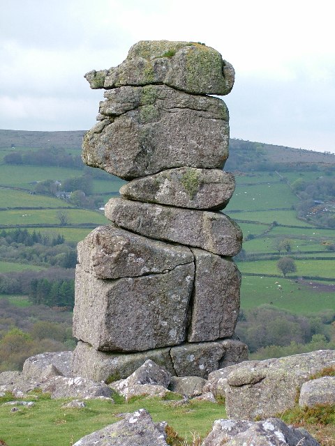
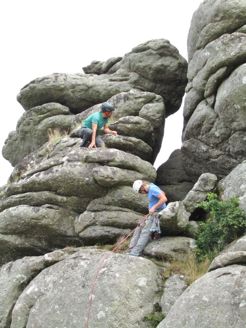
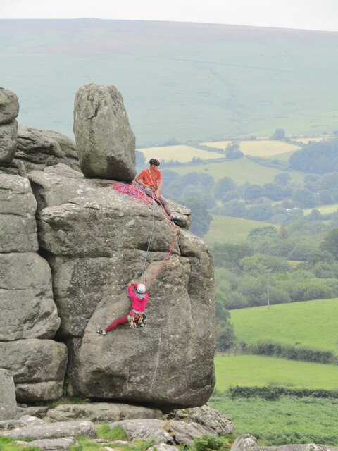
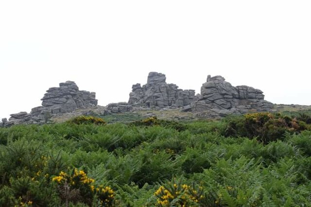
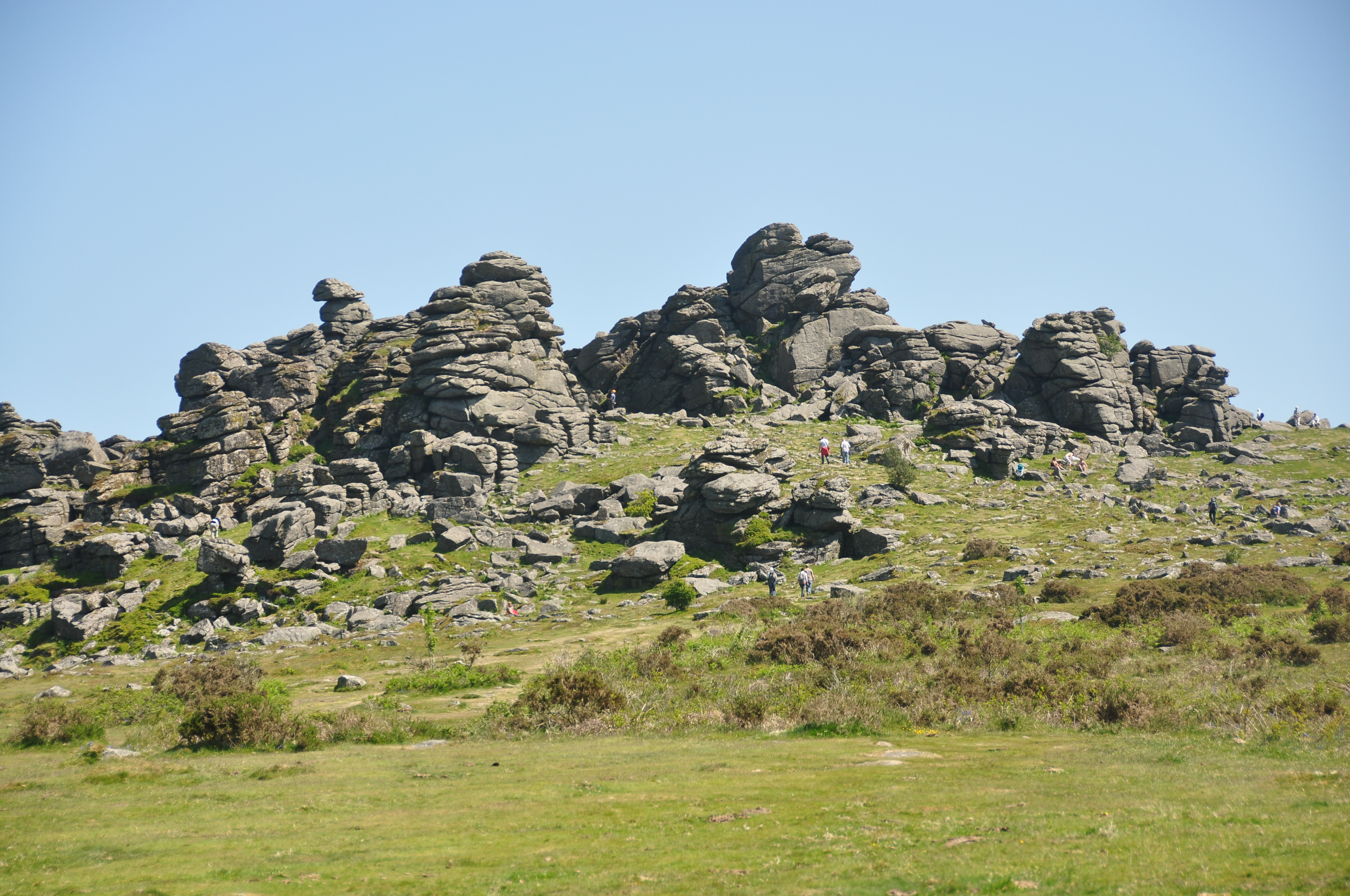
Bowerman's Nose

Bowerman's Nose is a stack of weathered granite on Dartmoor, Devon, England. It is situated on the northern slopes of Hayne Down, about a mile from Hound...
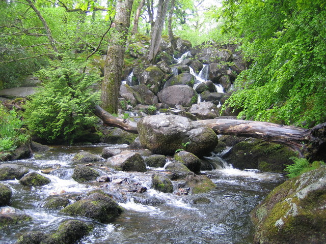
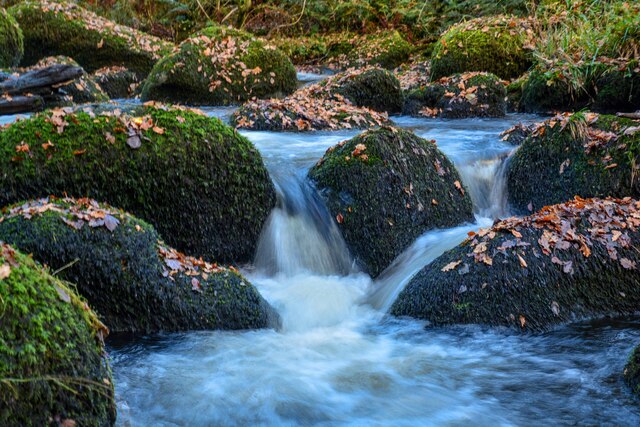
Becky Falls

Becky Falls, originally known as Becka Falls, is a tourist attraction in Dartmoor, England, centered on a waterfall of around 20 metres down a boulder...

Lustleigh Cleave

The Lustleigh Cleave is a steep sided valley above the River Bovey in the parish of Lustleigh on Dartmoor. The cleave has been noted for its beauty since...

Hunter's Tor, Lustleigh Cleave

Hunter's Tor is a granite tor located in the parish of Lustleigh, on Dartmoor. It is one of two tors with the same name, the other being in the Teign Gorge...
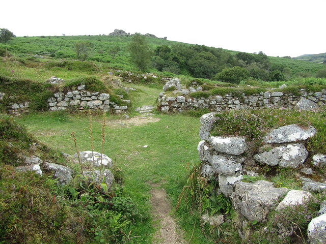
Hundatorra

Hundatorra or Hundetorre is a deserted medieval village near Hound Tor on Dartmoor, Devon. The site has seen two periods of historic occupation, the first...
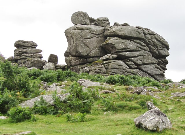
Hound Tor

Hound Tor is a tor on Dartmoor, Devon, England and is a good example of a heavily weathered granite outcrop. It is easily accessible, situated within a...

Jay's Grave

Jay's Grave (or Kitty Jay's Grave) is supposedly the last resting place of a suicide victim who is thought to have died in the late 18th century. It has...

Nearby Amenities

Located within 500m of 50.612648,-3.765974
Incline: 20%
Lat/Long: 50.6158958/-3.7680784
Hayne
Wpt Symbol: Dot
Lat/Long: 50.6115527/-3.7723465
Hayne Cross
Place: locality
Wpt Symbol: Dot
Lat/Long: 50.6123953/-3.7671346
Southcott
Wpt Symbol: Dot
Lat/Long: 50.6089222/-3.7680024
Barrier: stile
Lat/Long: 50.6120858/-3.7687491
Barrier: stile
Lat/Long: 50.6148311/-3.7681014
Bus Stop
The Forge (671)
Naptan AtcoCode: 1100DEB10263
Naptan NaptanCode: dvnawpmj
Operator: Carmel Coaches
Lat/Long: 50.6137539/-3.759469
Latitude Cartography Ltd.
Addr City: Manaton
Addr Housename: Heatherway
Addr Postcode: TQ13 9UF
Building: yes
Contact Email: maps@latitudecartography.co.uk
Contact Phone: +44 1647 221482
Website: https://www.latitudecartography.co.uk/
Lat/Long: 50.6134423/-3.7592737
Southcott
Place: hamlet
Lat/Long: 50.6086155/-3.7668424
Generator Method: photovoltaic
Generator Output Electricity: yes
Generator Source: solar
Generator Type: solar_photovoltaic_panel
Location: roof
Power: generator
Lat/Long: 50.6154352/-3.7628214
Generator Method: photovoltaic
Generator Output Electricity: yes
Generator Source: solar
Generator Type: solar_photovoltaic_panel
Location: roof
Power: generator
Lat/Long: 50.6130082/-3.7590469
Board Type: community
Information: board
Tourism: information
Lat/Long: 50.6136274/-3.7594278
The data included in this document is from www.openstreetmap.org. The data is made available under ODbL.

Have you been to Manaton?

Leave your review of Manaton below (or comments, questions and feedback).