Ible

Civil Parish in Derbyshire Derbyshire Dales

England

Ible

The A5012 Winding up through the wooded valley near Via Gellia.
The A5012 Credit: David Lally

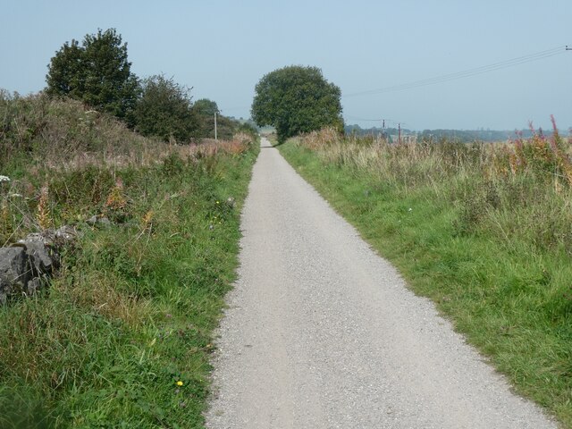
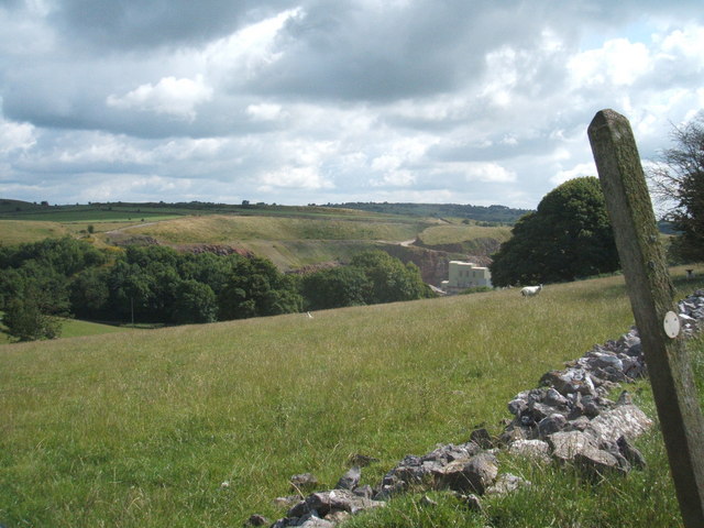
Ible is a small civil parish located in the Derbyshire Dales district of Derbyshire, England. Situated in the heart of the Peak District National Park, it covers an area of about 8 square miles. The parish is located near the town of Wirksworth and is surrounded by picturesque countryside, with rolling hills, lush green fields, and stunning natural landscapes.

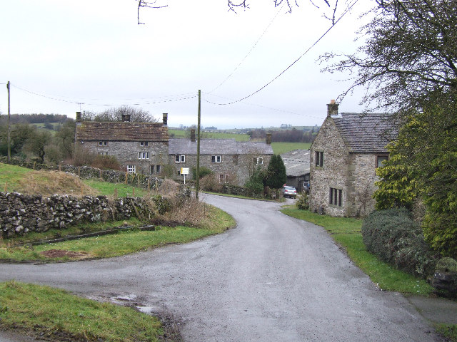
The village of Ible itself is home to a small population of around 100 residents, making it a close-knit and tight community. The settlement is nestled in a valley and is surrounded by rugged terrain, making it an ideal location for those seeking a peaceful and idyllic countryside retreat.

The village is characterized by its traditional stone-built houses and cottages, which add to its rustic charm. It has a small church, St. John the Baptist, which dates back to the 12th century and is a notable historic landmark in the area. The church holds regular services and is an important focal point for the local community.

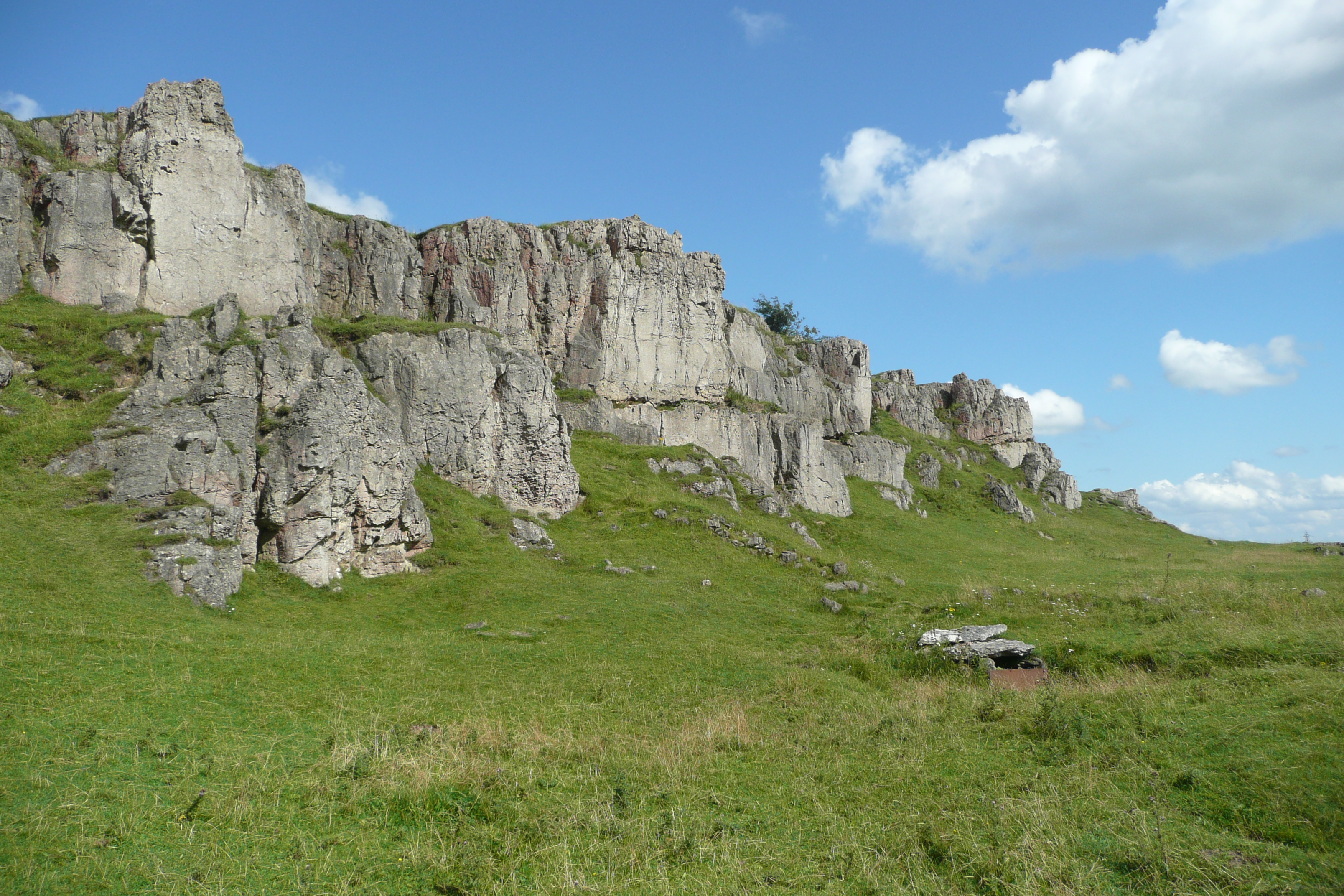
Ible is a popular destination for outdoor enthusiasts, with numerous walking trails and biking routes in the surrounding area. The nearby limestone quarries provide opportunities for rock climbing and bouldering. The village also offers stunning views of the surrounding countryside, making it a perfect spot for nature lovers and photographers.

Overall, Ible, Derbyshire is a quaint and peaceful civil parish that offers a tranquil escape from the hustle and bustle of city life. With its scenic beauty and rich history, it attracts visitors who are looking to explore the natural wonders of the Peak District.

If you have any feedback on the listing, please let us know in the comments section below.
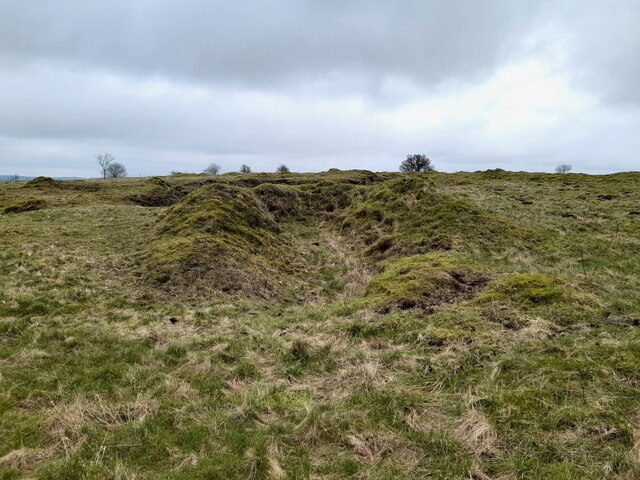
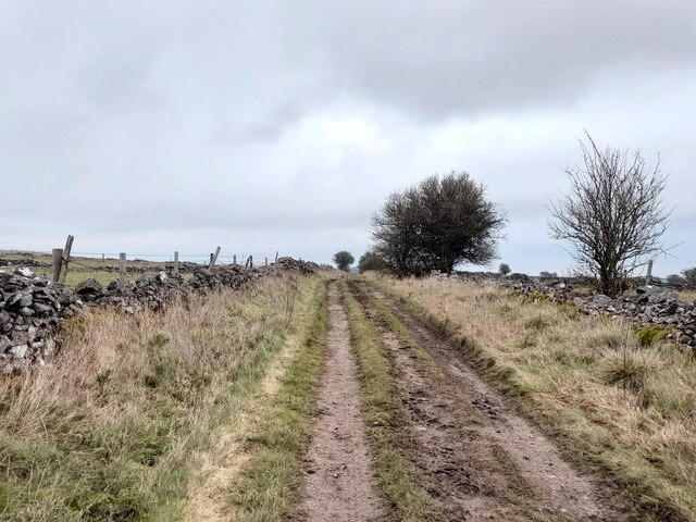
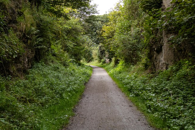
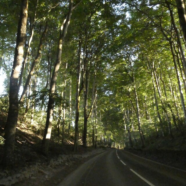
Ible Images

Images are sourced within 2km of 53.110868/-1.634111 or Grid Reference SK2457. Thanks to Geograph Open Source API. All images are credited.

The A5012 Winding up through the wooded valley near Via Gellia.
The A5012
Winding up through the wooded valley near Via Gellia.
Old limestone workings below Harboro Rocks A popular climbing area on the rocks, with old and modern limestone workings all around
Old limestone workings below Harboro Rocks
A popular climbing area on the rocks, with old and modern limestone workings all around
High Peak Trail in Derbyshire Former railway line, cruelly cut by Beeching in 1967, but now a delightful walking and cycling trail.
High Peak Trail in Derbyshire
Former railway line, cruelly cut by Beeching in 1967, but now a delightful walking and cycling trail.
Whitelows Farm Farm yard and house, with a few of very old household item in the yard awaiting to be sold.
Whitelows Farm
Farm yard and house, with a few of very old household item in the yard awaiting to be sold.
Derelict Farmhouse The long abandoned farmhouse at Whitelows, the farming equipment is all up for sale due to the death of the farmer.
Derelict Farmhouse
The long abandoned farmhouse at Whitelows, the farming equipment is all up for sale due to the death of the farmer.
Footpath and notice The auctioneers have posted a notice on the footpath gate, and fine views across to  Carsington Pasture with the wind turbines.
Footpath and notice
The auctioneers have posted a notice on the footpath gate, and fine views across to Carsington Pasture with the wind turbines.
The sale in progress The farming equipment up for auction at Whitelows farm.
The sale in progress
The farming equipment up for auction at Whitelows farm.
A narrow squeeze stile This stile was particularly narrow at the bottom. Too narrow for a German Shepherd.
A narrow squeeze stile
This stile was particularly narrow at the bottom. Too narrow for a German Shepherd.
Old limekiln
Old limekiln
Pond at Leys Farm
Pond at Leys Farm
Green Lane
Green Lane
Harboro Rocks Viewed from the Mid-Shires Way path.
Harboro Rocks
Viewed from the Mid-Shires Way path.
Harboro Rocks Old quarry workings at Harboro Rocks.
Harboro Rocks
Old quarry workings at Harboro Rocks.
Mechanical Hay Rake A mechanical hay rake on Harboro Farm.
Mechanical Hay Rake
A mechanical hay rake on Harboro Farm.
High Peak Trail On the trackbed of the dismantled Cromford and High Peak Railway.  Also part of the Midshires Way.
High Peak Trail
On the trackbed of the dismantled Cromford and High Peak Railway. Also part of the Midshires Way.
Tree lined road north of Curzon Lodge A narrow belt of trees lines the road on each side; it has been there for over 100 years in its current extent
Tree lined road north of Curzon Lodge
A narrow belt of trees lines the road on each side; it has been there for over 100 years in its current extent
Former quarry and Harboro' Rocks
High Peak Trail west of Harboro' Rocks The High Peak Trail follows the route of the Cromford and High Peak Railway which was completed in 1831 and axed as part of the Beeching cuts in the 1960s.
High Peak Trail west of Harboro' Rocks
The High Peak Trail follows the route of the Cromford and High Peak Railway which was completed in 1831 and axed as part of the Beeching cuts in the 1960s.
Show me another place!

Ible is located at Grid Ref: SK2457 (Lat: 53.110868, Lng: -1.634111)

Administrative County: Derbyshire

District: Derbyshire Dales

Police Authority: Derbyshire

What 3 Words

///headlight.teams.proposals. Near Cromford, Derbyshire

Nearby Locations

Ible Ible Grangemill

Related Wikis

Ible

Ible (pronounced 'eyebull', or 'ib-ull') is a hamlet in Derbyshire, England, just within the Peak District National Park.It is near the Via Gellia valley...

Grangemill

Grangemill is a village in the English county of Derbyshire. The hamlet is made up of a cluster of houses, a farm and a pub called the Hollybush. There...

Ivonbrook Grange

Ivonbrook Grange is a civil parish within the Derbyshire Dales district, in the county of Derbyshire, England. Largely rural, Ivonbrook Grange's population...

West Derbyshire (UK Parliament constituency)

West Derbyshire was a county constituency represented in the House of Commons of the Parliament of the United Kingdom. From 1885, until it was replaced...

Aldwark, Derbyshire

Aldwark (Old English "the old fortification") is a small upland village and parish in the Derbyshire Dales district of Derbyshire, England, about 8 miles...

Beans and Bacon mine

The Beans and Bacon mine is a disused lead mine on Bonsall Moor near the village of Bonsall, Derbyshire, United Kingdom. The nearest large town is Matlock...

Harboro' Rocks

Harboro' Rocks (or Harborough Rocks) is a dolomitic limestone hill near the village of Brassington in the Derbyshire Peak District. The summit is 379 metres...

Longcliffe

Longcliffe is a crossroads hamlet in the English county of Derbyshire. It lies on the B5056 road where it is crossed by the Brassington-Elton road. The...

Nearby Amenities

Located within 500m of 53.110868,-1.634111
Ible
Is In: Derbyshire, England, UK
Place: hamlet
Wikidata: Q2222062
Wikipedia: en:Ible
Lat/Long: 53.1102577/-1.6302326
Barrier: stile
Material: metal
Source: survey;gps
Stile: stepover
Lat/Long: 53.1100532/-1.6356349
Barrier: stile
Material: metal
Stile: squeezer
Lat/Long: 53.1101535/-1.6355592
Barrier: stile
Material: wood
Stile: stepover
Lat/Long: 53.1102541/-1.6323421
Barrier: stile
Material: stone
Stile: squeezer
Lat/Long: 53.1127912/-1.6301287
Post Box
Operator: Royal Mail
Ref: DE4 334
Lat/Long: 53.1099853/-1.6290969
Barrier: stile
Material: wood
Stile: stepover
Lat/Long: 53.1098981/-1.6271597
Barrier: stile
Lat/Long: 53.114792/-1.6325021
Power: tower
Lat/Long: 53.1073257/-1.6375414
Power: tower
Lat/Long: 53.1137257/-1.6364296
Power: tower
Lat/Long: 53.1141923/-1.6363183
Power: tower
Lat/Long: 53.1102349/-1.6373759
Power: pole
Lat/Long: 53.107023/-1.6371634
Power: pole
Lat/Long: 53.1076673/-1.6371219
Power: pole
Lat/Long: 53.1083979/-1.6370777
Power: pole
Lat/Long: 53.1094196/-1.6370401
Power: pole
Lat/Long: 53.110459/-1.6369682
Power: pole
Lat/Long: 53.1114884/-1.6369127
Power: tower
Lat/Long: 53.1124757/-1.6364711
Power: pole
Lat/Long: 53.1125204/-1.6368442
Power: pole
Lat/Long: 53.1135299/-1.6368012
Power: pole
Lat/Long: 53.1141932/-1.6373429
Power: pole
Lat/Long: 53.1145372/-1.6381663
Barrier: stile
Material: stone
Source: survey;gps
Stile: squeezer
Lat/Long: 53.1133452/-1.6302411
Barrier: stile
Material: stone
Source: survey;gps
Stile: stepover
Lat/Long: 53.1097074/-1.6287978
Barrier: stile
Material: stone
Source: survey;gps
Stile: squeezer
Lat/Long: 53.1099252/-1.6286489
Direction: 175
Generator Method: photovoltaic
Generator Output Electricity: yes
Generator Solar Modules: 13
Generator Source: solar
Generator Type: solar_photovoltaic_panel
Location: roof
Power: generator
Lat/Long: 53.1111442/-1.6299858
Barrier: stile
Material: stone
Source: survey;gps
Stile: squeezer
Lat/Long: 53.1105645/-1.630373
The data included in this document is from www.openstreetmap.org. The data is made available under ODbL.

Have you been to Ible?

Leave your review of Ible below (or comments, questions and feedback).