Aldwark

Settlement in Derbyshire Derbyshire Dales

England

Aldwark

Bronze-age barrow on Minninglow Hill, Derbyshire Minninglow is a hill in the Peak Park in Derbyshire, in the White Peak area. Within the clump of trees on the hill are a Neolithic chambered tomb and two Bronze Age bowl barrows.
There’s no public right of way butat thetime of posting a concessionary path gives access.
Bronze-age barrow on Minninglow Hill, Derbyshire Credit: Colin Hoskins

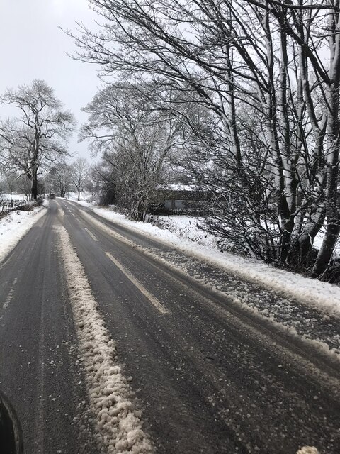
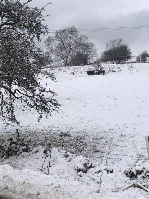
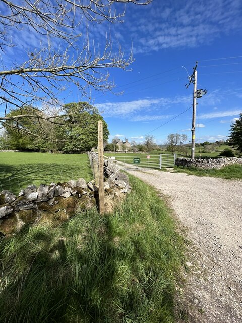
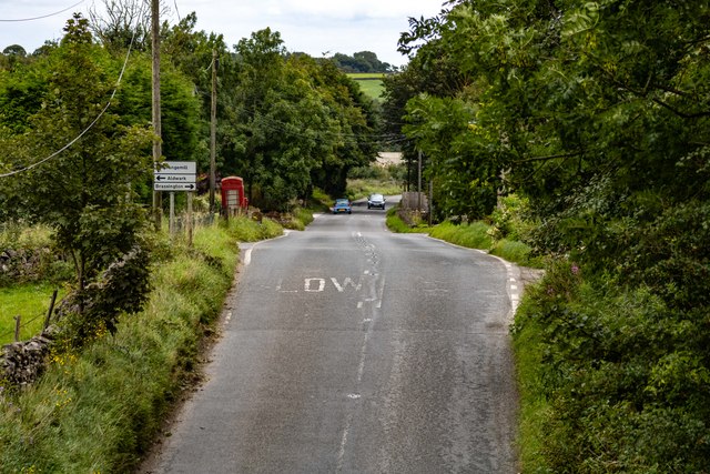
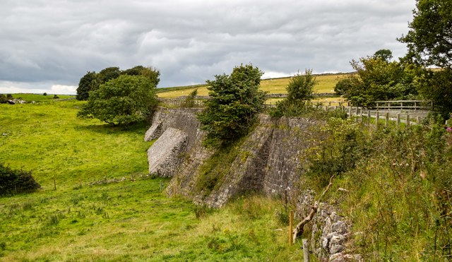
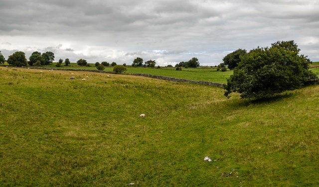
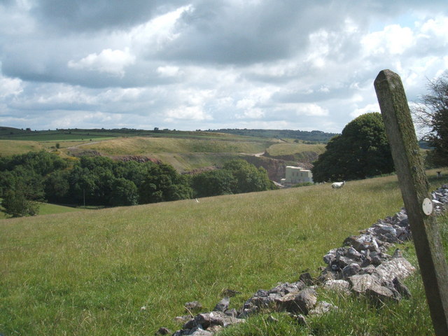
Aldwark is a small village located in the county of Derbyshire, England. Situated in the Amber Valley district, it lies about 12 miles north of Derby, the county town. The village is surrounded by picturesque countryside, offering stunning views of the rolling hills and valleys that characterize the area.

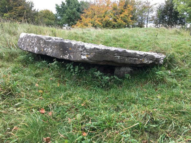
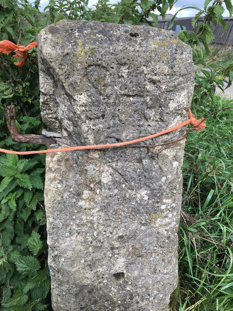
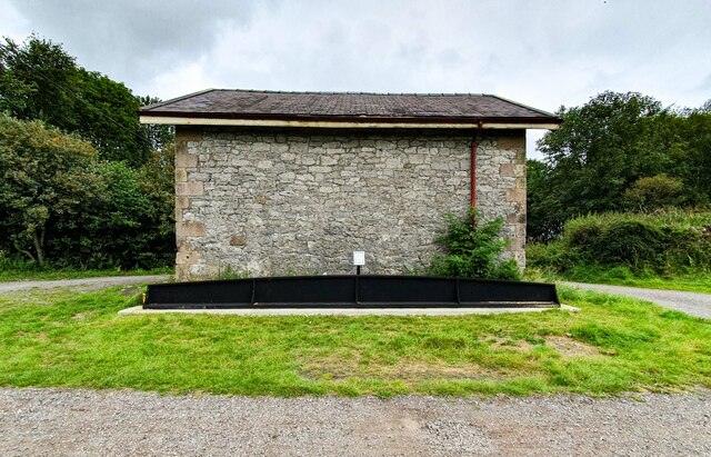
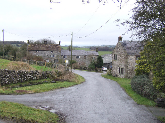
Aldwark is a historic village with roots dating back to the medieval period. It is known for its charming stone-built cottages and traditional architecture, which give the village a timeless appeal. The local church, St. Margaret's, is a notable landmark, boasting a Norman tower that dates back to the 12th century.

Although Aldwark is a small village, it has a strong sense of community. The villagers actively participate in various social events and activities, fostering a close-knit atmosphere. The village pub, The White Swan, serves as a popular meeting place for locals and visitors alike, offering a warm and friendly environment.

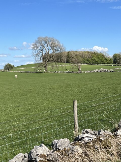
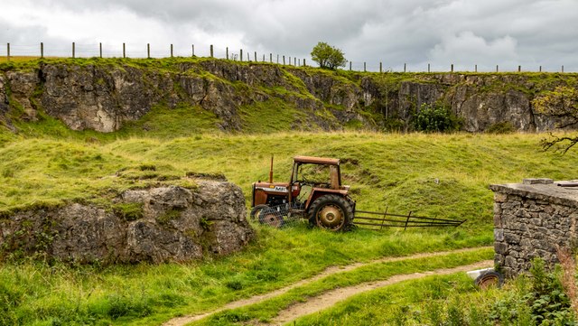
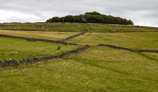
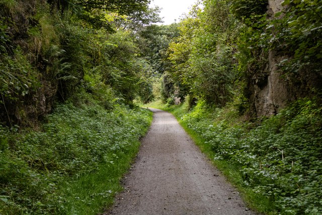
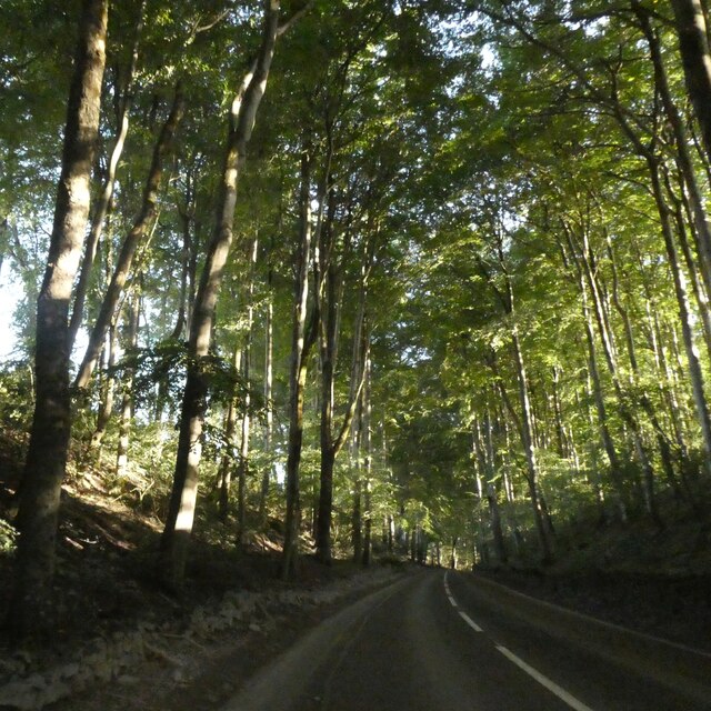
Nature enthusiasts will appreciate Aldwark's proximity to several scenic walking trails and nature reserves. The village is surrounded by lush green fields and woodlands, providing ample opportunities for outdoor recreation. Additionally, the nearby River Derwent offers fishing and boating activities for those who enjoy water-based pursuits.

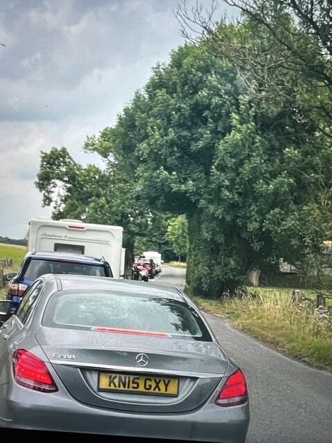
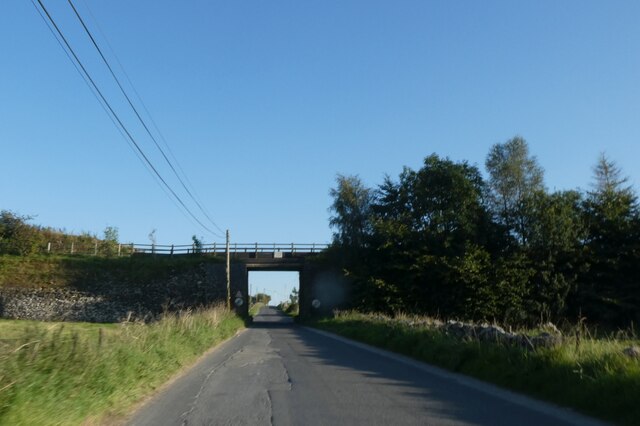
Despite its tranquil setting, Aldwark benefits from its convenient location. It is within easy reach of nearby towns and cities, including Derby and the Peak District National Park, making it an ideal base for exploring the wider region.

If you have any feedback on the listing, please let us know in the comments section below.

Aldwark Images

Images are sourced within 2km of 53.112686/-1.659373 or Grid Reference SK2257. Thanks to Geograph Open Source API. All images are credited.

Bronze-age barrow on Minninglow Hill, Derbyshire Minninglow is a hill in the Peak Park in Derbyshire, in the White Peak area. Within the clump of trees on the hill are a Neolithic chambered tomb and two Bronze Age bowl barrows.
There’s no public right of way butat thetime of posting a concessionary path gives access.
Bronze-age barrow on Minninglow Hill, Derbyshire
Minninglow is a hill in the Peak Park in Derbyshire, in the White Peak area. Within the clump of trees on the hill are a Neolithic chambered tomb and two Bronze Age bowl barrows. There’s no public right of way butat thetime of posting a concessionary path gives access.
Grange Barn Farm A snowy scene on the A5102 Nr Grange Mill.
Grange Barn Farm
A snowy scene on the A5102 Nr Grange Mill.
Feeding Cattle Cattle eating hay in the field next to Grange Barn Farm
Feeding Cattle
Cattle eating hay in the field next to Grange Barn Farm
Old Milestone, Slipper Low Farm Near Aldwark. A guide post re-located from a crossroads ¼ mile to the South. Now being used as a gatepost.

Inscription:  (A)SHB / (OU)RN // DER / BY // CHEST / ERFEIL / D 1709 // BUX / TO(N) / (1)

Listed in Derbyshire Heritage see <span class="nowrap"><a title="https://her.derbyshire.gov.uk/Monument/MDR8585" rel="nofollow ugc noopener" href="https://her.derbyshire.gov.uk/Monument/MDR8585">Link</a><img style="margin-left:2px;" alt="External link" title="External link - shift click to open in new window" src="https://s1.geograph.org.uk/img/external.png" width="10" height="10"/></span>

Milestone Society National ID: DE_XALD
Old Milestone, Slipper Low Farm
Near Aldwark. A guide post re-located from a crossroads ¼ mile to the South. Now being used as a gatepost. Inscription: (A)SHB / (OU)RN // DER / BY // CHEST / ERFEIL / D 1709 // BUX / TO(N) / (1) Listed in Derbyshire Heritage see LinkExternal link Milestone Society National ID: DE_XALD
Greenlow Hill Across the grassland towards Greenlow Hill.
Greenlow Hill
Across the grassland towards Greenlow Hill.
Footpath and Farm Entrance The footpath and entrance to Greenlow Farm.
Footpath and Farm Entrance
The footpath and entrance to Greenlow Farm.
Traffic Holdup Stationary traffic for the next two miles due to the Ynot music festival at Pikehall.
Traffic Holdup
Stationary traffic for the next two miles due to the Ynot music festival at Pikehall.
Old cliff face at Hoe Grange Quarry Hoe Grange is a very old Longcliffe quarry which is now under the combined management of The Butterfly Conservation and Derbyshire Wildlife Trust. It is managed for all wildlife but especially to increase the numbers and range of species of butterflies. Today 2/7/2023 has been the yearly open day with guided walks around this interesting site.
Old cliff face at Hoe Grange Quarry
Hoe Grange is a very old Longcliffe quarry which is now under the combined management of The Butterfly Conservation and Derbyshire Wildlife Trust. It is managed for all wildlife but especially to increase the numbers and range of species of butterflies. Today 2/7/2023 has been the yearly open day with guided walks around this interesting site.
Longcliffe Disused quarry at Longcliffe.
Longcliffe
Disused quarry at Longcliffe.
Longcliffe The B5056 at Longcliffe.
Longcliffe
The B5056 at Longcliffe.
Minninglow Hill
Minninglow Hill
Longcliffe New bridge carrying the High Peak Trail (part of the Midshires Way) over the B5056 at Longcliffe.
Longcliffe
New bridge carrying the High Peak Trail (part of the Midshires Way) over the B5056 at Longcliffe.
Longcliffe Station Building at Longliffe Station.

The black beam in front of the building is the last remaining from the 19th century Cromford & High Peak Railway bridge over the B5056.  The bridge was hit by an HGV on 17 April 2019 and a new bridge was installed in November 2022 (<a href="https://www.geograph.org.uk/photo/7581753">SK2255 : Longcliffe</a>).
Longcliffe Station
Building at Longliffe Station. The black beam in front of the building is the last remaining from the 19th century Cromford & High Peak Railway bridge over the B5056. The bridge was hit by an HGV on 17 April 2019 and a new bridge was installed in November 2022 (SK2255 : Longcliffe).
High Peak Trail Trackbed on a masonry embankment section of the dismantled Cromford and High Peak Railway.  Also part of the Midshires Way.
High Peak Trail
Trackbed on a masonry embankment section of the dismantled Cromford and High Peak Railway. Also part of the Midshires Way.
High Peak Trail On the trackbed of the dismantled Cromford and High Peak Railway.  Also part of the Midshires Way.
High Peak Trail
On the trackbed of the dismantled Cromford and High Peak Railway. Also part of the Midshires Way.
Haven Hoe Farm Fields on Haven Hoe Farm seen from the High Peak Trail.
Haven Hoe Farm
Fields on Haven Hoe Farm seen from the High Peak Trail.
Tree lined road north of Curzon Lodge A narrow belt of trees lines the road on each side; it has been there for over 100 years in its current extent
Tree lined road north of Curzon Lodge
A narrow belt of trees lines the road on each side; it has been there for over 100 years in its current extent
Pennine Bridleway and High Peak Trail bridge south of Longcliffe The High Peak Trail follows the route of the Cromford and High Peak Railway which was completed in 1831 and axed as part of the Beeching cuts in the 1960s.
Pennine Bridleway and High Peak Trail bridge south of Longcliffe
The High Peak Trail follows the route of the Cromford and High Peak Railway which was completed in 1831 and axed as part of the Beeching cuts in the 1960s.
Show me another place!

Aldwark is located at Grid Ref: SK2257 (Lat: 53.112686, Lng: -1.659373)

Administrative County: Derbyshire

District: Derbyshire Dales

Police Authority: Derbyshire

What 3 Words

///blubber.slopes.revives. Near Cromford, Derbyshire

Related Wikis

Aldwark, Derbyshire

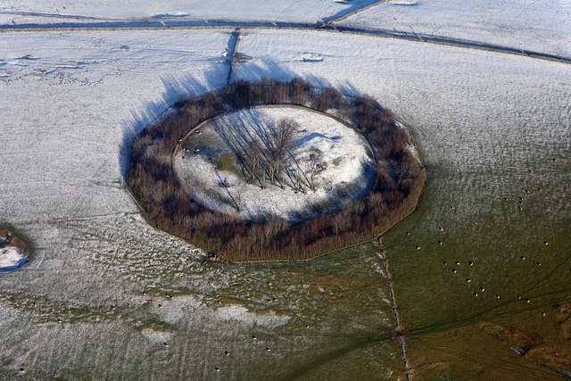
Aldwark (Old English "the old fortification") is a small upland village and parish in the Derbyshire Dales district of Derbyshire, England, about 8 miles...

Grangemill

Grangemill is a village in the English county of Derbyshire. The hamlet is made up of a cluster of houses, a farm and a pub called the Hollybush. There...

West Derbyshire (UK Parliament constituency)

West Derbyshire was a county constituency represented in the House of Commons of the Parliament of the United Kingdom. From 1885, until it was replaced...

Longcliffe

Longcliffe is a crossroads hamlet in the English county of Derbyshire. It lies on the B5056 road where it is crossed by the Brassington-Elton road. The...

Ivonbrook Grange

Ivonbrook Grange is a civil parish within the Derbyshire Dales district, in the county of Derbyshire, England. Largely rural, Ivonbrook Grange's population...

Minninglow

Minninglow (or Minning Low) is a hill in the Peak District National Park in Derbyshire, located within the White Peak area at grid reference SK209573....

Ible

Ible (pronounced 'eyebull', or 'ib-ull') is a hamlet in Derbyshire, England, just within the Peak District National Park.It is near the Via Gellia valley...
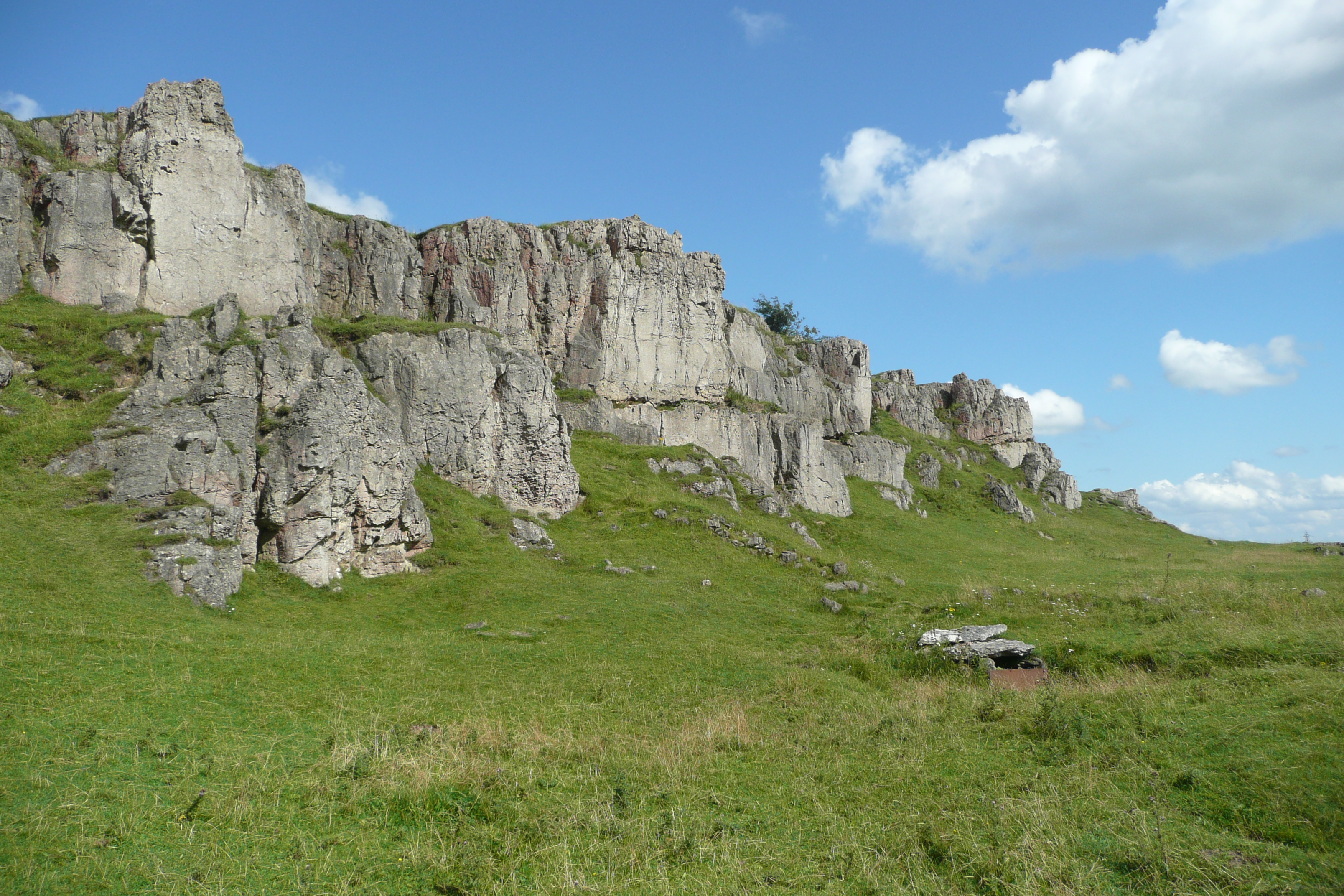
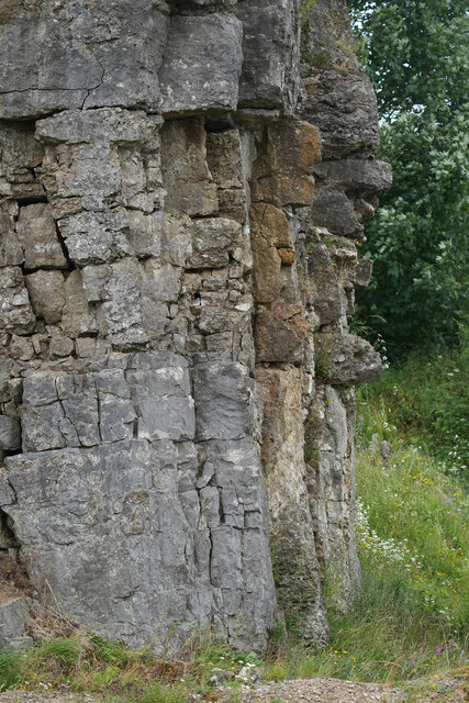
Harboro' Rocks

Harboro' Rocks (or Harborough Rocks) is a dolomitic limestone hill near the village of Brassington in the Derbyshire Peak District. The summit is 379 metres...

Nearby Amenities

Located within 500m of 53.112686,-1.659373
Aldwark
Is In: Derbyshire, England, UK
Place: village
Wikidata: Q2043743
Wikipedia: en:Aldwark, Derbyshire
Lat/Long: 53.1131333/-1.6599571
Post Box
Operator: Royal Mail
Ref: DE4 326
Lat/Long: 53.1127598/-1.6593538
Barrier: stile
Stile: squeezer
Lat/Long: 53.1168543/-1.6597976
Barrier: stile
Stile: squeezer
Lat/Long: 53.1142151/-1.6601333
Barrier: stile
Material: wood
Source: survey;gps
Stile: stepover
Lat/Long: 53.1125009/-1.6579286
Barrier: stile
Material: wood
Source: survey;gps
Stile: stepover
Lat/Long: 53.1132906/-1.6524515
Barrier: stile
Material: stone
Source: survey;gps
Stile: squeezer
Lat/Long: 53.1138489/-1.662772
Fixme: route is probably not correct. Seeking further information from PROW officer at Derbyshire CC
Lat/Long: 53.1134948/-1.6607021
Barrier: stile
Material: stone
Source: survey;gps
Stile: squeezer
Lat/Long: 53.1140594/-1.6653444
Barrier: stile
Material: stone
Source: survey;gps
Stile: squeezer
Lat/Long: 53.1140969/-1.6646199
Barrier: stile
Material: stone
Source: survey;gps
Stile: stepover
Lat/Long: 53.1133857/-1.6606168
Location Transition: yes
Power: pole
Lat/Long: 53.1118152/-1.6532176
Location Transition: yes
Power: pole
Lat/Long: 53.1118932/-1.6532225
Power: pole
Lat/Long: 53.1122789/-1.6523507
Direction: SE
Generator Method: photovoltaic
Generator Output Electricity: yes
Generator Solar Modules: 14
Generator Source: solar
Generator Type: solar_photovoltaic_panel
Location: roof
Power: generator
Lat/Long: 53.1125638/-1.658674
The data included in this document is from www.openstreetmap.org. The data is made available under ODbL.

Have you been to Aldwark?

Leave your review of Aldwark below (or comments, questions and feedback).