Aldwark

Settlement in Yorkshire Hambleton

England

Aldwark

Beside Bridge Farm Looking along the road towards Linton on Ouse.
Beside Bridge Farm Credit: DS Pugh

Aldwark is a picturesque village located in the Ryedale district of North Yorkshire, England. Situated approximately 12 miles north-west of the historic city of York, the village is nestled in the heart of the beautiful Yorkshire countryside.

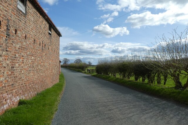
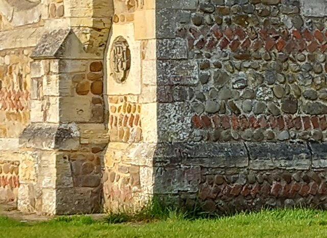
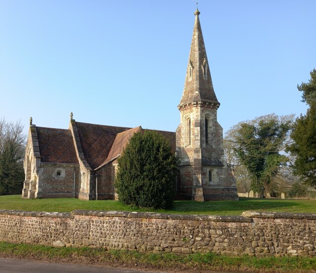
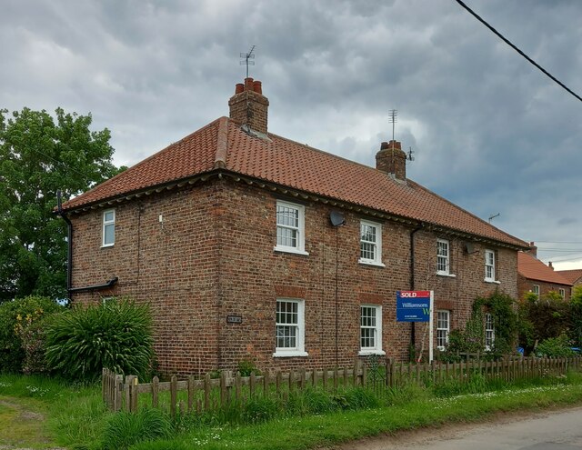
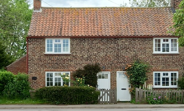
With a population of around 250 residents, Aldwark exudes a strong sense of community and charm. The village is characterized by its traditional stone-built houses, many of which date back several centuries, lending it an unmistakable rustic appeal. The stunning St. Stephen's Church, a Grade I listed building, adds to the village's architectural beauty.

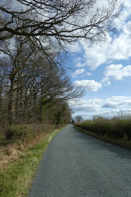
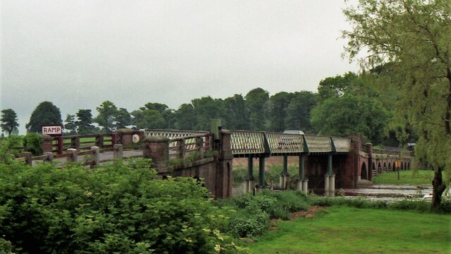
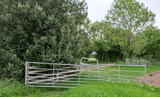
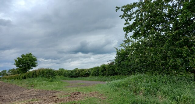
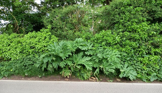
Nature enthusiasts are drawn to Aldwark for its idyllic surroundings. The village is surrounded by rolling hills, lush fields, and meandering rivers, making it an ideal destination for outdoor activities such as walking, cycling, and fishing. The nearby Aldwark Bridge presents a picturesque spot for a leisurely stroll, offering breathtaking views of the River Ure.

Despite its small size, Aldwark boasts a vibrant community spirit. The village has a local pub, The Aldwark Arms, which serves as a gathering place for residents and visitors alike. The pub offers a warm and inviting atmosphere, along with a selection of local ales and hearty pub cuisine.

Aldwark's proximity to York also provides residents with access to a range of amenities and attractions, including shopping centers, restaurants, and cultural landmarks. The village's tranquil location, combined with its strong community ties and natural beauty, make Aldwark a truly charming place to live or visit in Yorkshire.

If you have any feedback on the listing, please let us know in the comments section below.
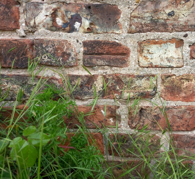
Aldwark Images

Images are sourced within 2km of 54.065927/-1.28935 or Grid Reference SE4663. Thanks to Geograph Open Source API. All images are credited.

Beside Bridge Farm Looking along the road towards Linton on Ouse.
Beside Bridge Farm
Looking along the road towards Linton on Ouse.
Road passing Aldwark Wood Looking along the road towards Linton on Ouse.
Road passing Aldwark Wood
Looking along the road towards Linton on Ouse.
Aldwark Bridge in 2000 Road toll bridge over River Ure, which becomes River Ouse shortly downstream. This is the only bridge across the river between York to the south and Boroughbridge to the north.
Aldwark Bridge in 2000
Road toll bridge over River Ure, which becomes River Ouse shortly downstream. This is the only bridge across the river between York to the south and Boroughbridge to the north.
Aldwark, St Stephen's church The benchmark is cut in a cornerstone on a north-east face of the church.
Aldwark, St Stephen's church
The benchmark is cut in a cornerstone on a north-east face of the church.
Aldwark, St Stephen's church There is a benchmark cut in a cornerstone on a north-east face of the church.
Aldwark, St Stephen's church
There is a benchmark cut in a cornerstone on a north-east face of the church.
Aldwark, Rice Lane According to the OS benchmark database there was a benchmark cut into a concrete gatepost in this vicinity. Nothing was found and it is likely the benchmark has been destroyed.
Aldwark, Rice Lane
According to the OS benchmark database there was a benchmark cut into a concrete gatepost in this vicinity. Nothing was found and it is likely the benchmark has been destroyed.
Aldwark, Rice Lane According to the OS benchmark database there was a benchmark cut into a concrete gatepost at this field entrance. Today there are no gateposts and it is likely the benchmark has been destroyed.
Aldwark, Rice Lane
According to the OS benchmark database there was a benchmark cut into a concrete gatepost at this field entrance. Today there are no gateposts and it is likely the benchmark has been destroyed.
Aldwark, Rice Lane According to the OS benchmark database there was a benchmark cut into a concrete gatepost in this section of the lane-side hedge. The field entrance and gateposts have gone, and very likely that the benchmark has been destroyed.
Aldwark, Rice Lane
According to the OS benchmark database there was a benchmark cut into a concrete gatepost in this section of the lane-side hedge. The field entrance and gateposts have gone, and very likely that the benchmark has been destroyed.
Aldwark, Rice Lane According to the OS benchmark database there was a benchmark cut into a wooden post at this location. A newer wooden finger post has been sunk adjacent to the old post and covering the face which has the benchmark. I'm unable to say if the mark still exists, but highly likely.
Aldwark, Rice Lane
According to the OS benchmark database there was a benchmark cut into a wooden post at this location. A newer wooden finger post has been sunk adjacent to the old post and covering the face which has the benchmark. I'm unable to say if the mark still exists, but highly likely.
Myton on Swale, Haddocks Lane The rivet and arrowhead were found on the east parapet of the bridge  on Haddocks Lane. This is a bridge over a very small tributary of the River Ure.
Myton on Swale, Haddocks Lane
The rivet and arrowhead were found on the east parapet of the bridge on Haddocks Lane. This is a bridge over a very small tributary of the River Ure.
Myton on Swale, Haddocks Lane There is a rivet and arrowhead on the east parapet of the bridge on Haddocks Lane. This is a bridge over a very small tributary of the River Ure.
Myton on Swale, Haddocks Lane
There is a rivet and arrowhead on the east parapet of the bridge on Haddocks Lane. This is a bridge over a very small tributary of the River Ure.
Aldwark, Longlands According to the OS benchmark database the gatepost at this field entrance had a cut benchmark. The gateposts are relatively new and there is no benchmark.
Aldwark, Longlands
According to the OS benchmark database the gatepost at this field entrance had a cut benchmark. The gateposts are relatively new and there is no benchmark.
Aldwark, Keepers Lodge According to the OS benchmark database there is a benchmark cut into the left hand corner of the road facing wall. The private property is gated and inaccessible, and it is unknown if the benchmark survives.
Aldwark, Keepers Lodge
According to the OS benchmark database there is a benchmark cut into the left hand corner of the road facing wall. The private property is gated and inaccessible, and it is unknown if the benchmark survives.
Aldwark, 1 New Cottages The benchmark is cut on the road facing wall and about 1 metre from the left hand corner.
Aldwark, 1 New Cottages
The benchmark is cut on the road facing wall and about 1 metre from the left hand corner.
Aldwark, 1 New Cottages There is a benchmark cut on the road facing wall and about 1 metre from the left hand corner.
Aldwark, 1 New Cottages
There is a benchmark cut on the road facing wall and about 1 metre from the left hand corner.
Aldwark, 1 The Green According to the OS benchmark database there is a benchmark cut into the road facing wall of the property and it is on the extreme left. There was plenty of vegetation along the front of the property obscuring any view of a benchmark.
Aldwark, 1 The Green
According to the OS benchmark database there is a benchmark cut into the road facing wall of the property and it is on the extreme left. There was plenty of vegetation along the front of the property obscuring any view of a benchmark.
Aldwark, bridge approaching village According to the OS benchmark database there is a benchmark cut into the east parapet of the bridge which crosses a small stream feeding the River Ure. A giant hogweed was flourishing and obscuring the parapet and so no search was made.
Aldwark, bridge approaching village
According to the OS benchmark database there is a benchmark cut into the east parapet of the bridge which crosses a small stream feeding the River Ure. A giant hogweed was flourishing and obscuring the parapet and so no search was made.
Show me another place!

Aldwark is located at Grid Ref: SE4663 (Lat: 54.065927, Lng: -1.28935)

Division: North Riding

Administrative County: North Yorkshire

District: Hambleton

Police Authority: North Yorkshire

What 3 Words

///clasping.teach.married. Near Linton upon Ouse, North Yorkshire

Nearby Locations

Aldwark The Woods

Related Wikis

Aldwark, Hambleton

Aldwark is a village and civil parish in the Hambleton District of North Yorkshire, England. It is situated on the River Ouse about 14 miles from York...

Youlton

Youlton is a village and civil parish in Hambleton District of North Yorkshire, England. It is situated approximately 5 miles (8 km) south-west of Easingwold...

Flawith

Flawith is a village and civil parish in Hambleton district of North Yorkshire, England. It is situated approximately 4 miles (6.4 km) south-west of Easingwold...
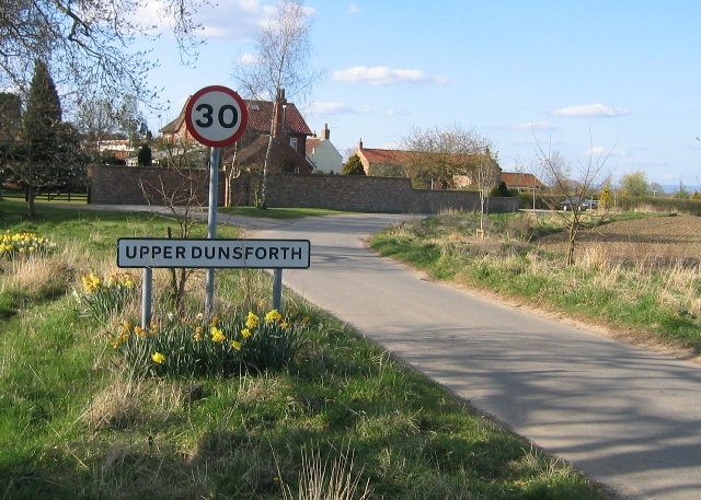
Upper Dunsforth

Upper Dunsforth is a village in located in the civil parish of Dunsforths, in the Borough of Harrogate of North Yorkshire, England. It was mentioned in...

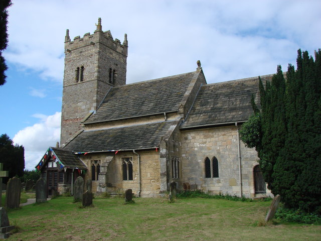
St Mary the Virgin's Church, Great Ouseburn

St Mary the Virgin's Church is in the village of Great Ouseburn, North Yorkshire, England. It is an active Anglican parish church in the deanery of Ripon...

Great Ouseburn

Great Ouseburn is a village and civil parish in the Harrogate district of North Yorkshire, England. It is situated 4 miles (6 km) south-east of Boroughbridge...

Dunsforths

Dunsforths is a civil parish in the Borough of Harrogate of North Yorkshire, England. In 2011, the civil parish had 224 inhabitants. It consists of Lower...

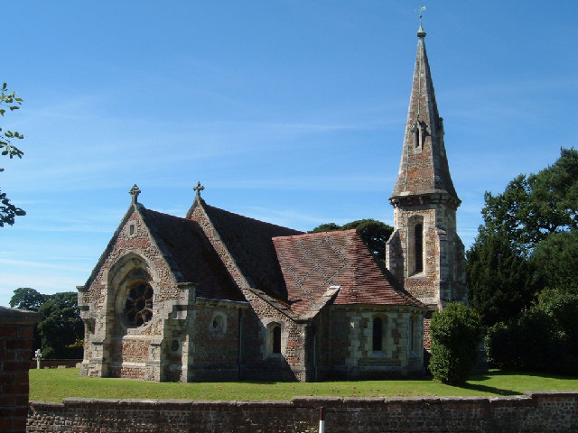
Holy Trinity Church, Little Ouseburn

Holy Trinity Church stands to the northeast of the village of Little Ouseburn, North Yorkshire, England. It is an Anglican parish church in the deanery...

Nearby Amenities

Located within 500m of 54.065927,-1.28935
Aldwark
Place: village
Lat/Long: 54.0667965/-1.289405
Public Bookcase
Aldwark Community Library
Booth: K6
Covered: booth
Disused Amenity: telephone
Man Made: telephone_box
Public Bookcase Type: phone_box
Lat/Long: 54.0655478/-1.2888533
Bench
Lat/Long: 54.0657327/-1.2890638
Bicycle Parking
Lat/Long: 54.0659531/-1.2899959
Aldwark Ramble
Information: board
Tourism: information
Lat/Long: 54.0643145/-1.2875229
Barrier: kissing_gate
Lat/Long: 54.0640372/-1.2856485
Post Box
Post Box Type: lamp
Ref: YO61 220
Royal Cypher: EIIR
Royal Cypher Wikidata: Q33102113
Lat/Long: 54.066118/-1.289767
Leisure: playground
Lat/Long: 54.0663612/-1.289744
Defibrillator
Defibrillator Location: outside Aldwark Arms, Aldwark, YO61 1UB - facing carpark next to bike racks
Emergency: defibrillator
Indoor: no
Lat/Long: 54.0659557/-1.289962
Information: board
Tourism: information
Lat/Long: 54.066148/-1.2897994
Bench
Lat/Long: 54.0682126/-1.2929533
The data included in this document is from www.openstreetmap.org. The data is made available under ODbL.

Have you been to Aldwark?

Leave your review of Aldwark below (or comments, questions and feedback).