Holwell

Civil Parish in Dorset West Dorset

England

Holwell

Lower Wood Bridge, east of Bishop's Caundle
Lower Wood Bridge, east of Bishop's Caundle Credit: David Smith

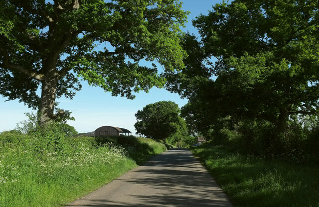
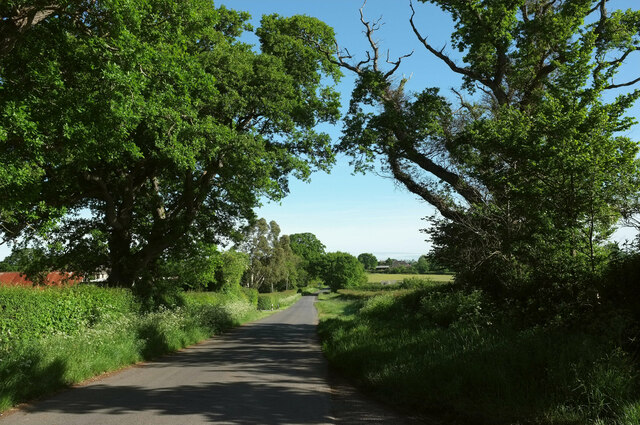
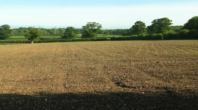
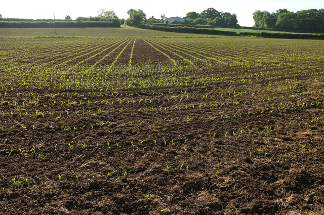
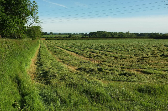
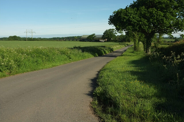
Holwell is a civil parish located in the county of Dorset, England. Situated in the West Dorset district, it covers an area of approximately 4 square kilometers. The parish is nestled in the beautiful countryside, with rolling hills and lush green fields surrounding it.

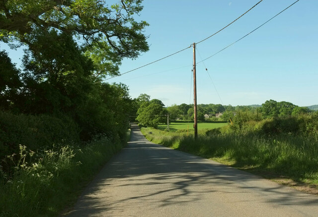
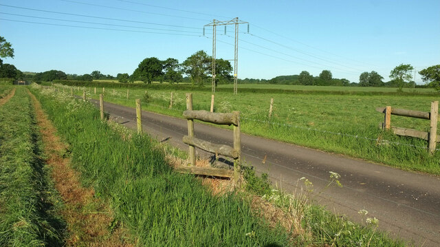
The village of Holwell itself is small and picturesque, with a population of around 150 residents. It is situated approximately 5 miles north of the market town of Sherborne and 10 miles south of Yeovil. The parish is well connected to nearby towns and cities, with the A352 road running through it, providing easy access to the surrounding areas.

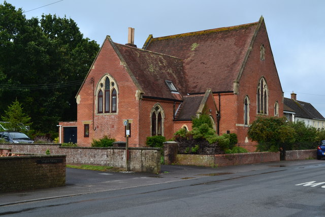
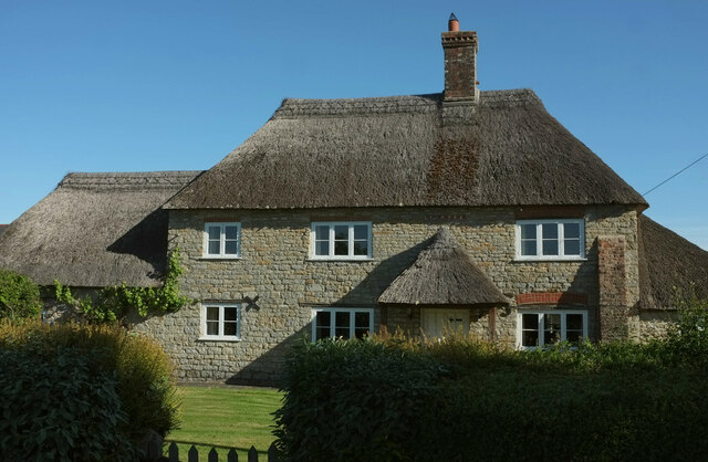
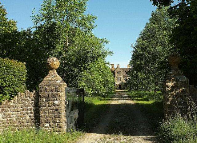
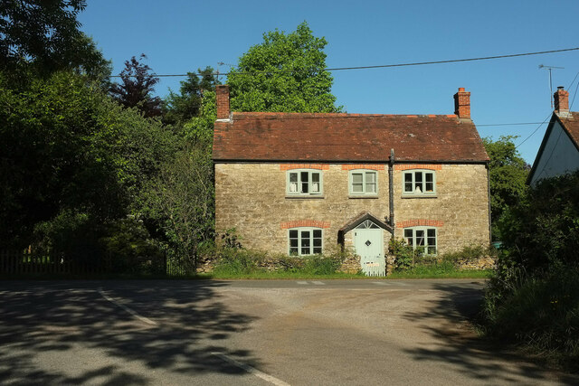
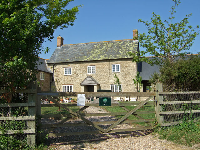
The village is predominantly residential, with a mix of traditional stone-built cottages and more modern houses. It has a tight-knit community, with local amenities including a village hall and a church. The St. Lawrence Church, dating back to the 13th century, is a prominent feature of the village and holds regular services.

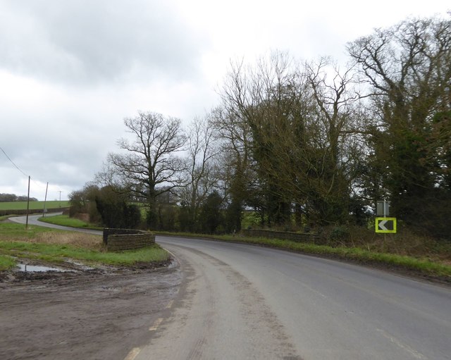
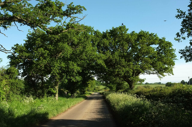
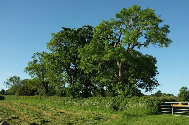
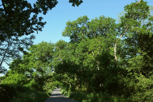
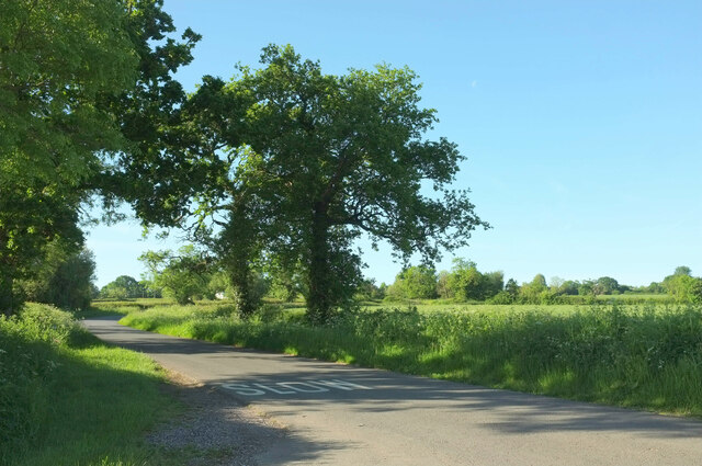
The surrounding countryside offers plenty of opportunities for outdoor activities, such as walking, cycling, and horse riding. There are also several nature reserves and parks in the area, providing a haven for wildlife and nature enthusiasts.

Overall, Holwell is a charming and peaceful village, perfect for those seeking a quiet rural lifestyle. Its idyllic location, coupled with its close proximity to larger towns and cities, makes it an attractive place to live for both families and retirees alike.

If you have any feedback on the listing, please let us know in the comments section below.

Holwell Images

Images are sourced within 2km of 50.896097/-2.429393 or Grid Reference ST6910. Thanks to Geograph Open Source API. All images are credited.

Lower Wood Bridge, east of Bishop's Caundle
Former chapel at Holwell
Direction Sign – Signpost Located on the north side of the A3030 beside the entrance to Woodbridge Farm, opposite Peaceful Lane in Holwell parish. 3 arms, 1 missing, and annulus finial. See also <a title="https://www.geograph.org.uk/photo/458327" href="https://www.geograph.org.uk/photo/458327">Link</a>.

Milestone Society National ID: DO_ST7112
Direction Sign – Signpost
Located on the north side of the A3030 beside the entrance to Woodbridge Farm, opposite Peaceful Lane in Holwell parish. 3 arms, 1 missing, and annulus finial. See also Link. Milestone Society National ID: DO_ST7112
Lane to Holwell Roadside trees on a straight lane passing Oakwood View.
Lane to Holwell
Roadside trees on a straight lane passing Oakwood View.
Trees near Hartmoor Farm Along the lane from Holwell to Pulham.
Trees near Hartmoor Farm
Along the lane from Holwell to Pulham.
Passing Holwell Hill Farm On the lane from Pulham to Holwell.
Passing Holwell Hill Farm
On the lane from Pulham to Holwell.
Lane to Holwell A little further north from <a href="https://www.geograph.org.uk/photo/7184565">ST7010 : Passing Holwell Hill Farm</a>. A little of the village of Holwell is visible ahead right of centre.
Lane to Holwell
A little further north from ST7010 : Passing Holwell Hill Farm. A little of the village of Holwell is visible ahead right of centre.
Crouch Hill Farm The thatched farmhouse on Holwell Drove is "possibly of C17 origin ..." <span class="nowrap"><a title="https://historicengland.org.uk/listing/the-list/list-entry/1304895?section=official-list-entry" rel="nofollow ugc noopener" href="https://historicengland.org.uk/listing/the-list/list-entry/1304895?section=official-list-entry">Link</a><img style="margin-left:2px;" alt="External link" title="External link - shift click to open in new window" src="https://s1.geograph.org.uk/img/external.png" width="10" height="10"/></span> .
Crouch Hill Farm
The thatched farmhouse on Holwell Drove is "possibly of C17 origin ..." LinkExternal link .
Holwell Drove Approaching a slight right bend, the only bend in the one and a half kilometres road between Holwell and Sandhills. Its drove-like quality is more pronounced towards the western end.
Holwell Drove
Approaching a slight right bend, the only bend in the one and a half kilometres road between Holwell and Sandhills. Its drove-like quality is more pronounced towards the western end.
Holwell Manor House Grade II* listed. "Country House, C16 with much rebuilding of 1889" <span class="nowrap"><a title="https://historicengland.org.uk/listing/the-list/list-entry/1118845?section=official-list-entry" rel="nofollow ugc noopener" href="https://historicengland.org.uk/listing/the-list/list-entry/1118845?section=official-list-entry">Link</a><img style="margin-left:2px;" alt="External link" title="External link - shift click to open in new window" src="https://s1.geograph.org.uk/img/external.png" width="10" height="10"/></span> . Seen past the entrance gate on Holwell Drove <a href="https://www.geograph.org.uk/photo/7564503">ST6810 : Holwell Drove</a>.
Holwell Manor House
Grade II* listed. "Country House, C16 with much rebuilding of 1889" LinkExternal link . Seen past the entrance gate on Holwell Drove ST6810 : Holwell Drove.
Cottage, Sandhills Tess Cottage is opposite the junction of Holwell Drove (foreground) with Stock Hill Lane. Presumably named as a whimsical reference to Hardy's famous character who spent time in the Blackmore Vale, which we are in.
Cottage, Sandhills
Tess Cottage is opposite the junction of Holwell Drove (foreground) with Stock Hill Lane. Presumably named as a whimsical reference to Hardy's famous character who spent time in the Blackmore Vale, which we are in.
Stock Hill Lane Passing Rails Farm. To the right of the telegraph pole is Magog Farm.
Stock Hill Lane
Passing Rails Farm. To the right of the telegraph pole is Magog Farm.
Arable field near Hartmoor Farm Looking right from <a href="https://www.geograph.org.uk/photo/7562508">ST7109 : Arable field near Hartmoor Farm</a>.
Arable field near Hartmoor Farm
Arable field near Hartmoor Farm I think this is baby maize, seen looking along the line of  footpath N49 14. Fairly easy to cross without treading on any of them.
Arable field near Hartmoor Farm
I think this is baby maize, seen looking along the line of footpath N49 14. Fairly easy to cross without treading on any of them.
Stiles near Hartmoor Farm On footpath N49 14, and designed for those long legs. Frankly, I couldn't face climbing over both of them. so took to the farm drive to reach the lane to Holwell.
Stiles near Hartmoor Farm
On footpath N49 14, and designed for those long legs. Frankly, I couldn't face climbing over both of them. so took to the farm drive to reach the lane to Holwell.
Mown grass near Hartmoor Farm From the start of the drive to the farm.
Mown grass near Hartmoor Farm
From the start of the drive to the farm.
Trees by the road to Pulham From the start of the drive to Hartmoor Farm.
Trees by the road to Pulham
From the start of the drive to Hartmoor Farm.
Road to Holwell Looking in the other direction from <a href="https://www.geograph.org.uk/photo/7562911">ST7009 : Trees by the road to Pulham</a>.
Road to Holwell
Looking in the other direction from ST7009 : Trees by the road to Pulham.
Show me another place!

Holwell is located at Grid Ref: ST6910 (Lat: 50.896097, Lng: -2.429393)

Administrative County: Dorset

District: West Dorset

Police Authority: Dorset

What 3 Words

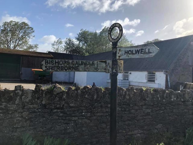
///shuffles.unopposed.second. Near Stalbridge, Dorset

Related Wikis

Holwell, Dorset

Holwell is a village and civil parish in the county of Dorset in southern England, situated approximately 5 miles (8.0 km) south-east of Sherborne. It...

Woodbridge, Dorset

Woodbridge is a hamlet in Dorset, England. The village is on the A3030 road and to the north east of Holwell. == History == Woodbridge was part of the...

Bishop's Caundle

Bishop's Caundle is a village and civil parish in Dorset, South West England. It is situated 6 miles (9.7 km) south-east of Sherborne. The local travel...

Pulham

Pulham is a village and civil parish in the county of Dorset in south-west England. It is situated in the Blackmore Vale, 7 miles (11 kilometres) southeast...

King's Stag Memorial Chapel

King's Stag Memorial Chapel is a Church of England chapel in King's Stag, Dorset, England. == History == The memorial chapel at King's Stag was built in...

St Peter and St Paul's Church, Caundle Marsh

St Peter and St Paul's Church is a Church of England parish church in Caundle Marsh, Dorset, England. It was designed by Robert Howard Shout and built...

Holnest SSSI, Dorset

Holnest SSSI, Dorset (grid reference ST667106) is a 54.83 hectare biological Site of Special Scientific Interest in Dorset, notified in 2004.The site has...

Caundle Marsh

Caundle Marsh is a village and civil parish in northwest Dorset, England, situated in the Blackmore Vale, 4 miles (6.4 km) southeast of Sherborne. The...

Nearby Amenities

Located within 500m of 50.896097,-2.429393
Post Box
Collection Times: Mo-Fr 12:30; Sa 09:00
Post Box Mounting: brick_pillar
Post Box Type: wall
Ref: DT9 44
Ref GB Uprn: 10015469034
Royal Cypher: GVIR
Royal Cypher Wikidata: Q33102169
Lat/Long: 50.8955199/-2.42483
Telephone
Booth: K6
Covered: booth
Lat/Long: 50.8955091/-2.4246756
Holwell
Is In: Dorset, England, UK
Place: village
Source: NPE
Lat/Long: 50.8962798/-2.4222916
Turning Circle
Lat/Long: 50.8951679/-2.4244817
Board Type: notice
Information: board
Tourism: information
Lat/Long: 50.895517/-2.4247585
Kindergarten
Holwell Nursery School
Lat/Long: 50.8965356/-2.4257568
Power: pole
Source: bing
Lat/Long: 50.8986787/-2.4235663
Power: pole
Source: bing
Lat/Long: 50.8974937/-2.4235891
Power: pole
Source: bing
Lat/Long: 50.8969718/-2.4230137
Power: pole
Source: bing
Lat/Long: 50.9000574/-2.4264671
Power: pole
Source: bing
Lat/Long: 50.8992116/-2.4255055
Power: pole
Source: bing
Lat/Long: 50.8979522/-2.4241081
Power: pole
Source: bing
Lat/Long: 50.8984207/-2.4246097
Power: pole
Source: bing
Lat/Long: 50.8971799/-2.4292767
Power: pole
Source: bing
Lat/Long: 50.8975368/-2.4280912
Poles: bipole
Power: pole
Source: bing
Transformer: distribution
Lat/Long: 50.8978836/-2.4268895
Power: pole
Source: bing
Lat/Long: 50.8981695/-2.4256557
Direction: S
Generator Method: photovoltaic
Generator Output Electricity: yes
Generator Solar Modules: 12
Generator Source: solar
Generator Type: solar_photovoltaic_panel
Location: roof
Power: generator
Lat/Long: 50.8953466/-2.4243164
Direction: S
Generator Method: photovoltaic
Generator Output Electricity: yes
Generator Solar Modules: 16
Generator Source: solar
Generator Type: solar_photovoltaic_panel
Location: roof
Power: generator
Lat/Long: 50.8950285/-2.4243513
The data included in this document is from www.openstreetmap.org. The data is made available under ODbL.

Have you been to Holwell?

Leave your review of Holwell below (or comments, questions and feedback).