Farnham Royal

Civil Parish in Buckinghamshire

England

Farnham Royal

Burnham Beeches Burnham Beeches is owned by the Corporation of London. This ancient woodland is a National Nature Reserve.
Burnham Beeches Credit: David Hawgood

Farnham Royal is a civil parish located in the county of Buckinghamshire, England. It is situated approximately 20 miles west of London and is part of the South Bucks district. The parish covers an area of around 5 square miles and has a population of approximately 2,500 people.

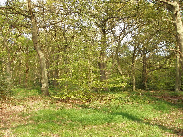
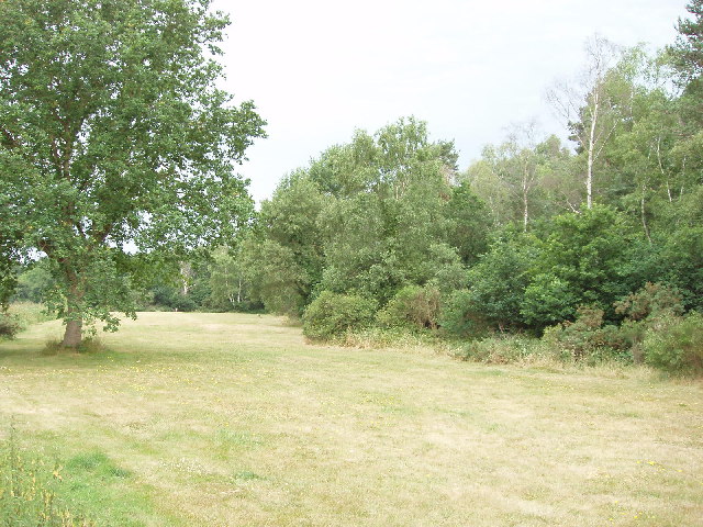
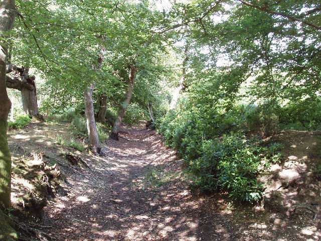
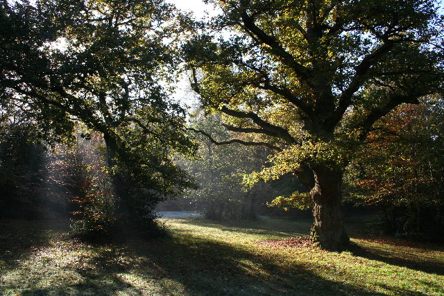
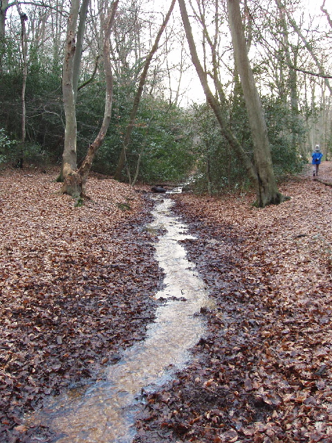
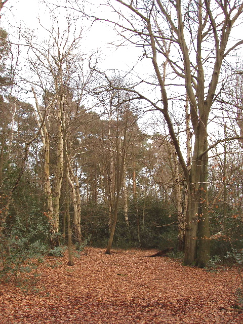
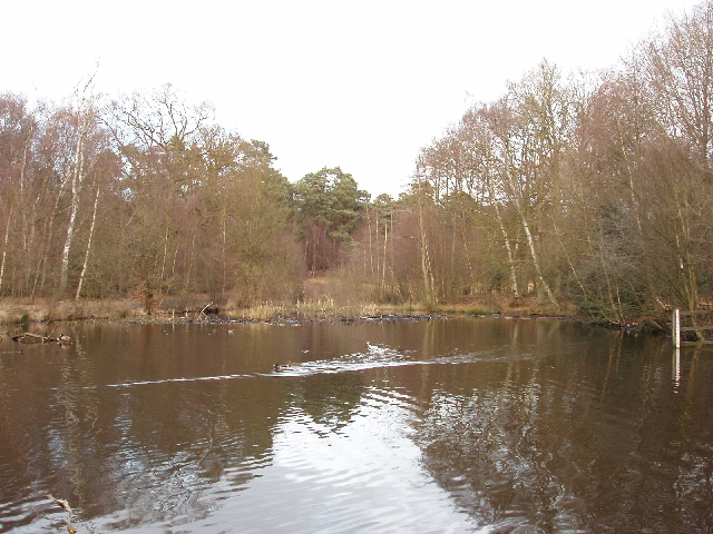
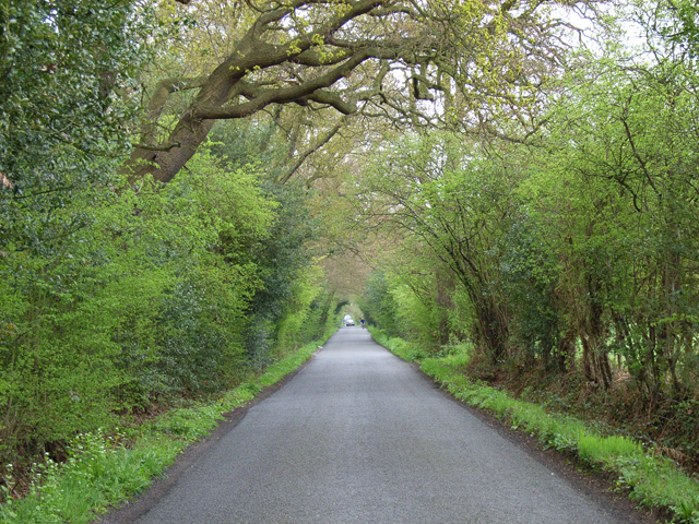
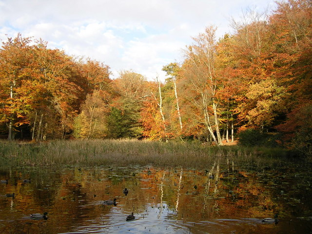
The village of Farnham Royal is known for its picturesque countryside and historic buildings. It is surrounded by green fields and woodland, making it an ideal location for nature lovers and outdoor enthusiasts. The area is also well-known for its equestrian activities, with several stables and riding schools in the vicinity.

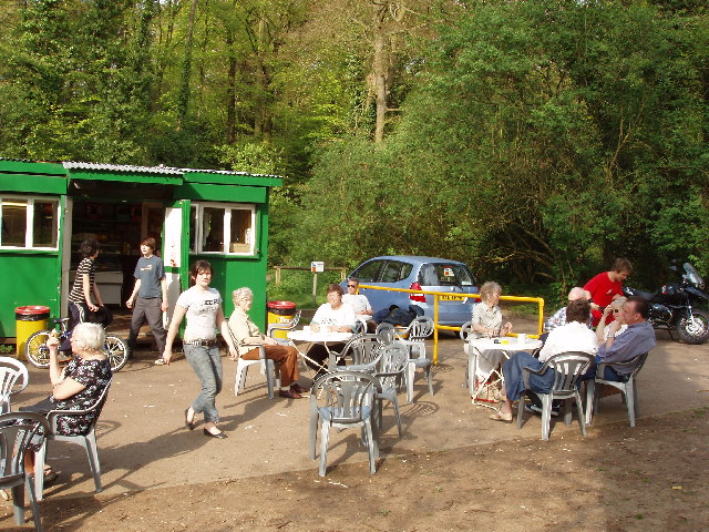
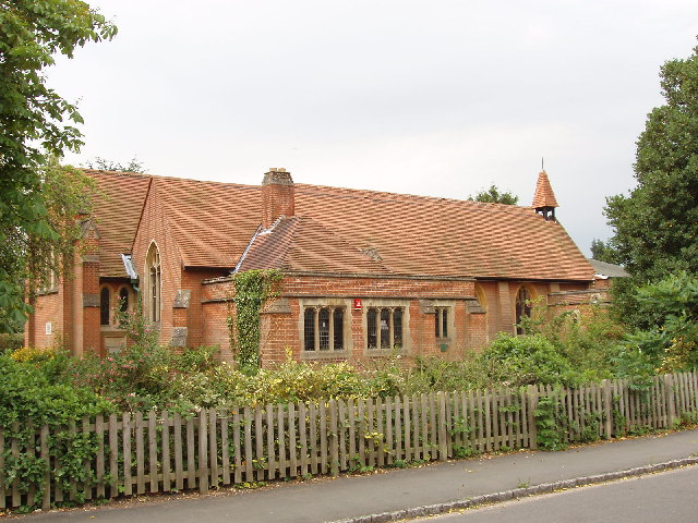
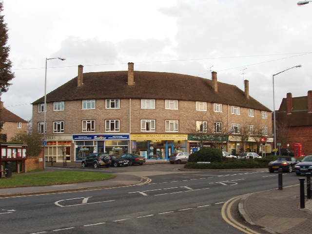
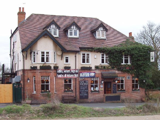
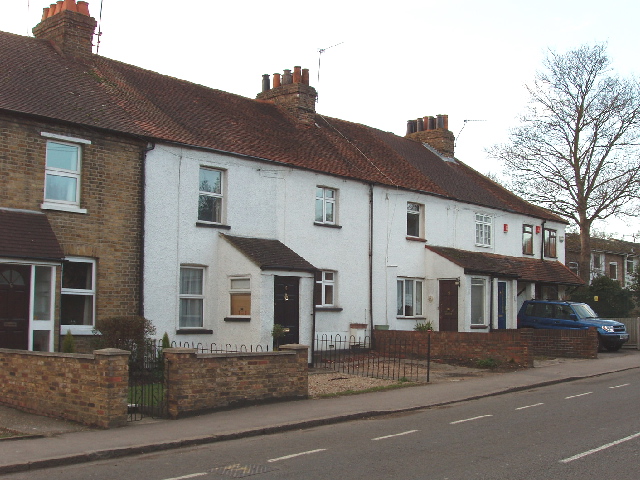
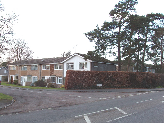
The village itself has a charming and traditional feel, with a mix of old cottages and more modern houses. It has a small but vibrant community, with a range of amenities including a primary school, village hall, and a few local shops and pubs. The parish is also home to St. Mary's Church, a beautiful Grade II listed building that dates back to the 12th century.

Farnham Royal is well-connected to surrounding areas by road, with the A355 passing through the village and providing easy access to nearby towns such as Slough and Beaconsfield. The area also benefits from good transport links, with several train stations within a short drive.

Overall, Farnham Royal offers a peaceful and idyllic setting, combining rural charm with convenient access to urban amenities. It is a desirable location for those seeking a quiet and picturesque place to live within commuting distance of London.

If you have any feedback on the listing, please let us know in the comments section below.

Farnham Royal Images

Images are sourced within 2km of 51.551831/-0.613992 or Grid Reference SU9684. Thanks to Geograph Open Source API. All images are credited.

Burnham Beeches Burnham Beeches is owned by the Corporation of London. This ancient woodland is a National Nature Reserve.
Burnham Beeches
Burnham Beeches is owned by the Corporation of London. This ancient woodland is a National Nature Reserve.
Cafe near Pumpkin Hill, Burnham Beeches This cafe on the southern boundary of Burnham Beeches is very convenient for disabled users.
Update: this has been closed and the building removed. It was replaced in 2007 by the one shown in <a href="https://www.geograph.org.uk/photo/670569">SU9585 : New café, toilets and information point at Burnham Beeches</a>.
Cafe near Pumpkin Hill, Burnham Beeches
This cafe on the southern boundary of Burnham Beeches is very convenient for disabled users. Update: this has been closed and the building removed. It was replaced in 2007 by the one shown in SU9585 : New café, toilets and information point at Burnham Beeches.
Mobile phone radio mast, near Farnham Common This mast is tucked into the corner of a field next to Brockhurst Wood
Mobile phone radio mast, near Farnham Common
This mast is tucked into the corner of a field next to Brockhurst Wood
Church of St John the Evangelist, Farnham Common Historically this area was in the parish of Farnham Royal, this church was built when the population here grew.
Church of St John the Evangelist, Farnham Common
Historically this area was in the parish of Farnham Royal, this church was built when the population here grew.
East Burnham Common in Burnham Beeches This area was bought by the City of London to preserve it for public enjoyment
East Burnham Common in Burnham Beeches
This area was bought by the City of London to preserve it for public enjoyment
Hartley Court Moat (Hardicanutes), Burnham Beeches This was a moated homestead dating from the 12th to 14th Centuries. This moat protected the inner enclosure of 0.6 hectares. There is also a shallower ditch and a low bank which would have been surmounted by a fence protecting an outer enclosure of almost 4 hectares.
Hartley Court Moat (Hardicanutes), Burnham Beeches
This was a moated homestead dating from the 12th to 14th Centuries. This moat protected the inner enclosure of 0.6 hectares. There is also a shallower ditch and a low bank which would have been surmounted by a fence protecting an outer enclosure of almost 4 hectares.
Old tree in Burnham Beeches Taken on Boxing Day walk Christmas 2004, while the Tsunami was underway unbeknown to us.
Old tree in Burnham Beeches
Taken on Boxing Day walk Christmas 2004, while the Tsunami was underway unbeknown to us.
Burnham Beeches
Burnham Beeches
Stream in Burnham Beeches View looking south-west in late afternoon. The shallow stream over gravel takes an overflow from the dam at Upper Pond, and flows into Middle Pond.
Stream in Burnham Beeches
View looking south-west in late afternoon. The shallow stream over gravel takes an overflow from the dam at Upper Pond, and flows into Middle Pond.
Shops in Farnham Common These shops are on Beaconsfield Road, the A355 from Slough to Beaconsfield, at the junction with Rosewood Way. Photo taken from the end of Beeches Road.
Shops in Farnham Common
These shops are on Beaconsfield Road, the A355 from Slough to Beaconsfield, at the junction with Rosewood Way. Photo taken from the end of Beeches Road.
The Stag, Burnham Beeches - walkers welcome! This public house (marked on the OS map) is opposite a large public car park for those walking in Burnham Beeches. A sign on the pub says "Wellies, walkers, dogs and families -  all welcome here".
The Stag, Burnham Beeches - walkers welcome!
This public house (marked on the OS map) is opposite a large public car park for those walking in Burnham Beeches. A sign on the pub says "Wellies, walkers, dogs and families - all welcome here".
Burnham Beeches - birch, beech and holly Walking through the woods from "The Stag" to here, many of the trees were oaks, with some large fir trees. Here they have changed to being a mixture of birch and beech. There are holly bushes under the trees in both areas.
Burnham Beeches - birch, beech and holly
Walking through the woods from "The Stag" to here, many of the trees were oaks, with some large fir trees. Here they have changed to being a mixture of birch and beech. There are holly bushes under the trees in both areas.
Upper pond, Burnham Beeches View looking north-east from the dam at the end of the pond. There are ducks on the pond.
Upper pond, Burnham Beeches
View looking north-east from the dam at the end of the pond. There are ducks on the pond.
Woodland Cottages, Farnham Common These cottages are on the main road through the village, Beaconsfield Road.
Woodland Cottages, Farnham Common
These cottages are on the main road through the village, Beaconsfield Road.
Ingle Glen, Farnham Common An area of mainly small post-war town houses. Photo at the junction with Beaconsfield Road.
Ingle Glen, Farnham Common
An area of mainly small post-war town houses. Photo at the junction with Beaconsfield Road.
The Dump
The Dump
Burnham Beeches Sign
Duffield Lane The car is approaching Duffield Farm.
Duffield Lane
The car is approaching Duffield Farm.
Show me another place!

Farnham Royal is located at Grid Ref: SU9684 (Lat: 51.551831, Lng: -0.613992)

Unitary Authority: Buckinghamshire

Police Authority: Thames Valley

What 3 Words

///cling.dame.arch. Near Farnham Royal, Buckinghamshire

Related Wikis

Nearby Amenities

Located within 500m of 51.551831,-0.613992
Crossing
Lat/Long: 51.5508136/-0.6180845
Turning Circle
Lat/Long: 51.5542609/-0.6106661
Noexit: yes
Lat/Long: 51.5520299/-0.6157688
Bus Stop
Kennedy Close
Bus: yes
Public Transport: platform
Shelter: no
Lat/Long: 51.5498998/-0.6149419
Bus Stop
Kennedy Close
Bus: yes
Naptan AtcoCode: 040000001262
Naptan NaptanCode: bucdajdw
Public Transport: platform
Shelter: no
Lat/Long: 51.55078/-0.6154739
Bus Stop
The Forester's Arms
Bench: yes
Bus: yes
Public Transport: platform
Shelter: yes
Lat/Long: 51.5538016/-0.6154505
Bus Stop
The Forester's Arms
Bench: yes
Bus: yes
Public Transport: platform
Shelter: yes
Lat/Long: 51.5541006/-0.6152736
Crossing
Crossing: marked
Crossing Markings: yes
Lat/Long: 51.5557018/-0.615324
Crossing
Crossing: marked
Crossing Markings: yes
Lat/Long: 51.5545914/-0.6153369
Direction: 180
Generator Method: photovoltaic
Generator Output Electricity: yes
Generator Solar Modules: 12
Generator Source: solar
Generator Type: solar_photovoltaic_panel
Location: roof
Power: generator
Lat/Long: 51.5533894/-0.6146408
Direction: 210
Generator Method: photovoltaic
Generator Output Electricity: yes
Generator Solar Modules: 15
Generator Source: solar
Generator Type: solar_photovoltaic_panel
Location: roof
Power: generator
Lat/Long: 51.5495797/-0.6193357
Direction: 180
Generator Method: photovoltaic
Generator Output Electricity: yes
Generator Solar Modules: 8
Generator Source: solar
Generator Type: solar_photovoltaic_panel
Location: roof
Power: generator
Lat/Long: 51.550131/-0.6179679
Direction: 270
Generator Method: photovoltaic
Generator Output Electricity: yes
Generator Solar Modules: 18
Generator Source: solar
Generator Type: solar_photovoltaic_panel
Location: roof
Power: generator
Lat/Long: 51.5502199/-0.6179499
Direction: 180
Generator Method: photovoltaic
Generator Output Electricity: yes
Generator Solar Modules: 16
Generator Source: solar
Generator Type: solar_photovoltaic_panel
Location: roof
Power: generator
Lat/Long: 51.5495201/-0.6180182
Direction: 170
Generator Method: photovoltaic
Generator Output Electricity: yes
Generator Solar Modules: 8
Generator Source: solar
Generator Type: solar_photovoltaic_panel
Location: roof
Power: generator
Lat/Long: 51.5498957/-0.6158229
Direction: 100
Generator Method: photovoltaic
Generator Output Electricity: yes
Generator Solar Modules: 4
Generator Source: solar
Generator Type: solar_photovoltaic_panel
Location: roof
Power: generator
Lat/Long: 51.5488476/-0.6169482
Direction: 190
Fixme: survey to verify number & type of panel
Generator Method: photovoltaic
Generator Output Electricity: yes
Generator Solar Modules: 4
Generator Source: solar
Generator Type: solar_photovoltaic_panel
Location: roof
Power: generator
Lat/Long: 51.5488351/-0.6169866
Direction: 85
Generator Method: photovoltaic
Generator Output Electricity: yes
Generator Solar Modules: 16
Generator Source: solar
Generator Type: solar_photovoltaic_panel
Location: roof
Power: generator
Lat/Long: 51.5545986/-0.6141725
Direction: 85
Generator Method: photovoltaic
Generator Output Electricity: yes
Generator Solar Modules: 16
Generator Source: solar
Generator Type: solar_photovoltaic_panel
Location: roof
Power: generator
Lat/Long: 51.5547368/-0.614183
Direction: 180
Generator Method: photovoltaic
Generator Output Electricity: yes
Generator Solar Modules: 16
Generator Source: solar
Generator Type: solar_photovoltaic_panel
Location: roof
Power: generator
Lat/Long: 51.5550783/-0.6139983
Direction: 180
Generator Method: photovoltaic
Generator Output Electricity: yes
Generator Solar Modules: 16
Generator Source: solar
Generator Type: solar_photovoltaic_panel
Location: roof
Power: generator
Lat/Long: 51.5550797/-0.6137695
Direction: 90
Generator Method: photovoltaic
Generator Output Electricity: yes
Generator Solar Modules: 10
Generator Source: solar
Generator Type: solar_photovoltaic_panel
Location: roof
Power: generator
Lat/Long: 51.554756/-0.6128002
Direction: 180
Generator Method: photovoltaic
Generator Output Electricity: yes
Generator Solar Modules: 12
Generator Source: solar
Generator Type: solar_photovoltaic_panel
Location: roof
Power: generator
Lat/Long: 51.5556791/-0.6104291
Direction: 175
Generator Method: photovoltaic
Generator Output Electricity: yes
Generator Solar Modules: 4
Generator Source: solar
Generator Type: solar_photovoltaic_panel
Location: roof
Power: generator
Lat/Long: 51.5534337/-0.6117241
Give Way
Direction: backward
Lat/Long: 51.5510177/-0.6117703
Post Box
Post Box Apertures: 2
Post Box Design: type_c
Post Box Type: pillar
Royal Cypher: EIIR
Royal Cypher Wikidata: Q33102113
Lat/Long: 51.5558442/-0.6151948
Telephone
Booth: K6
Covered: booth
Mapillary: 469090931012119
Lat/Long: 51.5559852/-0.6151781
Restaurant
Izmir
Addr Postcode: SL2 3PQ
Cuisine: turkish
Fhrs Id: 1521969
Lat/Long: 51.5546976/-0.6155304
Ultrasound Clinic
Healthcare: clinic
Lat/Long: 51.5544598/-0.6157144
Bench
Lat/Long: 51.5542885/-0.6154082
Bench
Lat/Long: 51.5543717/-0.6155321
Bench
Lat/Long: 51.5543537/-0.6157221
Bench
Lat/Long: 51.5542238/-0.6157287
Man Made: flagpole
Lat/Long: 51.5542778/-0.6155129
Post Box
Operator: Royal Mail
Operator Wikidata: Q638098
Ref: SL2 80
Lat/Long: 51.5544209/-0.6122735
Defibrillator
Defibrillator Location: on southern wall of Ashford, Opposite side of road of Sainsburys,
Emergency: defibrillator
Lat/Long: 51.5555205/-0.6151078
Post Box
Operator: Royal Mail
Operator Wikidata: Q638098
Post Box Type: yes
Ref: SL2 75
Royal Cypher: GR
Lat/Long: 51.5509613/-0.6116671
Post Box
Operator: Royal Mail
Operator Wikidata: Q638098
Ref: SL2 164
Lat/Long: 51.5509565/-0.6181393
Bench
Lat/Long: 51.5545497/-0.615217
Bench
Lat/Long: 51.554523/-0.6152137
Bench
Lat/Long: 51.5552382/-0.6151937
Construction Name: Bucks Beauty
Shop: vacant
Lat/Long: 51.5546618/-0.6155252
Construction Name: Arnold Funeral Home
Shop: vacant
Lat/Long: 51.5546205/-0.6155135
Clayton Stoke Solicitors
Addr City: Farnham Common
Addr Housenumber: 3
Addr Postcode: SL2 3PQ
Addr Street: The Broadway
Office: lawyer
Website: https://www.claytonstoke.co.uk/
Lat/Long: 51.5545643/-0.6155161
Tru Barbers
Shop: hairdresser
Lat/Long: 51.5545064/-0.6155203
Ginger Rabbit
Shop: hairdresser
Lat/Long: 51.5561885/-0.6148222
Sunrise Dry Cleaner
Shop: dry_cleaning
Lat/Long: 51.5561421/-0.6149138
myBoutique.online
Shop: clothes
Lat/Long: 51.5560989/-0.6149621
Tru Beauty
Shop: beauty
Lat/Long: 51.556061/-0.6149595
Foreman King
Office: estate_agent
Lat/Long: 51.5560023/-0.6149725
LynnNails
Beauty: nails
Shop: beauty
Lat/Long: 51.5559546/-0.6149724
Bench
Lat/Long: 51.5561455/-0.6151573
Bench
Lat/Long: 51.5560022/-0.6151882
The data included in this document is from www.openstreetmap.org. The data is made available under ODbL.

Have you been to Farnham Royal?

Leave your review of Farnham Royal below (or comments, questions and feedback).