Chatburn

Civil Parish in Lancashire Ribble Valley

England

Chatburn

St. Leonard's Church, Downham Looking at the east side of the church from the front of the Assheton Arms.
St. Leonard's Church, Downham Credit: Greum

Chatburn is a civil parish located in the county of Lancashire, in the North West region of England. It is situated on the banks of the River Ribble, just south of Clitheroe. The parish covers an area of approximately 3 square miles and has a population of around 1,000 residents.

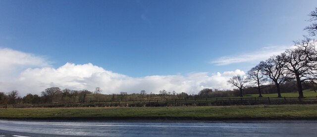
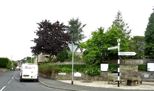
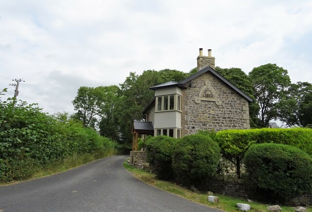
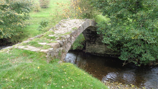
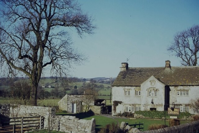
The village of Chatburn is known for its picturesque setting, surrounded by the rolling hills and lush greenery of the Ribble Valley. It retains much of its traditional charm, with a mix of historic stone buildings and newer developments. The village is centered around a main street, which is lined with local shops, cafes, and pubs, providing amenities for both residents and visitors.

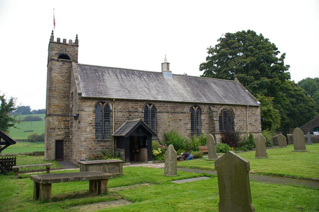
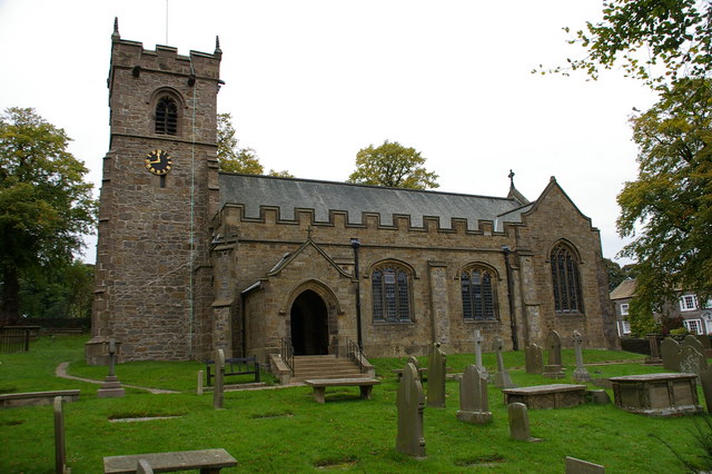
Chatburn is home to several notable landmarks and attractions. One of the most prominent is the Church of St. Paul, a Grade II listed building dating back to the 19th century. The church, with its beautiful stained glass windows and intricate stonework, is a popular destination for history and architecture enthusiasts.

The village also boasts a primary school, a community center, and a recreational ground, offering facilities for sports and leisure activities. The surrounding countryside provides ample opportunities for outdoor pursuits, including walking, cycling, and fishing.

Overall, Chatburn offers a tranquil and scenic setting for those seeking a peaceful village lifestyle, while still being within easy reach of the larger towns and cities in Lancashire.

If you have any feedback on the listing, please let us know in the comments section below.
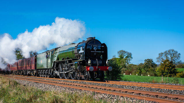
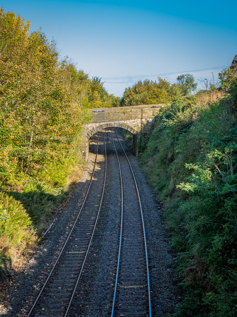
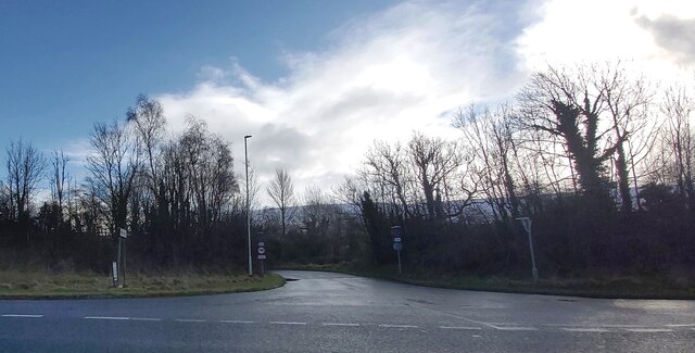
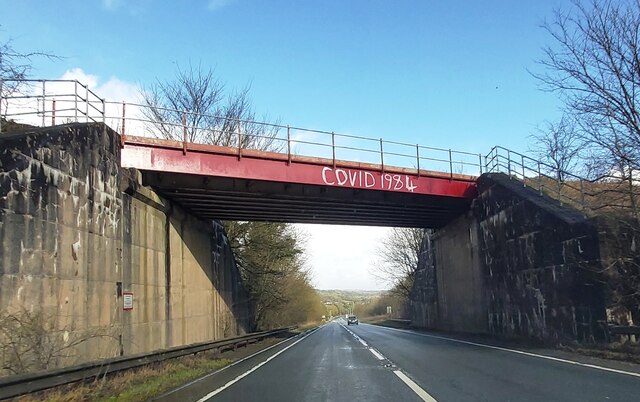
Chatburn Images

Images are sourced within 2km of 53.895208/-2.353663 or Grid Reference SD7644. Thanks to Geograph Open Source API. All images are credited.

St. Leonard's Church, Downham Looking at the east side of the church from the front of the Assheton Arms.
St. Leonard's Church, Downham
Looking at the east side of the church from the front of the Assheton Arms.
Tornado bound for Carlisle on the Clitheroe to Hellifield Line
Seldom used railway line at Chatburn
The lane to Worston
The lane to Worston
Rail Bridge over the A59
Fields near Smithies Bridge
Main entrance to Clitheroe Community Hospital On the A671.
Main entrance to Clitheroe Community Hospital
On the A671.
Grindleton village centre At the junction of Main Street and Greendale View.
Grindleton village centre
At the junction of Main Street and Greendale View.
Hydro Lodge An Edwardian lodge house on Sawley Road.
Hydro Lodge
An Edwardian lodge house on Sawley Road.
Swanside Bridge Over Smithies Brook, an old route to Sawley Abbey
Swanside Bridge
Over Smithies Brook, an old route to Sawley Abbey
Arnot House, Chatburn Grade 2 Listed Building 1677. Limestone rubble with sandstone dressings and stone slate roof.
Arnot House, Chatburn
Grade 2 Listed Building 1677. Limestone rubble with sandstone dressings and stone slate roof.
Downham, Ribble Valley Bridge over the village stream, with Pendle Hill in the distance
Downham, Ribble Valley
Bridge over the village stream, with Pendle Hill in the distance
Footpath to Quarry The footpath and track leading from Clitheroe Road Chatburn to Bellmanpark Quarry.
Footpath to Quarry
The footpath and track leading from Clitheroe Road Chatburn to Bellmanpark Quarry.
Cows near Downham
Cows near Downham
Lane near Worsaw End
Track at Rad Brook - Worsaw End House
Worsaw End House
Worsaw End House
Path towards Worsaw End
Show me another place!

Chatburn is located at Grid Ref: SD7644 (Lat: 53.895208, Lng: -2.353663)

Administrative County: Lancashire

District: Ribble Valley

Police Authority: Lancashire

What 3 Words

///poker.meanders.roadmap. Near Chatburn, Lancashire

Related Wikis

Christ Church, Chatburn

Christ Church is in the village of Chatburn, Lancashire, England. It is an active Anglican parish church in the deanery of Whalley, the archdeaconry of...

Chatburn

Chatburn is a village, civil parish and electoral ward in the Ribble Valley, East Lancashire, England. The population of the civil parish at the 2011 census...

Chatburn railway station

Chatburn railway station once served the small village of Chatburn in Lancashire, England. == History == The original single line opened in June 1850 and...

St Ambrose's Church, Grindleton

St Ambrose's Church is in the village of Grindleton, which is situated about 3 miles (5 km) northeast of Clitheroe, Lancashire, England. It is an active...
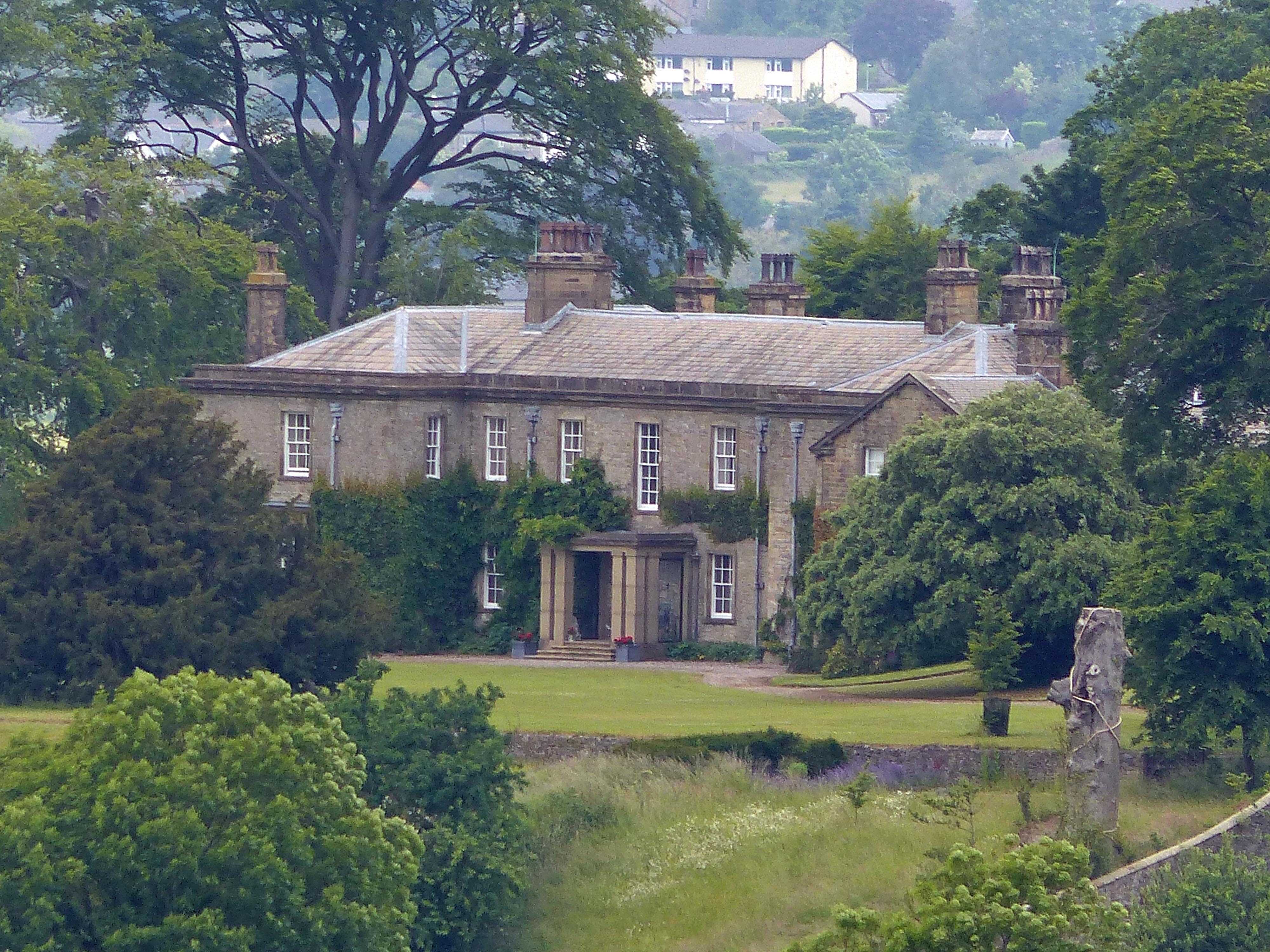
Downham Hall

Downham Hall is an English country house in Downham, Lancashire, England. == Overview == Downham Hall was designed by George Webster (1797–1864) in 1835...

Grindleton

Grindleton is a village and civil parish in the Ribble Valley district of the English county of Lancashire, formerly in the West Riding of Yorkshire. Its...

Grindletonians

The Grindletonians were a Puritan sect that arose in the town of Grindleton in Lancashire, England, in around 1610. The sect remained active in the North...

St Leonard's Church, Downham

St Leonard's Church is in the village of Downham, Lancashire, England. It is an active Anglican parish church in the diocese of Blackburn. The tower...

Nearby Amenities

Located within 500m of 53.895208,-2.353663
Chatburn
Place: village
Lat/Long: 53.8919482/-2.3543148
Hudsons Ice Cream
Shop: convenience
Lat/Long: 53.8928712/-2.3520751
Toilets
Lat/Long: 53.8933993/-2.3519397
Post Office
Chatburn Post Office
Addr City: Clitheroe
Addr Housenumber: 1-3
Addr Postcode: BB7 4AW
Addr Street: Bridge Road
Addr Village: Chatburn
Brand: Post Office
Brand Wikidata: Q1783168
Opening Hours: Mo-Fr 08:00-18:00; Sa 09:00-12:30
Ref Pol Id: 12940
Website: https://www.postoffice.co.uk/branch-finder/3274276/chatburn
Lat/Long: 53.8925051/-2.3547471
Library
Chatburn Library
Lat/Long: 53.8934689/-2.352007
Pub
The Brown Cow
Lat/Long: 53.8928414/-2.3534491
madaboutbeauty
Shop: hairdresser
Lat/Long: 53.892581/-2.3533577
Cafe
The Lemon House
Lat/Long: 53.8926663/-2.3529714
Telephone
Booth: KX100
Covered: booth
Lat/Long: 53.8929832/-2.3520925
The Beauty Boutique
Shop: hairdresser
Lat/Long: 53.893169/-2.351861
Bus Stop
Bus: yes
Naptan AtcoCode: 25001238
Naptan NaptanCode: lanajawt
Public Transport: platform
Lat/Long: 53.8923312/-2.3543233
Pub
The Black Bull
Lat/Long: 53.8926821/-2.3541302
Scissor Sister
Shop: hairdresser
Lat/Long: 53.8925272/-2.3543233
Bus Stop
Bus: yes
Public Transport: platform
Lat/Long: 53.8925177/-2.3541462
Fast Food
Jade Fountain
Lat/Long: 53.8924925/-2.3535991
Bus Stop
Bus: yes
Naptan AtcoCode: 2500DCL5769
Naptan NaptanCode: landmtat
Public Transport: platform
Lat/Long: 53.8941805/-2.3509378
Bus Stop
Bus: yes
Naptan AtcoCode: 250011071
Naptan NaptanCode: lanadwaj
Public Transport: platform
Lat/Long: 53.8944081/-2.351088
Bench
Lat/Long: 53.8929202/-2.3530139
Bench
Lat/Long: 53.8931067/-2.352464
GATE1
Ele: 96.74
Wpt Description: 19-MAR-10 10:20:56
Wpt Symbol: Navaid, Red
Lat/Long: 53.8933599/-2.3523168
BENCH8
Ele: 99.14
Wpt Description: 19-MAR-10 10:10:45
Wpt Symbol: Navaid, Red
Lat/Long: 53.8929199/-2.3530131
Bus Stop
Bus: yes
Public Transport: platform
Lat/Long: 53.8938493/-2.3505707
Bus Stop
Bus: yes
Public Transport: platform
Lat/Long: 53.8941939/-2.3476149
Town Head Barn
Place: neighbourhood
Lat/Long: 53.8950775/-2.3465308
Generator Method: photovoltaic
Generator Output Electricity: yes
Generator Source: solar
Generator Type: solar_photovoltaic_panel
Location: roof
Power: generator
Lat/Long: 53.8928322/-2.3498681
Generator Method: photovoltaic
Generator Output Electricity: yes
Generator Source: solar
Generator Type: solar_photovoltaic_panel
Location: roof
Power: generator
Lat/Long: 53.8936242/-2.3478242
Generator Method: photovoltaic
Generator Output Electricity: yes
Generator Source: solar
Generator Type: solar_photovoltaic_panel
Location: roof
Power: generator
Lat/Long: 53.893678/-2.3572651
Generator Method: photovoltaic
Generator Output Electricity: yes
Generator Source: solar
Generator Type: solar_photovoltaic_panel
Location: roof
Power: generator
Lat/Long: 53.8939235/-2.355468
Generator Method: photovoltaic
Generator Output Electricity: yes
Generator Source: solar
Generator Type: solar_photovoltaic_panel
Location: roof
Power: generator
Lat/Long: 53.8939425/-2.3553902
Generator Method: photovoltaic
Generator Output Electricity: yes
Generator Source: solar
Generator Type: solar_photovoltaic_panel
Location: roof
Power: generator
Lat/Long: 53.8938429/-2.355401
Generator Method: photovoltaic
Generator Output Electricity: yes
Generator Source: solar
Generator Type: solar_photovoltaic_panel
Location: roof
Power: generator
Lat/Long: 53.891815/-2.3558569
Generator Method: photovoltaic
Generator Output Electricity: yes
Generator Source: solar
Generator Type: solar_photovoltaic_panel
Location: roof
Power: generator
Lat/Long: 53.8931811/-2.3516956
Generator Method: photovoltaic
Generator Output Electricity: yes
Generator Source: solar
Generator Type: solar_photovoltaic_panel
Location: roof
Power: generator
Lat/Long: 53.8932032/-2.351634
Generator Method: photovoltaic
Generator Output Electricity: yes
Generator Source: solar
Generator Type: solar_photovoltaic_panel
Location: roof
Power: generator
Lat/Long: 53.8932411/-2.3515669
Generator Method: photovoltaic
Generator Output Electricity: yes
Generator Source: solar
Generator Type: solar_photovoltaic_panel
Location: roof
Power: generator
Lat/Long: 53.8932854/-2.3515133
Post Box
Operator: Royal Mail
Post Box Type: pillar
Ref: BB7 443
Royal Cypher: GVIR
Royal Cypher Wikidata: Q33102169
Lat/Long: 53.892463/-2.3547897
Post Box
Operator: Royal Mail
Post Box Type: lamp
Ref: BB7 442D
Royal Cypher: EIIR
Lat/Long: 53.8934382/-2.3489177
Man Made: mast
Tower Construction: lattice
Tower Type: communication
Lat/Long: 53.8968653/-2.3586571
The data included in this document is from www.openstreetmap.org. The data is made available under ODbL.

Have you been to Chatburn?

Leave your review of Chatburn below (or comments, questions and feedback).