Aldersgate

Settlement in Middlesex

England

Aldersgate

London Transport Museum - B type bus This is a London General Omnibus Company B-type in World War I guise. The type was introduced in 1910 and built in Walthamstow. 900 were used in WWI and the windows were replaced with planks as the soldiers' equipment kept breaking the glass. Airfix made a plastic model kit of this bus and you could build it in civilian or military guise. It was a lovely thing and I made one.
London Transport Museum - B type bus Credit: Chris Allen

Aldersgate is a historic area located in the London Borough of Islington, in the former county of Middlesex, England. It is situated just north of the City of London, between the neighborhoods of Clerkenwell and Barbican. The name "Aldersgate" derives from the ancient gate that once stood there as a part of the London Wall, which was built by the Romans in the 2nd century AD.

Throughout its history, Aldersgate has played an important role in London's development. In medieval times, it was a bustling gateway into the city, welcoming travelers and merchants. The area flourished during the Tudor period, with many wealthy merchants and craftsmen choosing to settle there. However, during the Great Fire of London in 1666, much of Aldersgate was devastated, including the gate itself.

Today, Aldersgate is known for its mix of architectural styles, blending historic buildings with modern developments. It is home to several notable institutions, including the Barbican Centre, a world-class arts and conference venue. The area also boasts a vibrant cultural scene, with numerous theaters, galleries, and music venues.

Aldersgate is well connected to the rest of London, with easy access to public transportation. It is served by the Barbican and Farringdon underground stations, as well as several bus routes. The neighborhood offers a range of amenities, including shops, restaurants, and parks, making it an attractive place to live and visit. Overall, Aldersgate is a captivating area that seamlessly combines its rich history with the energy of modern London.

If you have any feedback on the listing, please let us know in the comments section below.
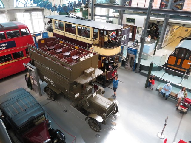
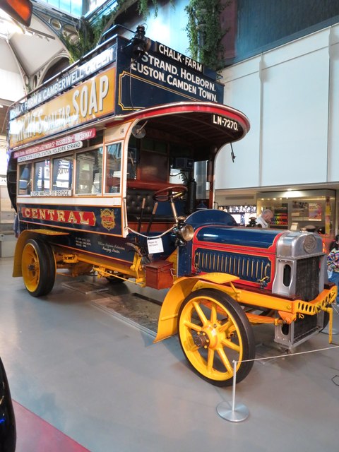
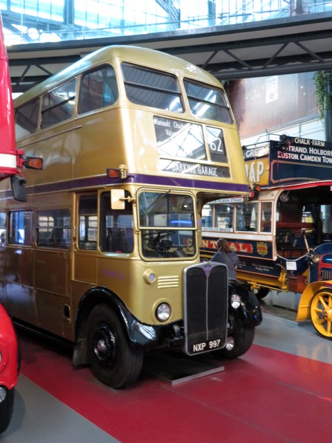
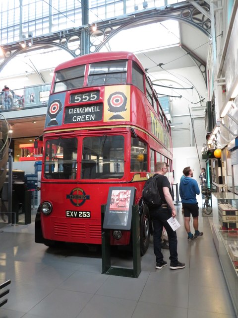
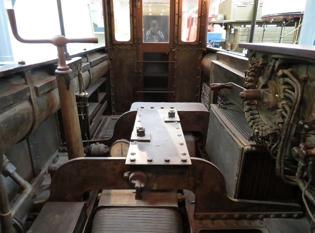
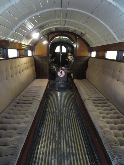
Aldersgate Images

Images are sourced within 2km of 51.518725/-0.097314 or Grid Reference TQ3281. Thanks to Geograph Open Source API. All images are credited.

London Transport Museum - B type bus This is a London General Omnibus Company B-type in World War I guise. The type was introduced in 1910 and built in Walthamstow. 900 were used in WWI and the windows were replaced with planks as the soldiers' equipment kept breaking the glass. Airfix made a plastic model kit of this bus and you could build it in civilian or military guise. It was a lovely thing and I made one.
London Transport Museum - B type bus
This is a London General Omnibus Company B-type in World War I guise. The type was introduced in 1910 and built in Walthamstow. 900 were used in WWI and the windows were replaced with planks as the soldiers' equipment kept breaking the glass. Airfix made a plastic model kit of this bus and you could build it in civilian or military guise. It was a lovely thing and I made one.
London Transport - X2 Bus A Leyland X2 built in 1908. Love the colour scheme.
London Transport - X2 Bus
A Leyland X2 built in 1908. Love the colour scheme.
London Transport Museum - gold AEC RT bus RT4712 ran in London service from 1954 to 1979, passing to the London Transport Museum on withdrawal. In 2002 it was one of the buses painted gold to celebrate the Golden Jubilee, with Arriva London North operating it in service on some London routes.
London Transport Museum - gold AEC RT bus
RT4712 ran in London service from 1954 to 1979, passing to the London Transport Museum on withdrawal. In 2002 it was one of the buses painted gold to celebrate the Golden Jubilee, with Arriva London North operating it in service on some London routes.
London Transport Museum - trolleybus A Leyland LPTB70 built in 1939 and operated by London Transport.
London Transport Museum - trolleybus
A Leyland LPTB70 built in 1939 and operated by London Transport.
London Transport Museum - electric locomotive 1890 A City and South London electric locomotive and matching carriage for the underground. the locomotive was built by Mather & Platt of Salford Ironworks, Manchester as No. 13.
London Transport Museum - electric locomotive 1890
A City and South London electric locomotive and matching carriage for the underground. the locomotive was built by Mather & Platt of Salford Ironworks, Manchester as No. 13.
London Transport Museum - underground railway carriage 1890 A City and South London electric locomotive and matching carriage for the underground. the locomotive was built by Mather & Platt of Salford Ironworks, Manchester as No. 13. This view is the interior of the carriage.
London Transport Museum - underground railway carriage 1890
A City and South London electric locomotive and matching carriage for the underground. the locomotive was built by Mather & Platt of Salford Ironworks, Manchester as No. 13. This view is the interior of the carriage.
Lamps and St Paul's Dusk at Bankside Pier looking across the river towards St Paul's Cathedral.
Lamps and St Paul's
Dusk at Bankside Pier looking across the river towards St Paul's Cathedral.
Cranes above the buildings There's always something being built or knocked down in the City.
As there probably always has been. The spire of St Bride's Church stands amidst it all, beyond Blackfriar's Bridge.
Cranes above the buildings
There's always something being built or knocked down in the City. As there probably always has been. The spire of St Bride's Church stands amidst it all, beyond Blackfriar's Bridge.
Millennium Bridge in the Evening Crossing the river at dusk. Of all the many Millennium projects, this footbridge must be one of the most useful.
Millennium Bridge in the Evening
Crossing the river at dusk. Of all the many Millennium projects, this footbridge must be one of the most useful.
War Memorial, Waterloo Station Waterloo is the busiest station in Britain (passenger numbers) and the largest of the London terminal stations.
Opened by the London and South Western Railway (L&SWR)  on 11 July 1848 as 'Waterloo Bridge Station',it was designed by William Tite. In 1886 it officially became 'Waterloo Station'.
In 1899 the L&SWR decided on a total rebuilding. The new station was opened in stages, finally opened in 1922 with 21 platforms and a concourse nearly 800 feet (250 m) long.  The main pedestrian entrance, the Victory Arch (known as Exit 5), is a memorial to company staff who were killed during the two world wars. 
Platforms 20 and 21 were lost to the Waterloo International railway station site, which from November 1994 to November 2007 was the London terminus of Eurostar international trains to Paris and Brussels. 
A few minutes walk from the main station, connected by a walkway, is Waterloo East, which connects with trains from Charing Cross
War Memorial, Waterloo Station
Waterloo is the busiest station in Britain (passenger numbers) and the largest of the London terminal stations. Opened by the London and South Western Railway (L&SWR) on 11 July 1848 as 'Waterloo Bridge Station',it was designed by William Tite. In 1886 it officially became 'Waterloo Station'. In 1899 the L&SWR decided on a total rebuilding. The new station was opened in stages, finally opened in 1922 with 21 platforms and a concourse nearly 800 feet (250 m) long. The main pedestrian entrance, the Victory Arch (known as Exit 5), is a memorial to company staff who were killed during the two world wars. Platforms 20 and 21 were lost to the Waterloo International railway station site, which from November 1994 to November 2007 was the London terminus of Eurostar international trains to Paris and Brussels. A few minutes walk from the main station, connected by a walkway, is Waterloo East, which connects with trains from Charing Cross
Double aperture Elizabeth II postbox on Borough High Street Postbox No. SE1 137.
Double aperture Elizabeth II postbox on Borough High Street
Postbox No. SE1 137.
The Trinity public house On Borough High Street.
The Trinity public house
On Borough High Street.
Sign for the Trinity public house
Costa Coffee, London Waterloo Railway Station Showing position of postbox No. SE1 38.
Costa Coffee, London Waterloo Railway Station
Showing position of postbox No. SE1 38.
Southwark Bridge Road, Southwark
The Young Vic Theatre
Greet St
Greet St
Show me another place!

Aldersgate is located at Grid Ref: TQ3281 (Lat: 51.518725, Lng: -0.097314)

Unitary Authority: City of London

Police Authority: City of London

What 3 Words

///lung.tubes.plants. Near Barbican, London

Related Wikis

Rutland House

Rutland House was the name of at least two London houses occupied by the Earls and Dukes of Rutland. That on Aldersgate Street was leased by playwright...

Worshipful Company of Information Technologists

The Worshipful Company of Information Technologists, also known as the Information Technologists' Company, is one of the livery companies of the City of...

Worshipful Company of Ironmongers

The Worshipful Company of Ironmongers is one of the Great Twelve livery companies of the City of London, incorporated under a Royal Charter in 1463....

200 Aldersgate

200 Aldersgate is a 434,005 sq ft office building in the City of London.Proposed in 1983, designed by the architects Fitzroy Robinson & Partners, and built...

Citizens Advice

Citizens Advice (previously Citizens Advice Bureau and also known as Cyngor ar Bopeth in Welsh) is an independent organisation specialising in confidential...

Centre for Music, London

The Centre for Music was a proposed concert hall in the City of London. The City announced on 18 February 2021 that the project would not be progressed...
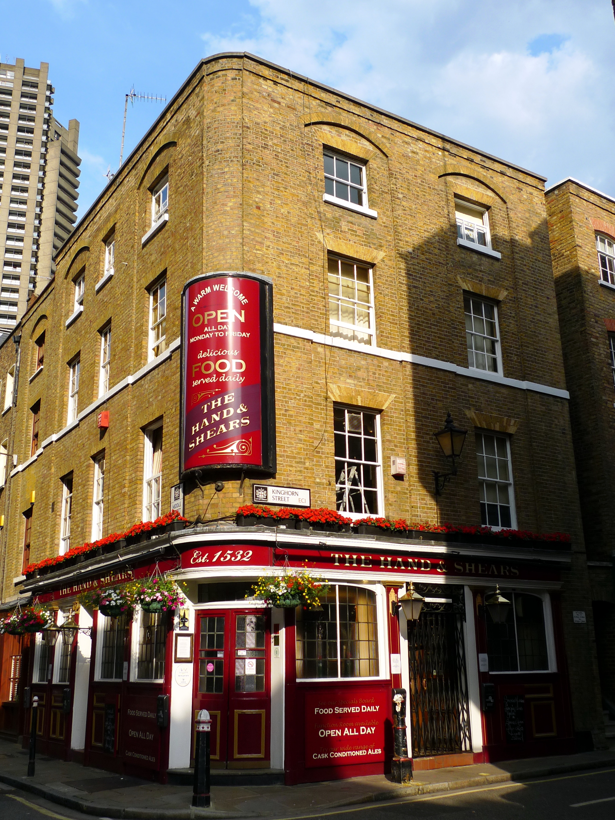
Hand and Shears

The Hand and Shears is a Grade II listed public house at 1 Middle Street, Smithfield, London.It is on the Campaign for Real Ale's National Inventory of...

School of Health Sciences, City, University of London

The School of Health Sciences at City, University of London, is composed of the former St Bartholomew School of Nursing & Midwifery and School of Allied...

Nearby Amenities

Located within 500m of 51.518725,-0.097314
Crossing
Button Operated: yes
Crossing: traffic_signals
Tactile Paving: yes
Traffic Signals Sound: no
Traffic Signals Vibration: yes
Lat/Long: 51.5153718/-0.0988079
Crossing
Button Operated: yes
Crossing: traffic_signals
Crossing Ref: pelican
Lat/Long: 51.5147211/-0.0968792
Crossing
Button Operated: yes
Crossing: traffic_signals
Crossing Island: no
Crossing Ref: pelican
Kerb: flush
Tactile Paving: yes
Lat/Long: 51.5158045/-0.1003632
Crossing
Crossing: traffic_signals
Crossing Island: no
Crossing Ref: pelican
Tactile Paving: yes
Lat/Long: 51.5149837/-0.0974289
Crossing
Button Operated: yes
Crossing: traffic_signals
Crossing Ref: pelican
Tactile Paving: yes
Traffic Signals Sound: no
Lat/Long: 51.5155547/-0.0986446
Bar
The Saint
Addr City: London
Addr Housenumber: 1
Addr Postcode: EC4M 7DQ
Addr Street: Rose Steet
Email: thesaint@wearebar.com
Fhrs Id: 294160
Opening Hours: Mo-Fr 10:00+
Phone: +44 20 7600 5500
Toilets: yes
Toilets Access: customers
Website: http://www.jamies.london/bars/the-saint
Lat/Long: 51.5150736/-0.0997325
Cinema
Barbican Centre (Cinema)
Lat/Long: 51.5197763/-0.0937556
Turning Circle
Lat/Long: 51.5189286/-0.0988668
Crossing
Crossing: uncontrolled
Crossing Ref: zebra
Tactile Paving: yes
Lat/Long: 51.5187536/-0.0970153
Ref GB Tflcid: RWG065137
Traffic Calming: hump
Lat/Long: 51.5206596/-0.1002046
Crossing
Crossing: uncontrolled
Crossing Island: no
Crossing Ref: zebra
Traffic Calming: table
Lat/Long: 51.5201638/-0.1001488
Crossing
Crossing: uncontrolled
Crossing Ref: zebra
Tactile Paving: yes
Lat/Long: 51.5187451/-0.0971271
Traffic Signals
Traffic Signals Direction: forward
Lat/Long: 51.520132/-0.0970303
Traffic Calming: table
Lat/Long: 51.5149117/-0.0946025
Post Box
Brand: Royal Mail
Brand Wikidata: Q638098
Brand Wikipedia: en:Royal Mail
Collection Times: Mo-Fr 18:00; Sa 12:00
Operator: Royal Mail
Operator Wikidata: Q638098
Post Box Apertures: 2
Post Box Design: type_c
Post Box Manufacturer: Handyside & Co Ltd, Derby & London
Post Box Type: pillar
Ref: EC1 130;EC1 1301
Royal Cypher: VR
Royal Cypher Wikidata: Q33102356
Lat/Long: 51.5209294/-0.0999515
Telephone
Booth: K2
Covered: booth
Listed Status: Grade II
Operator: BT
Operator Wikidata: Q593786
Lat/Long: 51.5204541/-0.0991614
University
St Bartholomew's and the Royal London School of Medicine and Dentistry
Lat/Long: 51.5227918/-0.0996753
Ref GB Tflcid: RWG064488
Traffic Calming: table
Lat/Long: 51.5154297/-0.0933675
Barbican
Layer: -2
Network: London Underground
Operator: London Underground
Public Transport: stop_position
Railway: stop
Ref: 1
Subway: yes
Lat/Long: 51.5202177/-0.098735
Pharmacy
Superdrug
Addr City: London
Addr Housename: Paternoster House
Addr Housenumber: 65
Addr Postcode: EC4M 8AB
Addr Street: St. Paul's Churchyard
Brand: Superdrug
Brand Wikidata: Q7643261
Brand Wikipedia: en:Superdrug
Contact Website: https://www.superdrug.com/store/london-st-paul%27s
Healthcare: pharmacy
Wheelchair: yes
Wheelchair Description: Step-free from both sides. Pre-order prescription collection only. (No Hearing Loop provision)
Lat/Long: 51.5145339/-0.0981903
Bicycle Parking
Capacity: 8
Lat/Long: 51.5173566/-0.0935693
Bicycle Parking
Bicycle Parking: stands
Capacity: 6
Covered: no
Layer: 0
Lat/Long: 51.5176473/-0.0936515
Bicycle Parking
Capacity: 10
Layer: 0
Lat/Long: 51.5174909/-0.0941793
Bicycle Parking
Bicycle Parking: stands
Capacity: 18
Covered: no
Lat/Long: 51.5163085/-0.0970517
Bicycle Parking
Capacity: 10
Lat/Long: 51.5156524/-0.0972537
Bicycle Parking
Bicycle Parking: stands
Capacity: 24
Covered: no
Lat/Long: 51.5156765/-0.0992991
Bicycle Parking
Bicycle Parking: stands
Capacity: 32
Covered: no
Lat/Long: 51.5157166/-0.0997532
King Edward Street / St Paul's Station
Bus: yes
Public Transport: stop_position
Lat/Long: 51.5165643/-0.0985492
Crossing
Crossing: traffic_signals
Crossing Ref: pelican
Lat/Long: 51.5174512/-0.0939375
Crossing
Crossing: traffic_signals
Crossing Ref: pelican
Lat/Long: 51.5175366/-0.0939383
Car Sharing
Capacity: 1
Operator: Zipcar
Operator Wikidata: Q1069924
Source: WebSite
Lat/Long: 51.5185874/-0.101345
Car Sharing
Capacity: 1
Operator: Zipcar
Operator Wikidata: Q1069924
Source: WebSite
Lat/Long: 51.5205/-0.0949
Post Box
Brand: Royal Mail
Brand Wikidata: Q638098
Brand Wikipedia: en:Royal Mail
Collection Times: Mo-Fr 18:30; Sa 12:00
Drive Through: no
Note: has post office sign on top right hand aperture "FRANKED MAIL", left hand "STAMPED MAIL"
Operator: Royal Mail
Operator Wikidata: Q638098
Post Box Apertures: 2
Post Box Design: type_c
Post Box Type: pillar
Postal Code: EC1
Ref: EC1A 101;EC1A 1011
Royal Cypher: EIIR
Royal Cypher Wikidata: Q33102113
Source: survey
Lat/Long: 51.5164907/-0.1029976
Barrier: bollard
Motor Vehicle: private
Lat/Long: 51.5207162/-0.0953292
Barrier: lift_gate
Lat/Long: 51.519067/-0.1011082
Nightclub
Parker McMillan
Addr City: London
Addr Housenumber: 47
Addr Postcode: EC1Y 4SB
Addr Street: Chiswell Street
Food: yes
Opening Hours: Mo-Fr 16:00-00:00
Source: survey;notes
Lat/Long: 51.521075/-0.0916939
Crossing
Crossing: uncontrolled
Crossing Island: no
Crossing Ref: zebra
Tactile Paving: yes
Lat/Long: 51.5209043/-0.0923809
Postal Code: EC1M 6DS
Website: https://www.rookeryhotel.com/
Lat/Long: 51.5201774/-0.1025129
Restaurant
Vinoteca Farringdon
Addr City: London
Addr Housenumber: 7
Addr Street: St. John Street
Postal Code: EC1M 4AA
Website: https://www.vinoteca.co.uk/
Lat/Long: 51.520045/-0.1018834
Urban Golf
Sport: golf
Lat/Long: 51.5175206/-0.1033861
Source: www.npemap.org.uk
Uk Postcode Centroid: EC2Y
Lat/Long: 51.518863/-0.0921766
Source: www.npemap.org.uk
Uk Postcode Centroid: EC1M
Lat/Long: 51.520041/-0.0959972
Pub
The Paternoster
Addr City: London
Addr Housenumber: 2-4
Addr Postcode: EC4M 7DZ
Addr Street: Queens Head Passage
Fhrs Id: 294590
Fhrs Local Authority Id: PI/000016099
Source Addr: FHRS Open Data
Wheelchair: limited
Lat/Long: 51.5150683/-0.0983225
Bar
Dirty Martini St. Pauls
Addr City: London
Addr Housename: Three Keys House
Addr Housenumber: 130
Addr Postcode: EC2V 6DL
Addr Street: Wood Street
Fhrs Id: 720402
Toilets: yes
Toilets Access: customers
Lat/Long: 51.5145419/-0.0948116
Bar
Balls Brothers
Toilets: yes
Toilets Access: customers
Lat/Long: 51.5153585/-0.0956641
Livery Hall
Saddlers' Hall
Addr City: London
Addr Housename: Saddlers' Hall
Addr Housenumber: 40
Addr Postcode: EC2V 6BR
Addr Street: Gutter Lane
Fhrs Id: 293975
Website: https://www.saddlershall.com/
Lat/Long: 51.5149109/-0.0955757
Farriers' Hall
Created By: Merkaartor 0.12
Lat/Long: 51.5148401/-0.0955889
Created By: Merkaartor 0.12
Lat/Long: 51.5147776/-0.0956982
Created By: Merkaartor 0.12
Lat/Long: 51.5151068/-0.0958993
Created By: Merkaartor 0.12
Lat/Long: 51.5152102/-0.0958949
Created By: Merkaartor 0.12
Lat/Long: 51.5152102/-0.0959387
Telephone
Booth: K6
Covered: booth
Operator: Arqiva
Phone: +44 20 7236 1970
Source: survey
Lat/Long: 51.5163183/-0.1023895
Parking
Smithfield Car Park
Lat/Long: 51.5186706/-0.1013931
Bar
Cellar Gascon
Addr City: London
Addr Housenumber: 57
Addr Postcode: EC1A 9DS
Addr Street: West Smithfield
Alt Name: Club Gascon
Fhrs Id: 294273
Wheelchair: no
Wikidata: Q5136253
Lat/Long: 51.5185662/-0.1002516
Disused Shop: yes
Lat/Long: 51.5198059/-0.0979314
Crossing
Crossing: uncontrolled
Crossing Ref: zebra
Tactile Paving: yes
Lat/Long: 51.5174562/-0.0962991
Crossing
Crossing: traffic_signals
Crossing Island: no
Crossing Ref: pelican
Lat/Long: 51.5151785/-0.0974153
Traffic Signals
Traffic Signals Direction: forward
Lat/Long: 51.5147956/-0.0969529
Entrance: yes
Lat/Long: 51.5226257/-0.0987829
Fountain
Lat/Long: 51.5196209/-0.0943821
Fountain
Lat/Long: 51.519555/-0.0940871
Fountain
Lat/Long: 51.5195883/-0.0942375
Fountain
Lat/Long: 51.5195193/-0.0939491
Fountain
Lat/Long: 51.5194891/-0.0937981
Barbican Laundrette
Addr City: London
Addr Postcode: EC2Y 8EA
Addr Street: White Lyon Court
Shop: laundry
Source Addr Postcode: code-point_open
Lat/Long: 51.5211627/-0.097114
Tesco Express
Addr City: London
Addr Housenumber: 131
Addr Postcode: EC1A 4JQ
Addr Street: Aldersgate Street
Branch: Barbican Express
Brand: Tesco Express
Brand Wikidata: Q98456772
Check Date: 2024-01-24
Contact Website: https://www.tesco.com/store-locator/london/131-aldersgate-st
Fhrs Id: 294443
Level: 0
Name Fa: تسکو اکسپرس
Opening Hours: Mo-Su 06:00-24:00
Payment Cash: yes
Payment Credit Cards: yes
Payment Debit Cards: yes
Shop: convenience
Wheelchair: yes
Lat/Long: 51.520574/-0.0977172
Cafe
Barbican Kitchen
Addr City: London
Addr Housename: Barbican Centre
Addr Postcode: EC2Y 8DS
Addr Street: Silk Street
Brewery: yes
Check Date: 2023-04-29
Diet Vegetarian: yes
Fhrs Id: 781406
Indoor Seating: yes
Level: 0
Opening Hours: 08:00-20:00
Outdoor Seating: yes
Payment Bancomat: yes
Payment Credit Cards: yes
Payment Debit Cards: yes
Payment Maestro: yes
Payment Mastercard: yes
Payment Visa: yes
Payment Visa Debit: yes
Payment Visa Electron: yes
Takeaway: yes
Toilets: yes
Toilets Access: general
Wheelchair: yes
Lat/Long: 51.5195292/-0.093295
Kindergarten
Newpark Childcare Centre
Addr City: London
Addr Housenumber: 1
Addr Postcode: EC2Y 8DU
Addr Street: Saint Giles' Terrace
Fhrs Id: 294212
Layer: -1
Level: -1
Note: This is below the pedestrian area. It's possibly not accurate to describe it as underground, its appears to be the same level as the ground floor of the Postern, with the pedestrian area built over the top.
Lat/Long: 51.5184986/-0.0934828
Bicycle Parking
Bicycle Parking: stands
Capacity: 8
Covered: no
Lat/Long: 51.5204346/-0.0973147
Post Box
Brand: Royal Mail
Brand Wikidata: Q638098
Brand Wikipedia: en:Royal Mail
Collection Times: Mo-Fr 18:30; Sa 12:00
Operator: Royal Mail
Operator Wikidata: Q638098
Post Box Apertures: 2
Post Box Design: type_c
Post Box Manufacturer: Machan Eng, Scotland
Post Box Type: pillar
Ref: EC1A 114;EC1A 1141
Royal Cypher: EIIR
Royal Cypher Wikidata: Q33102113
Source: survey
Lat/Long: 51.5163066/-0.0986281
Bus Stop
St Paul's Station
Bench: yes
Bin: no
Bus: yes
Lit: yes
Local Ref: SQ
Naptan AtcoCode: 490000225T
Naptan Bearing: W
Naptan CommonName: St Paul's
Naptan Indicator: Stop SQ
Naptan Street: NEWGATE STREET
Public Transport: platform
Ref: 58894
Shelter: yes
Tactile Paving: no
Lat/Long: 51.5152356/-0.0984732
Pharmacy
Boots
Addr City: London
Addr Housenumber: 1
Addr Postcode: EC4M 7DZ
Addr Street: Queens Head Passage
Branch: London Paternoster Square
Brand: Boots
Brand Wikidata: Q6123139
Brand Wikipedia: en:Boots (company)
Check Date: 2023-11-06
Contact Phone: +44 20 7236 6181
Dispensing: yes
Fhrs Id: 294300
Fhrs Local Authority Id: PI/000012853
Fixme: Is this Boots store still here? (Website broken)
Healthcare: pharmacy
Medical Supply: yes
Opening Hours: Mo-Fr 07:30-19:00
Ref: 793
Source: survey
Source Addr: FHRS Open Data
Website: https://www.boots.com/stores/793-london-paternoster-square-ec4m-7dx
Wheelchair: yes
Lat/Long: 51.5151432/-0.0987366
Newgate
Historic: memorial
Inscription: Site of Newgate Demolished 1777
Memorial: plaque
Note: Demolished 1777
Openplaques Id: 3956
Lat/Long: 51.5159987/-0.1014928
Site of the Saracen's Head Inn
Erected By: The Corporation of the City of London
Historic: memorial
Inscription: Site of the Saracen's Head Inn. Demolished 1868
Memorial: plaque
Openplaques Id: 6156
Scheme: City of London Corporation commemorative plaques
Lat/Long: 51.5170352/-0.1029072
Barbican Station
Bus: yes
Local Ref: BA
Public Transport: stop_position
Lat/Long: 51.5204592/-0.0974942
Barbican Station
Bus: yes
Local Ref: BB
Public Transport: stop_position
Lat/Long: 51.5208829/-0.0974011
Bus Stop
Barbican
Bus: yes
Naptan AtcoCode: 490000014W
Naptan Bearing: W
Naptan CommonName: Barbican
Naptan Indicator: Stop
Naptan Verified: no
Public Transport: platform
Lat/Long: 51.5199162/-0.0977434
Bus Stop
King Edward Street
Bench: yes
Bin: no
Bus: yes
Check Date Bench: 2024-02-22
Covered: no
Lit: no
Local Ref: ST
Naptan AtcoCode: 490000225S
Naptan Bearing: E
Naptan CommonName: St Paul's
Naptan Indicator: Stop ST
Naptan Street: NEWGATE STREET
Public Transport: platform
Ref: 50503
Shelter: yes
Tactile Paving: no
Lat/Long: 51.5157403/-0.0999169
Bus Stop
St Paul's Station
Bench: no
Bus: yes
Kerb: raised
Kerb Approach Aid: no
Lit: no
Local Ref: SP
Naptan AtcoCode: 490000225U
Naptan Bearing: W
Naptan CommonName: St Paul's
Naptan Indicator: Stop SP
Naptan Street: NEWGATE STREET
Passenger Information Display: no
Public Transport: platform
Ref: 76584
Shelter: yes
Tactile Paving: no
Lat/Long: 51.5150449/-0.0978521
Bus Stop
St Paul's Station
Bench: no
Bin: no
Bus: yes
Departures Board: yes
Lit: no
Local Ref: SW
Naptan AtcoCode: 490000225W
Naptan Bearing: S
Naptan CommonName: St Paul's
Naptan Indicator: SW
Naptan Street: ST MARTIN'S LE GRAND
Public Transport: platform
Ref: 52729
Shelter: no
Tactile Paving: no
Lat/Long: 51.515543/-0.0970327
Bus Stop
St Paul's Station
Bench: yes
Bus: yes
Check Date Bench: 2022-02-20
Covered: no
Local Ref: SY
Naptan AtcoCode: 490000225Y
Naptan Bearing: E
Naptan CommonName: St Paul's
Naptan Indicator: Stop SY
Naptan Street: CHEAPSIDE
Public Transport: platform
Ref: 91542
Shelter: yes
Lat/Long: 51.5144294/-0.0956865
Bus Stop
City Thameslink Station
Bench: yes
Bus: yes
Covered: no
Local Ref: HL
Naptan AtcoCode: 490001067Q
Naptan Bearing: E
Naptan CommonName: City Thameslink
Naptan Indicator: Stop HL
Naptan Street: HOLBORN VIADUCT
Public Transport: platform
Ref: 75771
Shelter: yes
Lat/Long: 51.5169254/-0.1036938
Bus Stop
City Thameslink Station
Bus: yes
Lit: yes
Local Ref: HK
Naptan AtcoCode: 490001067R
Naptan Bearing: W
Naptan CommonName: City Thameslink
Naptan Indicator: Stop HK
Naptan Street: HOLBORN VIADUCT
Public Transport: platform
Ref: 47844
Shelter: yes
Lat/Long: 51.5165025/-0.1028863
Bus Stop
Angel Street
Bus: yes
Naptan AtcoCode: 490003330E
Naptan Bearing: E
Naptan CommonName: Angel Street
Naptan Street: ANGEL STREET
Public Transport: platform
Lat/Long: 51.5161403/-0.0975379
Bus Stop
Clerkenwell Road / Old Street
Bench: yes
Bus: yes
Local Ref: BQ
Naptan AtcoCode: 490003573N
Naptan Bearing: N
Naptan CommonName: Baltic Street
Naptan Indicator: Stop BQ
Naptan Street: GOSWELL ROAD
Public Transport: platform
Ref: 57965
Shelter: yes
Wheelchair: yes
Lat/Long: 51.5228763/-0.0980358
Barbican Centre
Local Ref: BK
Naptan AtcoCode: 490003592E
Naptan Bearing: E
Naptan CommonName: Barbican Centre
Naptan Indicator: Stop BK
Naptan Street: SILK STREET
Naptan Verified: no
Lat/Long: 51.5199187/-0.0917262
Barbican Centre
Local Ref: BJ
Naptan AtcoCode: 490003592W
Naptan Bearing: W
Naptan CommonName: Barbican Centre
Naptan Indicator: Stop BJ
Naptan Street: SILK STREET
Naptan Verified: no
Lat/Long: 51.5196173/-0.0908647
Bus Stop
Beech Street
Bench: no
Bin: no
Bus: yes
Layer: -1
Lit: yes
Local Ref: BN
Naptan AtcoCode: 490003818E
Naptan Bearing: E
Naptan CommonName: Beech Street
Naptan Indicator: Stop BN
Naptan Street: BEECH STREET
Naptan Verified: yes
Note: Doesn't have a separate bus shelter, but the whole road is sheltered by the Barbican complex above
Public Transport: platform
Ref: 47223
Shelter: yes
Tactile Paving: no
Wheelchair: yes
Lat/Long: 51.5207704/-0.0941673
Beech Street
Local Ref: BL
Naptan AtcoCode: 490003818W
Naptan Bearing: W
Naptan CommonName: Beech Street
Naptan Indicator: Stop BL
Naptan Street: BEECH STREET
Naptan Verified: no
Lat/Long: 51.5207533/-0.0933451
Bus Stop
King Edward Street / St Paul's Station
Bench: no
Bin: no
Bus: yes
Lit: yes
Naptan AtcoCode: 490008743V
Naptan Bearing: N
Naptan CommonName: King Edward Street
Naptan Street: KING EDWARD STREET
Public Transport: platform
Shelter: no
Tactile Paving: no
Lat/Long: 51.5165565/-0.0986455
Bus Stop
London Wall
Bench: no
Bus: yes
Local Ref: BE
Naptan AtcoCode: 490010130E
Naptan Bearing: E
Naptan CommonName: London Wall / Museum Of London
Naptan Indicator: Stop BE
Naptan Street: LONDON WALL
Public Transport: platform
Ref: 73989
Shelter: no
Tactile Paving: no
Lat/Long: 51.5175768/-0.0951951
Bus Stop
Museum of London
Bus: yes
Local Ref: BC
Naptan AtcoCode: 490010130N
Naptan Bearing: N
Naptan CommonName: London Wall / Museum Of London
Naptan Indicator: Stop BC
Naptan Street: ALDERSGATE STREET
Public Transport: platform
Ref: 54237
Lat/Long: 51.5188725/-0.0972387
Museum of London
Bus: yes
Local Ref: BD
Public Transport: stop_position
Lat/Long: 51.5183634/-0.0969301
Bus Stop
London Wall
Bench: no
Bus: yes
Local Ref: BH
Naptan AtcoCode: 490010130W
Naptan Bearing: W
Naptan CommonName: London Wall / Museum Of London
Naptan Indicator: Stop BH
Naptan Street: LONDON WALL
Public Transport: platform
Ref: 72430
Shelter: no
Tactile Paving: no
Lat/Long: 51.5174023/-0.0951159
Bus Stop
St Bartholomew's Hospital
Bus: yes
Local Ref: HQ
Naptan AtcoCode: 490012637S
Naptan Bearing: S
Naptan CommonName: St.Bartholomews Hospital
Naptan Indicator: Stop HQ
Naptan Street: WEST SMITHFIELD
Public Transport: platform
Ref: 49522
Shelter: yes
Towards: Barbican or King's Cross
Lat/Long: 51.5174843/-0.1012598
Addr City: London
Addr Housenumber: 125
Addr Postcode: EC2Y 5AS
Addr Street: London Wall
Disused Amenity: restaurant
Level: 1
Old Name: PizzaExpress
Lat/Long: 51.5174595/-0.0940927
Fixme: yahoo shows a large island in the road?
Lat/Long: 51.5206441/-0.1017308
Cafe
Caffè Nero
Addr City: London
Addr Housenumber: 30
Addr Postcode: EC1A 7HL
Addr Street: Newgate Street
Brand: Caffè Nero
Brand Wikidata: Q675808
Brand Wikipedia: en:Caffè Nero
Contact Website: https://caffenero.com/uk/store/paternoster-sq-111/
Cuisine: coffee_shop
Fhrs Id: 295232
Fhrs Local Authority Id: PI/000102190
Source Addr: FHRS Open Data
Takeaway: yes
Wheelchair: yes
Lat/Long: 51.5149324/-0.0977564
Addr Housenumber: 61
Addr Street: Charterhouse Street
Lat/Long: 51.5192596/-0.1033451
Fixme: check building outline
Lat/Long: 51.5214516/-0.1018537
Pub
Sports Bar & Grill
Addr City: London
Addr Housename: Cowcross Place
Addr Postcode: EC1M 5UG
Addr Street: Cowcross Street
Addr Unit: Unit 4
Fhrs Id: 417181
Indoor Seating: yes
Operator: Stonegate
Operator Wikidata: Q7619176
Outdoor Seating: yes
Source Addr: FSA Food Hygiene Rating Scheme open data
Toilets: yes
Toilets Access: customers
Website: https://www.sportsbarandgrill.co.uk/farringdon
Lat/Long: 51.5204548/-0.1033955
Telephone
Booth: K6
Check Date: 2021-11-28
Covered: booth
Listed Status: Grade II
Lat/Long: 51.5195211/-0.1013165
Telephone
Booth: K2
Check Date: 2021-11-28
Covered: booth
Listed Status: Grade II
Lat/Long: 51.5194693/-0.101271
Bar
Oriole
Addr City: London
Addr Housenumber: 4
Addr Postcode: EC1A 9LH
Addr Street: East Poultry Avenue
Fhrs Id: 851086
Old Name: Cock Tavern
Source Addr Postcode: FSA Food Hygiene Rating Scheme open data
Lat/Long: 51.5188159/-0.1028783
Atm
Check Date: 2023-05-22
Description: Tesco ATM
Operator: RBS/Tesco
Lat/Long: 51.5153519/-0.0970422
Crossing
Crossing: marked
Kerb: lowered
Tactile Paving: yes
Lat/Long: 51.5220342/-0.0926234
Fast Food
Pret A Manger
Addr City: London
Addr Housenumber: 200
Addr Postcode: EC1A 4HD
Addr Street: Aldersgate Street
Brand: Pret A Manger
Brand Wikidata: Q2109109
Brand Wikipedia: en:Pret a Manger
Cuisine: sandwich
Fhrs Id: 294749
Short Name: Pret
Takeaway: yes
Wheelchair: yes
Lat/Long: 51.5171828/-0.0970164
The Larder
Amenity Disused: restaurant
Lat/Long: 51.5219608/-0.1020265
Parking
Smithfield Car Park
Layer: -1
Level: -1
Parking: underground
Lat/Long: 51.5187168/-0.1009564
Crossing
Crossing: unmarked
Crossing Island: no
Crossing Markings: no
Lat/Long: 51.5184826/-0.1005156
Noexit: yes
Lat/Long: 51.5183478/-0.0946079
The Gallery
Addr Housenumber: 77
Addr Street: Cowcross Street
Lat/Long: 51.5198188/-0.1034304
Crossing
Crossing: uncontrolled
Crossing Island: no
Crossing Ref: zebra
Tactile Paving: yes
Lat/Long: 51.519994/-0.1017606
Barrier: bollard
Lat/Long: 51.5206836/-0.103114
Barrier: bollard
Bicycle: yes
Bollard: fixed
Foot: yes
Lat/Long: 51.5184887/-0.1002492
Bicycle Rental
Museum of London
Bicycle Rental: docking_station
Brand: Santander Cycles
Brand Wikidata: Q807961
Local: Barbican
Network: tfl_cycle_hire
Official Name: Museum of London, Barbican
Official Ref: 126
Operator: Serco
Operator Wikidata: Q499104
Wheelchair: no
Lat/Long: 51.5178026/-0.0963747
Bicycle Rental
Berry Street
Bicycle Rental: docking_station
Brand: Santander Cycles
Brand Wikidata: Q807961
Capacity: 41
Flickr: http://www.flickr.com/photos/harrywood/4886034515/
Local: Clerkenwell
Network: tfl_cycle_hire
Official Name: Berry Street, Clerkenwell
Official Ref: 246
Operator: Serco
Operator Wikidata: Q499104
Wheelchair: yes
Lat/Long: 51.5228738/-0.0999595
Bicycle Rental
The Guildhall
Bicycle Rental: docking_station
Brand: Santander Cycles
Brand Wikidata: Q807961
Capacity: 17
Historic Ref: CH12217
Local: Guildhall
Network: tfl_cycle_hire
Official Name: The Guildhall, Guildhall
Official Ref: 120
Operator: Serco
Operator Wikidata: Q499104
Lat/Long: 51.5158929/-0.0930433
Bicycle Rental
Wood Street
Bicycle Rental: docking_station
Brand: Santander Cycles
Brand Wikidata: Q807961
Capacity: 17
Historic Ref: CH12218
Local: Guildhall
Network: tfl_cycle_hire
Official Name: Wood Street, Guildhall
Official Ref: 127
Operator: Serco
Operator Wikidata: Q499104
Lat/Long: 51.5170195/-0.0938486
Bicycle Rental
Golden Lane
Bicycle Rental: docking_station
Brand: Santander Cycles
Brand Wikidata: Q807961
Capacity: 27
Local: Barbican
Network: tfl_cycle_hire
Official Name: Golden Lane, Barbican
Official Ref: 54
Operator: Serco
Operator Wikidata: Q499104
Lat/Long: 51.5216753/-0.0944215
Bicycle Rental
Newgate Street
Bicycle Rental: docking_station
Brand: Santander Cycles
Brand Wikidata: Q807961
Capacity: 34
Local: St. Paul's
Network: tfl_cycle_hire
Official Name: Newgate Street, St. Paul's
Official Ref: 71
Operator: Serco
Operator Wikidata: Q499104
Wheelchair: no
Lat/Long: 51.5154128/-0.0988718
Historic: memorial
Memorial: plaque
Note: Site of St Michael Bassishaw demolished 1900
Lat/Long: 51.516477/-0.09162
Bicycle Parking
Bicycle Parking: stands
Capacity: 10
Covered: no
Mapillary: 295463445447059
Survey Date: 2019-02-24
Lat/Long: 51.5183524/-0.1004576
Bicycle Rental
West Smithfield Rotunda
Bicycle Rental: docking_station
Brand: Santander Cycles
Brand Wikidata: Q807961
Capacity: 25
Local: Farringdon
Network: tfl_cycle_hire
Official Name: West Smithfield Rotunda, Farringdon
Official Ref: 203
Operator: Serco
Operator Wikidata: Q499104
Wheelchair: no
Lat/Long: 51.5182687/-0.1007119
Bicycle Parking
Capacity: 10
Lat/Long: 51.5180352/-0.1009754
Entrance: main
Lat/Long: 51.5201268/-0.1023689
Bicycle Rental
Aldersgate Street
Bicycle Rental: docking_station
Brand: Santander Cycles
Brand Wikidata: Q807961
Local: Barbican
Network: tfl_cycle_hire
Official Name: Aldersgate Street, Barbican
Official Ref: 95
Operator: Serco
Operator Wikidata: Q499104
Wheelchair: no
Lat/Long: 51.5206978/-0.097346
Street Lamp
Lamp Mount: wall
Lat/Long: 51.5201069/-0.1006464
Elevator
Layer: 1
Level: 0,1
Lat/Long: 51.5194778/-0.0903724
Barrier: yes
Lat/Long: 51.5186035/-0.0909641
Aldersgate Flame
Historic: memorial
Layer: 1
Lat/Long: 51.5176842/-0.0962212
Entrance: yes
Lat/Long: 51.5172183/-0.0955702
Power: substation
Ref: 40529
Lat/Long: 51.5171727/-0.1024952
Crossing
Crossing: traffic_signals
Crossing Island: yes
Crossing Ref: pelican
Lat/Long: 51.5176868/-0.0935799
Restaurant
Paternoster Chop House
Addr City: London
Addr Housenumber: 3
Addr Postcode: EC4M 7DX
Addr Street: Paternoster Square
Lat/Long: 51.5145763/-0.0996723
Shepherd and Sheep
Artist Name: Elisabeth Frink
Artwork Type: sculpture
Tourism: artwork
Wheelchair: yes
Wheelchair Description: On footway.
Wikidata: Q21560732
Lat/Long: 51.5146457/-0.0989129
St Paul's Cross
Architect: Reginald Blomfield
Architect Wikidata: Q538999
Artist Wikidata: Q4895798
Artist Name: Bertram Mackennal
Artwork Type: sculpture
Description: Doric column of Portland stone with a gilded statue of St. Paul carrying an ecclesiastical cross in his left hand and with his right hand lifted in the act of bestowing a blessing. Standing on an elaborate base with four consoles and crouching figures...
Image: https://upload.wikimedia.org/wikipedia/commons/f/fd/St_Paul%27s_cross%2C_London%2C_England%2C_GB%2C_IMG_5127_edit.jpg
Inscription: ON·THIS·PLOT·OF·GROVND· STOOD·OF·OLD·”PAVLS’·CROSS”·WHEREAT·AMID·SVCH· SCENES·OF·GOOD·AND·EVIL·AS·MAKE·VP·HVMAN·AFFAIRS THE·CONSCIENCE·OF·CHVRCH·AND·NATION·THROVGH FIVE·CENTVRIES·FOVND·PVBLIC·VTTERANCE· THE·FIRST·RECORD·OF·IT·IS·IN·1191·A.D.·IT·WAS·REBVIL
Material: stone
Start Date: 1910
Subject Wikidata: Q9200
Tourism: artwork
Wikidata: Q23019679
Lat/Long: 51.5142318/-0.0976987
Clock
Check Date: 2022-07-13
Display: sundial
Lat/Long: 51.5148457/-0.0995176
Police
Addr Housename: Shakespeare Tower
Operator: City of London Police
Wheelchair: yes
Lat/Long: 51.5202001/-0.0950784
Crossing
Button Operated: yes
Crossing: traffic_signals
Crossing Island: no
Crossing Ref: pelican
Traffic Signals Vibration: yes
Lat/Long: 51.5151255/-0.0971956
Crossing
Crossing: traffic_signals
Crossing Island: yes
Crossing Ref: pelican
Kerb: flush
Tactile Paving: yes
Lat/Long: 51.5161594/-0.1017435
Public Transport: entrance
Railway: entrance
Lat/Long: 51.5166654/-0.1036325
Entrance: yes
Source: survey
Lat/Long: 51.5158445/-0.0953871
Addr City: London
Addr Housename: Cheapside House
Addr Housenumber: 138
Addr Postcode: EC2V 6BJ
Addr Street: Cheapside
Addr Unit: Dining Wall Retail Unit
Check Date: 2023-11-06
Cuisine: coffee_shop
Disused Amenity: cafe
Fhrs Id: 1151380
Old Name: Costa
Takeaway: yes
Lat/Long: 51.5147303/-0.0962884
Check Date: 2021-11-28
Operator: Barclays Bank PLC
Was Amenity: atm
Wheelchair: limited
Lat/Long: 51.5199468/-0.101692
Bicycle Rental
Snow Hill
Bicycle Rental: docking_station
Brand: Santander Cycles
Brand Wikidata: Q807961
Capacity: 15
Historic Ref: CH12021
Local: Farringdon
Network: tfl_cycle_hire
Official Name: Snow Hill, Farringdon
Official Ref: 393
Operator: Serco
Operator Wikidata: Q499104
Lat/Long: 51.5173154/-0.1035623
Bicycle Rental
Barbican Centre
Bicycle Rental: docking_station
Brand: Santander Cycles
Brand Wikidata: Q807961
Capacity: 19
Historic Ref: 1191
Local: Barbican
Network: tfl_cycle_hire
Official Name: Barbican Centre, Barbican
Official Ref: 275
Operator: Serco
Operator Wikidata: Q499104
Source: survey
Survey Date: 2021-11-13
Wheelchair: no
Lat/Long: 51.5200363/-0.0921246
Crossing
Crossing: uncontrolled
Crossing Ref: zebra
Lat/Long: 51.5175802/-0.0962547
Traffic Signals
Traffic Signals Direction: backward
Lat/Long: 51.5156804/-0.1006157
Crossing
Crossing: uncontrolled
Crossing Island: no
Crossing Ref: zebra
Traffic Calming: table
Lat/Long: 51.5195227/-0.0997748
Crossing
Crossing: traffic_signals
Crossing Island: no
Crossing Ref: pelican
Tactile Paving: yes
Lat/Long: 51.5160844/-0.0969968
Crossing
Button Operated: yes
Crossing: traffic_signals
Crossing Island: no
Crossing Ref: pelican
Lat/Long: 51.5170118/-0.0968503
Barrier: lift_gate
Lat/Long: 51.5154758/-0.0927858
Post Box
Brand: Royal Mail
Brand Wikidata: Q638098
Brand Wikipedia: en:Royal Mail
Collection Times: Mo-Fr 18:30; Sa 12:00
Mail Meter: yes
Mail Stamped: yes
Note: LH marked Stamped, RH marked Meter
Operator: Royal Mail
Operator Wikidata: Q638098
Post Box Apertures: 2
Post Box Design: type_c
Post Box Type: pillar
Ref: EC1M 112;EC1M 1121
Royal Cypher: EIIR
Royal Cypher Wikidata: Q33102113
Source: survey
Lat/Long: 51.5198516/-0.1013731
Drinking Water
Fortune Square
Fountain: drinking
Image: http://findafountain.org/system/32/original/uk-greater-london-london-corporation-of-london-fortune-sqaure-outdoor-fountain.jpg
Maintenance: ok
Source: osmsync:findafountain
Source Pkey: 20
Lat/Long: 51.5222/-0.09333
Post Box
Brand: Royal Mail
Brand Wikidata: Q638098
Brand Wikipedia: en:Royal Mail
Collection Times: Mo-Fr 18:30, Sa 12:00
Mail Meter: yes
Operator: Royal Mail
Operator Wikidata: Q638098
Post Box Type: meter
Ref: EC1A 124
Royal Cypher: EIIR
Royal Cypher Wikidata: Q33102113
Source: survey
Lat/Long: 51.5205893/-0.0975722
Post Box
Brand: Royal Mail
Brand Wikidata: Q638098
Brand Wikipedia: en:Royal Mail
Collection Times: Mo-Fr 18:30, Sa 12:00
Operator: Royal Mail
Operator Wikidata: Q638098
Post Box Apertures: 2
Post Box Design: type_c
Post Box Type: pillar
Ref: EC1A 123;EC1A 1231
Royal Cypher: VR
Royal Cypher Wikidata: Q33102356
Source: survey
Lat/Long: 51.5205744/-0.0975726
Traffic Signals
Traffic Signals Direction: forward
Lat/Long: 51.5198084/-0.1017271
King Edward Building
Disused Railway: station
Railway: disused
Lat/Long: 51.5163582/-0.0996007
Addr City: London
Addr Country: GB
Addr Housenumber: 53A
Addr Street: Long Lane
Note: Premises accessed from door next to Whistle Dry Cleaners, presumably above shop
Source: photograph
Lat/Long: 51.5190482/-0.1002131
Newsagents
Note: Name signed on shop is simply "Newsagents"
Shop: newsagent
Source: photograph
Lat/Long: 51.5184546/-0.1000851
Telephone
Booth: KX100
Operator: BT
Operator Wikidata: Q593786
Source: photograph;Bing
Lat/Long: 51.519208/-0.1000404
Crossing
Crossing: uncontrolled
Crossing Island: no
Crossing Markings: zebra
Crossing Ref: zebra
Source: Bing;photographic_survey
Lat/Long: 51.5194635/-0.0994452
Crossing
Button Operated: yes
Crossing: traffic_signals
Crossing Ref: pelican
Source: photograph
Lat/Long: 51.5197094/-0.1017406
Man Made: surveillance
Source: photograph
Surveillance: public
Lat/Long: 51.5196891/-0.1017443
Crossing
Button Operated: yes
Crossing: traffic_signals
Crossing Ref: pelican
Source: photograph
Tactile Paving: yes
Lat/Long: 51.5197935/-0.1017052
Vending Machine
Vending: parking_tickets
Lat/Long: 51.520372/-0.1015793
Bicycle Parking
Bicycle Parking: stands
Note: In island in centre of road
Source: photograph;Bing
Lat/Long: 51.5205692/-0.1016716
Bicycle Parking
Bicycle Parking: stands
Note: In island in centre of road
Source: photograph;Bing
Lat/Long: 51.5206731/-0.1016573
Motorcycle Parking
Addr City: London
Addr Country: GB
Note: In island in centre of road
Parking: surface
Source: photograph;Bing
Lat/Long: 51.5207685/-0.1016144
Restaurant
Tinseltown
Addr City: London
Addr Housename: Basement
Addr Housenumber: 44-46
Addr Postcode: EC1M 4DF
Addr Street: St. John Street
Addr Suburb: Islington
Addr Unit: Basement
Brand: Tinseltown
Brand Wikidata: Q112946935
Cuisine: american
Fhrs Id: 1542023
Source: photograph
Wheelchair: no
Lat/Long: 51.5209669/-0.1013075
Shop: hairdresser
Source: photograph
Lat/Long: 51.5210132/-0.1012921
Vending Machine
Source: photograph
Vending: parking_tickets
Lat/Long: 51.5217531/-0.1016586
Save The Children
Addr City: London
Addr Housenumber: 1
Addr Postcode: EC1M 4AR
Addr Street: St John's Lane
Office: ngo
Source: photograph
Wheelchair: yes
Lat/Long: 51.5207204/-0.102071
Telephone
Booth: K2
Covered: booth
Listed Status: Grade II
Operator: BT
Operator Wikidata: Q593786
Phone: +44 20 7606 5183
Source: survey
Lat/Long: 51.5177679/-0.1010846
Bench
Backrest: yes
Material: wood
Note: Actually more of a chair (each is for one person), there are several of these around here.
Lat/Long: 51.5181488/-0.1016925
St. Paul's
Level: -5
Network: London Underground
Operator: London Underground
Public Transport: stop_position
Railway: stop
Ref: 2
Source Name: local knowledge
Subway: yes
Wheelchair: no
Wikidata: Q1431081
Wikipedia: en:St Paul's tube station
Lat/Long: 51.5155459/-0.0991304
St. Paul's
Level: 0
Railway: subway_entrance
Ref: 2
Wheelchair: no
Wheelchair Description: Steps only to Booking Hall.
Lat/Long: 51.5149482/-0.0976011
Level: -1
Lat/Long: 51.5150235/-0.0971656
Stop
Direction: forward
Lat/Long: 51.5172604/-0.1032781
Bicycle Rental
King Edward Street
Bicycle Rental: docking_station
Brand: Santander Cycles
Brand Wikidata: Q807961
Capacity: 20
Local: St. Paul's
Network: tfl_cycle_hire
Official Name: King Edward Street, St. Pauls
Official Ref: 557
Operator: Serco
Operator Wikidata: Q499104
Lat/Long: 51.5163245/-0.0984754
Entrance: main
Lat/Long: 51.5187432/-0.0997388
Bar
Neo
Addr City: London
Addr Housenumber: 14-17
Addr Postcode: EC1M 6AD
Addr Street: Carthusian Street
Opening Hours: Mo-Th 12:00-00:00; Fr-Sa 12:00+
Phone: +44 20 7726 8925
Website: https://www.neobarbican.com/
Lat/Long: 51.5205378/-0.0980208
Pub
Slug & Lettuce
Addr City: London
Addr Housenumber: 2
Addr Postcode: EC2V 7JQ
Addr Street: Love Lane
Brand: Slug & Lettuce
Brand Wikidata: Q7542224
Fhrs Id: 295221
Operator: Stonegate
Operator Wikidata: Q7619176
Source: photograph
Website: https://www.slugandlettuce.co.uk/st-pauls-london
Lat/Long: 51.5163243/-0.0940154
Man Made: surveillance
Source: photograph
Surveillance: public
Lat/Long: 51.5152686/-0.0932816
Post Box
Brand: Royal Mail
Brand Wikidata: Q638098
Brand Wikipedia: en:Royal Mail
Collection Times: Mo-Fr 18:30; Sa 12:00
Operator: Royal Mail
Operator Wikidata: Q638098
Post Box Apertures: 2
Post Box Design: type_c
Post Box Type: pillar
Ref: EC2V 228;EC2V 2281
Royal Cypher: VR
Royal Cypher Wikidata: Q33102356
Source: survey
Lat/Long: 51.5152857/-0.0932938
Elevator
Fixme: level=*;* needs setting for elevator
Level: 0;1
Note: The lift and stairs is a free standing structure outside the building (no. 125) linked to it by a bridge
Source: photograph;Bing
Lat/Long: 51.5172793/-0.093588
Associated Board of the Royal Schools of Music (ABRSM)
Addr City: London
Addr Housename: Salters' Hall
Addr Housenumber: 4
Addr Postcode: EC2Y 5AU
Addr Street: London Wall Place
Entrance: yes
Lat/Long: 51.5181199/-0.0918921
Frank Harris
Note: At podium level
Shop: estate_agent
Source: photograph
Lat/Long: 51.5184017/-0.0912927
Phone
Emergency: phone
Note: At podium level, on wall of Frank Harris estate agent
Lat/Long: 51.5184351/-0.0912716
Access: private
Leisure: playground
Source: Bing;photographic_survey
Lat/Long: 51.5192595/-0.0918254
Fountain
Source: Bing;photographic_survey
Lat/Long: 51.5193209/-0.0932433
Fountain
Source: Bing;photographic_survey
Lat/Long: 51.5193535/-0.0933872
Fountain
Source: Bing;photographic_survey
Lat/Long: 51.5193862/-0.0935312
Addr City: London
Addr Country: GB
Addr Housename: Andrewes House
Addr Housenumber: 8-23
Lat/Long: 51.5184649/-0.0916696
Addr City: London
Addr Country: GB
Addr Housename: Andrewes House
Addr Housenumber: 185-192
Lat/Long: 51.5187603/-0.0929632
Addr Housename: Saint Giles' Rectory
Source: photograph
Lat/Long: 51.5186705/-0.0933551
Note: South Stair Willoughby House
Tourism: information
Lat/Long: 51.5183923/-0.0913799
Post Box
Brand: Royal Mail
Brand Wikidata: Q638098
Brand Wikipedia: en:Royal Mail
Collection Times: Mo-Fr 18:30; Sa 12:00
Level: 2
Operator: Royal Mail
Operator Wikidata: Q638098
Post Box Type: wall
Ref: EC2Y 2031
Royal Cypher: EIIR
Royal Cypher Wikidata: Q33102113
Source: survey
Lat/Long: 51.518713/-0.0929812
Post Box
Check Date: 2022-01-15
Collection Times: Mo-Fr 18:30; Sa 12:00
Level: 2
Operator: Royal Mail
Operator Wikidata: Q638098
Post Box Type: wall
Ref: EC2Y 203
Royal Cypher: EIIR
Royal Cypher Wikidata: Q33102113
Source: survey
Lat/Long: 51.5187193/-0.0930103
Entrance: yes
Lat/Long: 51.5187903/-0.0932316
Clock
Check Date: 2022-01-15
Display: analogue
Note: On church tower
Source: photograph
Support: wall_mounted
Lat/Long: 51.5187839/-0.0941057
Elevator
Fixme: level=*;* needs setting for elevator
Note: Public lift between ground and podium levels
Source: photograph
Lat/Long: 51.5188421/-0.0932016
Fountain
Source: photograph
Lat/Long: 51.5192019/-0.0937349
Fountain
Source: photograph
Lat/Long: 51.5192244/-0.0938604
Fountain
Source: photograph
Lat/Long: 51.5192517/-0.093997
Fountain
Source: photograph
Lat/Long: 51.5192859/-0.0941366
Fountain
Source: photograph
Lat/Long: 51.5193182/-0.0942873
Addr City: London
Addr Country: GB
Addr Housenumber: 40
Addr Street: St John's Lane
Lat/Long: 51.5208624/-0.1018581
Bus Stop
Silk Street
Bench: no
Bin: no
Bus: yes
Lit: yes
Local Ref: BM
Naptan AtcoCode: 490003824W
Naptan Bearing: W
Naptan Verified: no
Public Transport: platform
Ref: 56084
Shelter: no
Source: photograph
Tactile Paving: no
Wheelchair: yes
Lat/Long: 51.5209385/-0.091734
Post Box
Brand: Royal Mail
Brand Wikidata: Q638098
Brand Wikipedia: en:Royal Mail
Check Date Collection Times: 2022-03-19
Collection Times: Mo-Fr 18:30; Sa 12:00
Operator: Royal Mail
Operator Wikidata: Q638098
Post Box Apertures: 2
Post Box Type: wall
Ref: EC1Y 127;EC1Y 1271
Royal Cypher: VR
Royal Cypher Wikidata: Q33102356
Lat/Long: 51.5209452/-0.0919798
Parking
Barbican Centre
Fee: yes
Level: 0
Note: At ground (Beech St) level
Lat/Long: 51.5206514/-0.0938065
Thao V Hair Studio
Level: 0
Shop: hairdresser
Lat/Long: 51.5198811/-0.0968795
Crossing
Button Operated: yes
Crossing: traffic_signals
Crossing Ref: pelican
Tactile Paving: yes
Traffic Signals Vibration: yes
Lat/Long: 51.5201713/-0.097206
Note: There is a spiral staircase here from Beech Street to podium level, but it is gated and was not open at time of survey
Tourism: information
Lat/Long: 51.5205057/-0.0957435
Entrance: yes
Level: 0
Note: At ground (Beech St) level
Lat/Long: 51.5205603/-0.095538
Note: There is a barrier preventing access between Golden Lane and the westbound carriageway of Beech St
Tourism: information
Lat/Long: 51.5207416/-0.0938918
Entrance: yes
Note: Entrance to Barbican Centre Exhibition Hall 2
Source: photograph
Lat/Long: 51.521038/-0.0941647
Entrance: yes
Note: Entrance to Barbican Centre Exhibition Hall 1
Source: photograph
Lat/Long: 51.5211528/-0.0940176
Barbican
Layer: -2
Network: London Underground
Operator: London Underground
Public Transport: stop_position
Railway: stop
Ref: 2
Source Ref: http://en.wikipedia.org/wiki/List_of_London_Underground_stations
Subway: yes
Lat/Long: 51.5201838/-0.0987277
Atm
Cash In: no
Operator: Tesco Bank
Source: photograph
Lat/Long: 51.5182228/-0.1028822
Railway: switch
Lat/Long: 51.5184737/-0.0904587
Railway: switch
Lat/Long: 51.5185571/-0.0905161
Railway: switch
Lat/Long: 51.5186174/-0.0905652
Telephone
Booth: K6
Check Date: 2021-11-28
Colour: black
Operator: Arqiva
Operator Wikidata: Q4795774
Source: photograph
Lat/Long: 51.5201863/-0.1034289
Addr Country: GB
Addr Housenumber: 55
Source: survey
Lat/Long: 51.5169515/-0.091456
Addr City: London
Addr Country: GB
Addr Housenumber: 35
Addr Postcode: EC2V 7AF
Addr Street: Wood Street
Source: survey
Lat/Long: 51.5165848/-0.0940903
North Wing Entrance
Entrance: yes
Lat/Long: 51.5163532/-0.0919705
Heminge & Condell memorial
Artwork Type: bust
Note: Heminge & Condell memorial
Source: survey
Tourism: artwork
Wikidata: Q26317896
Wikipedia: en:John Heminges and Henry Condell Memorial
Lat/Long: 51.5163813/-0.0930327
Entrance: main
Lat/Long: 51.5168212/-0.0922934
Bench
Lat/Long: 51.5169216/-0.0926374
Bench
Lat/Long: 51.5169508/-0.0927592
Bench
Lat/Long: 51.5169807/-0.0928866
Bench
Lat/Long: 51.5171279/-0.0926297
Bench
Lat/Long: 51.5171398/-0.0926849
Bench
Lat/Long: 51.5171507/-0.0927377
Fast Food
Pret A Manger
Addr City: London
Addr Housenumber: 88
Addr Postcode: EC2V 7AJ
Addr Street: Wood Street
Brand: Pret A Manger
Brand Wikidata: Q2109109
Brand Wikipedia: en:Pret a Manger
Cuisine: sandwich
Short Name: Pret
Source Addr: FHRS Open Data
Takeaway: yes
Lat/Long: 51.5171393/-0.094835
Addr Country: GB
Addr Housenumber: 2
Addr Street: Gresham Street
Source: survey
Lat/Long: 51.5161482/-0.0964384
Addr Country: GB
Addr Housenumber: 3
Addr Street: Noble Street
Lat/Long: 51.5170366/-0.0953306
Addr City: London
Addr Country: GB
Addr Housenumber: 45
Addr Street: Gresham Street
Lat/Long: 51.5158903/-0.0949525
Marconi commemorative plaque
Description: From this site Guglielmo Marconi made the first public transimission of wireless signals on 27 July 1986
Memorial: plaque
Openplaques Id: 2389
Source: survey
Lat/Long: 51.51533/-0.0979795
Entrance: yes
Lat/Long: 51.5157131/-0.0948693
Give Way
Direction: forward
Lat/Long: 51.5163139/-0.0968977
Barrier: lift_gate
Lat/Long: 51.5167741/-0.0952755
Snow Hill
Historic Railway: station
Railway: site
Lat/Long: 51.5170532/-0.1037117
Traffic Signals
Traffic Signals Direction: forward
Lat/Long: 51.5154662/-0.0986392
Traffic Signals
Traffic Signals Direction: forward
Lat/Long: 51.5156138/-0.098897
Postman's Park
Board Type: board
Check Date: 2021-11-28
Information: board
Tourism: information
Lat/Long: 51.5168384/-0.0970417
Crossing
Crossing: unmarked
Lat/Long: 51.5159868/-0.0972032
Crossing
Crossing: unmarked
Lat/Long: 51.5160681/-0.0984554
Entrance: yes
Lat/Long: 51.5166509/-0.0960609
Entrance: yes
Lat/Long: 51.5181147/-0.100356
Entrance: yes
Lat/Long: 51.5170847/-0.1005067
Entrance: yes
Lat/Long: 51.5173575/-0.1008924
Cafe
Cafe Barts
Operator: St Barts Hospital
Lat/Long: 51.5179036/-0.0995562
Hospital Department
Gamma Knife & Reproductive Medice
Lat/Long: 51.5180932/-0.1002995
Clinic
St Barts Sexual Health Clinic
Healthcare: clinic
Lat/Long: 51.5179842/-0.1000444
Entrance: yes
Lat/Long: 51.5178351/-0.1007233
Entrance: yes
Lat/Long: 51.5179555/-0.1000809
Office: security
Lat/Long: 51.5179592/-0.1008796
Bicycle Parking
Capacity: 18
Covered: no
Lat/Long: 51.5180016/-0.1003702
Entrance: yes
Lat/Long: 51.5182326/-0.1001375
Grit Bin
Lat/Long: 51.51826/-0.1000639
Entrance: yes
Lat/Long: 51.5170668/-0.1002086
Entrance: yes
Lat/Long: 51.5175181/-0.1005861
Bicycle Parking
Capacity: 8
Lat/Long: 51.5174997/-0.1012108
Entrance: yes
Lat/Long: 51.517615/-0.0998626
Entrance: main
Lat/Long: 51.5162054/-0.1015895
Bicycle Parking
Bicycle Parking: stands
Capacity: 12
Covered: no
Lat/Long: 51.5156549/-0.0988768
Bicycle Parking
Bicycle Parking: stands
Capacity: 6
Covered: no
Lat/Long: 51.5156605/-0.0990184
Bicycle Parking
Bicycle Parking: stands
Capacity: 6
Covered: no
Lat/Long: 51.515664/-0.0991
Barrier: bollard
Lat/Long: 51.5157192/-0.0994246
Rowland Hill
Artwork Type: statue
Source: survey
Tourism: artwork
Wheelchair: yes
Wheelchair Description: On footway, but best viewed from across street!
Wikidata: Q23016273
Lat/Long: 51.516279/-0.098733
Bicycle Parking
Lat/Long: 51.5164899/-0.0991173
Bicycle Parking
Bicycle Parking: stands
Capacity: 16
Covered: no
Lat/Long: 51.5164521/-0.098444
Barrier: lift_gate
Lat/Long: 51.5167457/-0.1014832
Restaurant
Haz St Paul's
Addr City: London
Addr Housenumber: 34
Addr Postcode: EC2V 6HD
Addr Street: Foster Lane
Cuisine: turkish
Fhrs Id: 294734
Opening Hours: Mo-Su 11:30-23:30
Phone: +44 20 7600 4172
Website: https://www.hazrestaurant.co.uk/
Lat/Long: 51.5151325/-0.0965337
Entrance: yes
Lat/Long: 51.5172772/-0.0971917
Bicycle Parking
Bicycle Parking: stands
Covered: no
Lat/Long: 51.5166663/-0.1034785
Crossing
Crossing: traffic_signals
Crossing Ref: pelican
Lat/Long: 51.5167034/-0.1034216
Bicycle Parking
Bicycle Parking: stands
Capacity: 18
Covered: no
Lat/Long: 51.5167463/-0.103728
Note: Bing offset: -0.49; 0.00
Lat/Long: 51.5155335/-0.0996615
Ref GB Tflcid: RWG065085
Traffic Calming: hump
Lat/Long: 51.5201636/-0.0925763
Fortune Theatre Plaque
Historic: memorial
Source: Local knowledge
Lat/Long: 51.5225264/-0.0934603
Library
Barbican Library
Addr City: London
Internet Access: wlan
Level: 1
Operator: City of London Corporation
Wikidata: Q55125385
Lat/Long: 51.5199273/-0.0941693
1st Bomb of WWII Blitz
Historic: memorial
Memorial: plaque
Source: Local knowledge
Lat/Long: 51.5184095/-0.0929723
Golden Lane Pool
Access: yes
Covered: yes
Fee: yes
Leisure: swimming_pool
Location: indoor
Sport: swimming
Lat/Long: 51.5225441/-0.0964848
Crossing
Crossing: uncontrolled
Source: survey
Lat/Long: 51.5192526/-0.09033
Barrier: lift_gate
Foot: yes
Motor Vehicle: private
Lat/Long: 51.5218688/-0.0954935
Check Date: 2022-11-19
Disused Amenity: bar
Food: yes
Level: 1
Operator: Benugo
Owner: Museum of London
Real Ale: no
Source: local_knowledge
Was Name: London Wall Bar and Kitchen
Website: http://www.londonwallbarandkitchen.com/
Wheelchair: yes
Lat/Long: 51.5177374/-0.0968215
Entrance: main
Level: 1
Note: Public entrance to museum
Source: local_knowledge
Wheelchair: yes
Lat/Long: 51.5176895/-0.0963699
Entrance: service
Level: 1
Note: Staff entrance only
Source: local_knowledge
Lat/Long: 51.5179113/-0.0963943
Bus Stop
Baltic Street West
Bus: yes
Local Ref: BP
Naptan AtcoCode: 490003573S
Naptan Bearing: S
Naptan CommonName: Baltic Street
Naptan Indicator: Stop BP
Naptan Street: GOSWELL ROAD
Naptan Verified: no
Public Transport: platform
Ref: 73280
Shelter: yes
Lat/Long: 51.522208/-0.0973996
Entrance: yes
Entrance Marker Subway: yes
Note: Also access to steps up to highwalk bridge
Railway: subway_entrance
Wheelchair: no
Lat/Long: 51.5201738/-0.0975606
Check Date: 2022-08-20
Information: map
Operator: Islington Council
Source: photograph
Tourism: information
Lat/Long: 51.5207713/-0.0975937
Telephone
Check Date: 2022-08-20
Covered: booth
Operator: Spectrum Interactive
Source: Bing;photograph
Lat/Long: 51.5207972/-0.0975883
Parking
Access: yes
Fee: yes
Layer: -1
Operator: National Car Parks
Operator Type: private
Operator Wikidata: Q6971273
Parking: underground
Lat/Long: 51.518448/-0.0973908
Crossing
Button Operated: yes
Crossing: traffic_signals
Crossing Ref: pelican
Source: Bing;photograph
Tactile Paving: yes
Traffic Signals Vibration: yes
Lat/Long: 51.5198872/-0.0973735
Crossing
Button Operated: yes
Check Date Crossing: 2022-02-20
Crossing: traffic_signals
Crossing Ref: pelican
Source: Bing;photograph
Tactile Paving: yes
Traffic Signals Vibration: yes
Lat/Long: 51.5198966/-0.0972645
Crossing
Button Operated: yes
Crossing: traffic_signals
Crossing Island: yes
Crossing Ref: pelican
Source: Bing;photograph
Traffic Signals Vibration: yes
Lat/Long: 51.5200166/-0.0975053
Crossing
Crossing: uncontrolled
Crossing Island: no
Crossing Ref: zebra
Note: The Bing imagery (as at Mar 2018) is out-of-date, the zebra crossing has moved slightly to the west, and the pavement has been widened next to it
Source: photograph
Tactile Paving: yes
Traffic Calming: table
Lat/Long: 51.5205038/-0.0987692
Barrier: lift_gate
Vehicle: destination
Lat/Long: 51.5196329/-0.1015702
Joy
Addr City: London
Addr Housenumber: 5
Addr Postcode: EC4M 7EJ
Addr Street: Paternoster Row
Opening Hours: Mo-Fr 08:00-19:00; Sa 11:00-18:00; Su 12:00-18:00
Phone: +44 20 7489 7123
Shop: clothes
Website: https://www.joythestore.com/
Wheelchair: yes
Wheelchair Description: Wide step-free entrance
Lat/Long: 51.5145632/-0.0979581
Addr City: London
Addr Housenumber: 5
Addr Postcode: EC1M 4BH
Addr Street: St John's Lane
Lat/Long: 51.5209294/-0.1021785
Barbican Centre (Silk Street entrance)
Entrance: main
Note: This is generally considered the main entrance for the arts complex.
Website: https://www.barbican.org.uk/
Wheelchair: yes
Wikidata: Q2319878
Wikipedia: en:Barbican Estate
Lat/Long: 51.5202146/-0.0927563
Cinema
Barbican Cinemas 2 & 3
Addr City: London
Addr Housename: Barbican Arts And Conference Centre
Addr Postcode: EC2Y 8DS
Addr Street: Silk Street
Operator: Barbican
Source: survey
Website: https://www.barbican.org.uk/film/new-cinemas
Wheelchair: yes
Wikidata: Q42014966
Lat/Long: 51.5210215/-0.0928567
Traffic Signals
Traffic Signals Direction: forward
Lat/Long: 51.5197986/-0.0973527
Crossing
Button Operated: yes
Crossing: traffic_signals
Crossing Ref: pelican
Tactile Paving: yes
Traffic Signals Vibration: yes
Lat/Long: 51.5201044/-0.0971841
Traffic Signals
Traffic Signals Direction: forward
Lat/Long: 51.5203558/-0.0973567
Crossing
Button Operated: yes
Crossing: traffic_signals
Crossing Ref: pelican
Tactile Paving: yes
Traffic Signals Vibration: yes
Lat/Long: 51.5202449/-0.0974578
Crossing
Button Operated: yes
Crossing: traffic_signals
Crossing Ref: pelican
Tactile Paving: yes
Traffic Signals Sound: yes
Traffic Signals Vibration: yes
Lat/Long: 51.5202536/-0.0973369
Addr City: London
Addr Housenumber: 140
Addr Postcode: EC1A 9HA
Addr Street: Long Lane
Check Date: 2023-05-24
Disused Amenity: toilets
Fee: yes
Female: yes
Male: yes
Wheelchair: yes
Lat/Long: 51.5198665/-0.0978166
Clock
Newgate Street Clock
Designer: Joanna A Migdal
Diameter: 2
Display: unorthodox
Faces: 1
Funder: Worshipful Company of Clockmakers
Layer: 1
Manufacturer: Smith of Derby
Opened: 2007-05-01
Source Opened: https://www.flickr.com/photos/98587546@N00/5994923304/in/photostream/
Support: wall_mounted
Thermometer: yes
Url: http://web.archive.org/web/20070614084334/http://www.newgatestreetclock.com/
Visibility: street
Wikidata: Q30243845
Lat/Long: 51.5155404/-0.0990006
St Paul's Station
Bus: yes
Local Ref: SQ
Public Transport: stop_position
Lat/Long: 51.515299/-0.0983977
Door: yes
Entrance: yes
Lat/Long: 51.5155329/-0.0989657
Crossing
Button Operated: yes
Crossing: traffic_signals
Crossing Ref: pelican
Tactile Paving: yes
Traffic Signals Sound: no
Lat/Long: 51.5156243/-0.098765
Crossing
Crossing: marked
Crossing Island: yes
Tactile Paving: yes
Lat/Long: 51.5219479/-0.0944724
Cafe
Beech Street Cinema Cafe
Addr City: London
Addr Housename: Barbican Arts And Conference Centre
Addr Postcode: EC2Y 8DS
Addr Street: Silk Street
Fhrs Id: 846235
Operator: Barbican
Source: survey
Lat/Long: 51.5210147/-0.0928884
Restaurant
Côte Brasserie
Addr City: London
Addr Housenumber: 57
Addr Postcode: EC1Y 8AA
Addr Street: Whitecross Street
Brand: Côte Brasserie
Brand Wikidata: Q48699908
Brand Wikipedia: en:Côte
Cuisine: french
Diet Gluten Free: yes
Diet Vegetarian: yes
Fhrs Id: 556184
Operator: Barbican
Source: survey
Toilets Wheelchair: yes
Wheelchair: yes
Lat/Long: 51.5210895/-0.0926896
Bicycle Parking
Bicycle Parking: stands
Capacity: 26
Covered: no
Source: survey
Survey Date: 2021-11-13
Lat/Long: 51.5200727/-0.0922864
Bicycle Parking
Bicycle Parking: stands
Capacity: 12
Covered: no
Source: survey
Survey Date: 2021-11-13
Lat/Long: 51.5199338/-0.0916707
Bicycle Parking
Bicycle Parking: stands
Capacity: 10
Covered: no
Layer: 0
Lat/Long: 51.5172873/-0.0936815
Motorcycle Parking
Addr City: London
Addr Country: GB
Addr Housenumber: 23
Addr Street: London Wall
Capacity: 128
Covered: yes
Fee: no
Layer: -1
Lat/Long: 51.5174876/-0.0951594
Bicycle Parking
Addr Housenumber: 23
Addr Street: London Wall
Capacity: 176
Covered: yes
Fee: no
Layer: -1
Website: http://www.tfl.gov.uk/roadusers/cycling/11947.aspx#city-of-london
Lat/Long: 51.5174874/-0.0952804
Parking
Addr Housenumber: 23
Addr Street: London Wall
Capacity Disabled: 6
Capacity Motorcycle: 128
Fee: yes
Layer: -1
Parking: underground
Website: https://www.cityoflondon.gov.uk/services/transport-and-streets/parking/where-to-park/car-parks/Pages/London-Wall-car-park.aspx
Lat/Long: 51.517487/-0.0953877
Entrance: yes
Lat/Long: 51.519651/-0.0936046
JMP Consultants Lts
Addr City: London
Addr Housename: Abacus House
Addr Housenumber: 33
Addr Postcode: EC2V 8AS
Addr Street: Gutter Lane
Office: company
Phone: +44 20 3714 4400
Website: http://www.jmp.co.uk/
Wheelchair: yes
Lat/Long: 51.5151584/-0.0955124
Golden Boy of Pye Corner
Artwork Type: statue
Description: Inscription: “This Boy is in Memmory Put up for the late FIRE of LONDON Occasion’d by the Sin of Gluttony 1666.”
Heritage: 2
Listed Status: Grade II
Ref GB Nhle: 1286479
Tourism: artwork
Wikidata: Q1505515
Wikipedia: en:Golden Boy of Pye Corner
Lat/Long: 51.5172436/-0.1015864
Traffic Signals
Traffic Signals Direction: forward
Lat/Long: 51.5231368/-0.0982572
Give Way
Direction: backward
Lat/Long: 51.5215795/-0.0972394
Give Way
Direction: forward
Lat/Long: 51.5228962/-0.0978716
Cycleway: asl
Direction: forward
Lat/Long: 51.523173/-0.0983067
Give Way
Direction: forward
Lat/Long: 51.5207008/-0.0975755
DLA Piper
Office: lawyer
Lat/Long: 51.5170083/-0.0952568
Linklaters
Addr City: London
Addr Housenumber: 1
Addr Postcode: EC2Y 8HQ
Addr Street: Silk Street
Office: lawyer
Lat/Long: 51.520343/-0.0923418
Grit Bin
Lat/Long: 51.5193589/-0.090367
Library
Guildhall Library
Addr City: London
Addr Postcode: EC2V 7HH
Addr Street: Aldermanbury
Operator: City of London Corporation
Website: https://www.cityoflondon.gov.uk/things-to-do/visiting-the-city/archives-and-city-history/guildhall-library/Pages/default.aspx
Wikidata: Q3779557
Wikipedia: en:Guildhall Library
Lat/Long: 51.5161758/-0.0925982
Cafe
Barbican Foodhall
Opening Hours: Mo-Sa 09:00-20:00; Su 11:00-20:00
Smoking: no
Website: https://www.barbican.org.uk/restaurants-bars/barbican-foodhall
Lat/Long: 51.5196883/-0.093761
Entrance: main
Level: 1
Note: Entrance to offices no 140 - at podium level
Lat/Long: 51.5176233/-0.0956077
Fixme: Goes underground, location of start of this service road is unclear
Lat/Long: 51.5210221/-0.0947908
Bicycle Parking
Bicycle Parking: stands
Capacity: 4
Covered: no
Lat/Long: 51.5213615/-0.0943546
St. Paul's
Level: -4
Network: London Underground
Operator: London Underground
Public Transport: stop_position
Railway: stop
Ref: 1
Source Name: local knowledge
Subway: yes
Wheelchair: no
Wikidata: Q1431081
Wikipedia: en:St Paul's tube station
Lat/Long: 51.5154842/-0.0991571
Restaurant
Baracca
Addr City: London
Addr Housenumber: 2C
Addr Postcode: EC1Y 8NX
Addr Street: Cherry Tree Walk
Cuisine: italian
Fhrs Id: 416321
Source Addr: FHRS Open Data
Wheelchair: yes
Lat/Long: 51.5217187/-0.0924442
London Eye Optique
Shop: optician
Wheelchair: yes
Lat/Long: 51.5219107/-0.0924853
Fast Food
Pret A Manger
Addr City: London
Addr Housenumber: 1
Addr Postcode: EC1Y 8NX
Addr Street: Cherry Tree Walk
Addr Suburb: Islington
Brand: Pret A Manger
Brand Wikidata: Q2109109
Brand Wikipedia: en:Pret a Manger
Cuisine: sandwich
Fhrs Id: 724316
Short Name: Pret
Source Addr: FHRS Open Data
Takeaway: yes
Wheelchair: yes
Lat/Long: 51.5220384/-0.0925264
Ryman
Brand: Ryman
Brand Wikidata: Q7385188
Shop: stationery
Wheelchair: yes
Lat/Long: 51.5218032/-0.0924485
Post Box
Brand: Royal Mail
Brand Wikidata: Q638098
Brand Wikipedia: en:Royal Mail
Collection Times: Mo-Fr 18:30, Sa 12:00
Operator: Royal Mail
Operator Wikidata: Q638098
Post Box Apertures: 2
Post Box Design: type_c
Post Box Type: pillar
Ref: EC1Y 104;EC1Y 1041
Royal Cypher: VR
Royal Cypher Wikidata: Q33102356
Lat/Long: 51.5220684/-0.0946186
Fountain
Glass Fountain
Wikidata: Q123247807
Lat/Long: 51.5165379/-0.0924758
The Gardener
PMSA Ref: 468
PMSA Ref2: CLCOL417
Artist Name: Karin Jonzen
Artwork Type: sculpture
Commissioned By: Trees, Gardens and City Open Spaces Committee of the Corporation of London
Start Date: 1971
Tourism: artwork
Wikidata: Q30402221
Lat/Long: 51.5173001/-0.0925832
Telephone
Indoor: yes
Operator: BT
Operator Wikidata: Q593786
Phone: +44 20 7726 4392
Source: survey
Lat/Long: 51.5202306/-0.0975266
Barnett Waddingham
Addr City: London
Addr Housename: Cheapside House
Addr Housenumber: 138
Addr Postcode: EC2V 6BJ
Addr Street: Cheapside
Note: 3rd Floor and 8th Floor Reception on 8th Floor
Office: company
Opening Hours: 09:00-17:15
Phone: +44 20 7776 2200
Website: https://www.barnett-waddingham.co.uk/
Lat/Long: 51.5145702/-0.0957394
Barbican
Fare Zone: 1
Line: Metropolitan;Circle;Hammersmith & City
Name Ru: Барбакан
Naptan AtcoCode: 940GZZLUBBN
Network: London Underground
Old Name: Aldersgate
Operator: London Underground
Platforms: 2
Public Transport: station
Railway: station
Ref: ZBB
Ref Crs: ZBB
Start Date: 1865-12-23
Station: subway
Subway: yes
Wheelchair: no
Wikidata: Q38876
Wikimedia Commons: Category:Barbican tube station
Wikipedia: en:Barbican tube station
Lat/Long: 51.5201501/-0.0986832
The Barbican Muse
Artist Name: Matthew Spender
Artwork Type: sculpture
Material: fiberglass
Start Date: 1994
Tourism: artwork
Wikidata: Q18122622
Wikipedia: en:The Barbican Muse
Lat/Long: 51.5196059/-0.0929896
Bench
Bench: picnic_bench
Lat/Long: 51.5217851/-0.0992973
Bench
Bench: picnic_bench
Lat/Long: 51.5217896/-0.0993272
Bench
Bench: picnic_bench
Lat/Long: 51.5219658/-0.0991614
Entrance: yes
Wheelchair: no
Lat/Long: 51.5220502/-0.0988333
Barrier: lift_gate
Lat/Long: 51.5229201/-0.0995638
Clinic
CREATE Fertility
Addr City: London
Addr Housename: 150 Cheapside
Addr Housenumber: 150
Addr Postcode: EC2V 6ET
Addr Street: Cheapside
Healthcare: clinic
Source: www.createhealth.org
Lat/Long: 51.514924/-0.0969288
Tactile Paving: yes
Lat/Long: 51.5150084/-0.0974039
Tactile Paving: yes
Lat/Long: 51.5151283/-0.0972457
Tactile Paving: yes
Lat/Long: 51.5151562/-0.0973853
Tactile Paving: yes
Lat/Long: 51.5146707/-0.0970406
Tactile Paving: yes
Lat/Long: 51.5149564/-0.0974565
Bench
Backrest: no
Check Date: 2022-08-20
Material: stone
Seats: 4
Lat/Long: 51.5196994/-0.101889
Give Way
Direction: forward
Lat/Long: 51.5154711/-0.1022253
St Bartholomew's Hospital
Bus: yes
Local Ref: HQ
Public Transport: stop_position
Lat/Long: 51.5175072/-0.101342
Bench
Backrest: yes
Check Date: 2022-02-20
Colour: brown
Material: wood
Seats: 4
Lat/Long: 51.5189073/-0.0969195
Telephone
Booth: KX100
Covered: booth
Operator: BT
Operator Wikidata: Q593786
Phone: +44 20 7600 0479
Source: survey
Lat/Long: 51.51625/-0.0986375
Telephone
Booth: K6
Covered: booth
Operator: Arqiva
Phone: +44 20 7248 2369
Source: survey
Lat/Long: 51.5163368/-0.1024441
Cafe
Artigiano
Addr City: London
Addr Housenumber: 1
Addr Postcode: EC4M 7DX
Addr Street: Paternoster Square
Addr Unit: Unit 8
Fhrs Id: 579928
Lat/Long: 51.5143693/-0.098506
Bar
Dion
Addr City: London
Addr Housename: Paternoster House
Addr Housenumber: 65
Addr Postcode: EC4M 8AB
Addr Street: St. Paul's Churchyard
Addr Unit: Retail Unit 2
Fhrs Id: 295241
Not Addr Postcode: EC4M 8AA
Lat/Long: 51.5144559/-0.0977899
Tesco Express
Addr City: London
Addr Housenumber: 14
Addr Postcode: EC1A 4EN
Addr Street: St. Martin's Le Grand
Addr Unit: Unit 5
Brand: Tesco Express
Brand Wikidata: Q98456772
Brand Wikipedia: en:Tesco
Contact Website: https://www.tesco.com/store-locator/london/14-16-st-martins-le-grand
Fhrs Id: 294724
Name Fa: تسکو اکسپرس
Not Addr Postcode: EC2V 6BJ
Opening Hours: Mo-Su 06:00-23:00
Shop: convenience
Lat/Long: 51.515233/-0.0970086
Co-op Food
Addr City: London
Addr Housenumber: 5A
Addr Postcode: EC2V 6AA
Addr Street: Cheapside
Alt Name: St Paul's Co-op
Brand: Co-op Food
Brand Wikidata: Q3277439
Brand Wikipedia: en:Co-op Food
Check Date: 2023-11-06
Fhrs Id: 711647
Old Name: The Co-operative Food
Operator: The Co-operative Group
Operator Wikidata: Q117202
Shop: convenience
Website: https://www.coop.co.uk/store-finder/EC2V-6AA/5-cheapside
Lat/Long: 51.5147552/-0.097374
Giant
Addr City: London
Addr Housenumber: 200
Addr Postcode: EC1A 4HD
Addr Street: Aldersgate Street
Branch: St Paul's
Brand: Giant
Brand Wikidata: Q703557
Opening Hours: Mo-Fr 09:30-18:30; Sa,PH 10:00-16:00
Service: repair
Shop: bicycle
Source: local_knowledge
Lat/Long: 51.5173272/-0.0973819
King Edward Street
Bus: yes
Local Ref: ST
Public Transport: stop_position
Lat/Long: 51.5156936/-0.0999512
St Paul's Station
Bus: yes
Local Ref: SY
Public Transport: stop_position
Lat/Long: 51.5143805/-0.0957158
Entrance: yes
Lat/Long: 51.5190445/-0.0942649
Bicycle Parking
Bicycle Parking: stands
Capacity: 14
Covered: no
Lat/Long: 51.5189739/-0.0941823
Bus Stop
Little Britain
Bench: no
Bus: yes
Local Ref: SV
Naptan AtcoCode: 49008743N1
Public Transport: platform
Ref: 48024
Shelter: no
Lat/Long: 51.5176305/-0.0980261
Restaurant
People's Choice Cafe
Addr City: London
Addr Housenumber: 38
Addr Postcode: EC1M 7AA
Addr Street: Goswell Road
Check Date: 2024-01-24
Cuisine: breakfast
Fhrs Id: 293944
Level: 0
Smoking: no
Takeaway: yes
Wheelchair: yes
Lat/Long: 51.5228655/-0.0977285
Pharmacy
Chauhan S Chemist
Addr City: London
Addr Housenumber: 36
Addr Postcode: EC1M 7AA
Addr Street: Goswell Road
Check Date: 2024-01-24
Dispensing: yes
Fhrs Id: 293943
Healthcare: pharmacy
Level: 0
Wheelchair: yes
Lat/Long: 51.5228033/-0.0977166
City Thameslink station (North Entrance)
Railway: subway_entrance
Lat/Long: 51.5163873/-0.1034747
City Thameslink Station
Bus: yes
Public Transport: stop_position
Lat/Long: 51.5164357/-0.1024923
Dentist
Barbican Dental Centre
Addr City: London
Addr Housenumber: 16-18
Addr Postcode: EC1M 7AA
Addr Street: Goswell Road
Healthcare: dentist
Wheelchair: yes
Lat/Long: 51.5224283/-0.0974288
Barbican Greengrocers
Addr City: London
Addr Housenumber: 26
Addr Postcode: EC1M 7AA
Addr Street: Goswell Road
Shop: greengrocer
Wheelchair: yes
Lat/Long: 51.5225758/-0.0975238
Barbican News
Addr City: London
Addr Housenumber: 34
Addr Postcode: EC1M 7AA
Addr Street: Goswell Road
Check Date: 2024-01-24
Fhrs Id: 293942
Level: 0
Phone: +44 20 7253 0580
Security: ADT
Shop: newsagent
Wheelchair: yes
Lat/Long: 51.5227723/-0.0976702
City Clean
Addr City: London
Addr Housenumber: 24
Addr Postcode: EC1M 7AA
Addr Street: Goswell Road
Shop: dry_cleaning
Wheelchair: yes
Lat/Long: 51.5225228/-0.0974913
City Hardware
Addr City: London
Addr Housenumber: 10
Addr Postcode: EC1M 7AA
Addr Street: Goswell Road
Security: ADT
Shop: hardware
Wheelchair: limited
Lat/Long: 51.522157/-0.0972514
Clifford
Addr City: London
Addr Housenumber: 28
Addr Postcode: EC1M 7AA
Addr Street: Goswell Road
Male: yes
Shop: hairdresser
Wheelchair: yes
Lat/Long: 51.5226403/-0.0975703
Cafe
h.o.m.e
Addr City: London
Addr Housenumber: 12
Addr Postcode: EC1M 7AA
Addr Street: Goswell Road
Fhrs Id: 293939
Old Name: Coffee Aroma
Wheelchair: yes
Lat/Long: 51.5223134/-0.0973597
Cult Vision
Addr City: London
Addr Housenumber: 14
Addr Postcode: EC1M 7AA
Addr Street: Goswell Road
Shop: optician
Lat/Long: 51.5223813/-0.0973986
Wheelchair: limited
Lat/Long: 51.522916/-0.0981511
Ultima Hair Design
Addr City: London
Addr Housenumber: 30
Addr Postcode: EC1M 7AA
Addr Street: Goswell Road
Phone: +44 20 7253 0464
Shop: hairdresser
Lat/Long: 51.5226862/-0.0976043
Wine Shop
Addr City: London
Addr Housenumber: 32
Addr Postcode: EC1M 7AA
Addr Street: Goswell Road
Fhrs Id: 294865
Shop: wine
Lat/Long: 51.5227279/-0.0976313
Geranium
Addr City: London
Addr Housename: Lauderdale Tower
Addr Postcode: EC2Y 8BY
Addr Street: Lauderdale Place
Addr Unit: Retail Unit 2
Fhrs Id: 430544
Name Fa: گرانیوم
Organic: only
Shop: supermarket
Lat/Long: 51.5197662/-0.0966801
Bicycle Parking
Lat/Long: 51.5192867/-0.0904278
Motorcycle Parking
Addr City: London
Addr Country: GB
Capacity: 8
Covered: no
Lat/Long: 51.5221782/-0.0946296
Motorcycle Parking
Addr City: London
Addr Country: GB
Lat/Long: 51.5230014/-0.0976524
Bicycle Rental
Fore Street Avenue
Bicycle Rental: docking_station
Brand: Santander Cycles
Brand Wikidata: Q807961
Capacity: 25
Local: Guildhall
Network: tfl_cycle_hire
Official Name: Fore Street Avenue, Guildhall
Official Ref: 838
Operator: Serco
Operator Wikidata: Q499104
Lat/Long: 51.5180274/-0.0911972
Motorcycle Parking
Addr City: London
Addr Country: GB
Lat/Long: 51.5187171/-0.0905869
Motorcycle Parking
Addr City: London
Addr Country: GB
Lat/Long: 51.514616/-0.0955293
Motorcycle Parking
Addr City: London
Addr Country: GB
Lat/Long: 51.5153051/-0.0953577
Motorcycle Parking
Addr City: London
Addr Country: GB
Lat/Long: 51.5159191/-0.0955848
Motorcycle Parking
Addr City: London
Addr Country: GB
Lat/Long: 51.5162872/-0.0942667
Motorcycle Parking
Addr City: London
Addr Country: GB
Lat/Long: 51.5174637/-0.1036191
Motorcycle Parking
Addr City: London
Addr Country: GB
Lat/Long: 51.518524/-0.1016898
Motorcycle Parking
Addr City: London
Addr Country: GB
Lat/Long: 51.5188683/-0.0988365
Unihost.com
Description: web-hosting, vps, servers with Anti-DDoS
Payment Coins: yes
Payment Litecoin: yes
Phone: +44 20 3769 3962
Website: https://unihost.com
Lat/Long: 51.5169918/-0.0941398
Addr Housenumber: 64-65
Addr Street: Cowcross Street
Entrance: main
Lat/Long: 51.5200946/-0.1040517
Cafe
Bench
Addr City: London
Addr Housenumber: 42
Addr Postcode: EC1M 5AD
Addr Street: Britton Street
Fhrs Id: 707909
Source Addr: FSA Food Hygiene Rating Scheme open data
Website: http://benchlondon.com
Lat/Long: 51.520853/-0.1030579
Barrier: kerb
Kerb: flush
Lat/Long: 51.5177293/-0.1016141
Entrance: yes
Lat/Long: 51.5180471/-0.1017495
Escuela N1
Addr Housename: Reconquista
Addr Housenumber: 8
Lat/Long: 51.5217129/-0.0933215
Barbican Chimes Music Shop
Addr City: London
Addr Housename: Cromwell Tower
Addr Postcode: EC2Y 8DD
Addr Street: Silk Street
Shop: musical_instrument
Lat/Long: 51.5206008/-0.0926385
Pure Ride
Addr City: London
Addr Housenumber: 1
Addr Postcode: EC2Y 5EJ
Addr Street: Fore Street Avenue
Leisure: sports_centre
Phone: +44 333 234 0401
Sport: bicycling
Website: https://www.pureride.co.uk
Lat/Long: 51.5183566/-0.0907248
Entrance: main
Lat/Long: 51.5223052/-0.0976874
Cycleway: asl
Direction: forward
Lat/Long: 51.5147635/-0.0969153
AMFG
Office: it
Was Name: RP Platform
Lat/Long: 51.5191256/-0.1026882
Fast Food
Original Bagel Bakery
Addr City: London
Addr Housenumber: 22
Addr Postcode: EC1M 7AA
Addr Street: Goswell Road
Wheelchair: yes
Lat/Long: 51.5224788/-0.0974574
Virgin Active
Addr City: London
Addr Housenumber: 200
Addr Postcode: EC1A 4HD
Addr Street: Aldersgate Street
Branch: Health Club
Brand: Virgin Active
Brand Wikidata: Q4013942
Leisure: fitness_centre
Lat/Long: 51.5178552/-0.0974636
Snak Express
Addr City: London
Addr Housename: Barbican Underground Station
Addr Postcode: EC1A 4JA
Addr Street: Aldersgate Street
Addr Unit: Concourse Retail Unit
Fhrs Id: 293612
Shop: newsagent
Lat/Long: 51.5201605/-0.0977254
Wheelchair: limited
Lat/Long: 51.5229271/-0.0981637
Belmond Barbers
Opening Hours: Mo-Fr 09:00-19:30, Sa 10:00-18:00
Shop: hairdresser
Wheelchair: limited
Lat/Long: 51.5209496/-0.0976655
Bicycle Parking
Bicycle Parking: stands
Capacity: 16
Covered: colonnade
Cyclestreets Id: 74200
Lat/Long: 51.5209/-0.1025112
New London Architecture
Addr City: London
Addr Housename: The London Centre
Addr Postcode: EC2V 7HH
Addr Street: Aldermanbury
Check Date Opening Hours: 2023-09-05
Nohousenumber: yes
Opening Hours: Tu-Sa 11:00-17:00
Tourism: gallery
Website: https://www.newlondonarchitecture.org/
Wikidata: Q21716357
Lat/Long: 51.5160542/-0.092855
Crossing
Crossing: traffic_signals
Crossing Island: no
Crossing Ref: pelican
Tactile Paving: yes
Lat/Long: 51.5161562/-0.0985772
Barrier: kerb
Kerb: lowered
Tactile Paving: yes
Lat/Long: 51.5161537/-0.0985295
Ribon
Check Date: 2023-11-06
Cuisine: japanese
Disused Amenity: restaurant
Lat/Long: 51.5162456/-0.1026575
Entrance: main
Lat/Long: 51.5161707/-0.1014592
Cafe
Starbucks Coffee
Addr City: London
Addr Housenumber: 3
Addr Postcode: EC4M 7RA
Addr Street: Fleet Place
Addr Unit: Retail Unit 2
Brand: Starbucks
Brand Wikidata: Q37158
Brand Wikipedia: en:Starbucks
Check Date: 2023-11-06
Cuisine: coffee_shop
Fhrs Id: 293902
Official Name: Starbucks Coffee
Opening Hours: Mo-Fr 06:00-20:00; Sa-Su,PH off
Takeaway: yes
Lat/Long: 51.5164788/-0.1034052
Crossing
Button Operated: yes
Crossing: traffic_signals
Crossing Island: yes
Crossing Ref: pelican
Kerb: flush
Tactile Paving: yes
Lat/Long: 51.5161355/-0.1019779
Crossing
Crossing: traffic_signals
Crossing Island: yes
Crossing Ref: pelican
Tactile Paving: yes
Lat/Long: 51.5163172/-0.1021218
Crossing
Crossing: traffic_signals
Crossing Ref: pelican
Lat/Long: 51.5167183/-0.1032675
Barrier: lift_gate
Lat/Long: 51.517028/-0.1001701
Entrance: yes
Lat/Long: 51.5172762/-0.0997313
Entrance: yes
Lat/Long: 51.5168287/-0.0987033
Defibrillator
Emergency: defibrillator
Indoor: yes
Note: go through door to right of entrance, defibrillator is on east wall of stair well on ground floor
Lat/Long: 51.5190919/-0.0942198
Cripplegate
Historic: memorial
Inscription: Site of Cripplegate Demolished 1760
Memorial: plaque
Openplaques Id: 6082
Wikidata: Q1619586
Wikipedia: en:Cripplegate
Lat/Long: 51.5181529/-0.0931471
WeWork
Addr City: London
Addr Housenumber: 1
Addr Postcode: EC2Y 9DT
Addr Street: Fore Street Avenue
Brand: WeWork
Brand Wikidata: Q19995004
Brand Wikipedia: en:WeWork
Fee: yes
Fhrs Id: 1128193
Office: coworking
Lat/Long: 51.5179369/-0.0903179
Cook's Hall
Historic: memorial
Memorial: plaque
Lat/Long: 51.5171292/-0.0967375
St Mark's Hospital
Historic: memorial
Memorial: plaque
Lat/Long: 51.5171566/-0.0967295
Waste Basket
Lat/Long: 51.5166147/-0.095836
Fast Food
itsu
Addr City: London
Addr Housenumber: 4-6
Addr Postcode: EC4M 7EJ
Addr Street: Paternoster Row
Brand: itsu
Brand Wikidata: Q6094914
Brand Wikipedia: en:Itsu
Cuisine: asian
Fhrs Authority: City of London Corporation
Fhrs Id: 294548
Fhrs Local Authority Id: PI/000015517
Indoor Seating: yes
Opening Hours: Mo-Fr 07:30-21:00; Sa 11:00-19:00; Su 11:00-17:00
Outdoor Seating: yes
Takeaway: yes
Website: https://www.itsu.com/locations/shops/paternoster_square_UK10.html
Lat/Long: 51.5147687/-0.0978044
Cafe
Birley
Addr City: London
Addr Housename: Warwick Court
Addr Housenumber: 2
Addr Postcode: EC4M 7DX
Addr Street: Paternoster Square
Fhrs Id: 294322
Name Fa: برلی
Wheelchair: yes
Lat/Long: 51.5146786/-0.0998232
Addr City: London
Addr Housename: Church House
Addr Street: Cloth Fair
Lat/Long: 51.5190782/-0.0994202
Addr City: London
Addr Housenumber: 1-3
Addr Street: Newbury Street
Lat/Long: 51.5191919/-0.0984783
Barrier: bollard
Bicycle: yes
Foot: yes
Lat/Long: 51.5190785/-0.0985833
Sir John Betjeman
Historic: memorial
Inscription: Sir John Betjeman 1906 - 1984 Poet Laureate lived here
Memorial: blue_plaque
Openplaques Id: 3964
Lat/Long: 51.5189006/-0.1000988
Barrier: bollard
Foot: yes
Lat/Long: 51.5188796/-0.1000604
Addr Housenumber: 29
Addr Street: Cloth Fair
Lat/Long: 51.5192626/-0.0994603
Entrance: yes
Note: Entrance to no 29 Cloth Fair
Lat/Long: 51.5192566/-0.0994527
Restaurant
Pham Sushi
Addr City: London
Addr Housename: The Heron
Addr Housenumber: 5
Addr Postcode: EC2Y 9AP
Addr Street: Moor Lane
Email: theheron@phamsushi.com
Opening Hours: Mo-Fr 12:00-02:30, 17:00-22:00; Sa 17:00-22:00
Phone: +44 20 7638 6668
Website: https://www.phamsushi.com/
Wheelchair: yes
Lat/Long: 51.5196885/-0.0903759
St Bartholomew's Hospital museum
Fee: no
Opening Hours: Tu-Fr 10:00-16:00
Tourism: museum
Website: https://www.bartshealth.nhs.uk/bartsmuseum
Wikidata: Q111983699
Lat/Long: 51.517723/-0.1004735
King Edward Street Entrance
Entrance: yes
Lat/Long: 51.5163471/-0.0984059
PureGym
Addr City: London
Addr Housenumber: 20
Addr Postcode: EC1A 7DH
Addr Street: Little Britain
Branch: London St Paul's
Brand: PureGym
Brand Wikidata: Q18345898
Leisure: fitness_centre
Opening Hours: 24/7
Operator: Pure Gym
Lat/Long: 51.5171797/-0.098326
Entrance: main
Lat/Long: 51.5170014/-0.0983588
Entrance: yes
Lat/Long: 51.5170086/-0.0982574
Erected By: The Corporation of the City of London
Historic: memorial
Inscription: Adjoining this site stood the house of John Bray, scene of Charles Wesley's Evangelical conversion May 21st 1738
Memorial: plaque
Openplaques Id: 5300
Lat/Long: 51.5170212/-0.0980914
Historic: yes
Inscription: C.O. Becker. MA Vicar; John Adams .V.D. F.R.C.S; Edwin Hunt Churchwardens 1903
Note: plaque affixed to wall, not sure how to tag it, the historic=memorial tag used for most plaques isn't appropriate as it's not a memorial
Lat/Long: 51.5170408/-0.0975227
Access: permissive
Entrance: main
Note: PureGym Entrance
Lat/Long: 51.5170813/-0.0985253
Erected By: The Corporation of the City of London
Historic: memorial
Inscription: Site of the Royal College of Physicians 1674 - 1825
Memorial: plaque
Openplaques Id: 6150
Lat/Long: 51.5154176/-0.1008779
Bench
Backrest: yes
Lat/Long: 51.5159695/-0.0988471
Bench
Backrest: yes
Lat/Long: 51.5159737/-0.0989538
Bench
Backrest: yes
Lat/Long: 51.5159783/-0.099042
Erected By: The Corporation of the City of London
Historic: memorial
Inscription: Near this spot stood Poulters' Hall 1630-1666
Memorial: plaque
Openplaques Id: 3962
Lat/Long: 51.5159724/-0.0988039
Fitness First
Brand: Fitness First
Brand Wikidata: Q127120
Brand Wikipedia: en:Fitness First
Leisure: fitness_centre
Name Fa: تناسب اندام اول
Lat/Long: 51.5148394/-0.1004297
Barrier: bollard
Foot: yes
Lat/Long: 51.5149173/-0.100553
Post Box
The Penfold Postbox
Board Type: history
Brand: Royal Mail
Brand Wikidata: Q638098
Brand Wikipedia: en:Royal Mail
Collection Times: Mo-Fr 16:00; Sa 11:00
Colour: green
Description: Historic postbox unveiled on 2016-09-06 to commemorate the 500th anniversary of Brian Tuke, the first Master of the Posts
Information: board
Inscription: The Penfold Postbox. Designed by John Penfold in 1866. This postbox was unveiled by Their Royal Highnesses The Prince of Wales and The Duchess of Cornwall on 6th September 2016. It commemorates 500 years since the knighting of Brian Tuke, the first Master
Operator: Royal Mail
Operator Wikidata: Q638098
Post Box Design: reproduction_penfold
Post Box Type: pillar
Ref: EC1A 111
Royal Cypher: VR
Royal Cypher Wikidata: Q33102356
Source: survey
Lat/Long: 51.5161156/-0.0971396
Entrance: main
Lat/Long: 51.5154064/-0.0980655
Entrance: yes
Lat/Long: 51.515721/-0.0974156
Fixme: Was connected to the cable tunnel but is inaccurate.
Lat/Long: 51.5218359/-0.094291
Addr City: London
Addr Housenumber: 200
Addr Postcode: EC1A 4HD
Addr Street: Aldersgate Street
Disused Shop: yes
Lat/Long: 51.5180173/-0.0971851
Three Printers
Artist Name: Wilfred Dudeney
Artwork Type: statue
Description: Represents aspects of newspaper-making: a newsboy, a printer and an editor.
Material: stone
Start Date: 1957
Tourism: artwork
Website: https://www.londonremembers.com/memorials/three-printers-statue
Lat/Long: 51.5160533/-0.0954645
William Wallace
Commemorates Wikidata: Q82457
Historic: memorial
Source: survey
Lat/Long: 51.518256/-0.1003165
Bar
Davy's at Woolgate Bar and Brasserie
Addr City: London
Addr Housename: Woolgate Exchange
Addr Housenumber: 25
Addr Postcode: EC2V 5HA
Addr Street: Basinghall Street
Fhrs Id: 294650
Lat/Long: 51.5164211/-0.0911334
Police: checkpoint
Lat/Long: 51.5189135/-0.0970475
Crossing
Crossing: unmarked
Crossing Island: no
Crossing Markings: no
Lat/Long: 51.5188613/-0.1009803
Stop
Direction: backward
Lat/Long: 51.5176932/-0.1015957
Entrance: main
Source: photograph
Lat/Long: 51.5209255/-0.0986744
Restaurant
Disappearing Dining Club
Lat/Long: 51.5194111/-0.0983217
Addr City: London
Addr Housenumber: 171-176
Addr Postcode: EC1A 4HT
Addr Street: Aldersgate Street
Disused Shop: yes
Lat/Long: 51.5181369/-0.0971631
Bus Stop
Barbican Station
Bench: yes
Bin: yes
Bus: yes
Local Ref: BA
Naptan AtcoCode: 490000014A
Naptan Bearing: N
Naptan CommonName: Barbican
Naptan Indicator: Stop BA
Naptan Street: ALDERSGATE STREET
Naptan Verified: no
Public Transport: platform
Ref: 57079
Shelter: yes
Tactile Paving: no
Wheelchair: yes
Lat/Long: 51.5204571/-0.0975744
Bus Stop
Barbican Station
Bus: yes
Local Ref: BB
Naptan AtcoCode: 490000014B
Naptan Bearing: S
Naptan CommonName: Barbican
Naptan Indicator: Stop BB
Naptan Street: ALDERSGATE STREET
Naptan Verified: no
Public Transport: platform
Shelter: yes
Lat/Long: 51.5208745/-0.0973156
Traffic Signals
Traffic Signals: signal
Traffic Signals Direction: backward
Lat/Long: 51.5199811/-0.0976539
Cycleway: asl
Direction: backward
Lat/Long: 51.5200044/-0.0975532
Give Way
Direction: forward
Lat/Long: 51.5177062/-0.1013311
Give Way
Direction: forward
Lat/Long: 51.5176858/-0.1014463
Give Way
Direction: forward
Lat/Long: 51.5173137/-0.1036651
HP Inc. UK
Addr Housenumber: 88
Addr Street: Wood Street
Shop: computer
Lat/Long: 51.5170736/-0.0943803
Crossing
Crossing: uncontrolled
Crossing Island: no
Crossing Ref: zebra
Tactile Paving: yes
Lat/Long: 51.5197906/-0.0912547
Bus Stop
Museum of London
Bench: yes
Bin: no
Bus: yes
Local Ref: BD
Naptan AtcoCode: 490010130S
Naptan Bearing: S
Naptan CommonName: London Wall / Museum Of London
Naptan Indicator: Stop BD
Naptan Street: ALDERSGATE STREET
Public Transport: platform
Ref: 77491
Shelter: yes
Lat/Long: 51.518369/-0.0968434
Museum of London
Bus: yes
Local Ref: BC
Public Transport: stop_position
Lat/Long: 51.5188799/-0.0971602
London Wall
Bus: yes
Local Ref: BE
Public Transport: stop_position
Lat/Long: 51.5175266/-0.0951939
London Wall
Bus: yes
Local Ref: BH
Public Transport: stop_position
Lat/Long: 51.5174499/-0.0951175
Sourced Market
Addr City: London
Addr Housename: Islington
Addr Housenumber: 7-21
Addr Postcode: EC1M 7AH
Addr Street: Goswell Road
Check Date: 2024-01-24
Disused Amenity: restaurant
Fhrs Id: 1000839
Level: 0
Source Addr: FHRS Open Data
Takeaway: yes
Toilets Wheelchair: yes
Website: https://sourcedmarket.com/
Wheelchair: yes
Lat/Long: 51.5219865/-0.0976083
Little Britain
Bus: yes
Local Ref: SV
Public Transport: stop_position
Lat/Long: 51.5175619/-0.0980243
Level: -4
Lat/Long: 51.5152587/-0.0979884
Angel Street
Bus: yes
Public Transport: stop_position
Lat/Long: 51.5160948/-0.0975061
St Paul's Station
Bus: yes
Local Ref: SP
Public Transport: stop_position
Lat/Long: 51.5151437/-0.0977662
St Paul's Station
Bus: yes
Local Ref: SW
Public Transport: stop_position
Lat/Long: 51.5155617/-0.0971646
Entrance: yes
Lat/Long: 51.5202242/-0.1005933
Entrance: yes
Lat/Long: 51.5202345/-0.1005827
Entrance: yes
Lat/Long: 51.5203155/-0.1004995
Sven
Addr City: London
Addr Housenumber: 111
Addr Street: Charterhouse Street
Office: company
Website: https://www.sven.co.uk/
Lat/Long: 51.5203424/-0.100786
Hoopers
Addr City: London
Addr Housenumber: 111
Addr Street: Charterhouse Street
Description: "The international probate genealogists"
Office: company
Website: https://www.hoopers.co.uk/
Lat/Long: 51.5203525/-0.1007766
A Collected Man
Addr City: London
Addr Housenumber: 111
Addr Street: Charterhouse Street
Office: company
Website: https://www.acollectedman.com/
Lat/Long: 51.5203566/-0.1007914
Abrahams Dresden
Addr City: London
Addr Housenumber: 111
Addr Street: Charterhouse Street
Office: lawyer
Website: https://www.ad-solicitors.co.uk/
Lat/Long: 51.5203462/-0.1008014
Kainos
Addr City: London
Addr Housenumber: 111
Addr Street: Charterhouse Street
Office: company
Website: https://www.kainos.com/
Lat/Long: 51.5203625/-0.1008048
Whitemoor Accountants
Addr City: London
Addr Housenumber: 111
Addr Street: Charterhouse Street
Office: accountant
Website: http://www.whitemooraccountants.co.uk/
Lat/Long: 51.5203516/-0.1008135
Street Lamp
Lamp Mount: bent_mast
Lat/Long: 51.5203787/-0.1004407
Man Made: street_cabinet
Lat/Long: 51.5203333/-0.1004796
Entrance: main
Lat/Long: 51.5209651/-0.1004912
St. John of Jerusalem Eye Hospital Group
Addr City: London
Addr Housenumber: 4
Addr Street: Charterhouse Mews
Note: Approximate location, as Charterhouse Mews is gated it wasn't possible to survey the exact position of this address within the mews
Website: https://www.stjohneyehospital.org
Wikidata: Q7593655
Wikipedia: en:Saint John Eye Hospital Group
Lat/Long: 51.5209562/-0.1005781
The Order of St. John
Addr City: London
Addr Housenumber: 3
Addr Street: Charterhouse Mews
Note: Approximate location, as Charterhouse Mews is gated it wasn't possible to survey the exact position of this address within the mews
Website: https://www.stjohninternational.org
Wikidata: Q1465984
Wikipedia: en:Order of Saint John (chartered 1888)
Lat/Long: 51.5209508/-0.100613
Anstey Bond
Addr City: London
Addr Housenumber: 1
Addr Street: Charterhouse Mews
Note: Approximate location, as Charterhouse Mews is gated it wasn't possible to survey the exact position of this address within the mews
Office: accountant
Website: https://ansteybond.com/
Lat/Long: 51.520975/-0.1006043
Bennett Brooks
Addr City: London
Addr Housenumber: 1
Addr Street: Charterhouse Mews
Note: Approximate location, as Charterhouse Mews is gated it wasn't possible to survey the exact position of this address within the mews
Office: accountant
Website: https://www.bennettbrooks.co.uk/
Lat/Long: 51.5209683/-0.1006331
Entrance: main
Lat/Long: 51.5200165/-0.1009871
Entrance: yes
Lat/Long: 51.5201473/-0.1005075
Entrance: yes
Note: Entrance to no 38
Lat/Long: 51.5201551/-0.1004839
Entrance: main
Lat/Long: 51.5202002/-0.1003543
Entrance: yes
Lat/Long: 51.5201657/-0.1004532
Street Lamp
Lamp Mount: bent_mast
Lat/Long: 51.520302/-0.1003488
Entrance: yes
Lat/Long: 51.5204812/-0.1005045
Fire Hydrant
Emergency: fire_hydrant
Fire Hydrant Type: underground
Lat/Long: 51.5203971/-0.10055
Entrance: yes
Lat/Long: 51.5204451/-0.100542
Entrance: yes
Lat/Long: 51.5204567/-0.10053
Entrance: main
Lat/Long: 51.5203796/-0.1006099
Street Lamp
Lamp Mount: bent_mast
Lat/Long: 51.5202208/-0.1003005
Street Lamp
Lamp Mount: wall
Lat/Long: 51.5202051/-0.1003401
Street Lamp
Lamp Mount: straight_mast
Lat/Long: 51.5204288/-0.1005158
Entrance: emergency
Lat/Long: 51.5201551/-0.100841
Man Made: mast
Tower Type: communication
Lat/Long: 51.5201246/-0.1009771
Man Made: mast
Tower Type: communication
Lat/Long: 51.5201538/-0.1009443
Entrance: main
Lat/Long: 51.5201123/-0.1006813
Entrance: emergency
Lat/Long: 51.5202023/-0.1001869
Barrier: bollard
Lat/Long: 51.5202197/-0.1002641
Street Lamp
Lamp Mount: wall
Lat/Long: 51.5200957/-0.1039424
Entrance: main
Note: Entrance to "The Thai Princess"
Lat/Long: 51.5200978/-0.1038517
Entrance: yes
Lat/Long: 51.5200967/-0.1038987
Entrance: yes
Lat/Long: 51.5200961/-0.1039249
Entrance: yes
Lat/Long: 51.5200959/-0.1039347
Entrance: main
Lat/Long: 51.5200951/-0.1039993
Entrance: main
Lat/Long: 51.5198999/-0.1022109
Entrance: main
Lat/Long: 51.5199291/-0.1022507
Entrance: main
Lat/Long: 51.5198691/-0.1021692
Entrance: main
Lat/Long: 51.5197834/-0.1020531
Entrance: main
Lat/Long: 51.5198213/-0.1021044
Entrance: main
Wheelchair: no
Lat/Long: 51.5198537/-0.1021482
Entrance: emergency
Lat/Long: 51.5198344/-0.1021221
Traffic Signals
Traffic Signals Direction: forward
Lat/Long: 51.5197058/-0.1018454
Crossing
Button Operated: yes
Check Date Crossing: 2021-11-28
Crossing: traffic_signals
Crossing Ref: pelican
Source: photograph
Tactile Paving: yes
Lat/Long: 51.5197555/-0.101832
Entrance: yes
Lat/Long: 51.5204224/-0.1005655
Entrance: yes
Lat/Long: 51.5204341/-0.1005534
Entrance: main
Lat/Long: 51.5200949/-0.1041096
Fire Hydrant
Emergency: fire_hydrant
Fire Hydrant Diameter: 100
Fire Hydrant Position: sidewalk
Fire Hydrant Type: underground
Lat/Long: 51.5200906/-0.1029177
Cyber Duck Digital Agency
Addr City: London
Addr Housenumber: 85
Addr Street: Cowcross Street
Office: company
Lat/Long: 51.520019/-0.1027574
Corps Security
Addr City: London
Addr Housenumber: 85
Addr Street: Cowcross Street
Office: company
Lat/Long: 51.5200195/-0.1027829
Entrance: main
Lat/Long: 51.5200715/-0.102749
Street Lamp
Lamp Mount: wall
Lat/Long: 51.5200375/-0.1024346
Entrance: main
Lat/Long: 51.5200523/-0.1025424
Entrance: yes
Lat/Long: 51.5200485/-0.1025103
Barrier: bollard
Foot: yes
Lat/Long: 51.520305/-0.1022805
Man Made: street_cabinet
Lat/Long: 51.5202665/-0.1022914
Man Made: street_cabinet
Ref: 5
Lat/Long: 51.5202515/-0.1022974
Street Lamp
Lamp Mount: wall
Lat/Long: 51.5202376/-0.1023619
Fire Hydrant
Emergency: fire_hydrant
Fire Hydrant Diameter: 175
Fire Hydrant Position: sidewalk
Fire Hydrant Type: underground
Lat/Long: 51.5201505/-0.1024248
Entrance: main
Lat/Long: 51.5200155/-0.1021365
Entrance: main
Lat/Long: 51.5200733/-0.1021973
Addr City: London
Addr Housenumber: 4A
Addr Street: Cowcross Street
Lat/Long: 51.5201313/-0.1021989
Entrance: yes
Note: Entrance to 4A
Lat/Long: 51.5200842/-0.1022151
Entrance: main
Lat/Long: 51.5200906/-0.1022321
Entrance: yes
Lat/Long: 51.5201101/-0.1022893
Entrance: yes
Lat/Long: 51.5200368/-0.1021569
Entrance: yes
Lat/Long: 51.5200295/-0.1021488
Entrance: yes
Lat/Long: 51.5199571/-0.102093
Entrance: yes
Lat/Long: 51.5199756/-0.1021079
The Partners
Note: Gate is signed "The Partners" - is this in the building by the railway line?
Office: company
Website: http://www.the-partners.com/
Lat/Long: 51.5198067/-0.1029083
Entrance: yes
Lat/Long: 51.5197701/-0.1027839
Fire Hydrant
Emergency: fire_hydrant
Fire Hydrant Position: sidewalk
Fire Hydrant Type: underground
Note: Double hydrant
Lat/Long: 51.5199644/-0.1022733
Entrance: yes
Note: Entrance to 90-93 Greenhill House
Lat/Long: 51.5198893/-0.1024018
Entrance: main
Lat/Long: 51.519998/-0.102358
Street Lamp
Lamp Mount: bent_mast
Lat/Long: 51.5198138/-0.1027145
Street Lamp
Lamp Mount: bent_mast
Lat/Long: 51.5199448/-0.1024155
Street Lamp
Lamp Mount: bent_mast
Lat/Long: 51.5200166/-0.1021623
Entrance: yes
Note: Entrance to "Huckletree"
Lat/Long: 51.5197692/-0.1020338
Camera Mount: pole
Man Made: surveillance
Surveillance: public
Surveillance Type: camera
Lat/Long: 51.5197409/-0.1017424
Grit Bin
Lat/Long: 51.5198417/-0.101881
Street Lamp
Lamp Mount: bent_mast
Lat/Long: 51.5202677/-0.1018213
Street Lamp
Lamp Mount: bent_mast
Lat/Long: 51.5202582/-0.1016631
Street Lamp
Lamp Mount: bent_mast
Lat/Long: 51.5199573/-0.1017194
Entrance: main
Lat/Long: 51.5201033/-0.1036418
Street Lamp
Lamp Mount: wall
Lat/Long: 51.5201039/-0.103616
Street Lamp
Lamp Mount: wall
Lat/Long: 51.5201064/-0.1033475
Street Lamp
Lamp Mount: wall
Lat/Long: 51.5200833/-0.1029232
Entrance: main
Wheelchair: no
Wheelchair Description En: 3 steps at entrance
Lat/Long: 51.5201021/-0.1030638
Street Lamp
Lamp Mount: bent_mast
Lat/Long: 51.5207664/-0.1031511
Street Lamp
Lamp Mount: bent_mast
Operator: Islington Council
Ref: LC 883
Lat/Long: 51.5209191/-0.103312
Street Lamp
Lamp Mount: bent_mast
Lat/Long: 51.5209929/-0.1032811
City Thameslink Station
Bus: yes
Local Ref: HL
Public Transport: stop_position
Lat/Long: 51.516872/-0.1037468
Street Lamp
Lamp Mount: wall
Lat/Long: 51.5218422/-0.1022454
Entrance: yes
Lat/Long: 51.5217921/-0.1025313
KHWS
Office: company
Lat/Long: 51.5218232/-0.1024678
Entrance: main
Lat/Long: 51.5218217/-0.1025501
Street Lamp
Lamp Mount: bent_mast
Lat/Long: 51.5215716/-0.102506
Man Made: street_cabinet
Lat/Long: 51.5212637/-0.1021868
Man Made: street_cabinet
Lat/Long: 51.5212478/-0.1021754
Clock
Display: analogue
Support: wall_mounted
Lat/Long: 51.5215565/-0.102366
Clock
Display: analogue
Support: wall_mounted
Lat/Long: 51.5212175/-0.1021482
Entrance: yes
Lat/Long: 51.5214499/-0.1022951
Entrance: yes
Lat/Long: 51.5213722/-0.102247
Man Made: street_cabinet
Lat/Long: 51.5212637/-0.1024979
Street Lamp
Lamp Mount: bent_mast
Lat/Long: 51.5213613/-0.1022653
Street Lamp
Lamp Mount: bent_mast
Lat/Long: 51.5212099/-0.1026696
Entrance: yes
Lat/Long: 51.5211955/-0.1029524
Entrance: yes
Lat/Long: 51.5211857/-0.102983
Man Made: street_cabinet
Lat/Long: 51.5210017/-0.103255
Street Lamp
Lamp Mount: bent_mast
Lat/Long: 51.5209099/-0.1035406
Entrance: main
Lat/Long: 51.5213632/-0.1024426
Barrier: bollard
Lat/Long: 51.5212752/-0.1026398
Barrier: bollard
Lat/Long: 51.5212524/-0.1027118
Street Lamp
Lamp Mount: bent_mast
Lat/Long: 51.5212708/-0.1024718
Street Lamp
Lamp Mount: bent_mast
Lat/Long: 51.5220569/-0.1018099
Street Lamp
Lamp Mount: bent_mast
Lat/Long: 51.5218119/-0.1019025
Street Lamp
Lamp Mount: bent_mast
Lat/Long: 51.5218211/-0.101702
Entrance: service
Lat/Long: 51.5220431/-0.1020304
Camera Mount: wall
Man Made: surveillance
Surveillance: outdoor
Surveillance Type: camera
Lat/Long: 51.5219165/-0.1020028
Entrance: main
Lat/Long: 51.521991/-0.1020092
Entrance: main
Lat/Long: 51.5219386/-0.1019878
Street Lamp
Lamp Mount: bent_mast
Lat/Long: 51.5220218/-0.1019789
Street Lamp
Lamp Mount: bent_mast
Note: 2 lamps on a single mast, one facing each side of the island
Lat/Long: 51.5207104/-0.1016671
Entrance: yes
Lat/Long: 51.5219284/-0.1017248
Entrance: yes
Lat/Long: 51.5219175/-0.1017199
Fire Hydrant
Emergency: fire_hydrant
Fire Hydrant Type: underground
Lat/Long: 51.5209604/-0.1014338
Street Lamp
Lamp Mount: bent_mast
Lat/Long: 51.5212929/-0.1014706
Liberation
Addr City: London
Addr Housenumber: 77
Addr Street: St. John Street
Office: ngo
Website: https://liberationorg.co.uk/
Wheelchair: yes
Lat/Long: 51.521595/-0.1019494
Justice for Colombia
Addr City: London
Addr Housenumber: 77
Addr Street: St. John Street
Office: ngo
Website: https://justiceforcolombia.org/
Wheelchair: yes
Lat/Long: 51.5216234/-0.1019695
Street Lamp
Lamp Mount: bent_mast
Lat/Long: 51.5215416/-0.1015759
Fire Hydrant
Emergency: fire_hydrant
Fire Hydrant Type: underground
Lat/Long: 51.5217351/-0.1016681
Entrance: main
Lat/Long: 51.5219909/-0.1017528
Entrance: main
Lat/Long: 51.521939/-0.1017295
Bench
Backrest: yes
Lat/Long: 51.5191153/-0.093868
Bench
Backrest: yes
Lat/Long: 51.5191/-0.0937966
Bench
Backrest: yes
Lat/Long: 51.5190854/-0.0937196
Bench
Backrest: yes
Lat/Long: 51.5190735/-0.0936628
Bench
Backrest: yes
Lat/Long: 51.5190586/-0.0936061
Bench
Backrest: yes
Lat/Long: 51.5190463/-0.0935465
Addr Housenumber: 33
Lat/Long: 51.520647/-0.1032476
Fire Hydrant
Emergency: fire_hydrant
Fire Hydrant Diameter: 4 inch
Fire Hydrant Position: sidewalk
Fire Hydrant Type: underground
Lat/Long: 51.5209111/-0.1027011
Street Lamp
Lamp Mount: bent_mast
Lat/Long: 51.5208056/-0.1029995
Street Lamp
Lamp Mount: bent_mast
Operator: Islington Council
Ref: LC 925
Lat/Long: 51.5209892/-0.1024651
Street Lamp
Lamp Mount: bent_mast
Lat/Long: 51.5211907/-0.10216
Barrier: bollard
Lat/Long: 51.5211164/-0.1021975
Barrier: bollard
Lat/Long: 51.5210828/-0.1021771
Street Lamp
Lamp Mount: bent_mast
Lat/Long: 51.5209324/-0.1020943
Street Lamp
Lamp Mount: bent_mast
Lat/Long: 51.5206495/-0.1018388
Street Lamp
Lamp Mount: bent_mast
Lat/Long: 51.5207351/-0.1019025
Fire Hydrant
Emergency: fire_hydrant
Fire Hydrant Type: underground
Lat/Long: 51.5206775/-0.1018227
Street Lamp
Lamp Mount: straight_mast
Lat/Long: 51.5204601/-0.1030907
Street Lamp
Lamp Mount: straight_mast
Lat/Long: 51.5203253/-0.1032
Street Lamp
Lamp Mount: straight_mast
Lat/Long: 51.520342/-0.1030029
Fast Food
Rustichino
Addr City: London
Addr Housenumber: 6
Addr Postcode: EC2V 6HH
Addr Street: Foster Lane
Addr Unit: Retail Unit
Cuisine: italian
Fhrs Id: 295293
Operator: Rucoletta Deli
Outdoor Seating: yes
Takeaway: yes
Lat/Long: 51.5151037/-0.096285
Restaurant
Rucoletta Deli
Addr City: London
Addr Housenumber: 5
Addr Postcode: EC2V 6HH
Addr Street: Foster Lane
Addr Unit: Retail Unit
Cuisine: italian
Fhrs Id: 295292
Lat/Long: 51.5151522/-0.0962783
Bank
Goldman Sachs
Lat/Long: 51.5152546/-0.0997738
Entrance: yes
Lat/Long: 51.5197069/-0.093258
Boots Opticians
Brand: Boots Opticians
Brand Wikidata: Q4944037
Brand Wikipedia: en:Boots Opticians
Check Date: 2023-06-09
Shop: optician
Short Name: Boots
Lat/Long: 51.5147569/-0.0982032
T.M.Lewin
Addr City: London
Addr Housename: St. Martin's Court
Addr Postcode: EC4M 7DX
Addr Street: Paternoster Square
Addr Unit: 8
Brand: T.M.Lewin
Brand Wikidata: Q16933755
Brand Wikipedia: en:T. M. Lewin
Check Date: 2023-06-09
Opening Hours: Mo-Fr 08:00-19:00
Phone: +44 20 7332 0905
Shop: clothes
Wheelchair: yes
Lat/Long: 51.5147694/-0.0980047
Barrier: bollard
Foot: yes
Lat/Long: 51.5173821/-0.0923157
Second Millenium marker
PMSA Ref: 1231
PMSA Ref2: CLCOL769
Commissioned By: The Worshipful Company of Brewers
Historic: memorial
Inscription: Nothing Is Distant From God...
Memorial: stone
Start Date: 2000
Wikidata: Q123247833
Lat/Long: 51.5171589/-0.0928596
Cafe
Pain Quotidien
Addr City: London
Addr Housenumber: 1
Addr Postcode: EC2Y 9DT
Addr Street: Fore Street Avenue
Name En: Pain Quotidien
Lat/Long: 51.5180789/-0.0904525
Camera Mount: pole
Man Made: surveillance
Surveillance: public
Surveillance Type: camera
Lat/Long: 51.5168587/-0.0939873
Entrance: yes
Lat/Long: 51.5172176/-0.0966855
Entrance: main
Lat/Long: 51.5171841/-0.0967137
Elevator
Level: 0;1
Lat/Long: 51.5171815/-0.0966804
Fire Hydrant
Emergency: fire_hydrant
Fire Hydrant Type: underground
Lat/Long: 51.5146133/-0.0945801
Format: plaque
Historic: boundary_stone
Inscription: St Peter Cheap 1819
Note: Boundary marker for St Peter Cheap parish - metal plaque attached to building
Lat/Long: 51.5148728/-0.0943244
Crossing
Crossing: unmarked
Crossing Markings: no
Lat/Long: 51.5148641/-0.0946248
Erected By: City of London Corporation
Inscription: The Ward of Cheap
Note: City of London ward plaque
Lat/Long: 51.5148954/-0.095471
Operator: UK Power Networks
Operator Wikidata: Q7864927
Power: substation
Lat/Long: 51.5146231/-0.0956663
Entrance: emergency
Lat/Long: 51.5146013/-0.0956239
Bicycle Parking
Capacity: 14
Lat/Long: 51.5165901/-0.0948673
Bench
Lat/Long: 51.5167491/-0.0948872
Information: board
Tourism: information
Lat/Long: 51.5166246/-0.0950164
Crossing
Button Operated: yes
Crossing: traffic_signals
Crossing Island: no
Crossing Ref: pelican
Tactile Paving: yes
Lat/Long: 51.5173092/-0.0937822
The London Wall Walk - 14
Tourism: information
Lat/Long: 51.5183278/-0.0936592
Theatre
Barbican Hall
Lat/Long: 51.5202044/-0.093748
Theatre
Barbican Theatre
Lat/Long: 51.5198304/-0.0929942
City Police Museum
Description: Currently closed
Disused Tourism: museum
Email: colpolicemuseum@london.co.uk
Fee: no
Website: https://cityoflondon.police.uk/about-us/history/museum/Pages/default.aspx
Lat/Long: 51.5161425/-0.0927861
Entrance: yes
Lat/Long: 51.5157378/-0.0919915
West Wing Entrance
Entrance: yes
Lat/Long: 51.5156335/-0.0927138
Access: customers
Entrance: staircase
Note: PureGym Entrance
Lat/Long: 51.5171706/-0.0983152
The Charterhouse
Admission: free
Fee: no
Opening Hours: Tu-Su 11:00-16:45
Tourism: museum
Website: https://thecharterhouse.org/
Wikidata: Q6670230
Wikipedia: en:London Charterhouse
Lat/Long: 51.5214637/-0.0997845
Telephone
Booth: K2
Check Date: 2021-11-28
Covered: booth
Listed Status: Grade II
Lat/Long: 51.5195024/-0.1013042
Telephone
Booth: K6
Check Date: 2021-11-28
Covered: booth
Listed Status: Grade II
Lat/Long: 51.5195686/-0.1013574
Telephone
Booth: K6
Check Date: 2021-11-28
Covered: booth
Listed Status: Grade II
Lat/Long: 51.5194477/-0.1012603
Telephone
Booth: K2
Check Date: 2021-11-28
Covered: booth
Listed Status: Grade II
Operator: BT
Operator Wikidata: Q593786
Lat/Long: 51.5195873/-0.1013724
Leisure: bird_hide
Lat/Long: 51.5212289/-0.0961619
Bicycle Parking
Access: yes
Bicycle Parking: stands
Capacity: 8
Covered: no
Fee: no
Source: survey
Lat/Long: 51.5155786/-0.1006111
Bicycle Parking
Access: yes
Bicycle Parking: stands
Capacity: 8
Covered: no
Fee: no
Source: survey
Lat/Long: 51.5156582/-0.1005558
artistic bench
Tourism: artwork
Lat/Long: 51.5146885/-0.0966928
Crossing
Button Operated: yes
Crossing: traffic_signals
Crossing Ref: pelican
Tactile Paving: yes
Traffic Signals Vibration: yes
Lat/Long: 51.5168876/-0.0985966
King Edward Building
Disused Railway: station
Railway: disused
Lat/Long: 51.5163717/-0.0995997
Wci
Office: company
Lat/Long: 51.5166477/-0.0922416
Motorcycle Parking
Lat/Long: 51.5165255/-0.0927346
Clock
Check Date: 2022-08-20
Display: analogue
Support: wall_mounted
Lat/Long: 51.5205011/-0.0984839
Street Lamp
Lat/Long: 51.520845/-0.1000461
Street Lamp
Lat/Long: 51.5208972/-0.09998
Fire Hydrant
Emergency: fire_hydrant
Fire Hydrant Type: underground
Lat/Long: 51.5210935/-0.0988582
Entrance: main
Note: Public entrance for visitors to the museum during opening hours
Lat/Long: 51.521366/-0.0996984
Entrance: main
Lat/Long: 51.5212795/-0.099009
Ref GB Tflcid: RWG065135
Traffic Calming: hump
Lat/Long: 51.5212203/-0.098948
Barrier: lift_gate
Entrance: yes
Foot: permissive
Lat/Long: 51.5214727/-0.098935
Elevator
Indoor: yes
Level: -1.5;0
Wheelchair: yes
Lat/Long: 51.5197459/-0.1042808
Elevator
Indoor: yes
Level: -1.5;0
Wheelchair: yes
Lat/Long: 51.5197255/-0.1042638
Level: -2
Lat/Long: 51.5196642/-0.1043272
Level: -1
Lat/Long: 51.5196221/-0.1042792
Level: -1
Lat/Long: 51.519605/-0.104318
Addr City: London
Addr Housenumber: 2
Addr Street: East Poultry Avenue
Note: Offices occupied by various businesses
Lat/Long: 51.5188545/-0.1024121
Entrance: exit
Note: Vehicle exit (for market traders etc)
Ref: 20
Lat/Long: 51.5182542/-0.1036278
Entrance: service
Note: Vehicle entrance
Ref: 18
Vehicle: private
Lat/Long: 51.51857/-0.1026293
Gate 16
Entrance: main
Ref: 16
Lat/Long: 51.518943/-0.102586
Addr City: London
Addr Street: East Poultry Avenue
Addr Unit: 214
Lat/Long: 51.5187712/-0.1027913
Entrance: main
Ref: P1
Wheelchair: yes
Lat/Long: 51.5188657/-0.102867
Addr Unit: 213
Lat/Long: 51.518944/-0.1029298
Addr Unit: 212
Lat/Long: 51.5189884/-0.1029655
Addr Unit: 211
Lat/Long: 51.5190355/-0.1030032
Addr Unit: 210
Lat/Long: 51.5190834/-0.1030417
Maritz
Addr City: London
Addr Housenumber: 1
Addr Street: East Poultry Avenue
Office: company
Lat/Long: 51.5191099/-0.102561
Innovation Warehouse
Addr City: London
Addr Housenumber: 1
Addr Street: East Poultry Avenue
Office: company
Lat/Long: 51.5190924/-0.1025864
itlab
Addr City: London
Addr Housenumber: 1
Addr Street: East Poultry Avenue
Level: 2
Office: company
Lat/Long: 51.5191116/-0.1025972
Addr City: London
Addr Housenumber: 1
Addr Street: East Poultry Avenue
Note: Offices occupied by itlab, Maritz, Innovation Warehouse, and another company (whose sign I can't read on my photo)
Lat/Long: 51.5190765/-0.1026025
Note: The access from West Poultry Avenue is blocked
Lat/Long: 51.5188253/-0.104091
Entrance: exit
Note: Vehicle exit (for market traders etc)
Ref: 17
Vehicle: private
Lat/Long: 51.5191432/-0.1030881
Fire Hydrant
Emergency: fire_hydrant
Fire Hydrant Type: underground
Lat/Long: 51.5195422/-0.1023518
Nightclub
Club Reina
Addr City: London
Addr Housenumber: 85
Addr Postcode: EC1M 6HJ
Addr Street: Charterhouse Street
Fhrs Id: 416186
Source Addr: FSA Food Hygiene Rating Scheme open data
Website: http://www.clubreina.co.uk
Lat/Long: 51.5196932/-0.1022056
Entrance: main
Lat/Long: 51.5199064/-0.1013593
Entrance: main
Note: Entrance to offices
Lat/Long: 51.5198949/-0.1014021
Entrance: main
Lat/Long: 51.5199355/-0.1012507
Entrance: emergency
Lat/Long: 51.5199626/-0.1011496
Entrance: emergency
Lat/Long: 51.5199731/-0.1011105
Fire Hydrant
Emergency: fire_hydrant
Fire Hydrant Type: underground
Lat/Long: 51.5199615/-0.1010824
Bicycle Parking
Bicycle Parking: stands
Lat/Long: 51.518174/-0.1032912
Fire Hydrant
Emergency: fire_hydrant
Fire Hydrant Type: underground
Lat/Long: 51.5182695/-0.1028413
Street Lamp
Lat/Long: 51.5182015/-0.1032342
Fire Hydrant
Emergency: fire_hydrant
Fire Hydrant Type: underground
Lat/Long: 51.5185783/-0.1020198
Give Way
Direction: forward
Lat/Long: 51.5185502/-0.1024973
Entrance: yes
Ref: P6
Lat/Long: 51.5190456/-0.1032654
Entrance: main
Lat/Long: 51.5185428/-0.1038624
Corporation of London Maintenance Department
Addr Unit: 229
Operator: City of London Corporation
Lat/Long: 51.5184855/-0.103816
Addr Unit: 228
Lat/Long: 51.5184295/-0.1037706
Addr Unit: 226
Lat/Long: 51.5183205/-0.1036824
Taxi
Lat/Long: 51.5191842/-0.1034863
Addr Housenumber: 57
Addr Street: Charterhouse Street
Lat/Long: 51.519189/-0.1035748
St. Paul's
Fare Zone: 1
Line: Central
Name Ru: Сент-Полс
Naptan AtcoCode: 940GZZLUSPU
Network: London Underground
Old Name: Post Office
Public Transport: station
Railway: station
Source Name: local knowledge
Station: subway
Subway: yes
Wheelchair: no
Wikidata: Q1431081
Wikipedia: en:St Paul's tube station
Lat/Long: 51.5154195/-0.0987321
Level: -5
Lat/Long: 51.5154643/-0.0984586
Level: -5
Lat/Long: 51.5154276/-0.0984864
Level: -5
Lat/Long: 51.5154413/-0.0984591
Level: -4.7;-4.2
Lat/Long: 51.5154298/-0.0984201
Level: -4.7;-4.2
Lat/Long: 51.5154267/-0.0984093
Level: -4.2
Lat/Long: 51.5154084/-0.098347
Level: -4.2
Lat/Long: 51.5154054/-0.0983369
Level: -0.5
Lat/Long: 51.5149/-0.0975951
Level: -4
Lat/Long: 51.5153819/-0.0983308
Level: -4
Lat/Long: 51.5154186/-0.098303
Level: -4
Lat/Long: 51.5154021/-0.0983255
Level: -4
Lat/Long: 51.5152437/-0.0980095
Level: -3.5
Lat/Long: 51.5152261/-0.0979772
Level: -3.5
Lat/Long: 51.5152211/-0.0979679
Level: -3
Lat/Long: 51.5151929/-0.097916
Level: -3
Lat/Long: 51.5151884/-0.0979077
Level: -2.5
Lat/Long: 51.5151601/-0.0978554
Level: -2.5
Lat/Long: 51.5151551/-0.0978462
Level: -2
Lat/Long: 51.5151267/-0.0977938
Level: -2
Lat/Long: 51.5151217/-0.0977846
Level: -1.6
Lat/Long: 51.5150932/-0.0977322
Level: -1.6
Lat/Long: 51.5150883/-0.0977231
Level: -1.2
Lat/Long: 51.5150599/-0.0976709
Level: -1.2
Lat/Long: 51.515055/-0.0976617
Level: -4
Lat/Long: 51.5152738/-0.0979673
Level: -1
Lat/Long: 51.5150497/-0.097652
Level: -1
Lat/Long: 51.5150666/-0.0976342
Level: -1
Lat/Long: 51.5150816/-0.0976132
Level: -0.5
Lat/Long: 51.5150242/-0.0971355
Level: -0.5
Lat/Long: 51.51501/-0.0971118
St. Paul's
Level: 0
Railway: subway_entrance
Ref: 1
Wheelchair: no
Lat/Long: 51.5149649/-0.0970955
Level: -0.5
Lat/Long: 51.5150422/-0.0971236
St. Paul's
Level: 0
Railway: subway_entrance
Ref: 1
Wheelchair: no
Lat/Long: 51.5150872/-0.0971399
Level: -1
Lat/Long: 51.5149292/-0.0975267
Level: -0.5
Lat/Long: 51.514902/-0.097536
Farringdon
Public Transport: stop_position
Railway: stop
Ref: A
Train: yes
Lat/Long: 51.5202383/-0.0995101
Level: -0.5
Lat/Long: 51.5202455/-0.0976167
Level: -0.5
Lat/Long: 51.5202458/-0.0975934
Level: -0.5
Lat/Long: 51.5202454/-0.0976475
Level: -1
Lat/Long: 51.5202196/-0.0976465
Level: -0.5
Lat/Long: 51.5202451/-0.0976711
Level: -1
Lat/Long: 51.5202192/-0.0976703
Level: -1
Lat/Long: 51.5200349/-0.097941
Level: -1.5
Lat/Long: 51.5200337/-0.0980008
Level: -1.5
Lat/Long: 51.5200335/-0.0980163
Layer: -2
Level: -2
Lat/Long: 51.5200328/-0.0980591
Level: -1
Lat/Long: 51.5201646/-0.0979574
Level: -1.5
Lat/Long: 51.5201635/-0.0980014
Level: -1.5
Lat/Long: 51.5201631/-0.098023
Layer: -2
Level: -2
Lat/Long: 51.5201623/-0.0980705
Level: -1
Lat/Long: 51.5202881/-0.0978221
Layer: -2
Level: -2
Lat/Long: 51.5202868/-0.0979565
Level: -1.5
Lat/Long: 51.5202877/-0.0978806
Level: -1.5
Lat/Long: 51.5202874/-0.0978962
Level: -1
Lat/Long: 51.5202872/-0.0979553
Level: -1.5
Lat/Long: 51.5202864/-0.0979991
Level: -1.5
Lat/Long: 51.5202861/-0.0980178
Layer: -2
Level: -2
Lat/Long: 51.5202853/-0.0980677
Peace Memorial Fountain
Artist Name: John Birnie Philip
Artwork Type: statue
Heritage: 2
Listed Status: Grade II
Material: bronze
Ref GB Nhle: 1358895
Start Date: 1873
Tourism: artwork
Year: 1873
Lat/Long: 51.5184698/-0.101156
The Great Rising
Artist Name: Emily Hoffnung
Commisioned: Matthew Bell
Historic: memorial
Memorial: plaque
Year: 2015
Lat/Long: 51.5183845/-0.1002075
John Rogers;John Bradford;John Philpot
Commissioned: The Protestant Alliance
Historic: memorial
Memorial: plaque
Year: 1870
Lat/Long: 51.5183683/-0.1002318
Addr City: London
Addr Housenumber: 10
Addr Street: Hosier Lane
Entrance: main
Lat/Long: 51.5177018/-0.1026631
Addr City: London
Addr Housenumber: 14
Addr Street: Hosier Lane
Entrance: main
Lat/Long: 51.5176895/-0.1024536
Street Lamp
Lat/Long: 51.5177263/-0.1013878
Fire Hydrant
Emergency: fire_hydrant
Fire Hydrant Type: underground
Lat/Long: 51.5177283/-0.1016148
Bench
Backrest: no
Colour: grey
Material: stone
Lat/Long: 51.5180405/-0.1013687
Bench
Backrest: no
Colour: grey
Material: stone
Lat/Long: 51.5180567/-0.1014365
Bench
Backrest: no
Colour: grey
Material: stone
Lat/Long: 51.5180768/-0.1015437
Bench
Backrest: no
Colour: grey
Material: stone
Lat/Long: 51.5180692/-0.1016215
Power: substation
Ref: 41200
Lat/Long: 51.5169493/-0.1031081
Street Lamp
Lat/Long: 51.5180137/-0.1034857
Barrier: bollard
Bicycle: yes
Bollard: fixed
Lat/Long: 51.5177354/-0.1024954
Taxi
Lat/Long: 51.5169404/-0.0940165
Telephone
Booth: K6
Covered: booth
Operator: BT
Operator Wikidata: Q593786
Lat/Long: 51.5152175/-0.0978065
Elevator
Fixme: level=*;* needs setting for elevator
Lat/Long: 51.5177679/-0.0917198
Entrance: emergency
Lat/Long: 51.5203295/-0.0976473
Addr City: London
Addr Housenumber: 125
Addr Postcode: EC2Y 5AS
Addr Street: London Wall
Disused Amenity: restaurant
Level: 1
Old Name: Jamies Bar & Restaurant
Lat/Long: 51.5174767/-0.0935192
Gallery Cafe
Addr City: London
Addr Housenumber: 2
Addr Postcode: EC2Y 5AP
Addr Street: Bastion Highwalk
Check Date: 2022-11-19
Disused Amenity: cafe
Fhrs Id: 1038405
Level: 1
Not Addr Postcode: EC2Y 5AS
Lat/Long: 51.517657/-0.0944553
Addr City: London
Addr Housenumber: 3
Addr Postcode: EC2Y 5AP
Addr Street: Bastion Highwalk
Disused Amenity: pub
Level: 1
Old Name: City Boot
Source Addr: FHRS Open Data
Lat/Long: 51.5176536/-0.0943454
City News
Addr City: London
Addr Housenumber: 1
Addr Postcode: EC2Y 5AP
Addr Street: Bastion Highwalk
Check Date: 2022-11-19
Disused Shop: newsagent
Fhrs Id: 295294
Level: 1
Lat/Long: 51.5176553/-0.0945787
Phone
Emergency: phone
Operator: City of London Police
Lat/Long: 51.5176653/-0.0968184
College
London School of Beauty & Make-Up
Addr City: London
Addr Housenumber: 18-19
Addr Postcode: EC1A 9PL
Addr Street: Long Lane
Phone: +44 20 7776 9766
Subject: beauty
Website: https://beauty-school.co.uk/
Lat/Long: 51.5196915/-0.0990508
Salon & Spa
Addr City: London
Addr Housenumber: 18-19
Addr Postcode: EC1A 9PL
Addr Street: Long Lane
Level: 0
Opening Hours: Mo-Fr 10:30-19:30
Operator: London School of Beauty & Make-Up
Phone: +44 20 7776 9767
Shop: beauty
Website: https://beauty-school.co.uk/school-salon-spa
Lat/Long: 51.519699/-0.099014
Farringdon
Public Transport: station
Railway: stop
Ref Stanox: 63636
Ref Tiploc: FRNDXR
Wheelchair: yes
Lat/Long: 51.5194101/-0.1043371
Bus Stop
City Thameslink Station
Bus: yes
Naptan AtcoCode: 490001067N
Naptan Bearing: W
Naptan CommonName: City Thameslink
Naptan Street: HOLBORN VIADUCT
Note: Alighting point only.
Public Transport: platform
Ref: 91355
Shelter: no
Lat/Long: 51.5163906/-0.1025248
City Thameslink Station
Bus: yes
Local Ref: HK
Public Transport: stop_position
Lat/Long: 51.5165491/-0.1028455
Fountain
Londons first drinking fountain
Historic: yes
Lat/Long: 51.5163815/-0.1020187
Aldersgate
Historic: memorial
Inscription: Site of Aldersgate demolished 1761
Memorial: plaque
Openplaques Id: 2845
Wikidata: Q17663811
Lat/Long: 51.5166301/-0.096756
Description: Gothic drinking fountain
Historic: memorial
Inscription: James & Mary Ann Ward late of Aldersgate and Islington Erected by their daughters 1876
Memorial: plaque
Wikidata: Q3305517
Wikipedia: en:Postman's Park
Lat/Long: 51.5168377/-0.0970093
Street Lamp
Lat/Long: 51.5193417/-0.0933199
Street Lamp
Lat/Long: 51.5193764/-0.0934604
Street Lamp
Lat/Long: 51.5191486/-0.0922634
Street Lamp
Lat/Long: 51.5191828/-0.0924069
Street Lamp
Lat/Long: 51.5192187/-0.0925544
Street Lamp
Lat/Long: 51.5192521/-0.0927086
Traffic Signals
Traffic Signals Direction: forward
Lat/Long: 51.51969/-0.1017899
Ayima
Addr City: London
Addr Housenumber: 1
Addr Postcode: EC1A 9HP
Addr Street: Lindsey Street
Office: company
Opening Hours: Mo-Fr 09:00-17:30
Phone: +44 20 7148 5970
Website: https://www.ayima.com
Lat/Long: 51.519614/-0.100022
Coachmakers' Hall
Historic: memorial
Memorial: plaque
Lat/Long: 51.5166882/-0.0956088
William Shakespeare
Historic: memorial
Memorial: plaque
Lat/Long: 51.5171821/-0.0952321
Bicycle Parking
Bicycle Parking: stands
Covered: no
Lat/Long: 51.5173746/-0.0943109
ROKITA GROUP INC.
Addr City: London
Addr Housenumber: 20
Addr Postcode: EC2V 7BB
Addr Street: Gresham Street
Description: Holding Company
Source: local knowledge
Lat/Long: 51.5153605/-0.0935128
Cycleway: asl
Direction: forward
Lat/Long: 51.514544/-0.0965179
Traffic Signals
Traffic Signals Direction: backward
Lat/Long: 51.5144384/-0.0968873
Cycleway: asl
Direction: forward
Lat/Long: 51.5156183/-0.0988235
Traffic Signals
Traffic Signals Direction: forward
Lat/Long: 51.5170402/-0.0968471
Traffic Signals
Traffic Signals Direction: forward
Lat/Long: 51.5161153/-0.0985826
Traffic Signals
Traffic Signals Direction: forward
Lat/Long: 51.5152254/-0.0973331
Crossing
Button Operated: yes
Crossing: traffic_signals
Crossing Island: yes
Crossing Ref: pelican
Lat/Long: 51.5145276/-0.0968763
Traffic Signals
Traffic Signals Direction: forward
Lat/Long: 51.5149286/-0.0973225
Cycleway: asl
Direction: forward
Lat/Long: 51.5155173/-0.0986466
Traffic Signals
Traffic Signals Direction: forward
Lat/Long: 51.515162/-0.0971913
Traffic Signals
Traffic Signals Direction: forward
Lat/Long: 51.5153547/-0.0987381
Traffic Signals
Traffic Signals Direction: forward
Lat/Long: 51.5161168/-0.0969901
Traffic Signals
Traffic Signals Direction: forward
Lat/Long: 51.5167323/-0.1033113
Traffic Signals
Traffic Signals Direction: forward
Lat/Long: 51.5166899/-0.1033776
Taxi
Capacity: 2
Lat/Long: 51.5166563/-0.1031591
Entrance: exit
Railway: subway_entrance
Lat/Long: 51.5196142/-0.099281
Police Telephone callbox
Description: Original Blue Police Telephone Callbox
Historic: yes
Lat/Long: 51.5167844/-0.0970085
Tower of St Elsyng Spital
Historic: ruins
Historic Civilization: medieval
Lat/Long: 51.5176904/-0.0921751
Alban Gate
Tourism: attraction
Lat/Long: 51.5174951/-0.0937283
Barrier: lift_gate
Bicycle: yes
Motor Vehicle: no
Lat/Long: 51.5180433/-0.1010724
Bicycle Parking
Lat/Long: 51.5168346/-0.1004588
Bicycle Parking
Lat/Long: 51.5173234/-0.1008349
Third Hall of the Parish Clerk's Company
Historic: memorial
Memorial: plaque
Lat/Long: 51.5170804/-0.093985
Entrance: yes
Lat/Long: 51.5196584/-0.0935743
Access: private
Entrance: yes
Lat/Long: 51.5193995/-0.0927304
Internet Cafe
Lat/Long: 51.517255/-0.0978705
Internet Cafe
Lat/Long: 51.5197564/-0.0976185
Veterinary
Medivet Clerkenwell
Addr City: London
Addr Housenumber: 15
Addr Postcode: EC1M 5PA
Addr Street: Clerkenwell Road
Addr Suburb: Clerkenwell
Contact Phone: +44 20 7017 8950
Contact Website: https://www.medivetgroup.com/vet-practices/clerkenwell/
Old Name: Clerkenwell Animal Hospital
Lat/Long: 51.5227078/-0.0992747
Crossing
Crossing: unmarked
Crossing Island: no
Crossing Markings: no
Traffic Calming: table
Lat/Long: 51.5203287/-0.0994196
Bicycle Parking
Bicycle Parking: stands
Capacity: 6
Covered: no
Lat/Long: 51.5205098/-0.0999056
Bicycle Parking
Bicycle Parking: stands
Capacity: 6
Covered: no
Lat/Long: 51.5206475/-0.1001177
Bicycle Parking
Bicycle Parking: stands
Capacity: 6
Covered: no
Lat/Long: 51.5203356/-0.0996875
Bicycle Rental
Capacity: 10
Dockless: yes
Network: Beryl;Freebike
Not Network: tfl_cycle_hire
Operator: City of London
Lat/Long: 51.5157862/-0.0972272
Bicycle Rental
Bicycle Rental: docking_station
Capacity: 10
Dockless: yes
Network: Beryl;Freebike
Not Network: tfl_cycle_hire
Operator: City of London
Lat/Long: 51.5157369/-0.0998499
Give Way
Direction: forward
Lat/Long: 51.5193748/-0.099676
Bicycle Rental
Roscoe Street
Bicycle Rental: docking_station
Brand: Santander Cycles
Brand Wikidata: Q807961
Capacity: 18
Local: St. Luke's
Network: tfl_cycle_hire
Official Name: Roscoe Street, St. Luke's
Official Ref: 52
Operator: Serco
Operator Wikidata: Q499104
Lat/Long: 51.5229454/-0.0949582
Crossing
Crossing: uncontrolled
Crossing Island: no
Crossing Ref: zebra
Tactile Paving: yes
Lat/Long: 51.5209538/-0.0926335
Give Way
Direction: backward
Lat/Long: 51.5194355/-0.0902332
Artist Name: J. B. Bunning
Artwork Type: statue
Description: Dragon boundary mark
Material: iron
Tourism: artwork
Lat/Long: 51.5228284/-0.097787
Barrier: block
Lat/Long: 51.5210667/-0.0994914
Barrier: block
Lat/Long: 51.5208801/-0.0999237
Barrier: kerb
Kerb: lowered
Lat/Long: 51.5163279/-0.0970151
Barrier: kerb
Kerb: lowered
Lat/Long: 51.5160318/-0.0972183
Addr City: London
Addr Housenumber: 12
Addr Postcode: EC1A 4EN
Addr Street: St. Martin's Le Grand
Check Date: 2022-02-20
Note: These two units were previously occupied by Maplin but are now (as of 2021) being marketed as units for A1/A3 use.
Shop: vacant
Lat/Long: 51.5151589/-0.0970167
Fast Food
Coco di Mama
Addr City: London
Addr Housenumber: 10
Addr Postcode: EC1A 4EN
Addr Street: St. Martin's Le Grand
Brand: Coco di Mama
Brand Wikidata: Q118146052
Cuisine: italian
Fhrs Id: 1228602
Takeaway: yes
Lat/Long: 51.5151179/-0.0970201
Addr City: London
Addr Housenumber: 12
Addr Postcode: EC1A 4EN
Addr Street: St. Martin's Le Grand
Check Date: 2022-02-20
Note: These two units were previously occupied by Maplin but are now (as of 2021) being marketed as units for A1/A3 use.
Shop: vacant
Lat/Long: 51.51519/-0.0970151
Cafe
Giddy Up Coffee
Addr City: London
Addr Housenumber: 200
Addr Postcode: EC1A 4HD
Addr Street: Aldersgate Street
Cuisine: coffee_shop
Fhrs Id: 1035143
Opening Hours: Mo-Fr 07:00-16:00
Lat/Long: 51.5173587/-0.0974004
Traffic Signals
Traffic Signals Direction: forward
Lat/Long: 51.5172217/-0.093838
Crossing
Crossing: traffic_signals
Crossing Ref: pelican
Lat/Long: 51.5174585/-0.0933553
Crossing
Crossing: traffic_signals
Crossing Ref: pelican
Lat/Long: 51.517538/-0.0933581
Crossing
Crossing: traffic_signals
Crossing Ref: pelican
Lat/Long: 51.5176692/-0.0934998
Cycleway: asl
Direction: forward
Lat/Long: 51.517744/-0.0934553
Traffic Signals
Traffic Signals Direction: forward
Lat/Long: 51.5175361/-0.0940163
Traffic Signals
Traffic Signals Direction: forward
Lat/Long: 51.5174595/-0.0932925
Parking Entrance
Lat/Long: 51.5184659/-0.0971693
Entrance: yes
Lat/Long: 51.5197951/-0.103385
Addr City: London
Addr Housenumber: 70
Addr Street: Cowcross Street
Lat/Long: 51.5200013/-0.1033742
Addr City: London
Addr Housenumber: 75
Addr Street: Cowcross Street
Lat/Long: 51.5199167/-0.1033989
Barrier: bollard
Lat/Long: 51.5205413/-0.0952537
Barrier: bollard
Lat/Long: 51.5204809/-0.095237
Crossing
Crossing: unmarked
Crossing Markings: no
Traffic Calming: table
Lat/Long: 51.5205679/-0.0952617
Barrier: bollard
Lat/Long: 51.5207289/-0.0939056
Crossing
Crossing: unmarked
Crossing Island: no
Tactile Paving: yes
Traffic Calming: table
Lat/Long: 51.5210701/-0.092379
St Bartholomew's Gatehouse
Historic: memorial
Material: stone
Memorial: stele
Lat/Long: 51.5184991/-0.1001686
Fire Hydrant
Emergency: fire_hydrant
Fire Hydrant Type: underground
Level: 0
Lat/Long: 51.5176553/-0.0962605
Barrier: kerb
Kerb: lowered
Tactile Paving: yes
Lat/Long: 51.5174206/-0.0962964
Entrance: main
Lat/Long: 51.5146526/-0.0962671
Entrance: main
Lat/Long: 51.5146028/-0.0961736
Entrance: main
Lat/Long: 51.5145668/-0.0960869
Entrance: main
Lat/Long: 51.514538/-0.0959962
Entrance: main
Lat/Long: 51.5145162/-0.0959028
Entrance: main
Lat/Long: 51.5144774/-0.0956759
Entrance: main
Lat/Long: 51.5144627/-0.0955937
Entrance: main
Lat/Long: 51.5144248/-0.0954
Give Way
Direction: forward
Lat/Long: 51.5145741/-0.0964331
Entrance: main
Note: Entrance to offices
Lat/Long: 51.5144959/-0.0957873
Bicycle Parking
Bicycle Parking: stands
Capacity: 10
Covered: no
Lat/Long: 51.5144836/-0.0960546
Tactile Paving: yes
Lat/Long: 51.5145136/-0.0967359
Crossing
Button Operated: yes
Crossing: traffic_signals
Crossing Island: no
Crossing Ref: pelican
Kerb: lowered
Tactile Paving: yes
Traffic Signals Vibration: yes
Lat/Long: 51.5145627/-0.0965993
Bicycle Parking
Bicycle Parking: stands
Capacity: 10
Covered: no
Lat/Long: 51.5145182/-0.0961927
Fast Food
Poncho 8
Addr City: London
Addr Housenumber: 11
Addr Postcode: EC4M 7DZ
Addr Street: Queens Head Passage
Cuisine: mexican
Fhrs Id: 294995
Lat/Long: 51.5148625/-0.0986188
Entrance: main
Lat/Long: 51.5149402/-0.0984643
Entrance: main
Lat/Long: 51.5148673/-0.0984535
Entrance: main
Lat/Long: 51.5147955/-0.098443
Entrance: main
Lat/Long: 51.514639/-0.0986218
Entrance: main
Lat/Long: 51.5148187/-0.0992684
Entrance: main
Lat/Long: 51.5147909/-0.0991143
Farringdon
Place: neighbourhood
Wikidata: Q122299
Wikipedia: en:Farringdon, London
Lat/Long: 51.5210061/-0.1019125
West Smithfield
Place: neighbourhood
Wikidata: Q3182018
Wikipedia: en:Smithfield, London
Lat/Long: 51.5178275/-0.1021753
Barbican
Place: quarter
Wikidata: Q2319878
Wikipedia: en:Barbican Estate
Lat/Long: 51.5194587/-0.0923806
Mobius Life
Addr City: London
Addr Housenumber: 20
Addr Postcode: EC2V 7JE
Addr Street: Gresham Street
Level: 7
Office: insurance
Website: https://mobiuslife.co.uk/
Lat/Long: 51.5153098/-0.0938696
TLT
Addr City: London
Addr Housenumber: 20
Addr Postcode: EC2V 7JE
Addr Street: Gresham Street
Fhrs Id: 1552279
Office: lawyer
Lat/Long: 51.5153836/-0.0942355
Sackers
Addr City: London
Addr Housenumber: 20
Addr Postcode: EC2V 7JE
Addr Street: Gresham Street
Fhrs Id: 1101368
Office: lawyer
Lat/Long: 51.5151382/-0.0943213
Bank
ICBC
Addr City: London
Addr Housenumber: 20
Addr Postcode: EC2V 7JE
Addr Street: Gresham Street
Brand: ICBC
Brand Wikidata: Q26463
Brand Wikipedia: en:Industrial and Commercial Bank of China
Fhrs Id: 294726
Lat/Long: 51.5150448/-0.0939055
Give Way
Direction: backward
Lat/Long: 51.5214551/-0.0943462
Street Lamp
Lat/Long: 51.5215412/-0.0942099
Location: indoor
Power: substation
Lat/Long: 51.5203316/-0.0968224
Entrance: home
Lat/Long: 51.5200779/-0.0961994
Barbican Art Gallery
Check Date: 2023-04-29
Fee: yes
Level: 3
Opening Hours: Mo-We,Sa-Su 10:00-18:00; Th-Fr 10:00-20:00
Operator: City of London Corporation
Payment Credit Cards: yes
Payment Debit Cards: yes
Survey Date: 2021-11-13
Tourism: gallery
Lat/Long: 51.5199619/-0.0941509
Street Lamp
Lat/Long: 51.5199518/-0.0947989
Street Lamp
Lat/Long: 51.5199255/-0.0946762
Street Lamp
Lat/Long: 51.5199918/-0.0946386
Street Lamp
Lat/Long: 51.5200181/-0.0947587
Street Lamp
Lat/Long: 51.520185/-0.0946581
Street Lamp
Lat/Long: 51.5200961/-0.0947111
Entrance: yes
Lat/Long: 51.5231377/-0.0973875
Entrance: yes
Lat/Long: 51.5231941/-0.0972351
Entrance: main
Lat/Long: 51.5229234/-0.0975039
Vending Machine
Vending: parking_tickets
Lat/Long: 51.522961/-0.0974795
Street Lamp
Lat/Long: 51.5229084/-0.0980971
Street Lamp
Lat/Long: 51.5229593/-0.0979422
Entrance: yes
Lat/Long: 51.5230099/-0.0982581
Entrance: main
Lat/Long: 51.5229779/-0.0982216
Entrance: yes
Lat/Long: 51.5229658/-0.0982079
Entrance: main
Lat/Long: 51.522935/-0.0981728
Entrance: yes
Lat/Long: 51.5229207/-0.0981564
Entrance: main
Lat/Long: 51.5228868/-0.0981179
Entrance: yes
Lat/Long: 51.5228742/-0.0981035
Entrance: main
Lat/Long: 51.5228357/-0.0980597
Entrance: yes
Lat/Long: 51.5231498/-0.0974554
Street Lamp
Lat/Long: 51.5230728/-0.0975338
Motorcycle Parking
Lat/Long: 51.523092/-0.097627
Street Lamp
Lat/Long: 51.5230465/-0.0977363
Street Lamp
Lat/Long: 51.5229735/-0.0977873
Crossing
Crossing: unmarked
Crossing Island: yes
Lat/Long: 51.5226107/-0.0977096
Street Lamp
Lat/Long: 51.522757/-0.0979409
Kuoni
Office: company
Lat/Long: 51.5226476/-0.0979429
Entrance: main
Lat/Long: 51.5226533/-0.0978758
Street Lamp
Lat/Long: 51.5222475/-0.0976324
Street Lamp
Lat/Long: 51.5220498/-0.0975566
Street Lamp
Lat/Long: 51.5218545/-0.0974802
Street Lamp
Lat/Long: 51.5212841/-0.0974058
Man Made: surveillance
Surveillance Type: camera
Surveillance Zone: traffic
Lat/Long: 51.5218643/-0.0973672
Man Made: surveillance
Surveillance Type: camera
Lat/Long: 51.5180726/-0.091069
Fire Hydrant
Emergency: fire_hydrant
Fire Hydrant Type: underground
Lat/Long: 51.5181087/-0.0931789
Street Lamp
Lat/Long: 51.5185632/-0.0929674
Restaurant
Stem + Glory
Diet Vegan: yes
Lat/Long: 51.518727/-0.0987578
Tudor Rose Court
Addr City: London
Addr Housenumber: 35
Addr Postcode: EC2Y 8DY
Addr Street: Fann Street
Landuse: residential
Phone: +44 1480 224770
Residential: apartments
Website: https://www.anchorhanover.org.uk/our-properties/tudor-rose-court-london
Lat/Long: 51.5215699/-0.0956228
Traffic Signals
Traffic Signals Direction: backward
Lat/Long: 51.5160631/-0.1019988
Cycleway: asl
Direction: backward
Lat/Long: 51.5161433/-0.1016827
Traffic Signals
Traffic Signals Direction: forward
Lat/Long: 51.5164347/-0.1018379
Traffic Signals
Traffic Signals Direction: backward
Lat/Long: 51.5161289/-0.1016334
Cycleway: asl
Direction: forward
Lat/Long: 51.5163775/-0.1018748
Crossing
Crossing: traffic_signals
Crossing Island: yes
Crossing Ref: pelican
Lat/Long: 51.5163512/-0.1018913
Cycleway: asl
Direction: backward
Lat/Long: 51.5160995/-0.1019886
Traffic Signals
Traffic Signals Direction: forward
Lat/Long: 51.5163519/-0.1022337
Cycleway: asl
Direction: forward
Lat/Long: 51.5163362/-0.1021816
Barrier: kerb
Kerb: lowered
Tactile Paving: yes
Lat/Long: 51.5153959/-0.0987919
Barrier: bollard
Bollard: rising
Lat/Long: 51.5155285/-0.0995051
Crossing
Button Operated: yes
Crossing: traffic_signals
Crossing Ref: pelican
Tactile Paving: yes
Traffic Signals Vibration: yes
Lat/Long: 51.5189779/-0.100884
Restaurant
Barbie Green
Addr City: London
Addr Housenumber: 2
Addr Postcode: EC2Y 5AU
Addr Street: London Wall Place
Fhrs Id: 1297517
Lat/Long: 51.5178437/-0.09274
Direction: SW
Generator Method: photovoltaic
Generator Output Electricity: yes
Generator Solar Modules: 38
Generator Source: solar
Generator Type: solar_photovoltaic_panel
Location: roof
Power: generator
Lat/Long: 51.5188061/-0.0985943
Entrance: main
Lat/Long: 51.5198346/-0.0998796
Entrance: service
Lat/Long: 51.5199143/-0.0994673
Crossing
Crossing: uncontrolled
Crossing Island: no
Crossing Ref: zebra
Lat/Long: 51.5224514/-0.0932615
Traffic Calming: choker
Lat/Long: 51.5189078/-0.1027145
Bicycle Parking
Bicycle Parking: stands
Capacity: 18
Lat/Long: 51.5201481/-0.1000169
Give Way
Direction: backward
Lat/Long: 51.520155/-0.1001727
Barrier: bollard
Lat/Long: 51.517494/-0.0952427
Give Way
Direction: forward
Lat/Long: 51.5181334/-0.0911852
Cycleway: asl
Direction: forward
Lat/Long: 51.5149469/-0.0973581
Tactile Paving: yes
Lat/Long: 51.5152008/-0.097446
Cycleway: asl
Direction: forward
Lat/Long: 51.5151936/-0.0973842
Barrier: kerb
Kerb: flush
Tactile Paving: no
Lat/Long: 51.5167064/-0.09701
Crossing
Crossing: unmarked
Crossing Island: no
Crossing Markings: no
Tactile Paving: no
Lat/Long: 51.5170928/-0.0969341
Crossing
Lat/Long: 51.5167266/-0.097001
Barrier: kerb
Kerb: flush
Tactile Paving: no
Lat/Long: 51.5167461/-0.0969949
Barrier: kerb
Kerb: lowered
Tactile Paving: no
Lat/Long: 51.5170739/-0.0969361
Barrier: kerb
Kerb: lowered
Tactile Paving: no
Lat/Long: 51.5171053/-0.0969321
Tactile Paving: yes
Lat/Long: 51.5170096/-0.0968033
Traffic Signals
Traffic Signals Direction: forward
Lat/Long: 51.5177714/-0.0934395
Traffic Signals
Bicycle: yes
Traffic Signals Direction: forward
Lat/Long: 51.5173442/-0.0937275
Cycleway: asl
Direction: forward
Lat/Long: 51.5172815/-0.0937999
Drinking Water
Drinking Water: yes
Man Made: water_tap
Lat/Long: 51.5144937/-0.0971112
Cheap
Place: quarter
Wikidata: Q5088843
Wikipedia: en:Cheap (ward)
Lat/Long: 51.5148401/-0.0939678
Give Way
Direction: backward
Lat/Long: 51.516536/-0.0941793
Access: private
Leisure: playground
Note: same level as private gardens
Lat/Long: 51.5194134/-0.0965832
Cycleway: asl
Direction: forward
Lat/Long: 51.5201134/-0.0971334
Give Way
Direction: forward
Lat/Long: 51.5183944/-0.1005153
Give Way
Direction: forward
Lat/Long: 51.5177961/-0.1034159
Direction: forward
Disused Highway: give_way
Lat/Long: 51.517875/-0.1034783
Direction: backward
Disused Highway: give_way
Lat/Long: 51.5180611/-0.1036474
Give Way
Direction: backward
Lat/Long: 51.5181603/-0.1036953
Savinvest
Addr City: London
Addr Housenumber: 45
Addr Postcode: EC2Y 8AD
Addr Street: Beech Street
Air Conditioning: yes
Internet Access: wlan
Office: accountant
Opening Hours: Mo-Fr 09:00-17:00
Phone: +44 20 8068 2044
Website: https://www.savinvest.co.uk
Lat/Long: 51.5205951/-0.095521
Entrance: main
Lat/Long: 51.516146/-0.1013662
Entrance: main
Lat/Long: 51.5161055/-0.1012147
Entrance: main
Lat/Long: 51.516069/-0.1010801
Entrance: main
Lat/Long: 51.5160281/-0.1009288
Entrance: yes
Lat/Long: 51.5160545/-0.1010258
Entrance: yes
Lat/Long: 51.5159997/-0.1008245
Entrance: main
Lat/Long: 51.5160075/-0.100853
Crossing
Crossing: traffic_signals
Crossing Island: no
Crossing Ref: pelican
Kerb: flush
Lat/Long: 51.5158759/-0.1006269
Site of Grey Friars Monastery
Historic: memorial
Memorial: plaque
Openplaques Id: 3960
Lat/Long: 51.515956/-0.1005714
Site of Christ's Hospital
Historic: memorial
Memorial: plaque
Openplaques Id: 3958
Lat/Long: 51.5159711/-0.1006295
Street Lamp
Lat/Long: 51.5159096/-0.1005607
Cycleway: asl
Direction: backward
Lat/Long: 51.5157904/-0.10031
Entrance: yes
Lat/Long: 51.5157791/-0.1019657
Street Lamp
Lat/Long: 51.5158247/-0.1021603
Entrance: main
Lat/Long: 51.515734/-0.1023164
Fountain
Note: Decorative fountain with 15 jets
Lat/Long: 51.5160271/-0.1022203
Entrance: yes
Lat/Long: 51.5162277/-0.1016719
Entrance: main
Lat/Long: 51.5162418/-0.1017131
Artwork Type: statue
Colour: gold
Note: On top of roof
Tourism: artwork
Lat/Long: 51.5157565/-0.1018183
Street Lamp
Lat/Long: 51.5180107/-0.1034704
Entrance: yes
Lat/Long: 51.518423/-0.1025019
Entrance: yes
Lat/Long: 51.5184179/-0.102514
Entrance: main
Wheelchair: no
Wheelchair Description En: There are 3 steps to entrance, so appears to be inaccessible
Lat/Long: 51.518357/-0.1026363
Entrance: main
Lat/Long: 51.5184092/-0.1025327
Entrance: main
Lat/Long: 51.5183698/-0.1026104
Bicycle Parking
Bicycle Parking: stands
Capacity: 10
Covered: no
Survey Date: 2021-11-13
Lat/Long: 51.5198783/-0.0914166
Traffic Signals
Traffic Signals Direction: forward
Lat/Long: 51.5145224/-0.0964207
Cycleway: asl
Direction: backward
Lat/Long: 51.5144748/-0.0968857
Addr City: London
Addr Housenumber: 65
Addr Postcode: EC1A 2FD
Addr Street: Holborn Viaduct
Lat/Long: 51.5168406/-0.1033301
Site of Merchant Taylors' School
Historic: memorial
Inscription: Site of Merchant Taylors' School, 1875 - 1933
Material: stone
Memorial: plaque
Lat/Long: 51.5220201/-0.0999415
Give Way
Direction: backward
Lat/Long: 51.5170907/-0.0968886
Give Way
Direction: forward
Lat/Long: 51.5162314/-0.0931047
Crossing
Crossing: unmarked
Crossing Island: no
Crossing Markings: no
Lat/Long: 51.5184795/-0.100406
Barrier: bollard
Bollard: fixed
Lat/Long: 51.5181314/-0.0996223
Give Way
Direction: forward
Lat/Long: 51.5169848/-0.098571
Give Way
Direction: backward
Lat/Long: 51.5173445/-0.0985321
Traffic Signals
Traffic Signals Direction: forward
Lat/Long: 51.5168476/-0.0985932
Farringdon
Fare Zone: 1
Naptan AtcoCode: 940GZZLUFCN
Network: Elizabeth line
Network Wikidata: Q111297173
Operator: Transport for London
Operator Wikidata: Q682520
Public Transport: station
Railway: station
Ref Crs: FDX
Train: yes
Wheelchair: yes
Wikipedia: en:Farringdon station#Crossrail project
Lat/Long: 51.519696/-0.1040013
Bench
Lat/Long: 51.5196165/-0.0997333
Entrance: yes
Railway: subway_entrance
Lat/Long: 51.5195344/-0.0996383
Barrier: kerb
Kerb: lowered
Lat/Long: 51.5160893/-0.0970591
Tactile Paving: yes
Lat/Long: 51.5170137/-0.0968906
Barrier: bollard
Lat/Long: 51.5177474/-0.1005602
Bicycle Parking
Bicycle Parking: stands
Capacity: 16
Lat/Long: 51.517753/-0.1007494
Bicycle Parking
Bicycle Parking: stands
Lat/Long: 51.5177246/-0.1006216
Bicycle Parking
Bicycle Parking: stands
Lat/Long: 51.5176255/-0.1007953
Bicycle Parking
Bicycle Parking: rack
Covered: yes
Lat/Long: 51.5182164/-0.0999075
Bicycle Parking
Bicycle Parking: rack
Covered: yes
Lat/Long: 51.5181919/-0.0998592
Bicycle Parking
Bicycle Parking: two-tier
Covered: yes
Lat/Long: 51.5181781/-0.0997889
Cycleway: asl
Direction: forward
Lat/Long: 51.5158889/-0.1006756
Cycleway: asl
Direction: backward
Lat/Long: 51.5157211/-0.100587
Traffic Signals
Traffic Signals Direction: forward
Lat/Long: 51.5159064/-0.1007417
Traffic Signals
Traffic Signals Direction: backward
Lat/Long: 51.5157711/-0.1002372
Bicycle Parking
Bicycle Parking: stands
Capacity: 8
Covered: no
Lat/Long: 51.5186795/-0.1004991
Give Way
Direction: forward
Lat/Long: 51.5188552/-0.101136
Traffic Signals
Traffic Signals: signal
Lat/Long: 51.518995/-0.1008318
Crossing
Crossing: unmarked
Crossing Island: no
Crossing Markings: no
Lat/Long: 51.5188307/-0.1011149
Parking Entrance
Lat/Long: 51.5184103/-0.1006692
Noexit: yes
Lat/Long: 51.5186326/-0.1009435
Bicycle Parking
Bicycle Parking: stands
Capacity: 8
Lat/Long: 51.5231999/-0.0976326
Traffic Calming: table
Lat/Long: 51.5173563/-0.0954049
Traffic Calming: table
Lat/Long: 51.5146779/-0.0963993
Crossing
Crossing: unmarked
Crossing Island: no
Fixme: The pedestrian crossing of the side road here may be either via a speed table or a "Copenhagen Crossing" (not checked when imported) #tflcid #surveyme
Kerb: flush
Tactile Paving: yes
Lat/Long: 51.5159427/-0.1021331
Crossing
Crossing: unmarked
Crossing Island: no
Fixme: The pedestrian crossing of the side road here may be either via a speed table or a "Copenhagen Crossing" (not checked when imported) #tflcid #surveyme
Kerb: flush
Tactile Paving: yes
Lat/Long: 51.5160422/-0.1020874
Crossing
Crossing: traffic_signals
Crossing Island: no
Fixme: The pedestrian crossing of the side road here may be either via a speed table or a "Copenhagen Crossing" (not checked when imported) #tflcid #surveyme
Kerb: flush
Tactile Paving: yes
Lat/Long: 51.5157853/-0.100542
Crossing
Fixme: The pedestrian crossing of the side road here may be either via a speed table or a "Copenhagen Crossing" (not checked when imported) #tflcid #surveyme
Lat/Long: 51.5156197/-0.0944509
Crossing
Fixme: The pedestrian crossing of the side road here may be either via a speed table or a "Copenhagen Crossing" (not checked when imported) #tflcid #surveyme
Lat/Long: 51.5157872/-0.0945733
Crossing
Crossing: unmarked
Lat/Long: 51.5144289/-0.0954925
Drinking Water
Bottle: yes
Cold Water: yes
Hot Water: no
Man Made: water_tap
Lat/Long: 51.5206865/-0.0925427
Barber-Surgeons Meadow
Access: yes
Landuse: meadow
Lat/Long: 51.5179713/-0.0951566
Waste Basket
Lat/Long: 51.5178103/-0.0949745
Addr City: London
Addr Housenumber: 17
Addr Postcode: EC1A 9PN
Addr Street: Long Lane
Lat/Long: 51.5196829/-0.0989868
Addr City: London
Addr Housenumber: 15
Addr Postcode: EC1A 9PN
Addr Street: Long Lane
Lat/Long: 51.5196902/-0.0989584
Ninety One
Office: investment_manager
Website: https://ninetyone.com/en/united-kingdom/contact-us
Lat/Long: 51.5158527/-0.0941294
Bench: yes
Covered: no
Leisure: picnic_table
Material: wood
Lat/Long: 51.522216/-0.0931797
Bench: yes
Covered: no
Leisure: picnic_table
Material: wood
Lat/Long: 51.5222332/-0.093149
Bench: yes
Covered: no
Leisure: picnic_table
Material: wood
Lat/Long: 51.5222118/-0.0931439
SYSTRA
Addr Floor: 3
Consulting: transport
Office: consulting
Lat/Long: 51.5153816/-0.0958671
Restaurant
Half Cup
Addr City: London
Addr Housenumber: 22-23
Addr Postcode: EC1A 7BB
Addr Street: Bartholomew Close
Cuisine: breakfast;coffee_shop
Fhrs Id: 1174374
Website: https://www.halfcup.co.uk/
Lat/Long: 51.5180672/-0.0987467
Crossing
Button Operated: yes
Crossing: traffic_signals
Crossing Ref: pelican
Traffic Signals Vibration: yes
Lat/Long: 51.5146893/-0.0969811
Tactile Paving: yes
Lat/Long: 51.5147395/-0.0968202
Tactile Paving: yes
Lat/Long: 51.515123/-0.0971497
Bicycle Parking
Bicycle Parking: post_hoop
Capacity: 2
Ref GB Tflcid: RWG057992
Lat/Long: 51.5228216/-0.0977945
Bicycle Parking
Bicycle Parking: stands
Capacity: 8
Covered: no
Ref GB Tflcid: RWG057878
Lat/Long: 51.5228324/-0.1001439
Bicycle Parking
Bicycle Parking: stands
Capacity: 4
Covered: yes
Ref GB Tflcid: RWG057996
Lat/Long: 51.5229292/-0.0951307
Bicycle Parking
Bicycle Parking: post_hoop
Capacity: 2
Ref GB Tflcid: RWG057759
Lat/Long: 51.523167/-0.0972569
Bicycle Parking
Bicycle Parking: stands
Capacity: 12
Covered: no
Ref GB Tflcid: RWG057882
Lat/Long: 51.5228715/-0.1000101
Bicycle Parking
Bicycle Parking: stands
Capacity: 10
Ref GB Tflcid: RWG057761
Lat/Long: 51.5230317/-0.0980083
Bicycle Parking
Bicycle Parking: post_hoop
Capacity: 2
Ref GB Tflcid: RWG057760
Lat/Long: 51.5229471/-0.0978484
Bicycle Parking
Bicycle Parking: post_hoop
Capacity: 2
Ref GB Tflcid: RWG057987
Lat/Long: 51.5226221/-0.0976153
Bicycle Parking
Bicycle Parking: post_hoop
Capacity: 2
Ref GB Tflcid: RWG057991
Lat/Long: 51.5227296/-0.0977032
Bicycle Parking
Bicycle Parking: stands
Capacity: 4
Covered: yes
Ref GB Tflcid: RWG057442
Lat/Long: 51.5211652/-0.0925287
Bicycle Parking
Bicycle Parking: post_hoop
Capacity: 2
Ref GB Tflcid: RWG057868
Lat/Long: 51.521797/-0.1016959
Bicycle Parking
Bicycle Parking: stands
Capacity: 8
Ref GB Tflcid: RWG057430
Lat/Long: 51.517766/-0.0976186
Bicycle Parking
Bicycle Parking: stands
Capacity: 8
Ref GB Tflcid: RWG056783
Lat/Long: 51.5157325/-0.0943677
Bicycle Parking
Bicycle Parking: stands
Capacity: 8
Ref GB Tflcid: RWG057589
Lat/Long: 51.5158433/-0.0948222
Bicycle Parking
Bicycle Parking: stands
Capacity: 12
Ref GB Tflcid: RWG057438
Lat/Long: 51.5212556/-0.0925039
Bicycle Parking
Bicycle Parking: stands
Capacity: 20
Covered: no
Ref GB Tflcid: RWG058014
Lat/Long: 51.5207751/-0.0925174
Bicycle Parking
Bicycle Parking: stands
Capacity: 6
Covered: no
Ref GB Tflcid: RWG057429
Lat/Long: 51.5218471/-0.0924995
Bicycle Parking
Bicycle Parking: stands
Capacity: 8
Covered: yes
Ref GB Tflcid: RWG058584
Lat/Long: 51.517781/-0.1027002
Bicycle Parking
Bicycle Parking: stands
Capacity: 8
Covered: yes
Ref GB Tflcid: RWG058586
Lat/Long: 51.5177829/-0.1027372
Bicycle Parking
Bicycle Parking: stands
Capacity: 8
Covered: yes
Ref GB Tflcid: RWG058235
Lat/Long: 51.5177801/-0.1026511
Bicycle Parking
Bicycle Parking: post_hoop
Capacity: 2
Ref GB Tflcid: RWG057969
Lat/Long: 51.5225319/-0.0975506
Bicycle Parking
Bicycle Parking: post_hoop
Capacity: 2
Ref GB Tflcid: RWG057985
Lat/Long: 51.5225673/-0.0975763
Bicycle Parking
Bicycle Parking: stands
Capacity: 4
Ref GB Tflcid: RWG057830
Lat/Long: 51.522053/-0.1019915
Bicycle Parking
Bicycle Parking: stands
Capacity: 6
Ref GB Tflcid: RWG057870
Lat/Long: 51.5221336/-0.1018488
Bicycle Parking
Bicycle Parking: stands
Capacity: 4
Ref GB Tflcid: RWG057833
Lat/Long: 51.5219092/-0.1019385
Bicycle Parking
Bicycle Parking: stands
Capacity: 6
Ref GB Tflcid: RWG058154
Lat/Long: 51.5198997/-0.0975808
Bicycle Parking
Bicycle Parking: stands
Capacity: 10
Covered: yes
Ref GB Tflcid: RWG057978
Lat/Long: 51.5215036/-0.0982745
Bicycle Parking
Bicycle Parking: stands
Capacity: 10
Ref GB Tflcid: RWG057981
Lat/Long: 51.5214868/-0.0982888
Bicycle Parking
Bicycle Parking: stands
Capacity: 8
Ref GB Tflcid: RWG058171
Lat/Long: 51.5194911/-0.0995237
Bicycle Parking
Bicycle Parking: stands
Capacity: 12
Ref GB Tflcid: RWG058215
Lat/Long: 51.5190264/-0.0989079
Bicycle Parking
Bicycle Parking: stands
Capacity: 10
Ref GB Tflcid: RWG058218
Lat/Long: 51.5194243/-0.0978512
Bicycle Parking
Bicycle Parking: stands
Capacity: 8
Ref GB Tflcid: RWG057843
Lat/Long: 51.5198375/-0.1019453
Bicycle Parking
Bicycle Parking: wall_loops
Capacity: 9
Ref GB Tflcid: RWG056930
Lat/Long: 51.5164162/-0.0926279
Bicycle Parking
Bicycle Parking: stands
Capacity: 4
Ref GB Tflcid: RWG056757
Lat/Long: 51.5165618/-0.0927932
Bicycle Parking
Bicycle Parking: stands
Capacity: 4
Ref GB Tflcid: RWG056770
Lat/Long: 51.5155444/-0.0930707
Bicycle Parking
Bicycle Parking: stands
Capacity: 4
Ref GB Tflcid: RWG056766
Lat/Long: 51.5156085/-0.0930697
Bicycle Parking
Bicycle Parking: stands
Capacity: 8
Ref GB Tflcid: RWG056765
Lat/Long: 51.5158772/-0.0930527
Bicycle Parking
Bicycle Parking: stands
Capacity: 8
Ref GB Tflcid: RWG056762
Lat/Long: 51.5160467/-0.0930271
Bicycle Parking
Bicycle Parking: stands
Capacity: 8
Ref GB Tflcid: RWG057570
Lat/Long: 51.5172694/-0.0971441
Bicycle Parking
Bicycle Parking: stands
Capacity: 12
Ref GB Tflcid: RWG057566
Lat/Long: 51.517372/-0.0965314
Bicycle Parking
Bicycle Parking: stands
Capacity: 10
Ref GB Tflcid: RWG058080
Lat/Long: 51.5148481/-0.0969136
Bicycle Parking
Bicycle Parking: stands
Capacity: 6
Covered: no
Ref GB Tflcid: RWG058081
Lat/Long: 51.5149555/-0.0972521
Bicycle Parking
Bicycle Parking: stands
Capacity: 10
Ref GB Tflcid: RWG056773
Lat/Long: 51.5155901/-0.094242
Ref GB Tflcid: RWG065081
Traffic Calming: hump
Lat/Long: 51.5223734/-0.0936146
Ref GB Tflcid: RWG065080
Traffic Calming: hump
Lat/Long: 51.5222312/-0.0942419
Bicycle Parking
Bicycle Parking: stands
Capacity: 4
Ref GB Tflcid: RWG058151
Lat/Long: 51.5198772/-0.0975034
Bicycle Parking
Bicycle Parking: post_hoop
Capacity: 2
Ref GB Tflcid: RWG057955
Lat/Long: 51.5217447/-0.0972612
Bicycle Parking
Bicycle Parking: stands
Capacity: 8
Ref GB Tflcid: RWG058097
Lat/Long: 51.5190321/-0.0946245
Bicycle Parking
Bicycle Parking: stands
Capacity: 8
Ref GB Tflcid: RWG058734
Lat/Long: 51.521555/-0.0968985
Bicycle Parking
Bicycle Parking: stands
Capacity: 8
Ref GB Tflcid: RWG058143
Lat/Long: 51.5216978/-0.0959287
Bicycle Parking
Bicycle Parking: post_hoop
Capacity: 2
Ref GB Tflcid: RWG057968
Lat/Long: 51.5220835/-0.0973228
Bicycle Parking
Bicycle Parking: stands
Capacity: 10
Ref GB Tflcid: RWG057064
Lat/Long: 51.5164204/-0.0922353
Bicycle Parking
Bicycle Parking: stands
Capacity: 10
Covered: no
Ref GB Tflcid: RWG056931
Lat/Long: 51.5170323/-0.0923928
Bicycle Parking
Bicycle Parking: stands
Capacity: 8
Ref GB Tflcid: RWG057441
Lat/Long: 51.5176292/-0.0975924
Bicycle Parking
Bicycle Parking: stands
Capacity: 8
Ref GB Tflcid: RWG058064
Lat/Long: 51.5168398/-0.0985205
Bicycle Parking
Bicycle Parking: stands
Capacity: 8
Ref GB Tflcid: RWG058293
Lat/Long: 51.5168378/-0.1007713
Bicycle Parking
Bicycle Parking: stands
Capacity: 10
Ref GB Tflcid: RWG058062
Lat/Long: 51.5157298/-0.0985414
Traffic Signals
Traffic Signals Direction: forward
Lat/Long: 51.5172269/-0.0968569
Toilets
Access: yes
Fee: no
Level: 1
Toilets Disposal: flush
Toilets Position: seated
Wheelchair: designated
Lat/Long: 51.5199306/-0.0933234
Description: beech Gardens
Information: map
Layer: 2
Level: 2
Map Size: site
Map Type: street
Tourism: information
Lat/Long: 51.5204109/-0.0958819
Post Box
Collection Times: Mo-Fr 18:00; Sa 12:00
Note: just inside the entry on the right hand side; 1 aperture marked "Stamped Mail" and the other "Meter Mail"
Operator: Royal Mail
Operator Wikidata: Q638098
Post Box Apertures: 2
Post Box Mounting: wall
Post Box Type: wall
Ref: EC1A 115
Royal Cypher: no
Source: survey
Lat/Long: 51.5179217/-0.1009806
The London Centre
Opening Hours: Tu-Sa 11:00-17:00
Operator: New London Architecture (NLA)
Tourism: gallery
Website: https://thelondoncentre.org/
Lat/Long: 51.5161194/-0.0928707
Cafe
Jumpin' Beans Coffee
Addr Housenumber: 58
Addr Street: Long Lane
Check Date: 2023-06-05
Lat/Long: 51.5191788/-0.0999384
Railway: railway_crossing
Lat/Long: 51.5199442/-0.1041214
Heritage: 2
Historic: lamp_standard
Listed Status: Grade II
Ref GB Nhle: 1180957
Lat/Long: 51.5175087/-0.1003493
Entrance: yes
Lat/Long: 51.5172903/-0.0972177
Access: yes
Door: no
Entrance: main
Lat/Long: 51.5160837/-0.0958106
Bastion 14
Historic: bastion
Lat/Long: 51.5177578/-0.0952258
Bastion 13
Historic: bastion
Lat/Long: 51.5181447/-0.0949594
Bastion 12
Historic: bastion
Lat/Long: 51.5185626/-0.0945913
Bastion 11A
Historic: bastion
Lat/Long: 51.5184083/-0.0938937
Entrance: yes
Lat/Long: 51.5187758/-0.0969213
Entrance: yes
Lat/Long: 51.517628/-0.0961004
Entrance: yes
Lat/Long: 51.5176437/-0.0963081
Entrance: main
Lat/Long: 51.5182218/-0.0965174
The Minotaur
Artist Name: Michael Ayrton
Artwork Type: sculpture
Tourism: artwork
Lat/Long: 51.5179155/-0.0918706
Bar
Simmons
Addr Housenumber: 105
Addr Street: Charterhouse Street
Brand: Simmons Bars
Brand Wikidata: Q109991573
Check Date: 2023-07-03
Cocktails: yes
Lat/Long: 51.5202343/-0.1009182
Bench
Lat/Long: 51.5168081/-0.0973923
Bench
Lat/Long: 51.5167629/-0.0973999
Bench
Lat/Long: 51.5166732/-0.0974404
Bench
Lat/Long: 51.5166523/-0.0974813
Bench
Lat/Long: 51.5166409/-0.0975621
Bench
Lat/Long: 51.5166323/-0.09764
Bench
Lat/Long: 51.5166353/-0.0976711
Bench
Lat/Long: 51.5166132/-0.0977854
Bench
Lat/Long: 51.5166231/-0.097902
Bench
Lat/Long: 51.5165995/-0.098009
Bench
Lat/Long: 51.5165966/-0.0981259
Bench
Lat/Long: 51.5165917/-0.0982462
Bench
Lat/Long: 51.5167489/-0.0980259
Bench
Lat/Long: 51.5167629/-0.0978559
Bench
Lat/Long: 51.5167708/-0.0978289
Bench
Lat/Long: 51.516779/-0.0977069
Bench
Lat/Long: 51.5167879/-0.0976644
Bench
Lat/Long: 51.5167972/-0.0976195
Bench
Lat/Long: 51.5168261/-0.0975926
Bench
Lat/Long: 51.5168761/-0.0975806
Bench
Lat/Long: 51.5169099/-0.097603
Bench
Lat/Long: 51.5169261/-0.0976531
Bench
Lat/Long: 51.5169214/-0.0977105
Bench
Lat/Long: 51.5169139/-0.0977582
Historic: monument
Lat/Long: 51.5168586/-0.0976802
Fountain
Drinking Water: no
Lit: no
Lat/Long: 51.5168415/-0.0972624
Bench
Lat/Long: 51.5168444/-0.0970604
Bench
Lat/Long: 51.5168428/-0.0970916
Bench
Lat/Long: 51.5168392/-0.0971444
Bench
Backrest: yes
Lat/Long: 51.5159786/-0.0991217
Bench
Backrest: yes
Lat/Long: 51.5159093/-0.0991974
Bench
Backrest: yes
Lat/Long: 51.5158349/-0.0992046
Information: board
Tourism: information
Lat/Long: 51.5159151/-0.0994782
Bench
Backrest: yes
Lat/Long: 51.5158936/-0.0995579
Bench
Backrest: yes
Lat/Long: 51.5159241/-0.0995558
Bench
Backrest: yes
Lat/Long: 51.5158891/-0.0996531
Bench
Backrest: yes
Lat/Long: 51.5159297/-0.0996898
Bench
Backrest: yes
Lat/Long: 51.5158899/-0.0997608
Bench
Backrest: yes
Lat/Long: 51.515936/-0.099821
Bench
Backrest: yes
Lat/Long: 51.5158966/-0.0998666
Bench
Backrest: yes
Lat/Long: 51.5159487/-0.1000016
Bench
Lat/Long: 51.5159916/-0.1000008
Bench
Lat/Long: 51.5158995/-0.1000064
Bench
Backrest: yes
Lat/Long: 51.5158349/-0.100013
Bench
Backrest: yes
Lat/Long: 51.5157481/-0.0988669
Bench
Backrest: yes
Lat/Long: 51.5157489/-0.0989201
Bench
Backrest: yes
Lat/Long: 51.5157552/-0.0990125
Bicycle Parking
Bicycle Parking: stands
Covered: no
Lat/Long: 51.5157273/-0.0990405
Bicycle Parking
Bicycle Parking: stands
Covered: no
Lat/Long: 51.5157317/-0.0991196
Bench
Lat/Long: 51.5178742/-0.0922394
Bench
Lat/Long: 51.5178822/-0.0922847
Bench
Lat/Long: 51.5178699/-0.0923294
Bench
Lat/Long: 51.5178805/-0.0923863
Bench
Lat/Long: 51.5178914/-0.0924422
Bench
Lat/Long: 51.5179073/-0.0925087
Bench
Lat/Long: 51.5179106/-0.0924284
Bench
Lat/Long: 51.5178997/-0.092381
Bench
Lat/Long: 51.5178875/-0.0923246
Bench
Lat/Long: 51.5179312/-0.0926072
Bench
Lat/Long: 51.5179226/-0.092571
Bench
Lat/Long: 51.5179159/-0.0925385
Bench
Lat/Long: 51.5180355/-0.0926488
Bench
Lat/Long: 51.5180516/-0.0926611
Bench
Lat/Long: 51.5180576/-0.0926908
Bench
Lat/Long: 51.5180319/-0.0926819
Bench
Lat/Long: 51.5180377/-0.0927097
Bench
Lat/Long: 51.5180684/-0.0928248
Bench
Lat/Long: 51.5180779/-0.0928248
Bench
Lat/Long: 51.5180887/-0.0928233
Bench
Lat/Long: 51.5184049/-0.0952678
Fountain
Lat/Long: 51.5186305/-0.0948671
Historic: tomb
Lat/Long: 51.5168471/-0.0973913
Crossing
Lat/Long: 51.5203346/-0.0926872
Entrance: yes
Lat/Long: 51.5210018/-0.0928714
Crossing
Crossing: unmarked
Crossing Markings: no
Lat/Long: 51.5146277/-0.0964159
Crossing
Crossing: unmarked
Lat/Long: 51.5155208/-0.096233
Crossing
Crossing: unmarked
Crossing Markings: no
Lat/Long: 51.516009/-0.0960429
Crossing
Lat/Long: 51.5150948/-0.095456
Crossing
Crossing: unmarked
Crossing Markings: no
Lat/Long: 51.5149758/-0.0954488
Crossing
Crossing: unmarked
Crossing Markings: no
Lat/Long: 51.5147671/-0.0954604
Crossing
Lat/Long: 51.5146522/-0.0956138
Crossing
Lat/Long: 51.5146987/-0.0955991
Crossing
Crossing: unmarked
Crossing Markings: no
Lat/Long: 51.5149719/-0.0953348
Crossing
Crossing: unmarked
Lat/Long: 51.5149178/-0.0946791
Crossing
Crossing: unmarked
Lat/Long: 51.5149665/-0.0945907
Crossing
Crossing: unmarked
Crossing Markings: no
Lat/Long: 51.5153674/-0.0933945
Tactile Paving: yes
Lat/Long: 51.5145415/-0.0969929
Crossing
Crossing: unmarked
Lat/Long: 51.5153903/-0.0931114
Barrier: kerb
Kerb: lowered
Tactile Paving: yes
Lat/Long: 51.5153508/-0.0988219
Smoking Area
Shelter: yes
Lat/Long: 51.5182618/-0.0977698
Crossing
Crossing: unmarked
Crossing Markings: no
Lat/Long: 51.51481/-0.0963266
Cycleway: asl
Direction: forward
Lat/Long: 51.5198431/-0.0973629
Cycleway: asl
Direction: forward
Lat/Long: 51.520289/-0.0973436
Bicycle: yes
Proposed Highway: traffic_signals
Traffic Signals Direction: backward
Lat/Long: 51.5149874/-0.0971395
Proposed Highway: traffic_signals
Traffic Signals Direction: forward
Lat/Long: 51.514783/-0.096885
Bicycle: yes
Proposed Highway: traffic_signals
Traffic Signals Direction: forward
Lat/Long: 51.5152065/-0.0971353
Bicycle: yes
Proposed Highway: traffic_signals
Traffic Signals Direction: forward
Lat/Long: 51.5150469/-0.0971612
Proposed Highway: traffic_signals
Traffic Signals Direction: backward
Lat/Long: 51.5158242/-0.0970007
Bicycle: yes
Proposed Highway: traffic_signals
Traffic Signals Direction: backward
Lat/Long: 51.5160649/-0.0970427
Proposed Highway: traffic_signals
Traffic Signals Direction: backward
Lat/Long: 51.51517/-0.0978721
Proposed Highway: traffic_signals
Traffic Signals Direction: forward
Lat/Long: 51.515195/-0.0978136
Fountain
Lat/Long: 51.5170282/-0.0928506
Fountain
Lat/Long: 51.5169726/-0.0926045
Fountain
Lat/Long: 51.5169985/-0.0927182
Beyond Tomorrow
Artwork Type: statue
Tourism: artwork
Wikidata: Q30402248
Lat/Long: 51.5163947/-0.0921508
Bench
Lat/Long: 51.5184743/-0.1010251
Bench
Lat/Long: 51.5183999/-0.1010887
Bench
Lat/Long: 51.5185008/-0.101042
Bench
Lat/Long: 51.5185503/-0.101195
Bench
Lat/Long: 51.518545/-0.1012299
Bench
Lat/Long: 51.5184672/-0.1012997
Bench
Lat/Long: 51.5183913/-0.1011232
Bench
Lat/Long: 51.5184367/-0.1012877
Bench
Lat/Long: 51.5183183/-0.1010374
Bench
Lat/Long: 51.5183639/-0.1013339
Bench
Lat/Long: 51.5185203/-0.1013987
Bench
Lat/Long: 51.5186017/-0.1013111
Bench
Lat/Long: 51.5186365/-0.1011879
Bench
Lat/Long: 51.5186187/-0.1010254
Bench
Lat/Long: 51.5185727/-0.1009178
Bench
Lat/Long: 51.5184662/-0.1008515
Crossing
Crossing: unmarked
Crossing Island: no
Crossing Markings: no
Tactile Paving: yes
Lat/Long: 51.5174699/-0.0923518
Crossing
Crossing: unmarked
Crossing Island: no
Crossing Markings: no
Tactile Paving: yes
Lat/Long: 51.5175534/-0.092355
Barrier: bollard
Lat/Long: 51.5171139/-0.0924595
The Montcalm
Addr City: London
Addr Housenumber: 52
Addr Postcode: EC1Y 4SA
Addr Street: Chiswell Street
Alt Name: The Montcalm London City
Tourism: hotel
Website: https://www.themontcalmlondoncity.co.uk/
Lat/Long: 51.5205953/-0.0911766
Post Office
Mail Boxes Etc.
Addr Housenumber: 128
Addr Street: Aldersgate Street
Brand: Mail Boxes Etc.
Brand Wikidata: Q1139182
Check Date: 2024-01-24
Level: 0
Opening Hours: Mo-Fr 08:30-18:00
Payment Cash: yes
Payment Credit Cards: yes
Payment Debit Cards: yes
Shop: copyshop
Wheelchair: limited
Lat/Long: 51.5207874/-0.0977125
Bench
Backrest: no
Lat/Long: 51.5147459/-0.0992788
Bench
Lat/Long: 51.5147668/-0.0993672
Bench
Backrest: no
Lat/Long: 51.5147614/-0.099468
Bench
Backrest: no
Lat/Long: 51.5145508/-0.0990355
Bench
Backrest: no
Lat/Long: 51.5144973/-0.0990927
Bench
Backrest: no
Lat/Long: 51.5144499/-0.0991668
Bench
Lat/Long: 51.5186115/-0.0939056
Bench
Lat/Long: 51.5185878/-0.0938092
Bench
Lat/Long: 51.5185447/-0.0939112
Bench
Lat/Long: 51.5184836/-0.0936482
Bench
Lat/Long: 51.5184507/-0.0935049
Bench
Lat/Long: 51.5186815/-0.0943969
Bench
Lat/Long: 51.518695/-0.0944566
Bench
Lat/Long: 51.5187119/-0.0945317
Bench
Lat/Long: 51.518729/-0.0945972
Bench
Lat/Long: 51.5187476/-0.0946838
Bench
Lat/Long: 51.5187599/-0.0947425
Bench
Lat/Long: 51.5188004/-0.0948629
Bench
Lat/Long: 51.5189133/-0.0948155
Bench
Lat/Long: 51.5190208/-0.0947508
Bench
Lat/Long: 51.5190652/-0.0947237
Bicycle Parking
Bicycle Parking: stands
Capacity: 14
Covered: no
Lat/Long: 51.5189809/-0.0940483
Entrance: main
Lat/Long: 51.5188435/-0.0938764
International Rescue Committee
Addr Housenumber: 100
Addr Street: Wood Street
Office: ngo
Short Name: IRC
Website: https://www.rescue.org/
Wikidata: Q1666849
Wikipedia: en:International Rescue Committee
Lat/Long: 51.5164776/-0.0945774
Just Eat
Addr Housename: Fleet Place House
Addr Housenumber: 2
Addr Street: Fleet Place
Office: company
Website: https://just-eat.co.uk/
Wikidata: Q6315697
Wikipedia: en:Just Eat
Lat/Long: 51.5165811/-0.1035535
IFM Investors
Addr City: London
Addr Housenumber: 2
Addr Postcode: EC2Y 5AU
Addr Street: London Wall Place
Office: company
Opening Hours: Mo-Fr 09:00-17:00
Phone: +44 20 7448 9600
Website: https://www.ifminvestors.com/en-gb
Lat/Long: 51.5177823/-0.0928345
Bench
Bench: picnic_bench
Lat/Long: 51.5218543/-0.0995892
Bench
Bench: picnic_bench
Lat/Long: 51.5218442/-0.0995207
Bench
Bench: picnic_bench
Lat/Long: 51.5218819/-0.0995553
Bench
Bench: picnic_bench
Lat/Long: 51.5218572/-0.099531
Bench
Bench: picnic_bench
Lat/Long: 51.5219727/-0.0994077
The data included in this document is from www.openstreetmap.org. The data is made available under ODbL.

Have you been to Aldersgate?

Leave your review of Aldersgate below (or comments, questions and feedback).