Brickhill

Civil Parish in Bedfordshire

England

Brickhill

Lake in Bedford Park
Lake in Bedford Park Credit: Rob Purvis

Brickhill is a civil parish located in the county of Bedfordshire, England. Situated approximately three miles south of the town of Bedford, the parish covers an area of about 10 square miles. It is a predominantly rural area with a population of around 1,500 residents.

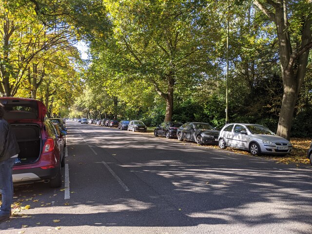
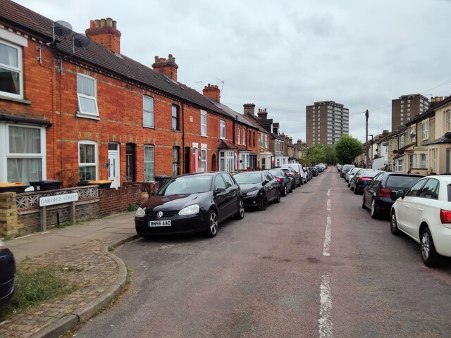
The village of Brickhill itself is small and charming, featuring a variety of architectural styles that range from traditional thatched cottages to more modern developments. The village is centered around the Church of St. Mary the Virgin, which dates back to the 13th century and is a notable landmark in the area.

Despite its rural setting, Brickhill is well-connected to surrounding areas. The nearby A421 road provides easy access to both Bedford and Milton Keynes, while the M1 motorway is also within close proximity. This makes Brickhill an attractive location for commuters and those looking to enjoy the peaceful countryside while remaining within reach of urban amenities.

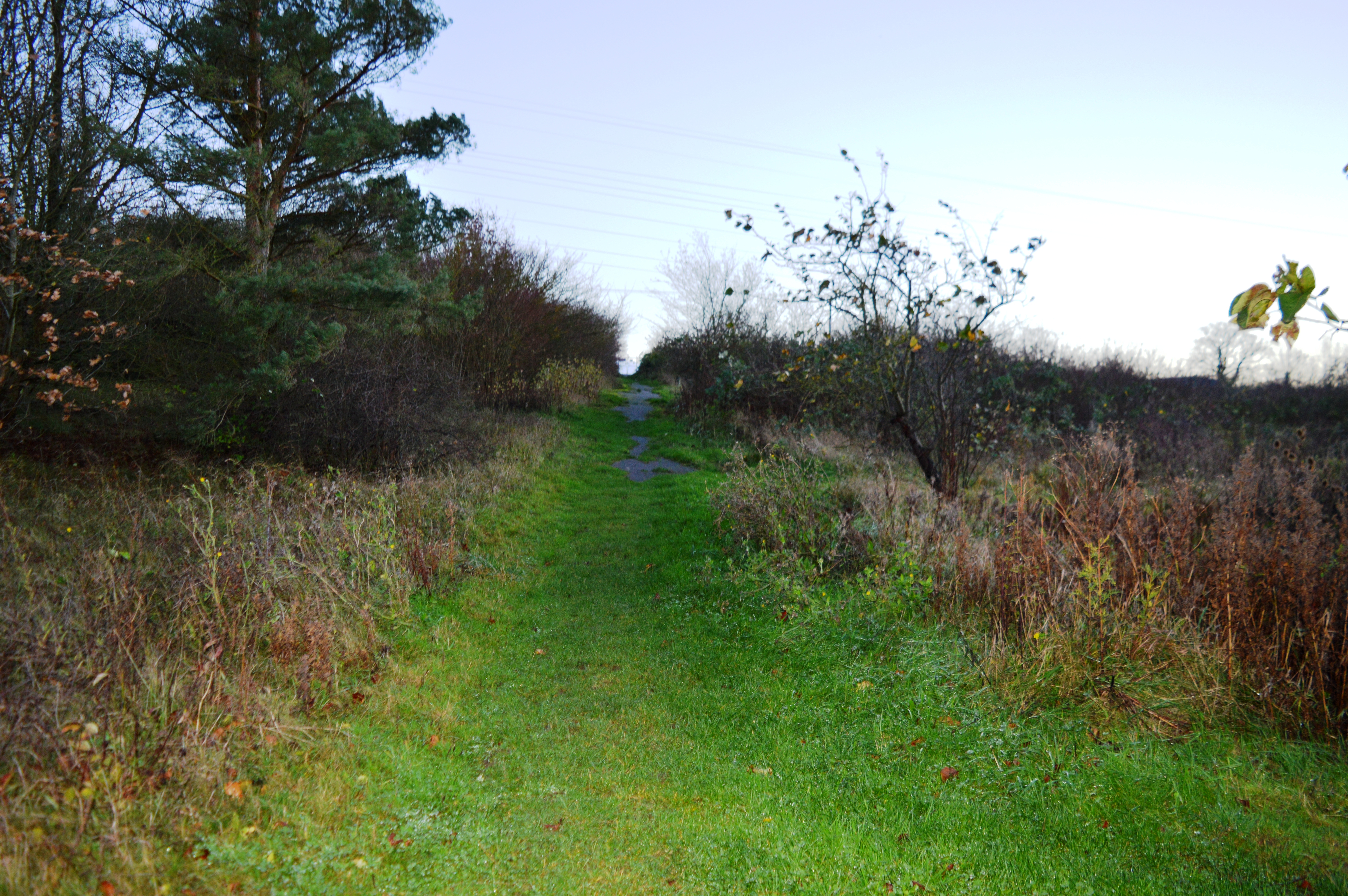
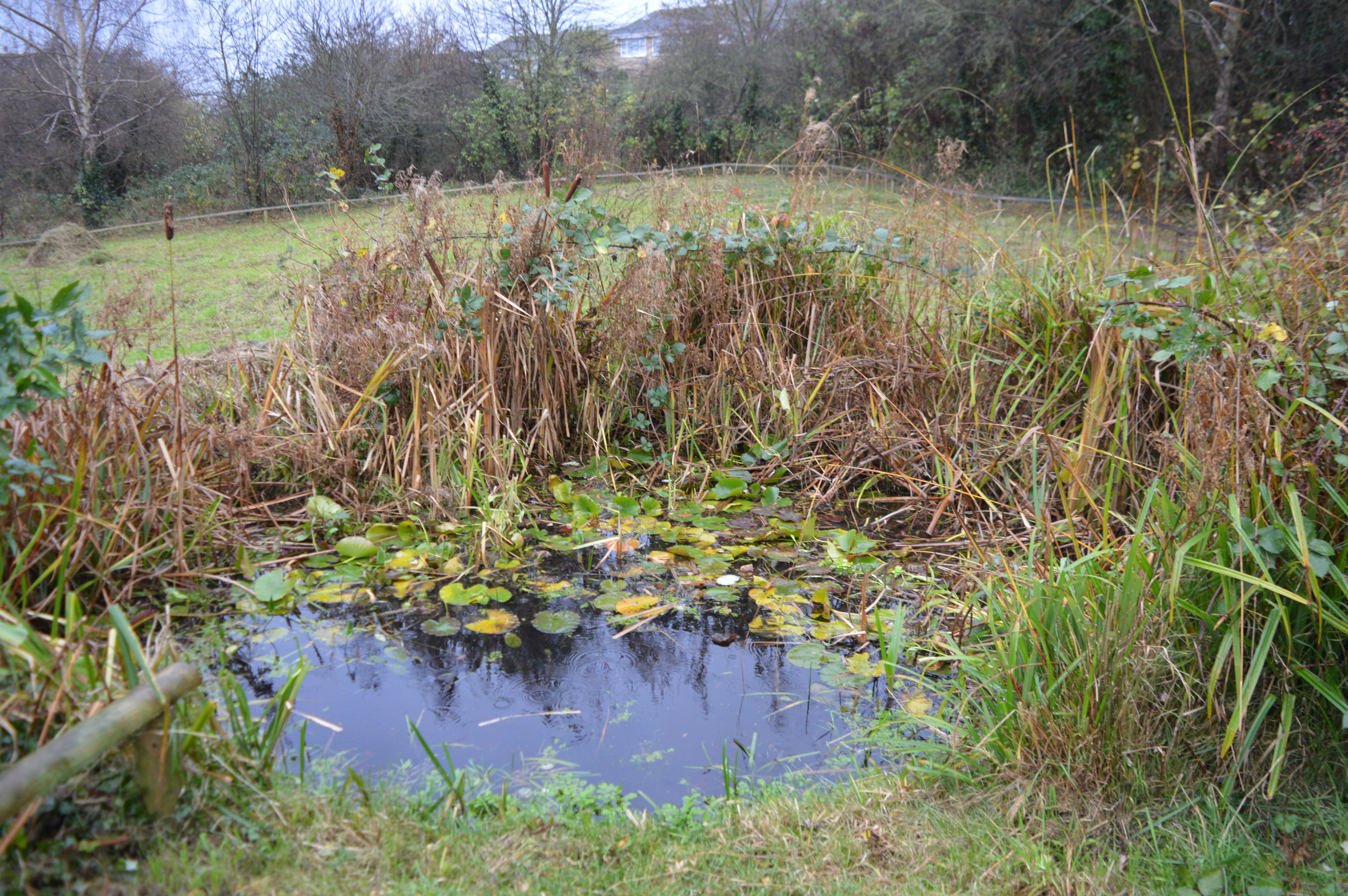
The parish is surrounded by picturesque countryside, offering residents and visitors ample opportunities for outdoor activities such as walking, cycling, and horse riding. The nearby Marston Vale Forest Centre is a popular destination for nature enthusiasts, boasting woodland trails, birdwatching hides, and a visitor center.

Brickhill also has a strong sense of community, with various local events and activities taking place throughout the year. These include the annual village fete, which showcases local crafts, produce, and entertainment.

Overall, Brickhill offers a tranquil and friendly environment for its residents, combining the charm of a rural village with convenient access to nearby towns and cities.

If you have any feedback on the listing, please let us know in the comments section below.

Brickhill Images

Images are sourced within 2km of 52.157393/-0.464901 or Grid Reference TL0552. Thanks to Geograph Open Source API. All images are credited.

Lake in Bedford Park
Park Avenue, looking south-west
Walking past the pavilion in Bedford Park
Bedford Park on a bright day in October
Path in Bedford Park
Gladstone Street, Bedford Terraced cottages typical of the Black Tom area of Bedford.
Gladstone Street, Bedford
Terraced cottages typical of the Black Tom area of Bedford.
The Burnaby Arms, Stanley Street, Bedford Public house on corner of Palmerston and Stanley Streets.
The Burnaby Arms, Stanley Street, Bedford
Public house on corner of Palmerston and Stanley Streets.
Garfield Street, Bedford View from Stanley Street.
Garfield Street, Bedford
View from Stanley Street.
Palmerston Street, Bedford View from Stanley Street along Palmerston Street.
Palmerston Street, Bedford
View from Stanley Street along Palmerston Street.
Brewpoint Bedford - brewery, roastery, shop, eating and gathering hub
Sign for Brewpoint Bedford
Aldi supermarket
Aldi supermarket
A600 approaching roundabout
Houses on Clapham Road
Entrance to Clapham Water Treatment Works off Clapham Road
Dual use path beside Clapham Road
Bedford / Clapham boundary stone dated 1934
Thatched cottage on Bedford Road
Show me another place!

Brickhill is located at Grid Ref: TL0552 (Lat: 52.157393, Lng: -0.464901)

Unitary Authority: Bedford

Police Authority: Bedfordshire

What 3 Words

///dices.mixed.mops. Near Clapham, Bedfordshire

Related Wikis

Brickhill

Brickhill is a civil parish and electoral ward within northern Bedford in Bedfordshire, England. The boundaries of Brickhill are approximately Kimbolton...

Park Wood, Bedford

Park Wood is a 5.2 hectare Local Nature Reserve located in the Brickhill area of Bedford. It is owned by Bedford Borough Council and managed by the council...

St Thomas More Catholic School, Bedford

St Thomas More Catholic School is a mixed secondary school and sixth form located in Bedford in the English county of Bedfordshire. The school is located...

Harpur Trust

The Harpur Trust is a charity in Bedford, England. The stated aim of the charity is to help and support the people who live in and around Bedford, and...

Hill Rise, Bedford

Hill Rise is a 0.9 hectare Local Nature Reserve (LNR) located in the Harpur area of Bedford. It is owned and managed by Bedford Borough Council.The site...

Bedford Park, Bedford

Bedford Park is a large urban park, located in the town of Bedford, Bedfordshire, England. The park is the largest urban park within the town, and it is...

Harpur

Harpur is an electoral ward and area within the town of Bedford, England. The boundaries of Harpur are approximately Manton Lane to the north, De Parys...

Freeman's Common

Freeman's Common is a 12.5 hectare area of land situated to the north of Bedford, in the parish of Ravensden. It was created in 1858. Over many years...

Nearby Amenities

Located within 500m of 52.157393,-0.464901
Mini Roundabout
Direction: clockwise
Lat/Long: 52.1536082/-0.4635462
Mini Roundabout
Direction: clockwise
Lat/Long: 52.1540259/-0.4660559
Direction: both
Surface: asphalt
Traffic Calming: hump
Lat/Long: 52.1561763/-0.4648853
Direction: both
Surface: asphalt
Traffic Calming: hump
Lat/Long: 52.1559039/-0.4640018
Post Office
Chambers Newsagent
Addr City: Bedford
Addr Country: GB
Addr Housenumber: 103
Addr Postcode: MK41 7QF
Addr Street: Brickhill Drive
Fhrs Authority: Bedford
Fhrs Id: 86931
Fhrs Local Authority Id: 22283
Shop: newsagent
Lat/Long: 52.1542784/-0.4651271
Post Office
Martin McColl
Addr City: Bedford
Addr Country: GB
Addr Housenumber: 18
Addr Postcode: MK41 7AF
Addr Street: Avon Drive
Brand Wikidata: Q116779207
Fhrs Authority: Bedford
Fhrs Id: 85457
Fhrs Local Authority Id: 21536
Ref Pol Id: 2564
Shop: convenience
Website: https://my.morrisons.com/storefinder/60196/martins-north-brickhill-avon-drive
Lat/Long: 52.1581556/-0.4585303
Post Box
Brand: Royal Mail
Brand Wikidata: Q638098
Check Date: 2021-08-16
Collection Times: Mo-Fr 17:00, Sa 11:30
Note: Information plate showed collection times but the reference was folded out of sight. According to Royal Mail list this should be MK41 296.
Operator: Royal Mail
Operator Wikidata: Q638098
Post Box Type: pillar
Ref: MK41 296
Royal Cypher: EIIR
Royal Cypher Wikidata: Q33102113
Source: survey
Lat/Long: 52.1582202/-0.4583808
Post Box
Brand: Royal Mail
Brand Wikidata: Q638098
Check Date: 2021-06-21
Collection Times: Mo-Fr 16:45, Sa 11:15
Operator: Royal Mail
Operator Wikidata: Q638098
Post Box Type: pillar
Ref: MK41 369
Royal Cypher: EIIR
Royal Cypher Wikidata: Q33102113
Source: survey
Lat/Long: 52.154101/-0.4648956
Fuel
Avon Drive Service Centre
Addr City: Bedford
Addr Country: GB
Addr Postcode: MK41 7AF
Addr Street: Avon Drive
Lat/Long: 52.1585965/-0.4585589
Recycling
Location: underground
Recycling Cans: yes
Recycling Glass Bottles: yes
Recycling Type: container
Lat/Long: 52.1579603/-0.4580265
Note: waterway dissappears into drain/soakaway
Lat/Long: 52.1583704/-0.4706899
Brickhill
Place: suburb
Wikidata: Q680874
Wikipedia: en:Brickhill
Lat/Long: 52.1568075/-0.4581375
Kerb: raised
Lat/Long: 52.1533696/-0.462034
Addr Housenumber: 46
Lat/Long: 52.1543906/-0.4599887
Addr Housenumber: 48
Addr Street: Falcon Avenue
Lat/Long: 52.1550123/-0.4621949
Addr Housenumber: 50
Addr Street: Falcon Avenue
Lat/Long: 52.1551042/-0.4624437
Addr Housenumber: 19
Lat/Long: 52.1545273/-0.4604677
Addr Housenumber: 11
Lat/Long: 52.1540231/-0.4606199
Addr Housenumber: 9
Lat/Long: 52.1537525/-0.4606063
Addr Housenumber: 2
Lat/Long: 52.1536272/-0.4622481
Addr Housenumber: 22
Lat/Long: 52.154942/-0.4619698
Addr Housenumber: 37
Lat/Long: 52.1552011/-0.4626401
Addr Housenumber: 25
Lat/Long: 52.1547191/-0.4629203
Addr Housenumber: 5
Lat/Long: 52.1539039/-0.4630883
Addr Housenumber: 1
Addr Street: Linnet Way
Lat/Long: 52.15365/-0.4631798
Addr Housenumber: 77
Lat/Long: 52.1535847/-0.4630057
Addr Housenumber: 71
Lat/Long: 52.1533505/-0.4624636
Addr Housenumber: 29
Lat/Long: 52.1548868/-0.4599926
Addr Housenumber: 31
Lat/Long: 52.1558188/-0.4625219
Addr Housenumber: 45
Lat/Long: 52.1563147/-0.4639576
Addr Housenumber: 3
Lat/Long: 52.1564241/-0.4638764
Addr Housenumber: 13
Lat/Long: 52.1568182/-0.4632176
Addr Housenumber: 15
Lat/Long: 52.1569936/-0.4628314
Addr Housenumber: 27
Lat/Long: 52.1574675/-0.462114
Addr Housenumber: 29
Lat/Long: 52.1577025/-0.4618981
Addr Housenumber: 37
Lat/Long: 52.1580223/-0.461612
Addr Housenumber: 43
Lat/Long: 52.1585082/-0.4613455
Addr Housenumber: 49
Lat/Long: 52.1588063/-0.4612199
Addr Housenumber: 22
Lat/Long: 52.1566203/-0.4629378
Addr Housenumber: 10
Lat/Long: 52.1563157/-0.4621496
Addr Housenumber: 4
Lat/Long: 52.1564328/-0.4617836
Addr Housenumber: 1
Lat/Long: 52.1563838/-0.4608715
Addr Housenumber: 19
Lat/Long: 52.1569656/-0.4620064
Addr Housenumber: 23
Lat/Long: 52.1568051/-0.4625238
Addr Housenumber: 42
Lat/Long: 52.1573204/-0.4618063
Addr Housenumber: 2
Lat/Long: 52.1577317/-0.4593564
Addr Housenumber: 25
Lat/Long: 52.1575736/-0.4615464
Addr Housenumber: 9
Lat/Long: 52.1574646/-0.4604716
Addr Housenumber: 1
Lat/Long: 52.1579518/-0.4596675
Addr Housenumber: 3
Lat/Long: 52.157797/-0.4599631
Addr Housenumber: 1
Lat/Long: 52.1577167/-0.460051
Addr Housenumber: 19
Lat/Long: 52.1583877/-0.4613723
Addr Housenumber: 6
Lat/Long: 52.1576095/-0.4605023
Addr Housenumber: 18
Lat/Long: 52.1580985/-0.4615303
Addr Housenumber: 2
Addr Street: Isis Road
Lat/Long: 52.157561/-0.4603462
Addr Housenumber: 46
Lat/Long: 52.1589201/-0.4610901
Addr Housenumber: 36
Lat/Long: 52.1587142/-0.4606683
Addr Housenumber: 16
Lat/Long: 52.1580494/-0.4598074
Addr Housenumber: 8
Lat/Long: 52.1575606/-0.4591572
Addr Housenumber: 2
Lat/Long: 52.1573275/-0.4588946
Addr Housenumber: 38
Lat/Long: 52.1571958/-0.4591869
Addr Housenumber: 16
Lat/Long: 52.1564176/-0.4607445
Addr Housenumber: 12
Lat/Long: 52.1562338/-0.4613571
Addr Housenumber: 2
Lat/Long: 52.155888/-0.4623507
Addr Housenumber: 22
Addr Street: Linnet Way
Lat/Long: 52.1553485/-0.4629506
Addr Housenumber: 52
Lat/Long: 52.1554254/-0.463191
Addr Housenumber: 64
Lat/Long: 52.1559632/-0.4646236
Addr Housenumber: 80
Lat/Long: 52.1562644/-0.4654401
Addr Housenumber: 35
Lat/Long: 52.155136/-0.4658922
Addr Housenumber: 1
Lat/Long: 52.1548968/-0.4632812
Addr Housenumber: 4
Lat/Long: 52.1546663/-0.4634615
Addr Housenumber: 34
Lat/Long: 52.1548573/-0.4657864
Addr Housenumber: 10
Addr Street: Linnet Way
Lat/Long: 52.154657/-0.4633212
Operator: EDF
Power: substation
Lat/Long: 52.1552507/-0.4663658
Addr Housenumber: 2
Lat/Long: 52.1555821/-0.4666424
Addr Housenumber: 8
Lat/Long: 52.1554653/-0.4675941
Addr Housenumber: 17
Lat/Long: 52.1559908/-0.467539
Addr Housenumber: 23
Lat/Long: 52.155831/-0.4666123
Addr Housenumber: 5
Lat/Long: 52.1565164/-0.4662767
Addr Housenumber: 1
Lat/Long: 52.1564948/-0.4656856
Addr Housenumber: 53
Lat/Long: 52.156756/-0.464936
Addr Housenumber: 49
Lat/Long: 52.1566162/-0.4644641
Addr Housenumber: 2
Lat/Long: 52.1566089/-0.464252
Addr Housenumber: 14
Lat/Long: 52.1571513/-0.4634171
Addr Housenumber: 26
Lat/Long: 52.1576128/-0.4626074
Addr Housenumber: 28
Lat/Long: 52.1578986/-0.4622856
Addr Housenumber: 40
Lat/Long: 52.1583461/-0.4619548
Addr Housenumber: 54
Lat/Long: 52.158898/-0.4616678
Addr Housenumber: 48
Lat/Long: 52.1591111/-0.4615172
Addr Housenumber: 54
Lat/Long: 52.1592034/-0.4618124
Addr Housenumber: 19a
Addr Street: Torrige Rise
Lat/Long: 52.1593059/-0.4618806
Addr Housenumber: 19
Lat/Long: 52.1593161/-0.4619975
Addr Housenumber: 25
Lat/Long: 52.1592981/-0.4626896
Addr Housenumber: 2
Lat/Long: 52.1590061/-0.4624122
Addr Housenumber: 14
Lat/Long: 52.1583888/-0.4627787
Addr Housenumber: 18
Lat/Long: 52.1582678/-0.4626479
Addr Housenumber: 17
Lat/Long: 52.1582371/-0.4633335
Addr Housenumber: 23
Lat/Long: 52.1579972/-0.4629213
Addr Housenumber: 33
Lat/Long: 52.1580615/-0.4626707
Addr Housenumber: 34
Lat/Long: 52.157805/-0.4631837
Addr Housenumber: 24
Lat/Long: 52.1580565/-0.4636577
Addr Housenumber: 23
Lat/Long: 52.158333/-0.4638647
Addr Housenumber: 1
Lat/Long: 52.159036/-0.4629366
Addr Housenumber: 40
Lat/Long: 52.1594878/-0.4624814
Addr Housenumber: 16
Lat/Long: 52.1599349/-0.4605222
Addr Housenumber: 2
Lat/Long: 52.1601405/-0.4596143
Power: tower
Lat/Long: 52.1600169/-0.4607989
Power: tower
Lat/Long: 52.1602321/-0.4610487
Power: tower
Lat/Long: 52.1592319/-0.4637922
Power: tower
Source: bing
Lat/Long: 52.1590358/-0.4635897
Crossing Island: yes
Lat/Long: 52.1538909/-0.4647533
Power: tower
Lat/Long: 52.1578982/-0.4674714
Power: tower
Lat/Long: 52.1567289/-0.4706037
Direction: both
Surface: asphalt
Traffic Calming: hump
Lat/Long: 52.1555873/-0.4630994
Power: tower
Source: bing
Lat/Long: 52.1576342/-0.4672773
Power: tower
Source: bing
Lat/Long: 52.1564858/-0.4703509
Atm
Check Date: 2021-08-16
Operator: Cash Zone
Lat/Long: 52.158207/-0.458527
Pharmacy
Lloyds Pharmacy
Addr City: Bedford
Addr Country: GB
Addr Housenumber: 107
Addr Postcode: MK41 7QF
Addr Street: Brickhill Drive
Brand: Lloyds Pharmacy
Brand Wikidata: Q6662870
Fhrs Authority: Bedford
Fhrs Id: 86932
Fhrs Local Authority Id: 22284
Healthcare: pharmacy
Source: Bing
Lat/Long: 52.1542647/-0.4652497
Crossing
Button Operated: yes
Crossing: traffic_signals
Crossing Island: no
Crossing Ref: pelican
Tactile Paving: yes
Traffic Signals Sound: yes
Traffic Signals Vibration: no
Lat/Long: 52.1539982/-0.4657087
Barrier: kissing_gate
Lat/Long: 52.1610279/-0.467949
Fast Food
Brickhill Fish and Chips
Addr City: Bedford
Addr Country: GB
Addr Housenumber: 12
Addr Postcode: MK41 7AF
Addr Street: Avon Drive
Cuisine: fish_and_chips
Fhrs Authority: Bedford
Fhrs Id: 85456
Fhrs Local Authority Id: 21532
Source: Bing
Takeaway: yes
Lat/Long: 52.1579931/-0.4585405
One Stop
Addr City: Bedford
Addr Country: GB
Addr Housenumber: 10
Addr Postcode: MK41 7AF
Addr Street: Avon Drive
Brand: One Stop
Brand Wikidata: Q65954217
Contact Website: https://www.onestop.co.uk/store?store=1759fa8f-0c6c-49c7-99d5-9e782ef34dea
Fhrs Authority: Bedford
Fhrs Id: 621152
Fhrs Local Authority Id: 114146
Shop: convenience
Source: Bing
Lat/Long: 52.1579259/-0.4584612
Fast Food
Ocean Fish Bar
Addr City: Bedford
Addr Country: GB
Addr Housenumber: 115
Addr Postcode: MK41 7QF
Addr Street: Brickhill Drive
Diet Vegan: no
Diet Vegetarian: yes
Fhrs Authority: Bedford
Fhrs Id: 427447
Fhrs Local Authority Id: 112517
Opening Hours: Mo-We 16:00-21:00; Th-Sa 12:00-14:00,16:00-21:00
Source: Bing
Lat/Long: 52.154272/-0.4654892
Post Box
Brand: Royal Mail
Brand Wikidata: Q638098
Check Date: 2021-08-08
Collection Times: Mo-Fr 09:00, Sa 07:00
Operator: Royal Mail
Operator Wikidata: Q638098
Post Box Type: pillar
Ref: MK41 401
Royal Cypher: EIIR
Royal Cypher Wikidata: Q33102113
Source: survey
Lat/Long: 52.1571483/-0.4652842
Bus Stop
Brickhill Drive
Bench: yes
Bin: yes
Bus: yes
Lit: yes
Naptan AtcoCode: 020035165
Naptan NaptanCode: bfsamgjg
Public Transport: platform
Shelter: yes
Tactile Paving: no
Lat/Long: 52.1538856/-0.4651351
Bus Stop
Bus: yes
Naptan AtcoCode: 020035166
Naptan NaptanCode: bfsamgjm
Public Transport: platform
Lat/Long: 52.1538474/-0.4643547
Recycling
Location: overground
Recycling Clothes: yes
Recycling Glass Bottles: yes
Recycling Shoes: yes
Recycling Type: container
Lat/Long: 52.1540048/-0.4647216
Board Type: notice
Information: board
Lat/Long: 52.1541041/-0.4648482
Access: yes
Leisure: playground
Lat/Long: 52.1541733/-0.4652453
Waste Basket
Check Date: 2022-07-11
Lat/Long: 52.1534187/-0.4615328
Waste Basket
Lat/Long: 52.1548128/-0.4612059
Bus Stop
Bus: yes
Public Transport: platform
Lat/Long: 52.1572652/-0.458358
Coral
Brand: Coral
Brand Wikidata: Q54621344
Shop: bookmaker
Lat/Long: 52.1580617/-0.4585362
Cafe
Roni's Coffee Bar
Addr City: Bedford
Addr Country: GB
Addr Housenumber: 89
Addr Postcode: MK41 7QF
Addr Street: Brickhill Drive
Fhrs Authority: Bedford
Fhrs Id: 1002090
Fhrs Local Authority Id: 126655
Lat/Long: 52.1539975/-0.4642367
Elegance
Shop: hairdresser
Lat/Long: 52.154269/-0.4653177
BG Bet
Shop: bookmaker
Lat/Long: 52.1542658/-0.4654008
Barrier: lift_gate
Lat/Long: 52.1616459/-0.4632619
Power: substation
Lat/Long: 52.1535467/-0.4622215
Bus Stop
Bus: yes
Public Transport: platform
Lat/Long: 52.1538351/-0.4681142
Crossing
Crossing: uncontrolled
Crossing Markings: yes
Crossing Ref: zebra
Lat/Long: 52.1556588/-0.4623697
The data included in this document is from www.openstreetmap.org. The data is made available under ODbL.

Have you been to Brickhill?

Leave your review of Brickhill below (or comments, questions and feedback).