Bretby

Civil Parish in Derbyshire South Derbyshire

England

Bretby

Lee Wood The wood has been here since at least the 1830s, when the Ordnance Survey First Series maps were surveyed. It was recorded, then, as Ley Wood Hill. The land in the foreground may be developed for housing in the next few years.
Lee Wood Credit: Ian Calderwood

Bretby is a civil parish located in Derbyshire, England. It is situated about 5 miles southwest of Burton upon Trent. The parish covers an area of approximately 5 square miles and has a population of around 1,500 people.

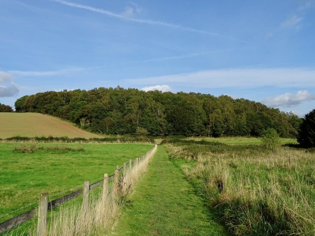
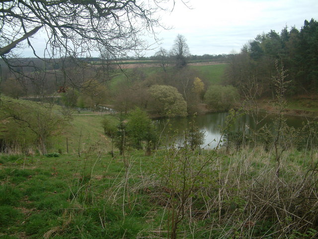
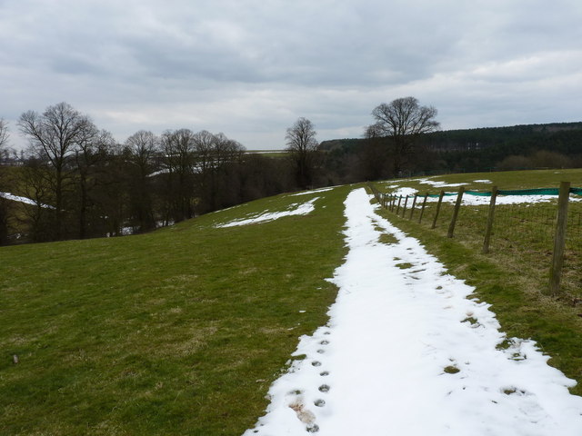
The village of Bretby is known for its picturesque surroundings and charming rural atmosphere. It is surrounded by open fields and countryside, providing residents with plenty of opportunities for outdoor activities such as walking, cycling, and horse riding. The River Trent flows nearby, adding to the scenic beauty of the area.

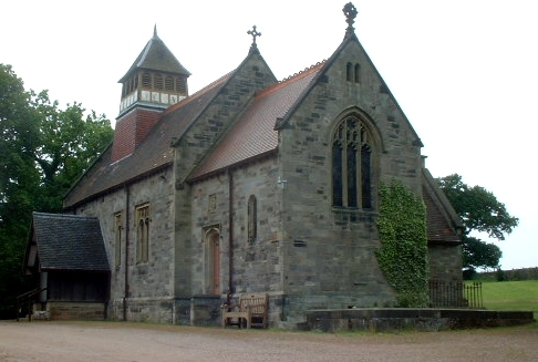
Historically, Bretby was a part of the ancient hundred of Repton and Gresley, and it is mentioned in the Domesday Book of 1086. The village has a rich industrial heritage, with coal mining and brick making being significant industries in the past. Today, the village is mainly residential, with a few local businesses and amenities serving the community.

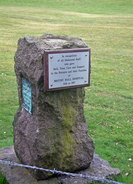
Bretby is home to the Bretby Art Pottery, which was established in the late 19th century and gained international recognition for its high-quality ceramics. The pottery is now a Grade-II listed building and serves as a testament to the village's artistic heritage.

The parish also includes the Bretby Hall, a historic country house that is now a private residence. The hall dates back to the early 19th century and showcases impressive Victorian architecture.

Overall, Bretby offers a tranquil and picturesque setting, making it an attractive place to live for those seeking a peaceful rural lifestyle.

If you have any feedback on the listing, please let us know in the comments section below.

Bretby Images

Images are sourced within 2km of 52.801206/-1.56448 or Grid Reference SK2922. Thanks to Geograph Open Source API. All images are credited.

Lee Wood The wood has been here since at least the 1830s, when the Ordnance Survey First Series maps were surveyed. It was recorded, then, as Ley Wood Hill. The land in the foreground may be developed for housing in the next few years.
Lee Wood
The wood has been here since at least the 1830s, when the Ordnance Survey First Series maps were surveyed. It was recorded, then, as Ley Wood Hill. The land in the foreground may be developed for housing in the next few years.
Farmland West of Bretby Mill Much of this grid square is taken up with sheep farming.
Farmland West of Bretby Mill
Much of this grid square is taken up with sheep farming.
Hill Farm
Hill Farm
Flood Noahs Ark is a dwelling built on high ground. Foresight perhaps?
Flood
Noahs Ark is a dwelling built on high ground. Foresight perhaps?
Undulating Sheep on the hills west of Hoofies Farm
Undulating
Sheep on the hills west of Hoofies Farm
Moxon's Hill Moxon's Hill near Hoofies Farm
Moxon's Hill
Moxon's Hill near Hoofies Farm
Bretby Hall Converted Hospital
Bretby Hall
Converted Hospital
Monument at Bretby
Monument at Bretby
Lakes at Bretby Hall The lakes viewed from the footpath running along the Southern edge of Bretby Hall. The strip of land separating these two lakes provides the crossing point of the footpath from Bretby to Hoolies wood and from there to either Upper Midway or Hartshorne.
Lakes at Bretby Hall
The lakes viewed from the footpath running along the Southern edge of Bretby Hall. The strip of land separating these two lakes provides the crossing point of the footpath from Bretby to Hoolies wood and from there to either Upper Midway or Hartshorne.
Collarbone Canon
Collarbone Canon
Bretby Park, Bretby Built by the fifth Earl of Chesterfield, begun in 1813 and unfinished when he died in 1815. This show front was probably designed by Jeffry Wyatville. Grade II* listed.
For much of the C20th it housed a hospital, but has now been converted to flats.
Bretby Park, Bretby
Built by the fifth Earl of Chesterfield, begun in 1813 and unfinished when he died in 1815. This show front was probably designed by Jeffry Wyatville. Grade II* listed. For much of the C20th it housed a hospital, but has now been converted to flats.
Road junction The junction of Greysich Lane with Repton Road in the valley.
Road junction
The junction of Greysich Lane with Repton Road in the valley.
The Repton Brook The brook meanders quietly through the woods near the road, crossing under it at a bridge which is undergoing some repair work.
The Repton Brook
The brook meanders quietly through the woods near the road, crossing under it at a bridge which is undergoing some repair work.
Pool at the Dower House One of a series of large ornamental ponds stretching off to the WSW in a valley near Bretby Park.
Pool at the Dower House
One of a series of large ornamental ponds stretching off to the WSW in a valley near Bretby Park.
Barns and bales at Dower House Farm
A bridleway at Dower House Farm The track just south of here past the farm sports signs asking you to keep out (of the Bretby Hall estate, presumably) but this bridleway is a right of way, and quite well marked along the fields.
A bridleway at Dower House Farm
The track just south of here past the farm sports signs asking you to keep out (of the Bretby Hall estate, presumably) but this bridleway is a right of way, and quite well marked along the fields.
The bridleway above Watery Lane
Town Farm house The main farmhouse at Bretby's Town Farm.
Town Farm house
The main farmhouse at Bretby's Town Farm.
Show me another place!

Bretby is located at Grid Ref: SK2922 (Lat: 52.801206, Lng: -1.56448)

Administrative County: Derbyshire

District: South Derbyshire

Police Authority: Derbyshire

What 3 Words

///firmly.lock.entry. Near Swadlincote, Derbyshire

Related Wikis

Bretby

Bretby is a village and civil parish in the south of Derbyshire, England, north of Swadlincote and east of Burton upon Trent, on the border between Derbyshire...
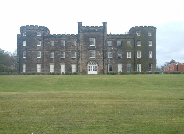
Bretby Hall

Bretby Hall is a country house at Bretby, Derbyshire, England, north of Swadlincote and east of Burton upon Trent on the border with Staffordshire. It...

South Derbyshire (UK Parliament constituency)

South Derbyshire is a constituency represented in the House of Commons of the UK Parliament since 2010 by Heather Wheeler, a Conservative. == Boundaries... ==

Bees, Wasps and Ants Recording Society

The Bees, Wasps and Ants Recording Society (BWARS) is a British society dedicated to recording bees, wasps and ants. The recording of these insects is...

William Allitt Academy

William Allitt Academy (formerly William Allitt School) is a co-educational secondary school located in the village of Newhall, Swadlincote in South Derbyshire...

Repton Rural District

Repton was a rural district in Derbyshire, England from 1894 to 1974. It was created under the Local Government Act 1894 from the part of the Burton upon...

South Derbyshire

South Derbyshire is a local government district in Derbyshire, England. The council is based in the town of Swadlincote. The district also contains numerous...

Newhall, Derbyshire

Newhall is a village in the South Derbyshire district of Derbyshire, England. As of the 2011 census it had a population of 776. The village of Stanton...

Nearby Amenities

Located within 500m of 52.801206,-1.56448
Power: pole
Lat/Long: 52.7974683/-1.5624833
Power: pole
Lat/Long: 52.7981122/-1.5626174
Power: pole
Lat/Long: 52.7988598/-1.562714
Power: pole
Lat/Long: 52.7997874/-1.5628481
Power: pole
Lat/Long: 52.8003193/-1.5643555
Power: pole
Lat/Long: 52.8007571/-1.5656108
Power: pole
Lat/Long: 52.8013766/-1.5672255
Power: pole
Lat/Long: 52.8018177/-1.5683949
Power: pole
Lat/Long: 52.8024176/-1.5700793
Power: pole
Lat/Long: 52.8028814/-1.5713561
The data included in this document is from www.openstreetmap.org. The data is made available under ODbL.

Have you been to Bretby?

Leave your review of Bretby below (or comments, questions and feedback).