Bretby Park
Downs, Moorland in Derbyshire South Derbyshire
England
Bretby Park
Bretby Park is a picturesque area located in Derbyshire, England. Situated amidst the serene countryside, it encompasses both downs and moorland landscapes, offering visitors a diverse natural experience. The park covers a vast expanse, with rolling hills, open fields, and pockets of woodland, providing ample opportunities for outdoor activities and exploration.
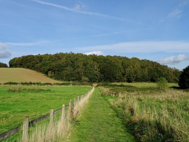
One of the prominent features of Bretby Park is its downs, which are characterized by gently sloping hills covered in lush grass. These downs offer panoramic views of the surrounding countryside and provide a peaceful setting for leisurely walks, picnics, and relaxation. Visitors can revel in the tranquility of the downs, soaking in the beauty of the unspoiled natural scenery.
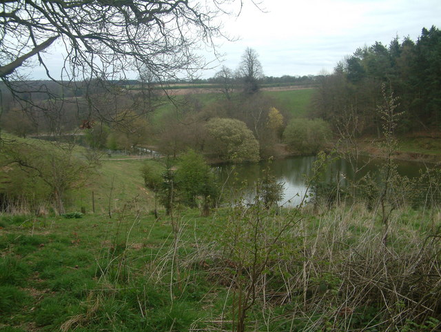
Adjacent to the downs, the park also boasts moorland areas, which present a different landscape altogether. Moorlands are characterized by heather-covered expanses, interspersed with small pools and streams. These areas are home to a variety of wildlife species, including birds, small mammals, and insects. Nature enthusiasts can indulge in birdwatching or simply immerse themselves in the unique ecosystem of the moorlands.
Bretby Park is a haven for outdoor enthusiasts, offering a range of activities such as hiking, cycling, and horseback riding. The park features well-maintained trails that wind through its various terrains, allowing visitors to explore its diverse landscapes at their own pace. Additionally, the park provides facilities for camping and picnicking, making it an ideal destination for day trips or weekend getaways.
In summary, Bretby Park in Derbyshire is a captivating natural haven, encompassing both downs and moorlands. Its rolling hills, open fields, and woodland areas offer a diverse range of landscapes for visitors to enjoy. Whether seeking peaceful walks, wildlife observation, or outdoor activities, this park has something to offer everyone.
If you have any feedback on the listing, please let us know in the comments section below.
Bretby Park Images
Images are sourced within 2km of 52.798405/-1.559212 or Grid Reference SK2922. Thanks to Geograph Open Source API. All images are credited.


Bretby Park is located at Grid Ref: SK2922 (Lat: 52.798405, Lng: -1.559212)
Administrative County: Derbyshire
District: South Derbyshire
Police Authority: Derbyshire
What 3 Words
///traps.stand.life. Near Swadlincote, Derbyshire
Nearby Locations
Related Wikis
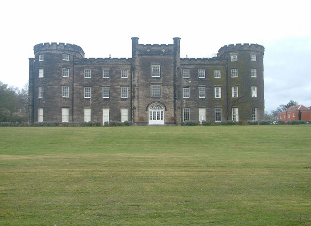
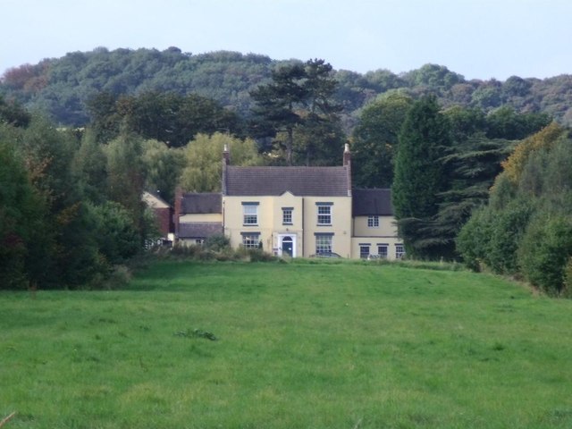
Bretby Hall
Bretby Hall is a country house at Bretby, Derbyshire, England, north of Swadlincote and east of Burton upon Trent on the border with Staffordshire. It...

South Derbyshire (UK Parliament constituency)
South Derbyshire is a constituency represented in the House of Commons of the UK Parliament since 2010 by Heather Wheeler, a Conservative. == Boundaries... ==
Bretby
Bretby is a village and civil parish in the south of Derbyshire, England, north of Swadlincote and east of Burton upon Trent, on the border between Derbyshire...

Bees, Wasps and Ants Recording Society
The Bees, Wasps and Ants Recording Society (BWARS) is a British society dedicated to recording bees, wasps and ants. The recording of these insects is...

South Derbyshire
South Derbyshire is a local government district in Derbyshire, England. The council is based in the town of Swadlincote. The district also contains numerous...
William Allitt Academy
William Allitt Academy (formerly William Allitt School) is a co-educational secondary school located in the village of Newhall, Swadlincote in South Derbyshire...
Repton Rural District
Repton was a rural district in Derbyshire, England from 1894 to 1974. It was created under the Local Government Act 1894 from the part of the Burton upon...
Newhall, Derbyshire
Newhall is a village in the South Derbyshire district of Derbyshire, England. As of the 2011 census it had a population of 776. The village of Stanton...
Nearby Amenities
Located within 500m of 52.798405,-1.559212Have you been to Bretby Park?
Leave your review of Bretby Park below (or comments, questions and feedback).