Ardsley Common
Downs, Moorland in Yorkshire
England
Ardsley Common

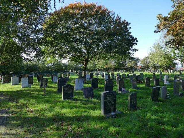
Ardsley Common is a picturesque area located in Yorkshire, England. Nestled amidst the stunning Yorkshire Downs and Moorland, it covers a sprawling expanse of land that captivates visitors with its natural beauty. With an approximate area of 100 hectares, Ardsley Common is a haven for outdoor enthusiasts and nature lovers.
The common is characterized by its diverse landscape, featuring rolling hills, vibrant meadows, and serene woodlands. The Yorkshire Downs provide a majestic backdrop, with their lush greenery and breathtaking views. The Moorland, on the other hand, adds a touch of ruggedness to the scenery, with its heather-covered expanses and rocky outcrops.
Ardsley Common is home to a rich array of flora and fauna. Its meadows burst with colorful wildflowers during the spring and summer months, attracting a variety of butterflies and bees. The woodlands provide a habitat for numerous bird species, including the melodious song thrush and the elusive tawny owl. Visitors may also spot rabbits, foxes, and deer roaming freely across the common.
The common offers a range of activities for visitors to enjoy. Walking and hiking trails crisscross the area, allowing visitors to explore its natural wonders at their own pace. Picnic areas are available for those who wish to take a break and savor the tranquil surroundings. Ardsley Common is also a popular spot for birdwatching and photography, providing ample opportunities to capture the beauty of the landscape on camera.
Overall, Ardsley Common in Yorkshire is a captivating destination that showcases the best of Yorkshire's Downs and Moorland. Its natural beauty, diverse wildlife, and recreational activities make it a must-visit location for nature enthusiasts and anyone seeking a peaceful retreat in the heart of Yorkshire.
If you have any feedback on the listing, please let us know in the comments section below.
Ardsley Common Images
Images are sourced within 2km of 53.731581/-1.5494703 or Grid Reference SE2926. Thanks to Geograph Open Source API. All images are credited.


Ardsley Common is located at Grid Ref: SE2926 (Lat: 53.731581, Lng: -1.5494703)
Division: West Riding
Unitary Authority: Leeds
Police Authority: West Yorkshire
What 3 Words
///wool.factories.edge. Near Lofthouse, West Yorkshire
Nearby Locations
Related Wikis
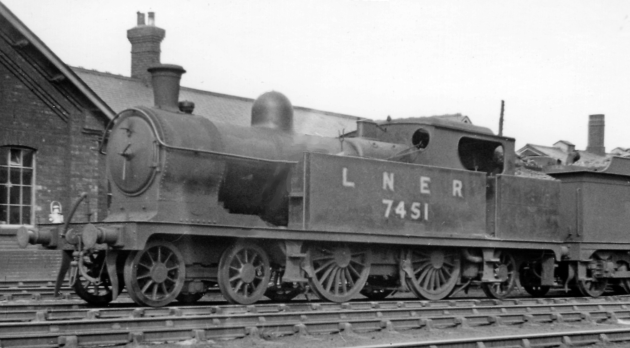
Ardsley railway station
Ardsley railway station was situated on the Great Northern Railway between Tingley and Lofthouse and Outwood on the main line and west of Stanley on the...

East Ardsley
East Ardsley is a village in the City of Leeds metropolitan borough, in West Yorkshire, England. East Ardsley forms part of the Heavy Woollen District...
Middleton, Leeds
Middleton is a largely residential suburb of Leeds in West Yorkshire, England and historically a village in the West Riding of Yorkshire. It is situated...

St Cross Church, Middleton
The Church of St Cross is in Middleton, Leeds, West Yorkshire, England. It is an active Anglican church and part of the Armley deanery in the archdeaconry...

Thorpe on the Hill, West Yorkshire
Thorpe on the Hill (or Thorpe) is a small village in West Yorkshire, England. The village falls within the Ardsley and Robin Hood ward of the Leeds Metropolitan...

Tingley railway station
Tingley railway station served the settlement of Tingley, West Yorkshire, England, from 1857 to 1966 on the Leeds, Bradford and Halifax Junction Railway...
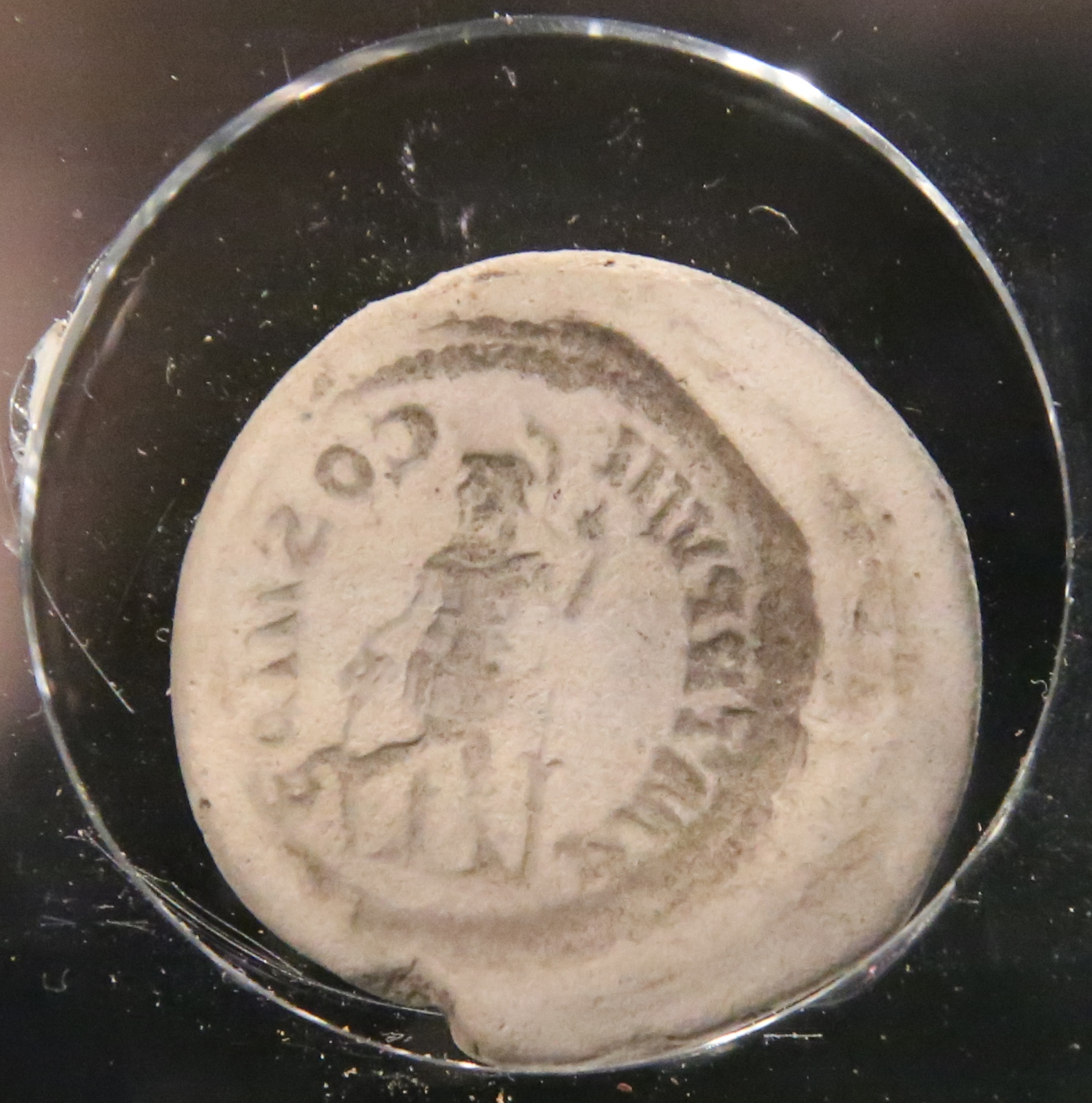
Lingwell Gate coin moulds
The Lingwell Gate coin moulds are a group of Roman, clay coin moulds used in the forgery of coinage found at Lingwell Gate between 1697 and 1879. As of...

Woodkirk
Woodkirk is an ancient village between Leeds and Dewsbury, West Yorkshire, England. The parish church is a grade II listed building. It is traditionally...
Nearby Amenities
Located within 500m of 53.731581,-1.5494703Have you been to Ardsley Common?
Leave your review of Ardsley Common below (or comments, questions and feedback).