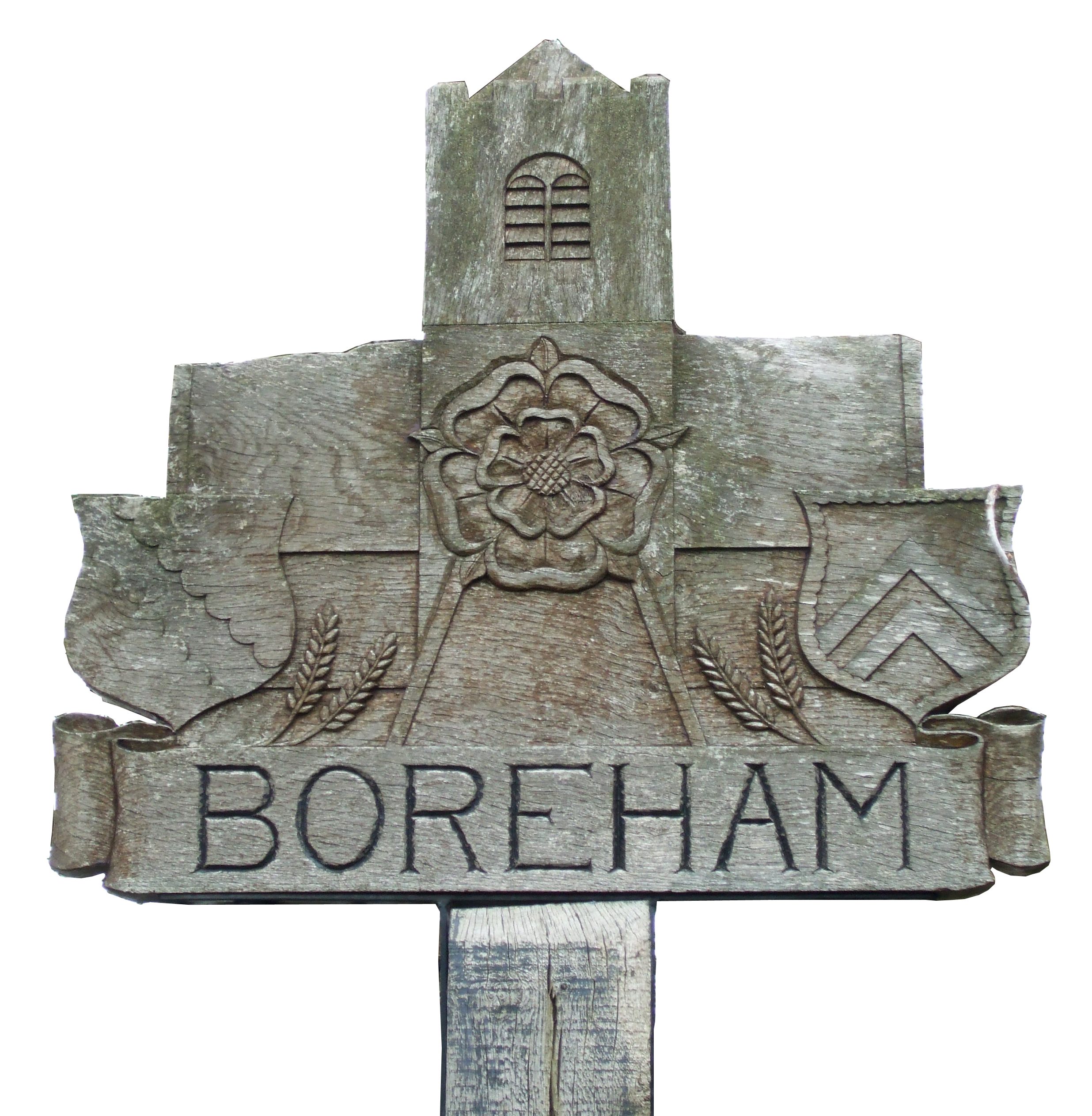
Boreham

Civil Parish in Essex Chelmsford

England

Boreham

Car boot sale near Boreham House Car boot sale at Boreham house, one lazy Sunday in 2021
Car boot sale near Boreham House Credit: Trevor Alder

Boreham is a civil parish located in the county of Essex, England. It is situated about 4 miles northeast of the city of Chelmsford, the county town. The parish covers an area of approximately 7.5 square miles and is surrounded by beautiful countryside, offering a peaceful and picturesque environment.

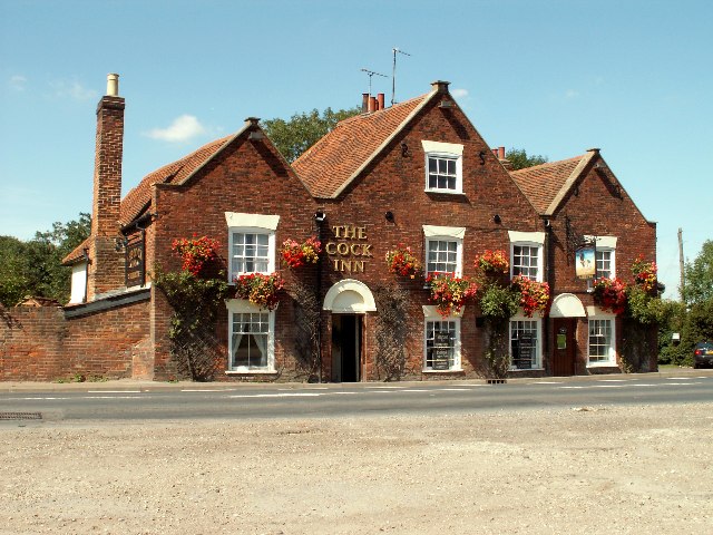
The village itself has a long history, with evidence of human settlement dating back to prehistoric times. The name "Boreham" is of Anglo-Saxon origin, meaning "homestead on the hill," reflecting the village's geographical features. The architecture in Boreham is a mix of old and new, with a number of historic buildings such as St. Andrew's Church, which dates back to the 12th century, alongside more modern developments.

The population of Boreham is relatively small, with around 2,000 residents. The village has a strong sense of community, with various local events and activities organized throughout the year. Boreham also has a primary school, providing education for children in the area.

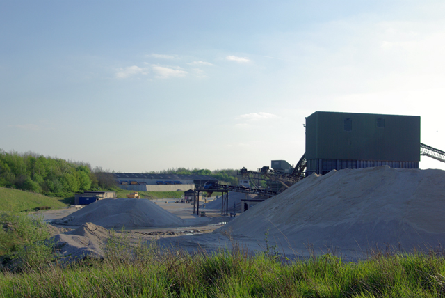
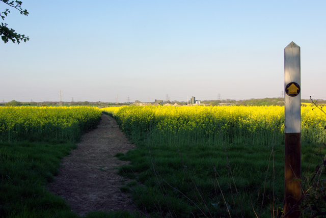
The surrounding countryside offers plenty of opportunities for outdoor activities such as walking, cycling, and horse riding. Boreham is also known for its agricultural heritage, with many farms and fields producing crops and livestock.

The village benefits from good transport links, with the A12 road passing nearby, providing easy access to Chelmsford and other nearby towns. There are also regular bus services connecting Boreham to the surrounding areas.

Overall, Boreham offers a charming and peaceful village lifestyle, with its rich history, beautiful countryside, and strong sense of community.

If you have any feedback on the listing, please let us know in the comments section below.

Boreham Images

Images are sourced within 2km of 51.766826/0.537364 or Grid Reference TL7510. Thanks to Geograph Open Source API. All images are credited.

Car boot sale near Boreham House Car boot sale at Boreham house, one lazy Sunday in 2021
Car boot sale near Boreham House
Car boot sale at Boreham house, one lazy Sunday in 2021
New road under construction near Boreham Believed to be part of the A130 / Chelmsford North East Bypass.
New road under construction near Boreham
Believed to be part of the A130 / Chelmsford North East Bypass.
Grassland near Chelmsford
Worked out gravel pits. Flooded gravel pits on the north east of Boreham airfield.  Now landscaped and saved the ignomy of becoming a landfill site.
Worked out gravel pits.
Flooded gravel pits on the north east of Boreham airfield. Now landscaped and saved the ignomy of becoming a landfill site.
The Cock Inn, Boreham, Essex The Cock Inn dates back to the 15th century and stands on the old A12 London to Ipswich road.
The Cock Inn, Boreham, Essex
The Cock Inn dates back to the 15th century and stands on the old A12 London to Ipswich road.
'The Cock Inn' at Boreham, Essex This inn is said to date back to the early part of the 15th century. It stands alongside the old Roman road between London and Colchester, which became the A.12 until it was changed to the new trunk road close by.
'The Cock Inn' at Boreham, Essex
This inn is said to date back to the early part of the 15th century. It stands alongside the old Roman road between London and Colchester, which became the A.12 until it was changed to the new trunk road close by.
Clock House, Boreham, Essex This is a fine timber-framed building that stands alongside the old A.12 road. It probably dates back to the early 15th century.
Clock House, Boreham, Essex
This is a fine timber-framed building that stands alongside the old A.12 road. It probably dates back to the early 15th century.
Chantry Farm, near Boreham, Essex
Country road just north of Boreham, Essex
Toppinghoehall Wood More strictly, the northern fragment of Toppinghoehall Wood on the right, and Porters Wood on the left. There is no trace of the mapped route of the public footpath through these woods.
Toppinghoehall Wood
More strictly, the northern fragment of Toppinghoehall Wood on the right, and Porters Wood on the left. There is no trace of the mapped route of the public footpath through these woods.
Gravel processing plant A large scale operation now using gravel from part of the old Boreham airfield site.
Gravel processing plant
A large scale operation now using gravel from part of the old Boreham airfield site.
Gravel conveyor Taken from the footpath bridge over the feed belt.
Gravel conveyor
Taken from the footpath bridge over the feed belt.
Walford House On the edge of the old Boreham airfield site.
Walford House
On the edge of the old Boreham airfield site.
Footpath through the Rape A very well cleared footpath route through a crop which otherwise is almost impassable at this stage of growth.
Footpath through the Rape
A very well cleared footpath route through a crop which otherwise is almost impassable at this stage of growth.
Power line junction The nearest pylon is on the spur off the main route whose pylon is a little further away. The three left hand conductors of the spur and the top earth are connected directly. The three right hand cables are taken under the main route via the wooden posts to reach the far three conductors of the main route. The furthest pylon is on a separate route.
Power line junction
The nearest pylon is on the spur off the main route whose pylon is a little further away. The three left hand conductors of the spur and the top earth are connected directly. The three right hand cables are taken under the main route via the wooden posts to reach the far three conductors of the main route. The furthest pylon is on a separate route.
Footpath through the gravel workings The extraction area is now on the left, and the processing area on the right.
Footpath through the gravel workings
The extraction area is now on the left, and the processing area on the right.
Generals Lane A private road now, but public footpath. Shafts of evening light at 6:34 p.m.on a perfect spring day.
Generals Lane
A private road now, but public footpath. Shafts of evening light at 6:34 p.m.on a perfect spring day.
Anglia reclaimed building supplies The entrance on an awkward bend on the quite busy Waltham Road, Boreham. Rather handily, Service On Site breakdown specialists are also on site.
Anglia reclaimed building supplies
The entrance on an awkward bend on the quite busy Waltham Road, Boreham. Rather handily, Service On Site breakdown specialists are also on site.
Show me another place!

Boreham is located at Grid Ref: TL7510 (Lat: 51.766826, Lng: 0.537364)

Administrative County: Essex

District: Chelmsford

Police Authority: Essex

What 3 Words

///plays.tiles.stove. Near Boreham, Essex

Related Wikis

Boreham

Boreham is a village and civil parish in Essex, England. The parish is in the City of Chelmsford and Chelmsford Parliament constituency. The village is...

Boreham House

Boreham House is a Grade I Listed mansion set in 35 acres (140,000 m2) of Boreham, Chelmsford, Essex, England. Boreham House was built from 1728 to 1733...

New Hall School

New Hall School is a Catholic co-educational private boarding and day school in the village of Boreham near Chelmsford, Essex, England. It was founded...
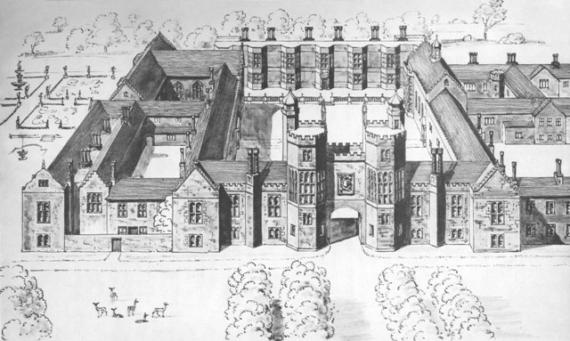
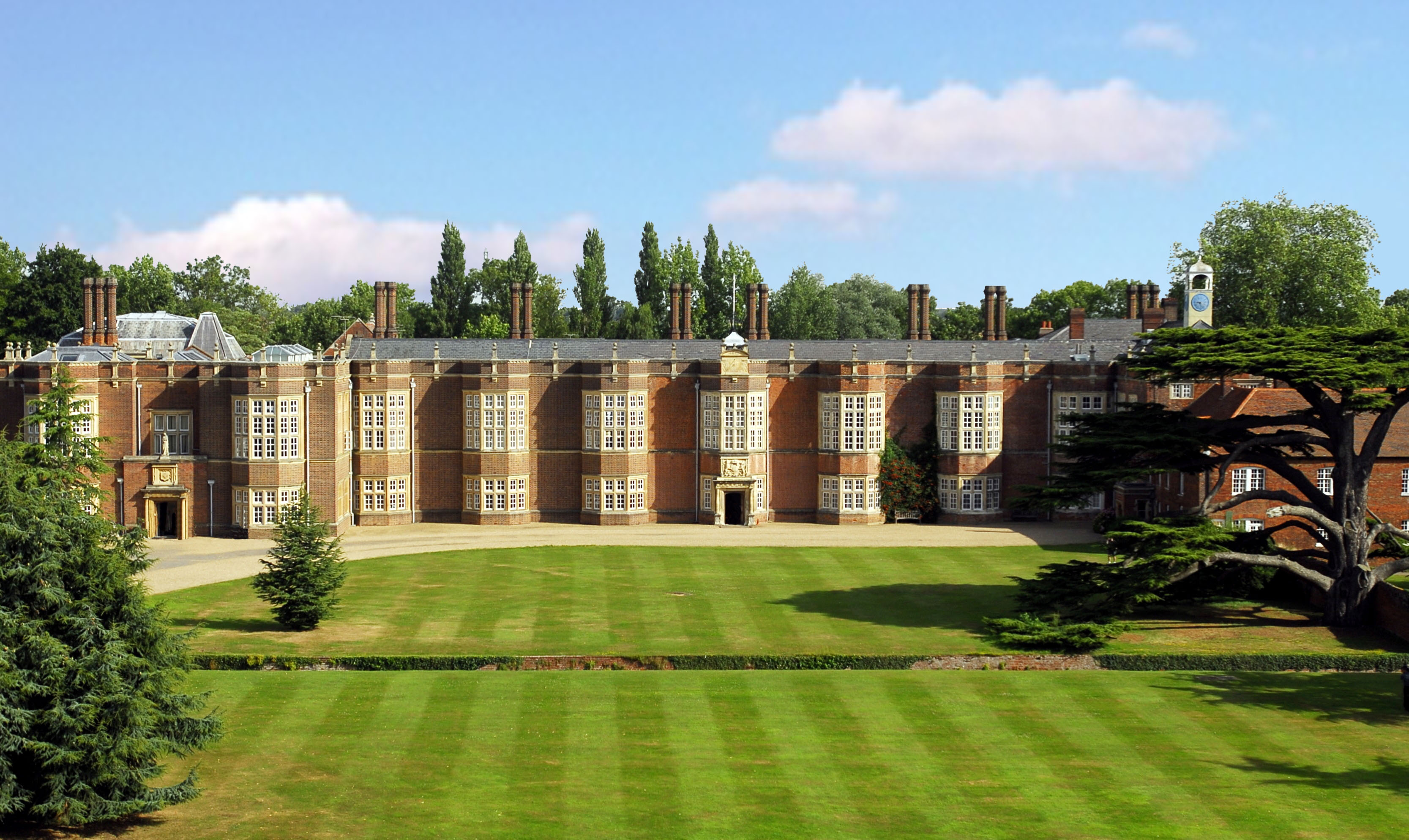
Palace of Beaulieu

The Palace of Beaulieu ( BEW-lee) is a former royal palace in Boreham, Essex, England, north-east of Chelmsford. The surviving part is a Grade I listed...
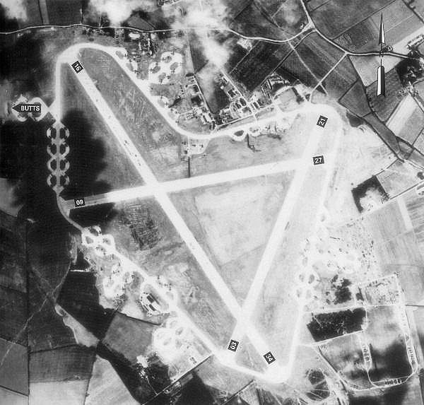
RAF Boreham

Royal Air Force Boreham or more simply RAF Boreham is a former Royal Air Force station in Essex, England. The airfield was always known locally as : "Boreham...

Beaulieu Park railway station

Beaulieu Park railway station is a planned station on the Great Eastern Main Line in the East of England that will serve a new development in Boreham,...

Essex County Football Association

The Essex County Football Association, also simply known as the Essex FA, is the governing body of football in the county of Essex. == References... ==

Mowden, Essex

Mowden is a hamlet in the civil parish of Hatfield Peverel, in the Braintree district, in the county of Essex, England. It is about 5 miles away from the...

Nearby Amenities

Located within 500m of 51.766826,0.537364
Power: tower
Lat/Long: 51.7636966/0.5336523
Power: tower
Lat/Long: 51.7664904/0.5370292
Power: tower
Lat/Long: 51.7692068/0.5402693
Power: tower
Ref: PSB19A
Lat/Long: 51.7642145/0.5331159
Power: tower
Lat/Long: 51.7671958/0.5353314
Power: pole
Lat/Long: 51.7702483/0.5379063
Power: tower
Lat/Long: 51.7652271/0.5338455
Power: pole
Lat/Long: 51.7639996/0.532349
Power: tower
Lat/Long: 51.7680921/0.5359751
Power: tower
Lat/Long: 51.7705918/0.537858
Power: pole
Lat/Long: 51.7639813/0.5322283
Power: tower
Lat/Long: 51.7702266/0.5333519
Power: pole
Lat/Long: 51.7704242/0.5374933
Power: tower
Lat/Long: 51.7705453/0.5372733
Power: transformer
Lat/Long: 51.765604/0.5375066
Power: transformer
Lat/Long: 51.7652537/0.5370802
Power: tower
Lat/Long: 51.765251/0.535514
Power: pole
Lat/Long: 51.7639759/0.5415708
Power: pole
Lat/Long: 51.7641763/0.5414239
Brick House Crossovers
Railway: switch
Lat/Long: 51.7634219/0.5387428
Brick House Crossovers
Railway: switch
Lat/Long: 51.7636958/0.5397322
Brick House Crossovers
Railway: switch
Lat/Long: 51.7632242/0.5379299
Brick House Crossovers
Railway: switch
Lat/Long: 51.7629743/0.5367529
The data included in this document is from www.openstreetmap.org. The data is made available under ODbL.

Have you been to Boreham?

Leave your review of Boreham below (or comments, questions and feedback).