Borley

Civil Parish in Essex Braintree

England

Borley

B1064 Rodbridge Hill enters Long Melford
B1064 Rodbridge Hill enters Long Melford Credit: Robin Webster

Borley is a civil parish located in the county of Essex, England. Situated on the Suffolk border, it is part of the Babergh district. The village of Borley is small, with a population of around 200 people. It is nestled in a rural area, surrounded by picturesque countryside and farmland.

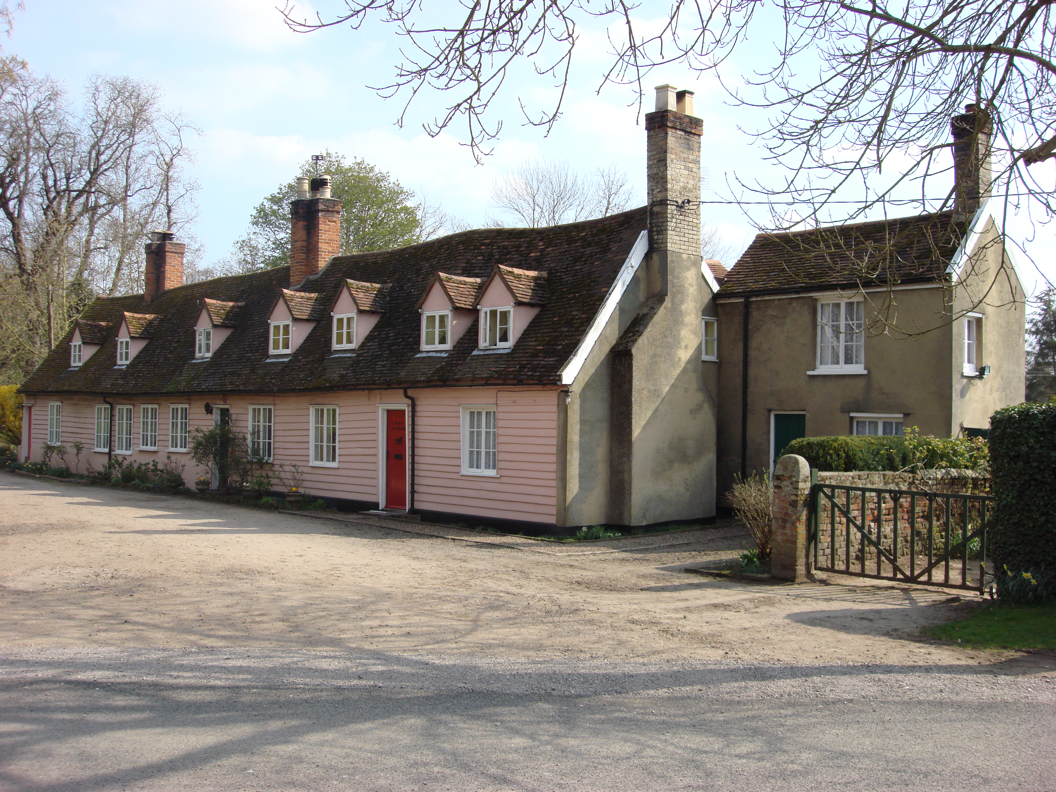
The history of Borley dates back to the Middle Ages, and the area has a rich heritage. The village is known for its traditional thatched cottages and historic buildings, which add to its charm and character. The parish church, St. Mary's, is a notable landmark, featuring a beautiful Norman tower and stained glass windows.

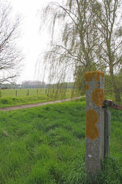
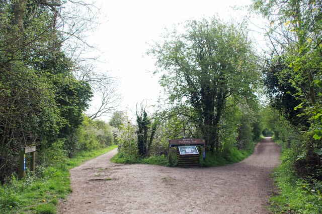
Borley is renowned for its natural beauty, with numerous walking trails and scenic spots to explore. The area is popular with outdoor enthusiasts, offering opportunities for hiking, cycling, and birdwatching. The nearby River Stour provides a tranquil setting for boating and fishing.

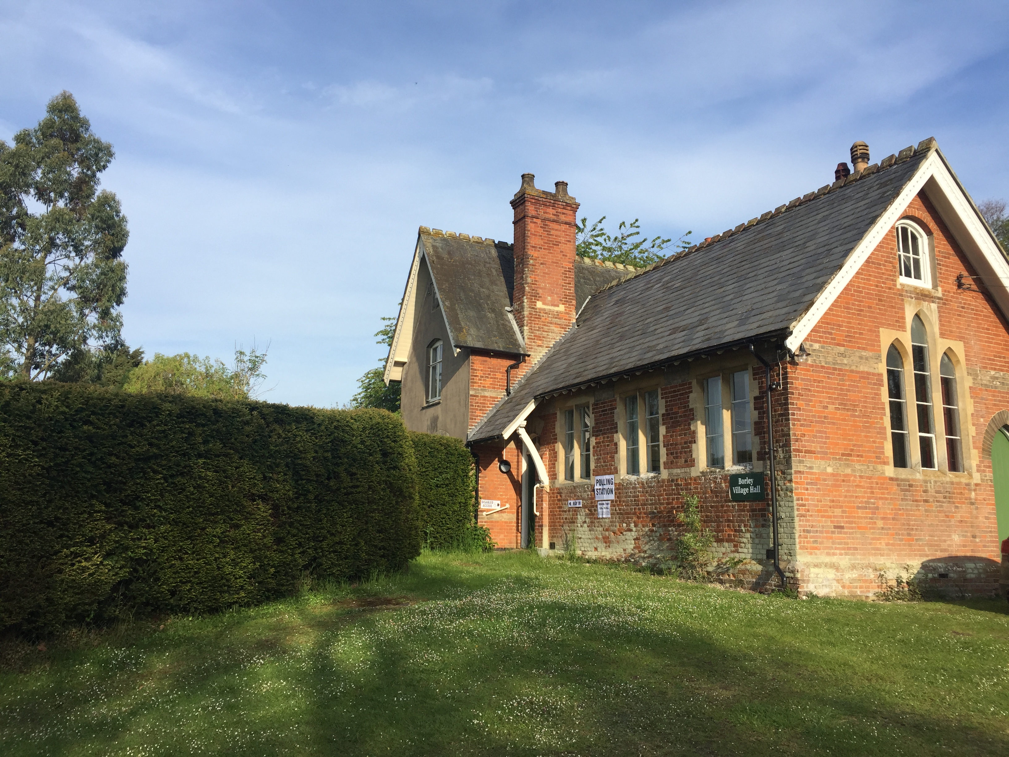
Despite its small size, Borley has a strong sense of community. The village hosts various events and activities throughout the year, such as a summer fete and a harvest festival. There is also a local pub, the Borley Bull, where residents and visitors can socialize and enjoy a drink or meal.

Overall, Borley offers a peaceful and idyllic setting for those seeking a quiet retreat or a taste of rural life. Its historical charm, natural beauty, and close-knit community make it a desirable place to live or visit.

If you have any feedback on the listing, please let us know in the comments section below.

Borley Images

Images are sourced within 2km of 52.053074/0.693042 or Grid Reference TL8442. Thanks to Geograph Open Source API. All images are credited.

B1064 Rodbridge Hill enters Long Melford
Station Road, Long Melford – 1971 It seems likely that the long row of very urban-looking cottages were built for workers at the large neighbouring maltings <a title="https://www.geograph.org.uk/photo/4076653" href="https://www.geograph.org.uk/photo/4076653">Link</a> .

Theobald's Coaches were based in the village and ran a local bus service between Bury St Edmunds and Sudbury. Like many small bus operators they relied on second hand purchases, the bus seen here being an AEC Regent V with Metro-Cammell body, new to Halifax Corporation in 1960.

This is one of a series of views featuring buses in the 60s, 70s, and 80s. <a title="https://www.geograph.org.uk/search.php?i=137652761" href="https://www.geograph.org.uk/search.php?i=137652761">Link</a>
Station Road, Long Melford – 1971
It seems likely that the long row of very urban-looking cottages were built for workers at the large neighbouring maltings Link . Theobald's Coaches were based in the village and ran a local bus service between Bury St Edmunds and Sudbury. Like many small bus operators they relied on second hand purchases, the bus seen here being an AEC Regent V with Metro-Cammell body, new to Halifax Corporation in 1960. This is one of a series of views featuring buses in the 60s, 70s, and 80s. Link
The Former Long Melford Maltings In about 1979 I went on a guided tour of the Maltings when it was still in operation. My abiding memory is seeing the malting's moggie chasing mice across the sprouting barley on the malting room  floor! It didn't stop me from thoroughly enjoying a bottle of "Ben Truman Export" shipped down from London's <a href="https://www.geograph.org.uk/photo/7049349">TQ3382 : Black Eagle Brewery</a> in Brick Lane that very morning.
The Former Long Melford Maltings
In about 1979 I went on a guided tour of the Maltings when it was still in operation. My abiding memory is seeing the malting's moggie chasing mice across the sprouting barley on the malting room floor! It didn't stop me from thoroughly enjoying a bottle of "Ben Truman Export" shipped down from London's TQ3382 : Black Eagle Brewery in Brick Lane that very morning.
Old Railway Bridge Over the River Stour A forlorn looking piece of "Beechinged" railway infrastructure on the Stour Valley Line <span class="nowrap"><a title="https://en.wikipedia.org/wiki/Stour_Valley_Railway" rel="nofollow ugc noopener" href="https://en.wikipedia.org/wiki/Stour_Valley_Railway">Link</a><img style="margin-left:2px;" alt="External link" title="External link - shift click to open in new window" src="https://s1.geograph.org.uk/img/external.png" width="10" height="10"/></span> . The river marks the Essex Suffolk boundary.
Old Railway Bridge Over the River Stour
A forlorn looking piece of "Beechinged" railway infrastructure on the Stour Valley Line LinkExternal link . The river marks the Essex Suffolk boundary.
Rod Bridge on Borley Road This is the 1911 Bridge, see <a href="https://www.geograph.org.uk/photo/6049728">TL8543 : Old Bridge Marker on Rod Bridge, Borley Road, Foxearth parish</a>. The weight of the traffic is actually taken by a more modern construction inside the older structure. 
See <a href="https://www.geograph.org.uk/photo/7470482">TL8543 : A Bridge Over Rod Bridge</a>.
Rod Bridge on Borley Road
This is the 1911 Bridge, see TL8543 : Old Bridge Marker on Rod Bridge, Borley Road, Foxearth parish. The weight of the traffic is actually taken by a more modern construction inside the older structure. See TL8543 : A Bridge Over Rod Bridge.
A Bridge Over Rod Bridge This is the remedial span that takes the strain off of the old 1911 <a href="https://www.geograph.org.uk/photo/7470475">TL8543 : Rod Bridge on Borley Road</a> that can't take the weight of modern traffic.
A Bridge Over Rod Bridge
This is the remedial span that takes the strain off of the old 1911 TL8543 : Rod Bridge on Borley Road that can't take the weight of modern traffic.
Pond in Melford Country Park This is a worked out sand pit dug to provide sand and gravel for the construction of numerous WW2 airfields around here. It is now part of Long Melford Country Park <span class="nowrap"><a title="https://www.dayoutwiththekids.co.uk/attractions/long-melford-country-park-5758d4e6" rel="nofollow ugc noopener" href="https://www.dayoutwiththekids.co.uk/attractions/long-melford-country-park-5758d4e6">Link</a><img style="margin-left:2px;" alt="External link" title="External link - shift click to open in new window" src="https://s1.geograph.org.uk/img/external.png" width="10" height="10"/></span>
Pond in Melford Country Park
This is a worked out sand pit dug to provide sand and gravel for the construction of numerous WW2 airfields around here. It is now part of Long Melford Country Park LinkExternal link
Old Gatepost and Stour Valley Path A lichen covered concrete gatepost on the old Stour Valley Railway <span class="nowrap"><a title="https://en.wikipedia.org/wiki/Stour_Valley_Railway" rel="nofollow ugc noopener" href="https://en.wikipedia.org/wiki/Stour_Valley_Railway">Link</a><img style="margin-left:2px;" alt="External link" title="External link - shift click to open in new window" src="https://s1.geograph.org.uk/img/external.png" width="10" height="10"/></span>  . It is part of the Stour Valley Path <span class="nowrap"><a title="https://ldwa.org.uk/ldp/members/show_path.php?path_name=Stour+Valley+Path+%28East+Anglia%29" rel="nofollow ugc noopener" href="https://ldwa.org.uk/ldp/members/show_path.php?path_name=Stour+Valley+Path+%28East+Anglia%29">Link</a><img style="margin-left:2px;" alt="External link" title="External link - shift click to open in new window" src="https://s1.geograph.org.uk/img/external.png" width="10" height="10"/></span> and the National Cycle Network .
Old Gatepost and Stour Valley Path
A lichen covered concrete gatepost on the old Stour Valley Railway LinkExternal link . It is part of the Stour Valley Path LinkExternal link and the National Cycle Network .
Stour Valley Walk Near Borley Hall Taken Looking towards Sudbury.
Stour Valley Walk Near Borley Hall
Taken Looking towards Sudbury.
Towards Brundon Heading for Sudbury on the Stour Valley Path.
Towards Brundon
Heading for Sudbury on the Stour Valley Path.
Bridgeworks on the Old Railway Repairs in progress on the Stour Valley Path. This was once part of the Stour Valley Railway <span class="nowrap"><a title="https://en.wikipedia.org/wiki/Stour_Valley_Railway" rel="nofollow ugc noopener" href="https://en.wikipedia.org/wiki/Stour_Valley_Railway">Link</a><img style="margin-left:2px;" alt="External link" title="External link - shift click to open in new window" src="https://s1.geograph.org.uk/img/external.png" width="10" height="10"/></span>
Bridgeworks on the Old Railway
Repairs in progress on the Stour Valley Path. This was once part of the Stour Valley Railway LinkExternal link
A fork in the Trail The old bridleway to Sudbury is the left hand fork and the dismantled railway goes to the right.
A fork in the Trail
The old bridleway to Sudbury is the left hand fork and the dismantled railway goes to the right.
Bridleway to Bardfield Bridge This is the bridleway from Brundon to Bardfield Bridge.
Bridleway to Bardfield Bridge
This is the bridleway from Brundon to Bardfield Bridge.
Brundon to Bardfield Bridge Bridleway
Belchamp Brook Looking upstream
Belchamp Brook
Looking upstream
Bardfield Bridge Gauging Station Looking down stream on <a href="https://www.geograph.org.uk/photo/7470537">TL8542 : Belchamp Brook</a>
Bardfield Bridge Gauging Station
Looking down stream on TL8542 : Belchamp Brook
Show me another place!

Borley is located at Grid Ref: TL8442 (Lat: 52.053074, Lng: 0.693042)

Administrative County: Essex

District: Braintree

Police Authority: Essex

What 3 Words

///reef.showrooms.appraised. Near Long Melford, Suffolk

Nearby Locations

Borley

Related Wikis

Borley Rectory

Borley Rectory was a house located in Borley, Essex, famous for being described as "the most haunted house in England" by psychic researcher Harry Price...
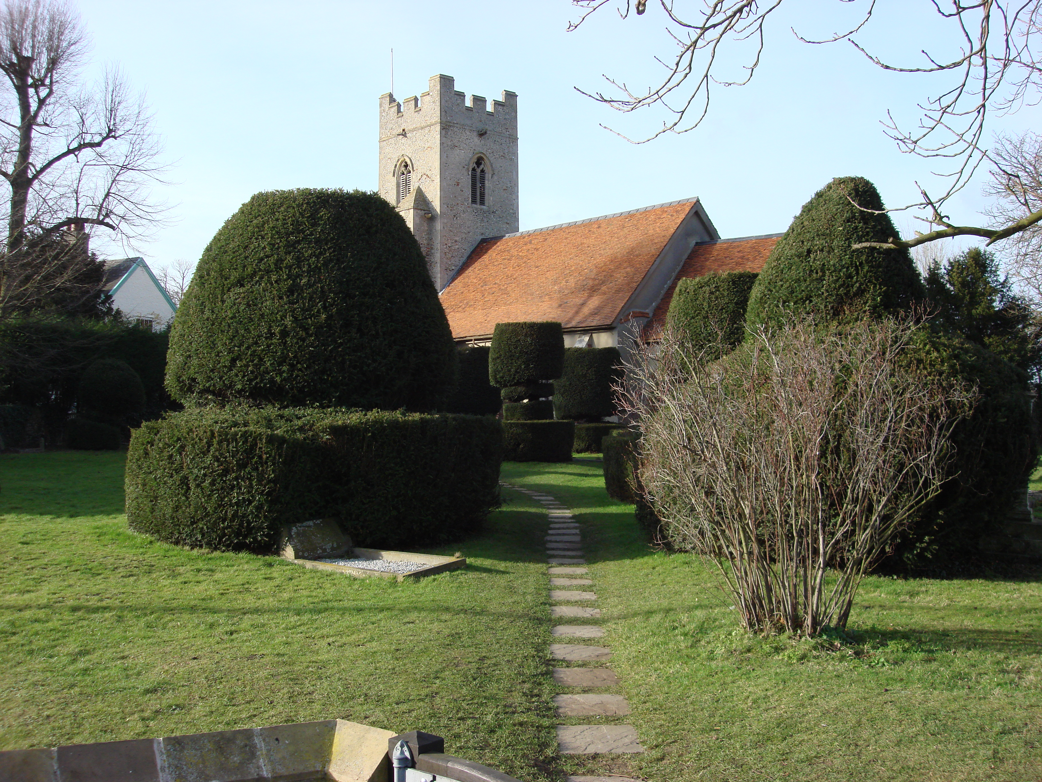
Borley Church

Borley Church is the parish church in Borley, Essex. The church is in the ecclesiastical parish of Borley and Liston, one of the Fifteen Churches of the...

Borley

Borley is a village and civil parish in rural north Essex, England close to the border with Suffolk. It is located near the River Stour. The closest town...

Brundon

Brundon is a hamlet in the Babergh district, in the English county of Suffolk. It is located on the River Stour near the town of Sudbury (its post town...

Long Melford railway station

Long Melford railway station is a disused station that served the village of Long Melford in Suffolk, England. It opened in 1865 as "Melford" and was renamed...

Liston, Essex

Liston is a small village and civil parish in North Essex, England, located one mile WSW of Long Melford, on the banks of the River Stour. Its parish church...

A.F.C. Sudbury

Amalgamated Football Club Sudbury is a football club based in Sudbury, Suffolk, England. The club was formed in 1999 by the merger of Sudbury Town and...

Sudbury Benedictine Priory

St Bartholemew's Benedictine Priory, Sudbury was a priory in Sudbury, Suffolk, England. The priory was established as a monastic grange for the Benedictine...

Nearby Amenities

Located within 500m of 52.053074,0.693042
Borley
Place: hamlet
Lat/Long: 52.055484/0.6922172
Waste Basket
Lat/Long: 52.0548263/0.6937502
Defibrillator
Access: yes
Defibrillator Location: on left hand wall of garage at front under car port
Emergency: defibrillator
Indoor: no
Lat/Long: 52.0561304/0.688202
The data included in this document is from www.openstreetmap.org. The data is made available under ODbL.

Have you been to Borley?

Leave your review of Borley below (or comments, questions and feedback).