Borden

Civil Parish in Kent Swale

England

Borden

Unmapped steps These steps down from Wormdale Hill road towards Danaway are not shown on either the 1:25000 or 1:50000 Ordnance Survey (nor Google) maps. From their nature it is suspected that they were installed as part of the expansion of the A249.
Unmapped steps Credit: Tony Hunt

Borden is a civil parish located in the county of Kent, in the southeastern part of England. It is situated about 5 miles southeast of Sittingbourne and roughly 50 miles east of London. The parish covers an area of approximately 7 square miles and is home to a population of around 3,000 people.

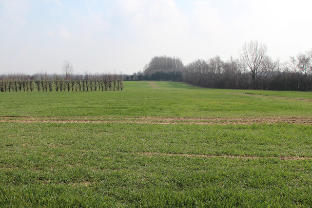
Borden is a predominantly rural area, characterized by its picturesque countryside and charming villages. The landscape is dotted with farms, fields, and woodlands, creating a tranquil and serene environment. The parish is surrounded by several other smaller villages, including Borden Hill, Borden Lane, and Borden Green.

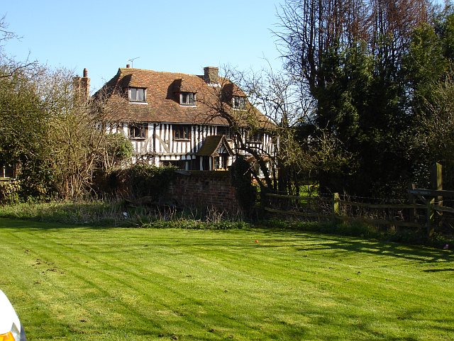
The village of Borden itself is the main settlement within the parish. It features a range of amenities and services, including a local primary school, a village hall, a post office, and a pub. The parish also has a strong sense of community, with various social and recreational activities organized throughout the year.

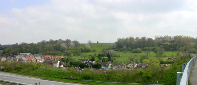
Borden is well-connected to surrounding areas by road, with the A249 running nearby and providing easy access to the M2 motorway. The nearby town of Sittingbourne offers additional amenities and transportation links, including a railway station with regular services to London and other major cities.

Overall, Borden, Kent is a charming and peaceful civil parish, offering a countryside lifestyle with easy access to larger towns and cities in the region.

If you have any feedback on the listing, please let us know in the comments section below.

Borden Images

Images are sourced within 2km of 51.332145/0.692172 or Grid Reference TQ8762. Thanks to Geograph Open Source API. All images are credited.

Unmapped steps These steps down from Wormdale Hill road towards Danaway are not shown on either the 1:25000 or 1:50000 Ordnance Survey (nor Google) maps. From their nature it is suspected that they were installed as part of the expansion of the A249.
Unmapped steps
These steps down from Wormdale Hill road towards Danaway are not shown on either the 1:25000 or 1:50000 Ordnance Survey (nor Google) maps. From their nature it is suspected that they were installed as part of the expansion of the A249.
Field View at Keycol Farm Triangulation Pillar Looking westward.
Field View at Keycol Farm Triangulation Pillar
Looking westward.
Woodgate Oast, Woodgate Lane, Oad Street Two round kiln oast house. Partially converted to accommodation in early 2000s. Has permission to convert to a ten bedroom hotel.
Woodgate Oast, Woodgate Lane, Oad Street
Two round kiln oast house. Partially converted to accommodation in early 2000s. Has permission to convert to a ten bedroom hotel.
The Oast House, Wrens Road, Borden Single square kiln oast house. Black weatherboard stowage and slate roofs.
The Oast House, Wrens Road, Borden
Single square kiln oast house. Black weatherboard stowage and slate roofs.
The Oast House, Wrens Road, Borden Single square kiln oast house. Black weatherboard stowage and slate roofs.
The Oast House, Wrens Road, Borden
Single square kiln oast house. Black weatherboard stowage and slate roofs.
Wrens Road Looking towards The Oast House.
Wrens Road
Looking towards The Oast House.
The Oast, Hengist House, Borden Triple square kiln fake oast house. The building was built around 1990.
The Oast, Hengist House, Borden
Triple square kiln fake oast house. The building was built around 1990.
The Oast, Pond Farm Road, Borden Single square kiln oast house.
The Oast, Pond Farm Road, Borden
Single square kiln oast house.
The Oast, Pond Farm Road, Borden Single square kiln oast house.
The Oast, Pond Farm Road, Borden
Single square kiln oast house.
Field by Sutton Baron Road
243-247 Borden Lane Grade II listed <span class="nowrap"><a title="https://www.historicengland.org.uk/listing/the-list/list-entry/1069423" rel="nofollow ugc noopener" href="https://www.historicengland.org.uk/listing/the-list/list-entry/1069423">Link</a><img style="margin-left:2px;" alt="External link" title="External link - shift click to open in new window" src="https://s1.geograph.org.uk/img/external.png" width="10" height="10"/></span> Wealden hall house.
243-247 Borden Lane
Grade II listed LinkExternal link Wealden hall house.
College Road
College Road
Riddles Road
Riddles Road
Wises Oast, Wises Lane, Borden
Wises Oast, Wises Lane, Borden 20th century, internal kiln oast house, built 1950's. One cowl to roof. Converted to offices known as Wises Oast Business Centre.
Wises Oast, Wises Lane, Borden
20th century, internal kiln oast house, built 1950's. One cowl to roof. Converted to offices known as Wises Oast Business Centre.
Footpath gate near M2
Field beside M2 M2 is hidden on the right.
Field beside M2
M2 is hidden on the right.
Show me another place!

Borden is located at Grid Ref: TQ8762 (Lat: 51.332145, Lng: 0.692172)

Administrative County: Kent

District: Swale

Police Authority: Kent

What 3 Words

///dented.commands.classmate. Near Newington, Kent

Nearby Locations

Borden Oad Street

Related Wikis

Oad Street

Oad Street is a small hamlet in the English county of Kent.Oad Street forms part of the civil parish of Borden which, in turn, is part of Swale district...

Chestnut Street, Kent

Chestnut Street is a settlement to the west of Sittingbourne in the Borough of Swale, Kent, England. It is located on the former A249 road alignment, between...

A249 road

The A249 is a road in Kent, England, running from Maidstone to Sheerness on the Isle of Sheppey. It mainly functions as a link between the M2 and M20 motorways...

Heart's Delight, Swale

Heart's Delight is a settlement located to the south of Sittingbourne in Kent, England. Heart's Delight Road, leading to it, has the postal address of...

Danaway

Danaway is a village near the A249 road and the M2 motorway, in the Swale district, in the English county of Kent. The nearest town is Sittingbourne. It...

Stiff Street

Stiff Street is a hamlet almost on the M2 motorway, near the village of Bredgar, in the Swale District, in the English county of Kent. The nearest town...

Westlands School, Sittingbourne

Westlands School is a coeducational secondary school and sixth form with academy status, located in Sittingbourne in the English county of Kent.Previously...

Keycol

Keycol is a village near Sittingbourne in Kent, England. At the 2011 Census the population of the village was recorded in the civil parish of Bobbing....

Nearby Amenities

Located within 500m of 51.332145,0.692172
Munsgore
Building: yes
Source: npe
Lat/Long: 51.3340533/0.687429
Surprise
Building: yes
Lat/Long: 51.3291853/0.6941282
The Oast
Building: yes
Lat/Long: 51.3285813/0.6941999
Pond House
Building: yes
Lat/Long: 51.3321027/0.6975491
Duvard's Place
Building: yes
Lat/Long: 51.3286888/0.6927667
Power: tower
Lat/Long: 51.3311823/0.6902729
Power: tower
Lat/Long: 51.3333387/0.6912297
Power: pole
Lat/Long: 51.3283238/0.6914134
Power: pole
Lat/Long: 51.3292712/0.6917159
Power: pole
Lat/Long: 51.3299547/0.6919453
Power: pole
Lat/Long: 51.3307503/0.6922047
Power: pole
Lat/Long: 51.3317412/0.6925139
Power: pole
Lat/Long: 51.3327571/0.6928231
Power: pole
Lat/Long: 51.3332972/0.6930186
Power: pole
Lat/Long: 51.3342463/0.6936724
Power: pole
Lat/Long: 51.3350049/0.6942172
Power: pole
Lat/Long: 51.3358401/0.6947849
Power: tower
Lat/Long: 51.3359206/0.6924547
The data included in this document is from www.openstreetmap.org. The data is made available under ODbL.

Have you been to Borden?

Leave your review of Borden below (or comments, questions and feedback).