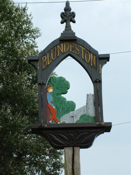
Blundeston
Civil Parish in Suffolk East Suffolk
England
Blundeston
Blundeston is a civil parish located in the county of Suffolk, England. Situated approximately 4 miles south of Lowestoft, it covers an area of about 6 square miles. The parish is nestled on the eastern coast of England, offering stunning views of the North Sea.
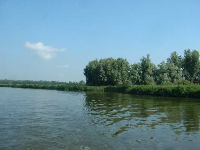
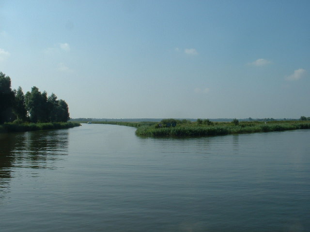
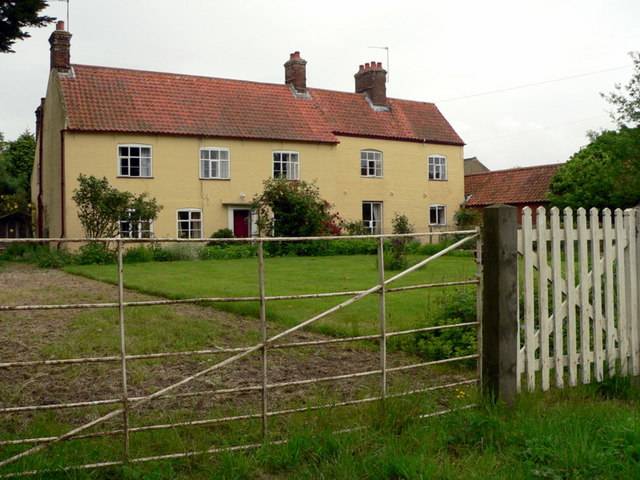
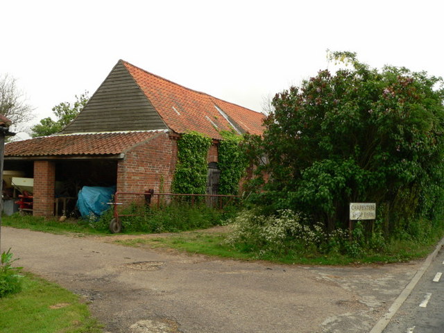
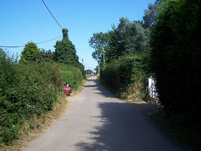
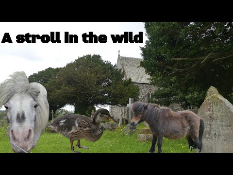
Blundeston is a small, rural community with a population of around 1,200 residents. The area is known for its picturesque landscapes, including vast fields, woodland areas, and charming country lanes. The parish is also home to a variety of wildlife, making it a popular destination for nature enthusiasts.
The village itself is characterized by its historic architecture and traditional charm. It features a mix of residential houses, farms, and a few local businesses. Blundeston has a close-knit community, with various social and recreational activities organized throughout the year.
One notable feature of Blundeston is its close proximity to the Blundeston Prison, a Category C men's prison. The prison, originally established in 1963, provides employment opportunities for many locals and contributes to the local economy.
Blundeston benefits from good transportation links, with the A12 road passing nearby, providing easy access to nearby towns and cities. The village is also served by regular bus services, connecting residents to surrounding areas.
Overall, Blundeston offers a tranquil and idyllic setting, making it an attractive place to live for those seeking a peaceful rural lifestyle while still being within easy reach of amenities and nearby urban areas.
If you have any feedback on the listing, please let us know in the comments section below.
Blundeston Images
Images are sourced within 2km of 52.501438/1.683079 or Grid Reference TM5095. Thanks to Geograph Open Source API. All images are credited.
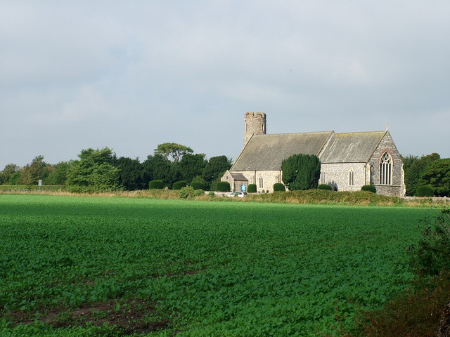


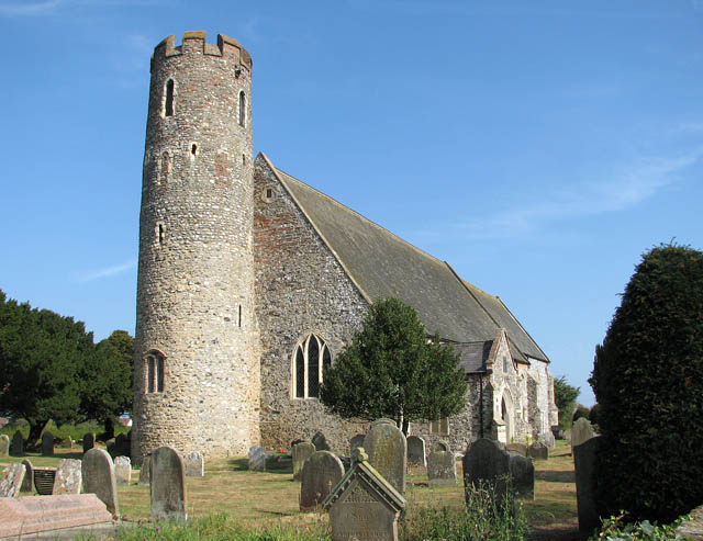
![St Mary's church There has been a church in Blundeston village since St. Fursey, an Irish Missionary, first preached Christianity in this area in the 7th century. Nothing remains of the original church. The round tower of St Mary&#039;s church &gt; <a title="https://www.geograph.org.uk/photo/1510544" href="https://www.geograph.org.uk/photo/1510544">Link</a> - <a title="https://www.geograph.org.uk/photo/1510597" href="https://www.geograph.org.uk/photo/1510597">Link</a> was built around 988 and a century later nave and chancel were built onto the tower. A larger building replaced the Norman church in the 14th century, the widened nave offsetting the tower to the north. The font &gt; <a title="https://www.geograph.org.uk/photo/1510643" href="https://www.geograph.org.uk/photo/1510643">Link</a> dates from this time. A second font - it can be seen outside by the priest door on the chancel south wall - was brought here from St Andrew&#039;s church in neighbouring Flixton. [St Andrew&#039;s church was destroyed in 1705 in a gale but the ruins can still be seen.] The rood screen dates from 1490, its faded panels depicting Angels of the Passion &gt; <a title="https://www.geograph.org.uk/photo/1510603" href="https://www.geograph.org.uk/photo/1510603">Link</a>. The royal arms are to Charles II &gt; <a title="https://www.geograph.org.uk/photo/1510624" href="https://www.geograph.org.uk/photo/1510624">Link</a>. St Mary&#039;s was extensively restored in the 1850s when the oak pews were fitted. Some of the pews have 14th century poppy heads &gt; <a title="https://www.geograph.org.uk/photo/1510620" href="https://www.geograph.org.uk/photo/1510620">Link</a> attached to the bench ends. The church is open every day.
Blundeston is the birthplace of &#039;David Copperfield&#039;, in the novel of the same name by Charles Dickens. Despite local legend, it is difficult to tell whether Dickens actually visited here, or stayed at Somerleyton Hall &gt; <a title="https://www.geograph.org.uk/photo/1506718" href="https://www.geograph.org.uk/photo/1506718">Link</a> in the neighbouring village.](https://s1.geograph.org.uk/geophotos/01/51/05/1510537_4bc7bc26.jpg)
![St Mary's church There has been a church in Blundeston village since St. Fursey, an Irish Missionary, first preached Christianity in this area in the 7th century. Nothing remains of the original church. The round tower of St Mary&#039;s church &gt; <a title="https://www.geograph.org.uk/photo/1510544" href="https://www.geograph.org.uk/photo/1510544">Link</a> - <a title="https://www.geograph.org.uk/photo/1510597" href="https://www.geograph.org.uk/photo/1510597">Link</a> was built around 988 and a century later nave and chancel were built onto the tower. A larger building replaced the Norman church in the 14th century, the widened nave offsetting the tower to the north. The font &gt; <a title="https://www.geograph.org.uk/photo/1510643" href="https://www.geograph.org.uk/photo/1510643">Link</a> dates from this time. A second font - it can be seen outside by the priest door on the chancel south wall - was brought here from St Andrew&#039;s church in neighbouring Flixton. [St Andrew&#039;s church was destroyed in 1705 in a gale but the ruins can still be seen.] The rood screen dates from 1490, its faded panels depicting Angels of the Passion &gt; <a title="https://www.geograph.org.uk/photo/1510603" href="https://www.geograph.org.uk/photo/1510603">Link</a>. The royal arms are to Charles II &gt; <a title="https://www.geograph.org.uk/photo/1510624" href="https://www.geograph.org.uk/photo/1510624">Link</a>. St Mary&#039;s was extensively restored in the 1850s when the oak pews were fitted. Some of the pews have 14th century poppy heads &gt; <a title="https://www.geograph.org.uk/photo/1510620" href="https://www.geograph.org.uk/photo/1510620">Link</a> attached to the bench ends. The church is open every day.
Blundeston is the birthplace of &#039;David Copperfield&#039;, in the novel of the same name by Charles Dickens. Despite local legend, it is difficult to tell whether Dickens actually visited here, or stayed at Somerleyton Hall &gt; <a title="https://www.geograph.org.uk/photo/1506718" href="https://www.geograph.org.uk/photo/1506718">Link</a> in the neighbouring village.](https://s1.geograph.org.uk/geophotos/01/51/05/1510549_d0d5e08f.jpg)


![St Mary's church - the organ There has been a church in Blundeston village since St. Fursey, an Irish Missionary, first preached Christianity in this area in the 7th century. Nothing remains of the original church. The round tower of St Mary&#039;s church &gt; <a title="https://www.geograph.org.uk/photo/1510544" href="https://www.geograph.org.uk/photo/1510544">Link</a> - <a title="https://www.geograph.org.uk/photo/1510597" href="https://www.geograph.org.uk/photo/1510597">Link</a> was built around 988 and a century later nave and chancel were built onto the tower. A larger building replaced the Norman church in the 14th century, the widened nave offsetting the tower to the north. The font &gt; <a title="https://www.geograph.org.uk/photo/1510643" href="https://www.geograph.org.uk/photo/1510643">Link</a> dates from this time. A second font - it can be seen outside by the priest door on the chancel south wall - was brought here from St Andrew&#039;s church in neighbouring Flixton. [St Andrew&#039;s church was destroyed in 1705 in a gale but the ruins can still be seen.] The rood screen dates from 1490, its faded panels depicting Angels of the Passion &gt; <a title="https://www.geograph.org.uk/photo/1510603" href="https://www.geograph.org.uk/photo/1510603">Link</a>. The royal arms are to Charles II &gt; <a title="https://www.geograph.org.uk/photo/1510624" href="https://www.geograph.org.uk/photo/1510624">Link</a>. St Mary&#039;s was extensively restored in the 1850s when the oak pews were fitted. Some of the pews have 14th century poppy heads &gt; <a title="https://www.geograph.org.uk/photo/1510620" href="https://www.geograph.org.uk/photo/1510620">Link</a> attached to the bench ends. The church is open every day.
Blundeston is the birthplace of &#039;David Copperfield&#039;, in the novel of the same name by Charles Dickens. Despite local legend, it is difficult to tell whether Dickens actually visited here, or stayed at Somerleyton Hall &gt; <a title="https://www.geograph.org.uk/photo/1506718" href="https://www.geograph.org.uk/photo/1506718">Link</a> in the neighbouring village.](https://s0.geograph.org.uk/geophotos/01/51/06/1510628_81673cd9.jpg)
![St Mary's church - view west There has been a church in Blundeston village since St. Fursey, an Irish Missionary, first preached Christianity in this area in the 7th century. Nothing remains of the original church. The round tower of St Mary&#039;s church &gt; <a title="https://www.geograph.org.uk/photo/1510544" href="https://www.geograph.org.uk/photo/1510544">Link</a> - <a title="https://www.geograph.org.uk/photo/1510597" href="https://www.geograph.org.uk/photo/1510597">Link</a> was built around 988 and a century later nave and chancel were built onto the tower. A larger building replaced the Norman church in the 14th century, the widened nave offsetting the tower to the north. The font &gt; <a title="https://www.geograph.org.uk/photo/1510643" href="https://www.geograph.org.uk/photo/1510643">Link</a> dates from this time. A second font - it can be seen outside by the priest door on the chancel south wall - was brought here from St Andrew&#039;s church in neighbouring Flixton. [St Andrew&#039;s church was destroyed in 1705 in a gale but the ruins can still be seen.] The rood screen dates from 1490, its faded panels depicting Angels of the Passion &gt; <a title="https://www.geograph.org.uk/photo/1510603" href="https://www.geograph.org.uk/photo/1510603">Link</a>. The royal arms are to Charles II &gt; <a title="https://www.geograph.org.uk/photo/1510624" href="https://www.geograph.org.uk/photo/1510624">Link</a>. St Mary&#039;s was extensively restored in the 1850s when the oak pews were fitted. Some of the pews have 14th century poppy heads &gt; <a title="https://www.geograph.org.uk/photo/1510620" href="https://www.geograph.org.uk/photo/1510620">Link</a> attached to the bench ends. The church is open every day.
Blundeston is the birthplace of &#039;David Copperfield&#039;, in the novel of the same name by Charles Dickens. Despite local legend, it is difficult to tell whether Dickens actually visited here, or stayed at Somerleyton Hall &gt; <a title="https://www.geograph.org.uk/photo/1506718" href="https://www.geograph.org.uk/photo/1506718">Link</a> in the neighbouring village.](https://s0.geograph.org.uk/geophotos/01/51/06/1510640_c7665fd8.jpg)
Blundeston is located at Grid Ref: TM5095 (Lat: 52.501438, Lng: 1.683079)
Administrative County: Suffolk
District: East Suffolk
Police Authority: Suffolk
What 3 Words
///spans.asked.evolution. Near Hopton on Sea, Norfolk
Nearby Locations
Related Wikis

Mutford and Lothingland Hundred
Mutford and Lothingland was a hundred of Suffolk, with an area of 33,368 acres (135.04 km2). Lowestoft Ness, the most easterly point of Great Britain fell...

Mutford and Lothingland Rural District
Mutford and Lothingland Rural District was a rural district within the administrative county of East Suffolk between 1894 and 1934. It was created out...
Flixton, Lothingland
Flixton is a civil parish in the north of the English county of Suffolk. It is 2 miles (3.2 km) north-east of Lowestoft in the East Suffolk district. The...
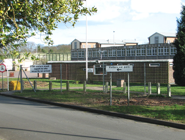
HM Prison Blundeston
HM Prison Blundeston was a Category C men's prison, located in the Village of Blundeston in Suffolk, England. The prison was operated by Her Majesty's...

Oulton, Suffolk
Oulton is a civil parish on the western edge of the town of Lowestoft in the north of the English county of Suffolk. It is in the East Suffolk district...
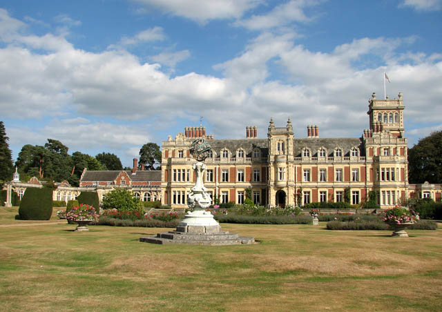
Somerleyton Hall
Somerleyton Hall is a country house and 5,000-acre (2,000 ha) estate near Somerleyton and Lowestoft in Suffolk, England owned and lived in by Hugh Crossley...
Blundeston
Blundeston is a village and civil parish in the north of the English county of Suffolk. It is 3.5 miles (5.6 km) north-west of Lowestoft, 6 miles (9.7...

Somerleyton railway station
Somerleyton railway station is on the Wherry Lines in the east of England, serving the village of Somerleyton, Suffolk. It is 18 miles (29 km) down the...
Related Videos


LOBMBC May bank holiday Powerboat Racing highlights
Highlights of each class from the LOBMBC May bank holiday club event. 0:00 Clips from the pits 5:15 Hydros 11:27 Formula 4 ...
Ambient country travel
PINAC #photography #wildlife My primary channel https://youtube.com/c/Wat-hmeDothisPoshboss Watch Me Shop This ...

Oulton broad , Waveney. #yacht #boat #travel #lowestoft. Please subscribe. Thank you 👍
Oulton broad, Waveney #sailing #travel #boat #lowestof. Please subscribe ☠️. Thank you.
Nearby Amenities
Located within 500m of 52.501438,1.683079Have you been to Blundeston?
Leave your review of Blundeston below (or comments, questions and feedback).