Battlesden

Civil Parish in Bedfordshire

England

Battlesden

Ford Spinney Taken from the A4012 near Battlesden
Ford Spinney Credit: Rob Farrow

Battlesden is a civil parish located in the county of Bedfordshire, England. Situated approximately 6 miles southwest of the town of Ampthill, the parish covers an area of around 1,400 acres. It is a small and rural community with a population of just over 100 residents.

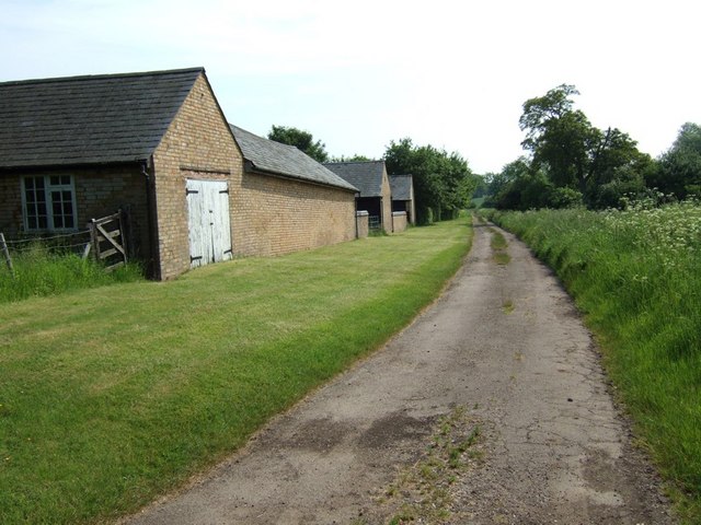
The parish is known for its picturesque countryside, characterized by rolling hills and fields. It is primarily an agricultural area, with farming playing a significant role in the local economy. The landscape is dotted with traditional farmhouses and barns, adding to the charm of the area.

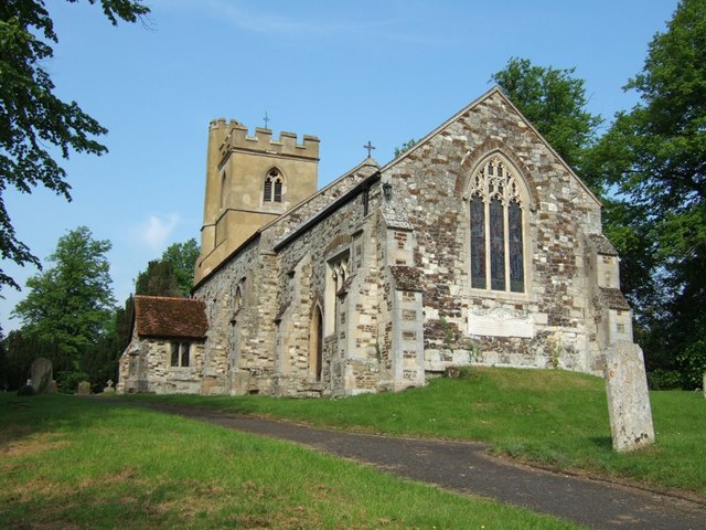
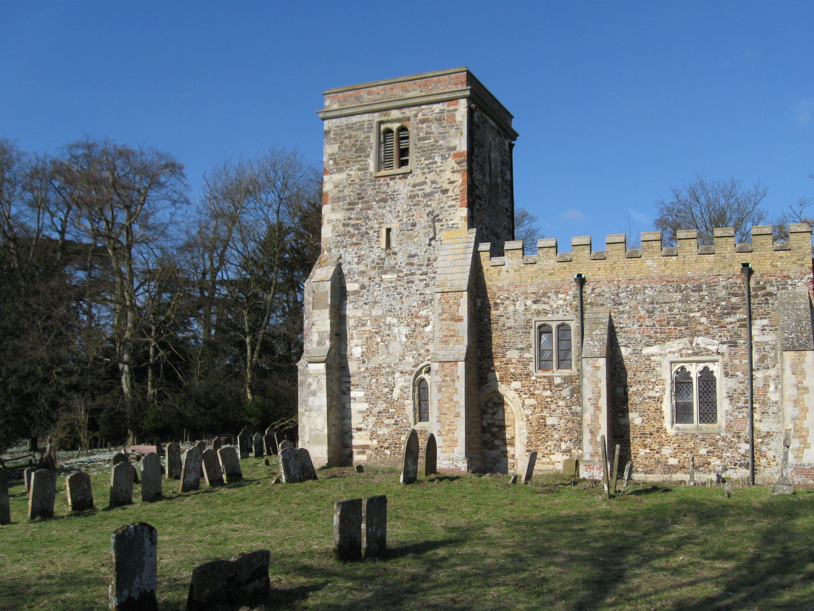
Battlesden is home to the Grade I listed Holy Trinity Church, which dates back to the 13th century. The church is a notable architectural landmark and attracts visitors interested in its historical significance. Additionally, the parish boasts several other listed buildings, including the 17th-century Battlesden House.

Despite its small size, Battlesden has a strong sense of community. Residents often come together for various events and activities, fostering a close-knit atmosphere. The parish is served by a community hall, providing a space for social gatherings and local events.

For amenities and services, residents typically rely on nearby towns and villages. The parish is conveniently located within a short drive of Ampthill, which offers a wider range of facilities including shops, schools, and healthcare services.

Overall, Battlesden presents a tranquil and idyllic setting, appealing to those seeking a peaceful rural lifestyle amidst the beautiful Bedfordshire countryside.

If you have any feedback on the listing, please let us know in the comments section below.

Battlesden Images

Images are sourced within 2km of 51.944973/-0.591938 or Grid Reference SP9628. Thanks to Geograph Open Source API. All images are credited.

Ford Spinney Taken from the A4012 near Battlesden
Ford Spinney
Taken from the A4012 near Battlesden
Hill Farm Sheep These sheep belong to Hill Farm which can be seen in the background. The lane abruptly ends just after this point with a private road continuing to the farm and a track leading to Battlesden.
Hill Farm Sheep
These sheep belong to Hill Farm which can be seen in the background. The lane abruptly ends just after this point with a private road continuing to the farm and a track leading to Battlesden.
Manor Avenue, Hockliffe Just short of the traffic lights where the A4012 staggers across the A5 Watling Street, this no-through-road leads to a few houses.
Manor Avenue, Hockliffe
Just short of the traffic lights where the A4012 staggers across the A5 Watling Street, this no-through-road leads to a few houses.
Lane to Hill Farm, Battlesden This lane leads off the Hockliffe Road near Watergate Lodge and goes to Hill Farm (see <a href="https://www.geograph.org.uk/photo/171948">SP9728 : Hill Farm Sheep</a>). As a track it continues to Battlesden.
Lane to Hill Farm, Battlesden
This lane leads off the Hockliffe Road near Watergate Lodge and goes to Hill Farm (see SP9728 : Hill Farm Sheep). As a track it continues to Battlesden.
St. Nicholas, Church End, Hockliffe Church End is a lovely quiet backwater of Hockliffe. Most of the village sprawls along the very busy A5 Watling Street, but this part of the village seems miles from hectic activity.
St. Nicholas, Church End, Hockliffe
Church End is a lovely quiet backwater of Hockliffe. Most of the village sprawls along the very busy A5 Watling Street, but this part of the village seems miles from hectic activity.
Hockliffe Grange Peeping over the trees which surround it, this is about the best view you can get of Hockliffe Grange, taken from the lane that approaches it from the church.
Hockliffe Grange
Peeping over the trees which surround it, this is about the best view you can get of Hockliffe Grange, taken from the lane that approaches it from the church.
Gates to Hockliffe Rectory Rather wonderfully overgrown gates and fencing to The Rectory, Church End, Hockliffe. This is almost opposite the church but in the adjacent square.
Gates to Hockliffe Rectory
Rather wonderfully overgrown gates and fencing to The Rectory, Church End, Hockliffe. This is almost opposite the church but in the adjacent square.
Ground Farm, Hockliffe The road from the church out to this farm gradually deteriorates until it becomes a muddy track with grass in the middle. It then improves a little just before you reach this farm. The area the farm is in is called "Hockliffe Grounds" hence the name of the farm.
Ground Farm, Hockliffe
The road from the church out to this farm gradually deteriorates until it becomes a muddy track with grass in the middle. It then improves a little just before you reach this farm. The area the farm is in is called "Hockliffe Grounds" hence the name of the farm.
Fields near Battlesden Looking across fields to the church and manor at Battlesden (which are in the adjacent square, see <a href="https://www.geograph.org.uk/photo/183068">SP9529 : St Peter and All Saints, Battlesden</a>). I think the crop is wheat, but as it has not yet produced its ears I'm by no means certain.
Fields near Battlesden
Looking across fields to the church and manor at Battlesden (which are in the adjacent square, see SP9529 : St Peter and All Saints, Battlesden). I think the crop is wheat, but as it has not yet produced its ears I'm by no means certain.
Lane to Battlesden This is the lane to Battlesden having left the main A4012 and travelled a few hundred yards. There is a footpath off to the right (North) at this point which leads towards Milton Bryan.
Lane to Battlesden
This is the lane to Battlesden having left the main A4012 and travelled a few hundred yards. There is a footpath off to the right (North) at this point which leads towards Milton Bryan.
Approaching Battlesden Church This lane runs up to the church at Battlesden (see <a href="https://www.geograph.org.uk/photo/183068">SP9529 : St Peter and All Saints, Battlesden</a>) then comes to an abrupt halt as a road but continues as a footpath past the church and Battlesden House. The precariously leaning tree on the right looks like a Scots Pine to me. The manor here was once owned by the remarkably-named Sir Gregory Page-Turner who should have been a novelist really !
Approaching Battlesden Church
This lane runs up to the church at Battlesden (see SP9529 : St Peter and All Saints, Battlesden) then comes to an abrupt halt as a road but continues as a footpath past the church and Battlesden House. The precariously leaning tree on the right looks like a Scots Pine to me. The manor here was once owned by the remarkably-named Sir Gregory Page-Turner who should have been a novelist really !
Centre Farm, Battlesden These buildings belong to Centre Farm in Battlesden. The track continues to Hill Farm (see <a href="https://www.geograph.org.uk/photo/171948">SP9728 : Hill Farm Sheep</a>) and according to my old 1:50000 is marked as a yellow (drivable) lane - but having seen the other end of it I think it would be a little cruel to an ordinary saloon car !
Centre Farm, Battlesden
These buildings belong to Centre Farm in Battlesden. The track continues to Hill Farm (see SP9728 : Hill Farm Sheep) and according to my old 1:50000 is marked as a yellow (drivable) lane - but having seen the other end of it I think it would be a little cruel to an ordinary saloon car !
Battlesden Taken at the hairpin (see map) in Battlesden where the main drivable lane doubles back to get to Battlesden church. In addition to this lane and the track next to <a href="https://www.geograph.org.uk/photo/183064">SP9628 : Centre Farm, Battlesden</a> there is a more direct footpath here to Hill Farm and a bridleway which heads towards Hockliffe. There are very few properties in this parish which is a very quiet little oasis. It has a church which I think means that it is a village, but there are many hamlets bigger than this !
Battlesden
Taken at the hairpin (see map) in Battlesden where the main drivable lane doubles back to get to Battlesden church. In addition to this lane and the track next to SP9628 : Centre Farm, Battlesden there is a more direct footpath here to Hill Farm and a bridleway which heads towards Hockliffe. There are very few properties in this parish which is a very quiet little oasis. It has a church which I think means that it is a village, but there are many hamlets bigger than this !
St Peter and All Saints, Battlesden Tiny Battlesden's rather splendid church. Although not particularly large I would think that this church could hold the entire population of Battlesden five times over ! Read more about Battlesden and its church here <span class="nowrap"><a title="http://www.british-history.ac.uk/report.asp?compid=42445" rel="nofollow ugc noopener" href="http://www.british-history.ac.uk/report.asp?compid=42445">Link</a><img style="margin-left:2px;" alt="External link" title="External link - shift click to open in new window" src="https://s1.geograph.org.uk/img/external.png" width="10" height="10"/></span>
St Peter and All Saints, Battlesden
Tiny Battlesden's rather splendid church. Although not particularly large I would think that this church could hold the entire population of Battlesden five times over ! Read more about Battlesden and its church here LinkExternal link
House and churchyard, Battlesden The western part of the churchyard at Battlesden is very overgrown with tall grass and cow parsley in abundance. I would guess that the house here - one of very few in Battlesden - was the rectory. As most of the properties here were built on the instructions of the Duke of Bedford, I would think that this one certainly was.
House and churchyard, Battlesden
The western part of the churchyard at Battlesden is very overgrown with tall grass and cow parsley in abundance. I would guess that the house here - one of very few in Battlesden - was the rectory. As most of the properties here were built on the instructions of the Duke of Bedford, I would think that this one certainly was.
Church End, Hockliffe As it says on the sign. The eponymous church is <a href="https://www.geograph.org.uk/photo/182708">SP9626 : St. Nicholas, Church End, Hockliffe</a>
Church End, Hockliffe
As it says on the sign. The eponymous church is SP9626 : St. Nicholas, Church End, Hockliffe
Church Lane, Church End, Hockliffe This is the view back roughly southwards down Church Lane from near the lane junction at Church End. Note: The map shows this lane as Goose Green, but I'm pretty sure its street nameplate said Church Lane.
Church Lane, Church End, Hockliffe
This is the view back roughly southwards down Church Lane from near the lane junction at Church End. Note: The map shows this lane as Goose Green, but I'm pretty sure its street nameplate said Church Lane.
Steps & churchyard Steps illuminated with dappled light lead into the churchyard of <a href="https://www.geograph.org.uk/photo/182708">SP9626 : St. Nicholas, Church End, Hockliffe</a>
Steps & churchyard
Steps illuminated with dappled light lead into the churchyard of SP9626 : St. Nicholas, Church End, Hockliffe
Show me another place!

Battlesden is located at Grid Ref: SP9628 (Lat: 51.944973, Lng: -0.591938)

Unitary Authority: Central Bedfordshire

Police Authority: Bedfordshire

What 3 Words

///cushy.fermented.crashing. Near Battlesden, Bedfordshire

Nearby Locations

Battlesden Battlesden

Related Wikis

Battlesden

Battlesden is a hamlet and civil parish in the Central Bedfordshire district of Bedfordshire, England. It is just north of the A5, between Dunstable...

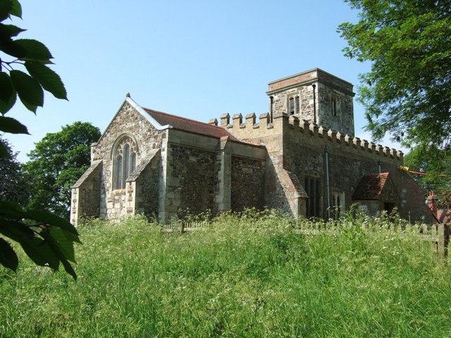
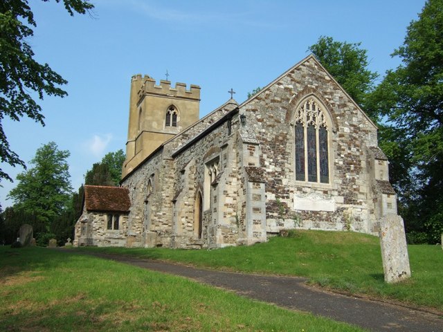
Church of St Peter & All Saints, Battlesden

Church of St Peter & All Saints is a Grade I listed church in Battlesden, Bedfordshire, England. It became a listed building on 23 January 1961. ��2...
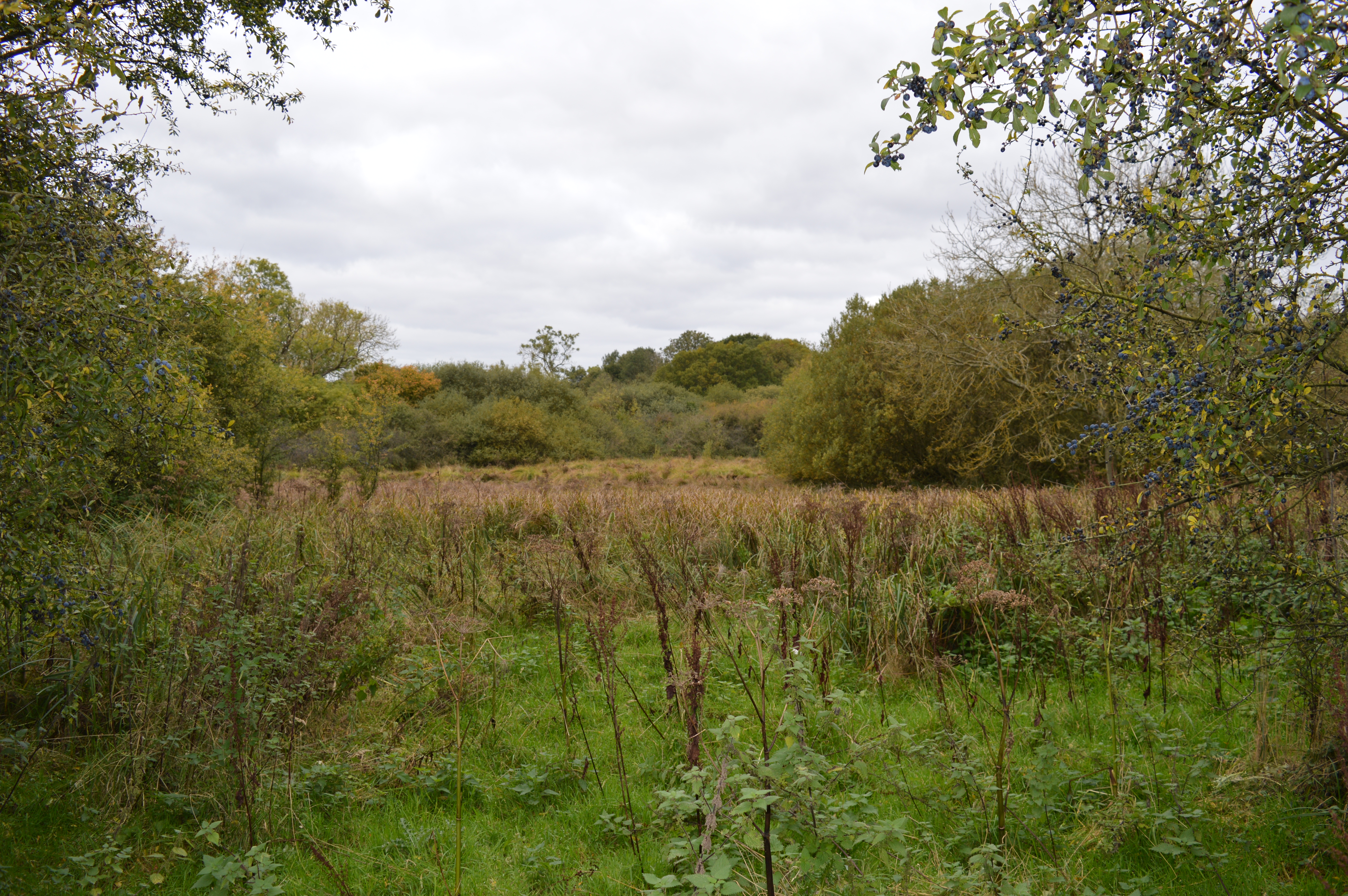
Tebworth Marsh

Tebworth Marsh is a 5.6-hectare biological Site of Special Scientific Interest north of Tebworth in Bedfordshire. It was notified under Section 28 of the...

Hockliffe

Hockliffe is a village and civil parish in Bedfordshire on the crossroads of the A5 road which lies upon the course of the Roman road known as Watling...

Potsgrove

Potsgrove is a small village and civil parish located in the Central Bedfordshire district of Bedfordshire, England. The parish includes the hamlet of...

Milton Bryan

Milton Bryan is a village and civil parish located in Central Bedfordshire (the spelling Milton Bryant was previously common and is still recognised by...

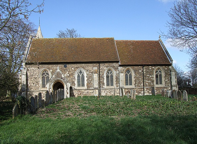
St Mary's Church, Potsgrove

St Mary's Church is a redundant Anglican church in the village of Potsgrove, Bedfordshire. England. It is recorded in the National Heritage List for England...

Church of St Peter, Milton Bryan

Church of St Peter is a Grade I listed church in Milton Bryan, Bedfordshire, England. It became a listed building on 23 January 1961. == History == St...

Nearby Amenities

Located within 500m of 51.944973,-0.591938
Battlesden
Place: hamlet
Source: survey
Lat/Long: 51.9479314/-0.594986
Place: farm
Lat/Long: 51.945155/-0.5909686
The data included in this document is from www.openstreetmap.org. The data is made available under ODbL.

Have you been to Battlesden?

Leave your review of Battlesden below (or comments, questions and feedback).