Baughurst

Civil Parish in Hampshire Basingstoke and Deane

England

Baughurst

Farmland near Baughurst This square is largely farmland and a network of minor roads. This view was taken near the footpath, at the intersection in the adjacent square. The view looks southeast along the road.
Farmland near Baughurst Credit: Pam Brophy

Baughurst is a civil parish located in the county of Hampshire, England. Situated approximately 7 miles south of the town of Newbury, Baughurst covers an area of about 3.5 square miles. It is a rural area with a population of around 2,000 residents.

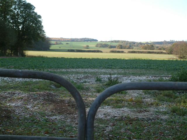
The parish is known for its picturesque countryside and charming villages. It is surrounded by rolling hills, woodlands, and farmlands, offering beautiful views and ample opportunities for outdoor activities such as hiking, cycling, and horse riding. The area is also rich in wildlife, with several nature reserves and protected areas nearby.

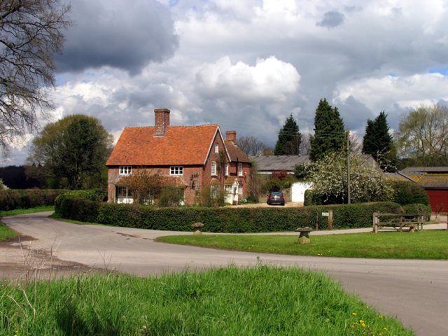
Baughurst has a strong community spirit, with various local groups and organizations catering to the needs and interests of its residents. The parish boasts a primary school, a village hall, and a church, which serves as a focal point for the community.

Despite its rural character, Baughurst benefits from its proximity to larger towns and cities. Newbury, with its wide range of amenities including shopping centers, leisure facilities, and a train station, is easily accessible. The parish is also well-connected by road, with the A339 passing through it, providing convenient access to nearby towns and major routes.

Overall, Baughurst offers a peaceful and idyllic setting for those seeking a rural lifestyle while still being within reach of urban amenities. Its natural beauty, strong sense of community, and convenient location make it an attractive place to live for both families and individuals.

If you have any feedback on the listing, please let us know in the comments section below.

Baughurst Images

Images are sourced within 2km of 51.328562/-1.18186 or Grid Reference SU5759. Thanks to Geograph Open Source API. All images are credited.

Farmland near Baughurst This square is largely farmland and a network of minor roads. This view was taken near the footpath, at the intersection in the adjacent square. The view looks southeast along the road.
Farmland near Baughurst
This square is largely farmland and a network of minor roads. This view was taken near the footpath, at the intersection in the adjacent square. The view looks southeast along the road.
St  Stephen's near Baughurst This square is mostly farmland and also contains this church. This view taken from the only spot where one can get the whole building in the picture comfortably, is from the north east.
St Stephen's near Baughurst
This square is mostly farmland and also contains this church. This view taken from the only spot where one can get the whole building in the picture comfortably, is from the north east.
St Stephen's and the graveyard, near Baughurst This view of the church and gravestones, backlit against the late afternoon sun, was taken from more or less the east side of the church. The church is surrounded by the graveyard on three sides, the west side of the church being right on the boundary of the church grounds.
St Stephen's and the graveyard, near Baughurst
This view of the church and gravestones, backlit against the late afternoon sun, was taken from more or less the east side of the church. The church is surrounded by the graveyard on three sides, the west side of the church being right on the boundary of the church grounds.
Paddock near Browning Hill Green This square being largely farmland also has a paddock or two. This paddock is in the north western section of the square.
Paddock near Browning Hill Green
This square being largely farmland also has a paddock or two. This paddock is in the north western section of the square.
Farmland near Stratton Manor This view (where the road takes a sharp turn) shows the entrance to Stratton Manor on the left and the farmland behind the trees is in the east section of the square.
Farmland near Stratton Manor
This view (where the road takes a sharp turn) shows the entrance to Stratton Manor on the left and the farmland behind the trees is in the east section of the square.
The Wolverton Road The section of the road opposite Wolverton Wood in the south eastern section of the grid square. It runs diagonally across this section of the square and the field on the western side of the road is just visible. The picture was taken looking north east along the road.
The Wolverton Road
The section of the road opposite Wolverton Wood in the south eastern section of the grid square. It runs diagonally across this section of the square and the field on the western side of the road is just visible. The picture was taken looking north east along the road.
The George & Dragon Inn, Towns End
Towns End
Towns End
Wolverton Common
Wolverton Common
Portway  to Old Sarum The route of Portway, the old Roman road from Calleva (Silchester) to Old Sarum (Salisbury), and the South Coast. It runs in a straight line to the right of the wood which can be seen to the left of the image, almost directly above the middle of the gates.
Portway to Old Sarum
The route of Portway, the old Roman road from Calleva (Silchester) to Old Sarum (Salisbury), and the South Coast. It runs in a straight line to the right of the wood which can be seen to the left of the image, almost directly above the middle of the gates.
Looking West
Looking West
Looking South
Looking South
Farmland near Ewhurst Park Cut Wood is to the right of the rape-field. The first two pylons are within the grid-square.
Farmland near Ewhurst Park
Cut Wood is to the right of the rape-field. The first two pylons are within the grid-square.
St Catherine's Churchyard, Wolverton A well kept churchyard with levelled graves and a lovely view.
St Catherine's Churchyard, Wolverton
A well kept churchyard with levelled graves and a lovely view.
Wolverton House A handsome late Georgian manor house. Strangely, the house attracts no attention from most Hampshire guides. Perhaps its proximity to St Catherine's Church means that it is overlooked by visitors.

Wolverton formed part of the estate of the Duke of Wellington until the mid-20th century.
Wolverton House
A handsome late Georgian manor house. Strangely, the house attracts no attention from most Hampshire guides. Perhaps its proximity to St Catherine's Church means that it is overlooked by visitors. Wolverton formed part of the estate of the Duke of Wellington until the mid-20th century.
Church lane Please drive carefully in this lovely hamlet.
Church lane
Please drive carefully in this lovely hamlet.
West heath snow Best to drive very slowly
West heath snow
Best to drive very slowly
Snow deer Roe deer in field at Stony Heath.
Snow deer
Roe deer in field at Stony Heath.
Show me another place!

Baughurst is located at Grid Ref: SU5759 (Lat: 51.328562, Lng: -1.18186)

Administrative County: Hampshire

District: Basingstoke and Deane

Police Authority: Hampshire

What 3 Words

///responded.climate.confident. Near Kingsclere, Hampshire

Related Wikis

Axmansford

Axmansford is a village in Hampshire, England. It is in the civil parish of Baughurst. == External links == Media related to Axmansford at Wikimedia Commons

Wolverton Common

Wolverton Common is a hamlet in north Hampshire, England. Its nearest town is Tadley, which lies approximately 2.5 miles (4 km) east from the hamlet....

Wolverton, Hampshire

Wolverton is a village in north Hampshire, England. It is within the civil parish of Baughurst, and located approximately 7 miles (11 km) from both Newbury...

Ramsdell

Ramsdell is a small village in the civil parish of Wootton St Lawrence with Ramsdell, in the Basingstoke and Deane district, in the English county of Hampshire...

Inhurst

Inhurst is a hamlet in Hampshire, England. It is in the civil parish of Baughurst. == History == Inhurst House was established as a school in the 1960s...

Ewhurst, Hampshire

Ewhurst is a village in Hampshire, England, and 6.2 miles (10.0 km) northwest of Basingstoke. Its parish church dates from 1682. The village itself is...

West Heath, Hampshire

West Heath is a hamlet in the Basingstoke and Deane district of Hampshire, England. It is in the civil parish of Wootton St Lawrence. Its nearest town...

Ashford Hill Woods and Meadows

Ashford Hill Woods and Meadows is a 141.5-hectare (350-acre) biological Site of Special Scientific Interest near Ashford Hill in Hampshire. An area of...

Nearby Amenities

Located within 500m of 51.328562,-1.18186
Brown's Farm
Landuse: farmyard
Note Retag: CS #48756035
Lat/Long: 51.3298339/-1.1806658
Barrier: stile
Lat/Long: 51.3288288/-1.1842126
Little Brook Farm
Landuse: farm
Note Retag: CS #48756035
Lat/Long: 51.3281327/-1.1846122
Lovedays Farmhouse
Landuse: farm
Note Retag: CS #48756035
Lat/Long: 51.3266763/-1.1865768
Give Way
Source: Hampshire-Aerial-FCIR
Lat/Long: 51.3303477/-1.1812557
The data included in this document is from www.openstreetmap.org. The data is made available under ODbL.

Have you been to Baughurst?

Leave your review of Baughurst below (or comments, questions and feedback).