Batchworth

Civil Parish in Hertfordshire Three Rivers

England

Batchworth

Lot Mead Lock
Lot Mead Lock Credit: RG

Batchworth is a civil parish located in the county of Hertfordshire, England. It is situated approximately 20 miles northwest of central London and is part of the Three Rivers district. The parish covers an area of around 4 square miles and has a population of approximately 2,000 people.

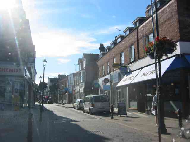
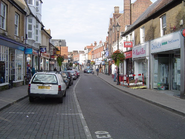
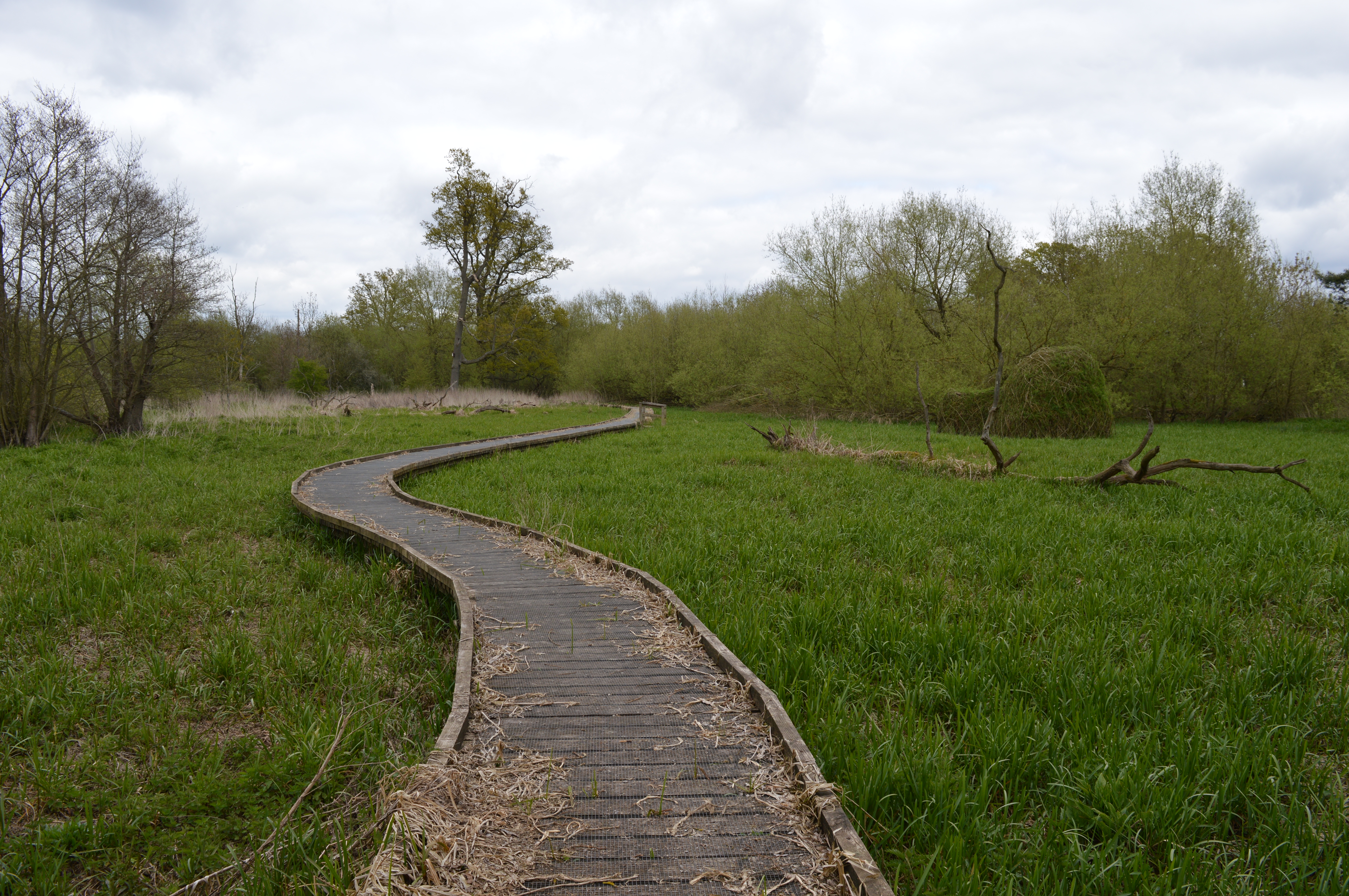
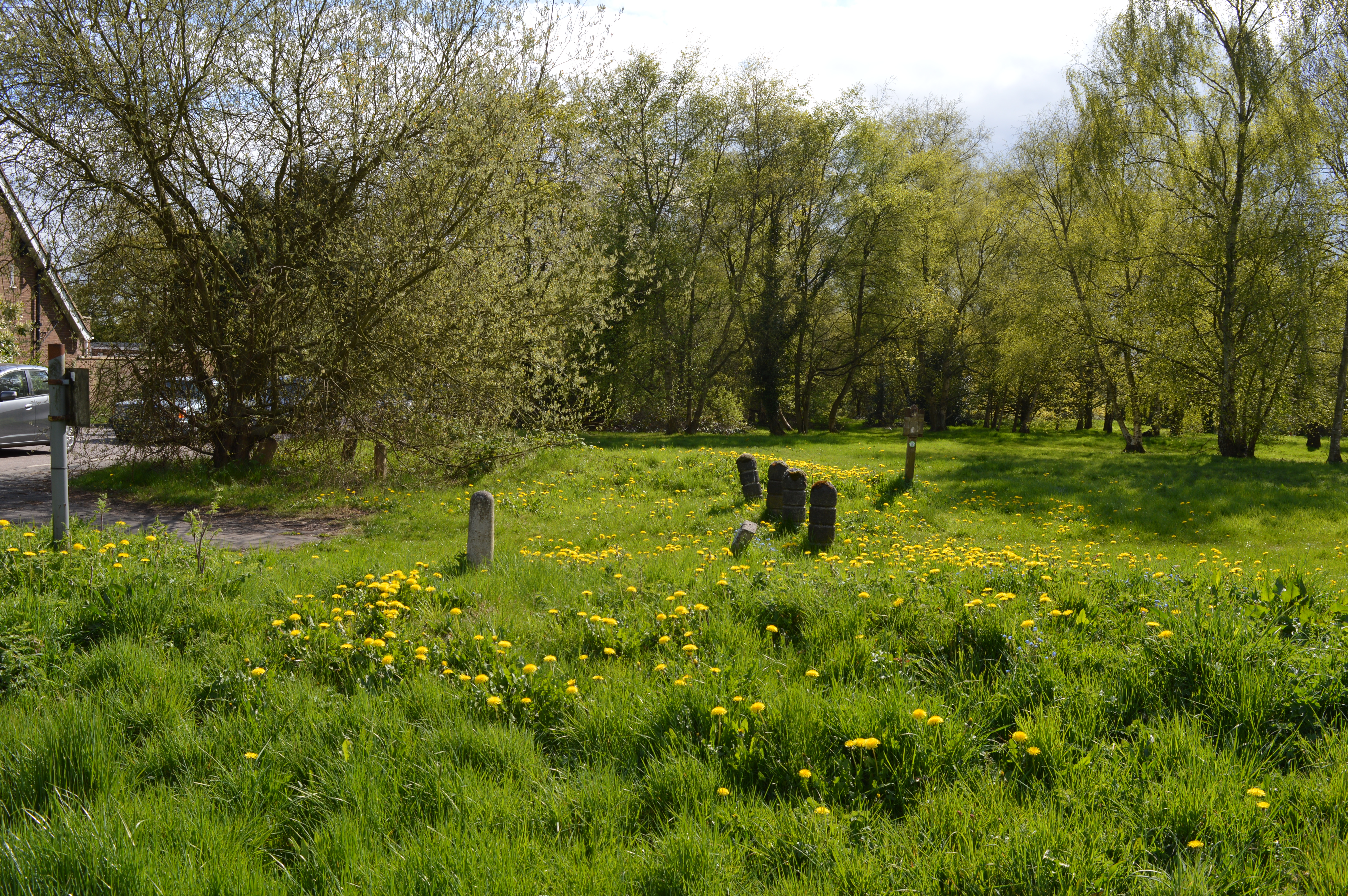
The village of Batchworth is located on the outskirts of the town of Rickmansworth and is known for its picturesque countryside and charming rural atmosphere. The area is surrounded by green fields and woodland, providing plenty of opportunities for outdoor activities such as walking, cycling, and horse riding.

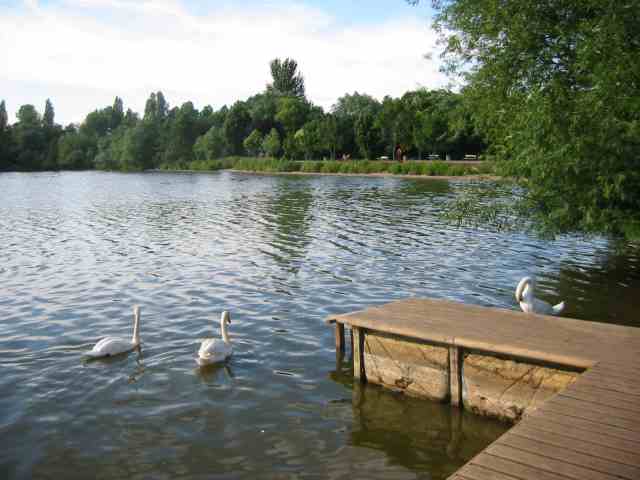
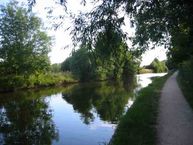
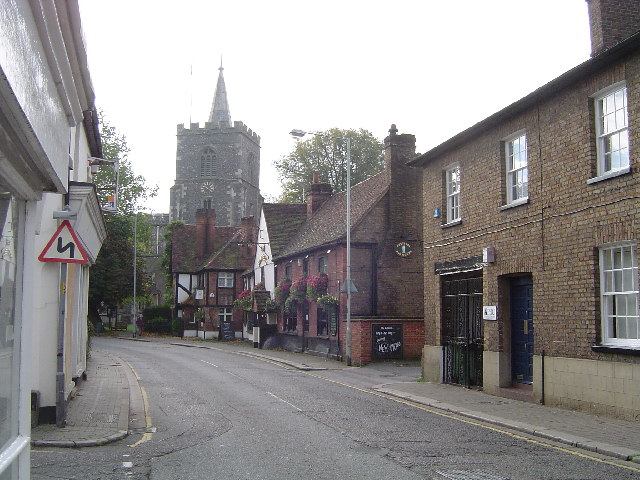
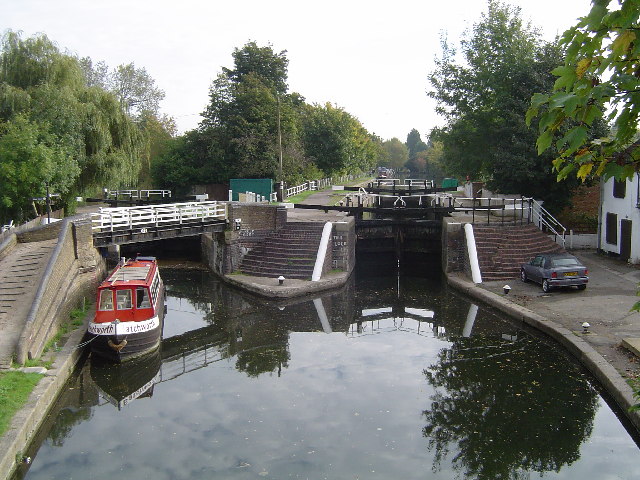
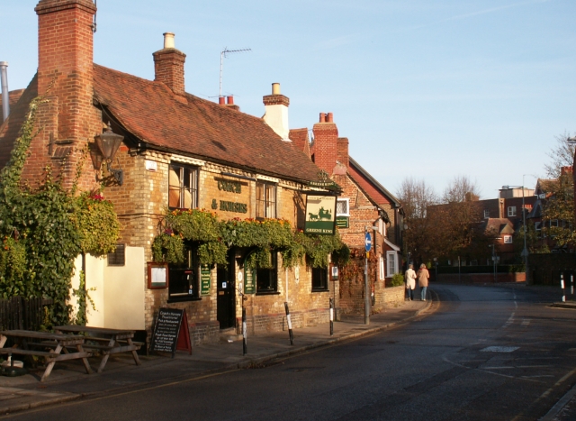
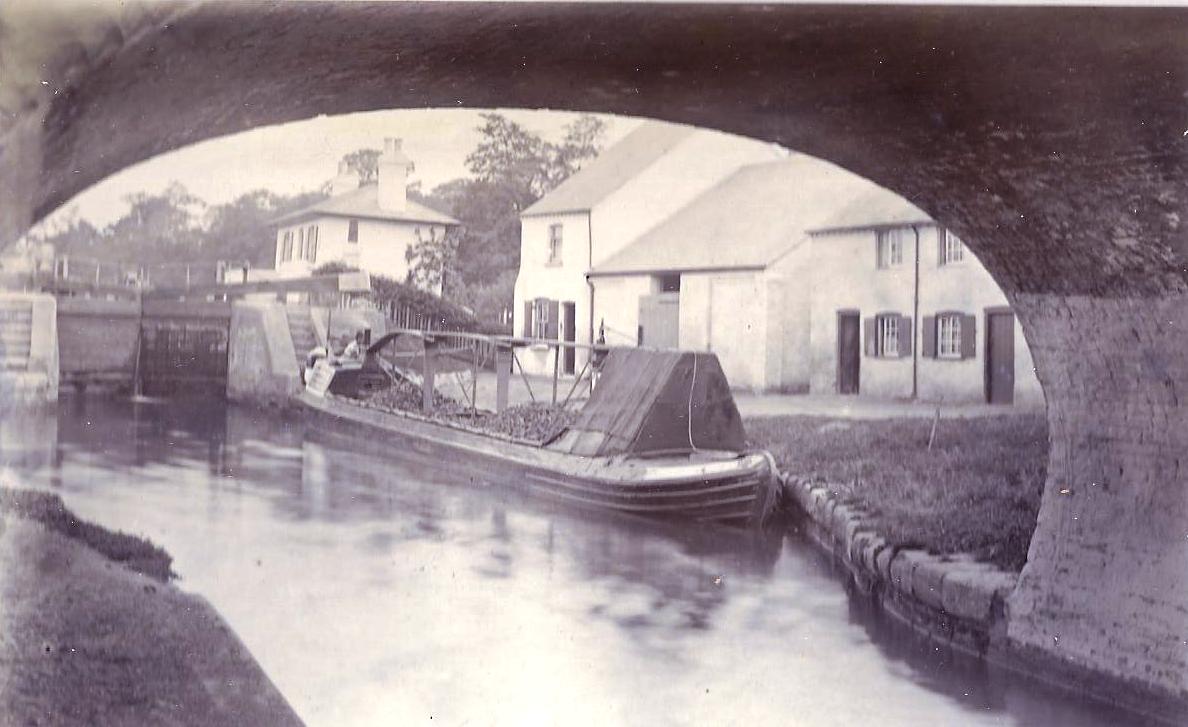
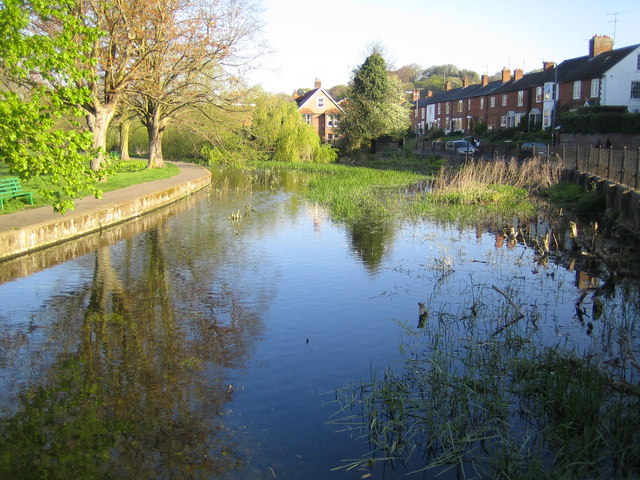
Batchworth is home to a number of historic buildings and landmarks, including the Batchworth Lock, which is part of the Grand Union Canal, and the Batchworth Heath Nature Reserve, a designated Site of Special Scientific Interest. The parish also boasts a variety of amenities and services, including a primary school, a village hall, and a local pub.

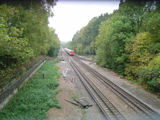
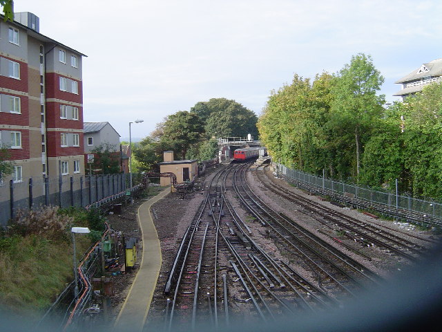
The village is well-connected to surrounding areas via road and rail links. The M25 motorway is easily accessible, providing convenient access to London and other major cities. Rickmansworth station, located nearby, offers regular train services to London and other destinations.

Overall, Batchworth offers a peaceful and scenic setting for residents, with its countryside charm and proximity to urban amenities making it an attractive place to live.

If you have any feedback on the listing, please let us know in the comments section below.

Batchworth Images

Images are sourced within 2km of 51.629693/-0.45137 or Grid Reference TQ0793. Thanks to Geograph Open Source API. All images are credited.

Lot Mead Lock
Lot Mead Lock
Street Scene in Rickmansworth The lack of shoppers surprised me but it does have a pedestrian precinct atmosphere
Street Scene in Rickmansworth
The lack of shoppers surprised me but it does have a pedestrian precinct atmosphere
Batchwood  Lake at the Aquadrome  Rickmansworth This is the last of the group of lakes which spread 
southwards along the route of the River Colne
Batchwood Lake at the Aquadrome Rickmansworth
This is the last of the group of lakes which spread southwards along the route of the River Colne
Grand Union Canal  Rickmansworth The aquadrome park is just to the right of the tow path
Grand Union Canal Rickmansworth
The aquadrome park is just to the right of the tow path
Office Buildings at Business Park Tolpits Lane  Rickmansworth The anonymous office buildings are slightly forbidding
Office Buildings at Business Park Tolpits Lane Rickmansworth
The anonymous office buildings are slightly forbidding
Mount Vernon Hospital  Northwood This building looks recent but I don't know its function
Mount Vernon Hospital Northwood
This building looks recent but I don't know its function
Mount Vernon Hospital  Northwood By contrast this doctor's practice is a building erected perhaps in 1940
Mount Vernon Hospital Northwood
By contrast this doctor's practice is a building erected perhaps in 1940
The Gate Pub at Northwood. I think this pub was sited at the entrance to the town.
The Gate Pub at Northwood.
I think this pub was sited at the entrance to the town.
Rickmansworth: Main Avenue, Moor Park Viewed looking downhill and eastwards towards the only shops in this exclusive housing estate, Moor Park railway station is beyond the trees at the end of the road.
Rickmansworth: Main Avenue, Moor Park
Viewed looking downhill and eastwards towards the only shops in this exclusive housing estate, Moor Park railway station is beyond the trees at the end of the road.
Rickmansworth: High Street A view looking westwards on a Sunday morning.
Rickmansworth: High Street
A view looking westwards on a Sunday morning.
Metropolitan Line railway between Rickmansworth and Moor Park A southbound Metropolitan Line train approaches the Croxleyhall Farm Bridge from the Rickmansworth direction (and for those who collect such things, no, I did not get its number!). These tracks are shared between London Underground and Chiltern Railways. The London Underground trains go to and from Amersham and Baker Street and Aldgate, and the Chiltern Line trains run from London Marylebone to and from Aylesbury. The tracks leading to the right in front of the train go to Watford along a short section of track that is only used for early morning and late evening train positioning movements, forming one side  of the "Croxley Triangle".
Metropolitan Line railway between Rickmansworth and Moor Park
A southbound Metropolitan Line train approaches the Croxleyhall Farm Bridge from the Rickmansworth direction (and for those who collect such things, no, I did not get its number!). These tracks are shared between London Underground and Chiltern Railways. The London Underground trains go to and from Amersham and Baker Street and Aldgate, and the Chiltern Line trains run from London Marylebone to and from Aylesbury. The tracks leading to the right in front of the train go to Watford along a short section of track that is only used for early morning and late evening train positioning movements, forming one side of the "Croxley Triangle".
Metropolitan Line railway between Watford and Moor Park A northbound Metropolitan Line train approaches Croxley station on the Watford branch from the Moor Park direction (and for those who collect such things, no, I did not get its number!). This is one side of the "Croxley Triangle", and the image was taken from the overbridge by the signal box.
Metropolitan Line railway between Watford and Moor Park
A northbound Metropolitan Line train approaches Croxley station on the Watford branch from the Moor Park direction (and for those who collect such things, no, I did not get its number!). This is one side of the "Croxley Triangle", and the image was taken from the overbridge by the signal box.
Rickmansworth: Saints and Sinners The tower and spire of St Marys Church overlook The Feathers Public House in this view taken looking southwards in Church Street.
Rickmansworth: Saints and Sinners
The tower and spire of St Marys Church overlook The Feathers Public House in this view taken looking southwards in Church Street.
Grand Union Canal: Lock Number 81: Batchworth Lock Lock Number 81 on the Grand Union Canal is the one on the right, as viewed from the London Road overbridge. The lock on the left is Salter's Cut Lock leading to a short stub of canal along the River Chess. It was built in 1805 by the brewer Samuel Salter to enable access by canal to his brewery, and was later used to allow boats to reach the Rickmansworth gasworks. Compare this image with Neil's <a href="https://www.geograph.org.uk/photo/460073">TQ0694 : Batchworth Lock No 81, Grand Union Canal, with side lock</a> taken from more or less the same location in 1977.
Grand Union Canal: Lock Number 81: Batchworth Lock
Lock Number 81 on the Grand Union Canal is the one on the right, as viewed from the London Road overbridge. The lock on the left is Salter's Cut Lock leading to a short stub of canal along the River Chess. It was built in 1805 by the brewer Samuel Salter to enable access by canal to his brewery, and was later used to allow boats to reach the Rickmansworth gasworks. Compare this image with Neil's TQ0694 : Batchworth Lock No 81, Grand Union Canal, with side lock taken from more or less the same location in 1977.
Rickmansworth Station A view taken from the footbridge east of the station showing a northbound Metropolitan Line train about to depart for Amersham (and for those who collect such things, no, I did not get its number!). (The blurred grey line at the bottom of the image is part of the dense mesh security screen on the footbridge - apologies for this!) These tracks are shared between London Underground and Chiltern Railways. The London Underground trains go to and from Amersham and Baker Street and Aldgate, and the Chiltern Line trains run from London Marylebone to and from Aylesbury.
Rickmansworth Station
A view taken from the footbridge east of the station showing a northbound Metropolitan Line train about to depart for Amersham (and for those who collect such things, no, I did not get its number!). (The blurred grey line at the bottom of the image is part of the dense mesh security screen on the footbridge - apologies for this!) These tracks are shared between London Underground and Chiltern Railways. The London Underground trains go to and from Amersham and Baker Street and Aldgate, and the Chiltern Line trains run from London Marylebone to and from Aylesbury.
Old Redbrick buildings, Rickmansworth Fine old redbrick buildings at the North end of the High street. The nearest one is the Coach and Horses public house
Old Redbrick buildings, Rickmansworth
Fine old redbrick buildings at the North end of the High street. The nearest one is the Coach and Horses public house
Croxley Common Moor An SSSI in which over 140 species of plants have been discovered, the moor is grazed during the summer months. This view was taken looking northwards towards Croxley Green and the Grand Union Canal.
Croxley Common Moor
An SSSI in which over 140 species of plants have been discovered, the moor is grazed during the summer months. This view was taken looking northwards towards Croxley Green and the Grand Union Canal.
River Gade, Croxley Common Moor Viewed looking south westwards and downstream, the Grand Union Canal is just beyond the bushes on the right.
River Gade, Croxley Common Moor
Viewed looking south westwards and downstream, the Grand Union Canal is just beyond the bushes on the right.
Show me another place!

Batchworth is located at Grid Ref: TQ0793 (Lat: 51.629693, Lng: -0.45137)

Administrative County: Hertfordshire

District: Three Rivers

Police Authority: Hertfordshire

What 3 Words

///liver.focus.powder. Near Rickmansworth, Hertfordshire

Nearby Locations

Batchworth Green Knoll

Related Wikis

Moor Park Golf Club

Moor Park Golf Club is a country club located in Rickmansworth, Hertfordshire, England. It has two eighteen-hole golf courses, the High Course and the...
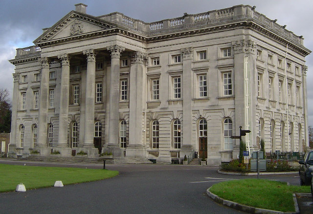
Moor Park (house)

Moor Park is a Neo-Palladian mansion set within several hundred acres of parkland to the south-east of Rickmansworth in Hertfordshire, England. It is called...

Batchworth

Batchworth was once a hamlet and is now a civil parish and part of Rickmansworth in Hertfordshire. The parish of Batchworth was created on 1 April 2017...

The Withey Beds

The Withey Beds is a 7.5 hectare Local Nature Reserve (LNR) in Rickmansworth in Hertfordshire. It was declared an LNR in 2004 by Three Rivers District...

Batchworth Heath

Batchworth Heath is 4 hectares (10 acres) of designated common land in Rickmansworth, Hertfordshire, around the junction of Batchworth Heath Hill, Batchworth...

The More

The More (also known as the Manor of the More) was a 16th-century palace in the parish of Rickmansworth, Hertfordshire, England, where Catherine of Aragon...

Rickmansworth (Church Street) railway station

Rickmansworth (Church Street) railway station was a London and North Western Railway (LNWR) station in Rickmansworth, Hertfordshire, UK. Opened in 1862...

River Chess

The River Chess is a chalk stream that rises near Chesham in the Chiltern Hills, and flows for 11 miles (18 km) through Buckinghamshire and Hertfordshire...

Nearby Amenities

Located within 500m of 51.629693,-0.45137
Barrier: cycle_barrier
Lat/Long: 51.6329362/-0.447517
Post Box
Note: At reception desk
Ref: WD3 266
Lat/Long: 51.6278862/-0.4476979
Golf: pin
Lat/Long: 51.631513/-0.4511622
Golf: pin
Lat/Long: 51.6317493/-0.4453503
Golf: pin
Lat/Long: 51.6313687/-0.4449585
Golf: pin
Lat/Long: 51.6318339/-0.4485087
Golf: pin
Lat/Long: 51.6323513/-0.4536154
Golf: pin
Lat/Long: 51.6326802/-0.4544003
Golf: pin
Lat/Long: 51.6298644/-0.4534235
Fountain
Lat/Long: 51.6285476/-0.4472012
Historic: monument
Lat/Long: 51.6282137/-0.4471823
Direction: 195
Generator Method: photovoltaic
Generator Output Electricity: yes
Generator Solar Modules: 10
Generator Source: solar
Generator Type: solar_photovoltaic_panel
Location: roof
Power: generator
Lat/Long: 51.6331877/-0.4512726
Direction: 195
Generator Method: photovoltaic
Generator Output Electricity: yes
Generator Solar Modules: 13
Generator Source: solar
Generator Type: solar_photovoltaic_panel
Location: roof
Power: generator
Lat/Long: 51.6331309/-0.4508429
Direction: 195
Generator Method: photovoltaic
Generator Output Electricity: yes
Generator Solar Modules: 12
Generator Source: solar
Generator Type: solar_photovoltaic_panel
Location: roof
Power: generator
Lat/Long: 51.6328973/-0.4495747
Direction: 185
Generator Method: photovoltaic
Generator Output Electricity: yes
Generator Solar Modules: 20
Generator Source: solar
Generator Type: solar_photovoltaic_panel
Location: roof
Power: generator
Lat/Long: 51.6327335/-0.4473308
The data included in this document is from www.openstreetmap.org. The data is made available under ODbL.

Have you been to Batchworth?

Leave your review of Batchworth below (or comments, questions and feedback).