Bashall Eaves

Civil Parish in Yorkshire Ribble Valley

England

Bashall Eaves

Lake at Browsholme Hall Complete with boathouse.
Lake at Browsholme Hall Credit: Bill Boaden

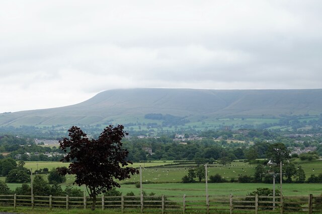
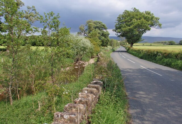
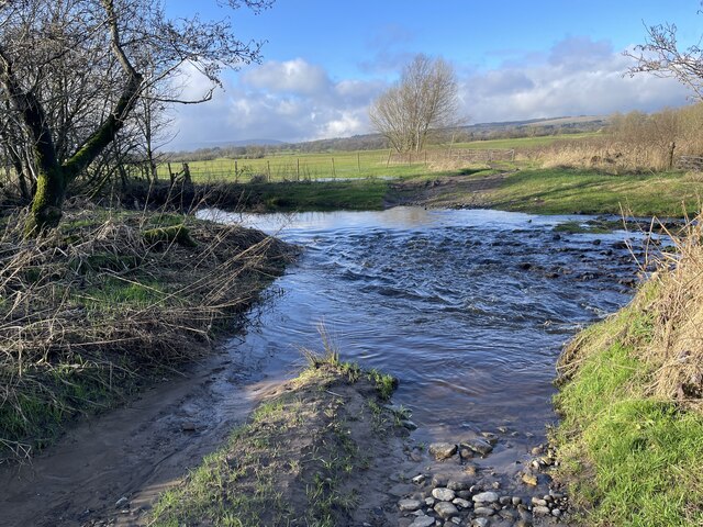
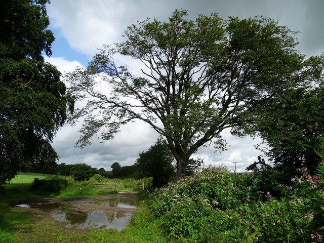
Bashall Eaves is a small civil parish located in the picturesque region of Yorkshire, England. Situated in the Ribble Valley, this charming village is surrounded by rolling hills and countryside, offering a tranquil and idyllic setting.

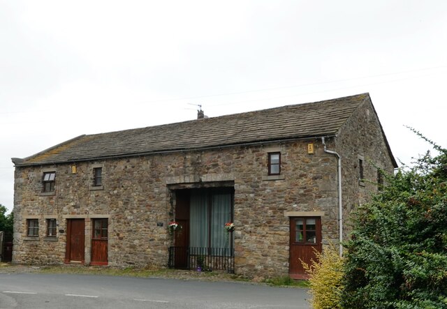
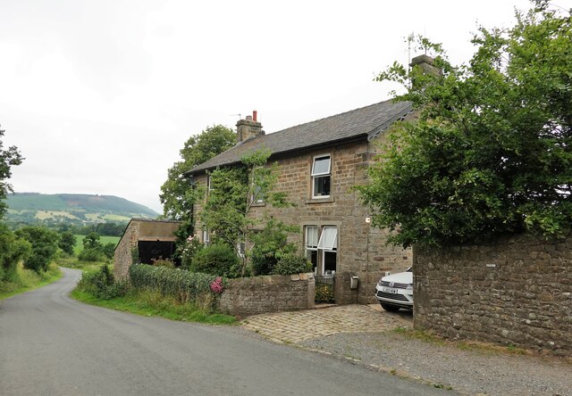
With a population of approximately 200 residents, Bashall Eaves exudes a sense of tight-knit community and rural charm. The parish is known for its historic buildings, including the Grade II listed All Hallows Church, which dates back to the 17th century. This architectural gem is a prominent feature of the village and serves as a reminder of its rich heritage.

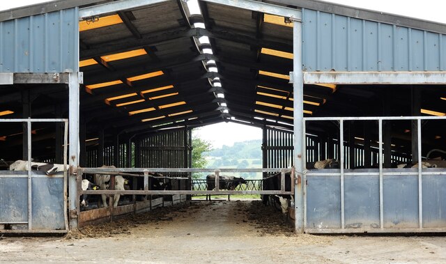
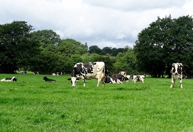
Despite its small size, Bashall Eaves boasts a thriving agricultural industry, with farming playing a significant role in the local economy. The lush green fields and grazing livestock contribute to the area's bucolic and agrarian ambiance.

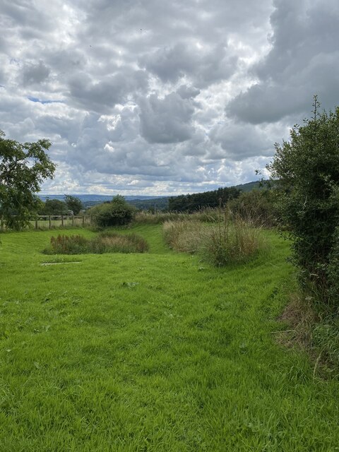
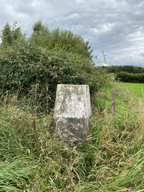
For outdoor enthusiasts, Bashall Eaves offers ample opportunities for exploring the surrounding countryside. The parish is located near the Forest of Bowland, an Area of Outstanding Natural Beauty, renowned for its scenic landscapes, walking trails, and wildlife. Visitors can enjoy activities such as hiking, cycling, and birdwatching in this stunning natural environment.

Although Bashall Eaves may be a rural retreat, it is not lacking in amenities. The village is home to a popular farm shop and café, providing locals and visitors with a taste of fresh, local produce.

Overall, Bashall Eaves epitomizes the charm and tranquility of rural Yorkshire, making it an attractive destination for those seeking a peaceful and scenic escape from the bustle of city life.

If you have any feedback on the listing, please let us know in the comments section below.

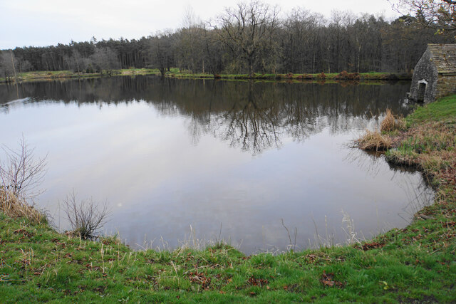
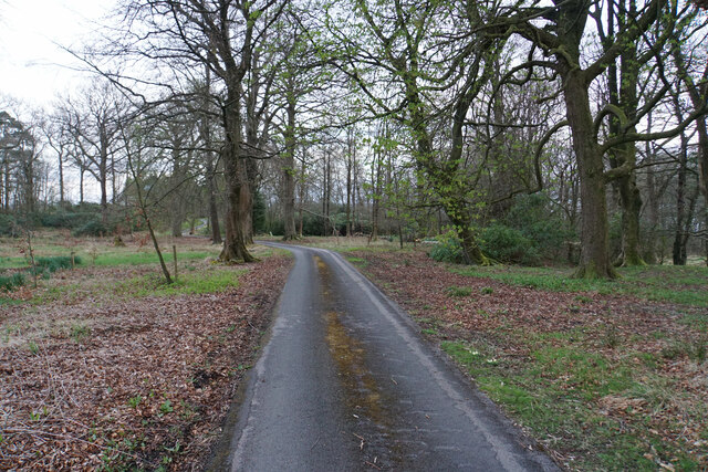
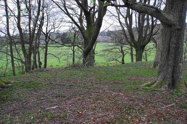
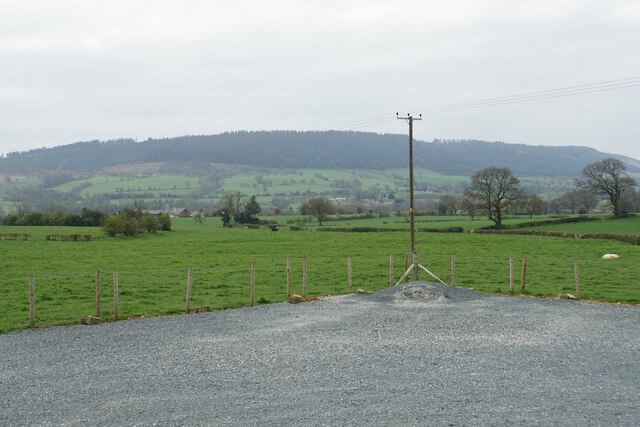
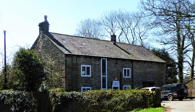
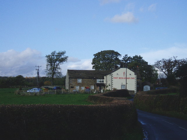
Bashall Eaves Images

Images are sourced within 2km of 53.887807/-2.458567 or Grid Reference SD6943. Thanks to Geograph Open Source API. All images are credited.

Lake at Browsholme Hall Complete with boathouse.
Lake at Browsholme Hall
Complete with boathouse.
Driveway in Bashall Moor Wood An access driveway for Browsholme Hall.
Driveway in Bashall Moor Wood
An access driveway for Browsholme Hall.
Part of Bashall Moor Wood You can see through the trees at the edge of the wood to Browsholme Hall, to which this wood belongs.
Part of Bashall Moor Wood
You can see through the trees at the edge of the wood to Browsholme Hall, to which this wood belongs.
Farmland near Bashall Eaves Looking towards Longridge Fell from the car park of the Red Pump Inn, some of which can be seen in the foreground.
Farmland near Bashall Eaves
Looking towards Longridge Fell from the car park of the Red Pump Inn, some of which can be seen in the foreground.
Memorial Plaque - Dorothea Margaret Worsley-Taylor
Memorial Garden for Dorothea Margaret Worsley-Taylor
Bashall Eaves Trig Point Flush Bracket S4682
Converted farm buildings Old Stable Cottage and Towler's Barn at Bashall Town.
Converted farm buildings
Old Stable Cottage and Towler's Barn at Bashall Town.
Mist over Pendle Pendle Hill from Bashall Town.
Mist over Pendle
Pendle Hill from Bashall Town.
Shippon at Bashall Town Cows munching hay while a companion looks in.
Shippon at Bashall Town
Cows munching hay while a companion looks in.
Bashall Town Farmhouse Built in 1889 and situated on Twitter Lane.
Bashall Town Farmhouse
Built in 1889 and situated on Twitter Lane.
Bashall Brook alongside road The point where Bashall Brook nears the bend and follows the road going towards Bashall Town.
Bashall Brook alongside road
The point where Bashall Brook nears the bend and follows the road going towards Bashall Town.
Bashall Brook Ford  This is a field access ford over Bashall Brook.
Bashall Brook Ford
This is a field access ford over Bashall Brook.
Cows at pasture Recent rains have facilitated lush feeding for the cattle.
Cows at pasture
Recent rains have facilitated lush feeding for the cattle.
Old Boundary Marker east of Hodder House, Bashall Eaves Parish Boundary Marker by the UC road, in parish of Bashall Eaves (Ribble Valley District), South of entrance to Hodder House, on verge, West side of road.

Surveyed

Milestone Society National ID: YW_BAEGMI01pb
Old Boundary Marker east of Hodder House, Bashall Eaves
Parish Boundary Marker by the UC road, in parish of Bashall Eaves (Ribble Valley District), South of entrance to Hodder House, on verge, West side of road. Surveyed Milestone Society National ID: YW_BAEGMI01pb
Lane north of Bashall Brook The lane leads from Twitter Lane to Cow Hey farmhouse.
Lane north of Bashall Brook
The lane leads from Twitter Lane to Cow Hey farmhouse.
Braddup House on Cross Lane The house, in Bashall Eaves, was built in 1787 and is grade II listed.
Braddup House on Cross Lane
The house, in Bashall Eaves, was built in 1787 and is grade II listed.
The Red Pump Inn, Bashall Eaves
Show me another place!

Bashall Eaves is located at Grid Ref: SD6943 (Lat: 53.887807, Lng: -2.458567)

Division: West Riding

Administrative County: Lancashire

District: Ribble Valley

Police Authority: Lancashire

What 3 Words

///alas.encourage.composts. Near Waddington, Lancashire

Related Wikis

Bashall Eaves

Bashall Eaves is a village and civil parish in the Ribble Valley district of Lancashire, England, about four miles (6 km) west of Clitheroe. The placename...

Browsholme Hall

Browsholme Hall is a privately owned Tudor house in the parish of Bowland Forest Low in the borough of Ribble Valley, Lancashire (although historically...

Waddington, Lancashire

Waddington is a small village, 2 miles (3 km) north-west of Clitheroe in the Ribble Valley, Lancashire, England. The population of the civil parish at...

St Helen's Church, Waddington

St Helen's Church is in the village of Waddington, Lancashire, England. It is an active Anglican parish church in the deanery of Whalley, the archdeaconry...

Nearby Amenities

Located within 500m of 53.887807,-2.458567
Bashall Eaves
Is In: Ribble Valley, Lancashire
Place: village
Source: npe
Lat/Long: 53.885438/-2.4648502
Post Box
Post Box Type: wall
Royal Cypher: VR
Royal Cypher Wikidata: Q33102356
Lat/Long: 53.8861825/-2.4645427
Marsdens
Place: neighbourhood
Source: OSOpenDataStreet
Lat/Long: 53.8895071/-2.46124
Coulthurst
Place: neighbourhood
Source: OSOpenDataStreet
Lat/Long: 53.886864/-2.4599504
Saddle Bridge
Place: neighbourhood
Source: OSOpenDataStreet
Lat/Long: 53.8869592/-2.4544261
Moor End Farm
Place: neighbourhood
Source: OSOpenDataStreet
Lat/Long: 53.8878631/-2.4590728
Clough Bottom
Place: neighbourhood
Source: OSOpenDataStreet
Lat/Long: 53.8890652/-2.4558541
The Old Forge
Is In: Ribble Valley, Lancashire
Place: village
Source: npe
Lat/Long: 53.8863678/-2.4654655
Old Vicarage Farm
Place: neighbourhood
Source: OSOpenDataStreet
Lat/Long: 53.8857518/-2.4606392
Oakmere
Place: neighbourhood
Source: OSOpenDataStreet
Lat/Long: 53.8869279/-2.4572703
Rugglesmire
Place: neighbourhood
Source: OSOpenDataStreet
Lat/Long: 53.8858841/-2.453873
Saddle Barn
Place: neighbourhood
Source: OSOpenDataStreet
Lat/Long: 53.8879011/-2.4565837
Bus Stop
Bus: yes
Public Transport: platform
Lat/Long: 53.8851852/-2.4641565
Give Way
Direction: forward
Lat/Long: 53.8853892/-2.4638929
Bench
Lat/Long: 53.8856022/-2.4638322
The data included in this document is from www.openstreetmap.org. The data is made available under ODbL.

Have you been to Bashall Eaves?

Leave your review of Bashall Eaves below (or comments, questions and feedback).