Basford

Civil Parish in Cheshire

England

Basford

New A500 Dual Carriageway Runs from near Nantwich to the M6 AT J16. Taken 14th October at 10:42.
New A500 Dual Carriageway Credit: David Crocker

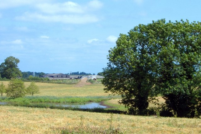
Basford is a civil parish located in the county of Cheshire, England. Situated approximately 3 miles south of Crewe, it is a rural area surrounded by picturesque countryside. The parish covers an area of about 2 square miles and is home to a small but close-knit community.

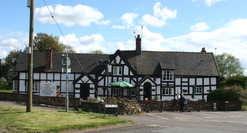
The village of Basford itself dates back to medieval times and is characterized by its charming traditional buildings, including a historic church that serves as a focal point for the community. The church, dedicated to St. Mary, is a Grade II listed building and features beautiful stained glass windows and intricate stonework.

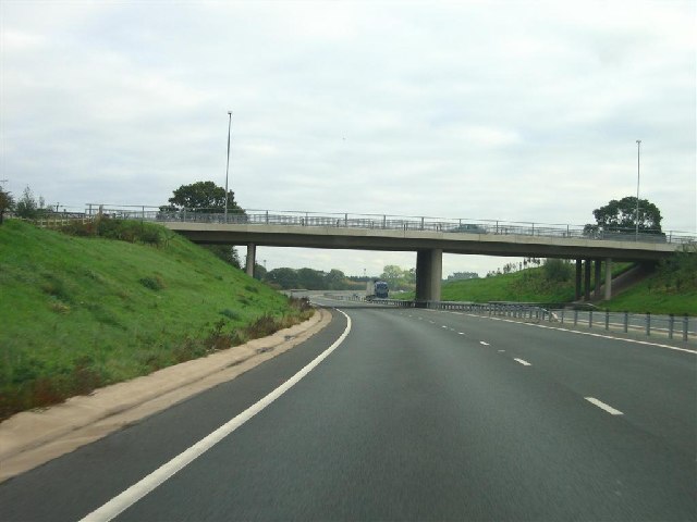
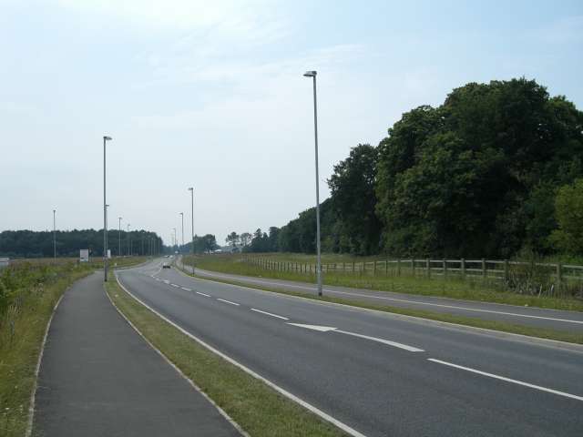
Despite its rural setting, Basford benefits from excellent transport links. The nearby Crewe railway station provides easy access to major cities such as Manchester and Birmingham, while the M6 motorway is just a short drive away, connecting the area to the wider region.

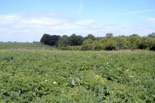
The economy of Basford is primarily centered around agriculture, with many residents involved in farming and related industries. The local countryside offers ample opportunities for outdoor activities, such as walking, cycling, and horse riding, attracting visitors from nearby towns and cities.

The parish has a strong sense of community, with several social and recreational events organized throughout the year. These include village fetes, community dinners, and sports tournaments. Basford also has a primary school, ensuring that families have access to education within the parish.

Overall, Basford offers a tranquil and idyllic setting for those seeking a rural lifestyle while still being within reach of urban amenities.

If you have any feedback on the listing, please let us know in the comments section below.

Basford Images

Images are sourced within 2km of 53.068029/-2.421621 or Grid Reference SJ7152. Thanks to Geograph Open Source API. All images are credited.

New A500 Dual Carriageway Runs from near Nantwich to the M6 AT J16. Taken 14th October at 10:42.
New A500 Dual Carriageway
Runs from near Nantwich to the M6 AT J16. Taken 14th October at 10:42.
Crewe Hall Taken from Weston Road looking towards <a href="https://www.geograph.org.uk/gridref/SJ7353">SJ7353</a>.
Crewe Hall
Taken from Weston Road looking towards SJ7353.
The A500, Shavington New dual carriageway bypassing Shavington and Hough to the south of Crewe.
The A500, Shavington
New dual carriageway bypassing Shavington and Hough to the south of Crewe.
The Mornflake Oats plant, Crewe The company are sponsors of the town's football team.
The Mornflake Oats plant, Crewe
The company are sponsors of the town's football team.
Crewe Hall Hotel
Crewe Hall Hotel
A5020 Crewe Green Link Road This Link road allows north/south through traffic to bypass some of the busiest parts Crewe. In the distance on the left is part of Rookery Wood. To the right of the road is Quaker's Coppice.
A5020 Crewe Green Link Road
This Link road allows north/south through traffic to bypass some of the busiest parts Crewe. In the distance on the left is part of Rookery Wood. To the right of the road is Quaker's Coppice.
Hough Common Hough. Hough Common from Cobbs Lane.
Hough Common
Hough. Hough Common from Cobbs Lane.
Heath Farm, Chorlton From the South Cheshire Way, near Heath Farm, Chorlton.
Heath Farm, Chorlton
From the South Cheshire Way, near Heath Farm, Chorlton.
Potato field, Basford Basford. On the South Cheshire Way; potato field near Burrow Coppice.
Potato field, Basford
Basford. On the South Cheshire Way; potato field near Burrow Coppice.
South Cheshire Way, Weston Weston. South Cheshire Way, beyond Smithy Lane. View of new A500 bridge.
South Cheshire Way, Weston
Weston. South Cheshire Way, beyond Smithy Lane. View of new A500 bridge.
Crossing Basford Brook Weston/Basford parish boundary. Crossing Basford Brook.
Crossing Basford Brook
Weston/Basford parish boundary. Crossing Basford Brook.
Hough - Cobbs Lane Hough. Cobbs Lane, from junction with Buck Lane.
Hough - Cobbs Lane
Hough. Cobbs Lane, from junction with Buck Lane.
Rail, road and foot The A500 dual carriageway bridge over the railway just to the south of Crewe station, with a freight train emerging. Since the construction of the new dual carriageway, the public footpath from Gresty Road in Crewe to Basford has been diverted to go under the railway bridge rather than over the A500 embankment around 200m west. The tower (left) carries lights to illuminate the adjacent Basford Hall Sorting Sidings
Rail, road and foot
The A500 dual carriageway bridge over the railway just to the south of Crewe station, with a freight train emerging. Since the construction of the new dual carriageway, the public footpath from Gresty Road in Crewe to Basford has been diverted to go under the railway bridge rather than over the A500 embankment around 200m west. The tower (left) carries lights to illuminate the adjacent Basford Hall Sorting Sidings
Pasture by Basford Hall Sorting Sidings Flat cattle pasture to the south of the city of Crewe, adjacent to the railway line and Basford Hall Sorting Sidings just south of Crewe station. A freight train is visible standing in the sidings (left). The tower is one of several carrying lights to illuminate the sidings. A stile on the public footpath from Gresty Road in Crewe to Basford is visible (foreground, centre left)
Pasture by Basford Hall Sorting Sidings
Flat cattle pasture to the south of the city of Crewe, adjacent to the railway line and Basford Hall Sorting Sidings just south of Crewe station. A freight train is visible standing in the sidings (left). The tower is one of several carrying lights to illuminate the sidings. A stile on the public footpath from Gresty Road in Crewe to Basford is visible (foreground, centre left)
Gresty Brook Gresty Brook emerges from the southern side of Crewe into pasture by the Mornflakes Oats Plant
Gresty Brook
Gresty Brook emerges from the southern side of Crewe into pasture by the Mornflakes Oats Plant
Cheshire Cheese, Gresty, Shavington Large red-brick public house on a right-angle bend in Crewe Road (B5071), just south of Crewe
Cheshire Cheese, Gresty, Shavington
Large red-brick public house on a right-angle bend in Crewe Road (B5071), just south of Crewe
Farm buildings at Yew Tree Farm, near Crewe Several farms lie around Crewe Road (B5071), immediately to the south of the city of Crewe. These farm buildings on a right-angle bend show the typical features of the area, with circular windows, arched entrances and cross-shaped ventilation holes. The chimneys of the Mornflakes plant, visible across much of the square, can be seen in the distance (left)
Farm buildings at Yew Tree Farm, near Crewe
Several farms lie around Crewe Road (B5071), immediately to the south of the city of Crewe. These farm buildings on a right-angle bend show the typical features of the area, with circular windows, arched entrances and cross-shaped ventilation holes. The chimneys of the Mornflakes plant, visible across much of the square, can be seen in the distance (left)
Brook near Greenbank Farm The public footpath from Gresty Road to Basford crosses a small brook, a tributary of Gresty Brook. Between the fences (centre left) runs a track to Greenbank Farm (not a right of way). In the distance, from left to right, are Greenbank Farm outbuildings, Rail House by Crewe station & warehousing by Basford Hall Sorting Sidings
Brook near Greenbank Farm
The public footpath from Gresty Road to Basford crosses a small brook, a tributary of Gresty Brook. Between the fences (centre left) runs a track to Greenbank Farm (not a right of way). In the distance, from left to right, are Greenbank Farm outbuildings, Rail House by Crewe station & warehousing by Basford Hall Sorting Sidings
Show me another place!

Basford is located at Grid Ref: SJ7152 (Lat: 53.068029, Lng: -2.421621)

Unitary Authority: Cheshire East

Police Authority: Cheshire

What 3 Words

///drooling.spurned.buying. Near Weston, Cheshire

Nearby Locations

Basford Basford

Related Wikis

Basford, Cheshire

Basford is a hamlet and former civil parish, now in the parish of Weston and Crewe Green, in the unitary authority area of Cheshire East and the ceremonial...

Basford Hall Yard

Basford Hall Yard is a railway marshalling yard near the town of Crewe, Cheshire, England. The yard, which is 0.93 miles (1.5 km) south of Crewe railway...

Basford railway station

Basford railway station was a station on the Grand Junction Railway serving the villages of Basford, Hough and Weston in what was then Cheshire, England...

Weston, Cheshire East

Weston is a village (at SJ730522) and former civil parish, now in the parish of Weston and Crewe Green, in the unitary authority area of Cheshire East...

Nearby Amenities

Located within 500m of 53.068029,-2.421621
Source: Bing
Lat/Long: 53.0692567/-2.4212629
Railway: switch
Lat/Long: 53.0685095/-2.4211436
Railway: switch
Lat/Long: 53.0649596/-2.4190355
Source: Bing
Lat/Long: 53.0678038/-2.42046
Source: Bing
Lat/Long: 53.0659751/-2.4193917
Railway: switch
Lat/Long: 53.0657571/-2.4196511
Railway: switch
Lat/Long: 53.0670102/-2.4201785
Railway: switch
Lat/Long: 53.0649924/-2.4188445
Railway: switch
Lat/Long: 53.0654529/-2.4192057
Railway: switch
Lat/Long: 53.064203/-2.4183905
Railway: switch
Lat/Long: 53.0719242/-2.4247364
Railway: switch
Lat/Long: 53.0717263/-2.4247545
Railway: switch
Lat/Long: 53.0721419/-2.4245731
Railway: switch
Lat/Long: 53.069045/-2.4215262
Railway: switch
Lat/Long: 53.0688003/-2.4213274
Railway: switch
Lat/Long: 53.0717883/-2.4242811
Railway: switch
Lat/Long: 53.0703756/-2.4232133
Man Made: tower
Tower Type: lighting
Lat/Long: 53.0706436/-2.4228491
Railway: switch
Lat/Long: 53.0693724/-2.4217998
Railway: switch
Lat/Long: 53.0716665/-2.4245299
Basford Hall Junction
Railway: junction
Source: Bing
Lat/Long: 53.0652671/-2.4189225
Railway: switch
Lat/Long: 53.0643997/-2.4184465
Railway: switch
Lat/Long: 53.0647041/-2.4186787
Railway: switch
Lat/Long: 53.0640971/-2.4182731
Barrier: kissing_gate
Lat/Long: 53.0662892/-2.4249894
Addr Housename: Basford Hall
Lat/Long: 53.0666244/-2.421885
Bus Stop
Basford, Weston Lane / Casey Lane
Bus: yes
Naptan AtcoCode: 0600CR19114
Naptan Bearing: SW
Naptan BusStopType: CUS
Naptan CommonName: Casey Lane
Naptan Crossing: Casey Lane
Naptan Indicator: cnr
Naptan Landmark: Dairy House
Naptan LocalityName: Basford
Naptan NaptanCode: chewtat
Naptan PlusbusZoneRef: CREWE
Naptan ShortCommonName: Casey Lane
Naptan Street: Weston Lane
Network: Cheshire East Council
Operator: Ansa Transport
Public Transport: platform
Source: naptan_import
Lat/Long: 53.0668772/-2.4179355
Bus Stop
Basford, Weston Lane / Casey Lane
Bus: yes
Naptan AtcoCode: 0600CR19113
Naptan Bearing: NE
Naptan BusStopType: CUS
Naptan CommonName: Casey Lane
Naptan Crossing: Casey Lane
Naptan Indicator: opp
Naptan Landmark: Dairy House
Naptan LocalityName: Basford
Naptan NaptanCode: chewtap
Naptan PlusbusZoneRef: CREWE
Naptan ShortCommonName: Casey Lane
Naptan Street: Weston Lane
Network: Cheshire East Council
Operator: Ansa Transport
Public Transport: platform
Source: naptan_import
Lat/Long: 53.0669852/-2.4181305
The data included in this document is from www.openstreetmap.org. The data is made available under ODbL.

Have you been to Basford?

Leave your review of Basford below (or comments, questions and feedback).