Balsall

Civil Parish in Warwickshire Solihull

England

Balsall

Balsall Common-The Saracen's Head Inn On the western fringes of the village.
Balsall Common-The Saracen's Head Inn Credit: Ian Rob

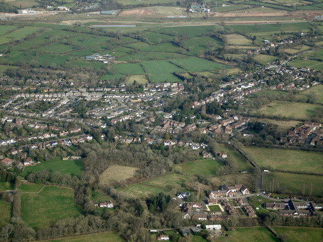
Balsall is a civil parish located in the county of Warwickshire, England. Situated approximately 10 miles southeast of the city of Coventry, Balsall is a quaint and picturesque village with a population of around 6,000 residents.

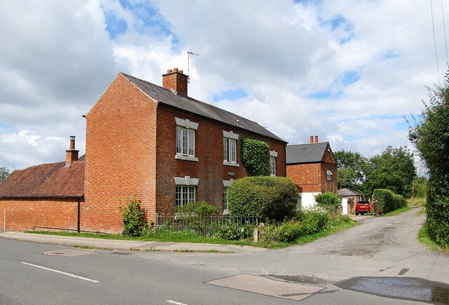
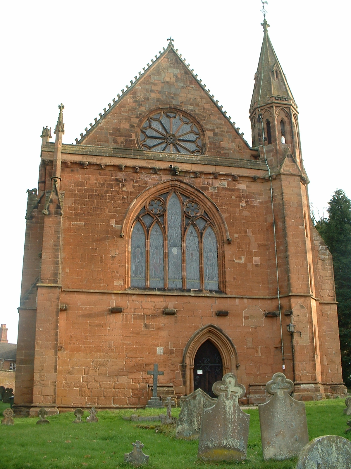
The village is known for its rich history, dating back to the medieval period, and is home to several historical landmarks. One such landmark is the 14th-century St. Mary's Church, which boasts stunning architecture and houses various historical artifacts. The village also features a number of well-preserved thatched cottages, adding to its charming character.

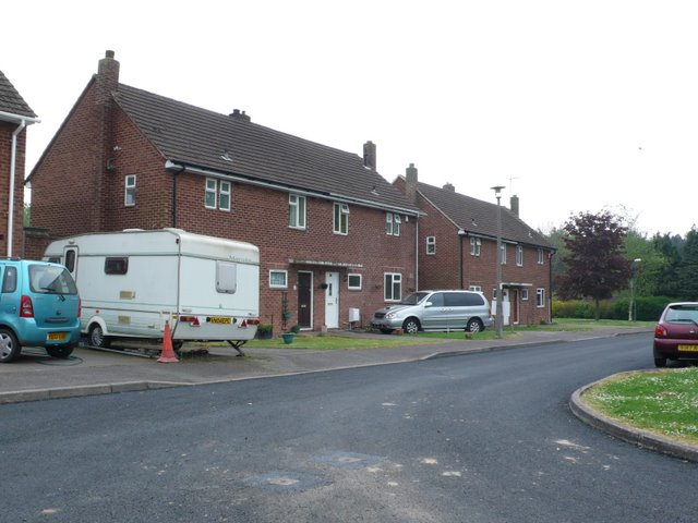
Balsall offers a range of amenities and services for its residents and visitors. The village has a primary school, a post office, a library, and a medical center, ensuring that essential services are easily accessible to the local community. There are also several shops, pubs, and restaurants, providing a variety of options for shopping and dining.

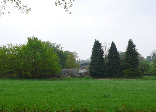
Nature lovers will appreciate the beautiful surrounding countryside, with numerous walking paths and green spaces to explore. The nearby Berkswell and Balsall Common Nature Reserve is a popular spot for wildlife enthusiasts, offering a tranquil environment to observe various bird species and other wildlife.

Transport links in Balsall are well-developed, with easy access to major roads such as the A452 and the A45. The village also benefits from a railway station, providing convenient connections to nearby towns and cities.

Overall, Balsall is a charming village that seamlessly blends its historical heritage with modern amenities, making it an attractive place to live or visit in Warwickshire.

If you have any feedback on the listing, please let us know in the comments section below.

Balsall Images

Images are sourced within 2km of 52.380696/-1.666444 or Grid Reference SP2275. Thanks to Geograph Open Source API. All images are credited.

Balsall Common-The Saracen's Head Inn On the western fringes of the village.
Balsall Common-The Saracen's Head Inn
On the western fringes of the village.
Balsall Common-Hobbe Cottage On Balsall Street.
Balsall Common-Hobbe Cottage
On Balsall Street.
Balsall Common-Ivy House Farm On Needlers End Lane.
Balsall Common-Ivy House Farm
On Needlers End Lane.
Balsall Common-The White Horse Public House on Kenilworth Road.
Balsall Common-The White Horse
Public House on Kenilworth Road.
Balsall Street View from the Lay-by.
Balsall Street
View from the Lay-by.
Barston Lane sewage works from the air Seen on approach to Birmingham from a flight from Prague.
Barston Lane sewage works from the air
Seen on approach to Birmingham from a flight from Prague.
HS2 construction site near Balsall Common from the air Balsall Common is in the foreground, with the HS2 works in the distance. Viewed from a Birmingham bound flight from Prague.
HS2 construction site near Balsall Common from the air
Balsall Common is in the foreground, with the HS2 works in the distance. Viewed from a Birmingham bound flight from Prague.
HS2 construction near Balsall Common from the air Looking along Station Road, the line of the HS2 works can be seen in the distance. Viewed from a Birmingham bound flight from Prague.
HS2 construction near Balsall Common from the air
Looking along Station Road, the line of the HS2 works can be seen in the distance. Viewed from a Birmingham bound flight from Prague.
The Elms from the air Just off the B4101 Balsall Street, west of Balsall Common. Viewed from a Birmingham bound flight from Prague.
The Elms from the air
Just off the B4101 Balsall Street, west of Balsall Common. Viewed from a Birmingham bound flight from Prague.
Balsall Common from the air The B4101 Balsall Street in the west side of Balsall Common is prominent. Viewed from a Birmingham bound flight from Prague.
Balsall Common from the air
The B4101 Balsall Street in the west side of Balsall Common is prominent. Viewed from a Birmingham bound flight from Prague.
Balsall Common from the air The B4101 Balsall Street East, on the south side of Balsall Common is prominent, as are the playing fields at Heart of England School and Berkswell Cricket Club. Viewed from a Birmingham bound flight from Prague.
Balsall Common from the air
The B4101 Balsall Street East, on the south side of Balsall Common is prominent, as are the playing fields at Heart of England School and Berkswell Cricket Club. Viewed from a Birmingham bound flight from Prague.
Balsall Common from the air Heart of England School and Balsall Common Primary School are prominent, as is Berkswell Cricket Club and the A452 road. Viewed from a Birmingham bound flight from Prague.
Balsall Common from the air
Heart of England School and Balsall Common Primary School are prominent, as is Berkswell Cricket Club and the A452 road. Viewed from a Birmingham bound flight from Prague.
Farm on Brees Lane These farm buildings are just off Brees lane just north of the Prodrive proving ground which occupies the old Meer End airfield.
Farm on Brees Lane
These farm buildings are just off Brees lane just north of the Prodrive proving ground which occupies the old Meer End airfield.
Fen End The small cluster of houses at Fen End were originally associated with the RAF station connected to the nearby airfield. There is now no military involvement and the airfield is an automotive proving ground belonging to Prodrive.
Fen End
The small cluster of houses at Fen End were originally associated with the RAF station connected to the nearby airfield. There is now no military involvement and the airfield is an automotive proving ground belonging to Prodrive.
Entrance to Prodrive. This is the closely guarded entrance to the Prodrive proving ground which occupies the old Fen End airfield.
Entrance to Prodrive.
This is the closely guarded entrance to the Prodrive proving ground which occupies the old Fen End airfield.
Haigs Hotel, Balsall Common Independent family-run hotel on Kenilworth Road.
Haigs Hotel, Balsall Common
Independent family-run hotel on Kenilworth Road.
Glendale Farm Glendale Farm is just to the west of the Kenilworth Rd the A452 just south of Balsall Common.
Glendale Farm
Glendale Farm is just to the west of the Kenilworth Rd the A452 just south of Balsall Common.
Blythe Avenue A typical residential road in Balsall Common consisting mainly of bungalows. The road at the far end is Malvern Rd.
Blythe Avenue
A typical residential road in Balsall Common consisting mainly of bungalows. The road at the far end is Malvern Rd.
Show me another place!

Balsall is located at Grid Ref: SP2275 (Lat: 52.380696, Lng: -1.666444)

Administrative County: West Midlands

District: Solihull

Police Authority: West Midlands

What 3 Words

///bowls.gear.drops. Near Balsall Common, West Midlands

Related Wikis

Heart of England Way

The Heart of England Way is a long-distance walk of around 160 km (100 mi) through the Midlands of England. The walk starts from Milford Common on Cannock...

Heart of England School

Heart of England School is a secondary school and sixth form with academy status located in Balsall Common in the West Midlands. The Headteacher, who started...

A452 road

The A452 is a road in England, which runs from Royal Leamington Spa, Warwickshire to Brownhills in the West Midlands. It is the major link to the M6 motorway...

Balsall Common

Balsall Common is a large village in the Metropolitan Borough of Solihull, West Midlands, England. It is situated 5 miles (7.5 km) northwest of Kenilworth...

Balsall Preceptory

Balsall Preceptory in Warwickshire was a manor that was given to the Knights Templars in recognition of their service in the Crusades. The donor, according...

Temple Balsall

Temple Balsall (grid reference SP207760) is a small hamlet within the Metropolitan Borough of Solihull in the English West Midlands, situated between the...

St Mary's Church, Temple Balsall

St Mary's Church, Temple Balsall is a parish church in the Church of England in Temple Balsall, Solihull, West Midlands, England. == History == The church...

Berkswell railway station

Berkswell railway station ( BURK-swəl), in the West Midlands of England, takes its name from the nearby village of Berkswell although it is located on...

Nearby Amenities

Located within 500m of 52.380696,-1.666444
Power Historic: tower
Source: OS 1:25k
Lat/Long: 52.3833794/-1.6619726
Barrier: kissing_gate
Lat/Long: 52.3827938/-1.6622597
Power: tower
Source: bing
Lat/Long: 52.3820567/-1.6689931
Power: tower
Source: bing
Lat/Long: 52.3807763/-1.6642871
Oaklands Farm
Communication: mobile_phone
Communication Mobile Phone: yes
Man Made: tower
Operator: EE
Ref: 21723
Source: Warwicks CC Aerial Imagery 2013
Source 1: survey
Tower Construction: freestanding
Tower Type: communication
Lat/Long: 52.3840711/-1.6624725
Ford: yes
Lat/Long: 52.3811724/-1.6693446
Power: pole
Source: bing
Lat/Long: 52.377474/-1.6709398
Power: pole
Source: bing
Lat/Long: 52.3784016/-1.6701324
Power: pole
Source: bing
Lat/Long: 52.378702/-1.6698669
Power: pole
Source: bing
Lat/Long: 52.3790467/-1.6695665
Power: pole
Source: bing
Lat/Long: 52.3797695/-1.6689442
Power: pole
Source: bing
Lat/Long: 52.3801461/-1.6686036
Power: pole
Source: bing
Lat/Long: 52.3806209/-1.6681986
Power: pole
Source: bing
Lat/Long: 52.3813413/-1.6675776
Power: pole
Source: bing
Lat/Long: 52.3820633/-1.6669406
Power: pole
Source: bing
Lat/Long: 52.3827305/-1.6663733
Power: pole
Source: bing
Lat/Long: 52.3833886/-1.6657779
Power: pole
Source: bing
Lat/Long: 52.384118/-1.6651623
Power: pole
Source: bing
Lat/Long: 52.3847777/-1.6649464
Power: pole
Source: bing
Lat/Long: 52.380192/-1.6722688
Power: pole
Source: bing
Lat/Long: 52.380079/-1.6711986
Power: pole
Source: bing
Lat/Long: 52.3799464/-1.670107
Power: pole
Ref: 720338
Source: wpd_opendata
Transformer: distribution
Lat/Long: 52.3840402/-1.6671646
The data included in this document is from www.openstreetmap.org. The data is made available under ODbL.

Have you been to Balsall?

Leave your review of Balsall below (or comments, questions and feedback).