Arnside

Civil Parish in Westmorland South Lakeland

England

Arnside

Wall and Fields near Meathop
Wall and Fields near Meathop Credit: Anthony Parkes

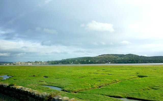
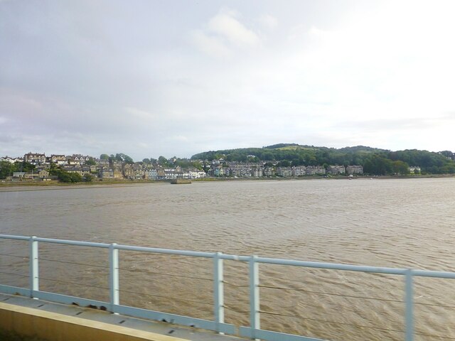
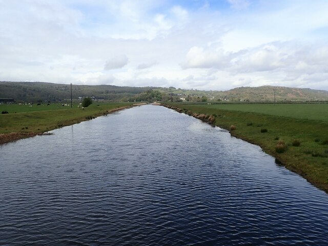
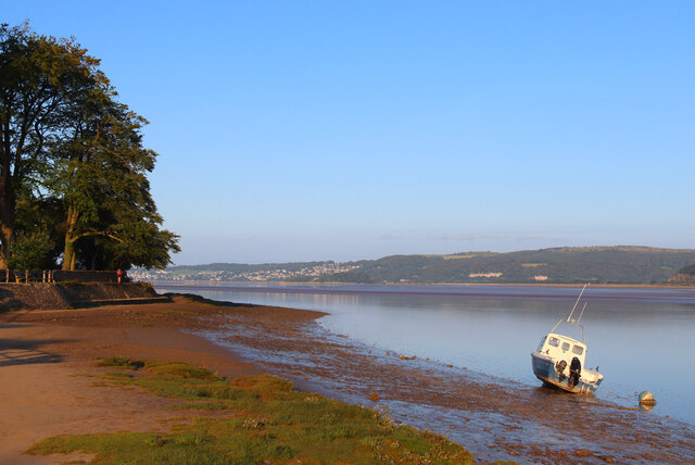
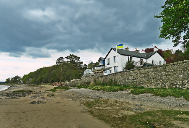
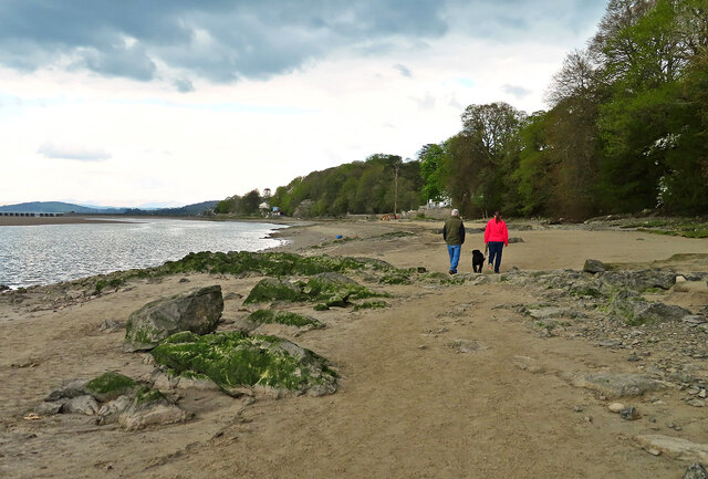
Arnside is a civil parish located in the county of Cumbria, in the historical region of Westmorland, England. Situated on the southern edge of the Lake District National Park, and bordered by the picturesque Morecambe Bay, Arnside is a charming village with a population of around 2,500 residents.

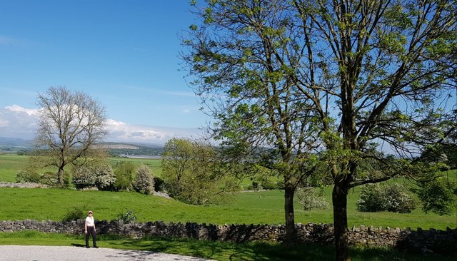
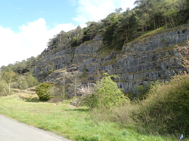
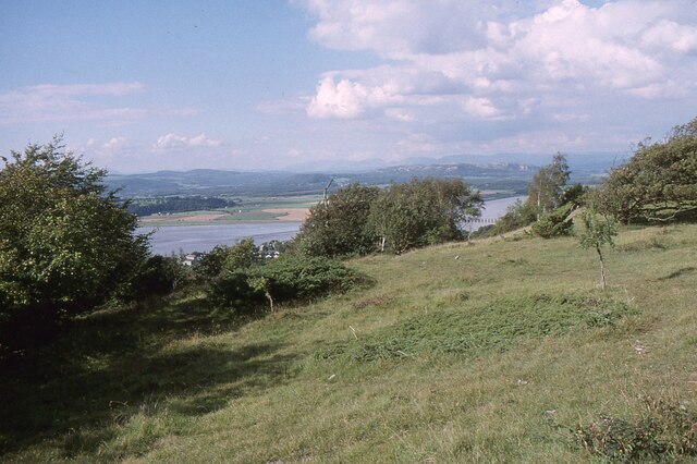
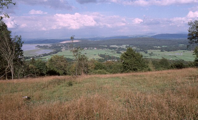
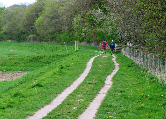
The village is known for its stunning natural beauty, with the Arnside Knott offering panoramic views of the surrounding countryside and coastline. It is a popular spot for walkers and nature enthusiasts, with several designated nature reserves nearby, including the Arnside and Silverdale Area of Outstanding Natural Beauty.

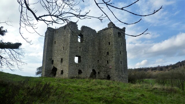
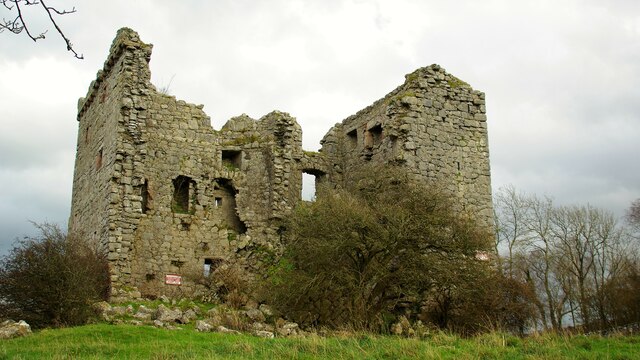
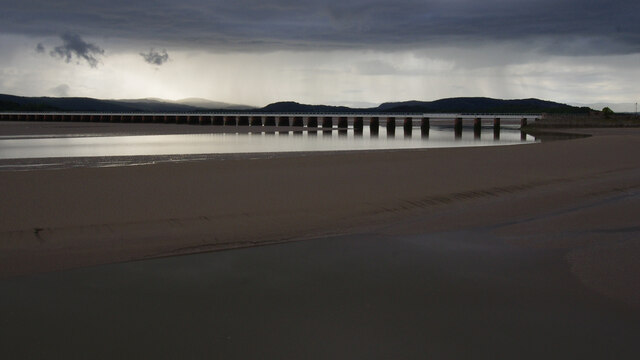
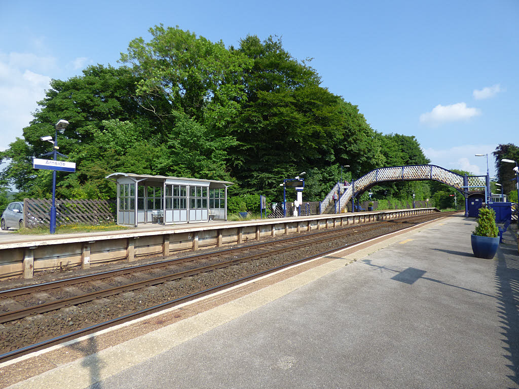
Arnside boasts a rich history, with evidence of settlements in the area dating back to prehistoric times. The village grew during the Victorian era, with the arrival of the railway in the 1850s, which made it an attractive destination for tourists and day-trippers. Today, the railway station remains an important transportation hub for both locals and visitors.

The village center is home to a variety of amenities, including a range of independent shops, cafes, and restaurants. There is also a primary school, a community center, and several churches serving the local community.

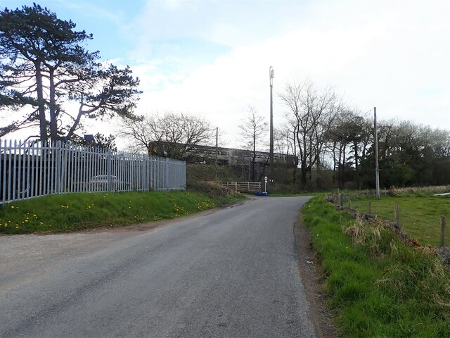
Arnside is well-connected, with good road and rail links to nearby towns and cities such as Kendal and Lancaster. The village offers a peaceful and idyllic setting, making it a desirable place to live or visit for those seeking a relaxing retreat amidst beautiful natural surroundings.

If you have any feedback on the listing, please let us know in the comments section below.

Arnside Images

Images are sourced within 2km of 54.199938/-2.845373 or Grid Reference SD4478. Thanks to Geograph Open Source API. All images are credited.

Wall and Fields near Meathop
Saltmarsh on the Kent estuary Arnside Knott in background, Arnside town to the left.
Saltmarsh on the Kent estuary
Arnside Knott in background, Arnside town to the left.
River Kent River Kent viewed from the Kent Viaduct. Arnside town in distance
River Kent
River Kent viewed from the Kent Viaduct. Arnside town in distance
Meathop Park Farm In the distance is Arnside, which is across Morecambe Bay
Meathop Park Farm
In the distance is Arnside, which is across Morecambe Bay
Craggy southern end of Meathop Fell
River Winster Between Lindale and Meathop. The river was the boundary between the ancient counties of Lancashire and Westmorland.
River Winster
Between Lindale and Meathop. The river was the boundary between the ancient counties of Lancashire and Westmorland.
River Winster nearing its end The River discharges into the River Kent just east of Grange-Over-Sands. To the left are quarried rocks of Meathop Fell, then the river flows under a railway bridge.
River Winster nearing its end
The River discharges into the River Kent just east of Grange-Over-Sands. To the left are quarried rocks of Meathop Fell, then the river flows under a railway bridge.
Coastal train heading for Grange-Over-Sands Two carriages on the Furness Line, which runs between Lancaster and Barrow-in-Furness
Coastal train heading for Grange-Over-Sands
Two carriages on the Furness Line, which runs between Lancaster and Barrow-in-Furness
The Kent Estuary near Grubbins Wood A late afternoon view of the Kent Estuary on New Year's Day 2022 after the hordes had headed back to Arnside.

This photograph was taken during the Coronavirus (COVID-19) pandemic of 2020/21/22.
The Kent Estuary near Grubbins Wood
A late afternoon view of the Kent Estuary on New Year's Day 2022 after the hordes had headed back to Arnside. This photograph was taken during the Coronavirus (COVID-19) pandemic of 2020/21/22.
Arnside Knott Looking north-northeast over the Kent Estuary. Part of the Kent Viaduct is visible behind the trees in the centre.

Arnside Knott is a National Trust property renowned for its wildlife on this important limestone outcrop.

Position within the square uncertain.
Arnside Knott
Looking north-northeast over the Kent Estuary. Part of the Kent Viaduct is visible behind the trees in the centre. Arnside Knott is a National Trust property renowned for its wildlife on this important limestone outcrop. Position within the square uncertain.
Arnside Knott Looking northeast towards Storth and Sandside Quarry.

Arnside Knott is a National Trust property renowned for its wildlife on this important limestone outcrop.

Position within the square uncertain.
Arnside Knott
Looking northeast towards Storth and Sandside Quarry. Arnside Knott is a National Trust property renowned for its wildlife on this important limestone outcrop. Position within the square uncertain.
Arnside Promenade Coast at Arnside.
Arnside Promenade
Coast at Arnside.
Walking on the Arnside–Storth embankment This is a concessionary footpath where walkers are asked to keep to the track and have all dogs on leads.
Walking on the Arnside–Storth embankment
This is a concessionary footpath where walkers are asked to keep to the track and have all dogs on leads.
Beachwood House Right down there on the foreshore of the Kent Estuary.
Beachwood House
Right down there on the foreshore of the Kent Estuary.
A quick foreshore walk The deteriorating weather discouraged walkers from going very far from Arnside on this late-April afternoon.
A quick foreshore walk
The deteriorating weather discouraged walkers from going very far from Arnside on this late-April afternoon.
Arnside Tower View from east of the fortified house
Arnside Tower
View from east of the fortified house
Arnside Tower View from west of the fortified house
Arnside Tower
View from west of the fortified house
Kent estuary at Arnside Looking towards the railway viaduct from the pier, at low water in the evening under threatening skies.
Kent estuary at Arnside
Looking towards the railway viaduct from the pier, at low water in the evening under threatening skies.
Show me another place!

Arnside is located at Grid Ref: SD4478 (Lat: 54.199938, Lng: -2.845373)

Administrative County: Cumbria

District: South Lakeland

Police Authority: Cumbria

What 3 Words

///inspected.tech.files. Near Arnside, Cumbria

Nearby Locations

Arnside Grubbins Wood

Related Wikis

Nearby Amenities

Located within 500m of 54.199938,-2.845373
Created By: almien_coastlines
Source: PGS
Lat/Long: 54.2009205/-2.8381072
Source: PGS
Lat/Long: 54.2006034/-2.8399285
Source: PGS
Lat/Long: 54.2001914/-2.8407302
Source: PGS
Lat/Long: 54.1999461/-2.8412277
Created By: almien_coastlines
Source: PGS
Lat/Long: 54.1995568/-2.8414214
Source: PGS
Lat/Long: 54.1992105/-2.8421105
Created By: almien_coastlines
Source: PGS
Lat/Long: 54.1989477/-2.8423589
Created By: almien_coastlines
Source: PGS
Lat/Long: 54.1986694/-2.8430514
Source: PGS
Lat/Long: 54.1982107/-2.8436533
Source: PGS
Lat/Long: 54.1979062/-2.8442372
Created By: almien_coastlines
Source: PGS
Lat/Long: 54.1977219/-2.8446896
Source: PGS
Lat/Long: 54.1974593/-2.8455902
Source: PGS
Lat/Long: 54.1971949/-2.8463959
Source: PGS
Lat/Long: 54.1970443/-2.8468766
Source: PGS
Lat/Long: 54.1969288/-2.8472027
Source: PGS
Lat/Long: 54.1967782/-2.8476748
Source: PGS
Lat/Long: 54.196733/-2.8481812
Source: PGS
Lat/Long: 54.1964217/-2.8494343
Source: PGS
Lat/Long: 54.1963966/-2.8499665
YHA Arnside
Addr City: Arnside
Addr Housename: YHA Arnside
Addr Postcode: LA5 0AT
Addr Street: Redhills Road
Operator: YHA England & Wales
Tourism: hostel
Lat/Long: 54.197922/-2.8417827
Turning Circle
Lat/Long: 54.196905/-2.8423305
Turning Circle
Lat/Long: 54.1961445/-2.8424149
Bench
Backrest: yes
Lat/Long: 54.199971/-2.8406549
Bench
Backrest: yes
Lat/Long: 54.2005046/-2.839338
Bench
Backrest: yes
Lat/Long: 54.2003838/-2.8399415
Bench
Lat/Long: 54.2002567/-2.8402151
Bench
Backrest: yes
Lat/Long: 54.2005422/-2.8389705
Bench
Lat/Long: 54.1979643/-2.8400327
Bench
Lat/Long: 54.1973681/-2.8454561
Bench
Lat/Long: 54.1973932/-2.844748
Bench
Lat/Long: 54.1976003/-2.8426881
Bench
Backrest: yes
Lat/Long: 54.1993765/-2.8413416
Bench
Lat/Long: 54.1995443/-2.8390564
Historic: memorial
Lat/Long: 54.1995224/-2.8391556
Bench
Lat/Long: 54.1995271/-2.839279
Information: guidepost
Operator: Arnside Parish Council
Ref: No 5
Source: survey;gps
Tourism: information
Lat/Long: 54.1993597/-2.8413096
The Numbered Fingerposts of Westmorland
Board Type: history
Information: board
Tourism: information
Lat/Long: 54.1994435/-2.8412583
Siren
Emergency: siren
Operator: HM Coastguard
Siren Purpose: tide
Siren Type: electronic
Lat/Long: 54.1991786/-2.8417567
The data included in this document is from www.openstreetmap.org. The data is made available under ODbL.

Have you been to Arnside?

Leave your review of Arnside below (or comments, questions and feedback).