Almondsbury

Civil Parish in Gloucestershire

England

Almondsbury

John Lewis, The Mall, Cribbs Causeway The western entrance to the Mall and John Lewis store at Cribbs Causeway, a mecca for shoppers
John Lewis, The Mall, Cribbs Causeway Credit: Dave Bushell

Almondsbury is a civil parish located in the South Gloucestershire district of Gloucestershire, England. It is situated approximately 10 miles north of the city of Bristol and 30 miles south of Gloucester. The parish covers an area of around 12 square miles and is home to a population of approximately 5,000 residents.

The village of Almondsbury itself is a picturesque and historic settlement, with many buildings dating back to the 17th and 18th centuries. It is surrounded by beautiful countryside, offering stunning views of the nearby Severn Estuary and the rolling hills of Gloucestershire.

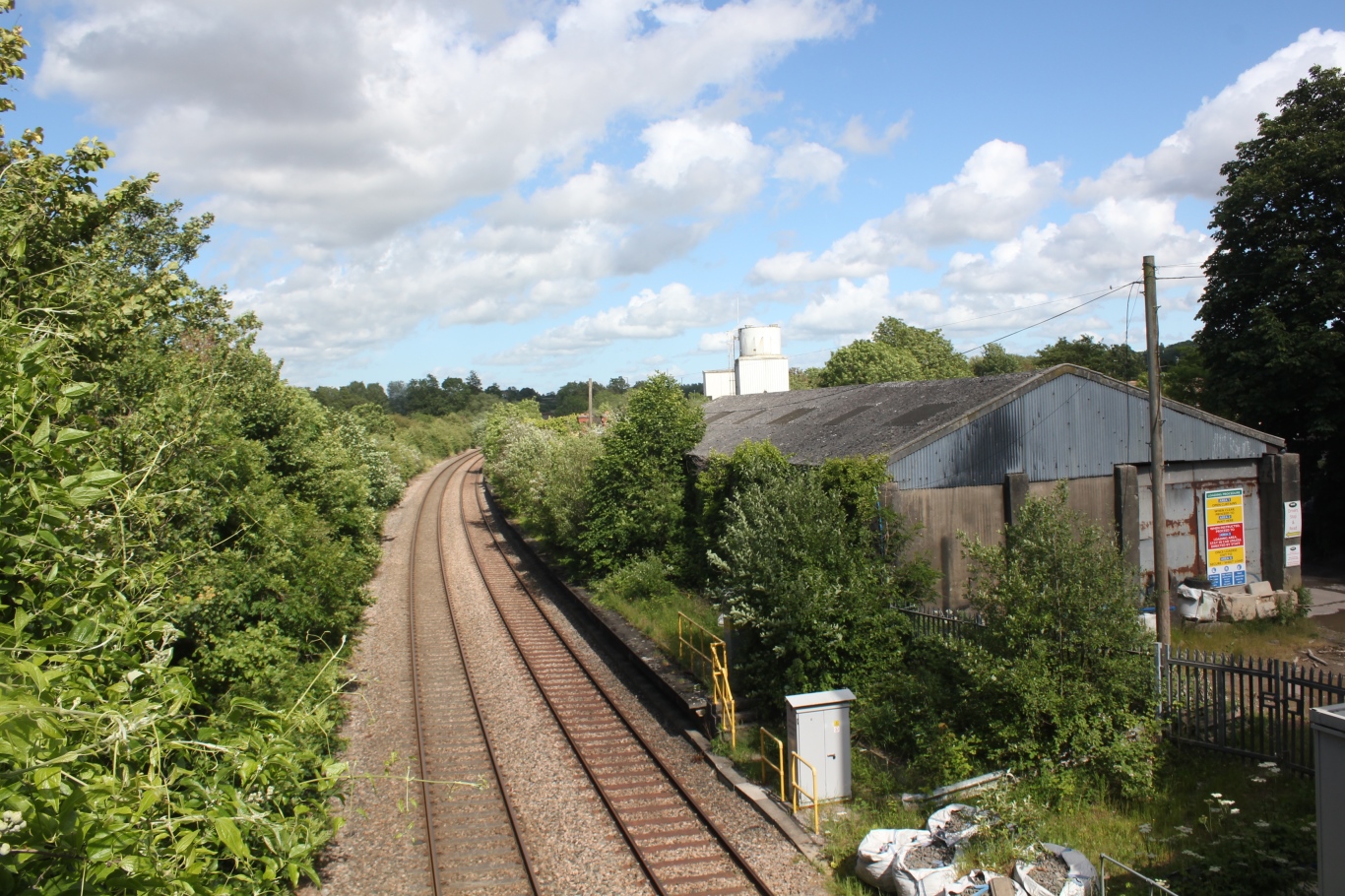
Despite its rural setting, Almondsbury benefits from excellent transport links. It is conveniently located near the M4 and M5 motorways, providing easy access to Bristol, Gloucester, and other major cities. The village also has a railway station, connecting it to the wider rail network.

Almondsbury offers a range of amenities and services to its residents. There are several local shops, a post office, and a primary school. The village also has a community center, sports facilities, and a number of pubs and restaurants.

The parish is surrounded by areas of natural beauty, including the nearby Thornbury Castle and Blaise Castle Estate, which provide opportunities for outdoor activities such as walking, cycling, and picnicking.

Overall, Almondsbury is a charming and well-connected civil parish that combines the tranquility of rural living with the convenience of nearby urban centers.

If you have any feedback on the listing, please let us know in the comments section below.

Almondsbury Images

Images are sourced within 2km of 51.531958/-2.627264 or Grid Reference ST5681. Thanks to Geograph Open Source API. All images are credited.

John Lewis, The Mall, Cribbs Causeway The western entrance to the Mall and John Lewis store at Cribbs Causeway, a mecca for shoppers
John Lewis, The Mall, Cribbs Causeway
The western entrance to the Mall and John Lewis store at Cribbs Causeway, a mecca for shoppers
Compton Greenfield (Glos) All Saints Church
Mercedes-Benz at Cribbs Just one of the many 'sheds' at Cribbs Causeway  shopping centre.
Mercedes-Benz at Cribbs
Just one of the many 'sheds' at Cribbs Causeway shopping centre.
Morrisons store, Cribbs Causeway A view looking west to the illuminated towers of the Morrisons store at Cribbs Causeway Regional Shopping Centre.
Morrisons store, Cribbs Causeway
A view looking west to the illuminated towers of the Morrisons store at Cribbs Causeway Regional Shopping Centre.
Wyck Beck Road, Henbury Behind the hedge beyond the roundabout is Clifton Rugby Ground. The row of trees on the horizon is the M5.
Wyck Beck Road, Henbury
Behind the hedge beyond the roundabout is Clifton Rugby Ground. The row of trees on the horizon is the M5.
Berwick
Berwick
Man Made Structure I don't know what this structure is that is marked on the OS Map running along the side of the road.
Man Made Structure
I don't know what this structure is that is marked on the OS Map running along the side of the road.
Man Made Embankment The end of the man-made embankment looking south-east. 
The map and the actual ground features seem slightly different as the footpath actually starts by the end of the structure. Another photo of the structure is <a href="https://www.geograph.org.uk/photo/118651">ST5580 : Man Made Structure</a> in the neighbouring grid square.
Man Made Embankment
The end of the man-made embankment looking south-east. The map and the actual ground features seem slightly different as the footpath actually starts by the end of the structure. Another photo of the structure is ST5580 : Man Made Structure in the neighbouring grid square.
End of the road This road used to go to Vimpenny's Common according to the 1940's OS Map, now the M49 blocks the way and Vimpenny's Common is no longer there. The M49 is on the horizon.
End of the road
This road used to go to Vimpenny's Common according to the 1940's OS Map, now the M49 blocks the way and Vimpenny's Common is no longer there. The M49 is on the horizon.
Road by Brook Farm
Road by Brook Farm
Compton Greenfield Junction leading into Compton Greenfield, looking north-west.
"Compton" is derived from the words 'combe' meaning valley, and 'ton' meaning settlement.
Compton Greenfield
Junction leading into Compton Greenfield, looking north-west. "Compton" is derived from the words 'combe' meaning valley, and 'ton' meaning settlement.
Steep winding road The road is narrow and climbs between the steep banks.
Steep winding road
The road is narrow and climbs between the steep banks.
Bridge under the M5 by Hollywood Tower The entrance to Hollywood Tower is on the left just before the bridge. On the other side of the bridge is the Cribbs Causeway Shopping Centre.
Bridge under the M5 by Hollywood Tower
The entrance to Hollywood Tower is on the left just before the bridge. On the other side of the bridge is the Cribbs Causeway Shopping Centre.
Gas works A view of all three gas containers from a field to the south.
Gas works
A view of all three gas containers from a field to the south.
Gas container A view of the sun striking the westernmost gas container with heavy rainclouds in the background.
Gas container
A view of the sun striking the westernmost gas container with heavy rainclouds in the background.
Gas works A view of all three gas containers from behind the Selvaco carbon plant.  The farm buildings in front of the containers are part of Minor farm.
Gas works
A view of all three gas containers from behind the Selvaco carbon plant. The farm buildings in front of the containers are part of Minor farm.
Electricity pylon This pylon is one of a long line carrying power from Seabank power station towards Bristol.
Electricity pylon
This pylon is one of a long line carrying power from Seabank power station towards Bristol.
Asda Walmart Superstore
Show me another place!

Almondsbury is located at Grid Ref: ST5681 (Lat: 51.531958, Lng: -2.627264)

Unitary Authority: South Gloucestershire

Police Authority: Avon and Somerset

What 3 Words

///copies.vanish.hoping. Near Pilning, Gloucestershire

Related Wikis

Compton Greenfield

Compton Greenfield is a small hamlet of farms and spread out houses to the south west of Easter Compton, in South Gloucestershire. The parish church of...

Easter Compton

Easter Compton is a village in the civil parish of Almondsbury, South Gloucestershire, England. It is situated at the bottom of a hill (known as Blackhorse...

Wild Place Project

Bristol Zoo Project, formerly known as Wild Place Project, is a wildlife conservation park in South Gloucestershire, United Kingdom. It is run by Bristol...

Berwick, Gloucestershire

Berwick is a hamlet in the South Gloucestershire district, in the English county of Gloucestershire. Nearby settlements include the city of Bristol and...

Catbrain

Catbrain Hill, simply known as Catbrain, is a small village in England north of the city of Bristol, within the county of South Gloucestershire. It is...

Cribbs F.C.

Cribbs Football Club is an English football club founded in 1958 and based at Cribbs Causeway, South Gloucestershire. They are currently members of Southern...

The Wave (company)

The Wave is a firm building artificial wave pools for surfing in England. The Wave: Bristol was opened in 2019, on the northern outskirts of the city....

Henbury railway station

Henbury railway station served the Bristol suburb of Henbury, England, from 1910 to 1965. The station was situated on the Henbury Loop Line of the Great...

Nearby Amenities

Located within 500m of 51.531958,-2.627264
Bus Stop
Vimpennys Lane
Naptan AtcoCode: 0170SGB20575
Naptan Bearing: E
Naptan CommonName: Vimpennys Lane
Naptan Crossing: Vimpennys Lane
Naptan NaptanCode: sgladwt
Naptan Street: Berwick Lane
Naptan Verified: no
Shelter: no
Source: naptan_import
Lat/Long: 51.5350942/-2.6315187
Bus Stop
Vimpennys Lane
Naptan AtcoCode: 0170SGB20576
Naptan Bearing: W
Naptan CommonName: Vimpennys Lane
Naptan Crossing: Vimpennys Lane
Naptan NaptanCode: sglagad
Naptan Street: Berwick Lane
Naptan Verified: no
Source: naptan_import
Lat/Long: 51.5351485/-2.630357
Bus Stop
Hollywood Lane
Naptan AtcoCode: 0170SGB20577
Naptan Bearing: NW
Naptan CommonName: Hollywood Lane
Naptan Crossing: Bowstreet Lane
Naptan NaptanCode: sglagaw
Naptan Street: Berwick Lane
Naptan Verified: no
Shelter: no
Source: naptan_import
Lat/Long: 51.5339413/-2.6233961
Bus Stop
Hollywood Lane
Naptan AtcoCode: 0170SGB20578
Naptan Bearing: SE
Naptan CommonName: Hollywood Lane
Naptan Crossing: Bowstreet Lane
Naptan NaptanCode: sglagda
Naptan Street: Berwick Lane
Naptan Verified: no
Shelter: no
Source: naptan_import
Lat/Long: 51.533727/-2.6226746
Power: tower
Lat/Long: 51.5359633/-2.6267827
Power: tower
Lat/Long: 51.5359521/-2.630302
Access: no
Barrier: kissing_gate
Foot: yes
Lat/Long: 51.5316359/-2.6297952
Barrier: kissing_gate
Lat/Long: 51.5334155/-2.6262745
Barrier: stile
Lat/Long: 51.5321292/-2.6265484
Generator Method: wind_turbine
Generator Source: wind
Generator Type: horizontal_axis
Power: generator
Lat/Long: 51.5302777/-2.6293592
Access: no
Barrier: kissing_gate
Foot: yes
Lat/Long: 51.530594/-2.6303976
Barrier: kissing_gate
Lat/Long: 51.5341994/-2.6254535
Ford: yes
Lat/Long: 51.5359476/-2.6251302
Barrier: horse_stile
Lat/Long: 51.5352931/-2.6252916
Barrier: kissing_gate
Lat/Long: 51.534708/-2.6249463
Compton Greenfield
Place: hamlet
Wikidata: Q5157162
Lat/Long: 51.5340324/-2.624291
Post Box
Collection Times: Mo-Fr 09:00; Sa 07:00
Operator: Royal Mail
Post Box Type: wall
Ref: BS35 91D
Royal Cypher: EIIR
Royal Cypher Wikidata: Q33102113
Lat/Long: 51.5346999/-2.6244643
Barrier: bollard
Bollard: removable
Material: steel
Lat/Long: 51.5309091/-2.6204203
Barrier: stile
Lat/Long: 51.5349386/-2.6317915
Addr Housename: Green Orchard
Building: yes
Fixme: approximate
Lat/Long: 51.5349744/-2.6299703
Addr Housename: Hill Croft
Building: yes
Fixme: approximate
Lat/Long: 51.5350195/-2.6306462
Addr Housename: Lyde House
Building: yes
Fixme: approximate
Lat/Long: 51.5337014/-2.6230797
Material: wood
Power: pole
Lat/Long: 51.5342836/-2.6212301
Power: pole
Lat/Long: 51.5337677/-2.6215309
Direction: 160
Generator Method: photovoltaic
Generator Output Electricity: yes
Generator Solar Modules: 4
Generator Source: solar
Generator Type: solar_photovoltaic_panel
Location: roof
Power: generator
Lat/Long: 51.5331299/-2.6222528
Direction: 200
Generator Method: photovoltaic
Generator Output Electricity: yes
Generator Solar Modules: 10
Generator Source: solar
Generator Type: solar_photovoltaic_panel
Location: roof
Power: generator
Lat/Long: 51.5330485/-2.6221984
Direction: 235
Generator Method: photovoltaic
Generator Output Electricity: yes
Generator Solar Modules: 21
Generator Source: solar
Generator Type: solar_photovoltaic_panel
Location: roof
Power: generator
Lat/Long: 51.5335888/-2.6234433
Power: pole
Lat/Long: 51.5339795/-2.6240801
Power: pole
Lat/Long: 51.5338733/-2.6249196
Power: pole
Lat/Long: 51.5337772/-2.6255254
Power: pole
Lat/Long: 51.5336052/-2.6268487
Power: pole
Lat/Long: 51.5334598/-2.6278285
Power: pole
Lat/Long: 51.5332689/-2.629292
Power: pole
Lat/Long: 51.533131/-2.6302027
Power: pole
Lat/Long: 51.532997/-2.631463
Power: pole
Lat/Long: 51.5328756/-2.6325444
Power: pole
Lat/Long: 51.5327643/-2.6336116
Power: pole
Lat/Long: 51.5328662/-2.6272912
Power: pole
Lat/Long: 51.5321628/-2.6266364
Power: pole
Lat/Long: 51.531308/-2.62588
Power: pole
Lat/Long: 51.5308183/-2.6254857
Power: pole
Lat/Long: 51.5301877/-2.625005
Power: pole
Lat/Long: 51.52949/-2.6253039
Power: pole
Lat/Long: 51.5286054/-2.6256967
Power: pole
Lat/Long: 51.5278099/-2.6260603
Direction: 180
Generator Method: photovoltaic
Generator Output Electricity: yes
Generator Solar Modules: 12
Generator Source: solar
Generator Type: solar_photovoltaic_panel
Location: roof
Power: generator
Lat/Long: 51.5354241/-2.6298181
Direction: 180
Generator Method: photovoltaic
Generator Output Electricity: yes
Generator Solar Modules: 3
Generator Source: solar
Generator Type: solar_photovoltaic_panel
Location: roof
Power: generator
Lat/Long: 51.5354234/-2.6297012
Spaniorum Hill
Natural: peak
Lat/Long: 51.5305454/-2.6303928
The data included in this document is from www.openstreetmap.org. The data is made available under ODbL.

Have you been to Almondsbury?

Leave your review of Almondsbury below (or comments, questions and feedback).