Aller

Civil Parish in Somerset South Somerset

England

Aller

Coy Orchard Tilting Weir
Coy Orchard Tilting Weir Credit: Nick Chipchase

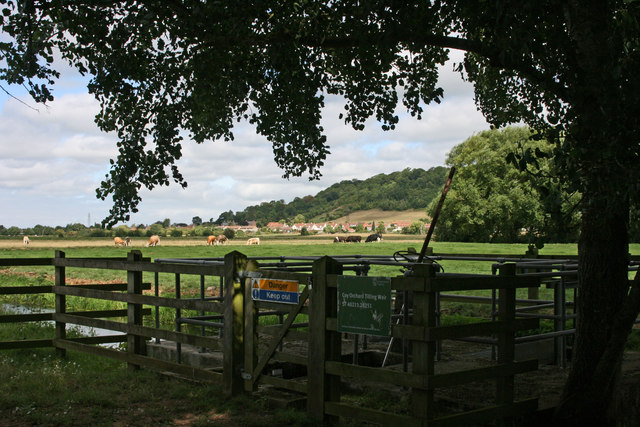
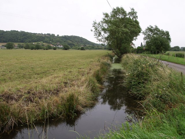
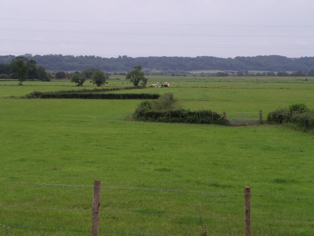
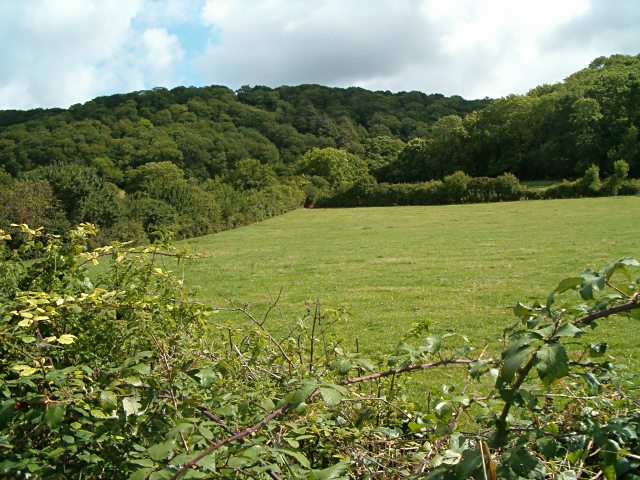
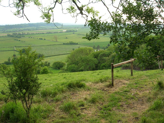
Aller is a civil parish located in the county of Somerset, England. Situated approximately 4 miles west of the town of Langport, Aller covers an area of about 1.27 square miles and has a population of around 450 people. The parish is set in the heart of the picturesque Somerset Levels, known for its flat, marshy landscapes and rich wildlife.

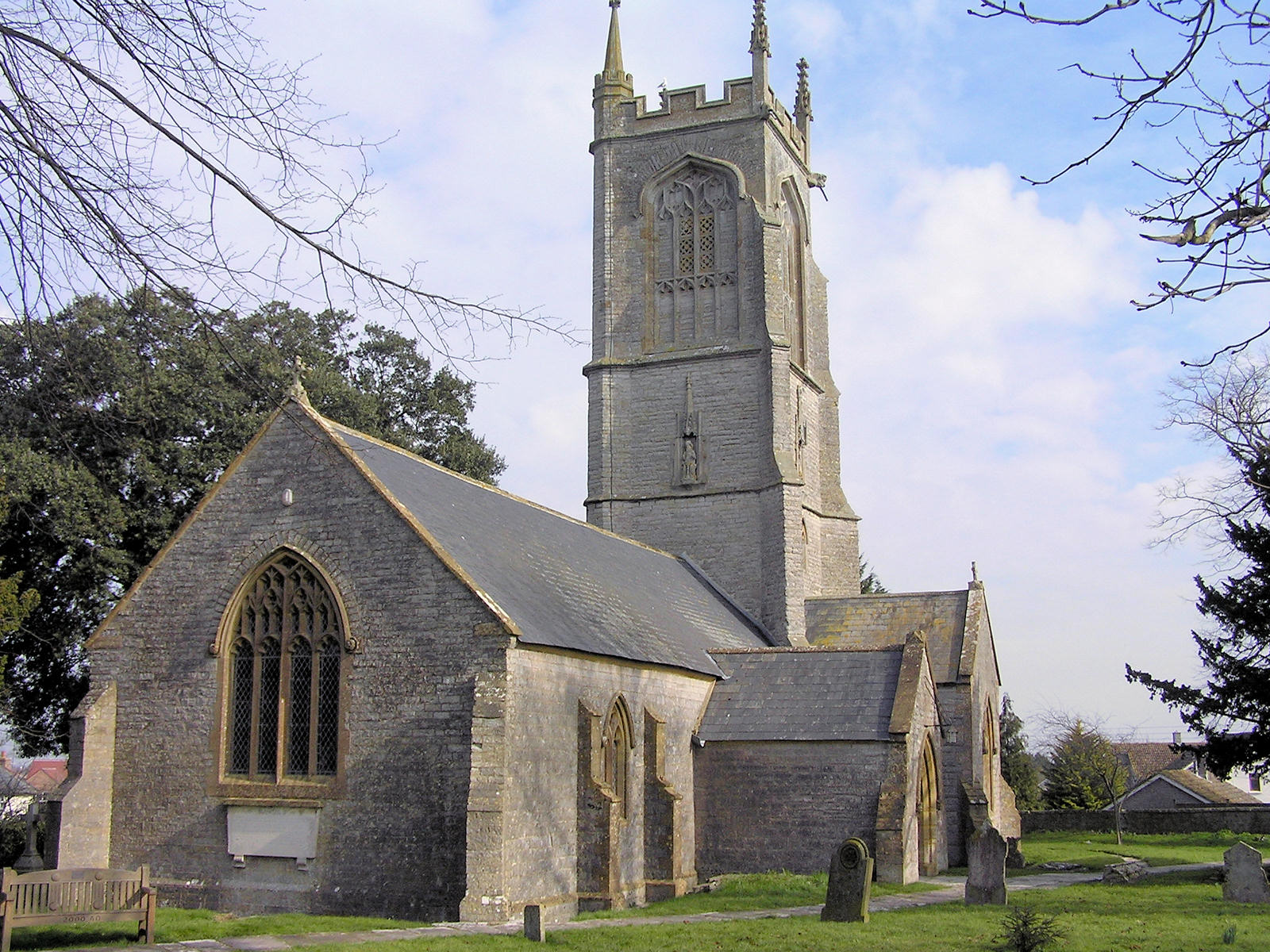
The village of Aller itself is a charming and traditional English village, with a scattering of quaint cottages and houses. The centerpiece of the village is the St. Andrew's Church, a beautiful medieval building that dates back to the 13th century. The church is known for its striking tower and impressive stained glass windows.

The community of Aller is close-knit and friendly, with an active parish council that works to maintain and enhance the village's facilities and services. The village hall serves as a hub for various community activities and events, including social gatherings, clubs, and classes.

Surrounded by fertile farmland, Aller is primarily an agricultural area with some residents engaged in farming activities. The village benefits from its rural location, offering residents a tranquil and idyllic lifestyle away from the hustle and bustle of larger towns and cities.

Overall, Aller, Somerset, is a charming and peaceful civil parish nestled in the beautiful countryside of Somerset. With its picturesque village, ancient church, and strong sense of community, Aller provides its residents with a quintessential English village experience.

If you have any feedback on the listing, please let us know in the comments section below.

Aller Images

Images are sourced within 2km of 51.065113/-2.863288 or Grid Reference ST3929. Thanks to Geograph Open Source API. All images are credited.

Coy Orchard Tilting Weir
Middlemoor from Combe
The Old Pound Inn at Aller
Aller  St Andrew's church and farm at Aller
Aller
St Andrew's church and farm at Aller
Aller The Old Pound Inn
Aller
The Old Pound Inn
Sowy River, Somerset Levels View looking southwest towards Stathe from Aller Drove Road. The "river" is better described as a large drainage ditch.
Sowy River, Somerset Levels
View looking southwest towards Stathe from Aller Drove Road. The "river" is better described as a large drainage ditch.
The London Inn. Othery
Sowey River On King's Sedge Moor
Sowey River
On King's Sedge Moor
Nightingale Farm at Beer The old Nightingale Farm has been subdivided into a number of smaller units, but retains its historical identity to the locals.
Nightingale Farm at Beer
The old Nightingale Farm has been subdivided into a number of smaller units, but retains its historical identity to the locals.
Aller Wood View from the A372 near Beer Corner.
Aller Wood
View from the A372 near Beer Corner.
Allerdrove Rhyne This runs beside Aller Drove on the right, which divides North Moor from Aller Moor and connects Pathe to Aller across this narrow stretch of the Somerset Levels. Seen from the junction with Leazeway Drove.
Allerdrove Rhyne
This runs beside Aller Drove on the right, which divides North Moor from Aller Moor and connects Pathe to Aller across this narrow stretch of the Somerset Levels. Seen from the junction with Leazeway Drove.
Rhyne at Longstone This continuation of Black Withies Rhyne bends at Longstone to run beside Aller Drove, the lane on the right. In the distance are buildings at Aller, and Aller Hill.
Rhyne at Longstone
This continuation of Black Withies Rhyne bends at Longstone to run beside Aller Drove, the lane on the right. In the distance are buildings at Aller, and Aller Hill.
Middle Moor A view from the A372 just outside Aller across part of the Somerset levels towards the River Parrett. The field to the right of the zigzagging hedge is shown on the 1:10000 map as an orchard, but on no others (including the 1940 1" map).
Middle Moor
A view from the A372 just outside Aller across part of the Somerset levels towards the River Parrett. The field to the right of the zigzagging hedge is shown on the 1:10000 map as an orchard, but on no others (including the 1940 1" map).
Wood Drove This no through road runs along the plateau above Aller Hill. Here the lane is passing Hill Farm.
Wood Drove
This no through road runs along the plateau above Aller Hill. Here the lane is passing Hill Farm.
North Moor Cattle graze near a conventional-looking haystack on the eastern part of North Moor, seen from Northmoor Drove.  According to <span class="nowrap"><a title="http://webapp1.somerset.gov.uk/her/details.asp?prn=18892" rel="nofollow ugc noopener" href="http://webapp1.somerset.gov.uk/her/details.asp?prn=18892">Link</a><img style="margin-left:2px;" alt="External link" title="External link - shift click to open in new window" src="https://s1.geograph.org.uk/img/external.png" width="10" height="10"/></span> , this area was actually the site of a number of medieval stack stands.

The building in the background is Black Withies. Aller Wood, on the slopes of Aller Hill, is in ST4030.
North Moor
Cattle graze near a conventional-looking haystack on the eastern part of North Moor, seen from Northmoor Drove. According to LinkExternal link , this area was actually the site of a number of medieval stack stands. The building in the background is Black Withies. Aller Wood, on the slopes of Aller Hill, is in ST4030.
North Moor A meadow at the southeast edge of North Moor, beside Aller Drove. On the left is a barn at Longstone Farm. As elsewhere on the Somerset levels, rhynes, with scattered willows along them, form the field boundaries.
North Moor
A meadow at the southeast edge of North Moor, beside Aller Drove. On the left is a barn at Longstone Farm. As elsewhere on the Somerset levels, rhynes, with scattered willows along them, form the field boundaries.
North Moor Another view of the area shown in <a href="https://www.geograph.org.uk/photo/560686">ST3929 : North Moor</a>, from near Longstone Cottage on Aller Drove - the group of cattle is the same.
North Moor
Another view of the area shown in ST3929 : North Moor, from near Longstone Cottage on Aller Drove - the group of cattle is the same.
Willow on North Moor The weed-covered rhyne by which this willow stands can just be seen at bottom left, but the roadside rhyne (the one shown in <a href="https://www.geograph.org.uk/photo/485751">ST3929 : Rhyne at Longstone</a>) is just out of sight below. Beyond, the levels stretch away for about 7 kilometres to Moorlinch.
Willow on North Moor
The weed-covered rhyne by which this willow stands can just be seen at bottom left, but the roadside rhyne (the one shown in ST3929 : Rhyne at Longstone) is just out of sight below. Beyond, the levels stretch away for about 7 kilometres to Moorlinch.
Show me another place!

Aller is located at Grid Ref: ST3929 (Lat: 51.065113, Lng: -2.863288)

Administrative County: Somerset

District: South Somerset

Police Authority: Avon and Somerset

What 3 Words

///bloom.voted.ripe. Near Langport, Somerset

Nearby Locations

Aller Aller Longstone

Related Wikis

Aller and Beer Woods

Aller and Beer Woods (grid reference ST404305) is a 56.9 hectares (141 acres) biological Site of Special Scientific Interest. off the A372 Othery to Langport...

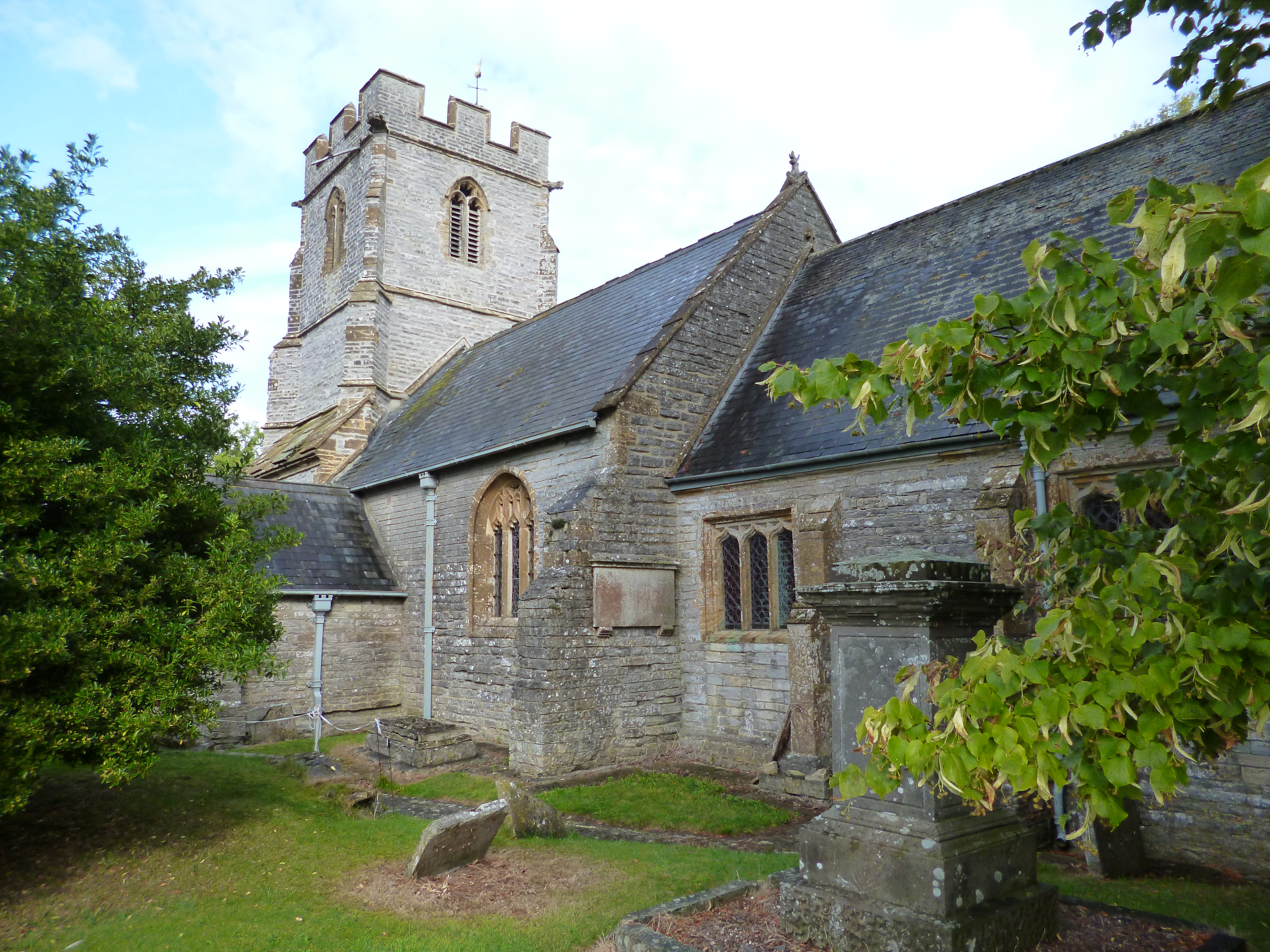
Church of St Andrew, Aller

The Anglican Church of St Andrew in Aller, Somerset, England, was built in the 11th century. It is a Grade II* listed building. == History == The Church...

Aller Hill

Aller Hill (grid reference ST408291) is an 18.4 hectare (45.4 acre) biological Site of Special Scientific Interest near Aller in Somerset, notified in...

Aller, Somerset

Aller is a village and parish in Somerset, England, situated 5 miles (8.0 km) west of Somerton on the A372 road towards Bridgwater. The village has a population...

Othery

The parish and village of Othery, established in 1515, sits on a detached extension of Sowy island on the Somerset Levels. It is 7 miles (11 km) east of...

Southlake Moor

Southlake Moor (grid reference ST370300) is a 196.1 hectare (484.6 acre) biological Site of Special Scientific Interest near Burrow Mump and Burrowbridge...

The Breeze (Bridgwater & West Somerset)

The Breeze (Bridgwater & West Somerset) formerly Quay West and Total Star Somerset was an Independent Local Radio station serving the Sedgemoor District...

King's Sedgemoor

King's Sedgemoor is a piece of rich animal habitat and farming land, that forms part of the Somerset Levels and Moors in South West England. The area of...

Related Videos

6233 Duchess of Sutherland The Great Britain XIV. Powering across the Somerset Levels

The Great Britain XIV Tour saw the Dutchess Of Sutherland travel through Somerset across the levels on its way from Cardiff to ...

The Great Britain XV featuring 44932 Black 5

On a sunny but breezy Saturday morning we see The Great Britain XV travel across the Somerset levels at Oath. Black 5 (44932) ...

Nearby Amenities

Located within 500m of 51.065113,-2.863288
Passing Place
Lat/Long: 51.0613449/-2.8671552
Passing Place
Lat/Long: 51.0611021/-2.8663924
Power: pole
Lat/Long: 51.0613674/-2.8669884
Power: pole
Lat/Long: 51.0620461/-2.8678966
Material: wood
Power: pole
Lat/Long: 51.0622992/-2.8578705
Material: wood
Power: pole
Lat/Long: 51.0626786/-2.8577759
Power: pole
Lat/Long: 51.0634005/-2.8576148
Power: pole
Lat/Long: 51.0644432/-2.8573626
Power: pole
Lat/Long: 51.0652788/-2.8569493
Power: pole
Lat/Long: 51.0660081/-2.8567742
The data included in this document is from www.openstreetmap.org. The data is made available under ODbL.

Have you been to Aller?

Leave your review of Aller below (or comments, questions and feedback).