Allerston

Civil Parish in Yorkshire Ryedale

England

Allerston

Near Newgate Farm Looking north from the bank above Newgate Farm.
Near Newgate Farm Credit: T Eyre

Allerston is a civil parish located in the county of Yorkshire, England. It is situated in the Ryedale district, approximately 5 miles south-west of the market town of Pickering. The parish covers an area of around 1,600 acres and has a population of around 300 people.

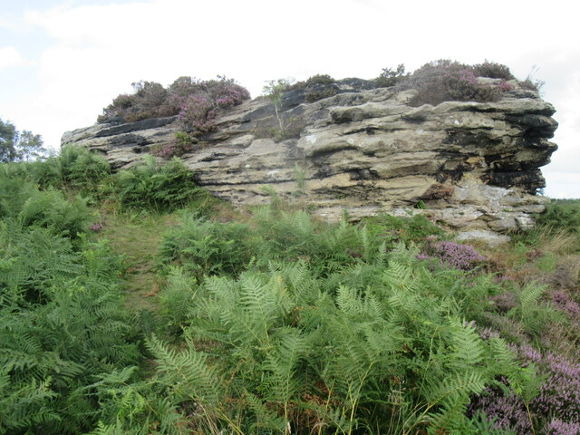
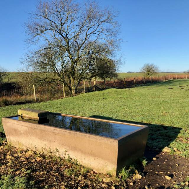
The village of Allerston is mostly agricultural, with a few residential properties scattered throughout. The landscape is characterized by rolling hills, open fields, and small pockets of woodland. The village is surrounded by picturesque countryside, offering stunning views of the Yorkshire Moors.

Allerston has a peaceful and tranquil atmosphere, making it an ideal place for those seeking a quiet rural lifestyle. The village is well-connected, with good road links to nearby towns and cities. It is also served by a local bus service, providing access to the wider region.

In terms of amenities, Allerston has a village hall that hosts various community events and activities throughout the year. There is also a local pub, offering a place for residents and visitors to socialize and enjoy a drink or meal.

The area surrounding Allerston is rich in history and natural beauty. There are several historic sites and landmarks nearby, including the ruins of Allerston Castle, which dates back to the 14th century. The village is also a popular base for outdoor enthusiasts, with numerous walking and cycling trails in the surrounding countryside.

If you have any feedback on the listing, please let us know in the comments section below.

Allerston Images

Images are sourced within 2km of 54.320702/-0.647899 or Grid Reference SE8892. Thanks to Geograph Open Source API. All images are credited.

Near Newgate Farm Looking north from the bank above Newgate Farm.
Near Newgate Farm
Looking north from the bank above Newgate Farm.
Blakey Topping Looking towards Blakey Topping near Newgate Foot Farm.
Blakey Topping
Looking towards Blakey Topping near Newgate Foot Farm.
Blakey Topping view Looking NW from Blakey Topping towards Hazelhead Moor.
Blakey Topping view
Looking NW from Blakey Topping towards Hazelhead Moor.
Blakey Topping view 2 Looking south from Blakey Topping towards Newgate Foot Farm.
Blakey Topping view 2
Looking south from Blakey Topping towards Newgate Foot Farm.
Blakey Topping view 3 Looking NE across Langdale Forest from Blakey Topping.
Blakey Topping view 3
Looking NE across Langdale Forest from Blakey Topping.
Blakey Topping view 4 Looking east from the summit of Blakey Topping across the southern part of Langdale Forest.
Blakey Topping view 4
Looking east from the summit of Blakey Topping across the southern part of Langdale Forest.
Bell Heather Bell Heather on Grime Moor.
Bell Heather
Bell Heather on Grime Moor.
One of the High Bride Stones One of the High Bride Stones on Grime Moor.
One of the High Bride Stones
One of the High Bride Stones on Grime Moor.
'Pepper pot' Zoomed in view of the 'pepper pot'.
'Pepper pot'
Zoomed in view of the 'pepper pot'.
Overgrown pond, Newgate Moor
Trough, Newgate Moor
Bridestones Moor A day spent cutting self sown, mainly birch saplings from the Bridestones heather moorland under a glorious blue sky. A day also for twitchering in which murmuring fieldfare, perhaps getting impatient, itching to leave for the summer, and a skylark, first of the year.

If left the birch would gradually begin to dominate. Bridestones Moor is unique in that since it was left to the National Trust in 1943 it has not been intensively managed. Other moors are either burnt frequently for grouse or too heavily grazed.

It’s important therefore that the condition of the moor is maintained allowing a good diversity of dwarf shrubs to grow, including old heather with collapsing canopy and natural dwarf shrub regeneration in the gaps.

If left birch would takeover the moor. The aim is for a tree cover of no more than 5%.

Somewhere on this moor is buried a time capsule containing up to 100 items from shoe polish to theatre tickets, teabags and, a newspaper.

It was buried by the National Trust in 1995 to mark their centenary. I guess the actual burial site would have been closer to the stones themselves.

Also included in the capsule is a plaque made from a fallen oak tree on the moor which has been inscribed with a list of key events during that first 100 years of the Trust’s existence: the first powered flight, the two world wars, the Kennedy assassination, and England’s 1966 Word Cup victory.

For sources and references see <span class="nowrap"><a title="http://www.fhithich.uk/?p=27350" rel="nofollow ugc noopener" href="http://www.fhithich.uk/?p=27350">Link</a><img style="margin-left:2px;" alt="External link" title="External link - shift click to open in new window" src="https://s1.geograph.org.uk/img/external.png" width="10" height="10"/></span>
Bridestones Moor
A day spent cutting self sown, mainly birch saplings from the Bridestones heather moorland under a glorious blue sky. A day also for twitchering in which murmuring fieldfare, perhaps getting impatient, itching to leave for the summer, and a skylark, first of the year. If left the birch would gradually begin to dominate. Bridestones Moor is unique in that since it was left to the National Trust in 1943 it has not been intensively managed. Other moors are either burnt frequently for grouse or too heavily grazed. It’s important therefore that the condition of the moor is maintained allowing a good diversity of dwarf shrubs to grow, including old heather with collapsing canopy and natural dwarf shrub regeneration in the gaps. If left birch would takeover the moor. The aim is for a tree cover of no more than 5%. Somewhere on this moor is buried a time capsule containing up to 100 items from shoe polish to theatre tickets, teabags and, a newspaper. It was buried by the National Trust in 1995 to mark their centenary. I guess the actual burial site would have been closer to the stones themselves. Also included in the capsule is a plaque made from a fallen oak tree on the moor which has been inscribed with a list of key events during that first 100 years of the Trust’s existence: the first powered flight, the two world wars, the Kennedy assassination, and England’s 1966 Word Cup victory. For sources and references see LinkExternal link
Blakey standing stones The largest of the standing stones near Blakey Topping. Crossbills were seen on the Larch trees nearby.
Blakey standing stones
The largest of the standing stones near Blakey Topping. Crossbills were seen on the Larch trees nearby.
Blakey Topping Looking north towards Blakey Topping near the standing stones.
Blakey Topping
Looking north towards Blakey Topping near the standing stones.
Near Red House Looking SE towards Jerry Noddle.
Near Red House
Looking SE towards Jerry Noddle.
Site of Blakey House farmstead The earthworks hide the foundations of farmstead that was destroyed during military training for World War II (NYM HER No: 8048).
Site of Blakey House farmstead
The earthworks hide the foundations of farmstead that was destroyed during military training for World War II (NYM HER No: 8048).
Yondhead Rigg Grassy forest track on Yondhead Rigg.
Yondhead Rigg
Grassy forest track on Yondhead Rigg.
Fungi on Yondhead Rigg Fungi growing on a tree stump on Yondhead Rigg.
Fungi on Yondhead Rigg
Fungi growing on a tree stump on Yondhead Rigg.
Show me another place!

Allerston is located at Grid Ref: SE8892 (Lat: 54.320702, Lng: -0.647899)

Division: North Riding

Administrative County: North Yorkshire

District: Ryedale

Police Authority: North Yorkshire

What 3 Words

///mixing.shatters.regulator. Near Thornton Dale, North Yorkshire

Nearby Locations

Allerston

Related Wikis

Blakey Topping standing stones

Blakey Topping standing stones is a small group of standing stones near the Hole of Horcum in the North York Moors. It sits at the foot of Blakey Topping...

Langdale Forest

Langdale Forest is an area of primarily coniferous woodland at the southern end of the North York Moors National Park, in North Yorkshire, England. The...

Hole of Horcum

The Hole of Horcum is a section of the valley of the Levisham Beck, upstream of Levisham and Lockton, in the Tabular Hills of the North York Moors National...

Lockton

Lockton is a small village and civil parish in North Yorkshire, England. It is situated in the North York Moors about 4 miles (6.4 km) north-east of Pickering...
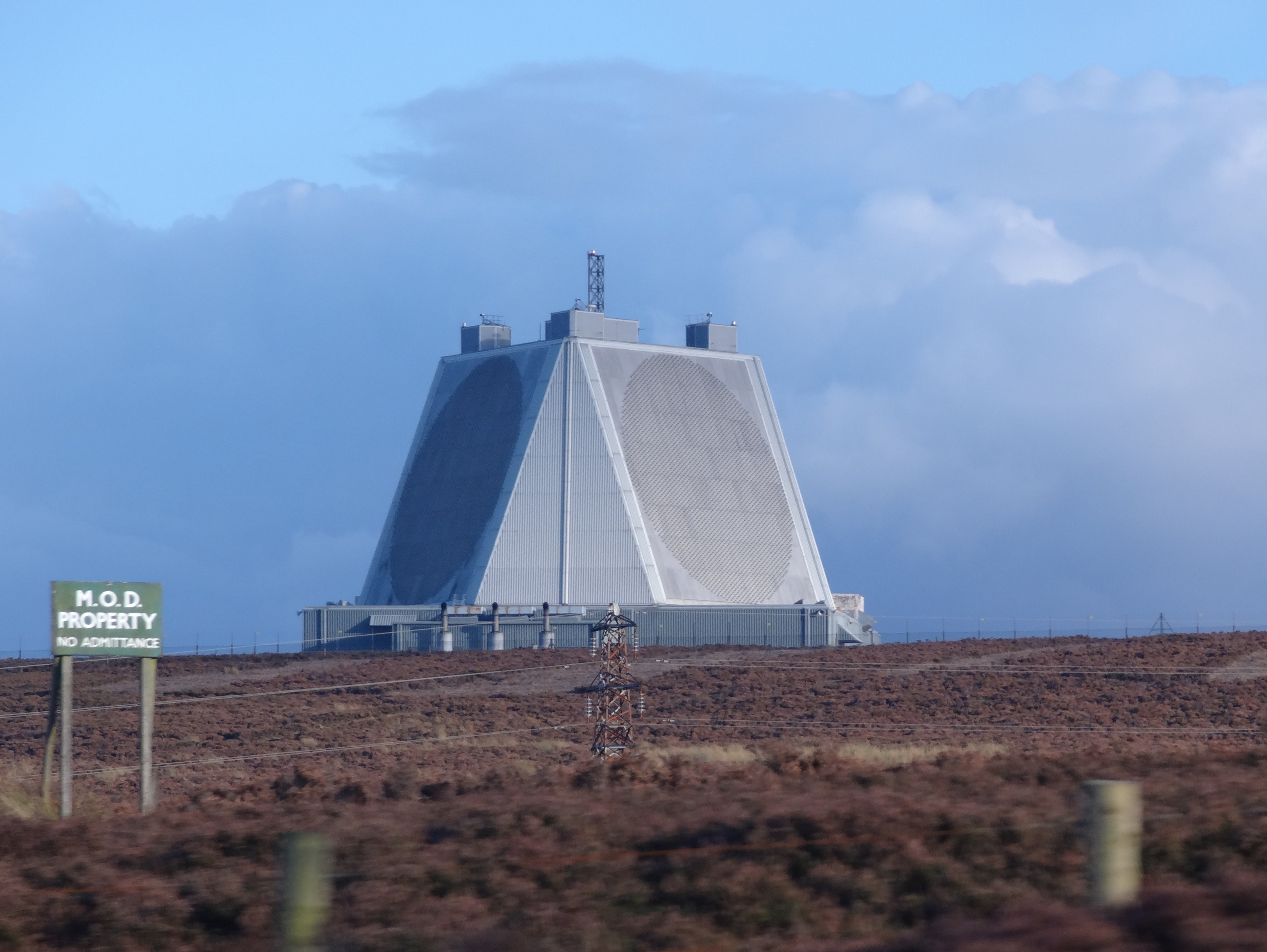
RAF Fylingdales

Royal Air Force Fylingdales or more simply RAF Fylingdales is a Royal Air Force station on Snod Hill in the North York Moors, England. Its motto is "Vigilamus...

Dalby Forest

Dalby Forest is a forest located on the southern slopes of the North York Moors National Park in North Yorkshire, England. It is maintained by Forestry...

Levisham

Levisham is a small village and civil parish in North Yorkshire, England, located within the North York Moors National Park about 5 miles (8 km) north...

Newton Dale Halt railway station

Newton Dale Halt railway station is a request stop on the North Yorkshire Moors Railway and serves as a stopping off point for walkers around Newton Dale...

Nearby Amenities

Located within 500m of 54.320702,-0.647899
Ford: yes
Lat/Long: 54.3183509/-0.6528915
Barrier: stile
Step Count: 1
Stile: stepover
Lat/Long: 54.3175558/-0.650556
The data included in this document is from www.openstreetmap.org. The data is made available under ODbL.

Have you been to Allerston?

Leave your review of Allerston below (or comments, questions and feedback).