Akeld

Civil Parish in Northumberland

England

Akeld

Down  into  the  valley  toward  Akeld  Bridge  on  A697 Sand and gravel pits behind trees on the left
Down into the valley toward Akeld Bridge on A697 Credit: Martin Dawes

Akeld is a civil parish located in the county of Northumberland, England. It is situated in the north of the country, near the Scottish border. The parish covers an area of approximately 15 square kilometers and has a population of around 100 residents.

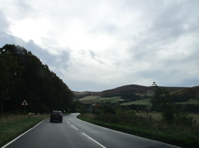
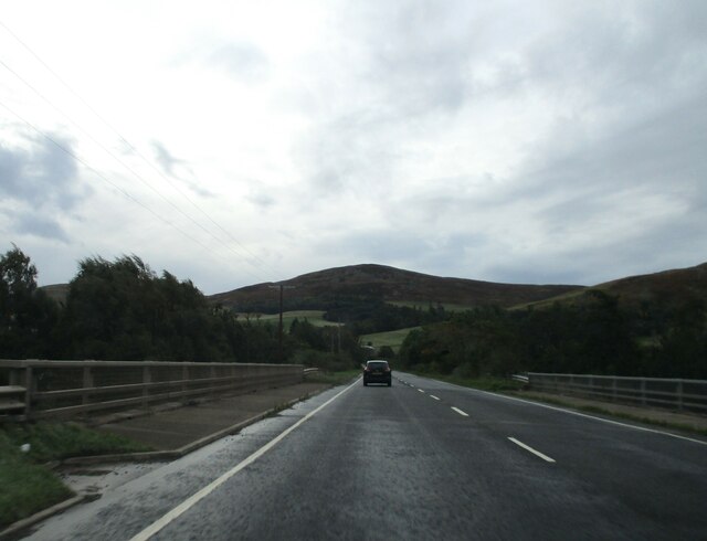
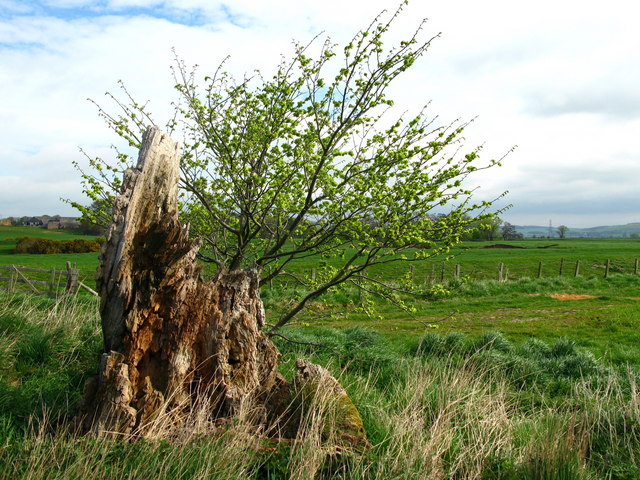
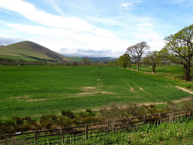
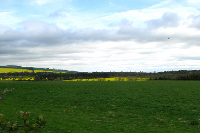
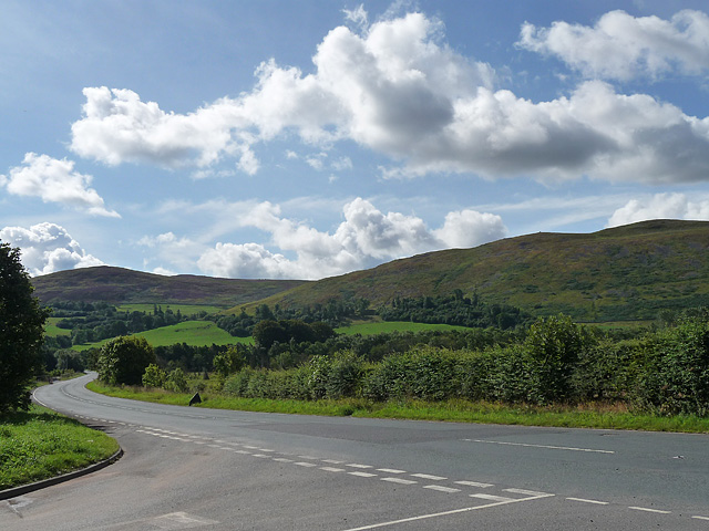
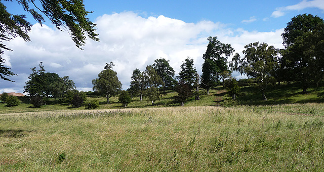
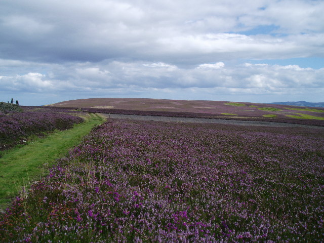
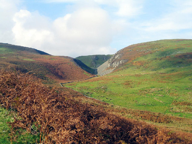
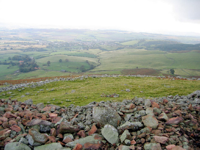
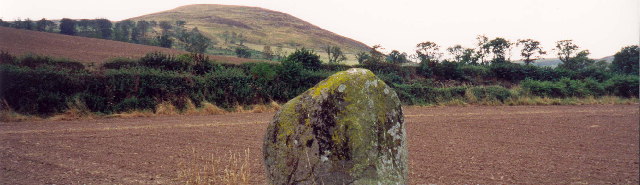
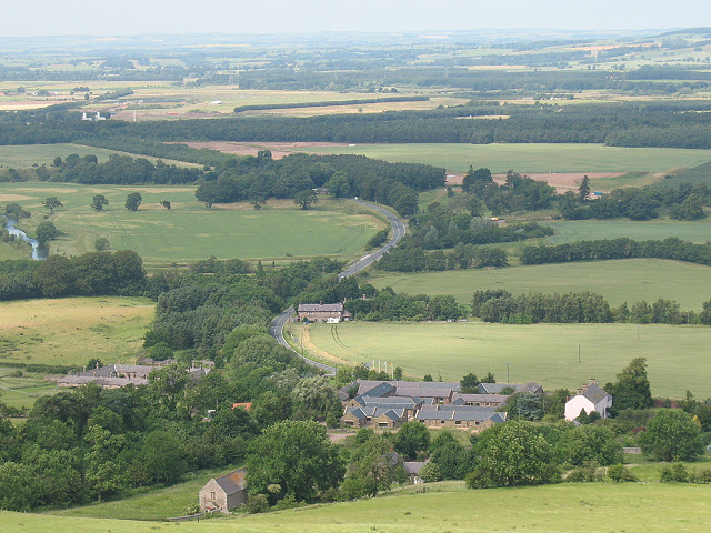
The village of Akeld is the main settlement within the parish. It is a small and rural community, characterized by its picturesque countryside and tranquil atmosphere. The village is surrounded by rolling hills, lush green fields, and beautiful woodlands, making it an ideal location for nature lovers and outdoor enthusiasts.

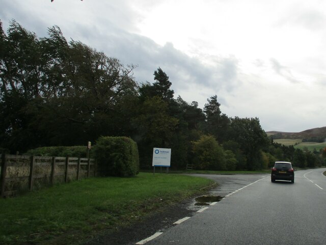
Despite its small size, Akeld offers a range of amenities for its residents. These include a local pub, a village hall, and a primary school. The village is also well-connected to nearby towns and cities, with good road links to the A697 and A6972 roads.

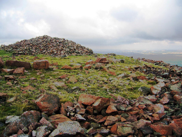
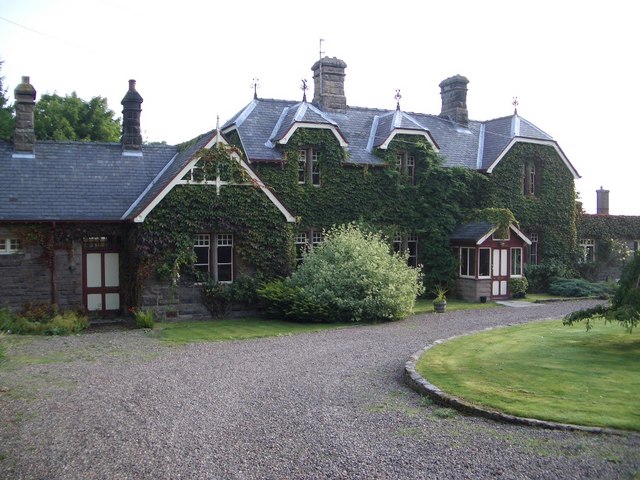
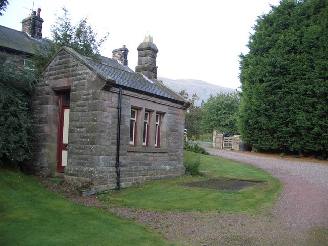
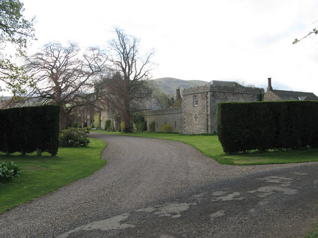
The parish is rich in history, with evidence of settlements dating back to the Neolithic period. There are several historic buildings and landmarks in the area, including the Grade II listed Akeld House and St. Bartholomew's Church, which dates back to the 12th century.

Overall, Akeld is a charming and peaceful parish, offering a rural lifestyle and a strong sense of community. It is an idyllic location for those seeking a quiet retreat in the beautiful Northumberland countryside.

If you have any feedback on the listing, please let us know in the comments section below.

Akeld Images

Images are sourced within 2km of 55.551557/-2.080392 or Grid Reference NT9528. Thanks to Geograph Open Source API. All images are credited.

Down  into  the  valley  toward  Akeld  Bridge  on  A697 Sand and gravel pits behind trees on the left
Down into the valley toward Akeld Bridge on A697
Sand and gravel pits behind trees on the left
Minor  road  junction  to  Cheviot  Quarry  access road Cheviot Quarry, part of Tarmac, is a sand and gravel quarry
Minor road junction to Cheviot Quarry access road
Cheviot Quarry, part of Tarmac, is a sand and gravel quarry
Akeld  Bridge  over  the  River  Glen.  A697  southbound The River Glen runs into the River Till a couple of miles downstream from here
Akeld Bridge over the River Glen. A697 southbound
The River Glen runs into the River Till a couple of miles downstream from here
Tree stump, Akeld Steads Rough grazing near Akeld Steads
Tree stump, Akeld Steads
Rough grazing near Akeld Steads
Akeld Newly planted crop with view to Akeld Hill behind.
Akeld
Newly planted crop with view to Akeld Hill behind.
River Glen Valley at Yeavering A number of rape fields in this Northumbrian river valley.
River Glen Valley at Yeavering
A number of rape fields in this Northumbrian river valley.
Akeld Sheep grazing away in field next to A697 to Wooler.
Akeld
Sheep grazing away in field next to A697 to Wooler.
Main road near Akeld The main road in question is the A697 which heads off south-east to Wooler, and the other way, north-west to Coldstream. The minor road loops back on itself towards Ford.
The hill ahead is Akeld Hill and the further one is Harehope Hill.
Main road near Akeld
The main road in question is the A697 which heads off south-east to Wooler, and the other way, north-west to Coldstream. The minor road loops back on itself towards Ford. The hill ahead is Akeld Hill and the further one is Harehope Hill.
Trees near Akeld A thin but varied band of trees (e.g. silver birch, pines, firs) in a not very obvious position at all. Perhaps originally connected to Ewart Park.
Behind them is a quarry, presumably fairly new as satellite imagery shows only a field.
Trees near Akeld
A thin but varied band of trees (e.g. silver birch, pines, firs) in a not very obvious position at all. Perhaps originally connected to Ewart Park. Behind them is a quarry, presumably fairly new as satellite imagery shows only a field.
Below Black Law,  Wooler Common Heather moorland in full bloom
Below Black Law, Wooler Common
Heather moorland in full bloom
Humbleton Hill hill fort The remains of the massive stone ramparts of the hill fort.
Humbleton Hill hill fort
The remains of the massive stone ramparts of the hill fort.
View of Monday Cleugh and Harehope Hill At the northern edge of Monday Cleugh are the remains of a hanging hill fort positioned on the edge of the ravine.
View of Monday Cleugh and Harehope Hill
At the northern edge of Monday Cleugh are the remains of a hanging hill fort positioned on the edge of the ravine.
Humbleton Hill hill fort Wooler can be seen in the distance over the ramparts of the hill fort.
Humbleton Hill hill fort
Wooler can be seen in the distance over the ramparts of the hill fort.
Bendor stone at the Battle of Homildon Hill The Battle of Homildon Hill was fought in 1402. It was around this stone that many of the Scots were killed.
Bendor stone at the Battle of Homildon Hill
The Battle of Homildon Hill was fought in 1402. It was around this stone that many of the Scots were killed.
Tom Tallon's Crag A small rocky outcrop no more than 5 foot high. Looking north towards Yeavering Bell.
Tom Tallon's Crag
A small rocky outcrop no more than 5 foot high. Looking north towards Yeavering Bell.
The Former Railway Station at Akeld Akeld Station was built by the North Eastern Railway as part of a branch that opened in 1887 and ran from Alnwick via Wooler to Cornhill. Architect William Bell was responsible for all the extravagant stone buildings on the branch, built in the same distinctive style with rough faced sandstone. The line was a failure and the last scheduled passenger train ran in September 1930.
The Former Railway Station at Akeld
Akeld Station was built by the North Eastern Railway as part of a branch that opened in 1887 and ran from Alnwick via Wooler to Cornhill. Architect William Bell was responsible for all the extravagant stone buildings on the branch, built in the same distinctive style with rough faced sandstone. The line was a failure and the last scheduled passenger train ran in September 1930.
Former Railway Freight Warehouse at Akeld Station Freight and agricultural traffic continued along this part of the railway from Cornhill (Coldstream) until 1965. Grain and fertiliser were stored in the warehouse until collected by farmers, and heavy goods were loaded on and off the trains by a one ton crane located by the entrance to the warehouse, now converted. The former edge of the station platform is visible in this view.
Former Railway Freight Warehouse at Akeld Station
Freight and agricultural traffic continued along this part of the railway from Cornhill (Coldstream) until 1965. Grain and fertiliser were stored in the warehouse until collected by farmers, and heavy goods were loaded on and off the trains by a one ton crane located by the entrance to the warehouse, now converted. The former edge of the station platform is visible in this view.
Weighbridge & House at Former Akeld Station Goods arriving at Akeld station were weighed in on the weighbridge by the gate shown in this view. The cast iron weighing platform is visible beside the weighing house. Just before the first world war the station handled about 800 tons of barley and 14 wagons of livestock per year.
Weighbridge & House at Former Akeld Station
Goods arriving at Akeld station were weighed in on the weighbridge by the gate shown in this view. The cast iron weighing platform is visible beside the weighing house. Just before the first world war the station handled about 800 tons of barley and 14 wagons of livestock per year.
Show me another place!

Akeld is located at Grid Ref: NT9528 (Lat: 55.551557, Lng: -2.080392)

Unitary Authority: Northumberland

Police Authority: Northumbria

What 3 Words

///upward.rezoning.caves. Near Kirknewton, Northumberland

Related Wikis

Akeld

Akeld is a village and civil parish in Northumberland, England. It is situated around 2.7 miles (4.3 km) to the west of Wooler and 9.3 miles (15.0 km)...

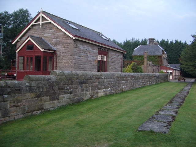
Akeld railway station

Akeld was a stone built railway station serving the hamlet of Akeld in Northumberland, England. It was on the Alnwick to Cornhill Branch which ran from...
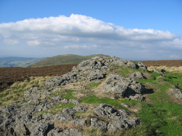
Humbleton Hill

Humbleton Hill is a hill in Northumberland, England, about 1.5 miles (2.4 km) west of Wooler. It is the location of the Battle of Homildon Hill of 1402...

Battle of Homildon Hill

The Battle of Holmedon Hill or Battle of Homildon Hill was a conflict between English and Scottish armies on 14 September 1402 in Northumberland, England...

Yeavering

Yeavering () is a hamlet in the north-east corner of the civil parish of Kirknewton in the English county of Northumberland. It is located on the River...

Yeavering Bell

Yeavering Bell is a twin-peaked hill near the River Glen in north Northumberland, England, to the west of Wooler, and forming part of the Cheviot Hills...

Battle of Yeavering

The Battle of Yeavering (or Battle of Geteryne) was fought in 1415 between English and Scottish forces near Yeavering in Northumberland. A small English...

Coupland Castle

Coupland Castle is situated in the village of Coupland, 4 miles (6 km) to the north-west of Wooler, Northumberland, England. It is a Grade I listed building...

Nearby Amenities

Located within 500m of 55.551557,-2.080392
Gleadsceugh
Place: locality
Lat/Long: 55.5550154/-2.0786211
Barrier: stile
Foot: yes
Lat/Long: 55.5534381/-2.0803567
Information: guidepost
Tourism: information
Lat/Long: 55.5539592/-2.0796794
Information: guidepost
Tourism: information
Lat/Long: 55.5475651/-2.0769813
Information: guidepost
Tourism: information
Lat/Long: 55.5540568/-2.076482
The data included in this document is from www.openstreetmap.org. The data is made available under ODbL.

Have you been to Akeld?

Leave your review of Akeld below (or comments, questions and feedback).