Monday Cleugh

Valley in Northumberland

England

Monday Cleugh

Mostly Ruined Wall The dilapidated wall shown in <a href="https://www.geograph.org.uk/photo/7580858">NT9528 : Ups and downs along the wall</a> continues eastwards over the slope of Gains Law. This is a grouse shooting moor and at intervals, bits of the wall have been rebuilt into platforms for gunmen to hide behind.
Mostly Ruined Wall Credit: Des Blenkinsopp

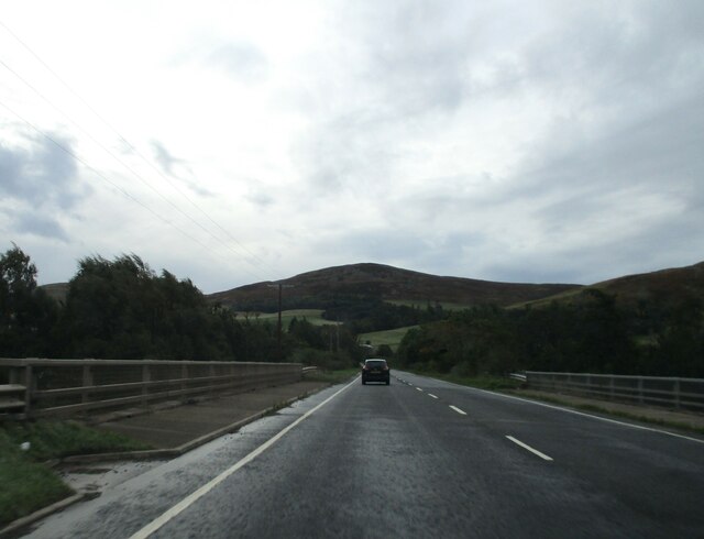
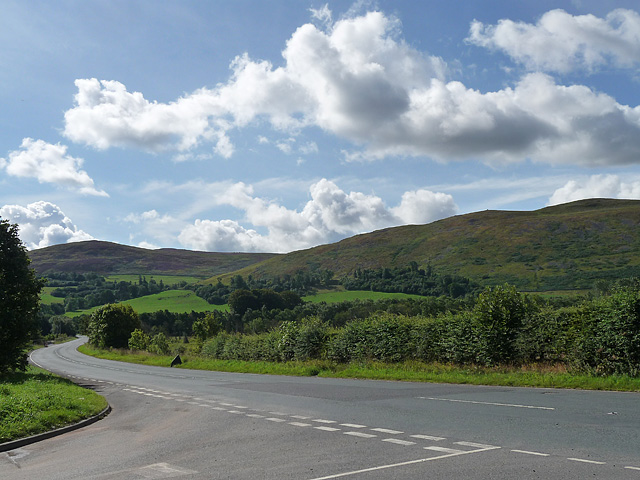
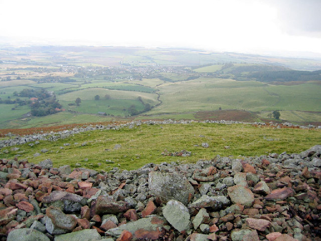
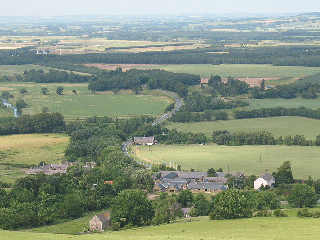
Monday Cleugh is a picturesque valley located in Northumberland, England. Nestled amidst the stunning Northumberland National Park, the valley offers breathtaking natural beauty and a tranquil atmosphere. The name "Cleugh" refers to a narrow ravine or steep-sided valley, which accurately describes the topography of this area.

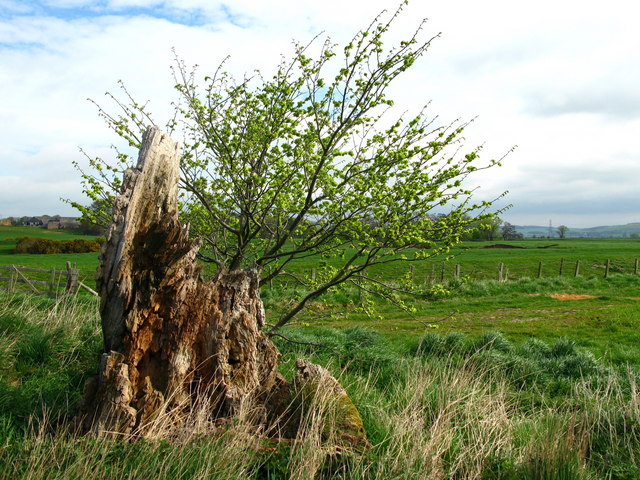
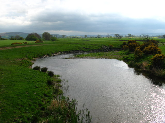
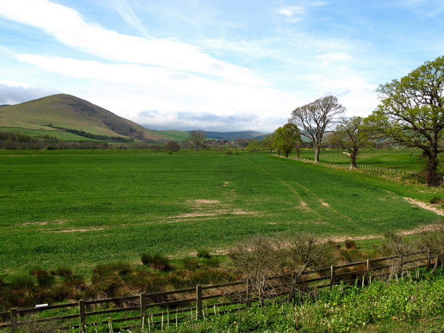
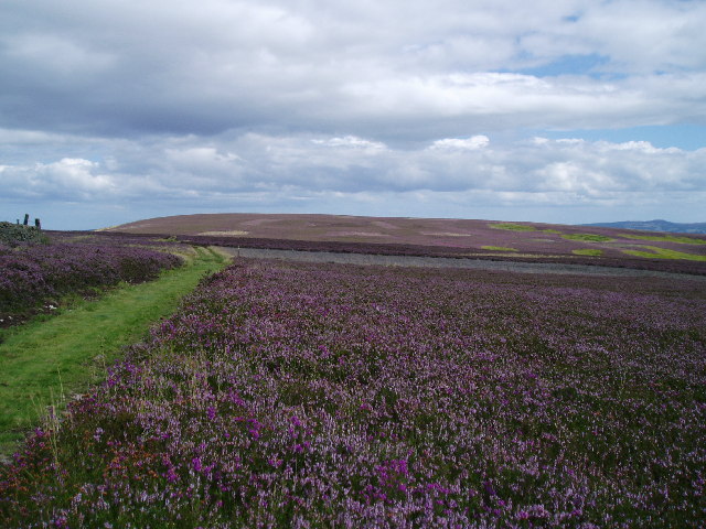
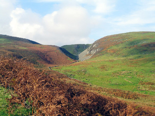
The valley is characterized by rolling hills, lush green meadows, and meandering streams. It is surrounded by dense woodlands, primarily consisting of oak and beech trees, adding to its scenic charm. The rich biodiversity of the region makes it a haven for wildlife enthusiasts and nature lovers.

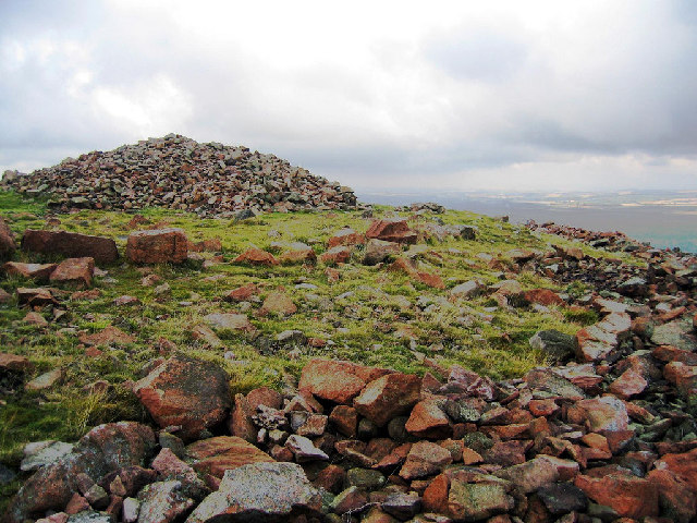
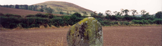
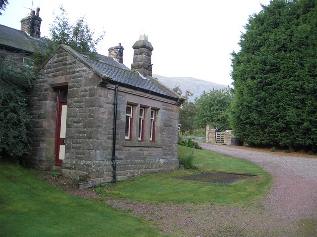
Monday Cleugh is renowned for its well-preserved historical sites and landmarks. The remnants of ancient settlements and Bronze Age burial mounds can be found scattered across the valley, providing insight into the area's rich history. Additionally, the valley is home to several traditional stone-built cottages, showcasing the architectural heritage of the region.

Outdoor activities abound in Monday Cleugh, making it a popular destination for hikers, cyclists, and nature walkers. The valley offers a variety of well-maintained trails, allowing visitors to explore its vast landscapes and enjoy stunning panoramic views.

The valley's tranquility and natural beauty make it an ideal location for those seeking a peaceful retreat or a romantic getaway. With its idyllic setting and historical significance, Monday Cleugh is a hidden gem in Northumberland that offers a delightful experience for visitors of all ages.

If you have any feedback on the listing, please let us know in the comments section below.

Monday Cleugh Images

Images are sourced within 2km of 55.55012/-2.0656863 or Grid Reference NT9528. Thanks to Geograph Open Source API. All images are credited.

Mostly Ruined Wall The dilapidated wall shown in <a href="https://www.geograph.org.uk/photo/7580858">NT9528 : Ups and downs along the wall</a> continues eastwards over the slope of Gains Law. This is a grouse shooting moor and at intervals, bits of the wall have been rebuilt into platforms for gunmen to hide behind.
Mostly Ruined Wall
The dilapidated wall shown in NT9528 : Ups and downs along the wall continues eastwards over the slope of Gains Law. This is a grouse shooting moor and at intervals, bits of the wall have been rebuilt into platforms for gunmen to hide behind.
Akeld  Bridge  over  the  River  Glen.  A697  southbound The River Glen runs into the River Till a couple of miles downstream from here
Akeld Bridge over the River Glen. A697 southbound
The River Glen runs into the River Till a couple of miles downstream from here
Tree stump, Akeld Steads Rough grazing near Akeld Steads
Tree stump, Akeld Steads
Rough grazing near Akeld Steads
River Glen, Akeld Steads
Akeld Newly planted crop with view to Akeld Hill behind.
Akeld
Newly planted crop with view to Akeld Hill behind.
Main road near Akeld The main road in question is the A697 which heads off south-east to Wooler, and the other way, north-west to Coldstream. The minor road loops back on itself towards Ford.
The hill ahead is Akeld Hill and the further one is Harehope Hill.
Main road near Akeld
The main road in question is the A697 which heads off south-east to Wooler, and the other way, north-west to Coldstream. The minor road loops back on itself towards Ford. The hill ahead is Akeld Hill and the further one is Harehope Hill.
Below Black Law,  Wooler Common Heather moorland in full bloom
Below Black Law, Wooler Common
Heather moorland in full bloom
Humbleton Hill hill fort The remains of the massive stone ramparts of the hill fort.
Humbleton Hill hill fort
The remains of the massive stone ramparts of the hill fort.
View of Monday Cleugh and Harehope Hill At the northern edge of Monday Cleugh are the remains of a hanging hill fort positioned on the edge of the ravine.
View of Monday Cleugh and Harehope Hill
At the northern edge of Monday Cleugh are the remains of a hanging hill fort positioned on the edge of the ravine.
Humbleton Hill hill fort Wooler can be seen in the distance over the ramparts of the hill fort.
Humbleton Hill hill fort
Wooler can be seen in the distance over the ramparts of the hill fort.
Bendor stone at the Battle of Homildon Hill The Battle of Homildon Hill was fought in 1402. It was around this stone that many of the Scots were killed.
Bendor stone at the Battle of Homildon Hill
The Battle of Homildon Hill was fought in 1402. It was around this stone that many of the Scots were killed.
The Former Railway Station at Akeld Akeld Station was built by the North Eastern Railway as part of a branch that opened in 1887 and ran from Alnwick via Wooler to Cornhill. Architect William Bell was responsible for all the extravagant stone buildings on the branch, built in the same distinctive style with rough faced sandstone. The line was a failure and the last scheduled passenger train ran in September 1930.
The Former Railway Station at Akeld
Akeld Station was built by the North Eastern Railway as part of a branch that opened in 1887 and ran from Alnwick via Wooler to Cornhill. Architect William Bell was responsible for all the extravagant stone buildings on the branch, built in the same distinctive style with rough faced sandstone. The line was a failure and the last scheduled passenger train ran in September 1930.
Former Railway Freight Warehouse at Akeld Station Freight and agricultural traffic continued along this part of the railway from Cornhill (Coldstream) until 1965. Grain and fertiliser were stored in the warehouse until collected by farmers, and heavy goods were loaded on and off the trains by a one ton crane located by the entrance to the warehouse, now converted. The former edge of the station platform is visible in this view.
Former Railway Freight Warehouse at Akeld Station
Freight and agricultural traffic continued along this part of the railway from Cornhill (Coldstream) until 1965. Grain and fertiliser were stored in the warehouse until collected by farmers, and heavy goods were loaded on and off the trains by a one ton crane located by the entrance to the warehouse, now converted. The former edge of the station platform is visible in this view.
Weighbridge & House at Former Akeld Station Goods arriving at Akeld station were weighed in on the weighbridge by the gate shown in this view. The cast iron weighing platform is visible beside the weighing house. Just before the first world war the station handled about 800 tons of barley and 14 wagons of livestock per year.
Weighbridge & House at Former Akeld Station
Goods arriving at Akeld station were weighed in on the weighbridge by the gate shown in this view. The cast iron weighing platform is visible beside the weighing house. Just before the first world war the station handled about 800 tons of barley and 14 wagons of livestock per year.
Guard's Van & Buffers at Former Akeld Station The Guard's Van was delivered in more recent times from Bescot Yard, Birmingham and now serves as an unusual sunhouse for the refurbished station, now a holiday home.
Guard's Van & Buffers at Former Akeld Station
The Guard's Van was delivered in more recent times from Bescot Yard, Birmingham and now serves as an unusual sunhouse for the refurbished station, now a holiday home.
Former Railway Station at Akeld The former station at Akeld was restored by its new owners from 1988 onwards, including the building of a 'Veranda' waiting room similar to one that originally ran the length of the station platform. The station house is now let to holidaymakers.
Former Railway Station at Akeld
The former station at Akeld was restored by its new owners from 1988 onwards, including the building of a 'Veranda' waiting room similar to one that originally ran the length of the station platform. The station house is now let to holidaymakers.
Lamp at Former Akeld Railway Station This authentic looking lamp is to be found lighting the former platform area at the rear of the former Akeld station house.
Lamp at Former Akeld Railway Station
This authentic looking lamp is to be found lighting the former platform area at the rear of the former Akeld station house.
Track to Humbleton The tree might be dead but it had something about it!
Track to Humbleton
The tree might be dead but it had something about it!
Show me another place!

Monday Cleugh is located at Grid Ref: NT9528 (Lat: 55.55012, Lng: -2.0656863)

Unitary Authority: Northumberland

Police Authority: Northumbria

What 3 Words

///suffice.awake.nudge. Near Wooler, Northumberland

Related Wikis

Humbleton Hill

Humbleton Hill is a hill in Northumberland, England, about 1.5 miles (2.4 km) west of Wooler. It is the location of the Battle of Homildon Hill of 1402...

Akeld

Akeld is a village and civil parish in Northumberland, England. It is situated around 2.7 miles (4.3 km) to the west of Wooler and 9.3 miles (15.0 km)...

Battle of Homildon Hill

The Battle of Holmedon Hill or Battle of Homildon Hill was a conflict between English and Scottish armies on 14 September 1402 in Northumberland, England...

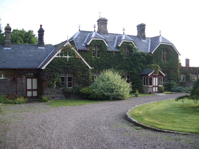
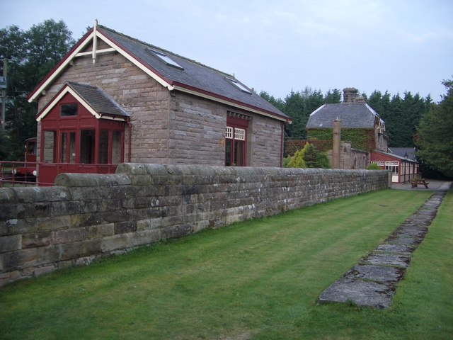
Akeld railway station

Akeld was a stone built railway station serving the hamlet of Akeld in Northumberland, England. It was on the Alnwick to Cornhill Branch which ran from...

Cheviot Fringe

Cheviot Fringe ( CHEE-vee-ət) is a geographical region and a Natural England designated National Character Area (or NCA) located in the county Northumberland...

Yeavering

Yeavering () is a hamlet in the north-east corner of the civil parish of Kirknewton in the English county of Northumberland. It is located on the River...

St Ninian's Catholic Church, Wooler

St Ninian’s church is a Catholic place of worship situated on Burnhouse Road in the town of Wooler in Northumberland, England. It is a Grade II listed...

Wooler

Wooler ( WUUL-ə) is a town in Northumberland, England. It lies on the edge of the Northumberland National Park, near the Cheviot Hills. It is a popular...

Nearby Amenities

Located within 500m of 55.55012,-2.0656863
Gains Law
Ele: 319
Natural: peak
Lat/Long: 55.5471566/-2.0714648
Monday Cleugh Hillfort
Historic: ruins
Tourism: attraction
Lat/Long: 55.5505622/-2.0694925
Harehope Hill
Ele: 283
Natural: peak
Lat/Long: 55.5517158/-2.0686057
Monday Cleugh
Place: locality
Lat/Long: 55.5498632/-2.0679576
The data included in this document is from www.openstreetmap.org. The data is made available under ODbL.

Have you been to Monday Cleugh?

Leave your review of Monday Cleugh below (or comments, questions and feedback).