Aislaby

Civil Parish in Yorkshire Scarborough

England

Aislaby

The path by Manor Farm Cottages A glorious day with a wonderful view over the valley from our holiday cottage.
The path by Manor Farm Cottages Credit: Malcolm Neal

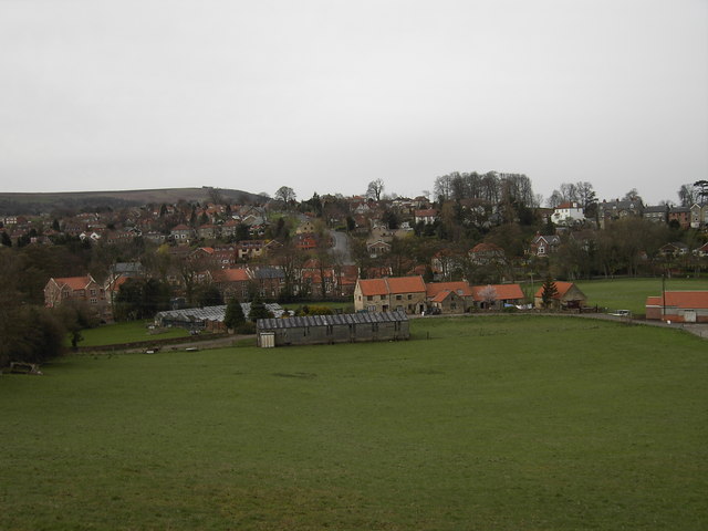
Aislaby is a civil parish located in the picturesque county of Yorkshire, England. Nestled in the North York Moors National Park, this charming village offers residents and visitors alike a peaceful and idyllic setting.

The parish covers an area of approximately 6 square miles and is home to a small population of around 250 people. Aislaby is situated just 3 miles south of the market town of Whitby, making it conveniently located for amenities and services.

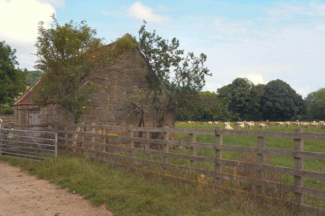
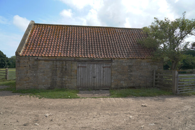
The village itself is characterized by its quaint and traditional architecture, with many buildings dating back several centuries. The centerpiece of the village is the Church of St. Margaret, a beautiful medieval church that has stood as a place of worship since the 12th century.

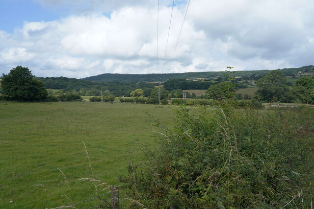
Surrounded by rolling hills and verdant countryside, Aislaby is a haven for nature lovers and outdoor enthusiasts. The area offers numerous walking trails and cycling routes, allowing visitors to explore the stunning landscapes of the North York Moors.

Despite its small size, Aislaby has a strong sense of community, with local events and activities bringing residents together. The village also benefits from a friendly pub and a village hall, which hosts a range of social gatherings throughout the year.

In summary, Aislaby is a delightful civil parish in Yorkshire, offering a tranquil and picturesque setting, rich history, and a close-knit community. It is a perfect destination for those seeking a peaceful escape in the heart of the beautiful North York Moors.

If you have any feedback on the listing, please let us know in the comments section below.

Aislaby Images

Images are sourced within 2km of 54.462769/-0.68142 or Grid Reference NZ8508. Thanks to Geograph Open Source API. All images are credited.

The path by Manor Farm Cottages A glorious day with a wonderful view over the valley from our holiday cottage.
The path by Manor Farm Cottages
A glorious day with a wonderful view over the valley from our holiday cottage.
Manor Farm Cottages This is not a single cottage but is actually three interconnected, but could be separate, cottages. We have all three for our family stay, which is good in these Covid-19 times.
Manor Farm Cottages
This is not a single cottage but is actually three interconnected, but could be separate, cottages. We have all three for our family stay, which is good in these Covid-19 times.
The games field The stone former gate pillars make for unusual but very sturdy goal posts.
The games field
The stone former gate pillars make for unusual but very sturdy goal posts.
The edge of the football field The only concession to football is the field has been closely mown but it is fine for children to play in.
The edge of the football field
The only concession to football is the field has been closely mown but it is fine for children to play in.
Coach Road Travelling along the western side of Sleights on the A169 as we drive towrds Whitby.
Coach Road
Travelling along the western side of Sleights on the A169 as we drive towrds Whitby.
The A169 We are over the bridge that vrosses the river and, to the south, the railway line.
The A169
We are over the bridge that vrosses the river and, to the south, the railway line.
The A169 The road the A169 is somewhat variable in the density of traffic, sometimes quite empty at others quite crowded.
The A169
The road the A169 is somewhat variable in the density of traffic, sometimes quite empty at others quite crowded.
An empty A169 The heat of the previous week has dried out the grass verges, which are looking quite pale.
An empty A169
The heat of the previous week has dried out the grass verges, which are looking quite pale.
A footpath to the railway line The rail line runs deep in the Esk valley and the trains can be heard but hardly seen from the footpath.
A footpath to the railway line
The rail line runs deep in the Esk valley and the trains can be heard but hardly seen from the footpath.
Our cottage view This is the view from the small terrace by our holiday cottage for the week.
Our cottage view
This is the view from the small terrace by our holiday cottage for the week.
A footpath with a concrete surface The footpath eventually leads to a railway line in the Esk valley.
A footpath with a concrete surface
The footpath eventually leads to a railway line in the Esk valley.
A new pipe has been put in the ground Not sure if this is a new pipe line running across the field but I cannot think of another reason for a covered trench across a field.
A new pipe has been put in the ground
Not sure if this is a new pipe line running across the field but I cannot think of another reason for a covered trench across a field.
A few sheep in the meadow Yesterday the sheep were in a field further up the hill.
A few sheep in the meadow
Yesterday the sheep were in a field further up the hill.
An empty field Looking over the hedge across an empty field used for grazing animals.
An empty field
Looking over the hedge across an empty field used for grazing animals.
A barn in a field There are many sheep in the field behind the barn and other fields are empty of stock.
A barn in a field
There are many sheep in the field behind the barn and other fields are empty of stock.
Looks like a new roof Compared to many barns this one looks well looked after with a fairly new roof and sturdy doors.
Looks like a new roof
Compared to many barns this one looks well looked after with a fairly new roof and sturdy doors.
The remains of St. John's chapel This is all that remains of the old sandstone chapel in Esk Dale.
The remains of St. John's chapel
This is all that remains of the old sandstone chapel in Esk Dale.
Near Iburngate The hill looks less steep than it was.
Near Iburngate
The hill looks less steep than it was.
Show me another place!

Aislaby is located at Grid Ref: NZ8508 (Lat: 54.462769, Lng: -0.68142)

Division: North Riding

Administrative County: North Yorkshire

District: Scarborough

Police Authority: North Yorkshire

What 3 Words

///obligated.civic.foggy. Near Sleights, North Yorkshire

Nearby Locations

Aislaby Aislaby

Related Wikis

Aislaby, Scarborough

Aislaby ( AYZ-əl-bi) is a village and civil parish in the Scarborough district of North Yorkshire, England. It is situated near the town of Whitby on the...

Aislaby Quarry

Aislaby Quarry is a sandstone quarry in the village of Aislaby, near to Whitby in North Yorkshire, England. The quarry produces sandstone which has been...

Briggswath

Briggswath is a village in the Scarborough district of North Yorkshire, England. the settlement is on the north bank of the River Esk, upstream of Ruswarp...

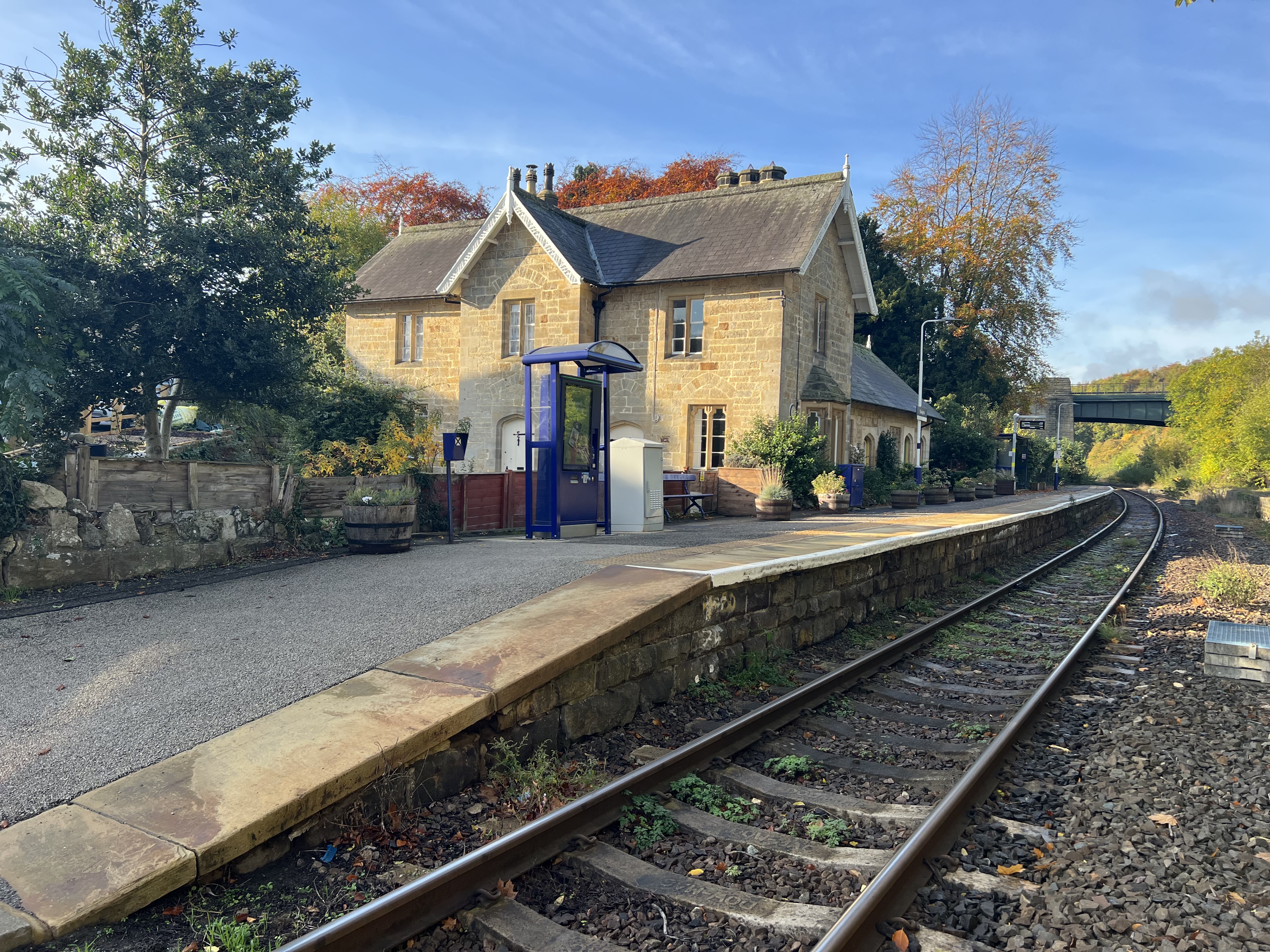
Sleights railway station

Sleights is a railway station on the Esk Valley Line, which runs between Middlesbrough and Whitby via Nunthorpe. The station, situated 2 miles 78 chains...

Sleights

Sleights is a village in North Yorkshire, England. Located in the Esk Valley in the postal region of Whitby, the village is part of the civil parish of...

Newholm-cum-Dunsley

Newholm-cum-Dunsley is a civil parish in the Scarborough district of North Yorkshire, England. According to the 2011 UK census, Newholm-cum-Dunsley parish...

Hutton Mulgrave

Hutton Mulgrave is a village and civil parish in the Scarborough district of North Yorkshire, England. According to the 2001 UK census, Hutton Mulgrave...

Ruswarp

Ruswarp village lies within the Scarborough borough of North Yorkshire, England. It is around 1.8 miles (2.9 km) from Whitby, at the junction of the B1410...

Related Videos

주영투어 영국 외곽 도시 걷기[JuyoungTour Walking through rural town in UK]

노스 요크 무어스 국립공원안에 있는 이 마을은 많은 영국인들이 트레킹이나 휴식여행을 하러 오는 곳 이라고 합니다. 몇몇의 동네 ...

주영투어 영국 개울 산책코스 [JuyoungTour small stream walking course in UK]

집에만 있기 지루해서 사람들 없는 산책로로 산책을 다녀왔습니다. (We went for a walk on the footpath where nobody goes because ...

Hutton Mulgrave Woods & Mulgrave Woods, North York Moors - 8 January 2023

A 6.85 mile walk from the A171, the route first heads north into Hutton Mulgrave Woods before exiting the woods and then ...

Camp Night / Mulgrave Castle

just a short clip put together from a brilliant night with the lads enjoying a night's camp at mulgrave castle drinks and lots of ...

Nearby Amenities

Located within 500m of 54.462769,-0.68142
Fixme: Where does the public bridleway go from here?
Lat/Long: 54.4599526/-0.6847276
Power: pole
Source: Bing
Lat/Long: 54.4669596/-0.6806298
Post Box
Collection Times: Mo-Fr 09:00; Sa 07:00
Operator: Royal Mail
Post Box Type: wall
Ref: YO21 42D
Royal Cypher: GR
Royal Cypher Wikidata: Q33102273
Lat/Long: 54.4657669/-0.677638
Bus Stop
Bench: yes
Bus: yes
Naptan AtcoCode: 3200YNA90719
Naptan NaptanCode: 32090719
Public Transport: platform
Shelter: yes
Lat/Long: 54.4658575/-0.6780033
Toilets
Female: yes
Male: yes
Lat/Long: 54.4659035/-0.6780141
Historic: memorial
Lat/Long: 54.4658021/-0.6791057
Coachman's Cottage
Place: isolated_dwelling
Lat/Long: 54.4604141/-0.6844023
Home Farm
Place: farm
Lat/Long: 54.4606268/-0.6821153
Community Centre
St Oswalds Pastoral Centre
Addr Postcode: YO21 1RY
Addr Street: Woodlands Drive
Lat/Long: 54.4609803/-0.6756374
Bus Stop
Bus: yes
Naptan AtcoCode: 3200YNB00735
Naptan NaptanCode: 32000735
Public Transport: platform
Lat/Long: 54.4657751/-0.6776856
Hiking: yes
Information: guidepost
Tourism: information
Lat/Long: 54.4657681/-0.6777218
Hiking: yes
Information: guidepost
Tourism: information
Lat/Long: 54.4627656/-0.6771545
Bench
Lat/Long: 54.4628451/-0.6771746
Bench
Lat/Long: 54.4646644/-0.678045
The data included in this document is from www.openstreetmap.org. The data is made available under ODbL.

Have you been to Aislaby?

Leave your review of Aislaby below (or comments, questions and feedback).