Above Derwent

Civil Parish in Cumberland Allerdale

England

Above Derwent

Grazing land in Newlands Valley Rough ground in Newlands Valley. Keskadale Beck flows along the bottom of the valley in front of woodland in the distance.
Grazing land in Newlands Valley Credit: Graham Robson

Above Derwent is a civil parish located in the county of Cumberland, in the northwest region of England. It covers an area of approximately 50 square kilometers and is situated in the picturesque Lake District National Park. The parish is named after the river Derwent, which flows through the area.

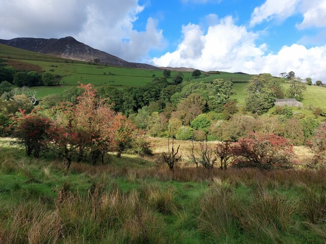
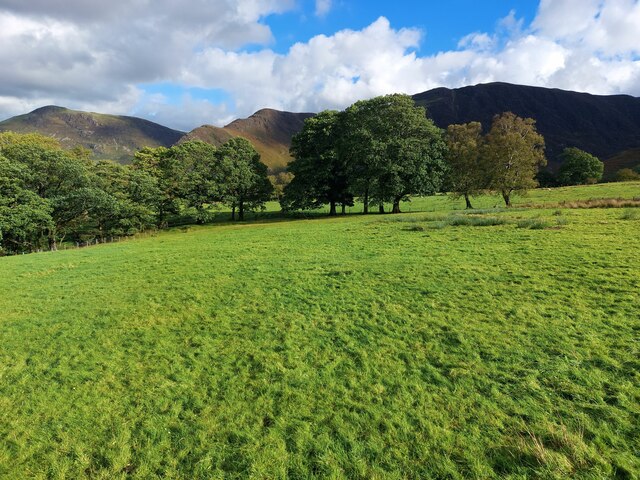
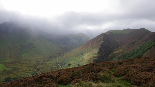
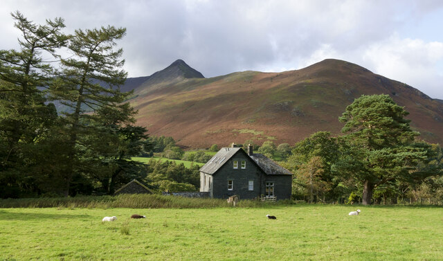
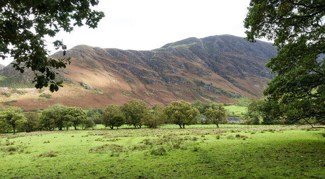
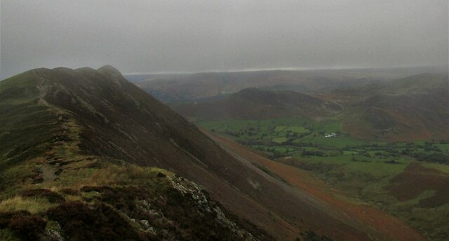
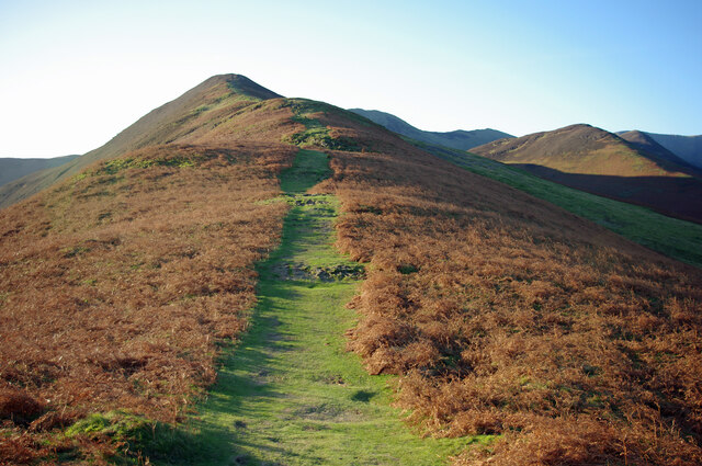
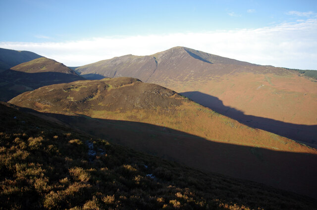
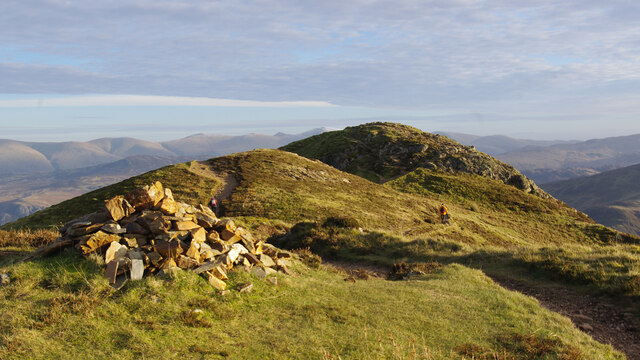
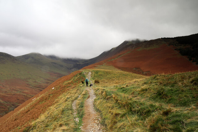
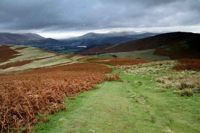
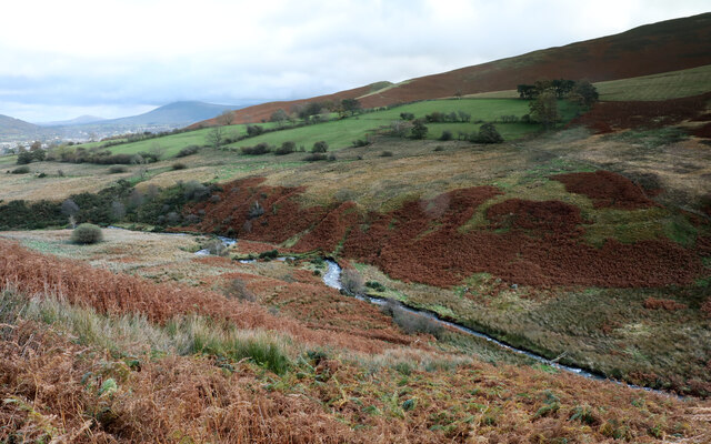
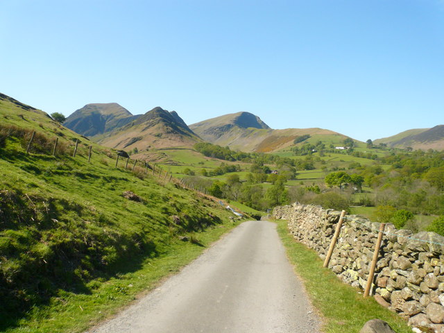
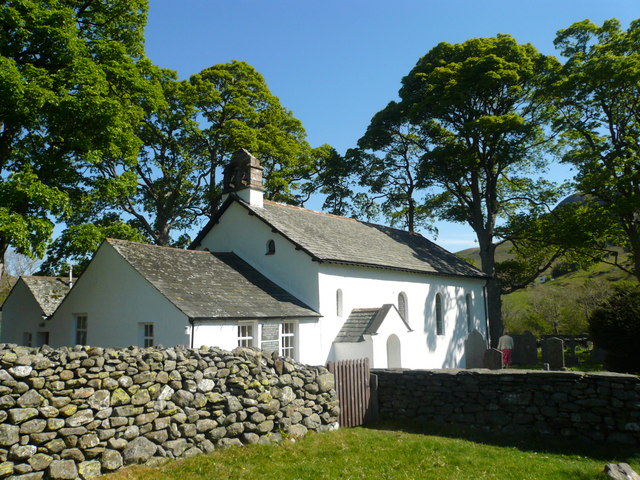
Above Derwent is surrounded by stunning natural landscapes, including mountains, hills, and lakes, making it a popular destination for outdoor enthusiasts and nature lovers. The parish includes several villages and hamlets, including Braithwaite, Portinscale, and Thornthwaite.

The economy of Above Derwent is primarily based on tourism, with many visitors attracted to the area for its natural beauty and outdoor recreational activities. Popular attractions within the parish include Derwentwater, a large lake known for its scenic views and water sports opportunities, as well as several hiking trails and cycling routes.

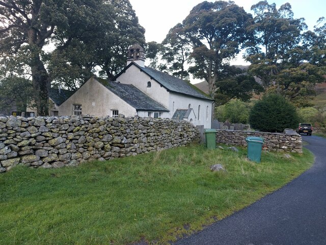
In addition to tourism, the area also has a small agricultural sector, with farming being practiced in some parts of the parish. The community is closely-knit, with a strong sense of community spirit and a range of local events and activities throughout the year.

Above Derwent has good transport links, with the A66 road passing through the parish, providing easy access to nearby towns and cities. The nearest major town is Keswick, located approximately 3 miles to the northeast. Keswick offers a range of amenities, including shops, restaurants, and leisure facilities. Overall, Above Derwent offers a peaceful and scenic place to live or visit, with a thriving tourism industry and a strong connection to the natural environment.

If you have any feedback on the listing, please let us know in the comments section below.

Above Derwent Images

Images are sourced within 2km of 54.580137/-3.202557 or Grid Reference NY2221. Thanks to Geograph Open Source API. All images are credited.
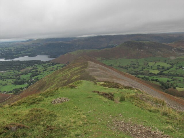
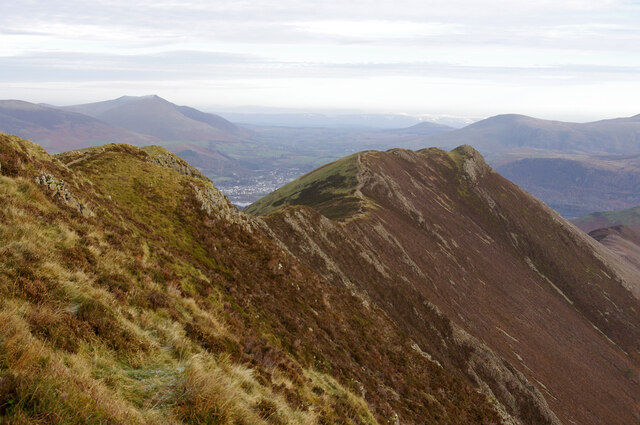
Grazing land in Newlands Valley Rough ground in Newlands Valley. Keskadale Beck flows along the bottom of the valley in front of woodland in the distance.
Grazing land in Newlands Valley
Rough ground in Newlands Valley. Keskadale Beck flows along the bottom of the valley in front of woodland in the distance.
Pasture near High Snab Grass fields used for the grazing of sheep to the north of the farm at High Snab.
Pasture near High Snab
Grass fields used for the grazing of sheep to the north of the farm at High Snab.
Newlands Church The small church with attached former schoolroom in an isolated setting in the Newlands Valley.
Newlands Church
The small church with attached former schoolroom in an isolated setting in the Newlands Valley.
On Aikin Knott Hindscarth and Robinson are in cloud on the left, with Keskadale below. Knott Rigg is on the right.
On Aikin Knott
Hindscarth and Robinson are in cloud on the left, with Keskadale below. Knott Rigg is on the right.
Yewthwaite The house known as Yewthwaite which is close to Little Town in the Newlands valley.
Causey Pike is beyond with the feature known as Rowling End above the trees to the right.
Yewthwaite
The house known as Yewthwaite which is close to Little Town in the Newlands valley. Causey Pike is beyond with the feature known as Rowling End above the trees to the right.
Rough grazing with line of trees A view across farmland from the access road for the farms, High Snab and Low High Snab.
Maiden Moor is the hill in the distance.
Rough grazing with line of trees
A view across farmland from the access road for the farms, High Snab and Low High Snab. Maiden Moor is the hill in the distance.
Causey Pike from the Scar Crags ridge A dull miserable day along the ridge.
Causey Pike from the Scar Crags ridge
A dull miserable day along the ridge.
Sleet Hause ridge to Rowling End On Causey Pike.
Sleet Hause ridge to Rowling End
On Causey Pike.
Path up Barrow The path climbs the northern spur. The ridge continues to Stile End and Outerside (catching the sun on the right).
Path up Barrow
The path climbs the northern spur. The ridge continues to Stile End and Outerside (catching the sun on the right).
Stile End from Barrow Stile End is in the centre of the photo, with Outerside beyond (catching the sun on the left). Grisedale Pike is in the background.
Stile End from Barrow
Stile End is in the centre of the photo, with Outerside beyond (catching the sun on the left). Grisedale Pike is in the background.
Causey Pike from the west Viewed from above Scar Crags. Part of Keswick is visible beyond the dip in the ridge. Blencathra is prominent in the left background.
Causey Pike from the west
Viewed from above Scar Crags. Part of Keswick is visible beyond the dip in the ridge. Blencathra is prominent in the left background.
On Causey Pike Looking east to the highest point.
On Causey Pike
Looking east to the highest point.
East from Causey Pike Sleet Hause and Rowling End are in the foreground. In the mid-distance are Derwent Water and Keswick (left), and Cat Bells (centre right). The Helvellyn range forms most of the skyline. 
[Image formed from 2 photos merged together.]
East from Causey Pike
Sleet Hause and Rowling End are in the foreground. In the mid-distance are Derwent Water and Keswick (left), and Cat Bells (centre right). The Helvellyn range forms most of the skyline. [Image formed from 2 photos merged together.]
Ascending Kinn towards Grisedale Pike After a steep pull from the road, the path to Grisedale Pike ascends more gently for a while up Kinn, as the morning sun disappears behind increasing amounts of cloud formed by a stiff northwesterly breeze. This is hardly unexpected in the Lakes in November, but an hour earlier the tops had been clear above a thermal inversion causing fog in the valley and we'd hoped for better views at least early in the walk. The forecast predicted an hour with rain in the middle of the day, so we counted ourselves fortunate that that didn't materialise.
Ascending Kinn towards Grisedale Pike
After a steep pull from the road, the path to Grisedale Pike ascends more gently for a while up Kinn, as the morning sun disappears behind increasing amounts of cloud formed by a stiff northwesterly breeze. This is hardly unexpected in the Lakes in November, but an hour earlier the tops had been clear above a thermal inversion causing fog in the valley and we'd hoped for better views at least early in the walk. The forecast predicted an hour with rain in the middle of the day, so we counted ourselves fortunate that that didn't materialise.
Looking back down Kinn Kinn forms the normal route of ascent of Grisedale Pike from the northeast near Braithwaite and steepens into Sleet How at about the point where this photograph was taken. There's about 400m of ascent to go, the majority of it now steep, so photography is always a good excuse to avoid starting the day's hard work...
Looking back down Kinn
Kinn forms the normal route of ascent of Grisedale Pike from the northeast near Braithwaite and steepens into Sleet How at about the point where this photograph was taken. There's about 400m of ascent to go, the majority of it now steep, so photography is always a good excuse to avoid starting the day's hard work...
Meanders in Coledale Beck Whilst it looks pleasant enough, pollution from the Force Crag mines further up the valley is a significant issue in the beck and whilst there is some rediation in the form of settlement ponds, no effort seems to be being made to entirely remove the ugly workings and tackle the cause of the pollution at source, let alone at the original mine owners' expense as would be proper.
Meanders in Coledale Beck
Whilst it looks pleasant enough, pollution from the Force Crag mines further up the valley is a significant issue in the beck and whilst there is some rediation in the form of settlement ponds, no effort seems to be being made to entirely remove the ugly workings and tackle the cause of the pollution at source, let alone at the original mine owners' expense as would be proper.
The Lane Leaving Little Town Hindscarth and Robinson can be seen in the distance.
The Lane Leaving Little Town
Hindscarth and Robinson can be seen in the distance.
Newlands Church
Newlands Church
Show me another place!

Above Derwent is located at Grid Ref: NY2221 (Lat: 54.580137, Lng: -3.202557)

Administrative County: Cumbria

District: Allerdale

Police Authority: Cumbria

What 3 Words

///mondays.lizard.discussed. Near Keswick, Cumbria

Related Wikis

Above Derwent

Above Derwent is a civil parish in Cumbria, England, to the west of Derwentwater and Keswick. It lies entirely within the Lake District National Park.At...

Rowling End

Rowling end is a peak in the Lake District about 433 meters it is a steep slope leading up towards Causey Pike. It is briefly mentioned in books however...

Causey Pike

Causey Pike is a fell in the English Lake District. It is situated in the Newlands Valley, 5 kilometres (3 miles) south-west of the town of Keswick. Even...

Barrow (Lake District)

Barrow is small fell in the English Lake District in the county of Cumbria which reaches a height of 455 metres (1,494 feet). It is in the Newlands Valley...

Outerside

Outerside is a fell in the Lake District in Cumbria, England. It is located 6 kilometres (4 miles) west of Keswick in the north western part of the national...

Stair, Cumbria

Stair is a village in Cumbria, England. It is situated in the Newlands Valley, to the west of Derwent Water and within the Lake District National Park...

Newlands Valley

The Newlands Valley is in the Lake District National Park in Cumbria, England. It is regarded as one of the most picturesque and quiet valleys in the national...

Rigg Beck

Rigg Beck is a minor river of Cumbria in England. Rigg Beck is also the name of a famous dwelling – the Purple House – placed where the Beck crosses the...

Nearby Amenities

Located within 500m of 54.580137,-3.202557
Ford: stepping_stones
Source: GPS Survey
Lat/Long: 54.579999/-3.1965733
Stoneycroft Lead Mine
Abandoned: yes
Historic: mine
Man Made: mine
Mineral: lead
Lat/Long: 54.580108/-3.195836
Sleet Hause
Place: locality
Lat/Long: 54.5757886/-3.203106
Ford: yes
Lat/Long: 54.5804539/-3.196478
Ford: yes
Lat/Long: 54.5804675/-3.1964225
The data included in this document is from www.openstreetmap.org. The data is made available under ODbL.

Have you been to Above Derwent?

Leave your review of Above Derwent below (or comments, questions and feedback).