Stile End

Hill, Mountain in Cumberland Allerdale

England

Stile End

Causey Pike from the Scar Crags ridge A dull miserable day along the ridge.
Causey Pike from the Scar Crags ridge Credit: steven ruffles

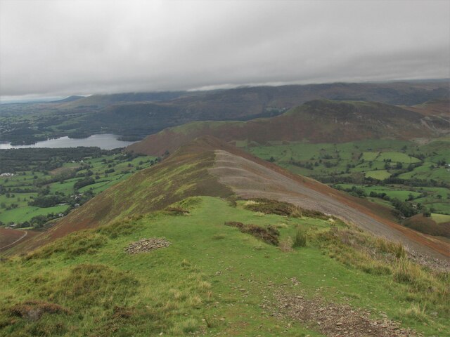
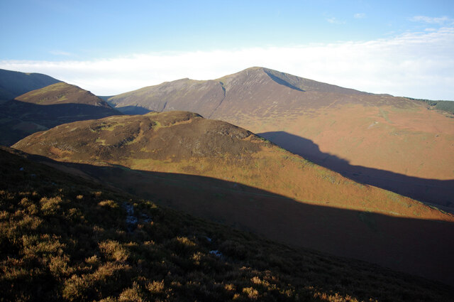
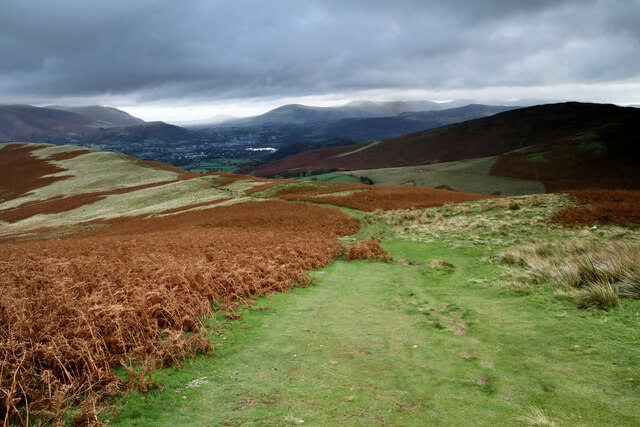
Stile End is a prominent hill located in Cumberland, England. Situated within the Lake District National Park, it is part of the larger Blencathra mountain range. Standing at an elevation of approximately 750 meters (2,461 feet), Stile End offers breathtaking panoramic views of the surrounding countryside.

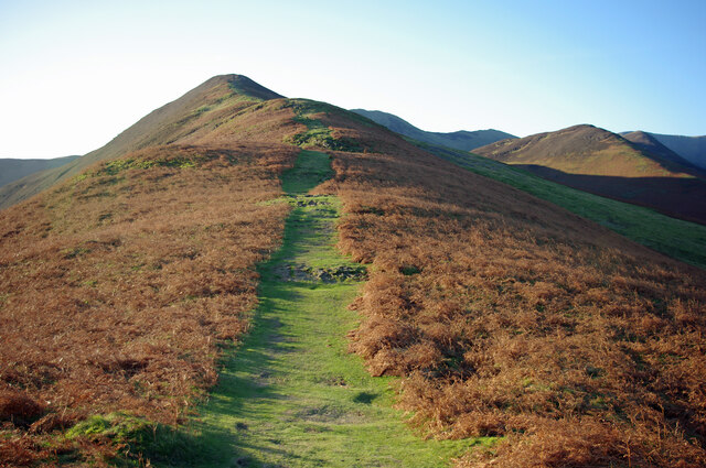
The hill is known for its distinctive shape, featuring steep slopes and a rugged terrain that challenges even experienced hikers. Its rocky summit offers a thrilling adventure for climbers and mountaineers, attracting outdoor enthusiasts from across the country.

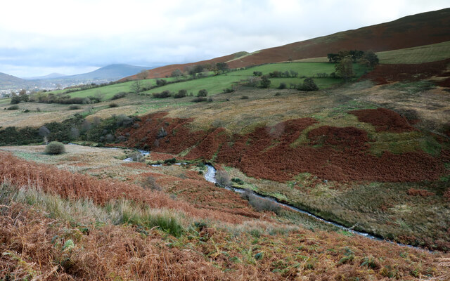
Stile End is surrounded by a diverse ecosystem, with its lower slopes covered in lush greenery and dotted with picturesque woodlands. The hill is home to a variety of plant and animal species, including heather moorland, native oak trees, and birds such as golden eagles and peregrine falcons.

Hikers and walkers can access Stile End from various starting points, including the nearby villages of Threlkeld and Scales. Popular routes include the ascent via Bannerdale Crags or the steep climb up Blease Fell. Those who reach the summit are rewarded with breathtaking views of the Lake District's iconic landscape, including nearby peaks like Blencathra and Skiddaw.

Stile End is not only a haven for outdoor enthusiasts but also holds historical significance. It was once used as a training ground for the infamous British commandos during World War II. Today, it remains a cherished destination for nature lovers, offering a memorable experience for all who visit.

If you have any feedback on the listing, please let us know in the comments section below.
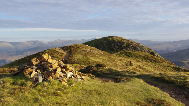
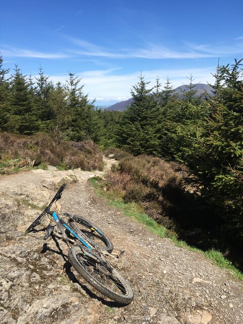
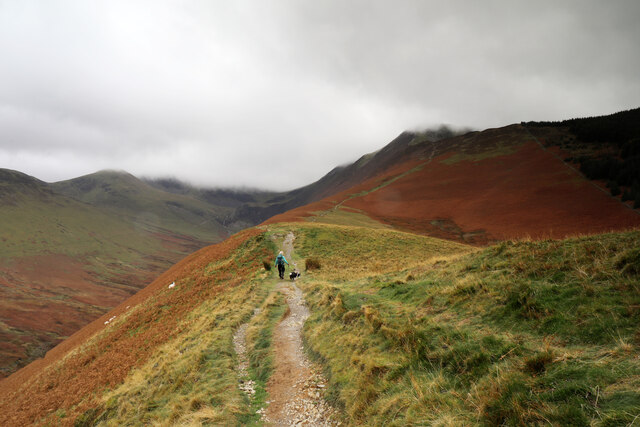
Stile End Images

Images are sourced within 2km of 54.586444/-3.2073768 or Grid Reference NY2221. Thanks to Geograph Open Source API. All images are credited.
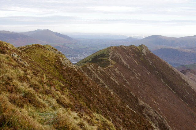
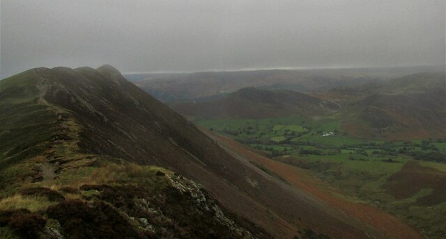
Causey Pike from the Scar Crags ridge A dull miserable day along the ridge.
Causey Pike from the Scar Crags ridge
A dull miserable day along the ridge.
Sleet Hause ridge to Rowling End On Causey Pike.
Sleet Hause ridge to Rowling End
On Causey Pike.
Path up Barrow The path climbs the northern spur. The ridge continues to Stile End and Outerside (catching the sun on the right).
Path up Barrow
The path climbs the northern spur. The ridge continues to Stile End and Outerside (catching the sun on the right).
Stile End from Barrow Stile End is in the centre of the photo, with Outerside beyond (catching the sun on the left). Grisedale Pike is in the background.
Stile End from Barrow
Stile End is in the centre of the photo, with Outerside beyond (catching the sun on the left). Grisedale Pike is in the background.
Causey Pike from the west Viewed from above Scar Crags. Part of Keswick is visible beyond the dip in the ridge. Blencathra is prominent in the left background.
Causey Pike from the west
Viewed from above Scar Crags. Part of Keswick is visible beyond the dip in the ridge. Blencathra is prominent in the left background.
On Causey Pike Looking east to the highest point.
On Causey Pike
Looking east to the highest point.
East from Causey Pike Sleet Hause and Rowling End are in the foreground. In the mid-distance are Derwent Water and Keswick (left), and Cat Bells (centre right). The Helvellyn range forms most of the skyline. 
[Image formed from 2 photos merged together.]
East from Causey Pike
Sleet Hause and Rowling End are in the foreground. In the mid-distance are Derwent Water and Keswick (left), and Cat Bells (centre right). The Helvellyn range forms most of the skyline. [Image formed from 2 photos merged together.]
Mountain bike track, Hospital Plantation, Whinlatter Forest Park
Ascending Kinn towards Grisedale Pike After a steep pull from the road, the path to Grisedale Pike ascends more gently for a while up Kinn, as the morning sun disappears behind increasing amounts of cloud formed by a stiff northwesterly breeze. This is hardly unexpected in the Lakes in November, but an hour earlier the tops had been clear above a thermal inversion causing fog in the valley and we'd hoped for better views at least early in the walk. The forecast predicted an hour with rain in the middle of the day, so we counted ourselves fortunate that that didn't materialise.
Ascending Kinn towards Grisedale Pike
After a steep pull from the road, the path to Grisedale Pike ascends more gently for a while up Kinn, as the morning sun disappears behind increasing amounts of cloud formed by a stiff northwesterly breeze. This is hardly unexpected in the Lakes in November, but an hour earlier the tops had been clear above a thermal inversion causing fog in the valley and we'd hoped for better views at least early in the walk. The forecast predicted an hour with rain in the middle of the day, so we counted ourselves fortunate that that didn't materialise.
Looking back down Kinn Kinn forms the normal route of ascent of Grisedale Pike from the northeast near Braithwaite and steepens into Sleet How at about the point where this photograph was taken. There's about 400m of ascent to go, the majority of it now steep, so photography is always a good excuse to avoid starting the day's hard work...
Looking back down Kinn
Kinn forms the normal route of ascent of Grisedale Pike from the northeast near Braithwaite and steepens into Sleet How at about the point where this photograph was taken. There's about 400m of ascent to go, the majority of it now steep, so photography is always a good excuse to avoid starting the day's hard work...
Sleet How climbs towards Grisedale Pike After an initial steep pull from Kinn, the path up Sleet How eases off for a while before the longer climb to the summit of Grisedale Pike. The latter lies immediately above the steep section without any of the demoralising false summits that beset some of these hills. An increasing northwesterly was bringing cloud to the tops, but at this point, blue sky and patches of sunshine had appeared, fueling hopes of a summit view. Alas, it wasn't to be, but at least the approach provided good scenery.
Sleet How climbs towards Grisedale Pike
After an initial steep pull from Kinn, the path up Sleet How eases off for a while before the longer climb to the summit of Grisedale Pike. The latter lies immediately above the steep section without any of the demoralising false summits that beset some of these hills. An increasing northwesterly was bringing cloud to the tops, but at this point, blue sky and patches of sunshine had appeared, fueling hopes of a summit view. Alas, it wasn't to be, but at least the approach provided good scenery.
Rocks outcrop on Sleet How The ridge of Kinn and Sleet How is entirely formed from the laminated mudstones and siltstones of the Kirkstile Formation of Arenig (Ordovician) age. As the path steepens, this starts to appear in frequent outcrops such as this one. The strata dip quite steeply to the left of the photograph, towards a syncline whose axis runs parallel to the ridge and about forty metres below at this point. A corresponding anticline lies off to the right, again with a SW-NE axis. The rock has taken something of a polish from decades of walkers' boots and some of the slightly scrambly bits higher up can be a little on the slippery side, although skulkers' routes exist almost everywhere, and the scree is compacted to a decent trod.
Rocks outcrop on Sleet How
The ridge of Kinn and Sleet How is entirely formed from the laminated mudstones and siltstones of the Kirkstile Formation of Arenig (Ordovician) age. As the path steepens, this starts to appear in frequent outcrops such as this one. The strata dip quite steeply to the left of the photograph, towards a syncline whose axis runs parallel to the ridge and about forty metres below at this point. A corresponding anticline lies off to the right, again with a SW-NE axis. The rock has taken something of a polish from decades of walkers' boots and some of the slightly scrambly bits higher up can be a little on the slippery side, although skulkers' routes exist almost everywhere, and the scree is compacted to a decent trod.
Stepping stones at Coledale gauging weir The broad path from Coledale Hause down into the valley is well constructed and not too steep, arriving at Coledale Beck just at the point where a gauging weir has been built below the old Force Crag mine workings. With all this expense, and the gauge obviously showing how often the waters are high, one would have thought that those now responsible for the gauge and the mine buildings might have spent that tiny bit extra to include a footbridge here, given how much is not being spent removing the ugly rusting hulks just upstream. The stepping stones are just sufficient in this weather, but the more northerly stones are wobbly and just going underwater despite the weather not being especially wet. The small tributary entering here, river right, is Birkthwaite Beck.
Stepping stones at Coledale gauging weir
The broad path from Coledale Hause down into the valley is well constructed and not too steep, arriving at Coledale Beck just at the point where a gauging weir has been built below the old Force Crag mine workings. With all this expense, and the gauge obviously showing how often the waters are high, one would have thought that those now responsible for the gauge and the mine buildings might have spent that tiny bit extra to include a footbridge here, given how much is not being spent removing the ugly rusting hulks just upstream. The stepping stones are just sufficient in this weather, but the more northerly stones are wobbly and just going underwater despite the weather not being especially wet. The small tributary entering here, river right, is Birkthwaite Beck.
Meanders in Coledale Beck Whilst it looks pleasant enough, pollution from the Force Crag mines further up the valley is a significant issue in the beck and whilst there is some rediation in the form of settlement ponds, no effort seems to be being made to entirely remove the ugly workings and tackle the cause of the pollution at source, let alone at the original mine owners' expense as would be proper.
Meanders in Coledale Beck
Whilst it looks pleasant enough, pollution from the Force Crag mines further up the valley is a significant issue in the beck and whilst there is some rediation in the form of settlement ponds, no effort seems to be being made to entirely remove the ugly workings and tackle the cause of the pollution at source, let alone at the original mine owners' expense as would be proper.
Traditional Cast Iron Fingerpost at Braithwaite Situated in the little village of Braithwaite by the Coledale Beck. A water level marker can also be seen. Braithwaite is only 2.5 miles from Keswick.
Traditional Cast Iron Fingerpost at Braithwaite
Situated in the little village of Braithwaite by the Coledale Beck. A water level marker can also be seen. Braithwaite is only 2.5 miles from Keswick.
Traditional old Iron Signpost at Braithwaite Old signpost beside the Coledale Beck.
Traditional old Iron Signpost at Braithwaite
Old signpost beside the Coledale Beck.
Methodist Chapel at Braithwaite
A Pretty Pink Cottage A very attractive pink house named Peter House in Braithwaite, Cumbria.
A Pretty Pink Cottage
A very attractive pink house named Peter House in Braithwaite, Cumbria.
Show me another place!

Stile End is located at Grid Ref: NY2221 (Lat: 54.586444, Lng: -3.2073768)

Administrative County: Cumbria

District: Allerdale

Police Authority: Cumbria

What 3 Words

///fatherly.flotation.pads. Near Keswick, Cumbria

Related Wikis

Barrow (Lake District)

Barrow is small fell in the English Lake District in the county of Cumbria which reaches a height of 455 metres (1,494 feet). It is in the Newlands Valley...

Above Derwent

Above Derwent is a civil parish in Cumbria, England, to the west of Derwentwater and Keswick. It lies entirely within the Lake District National Park.At...

Outerside

Outerside is a fell in the Lake District in Cumbria, England. It is located 6 kilometres (4 miles) west of Keswick in the north western part of the national...

Rowling End

Rowling End is a peak in the Lake District about 433 meters it is a steep slope leading up towards Causey Pike. It is briefly mentioned in books however...

Nearby Amenities

Located within 500m of 54.586444,-3.2073768
Barrow Door Mine
Abandoned: yes
Historic: mine
Mineral: lead
Lat/Long: 54.5876913/-3.202368
Barrow Door
Place: locality
Lat/Long: 54.5850165/-3.2047119
Stile End
Ele: 447
Natural: peak
Lat/Long: 54.5862988/-3.207366
Low Moss
Place: locality
Lat/Long: 54.5856608/-3.2122388
Ford: yes
Lat/Long: 54.5885739/-3.2120569
Abandoned: yes
Direction: 130
Man Made: adit
Lat/Long: 54.5876761/-3.202403
Abandoned: yes
Direction: 120
Man Made: adit
Lat/Long: 54.587714/-3.202445
The data included in this document is from www.openstreetmap.org. The data is made available under ODbL.

Have you been to Stile End?

Leave your review of Stile End below (or comments, questions and feedback).