Abbots Bromley

Civil Parish in Staffordshire East Staffordshire

England

Abbots Bromley

St Nicholas's Church Grade II* listed building of about 1300 - see <span class="nowrap"><a title="https://historicengland.org.uk/listing/the-list/list-entry/1374461" rel="nofollow ugc noopener" href="https://historicengland.org.uk/listing/the-list/list-entry/1374461">Link</a><img style="margin-left:2px;" alt="External link" title="External link - shift click to open in new window" src="https://s1.geograph.org.uk/img/external.png" width="10" height="10"/></span>
St Nicholas's Church Credit: Bob Harvey

Abbots Bromley is a civil parish located in the county of Staffordshire, England. Situated in the East Staffordshire district, it is a small village with a population of around 1,000 people. The parish covers an area of approximately 6 square miles.

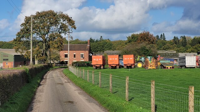
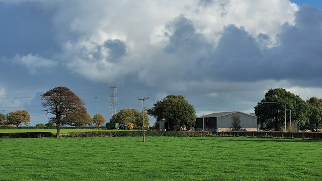
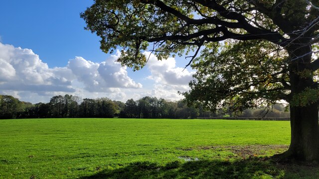
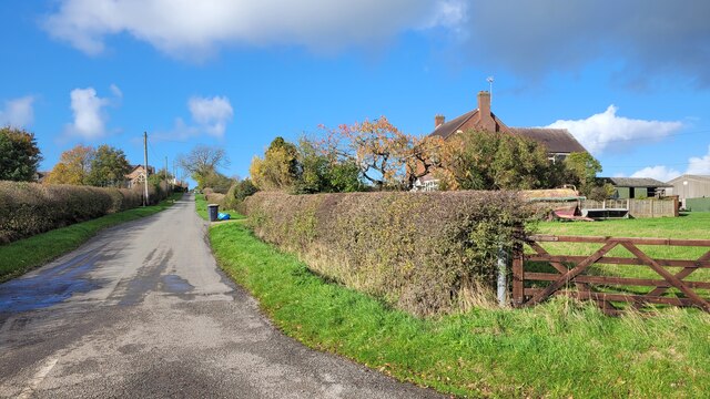
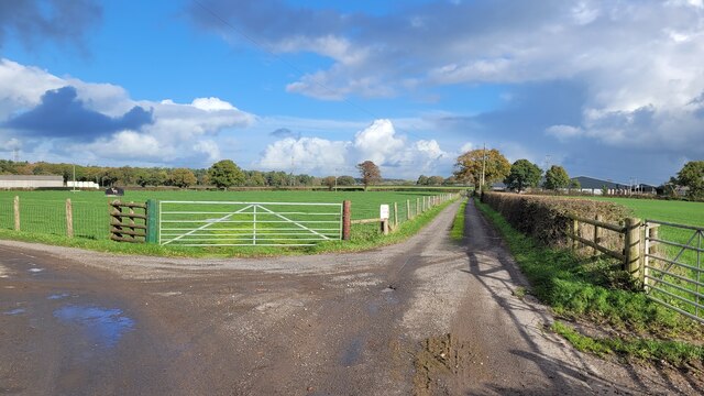
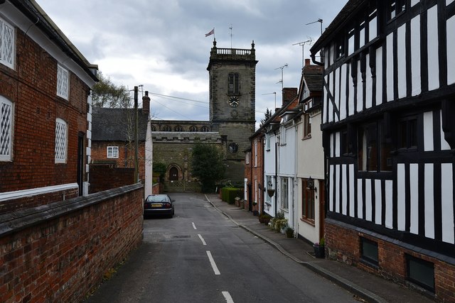
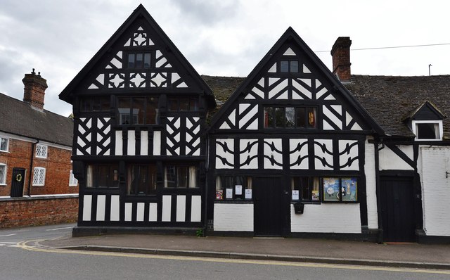
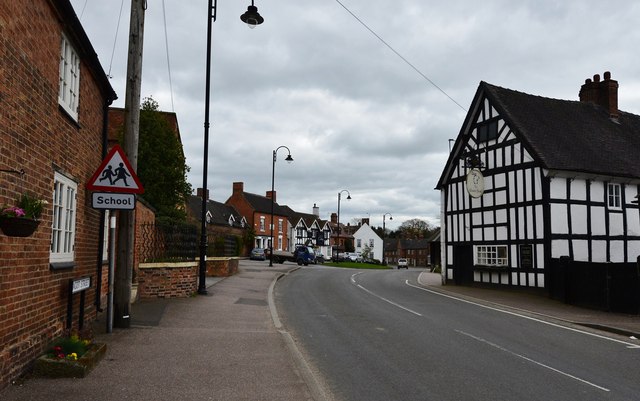
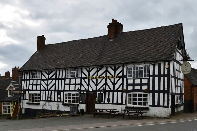
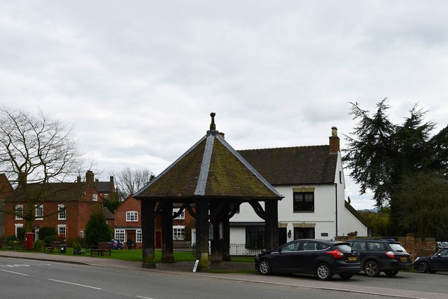
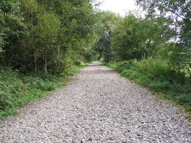
The village of Abbots Bromley is known for its picturesque setting and charming rural atmosphere. It features a mix of traditional English architecture, including thatched cottages and timber-framed buildings, which add to its historic character. The village is surrounded by beautiful countryside, with rolling hills and meadows, making it a popular destination for outdoor activities such as hiking and cycling.

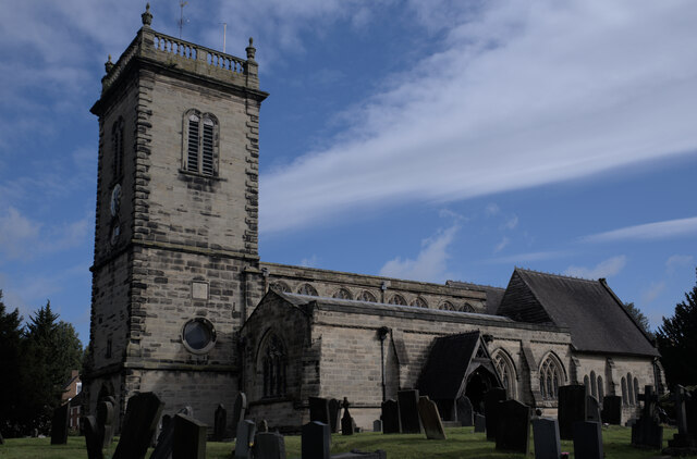
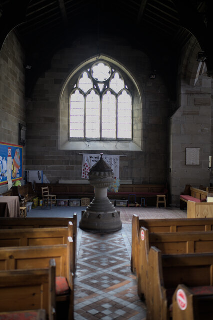
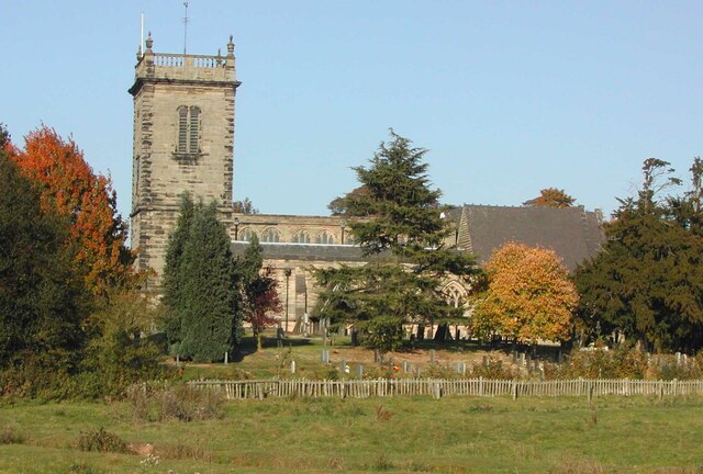
One of the notable landmarks in Abbots Bromley is the Church of St. Nicholas, a medieval parish church that dates back to the 13th century. The church is known for its impressive stained glass windows and architectural details. Another significant feature of the village is the Abbots Bromley School, a renowned independent boarding school founded in 1875.

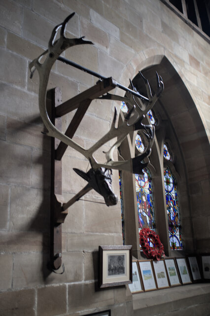
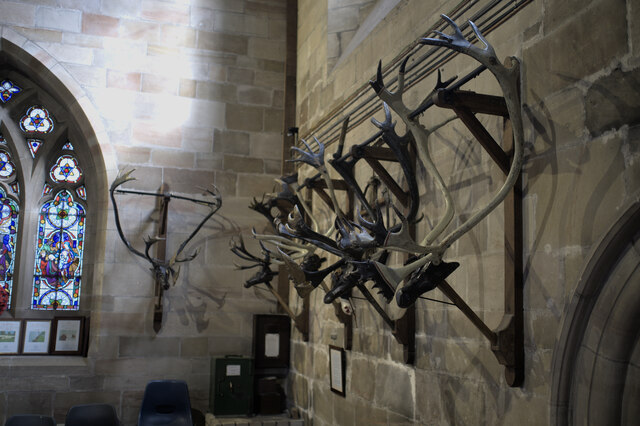
Abbots Bromley is also famous for its annual Horn Dance, a unique tradition that has been celebrated for over 800 years. The dance involves six horn dancers wearing reindeer antlers and performing a set of intricate steps around the village. This ancient ritual attracts visitors from all over the world and takes place on the first Monday after the first Sunday in September.

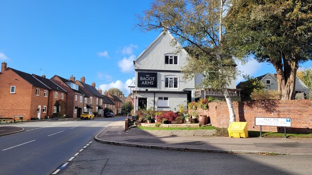
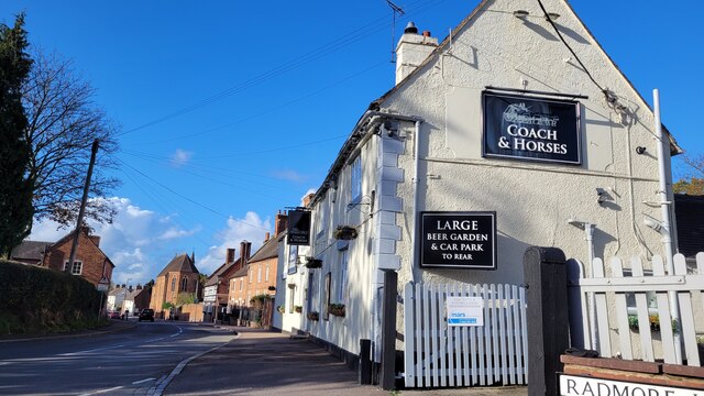
In terms of amenities, Abbots Bromley offers a range of facilities including a village hall, primary school, post office, and several shops and pubs. It is well-connected to nearby towns and cities by road, with Uttoxeter being the closest major town.

Overall, Abbots Bromley is a charming village with a rich history, beautiful surroundings, and a strong sense of community.

If you have any feedback on the listing, please let us know in the comments section below.

Abbots Bromley Images

Images are sourced within 2km of 52.825147/-1.872084 or Grid Reference SK0825. Thanks to Geograph Open Source API. All images are credited.

St Nicholas's Church Grade II* listed building of about 1300 - see <span class="nowrap"><a title="https://historicengland.org.uk/listing/the-list/list-entry/1374461" rel="nofollow ugc noopener" href="https://historicengland.org.uk/listing/the-list/list-entry/1374461">Link</a><img style="margin-left:2px;" alt="External link" title="External link - shift click to open in new window" src="https://s1.geograph.org.uk/img/external.png" width="10" height="10"/></span>
St Nicholas's Church
Grade II* listed building of about 1300 - see LinkExternal link
Horn dance headgear Preserved in <a href="https://www.geograph.org.uk/photo/6983789">SK0724 : St Nicholas's Church</a>. one of the reindeer horn headgear used in the ancient Abbots Bromley Horn Dance.  See <span class="nowrap"><a title="https://abbotsbromley.com/information/horn_dance/" rel="nofollow ugc noopener" href="https://abbotsbromley.com/information/horn_dance/">Link</a><img style="margin-left:2px;" alt="External link" title="External link - shift click to open in new window" src="https://s1.geograph.org.uk/img/external.png" width="10" height="10"/></span>
Horn dance headgear
Preserved in SK0724 : St Nicholas's Church. one of the reindeer horn headgear used in the ancient Abbots Bromley Horn Dance. See LinkExternal link
Horn dance headgear Preserved in <a href="https://www.geograph.org.uk/photo/6983789">SK0724 : St Nicholas's Church</a>.Several of the reindeer horn headgear used in the ancient Abbots Bromley Horn Dance.  See <span class="nowrap"><a title="https://abbotsbromley.com/information/horn_dance/" rel="nofollow ugc noopener" href="https://abbotsbromley.com/information/horn_dance/">Link</a><img style="margin-left:2px;" alt="External link" title="External link - shift click to open in new window" src="https://s1.geograph.org.uk/img/external.png" width="10" height="10"/></span>
Horn dance headgear
Preserved in SK0724 : St Nicholas's Church.Several of the reindeer horn headgear used in the ancient Abbots Bromley Horn Dance. See LinkExternal link
Walking Together A sculpture designed and commissioned by the parishioners to celebrate a thousand years of church history in the village of Abbots Bromley, made by Neil Wood from Stafford College.

See <span class="nowrap"><a title="https://media.acny.uk/media/venues/page/attachment/2018/03/Walking_Together_-_Celebrating_1000_years_of_St_Nicholas.pdf" rel="nofollow ugc noopener" href="https://media.acny.uk/media/venues/page/attachment/2018/03/Walking_Together_-_Celebrating_1000_years_of_St_Nicholas.pdf">Link</a><img style="margin-left:2px;" alt="External link" title="External link - shift click to open in new window" src="https://s1.geograph.org.uk/img/external.png" width="10" height="10"/></span>
Walking Together
A sculpture designed and commissioned by the parishioners to celebrate a thousand years of church history in the village of Abbots Bromley, made by Neil Wood from Stafford College. See LinkExternal link
St Nicholas's Church: The Font The font, at the Western end.
St Nicholas's Church: The Font
The font, at the Western end.
St Nicholas' Church, Abbots Bromley, Staffordshire View taken from a public footpath south of the church.  St Nicholas is the Parish Church of Abbots Bromley. It dates from about 1300, with a clerestorey added about 1500 and the west tower rebuilt in about 1700. The church is a Grade II*-listed building. Inside the church are a number of items related to the Abbots Bromley Horn Dance
St Nicholas' Church, Abbots Bromley, Staffordshire
View taken from a public footpath south of the church. St Nicholas is the Parish Church of Abbots Bromley. It dates from about 1300, with a clerestorey added about 1500 and the west tower rebuilt in about 1700. The church is a Grade II*-listed building. Inside the church are a number of items related to the Abbots Bromley Horn Dance
Hart's Farm Flat, fertile East Staffordshire.
The patches of woodland form a backdrop along with a sunny early November sky.
Hart's Farm
Flat, fertile East Staffordshire. The patches of woodland form a backdrop along with a sunny early November sky.
Park Farm Two large farm units one field apart. This is Park Farm photographed from the same spot as <a href="https://www.geograph.org.uk/photo/7331944">SK1026 : Hart's Farm</a> was taken.
Park Farm
Two large farm units one field apart. This is Park Farm photographed from the same spot as SK1026 : Hart's Farm was taken.
Bagot Arms, Abbot's Bromley On Bagot Street, B5234.
Bagot Arms, Abbot's Bromley
On Bagot Street, B5234.
The Coach and Horses One of several pubs in Abbot's Bromley.
The Coach and Horses
One of several pubs in Abbot's Bromley.
Flat pasture land View to the east of Radmore Lane.
Flat pasture land
View to the east of Radmore Lane.
Radmore Wood A small hamlet to the north east of Abbot's Bromley.
Radmore Wood
A small hamlet to the north east of Abbot's Bromley.
Farm tracks To the left to Hart's Farm, to the right to Park Farm.
Both are public rights of way.
Farm tracks
To the left to Hart's Farm, to the right to Park Farm. Both are public rights of way.
Abbots Bromley: St. Nicholas' Church
Abbots Bromley: Half timbered building in Bagot Street
Abbots Bromley: East along Bagot Street
Abbots Bromley: The Goat's Head PH
Abbots Bromley: The Butter Cross Records show that a Butter Cross has stood here since the 14th century; the present one is most probably a 17th century replacement.
Abbots Bromley: The Butter Cross
Records show that a Butter Cross has stood here since the 14th century; the present one is most probably a 17th century replacement.
Show me another place!

Abbots Bromley is located at Grid Ref: SK0825 (Lat: 52.825147, Lng: -1.872084)

Administrative County: Staffordshire

District: East Staffordshire

Police Authority: Staffordshire

What 3 Words

///shook.recruiter.slowly. Near Abbots Bromley, Staffordshire

Related Wikis

Nearby Amenities

Located within 500m of 52.825147,-1.872084
Barrier: stile
Steps: 1
Stile: stepover
Lat/Long: 52.8228481/-1.8716531
Barrier: stile
Stile: stepover
Lat/Long: 52.8278664/-1.8711243
Barrier: stile
Steps: 2
Stile: stepover
Lat/Long: 52.8243283/-1.8703836
Barrier: stile
Steps: 1
Stile: stepover
Lat/Long: 52.8216196/-1.8721645
Barrier: stile
Steps: 2
Stile: stepover
Lat/Long: 52.826538/-1.867289
Barrier: stile
Steps: 1
Stile: stepover
Lat/Long: 52.8228189/-1.8716664
Note: It's not obvious from the road how water gets to here. Presumably piped from northwest somehow
Lat/Long: 52.8236996/-1.8766762
Barrier: stile
Steps: 1
Stile: stepover
Lat/Long: 52.8240082/-1.8713982
Barrier: stile
Steps: 1
Stile: stepover
Lat/Long: 52.8238649/-1.8711428
Barrier: stile
Steps: 1
Stile: stepover
Lat/Long: 52.823799/-1.8710986
Barrier: stile
Steps: 2
Stile: stepover
Lat/Long: 52.8210677/-1.8735767
Radmore Wood
Place: locality
Source: OS_OpenData_StreetView
Lat/Long: 52.8234629/-1.8703251
Barrier: stile
Steps: 1
Stile: stepover
Lat/Long: 52.8242797/-1.877261
Barrier: stile
Steps: 2
Stile: stepover
Lat/Long: 52.8240042/-1.8738118
Barrier: stile
Steps: 1
Stile: stepover
Lat/Long: 52.8258663/-1.8681804
Barrier: stile
Steps: 1
Stile: stepover
Lat/Long: 52.8254379/-1.8687532
The data included in this document is from www.openstreetmap.org. The data is made available under ODbL.

Have you been to Abbots Bromley?

Leave your review of Abbots Bromley below (or comments, questions and feedback).