Bodelwyddan
Community in Flintshire
Wales
Bodelwyddan
Bodelwyddan is a community located in the county of Flintshire, Wales. Situated in the north-eastern part of the country, it is nestled between the towns of Rhyl and St Asaph. Bodelwyddan covers an area of approximately 8 square miles and has a population of around 3,000 residents.
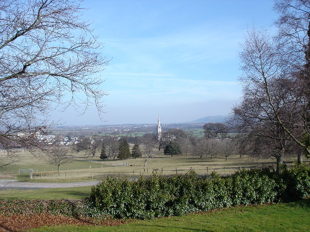
The community is primarily known for its historic Bodelwyddan Castle, which dates back to the 15th century. The castle, now a Grade II listed building, houses a museum and art gallery, showcasing a collection of Victorian artifacts and paintings. The castle is also surrounded by beautiful gardens, which attract visitors throughout the year.
Aside from its historical significance, Bodelwyddan is a thriving community with a range of amenities and services. It has a primary school, a post office, a few local shops, and a community center that hosts various events and activities. The community is well-connected with good transport links, including nearby access to the A55 North Wales Expressway.
Bodelwyddan is surrounded by picturesque countryside, offering plenty of opportunities for outdoor activities such as hiking, cycling, and fishing. The nearby coastal town of Rhyl provides easy access to sandy beaches and a range of seaside attractions.
Overall, Bodelwyddan is a charming and vibrant community that combines its rich history with modern amenities, making it an appealing place to live or visit in Flintshire, Wales.
If you have any feedback on the listing, please let us know in the comments section below.
Bodelwyddan Images
Images are sourced within 2km of 53.272874/-3.493813 or Grid Reference SJ0076. Thanks to Geograph Open Source API. All images are credited.


Bodelwyddan is located at Grid Ref: SJ0076 (Lat: 53.272874, Lng: -3.493813)
Unitary Authority: Denbighshire
Police Authority: North Wales
What 3 Words
///ranked.brick.recitals. Near Bodelwyddan, Denbighshire
Nearby Locations
Related Wikis
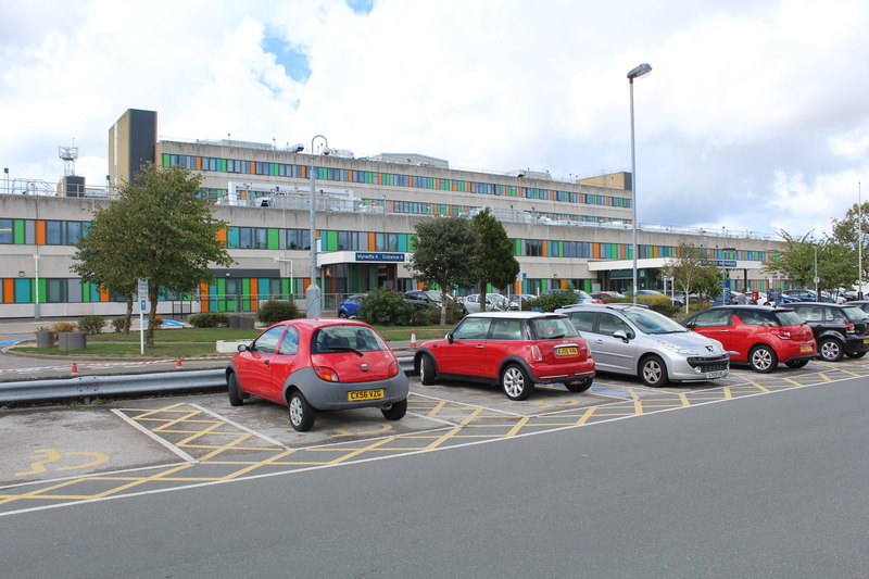
Glan Clwyd Hospital
Glan Clwyd Hospital (Welsh: Ysbyty Glan Clwyd) is a hospital in Bodelwyddan, Denbighshire, Wales. It is managed by the Betsi Cadwaladr University Health...
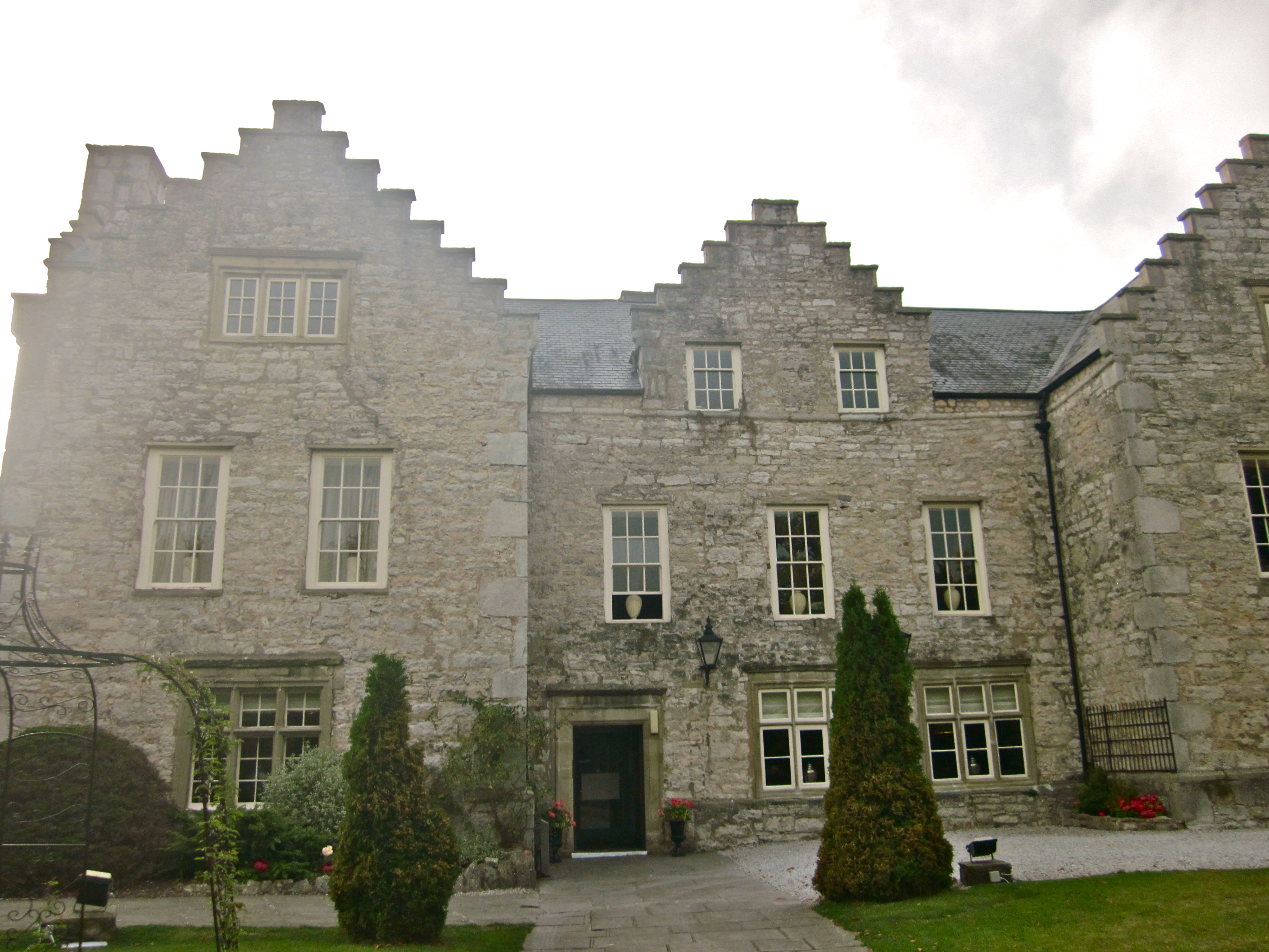
Faenol Fawr, Bodelwyddan
Faenol Fawr is an Elizabethan H-plan mansion with crow-stepped gables. The house is situated immediately to the north of Glan Clwyd Hospital in the parish...
Bodelwyddan
Bodelwyddan (Welsh pronunciation: [bɔdɛlˈwəðan]) is a village, electoral ward and community in Denbighshire, Wales, approximately 5 miles (8 km) South...

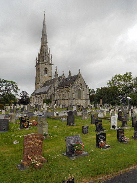
Marble Church, Bodelwyddan
St Margaret's Church, Bodelwyddan, nicknamed the Marble Church, is a Decorated Gothic Style parish church in the lower Vale of Clwyd in Denbighshire, Wales...
Nearby Amenities
Located within 500m of 53.272874,-3.493813Have you been to Bodelwyddan?
Leave your review of Bodelwyddan below (or comments, questions and feedback).