Faenol Fawr
Heritage Site in Flintshire
Wales
Faenol Fawr
Faenol Fawr is a historic estate located in Flintshire, Wales. It holds great significance as a heritage site due to its rich history and architectural beauty. The estate encompasses a sprawling landscape of approximately 1,000 acres, consisting of woodlands, gardens, and farmland.
The origins of Faenol Fawr can be traced back to the 16th century when it was built as a manor house. Over the centuries, it underwent several renovations and expansions, resulting in its magnificent appearance today. The architectural style of the main house is predominantly Georgian, showcasing the elegance and grandeur of the period.
The estate's gardens are equally impressive, featuring meticulously designed landscapes with manicured lawns, vibrant flowerbeds, and serene water features. The gardens also boast a variety of rare and exotic plants, making it a haven for nature enthusiasts and horticulturists.
In addition to its architectural and natural beauty, Faenol Fawr has a rich cultural heritage. It has hosted numerous events and concerts, including the renowned Faenol Festival, which attracted world-class musicians and performers. The estate has also been used as a filming location for several movies and television shows, further adding to its cultural significance.
Today, Faenol Fawr is open to the public, allowing visitors to explore its stunning grounds, take guided tours of the house, and enjoy the tranquility of the gardens. It serves as a testament to the region's history, offering a glimpse into the opulent lifestyle of the past and providing a delightful experience for all who visit.
If you have any feedback on the listing, please let us know in the comments section below.
Faenol Fawr Images
Images are sourced within 2km of 53.275/-3.492 or Grid Reference SJ0076. Thanks to Geograph Open Source API. All images are credited.


Faenol Fawr is located at Grid Ref: SJ0076 (Lat: 53.275, Lng: -3.492)
Unitary Authority: Denbighshire
Police Authority: North Wales
What 3 Words
///sleep.reviews.signature. Near Bodelwyddan, Denbighshire
Nearby Locations
Related Wikis
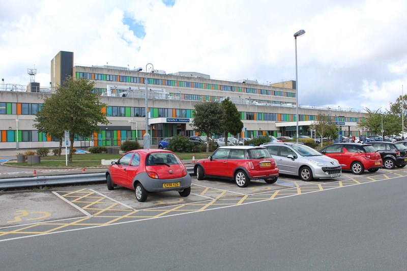
Glan Clwyd Hospital
Glan Clwyd Hospital (Welsh: Ysbyty Glan Clwyd) is a hospital in Bodelwyddan, Denbighshire, Wales. It is managed by the Betsi Cadwaladr University Health...
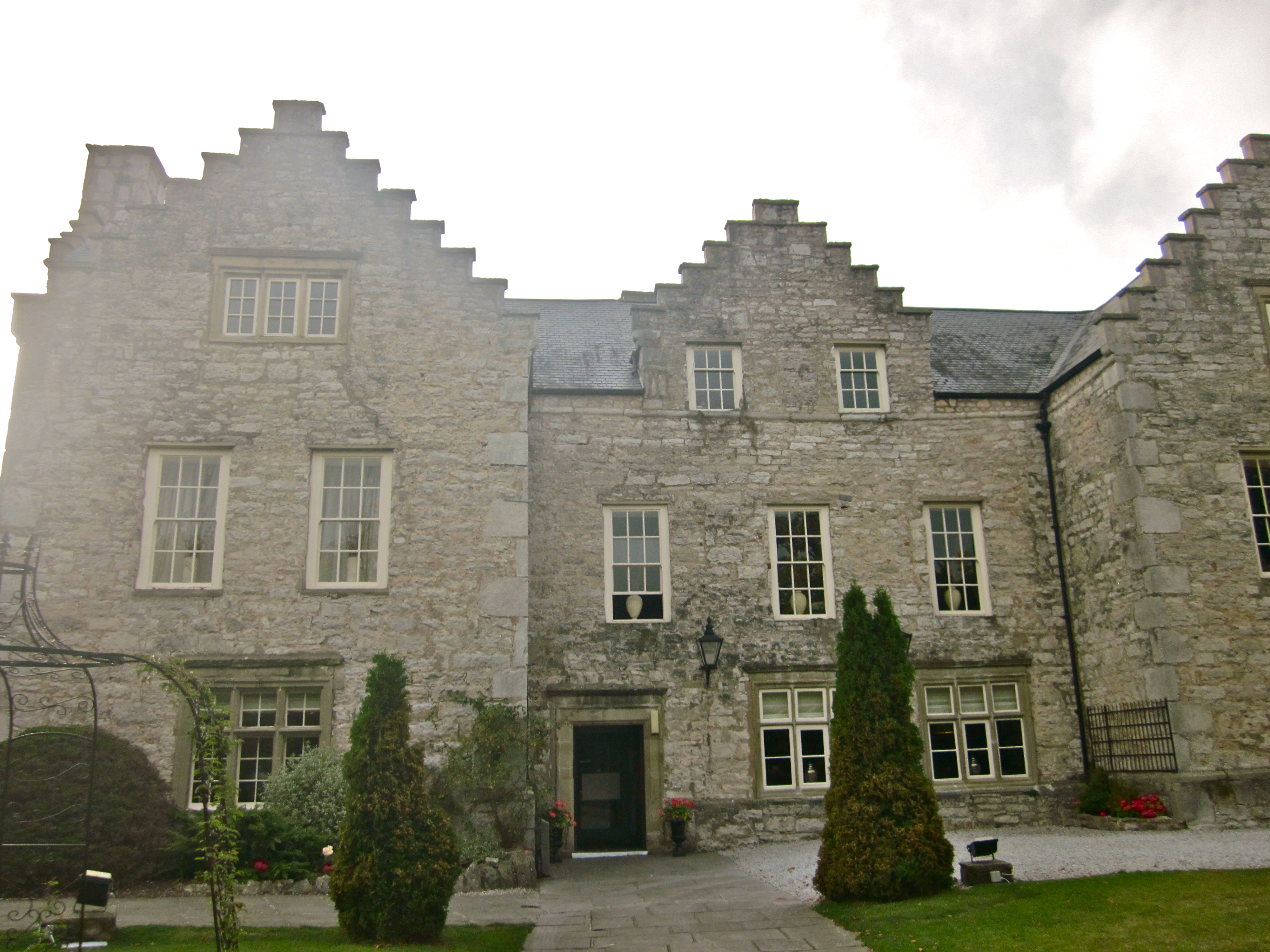
Faenol Fawr, Bodelwyddan
Faenol Fawr is an Elizabethan H-plan mansion with crow-stepped gables. The house is situated immediately to the north of Glan Clwyd Hospital in the parish...
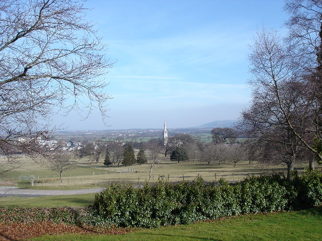
Bodelwyddan
Bodelwyddan (Welsh pronunciation: [bɔdɛlˈwəðan]) is a village, electoral ward and community in Denbighshire, Wales, approximately 5 miles (8 km) South...

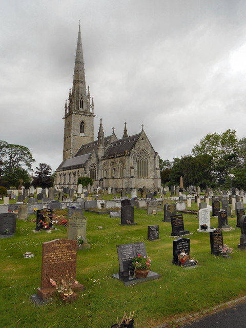
Marble Church, Bodelwyddan
St Margaret's Church, Bodelwyddan, nicknamed the Marble Church, is a Decorated Gothic Style parish church in the lower Vale of Clwyd in Denbighshire, Wales...
Nearby Amenities
Located within 500m of 53.275,-3.492Have you been to Faenol Fawr?
Leave your review of Faenol Fawr below (or comments, questions and feedback).