Witton Gilbert

Settlement in Durham

England

Witton Gilbert

Path to Stobbilee Farm Footpath leading south from the A691, Durham to Consett road, to Stobbilee Farm at Langley Park.
Path to Stobbilee Farm Credit: Robert Graham

Witton Gilbert is a picturesque village located in County Durham, England. Situated approximately four miles northwest of the historic city of Durham, it is nestled amidst the beautiful countryside of the North East of England. With a population of around 1,500 residents, the village offers a tranquil and close-knit community atmosphere.

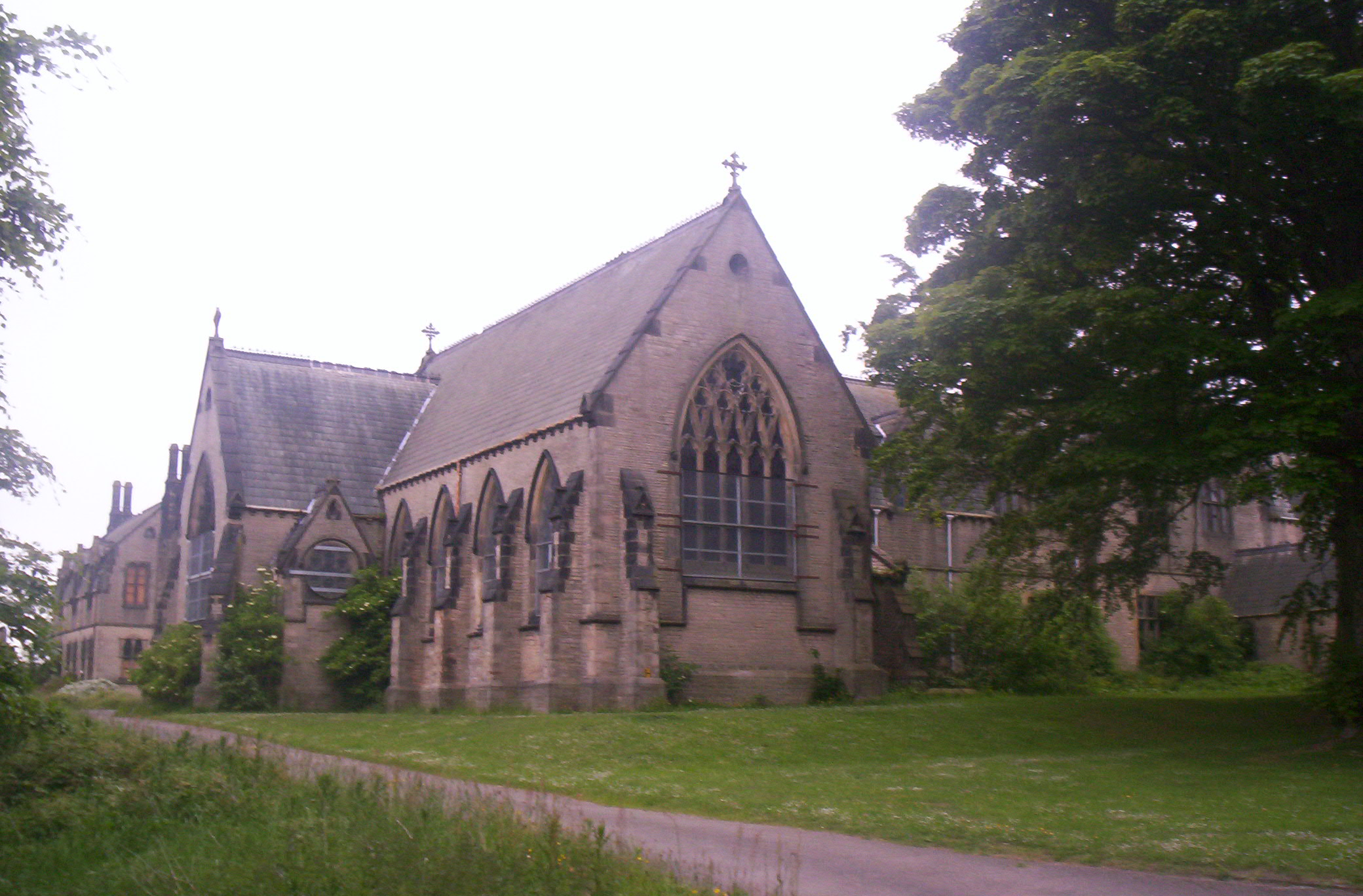
Witton Gilbert is renowned for its rich history, dating back to the medieval period. The village is home to several significant landmarks, including the All Saints Church, which dates back to the 12th century and features stunning Norman architecture. Additionally, the village boasts a number of traditional stone-built houses and cottages that lend a charming and authentic character to the area.

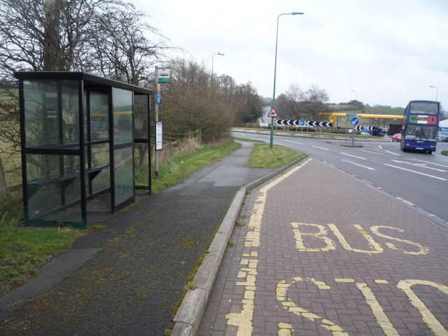
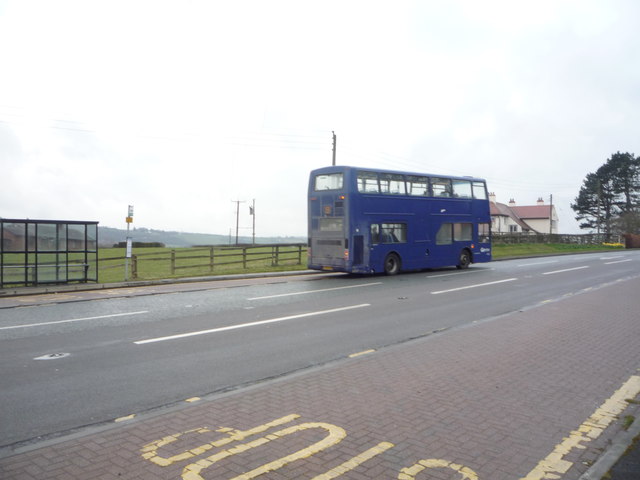
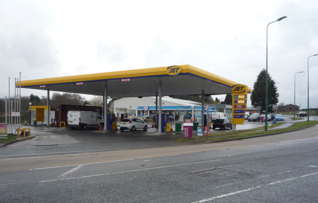
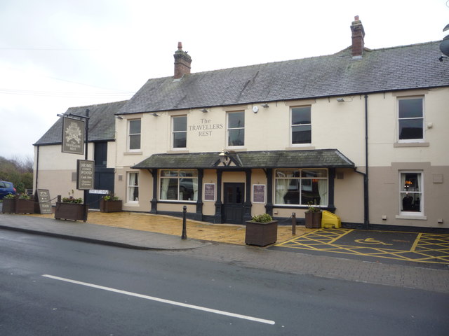
The village is well-served by amenities, including a primary school, a local shop, and a post office, catering to the daily needs of its residents. For recreational activities, Witton Gilbert offers a range of facilities, such as a community center, playing fields, and a playground, providing ample opportunities for residents, particularly families with children, to engage in outdoor activities.

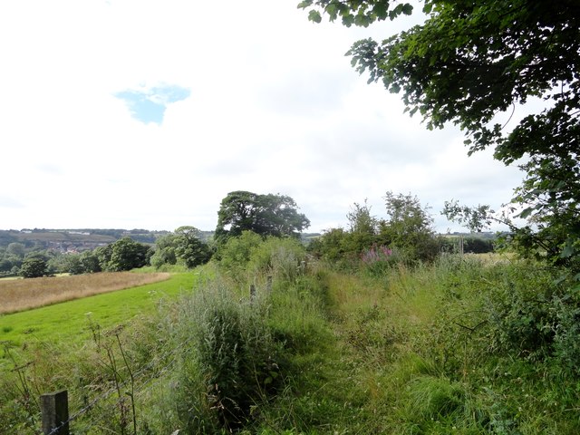
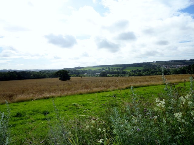
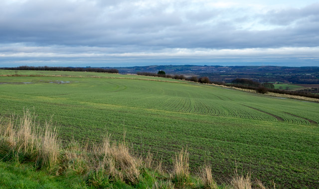
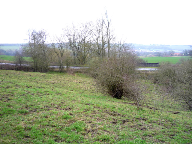
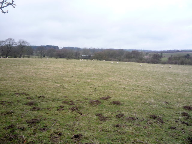
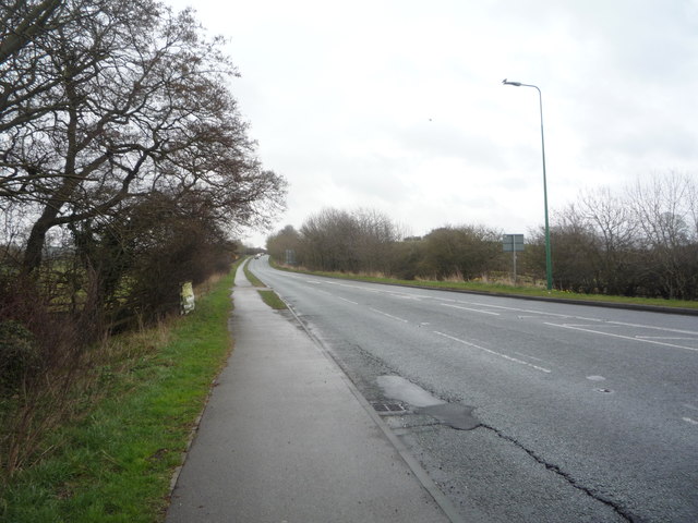
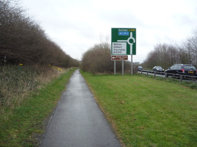
Surrounded by rolling hills and picturesque landscapes, Witton Gilbert also benefits from its proximity to the beautiful Durham countryside. The village offers easy access to various walking and cycling routes, providing residents with the opportunity to explore the natural beauty of the area.

Overall, Witton Gilbert is a charming and historic village that offers a peaceful and idyllic place to live, while still being conveniently located near the city of Durham and its amenities.

If you have any feedback on the listing, please let us know in the comments section below.

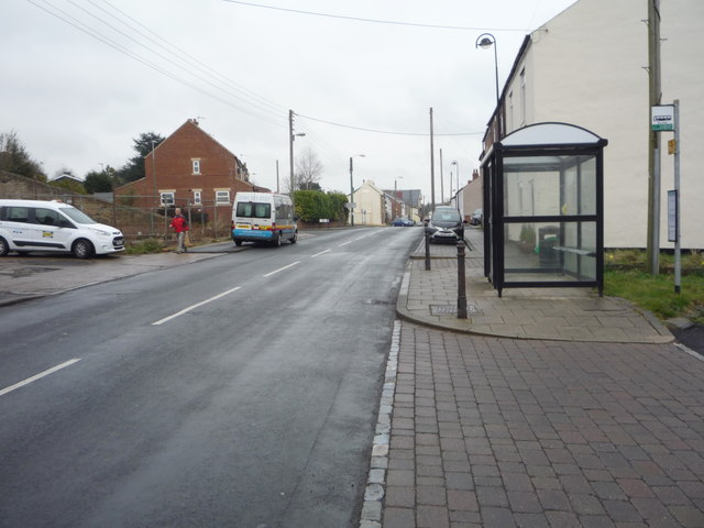
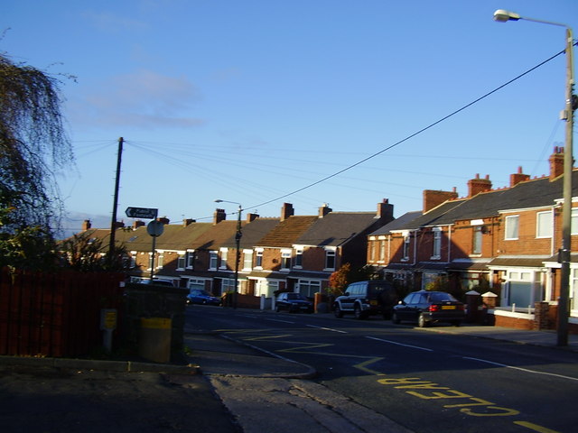
Witton Gilbert Images

Images are sourced within 2km of 54.805565/-1.640044 or Grid Reference NZ2345. Thanks to Geograph Open Source API. All images are credited.

Path to Stobbilee Farm Footpath leading south from the A691, Durham to Consett road, to Stobbilee Farm at Langley Park.
Path to Stobbilee Farm
Footpath leading south from the A691, Durham to Consett road, to Stobbilee Farm at Langley Park.
View south from the A691 near Kaysburn View from beside the Durham to Consett road near Stobbilee House. Looking south over Langley Park to the south side of the Browney valley.
View south from the A691 near Kaysburn
View from beside the Durham to Consett road near Stobbilee House. Looking south over Langley Park to the south side of the Browney valley.
Sacriston, a misty Front Street
War memorial at Witton Gilbert The memorial is slightly elevated above the east side of the B6312 at the northern end of the village. 
The houses of Green Lea are seen behind the monument.
Remnants of the first snow of the winter are on the ground.
War memorial at Witton Gilbert
The memorial is slightly elevated above the east side of the B6312 at the northern end of the village. The houses of Green Lea are seen behind the monument. Remnants of the first snow of the winter are on the ground.
'The Village Inn', Sacriston The closed and boarded pub is on the east side of Front Street, the B6532. It has probably been closed for some time - meals were on offer for £3.95 and there's a hole in the roof.
'The Village Inn', Sacriston
The closed and boarded pub is on the east side of Front Street, the B6532. It has probably been closed for some time - meals were on offer for £3.95 and there's a hole in the roof.
Field south of Sacriston The view is to the east over a field with an emerging crop from Bowbank, a road in a development known as Southburn Rise at the southern side Sacriston.
Field south of Sacriston
The view is to the east over a field with an emerging crop from Bowbank, a road in a development known as Southburn Rise at the southern side Sacriston.
Grazing off Langley Lane Looking towards the A691.
Grazing off Langley Lane
Looking towards the A691.
Langley Lane approaching the junction with the A691 Heading east towards Durham.
Langley Lane approaching the junction with the A691
Heading east towards Durham.
A691 towards Durham Heading east.
A691 towards Durham
Heading east.
Grazing north of the A691
Bus stop and shelter on the A691
Bus on the A691, Newlands
Service station on the A691
A691 towards Durham  Heading east.
A691 towards Durham
Heading east.
Path beside the A691 Looking east.
Path beside the A691
Looking east.
The Travellers Rest, Witton Gilbert On Front Street.
The Travellers Rest, Witton Gilbert
On Front Street.
Sign for the Travellers Rest, Witton Gilbert
Bus stop and shelter on Front Street, Witton Gilbert Looking east.
Bus stop and shelter on Front Street, Witton Gilbert
Looking east.
Show me another place!

Witton Gilbert is located at Grid Ref: NZ2345 (Lat: 54.805565, Lng: -1.640044)

Unitary Authority: County Durham

Police Authority: Durham

What 3 Words

///absorbing.buddy.deflation. Near Witton Gilbert, Co. Durham

Related Wikis

Witton Gilbert

Witton Gilbert is a village and civil parish in County Durham, England. == Geography == Witton Gilbert is situated about 3.7 miles (6.0 km) to the north...

Witton Gilbert railway station

Witton Gilbert railway station served the village of Witton Gilbert, County Durham, England from 1862 to 1963 on the Lanchester Valley Line. == History... ==

Fyndoune Community College

Fyndoune Community College was a co-educational secondary school located in Sacriston, County Durham, England. Previous names have included Sacriston Secondary...

Sacriston

Sacriston is a village and civil parish in County Durham, England, situated 3 miles (4.8 km) north of the city of Durham. Although the area has been populated...

Wall Nook

Wall Nook is a small village in County Durham, in England. It is situated to the south of Langley Park, to the north west of Durham. Wall Nook is known...

Langley Park, County Durham

Langley Park is a village in County Durham, England. The historic city of Durham lies 4 miles (6.4 km) to the east, and the larger city (and regional capital...

Langley Park Wind Farm

Langley Park Wind Farm is a wind farm near Langley Park, County Durham, England. It was developed by EDF Energy and is operated by Cumbria Wind Farms,...

Ushaw College

Ushaw College (formally St Cuthbert's College, Ushaw) is a former Catholic seminary near the village of Ushaw Moor, County Durham, England, which is now...

Nearby Amenities

Located within 500m of 54.805565,-1.640044
Crossing
Crossing: unmarked
Crossing Island: yes
Tactile Paving: yes
Lat/Long: 54.8050162/-1.6354211
Witton Gilbert
Place: village
Wikidata: Q778444
Lat/Long: 54.8059417/-1.6362242
Entrance: main
Lat/Long: 54.8020661/-1.6361781
Crossing
Crossing: unmarked
Crossing Island: yes
Tactile Paving: no
Lat/Long: 54.8048525/-1.635868
Bus Stop
Travellers Rest
Bench: yes
Bin: yes
Bus: yes
Departures Board: timetable
Naptan AtcoCode: 13005087C
Naptan Bearing: E
Naptan CommonName: Travellers Rest
Naptan Indicator: east bound
Naptan Landmark: Landmark not known
Naptan NaptanCode: durdgtgm
Naptan Notes: Front street- Witton Gilbert
Naptan Street: Front Street
Naptan Verified: yes
Public Transport: platform
Shelter: yes
Source: naptan_import; survey
Tactile Paving: no
Lat/Long: 54.8059119/-1.6435733
Bus Stop
Travellers Rest
Bench: yes
Naptan AtcoCode: 13005087G
Naptan Bearing: W
Naptan CommonName: Travellers Rest
Naptan Indicator: west bound
Naptan Landmark: Landmark not known
Naptan NaptanCode: durdgtgp
Naptan Notes: front street- in front of Travellers Rest pub- Witton Gilbert
Naptan Street: Front Street
Naptan Verified: yes
Shelter: yes
Source: naptan_import; survey
Tactile Paving: no
Lat/Long: 54.8056776/-1.6414794
Bus Stop
School
Bench: yes
Naptan AtcoCode: 13005088C
Naptan Bearing: E
Naptan CommonName: School
Naptan Indicator: east bound
Naptan Landmark: Landmark not known
Naptan NaptanCode: durdgtgt
Naptan Notes: road B6312- in front of school- Witton Gilbert
Naptan Street: Sacriston Lane
Naptan Verified: no
Shelter: yes
Source: naptan_import
Tactile Paving: no
Lat/Long: 54.8062454/-1.6378295
Bus Stop
School
Bench: no
Naptan AtcoCode: 13005088F
Naptan Bearing: SW
Naptan CommonName: School
Naptan Indicator: south west bound
Naptan Landmark: Landmark not known
Naptan NaptanCode: durdgtgw
Naptan Notes: road B6312- in front of Glenville House- Witton Gilbert
Naptan Street: Sacriston Lane
Naptan Verified: no
Shelter: no
Source: naptan_import
Tactile Paving: no
Lat/Long: 54.8060774/-1.6387489
Bus Stop
White Tun P.H.
Bench: yes
Bus: yes
Naptan AtcoCode: 13005089A
Naptan Bearing: N
Naptan CommonName: White Tun P.H.
Naptan Indicator: north bound
Naptan Landmark: Landmark not known
Naptan NaptanCode: durdgtja
Naptan Notes: road B6312- next junction with Durham gardens- Witton Gilbert
Naptan Street: Sacriston Lane
Naptan Verified: no
Public Transport: platform
Shelter: yes
Source: naptan_import
Tactile Paving: no
Lat/Long: 54.8083923/-1.6345429
Bus Stop
White Tun P.H.
Bench: yes
Bus: yes
Naptan AtcoCode: 13005089E
Naptan Bearing: S
Naptan CommonName: White Tun P.H.
Naptan Indicator: south bound
Naptan Landmark: Landmark not known
Naptan NaptanCode: durdgtjd
Naptan Notes: road B6312- in front of The White Tun pub- Witton Gilbert
Naptan Street: Sacriston Lane
Naptan Verified: yes
Public Transport: platform
Shelter: yes
Source: naptan_import; survey
Tactile Paving: no
Lat/Long: 54.8079486/-1.6344699
Bus Stop
Glendenning Arms
Bench: yes
Bin: yes
Bus: yes
Departures Board: timetable
Naptan AtcoCode: 13005091C
Naptan Bearing: E
Naptan CommonName: Glendenning Arms
Naptan Indicator: east bound
Naptan Landmark: Outside Hedleys Buildings
Naptan NaptanCode: durdgtjp
Naptan Street: Front Street
Naptan Verified: yes
Public Transport: platform
Shelter: yes
Source: naptan_import; survey
Tactile Paving: no
Lat/Long: 54.8053714/-1.6363967
Bus Stop
Glendenning Arms
Bench: yes
Naptan AtcoCode: 13005091G
Naptan Bearing: W
Naptan CommonName: Glendenning Arms
Naptan Indicator: west bound
Naptan Landmark: Outside No 9
Naptan NaptanCode: durdgtjt
Naptan Street: Front Street
Naptan Verified: yes
Shelter: yes
Source: naptan_import; survey
Tactile Paving: no
Lat/Long: 54.8052484/-1.6380025
Crossing
Check Date Crossing: 2020-12-25
Crossing: uncontrolled
Crossing Island: no
Crossing Ref: zebra
Tactile Paving: yes
Lat/Long: 54.8055446/-1.639816
Post Office
Witton Gilbert Post Office
Addr City: Durham
Addr Country: GB
Addr Postcode: DH7 6QU
Addr Street: Sacriston Lane
Addr Village: Witton Gilbert
Opening Hours: Mo-Sa 06:00-22:00; Su 07:00-22:00
Ref Pol Id: 125749
Lat/Long: 54.807722/-1.6341479
Barrier: stile
Foot: yes
Lat/Long: 54.808495/-1.6395517
Barrier: stile
Foot: yes
Lat/Long: 54.8086102/-1.6387634
Morrisons Daily
Addr City: Durham
Addr Housename: The White Tun
Addr Postcode: DH7 6QU
Addr Street: Sacriston Lane
Addr Village: Witton Gilbert
Brand: Morrisons Daily
Brand Wikidata: Q99752411
Fhrs Id: 809275
Opening Hours: Mo-Sa 06:00-22:00; Su 07:00-22:00
Operator: McColl's
Operator Wikidata: Q16997477
Shop: convenience
Source Addr: FHRS Open Data
Website: https://my.morrisons.com/storefinder/65577/morrisons-daily-witton-gilbert-sacriston
Lat/Long: 54.8076941/-1.6340419
Barrier: stile
Lat/Long: 54.804906/-1.6403925
Barrier: kissing_gate
Foot: yes
Lat/Long: 54.8037186/-1.6362423
Crossing
Crossing: unmarked
Tactile Paving: no
Lat/Long: 54.8044154/-1.6405976
Crossing
Bicycle: yes
Crossing: uncontrolled
Crossing Island: no
Tactile Paving: yes
Lat/Long: 54.8056586/-1.6446129
Generator Method: photovoltaic
Generator Orientation: 187
Generator Solar Modules: 16
Generator Source: solar
Generator Type: solar_photovoltaic_panel
Power: generator
Lat/Long: 54.8058407/-1.641799
Generator Method: photovoltaic
Generator Orientation: 170
Generator Solar Modules: 16
Generator Source: solar
Generator Type: solar_photovoltaic_panel
Power: generator
Lat/Long: 54.8057905/-1.6407744
Drinking Water
Bottle: yes
Lat/Long: 54.8021185/-1.6359125
Bench
Backrest: yes
Lat/Long: 54.8022054/-1.6363835
Pond Life
Board Type: nature
Information: board
Tourism: information
Lat/Long: 54.8042616/-1.6356654
Bench
Backrest: yes
Material: wood
Lat/Long: 54.8042442/-1.6360496
The Meadow
Board Type: nature
Information: board
Tourism: information
Lat/Long: 54.8044378/-1.6357479
Witton Gilbert Bypass
Historic: memorial
Memorial: plaque
Note: Date not clear from photo, 1996 or 1998?
Lat/Long: 54.8051551/-1.6371091
Barrier: stile
Foot: yes
Stile: stepover
Lat/Long: 54.8013659/-1.6391476
Power: pole
Lat/Long: 54.8094185/-1.6385776
Power: pole
Lat/Long: 54.8093606/-1.6397578
Power: pole
Lat/Long: 54.8092044/-1.641072
Power: pole
Lat/Long: 54.8090259/-1.6426452
Power: pole
Lat/Long: 54.8086742/-1.6441539
Power: pole
Lat/Long: 54.8083257/-1.6456841
Noexit: yes
Lat/Long: 54.8068608/-1.6356189
Noexit: yes
Lat/Long: 54.8068202/-1.6356115
Addr City: Durham
Addr Housenumber: 1
Addr Postcode: DH7 6TZ
Addr Street: Sacriston Lane
Addr Village: Witton Gilbert
Lat/Long: 54.8064173/-1.6393259
Barrier: stile
Lat/Long: 54.8064618/-1.6411364
Witton Farm S/S
Note: "Fulforth SW." to North
Power: pole
Lat/Long: 54.8064738/-1.641245
Addr Housename: Wittonstall
Addr Street: Front Street
Lat/Long: 54.8060432/-1.6416527
Addr Housename: Pengrail
Addr Street: Front Street
Lat/Long: 54.8062519/-1.6413845
Waste Basket
Lat/Long: 54.8056715/-1.6414583
Addr City: Durham
Addr Housenumber: 27
Addr Postcode: DH7 6TQ
Addr Street: Front Street
Addr Village: Witton Gilbert
Lat/Long: 54.8056977/-1.6420148
Addr City: Durham
Addr Housenumber: 28
Addr Postcode: DH7 6TQ
Addr Street: Front Street
Addr Village: Witton Gilbert
Lat/Long: 54.8057016/-1.6421328
Addr City: Durham
Addr Housename: Divine Cottage
Addr Housenumber: 29
Addr Postcode: DH7 6TQ
Addr Street: Front Street
Addr Village: Witton Gilbert
Lat/Long: 54.8057039/-1.6422415
Barrier: stile
Material: wood
Lat/Long: 54.8046309/-1.640448
Addr City: Durham
Addr Housenumber: 16
Addr Postcode: DH7 6SY
Addr Street: Front Street
Addr Village: Witton Gilbert
Lat/Long: 54.8055176/-1.6401024
Addr City: Durham
Addr Housenumber: 15
Addr Postcode: DH7 6SY
Addr Street: Front Street
Addr Village: Witton Gilbert
Lat/Long: 54.8055091/-1.6399898
Addr City: Durham
Addr Housenumber: 13
Addr Postcode: DH7 6SY
Addr Street: Front Street
Addr Village: Witton Gilbert
Lat/Long: 54.8054643/-1.6397792
Addr Housename: Meadow House
Addr Street: Best's Yard
Lat/Long: 54.8052162/-1.6397323
The data included in this document is from www.openstreetmap.org. The data is made available under ODbL.

Have you been to Witton Gilbert?

Leave your review of Witton Gilbert below (or comments, questions and feedback).