Witton Dene

Valley in Durham

England

Witton Dene

View south from the A691 near Kaysburn View from beside the Durham to Consett road near Stobbilee House. Looking south over Langley Park to the south side of the Browney valley.
View south from the A691 near Kaysburn Credit: Robert Graham

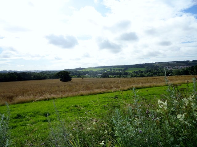
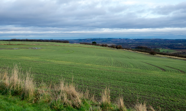
Witton Dene, also known as Witton Dene Valley, is a picturesque nature reserve located in County Durham, England. Situated near the town of Spennymoor, the Dene covers an area of approximately 17 hectares and is renowned for its stunning natural beauty.

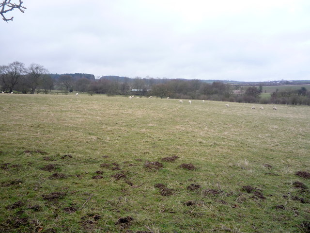
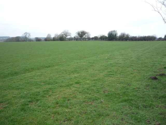
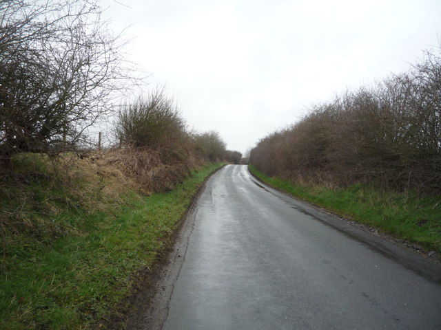
The Dene features a diverse range of habitats, including woodlands, wetlands, meadows, and a river, creating a haven for a wide variety of plant and animal species. Visitors can explore the numerous walking trails that wind through the reserve, offering breathtaking views of the surrounding countryside.

One of the main attractions of Witton Dene is its ancient woodland, which is dominated by native tree species such as oak, ash, and birch. The woodland provides a home for many bird species, including woodpeckers, owls, and various songbirds. Additionally, the reserve is home to a multitude of wildflowers, including bluebells, primroses, and orchids, which create a vibrant display in the spring and summer months.

The River Wear flows through Witton Dene, adding to its natural charm. The river supports a diverse range of aquatic life, including otters, brown trout, and kingfishers. Anglers also frequent the river, trying their luck at catching salmon and sea trout during the fishing season.

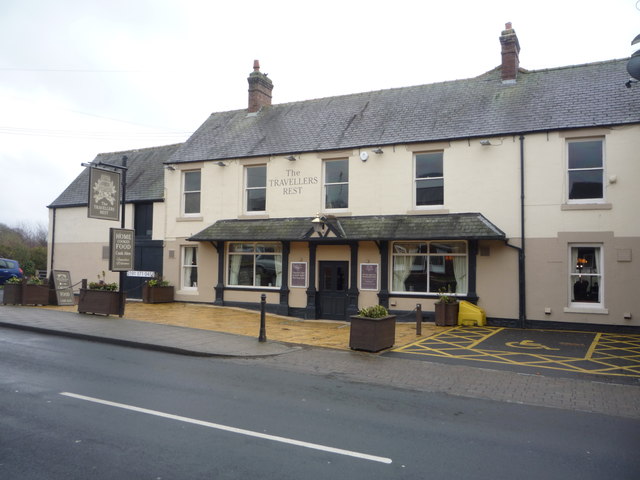
Witton Dene is a popular destination for both locals and tourists, offering a peaceful retreat from the hustle and bustle of everyday life. Its natural beauty, rich biodiversity, and tranquil atmosphere make it an ideal place for walking, birdwatching, photography, or simply enjoying the serene surroundings.

If you have any feedback on the listing, please let us know in the comments section below.
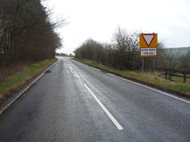
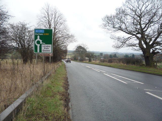
Witton Dene Images

Images are sourced within 2km of 54.802251/-1.634764 or Grid Reference NZ2345. Thanks to Geograph Open Source API. All images are credited.

View south from the A691 near Kaysburn View from beside the Durham to Consett road near Stobbilee House. Looking south over Langley Park to the south side of the Browney valley.
View south from the A691 near Kaysburn
View from beside the Durham to Consett road near Stobbilee House. Looking south over Langley Park to the south side of the Browney valley.
Sacriston, a misty Front Street
War memorial at Witton Gilbert The memorial is slightly elevated above the east side of the B6312 at the northern end of the village. 
The houses of Green Lea are seen behind the monument.
Remnants of the first snow of the winter are on the ground.
War memorial at Witton Gilbert
The memorial is slightly elevated above the east side of the B6312 at the northern end of the village. The houses of Green Lea are seen behind the monument. Remnants of the first snow of the winter are on the ground.
Field south of Sacriston The view is to the east over a field with an emerging crop from Bowbank, a road in a development known as Southburn Rise at the southern side Sacriston.
Field south of Sacriston
The view is to the east over a field with an emerging crop from Bowbank, a road in a development known as Southburn Rise at the southern side Sacriston.
Langley Lane approaching the junction with the A691 Heading east towards Durham.
Langley Lane approaching the junction with the A691
Heading east towards Durham.
A691 towards Durham Heading east.
A691 towards Durham
Heading east.
Grazing north of the A691
Bus stop and shelter on the A691
Bus on the A691, Newlands
Service station on the A691
A691 towards Durham  Heading east.
A691 towards Durham
Heading east.
Path beside the A691 Looking east.
Path beside the A691
Looking east.
The Travellers Rest, Witton Gilbert On Front Street.
The Travellers Rest, Witton Gilbert
On Front Street.
Sign for the Travellers Rest, Witton Gilbert
Bus stop and shelter on Front Street, Witton Gilbert Looking east.
Bus stop and shelter on Front Street, Witton Gilbert
Looking east.
Grazing off Norburn Lane
Norburn Lane Heading north.
Norburn Lane
Heading north.
The Glendenning Arms, Witton Gilbert On Front Street.
The Glendenning Arms, Witton Gilbert
On Front Street.
Show me another place!

Witton Dene is located at Grid Ref: NZ2345 (Lat: 54.802251, Lng: -1.634764)

Unitary Authority: County Durham

Police Authority: Durham

What 3 Words

///shocking.stoops.pronouns. Near Witton Gilbert, Co. Durham

Related Wikis

Witton Gilbert

Witton Gilbert is a village and civil parish in County Durham, England. == Geography == Witton Gilbert is situated about 3.7 miles (6.0 km) to the north...

Fyndoune Community College

Fyndoune Community College was a co-educational secondary school located in Sacriston, County Durham, England. Previous names have included Sacriston Secondary...

Witton Gilbert railway station

Witton Gilbert railway station served the village of Witton Gilbert, County Durham, England from 1862 to 1963 on the Lanchester Valley Line. == History... ==

Sacriston

Sacriston is a village and civil parish in County Durham, England, situated 3 miles (4.8 km) north of the city of Durham. Although the area has been populated...

Wall Nook

Wall Nook is a small village in County Durham, in England. It is situated to the south of Langley Park, to the north west of Durham. Wall Nook is known...

Langley Park Wind Farm

Langley Park Wind Farm is a wind farm near Langley Park, County Durham, England. It was developed by EDF Energy and is operated by Cumbria Wind Farms,...

Bearpark

Bearpark is a village and civil parish in County Durham in England. It is situated two and a half miles west of Durham, and a short distance to the north...

Langley Park, County Durham

Langley Park is a village in County Durham, England. The historic city of Durham lies 4 miles (6.4 km) to the east, and the larger city (and regional capital...

Nearby Amenities

Located within 500m of 54.802251,-1.634764
Crossing
Crossing: unmarked
Crossing Island: yes
Tactile Paving: yes
Lat/Long: 54.8050162/-1.6354211
Witton Gilbert
Place: village
Wikidata: Q778444
Lat/Long: 54.8059417/-1.6362242
Entrance: main
Lat/Long: 54.8020661/-1.6361781
Barrier: cycle_barrier
Foot: yes
Lat/Long: 54.8017715/-1.6342557
Crossing
Crossing: unmarked
Crossing Island: yes
Tactile Paving: no
Lat/Long: 54.8048525/-1.635868
Ford: yes
Lat/Long: 54.8005149/-1.631791
Bus Stop
School
Bench: yes
Naptan AtcoCode: 13005088C
Naptan Bearing: E
Naptan CommonName: School
Naptan Indicator: east bound
Naptan Landmark: Landmark not known
Naptan NaptanCode: durdgtgt
Naptan Notes: road B6312- in front of school- Witton Gilbert
Naptan Street: Sacriston Lane
Naptan Verified: no
Shelter: yes
Source: naptan_import
Tactile Paving: no
Lat/Long: 54.8062454/-1.6378295
Bus Stop
School
Bench: no
Naptan AtcoCode: 13005088F
Naptan Bearing: SW
Naptan CommonName: School
Naptan Indicator: south west bound
Naptan Landmark: Landmark not known
Naptan NaptanCode: durdgtgw
Naptan Notes: road B6312- in front of Glenville House- Witton Gilbert
Naptan Street: Sacriston Lane
Naptan Verified: no
Shelter: no
Source: naptan_import
Tactile Paving: no
Lat/Long: 54.8060774/-1.6387489
Bus Stop
Glendenning Arms
Bench: yes
Bin: yes
Bus: yes
Departures Board: timetable
Naptan AtcoCode: 13005091C
Naptan Bearing: E
Naptan CommonName: Glendenning Arms
Naptan Indicator: east bound
Naptan Landmark: Outside Hedleys Buildings
Naptan NaptanCode: durdgtjp
Naptan Street: Front Street
Naptan Verified: yes
Public Transport: platform
Shelter: yes
Source: naptan_import; survey
Tactile Paving: no
Lat/Long: 54.8053714/-1.6363967
Bus Stop
Glendenning Arms
Bench: yes
Naptan AtcoCode: 13005091G
Naptan Bearing: W
Naptan CommonName: Glendenning Arms
Naptan Indicator: west bound
Naptan Landmark: Outside No 9
Naptan NaptanCode: durdgtjt
Naptan Street: Front Street
Naptan Verified: yes
Shelter: yes
Source: naptan_import; survey
Tactile Paving: no
Lat/Long: 54.8052484/-1.6380025
Crossing
Check Date Crossing: 2020-12-25
Crossing: uncontrolled
Crossing Island: no
Crossing Ref: zebra
Tactile Paving: yes
Lat/Long: 54.8055446/-1.639816
Barrier: stile
Lat/Long: 54.804906/-1.6403925
Barrier: kissing_gate
Foot: yes
Lat/Long: 54.8037186/-1.6362423
Crossing
Crossing: unmarked
Tactile Paving: no
Lat/Long: 54.8044154/-1.6405976
Wildlife Meadow
Board Type: nature
Information: board
Tourism: information
Lat/Long: 54.8057155/-1.6320585
Waste Basket
Waste: dog_excrement
Lat/Long: 54.8058322/-1.6320518
Birds in the Dene
Board Type: wildlife
Information: board
Tourism: information
Lat/Long: 54.8017988/-1.6342458
Drinking Water
Bottle: yes
Lat/Long: 54.8021185/-1.6359125
Bench
Backrest: yes
Lat/Long: 54.8022054/-1.6363835
Pond Life
Board Type: nature
Information: board
Tourism: information
Lat/Long: 54.8042616/-1.6356654
Bench
Backrest: yes
Material: wood
Lat/Long: 54.8042442/-1.6360496
The Meadow
Board Type: nature
Information: board
Tourism: information
Lat/Long: 54.8044378/-1.6357479
Witton Gilbert Bypass
Historic: memorial
Memorial: plaque
Note: Date not clear from photo, 1996 or 1998?
Lat/Long: 54.8051551/-1.6371091
Barrier: stile
Foot: yes
Stile: stepover
Lat/Long: 54.8013659/-1.6391476
Barrier: stile
Material: wood
Lat/Long: 54.8046309/-1.640448
Addr City: Durham
Addr Housenumber: 16
Addr Postcode: DH7 6SY
Addr Street: Front Street
Addr Village: Witton Gilbert
Lat/Long: 54.8055176/-1.6401024
Addr City: Durham
Addr Housenumber: 15
Addr Postcode: DH7 6SY
Addr Street: Front Street
Addr Village: Witton Gilbert
Lat/Long: 54.8055091/-1.6399898
Addr City: Durham
Addr Housenumber: 13
Addr Postcode: DH7 6SY
Addr Street: Front Street
Addr Village: Witton Gilbert
Lat/Long: 54.8054643/-1.6397792
Addr Housename: Meadow House
Addr Street: Best's Yard
Lat/Long: 54.8052162/-1.6397323
The data included in this document is from www.openstreetmap.org. The data is made available under ODbL.

Have you been to Witton Dene?

Leave your review of Witton Dene below (or comments, questions and feedback).