Wilshaw

Settlement in Yorkshire

England

Wilshaw

Magdalen Road passing Royd Farm, Meltham Royd Farm is first shown on the 1906 1:2500 map. the house and bungalow were built later.
Magdalen Road passing Royd Farm, Meltham Credit: Humphrey Bolton

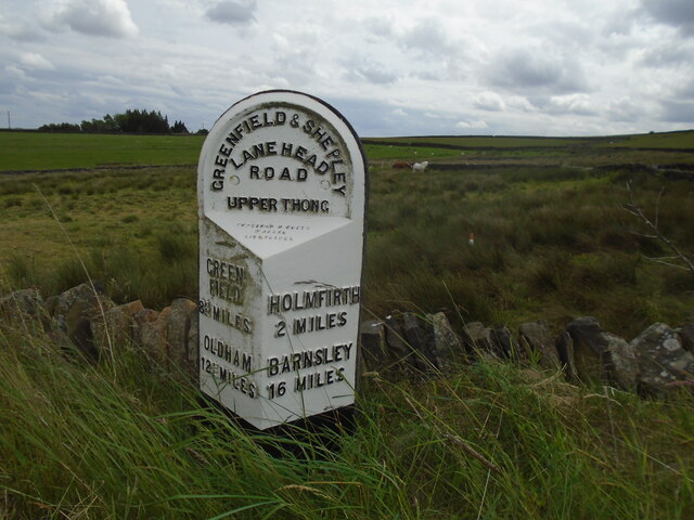
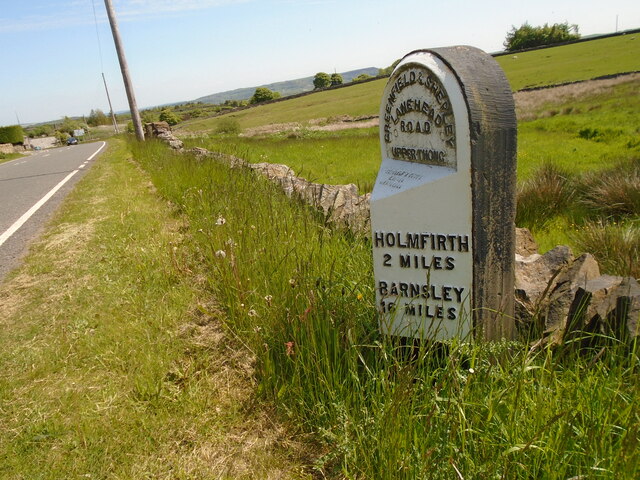
Wilshaw is a small village nestled in the picturesque countryside of West Yorkshire, England. Located just 5 miles southwest of the town of Huddersfield, it is part of the civil parish of Holme Valley. With a population of around 500 residents, Wilshaw exudes a charming and tight-knit community atmosphere.

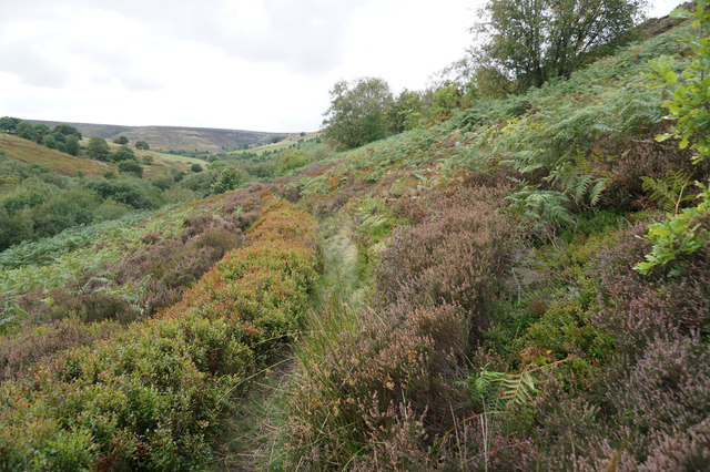
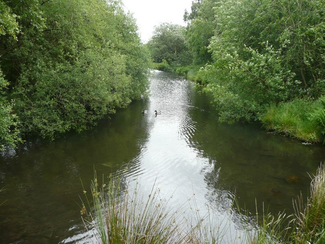
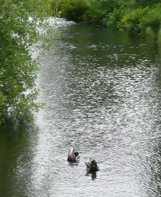
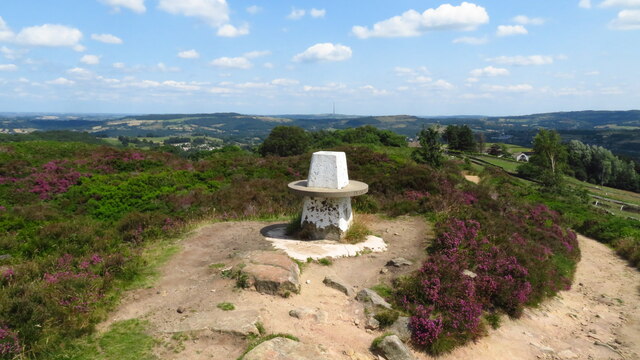
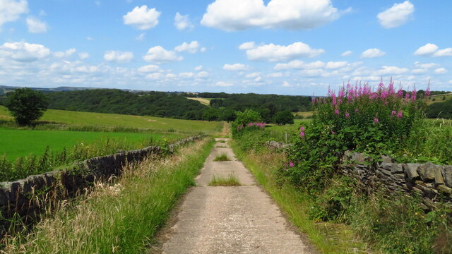
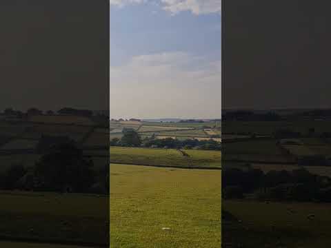
The village is renowned for its stunning natural beauty, surrounded by rolling hills, lush green fields, and ancient woodland. It offers a tranquil and idyllic setting, attracting visitors seeking a peaceful retreat from the hustle and bustle of city life.

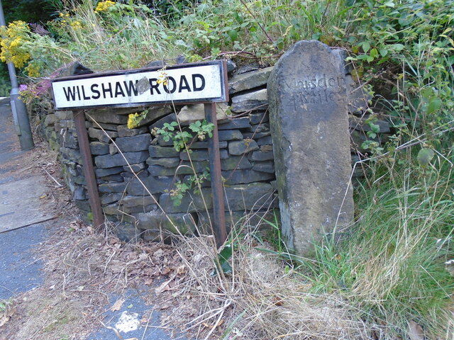
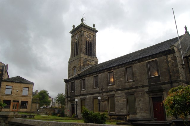
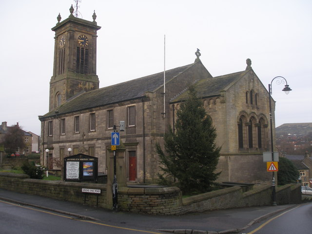
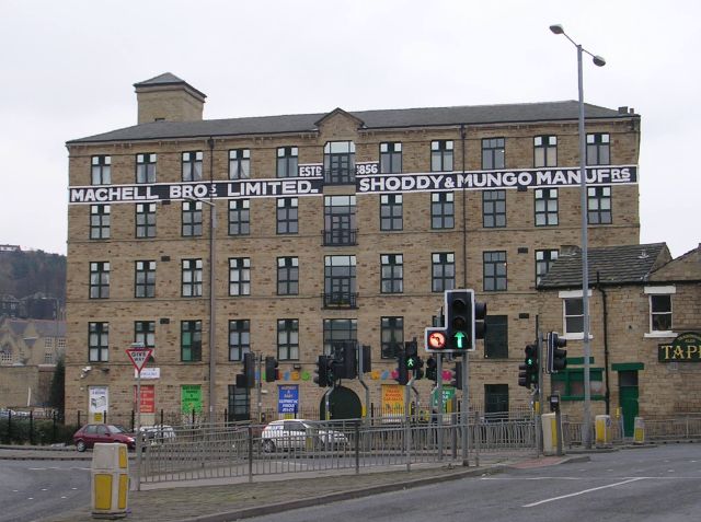
Wilshaw has a rich history dating back centuries, and evidence of its past can be seen in the village's architecture. Traditional stone-built houses, some dating back to the 17th century, line the narrow winding streets, adding to the village's charm and character.

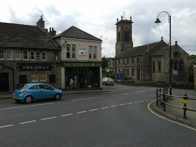
Although small in size, Wilshaw boasts a strong sense of community spirit. The village has a local pub, The Rose and Crown, which serves as the social hub for residents and visitors alike. The pub offers a warm and friendly atmosphere, where locals gather to enjoy a pint and engage in lively conversations.

Surrounded by nature, Wilshaw offers ample opportunities for outdoor activities. The village is located close to the Peak District National Park, providing residents and visitors with access to stunning hiking trails, cycling routes, and breathtaking scenery.

In conclusion, Wilshaw is a quaint and picturesque village in West Yorkshire, offering a peaceful and close-knit community atmosphere, stunning natural surroundings, and a rich history that is evident in its charming architecture.

If you have any feedback on the listing, please let us know in the comments section below.
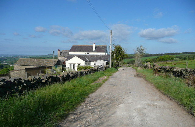
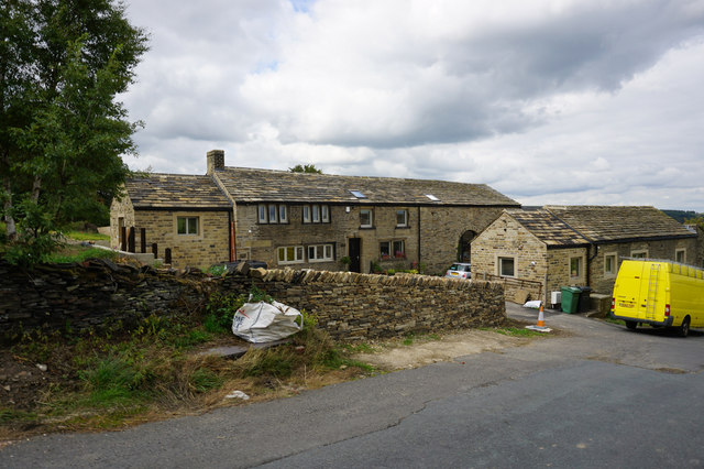
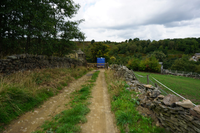
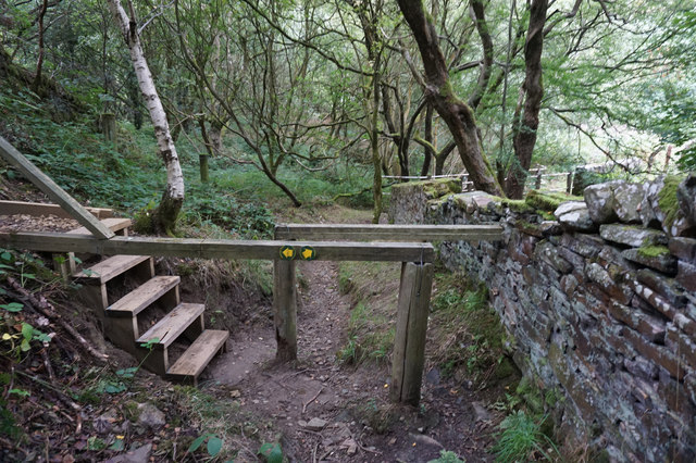
Wilshaw Images

Images are sourced within 2km of 53.584687/-1.8249677 or Grid Reference SE1109. Thanks to Geograph Open Source API. All images are credited.

Magdalen Road passing Royd Farm, Meltham Royd Farm is first shown on the 1906 1:2500 map. the house and bungalow were built later.
Magdalen Road passing Royd Farm, Meltham
Royd Farm is first shown on the 1906 1:2500 map. the house and bungalow were built later.
House on Royd Road near Meltham
Hebble Lane towards Intake Farm
Path leading to Royd Edge
Path leading to Royd Edge The left hand path leads to Royd Farm.
Path leading to Royd Edge
The left hand path leads to Royd Farm.
Footbridge over Royd Edge Clough
Path below Royd Edge
Millpond, Royd Edge Clough, Meltham This is the upstream end of the millpond for Royd Edge Mill. This pond is of the long narrow type, parallel with the stream.
Millpond, Royd Edge Clough, Meltham
This is the upstream end of the millpond for Royd Edge Mill. This pond is of the long narrow type, parallel with the stream.
Ducks on the millpond Although the subject really is the ripples on the water.  It was a windy day.
Ducks on the millpond
Although the subject really is the ripples on the water. It was a windy day.
Old milestone This is one of three remaining roadside guidestones/milestones in the West Yorkshire area of the Dark Peak.  A fourth is in the Tolson Museum, Huddersfield.   It is at the SE corner of Wilshaw Road (B6107) with Thick Hollins Road.  On the right-hand face Penist/11 Mile can just be made out.   On the back a faint Holmfirth/2 Miles.   In 'Huddersfield Highways Down the Ages' by WB Crump (1949) a sketch shows the date 1761 on the Holmfirth face.  When first recorded for the Milestone Society in 2002 it was leaning considerably but by 2005 had been set upright.
Old milestone
This is one of three remaining roadside guidestones/milestones in the West Yorkshire area of the Dark Peak. A fourth is in the Tolson Museum, Huddersfield. It is at the SE corner of Wilshaw Road (B6107) with Thick Hollins Road. On the right-hand face Penist/11 Mile can just be made out. On the back a faint Holmfirth/2 Miles. In 'Huddersfield Highways Down the Ages' by WB Crump (1949) a sketch shows the date 1761 on the Holmfirth face. When first recorded for the Milestone Society in 2002 it was leaning considerably but by 2005 had been set upright.
Trig Point on Wolfstones Heights
Track leading down to Bank Dike from B6107
Old milestone Another of the original 615 mileposts set up by the family firm of Gill Stead & Son of Mirfield for the newly formed West Riding County Council in 1893/94.   The attachment was forged at the Brayshaw & Booth foundry in Liversedge.   A few years ago several milestones in the area were repainted and this one also set upright.   It is on the south side of the A635 just west of Green Gate Road.   This route was turnpiked in 1823 to the 1880s.   The milestone is Grade II listed 1313569.
Old milestone
Another of the original 615 mileposts set up by the family firm of Gill Stead & Son of Mirfield for the newly formed West Riding County Council in 1893/94. The attachment was forged at the Brayshaw & Booth foundry in Liversedge. A few years ago several milestones in the area were repainted and this one also set upright. It is on the south side of the A635 just west of Green Gate Road. This route was turnpiked in 1823 to the 1880s. The milestone is Grade II listed 1313569.
Old milestone Travelling towards Holmfirth the road is mostly downhill from here.   Luckily the verge cutter is only cutting a narrow strip so avoiding the milestone and the telegraph poles.
Old milestone
Travelling towards Holmfirth the road is mostly downhill from here. Luckily the verge cutter is only cutting a narrow strip so avoiding the milestone and the telegraph poles.
Meltham Church
Meltham Church
The Church of St Bartholomew, Meltham
The Church of St Bartholomew at Meltham Viewed from the south-east.
The Church of St Bartholomew at Meltham
Viewed from the south-east.
Ordnance Survey Cut Mark This can be found on the wall of St Bartholomews Church, Meltham.
For more detail see : <span class="nowrap"><a title="http://www.bench-marks.org.uk/bm46320" rel="nofollow ugc noopener" href="http://www.bench-marks.org.uk/bm46320">Link</a><img style="margin-left:2px;" alt="External link" title="External link - shift click to open in new window" src="https://s1.geograph.org.uk/img/external.png" width="10" height="10"/></span>
Ordnance Survey Cut Mark
This can be found on the wall of St Bartholomews Church, Meltham. For more detail see : LinkExternal link
Show me another place!

Wilshaw is located at Grid Ref: SE1109 (Lat: 53.584687, Lng: -1.8249677)

Division: West Riding

Unitary Authority: Kirklees

Police Authority: West Yorkshire

What 3 Words

///paused.pounds.racing. Near Meltham Mills, West Yorkshire

Related Wikis

Holme Valley

Holme Valley, formerly Holmfirth is a large civil parish in the metropolitan borough of Kirklees in West Yorkshire, England. It has a population of 25...

South Crosland

South Crosland is a village in the metropolitan borough of Kirklees in West Yorkshire, England. It was originally a chapelry in the civil parish of Almondbury...

Meltham Town Hall

Meltham Town Hall is a municipal building in Carlile Street in Meltham, West Yorkshire, England. The building, which formerly operated as the offices of...

Heavy Woollen District

The Heavy Woollen District is a region of textile-focused industrial development in West Yorkshire, England. It acquired the name because of the heavyweight...

Related Videos

Being Watched ! #hiking #outdoors #sheep #shorts #walking #rucking #walkingshorts #hikinguk

Hot and sweaty loaded 6 miler today. Did 6 yesterday too loaded with 34lb in weight not including water. #altberg defender boots ...

Nearby Amenities

Located within 500m of 53.584687,-1.8249677
Bus Stop
Wilshaw Road St Marys Court
Local Ref: 45019185
Naptan AtcoCode: 450019185
Naptan Bearing: E
Naptan CommonName: Wilshaw Road St Marys Court
Naptan Crossing: St Marys Court
Naptan Indicator: Stop 45019185
Naptan Landmark: Old Peoples Home
Naptan PlusbusZoneRef: LEEDS
Naptan ShortCommonName: St. Marys Court
Naptan Street: Wilshaw Road
Naptan Verified: no
Public Transport: platform
Source: naptan_import
Lat/Long: 53.5832304/-1.8208076
Bus Stop
Wilshaw Road St Marys Court
Local Ref: 45019186
Naptan AtcoCode: 450019186
Naptan Bearing: W
Naptan CommonName: Wilshaw Road St Marys Court
Naptan Crossing: St Marys Court
Naptan Indicator: Stop 45019186
Naptan Landmark: Wilshaw Croft School
Naptan PlusbusZoneRef: LEEDS
Naptan ShortCommonName: St. Marys Court
Naptan Street: Wilshaw Road
Naptan Verified: no
Public Transport: platform
Source: naptan_import
Lat/Long: 53.5836556/-1.8226486
Bus Stop
Wilshaw Road Lower Greave Road
Bus: yes
Local Ref: 45019187
Naptan AtcoCode: 450019187
Naptan Bearing: W
Naptan CommonName: Wilshaw Road Lower Greave Road
Naptan Crossing: Lower Greave Road
Naptan Indicator: Stop 45019187
Naptan Landmark: St. Marys Church
Naptan PlusbusZoneRef: LEEDS
Naptan ShortCommonName: St. Marys Church
Naptan Street: Wilshaw Road
Naptan Verified: no
Public Transport: platform
Source: naptan_import
Lat/Long: 53.5847069/-1.8260672
Bus Stop
Wilshaw Road Willshaw Mill Road
Local Ref: 45019188
Naptan AtcoCode: 450019188
Naptan Bearing: E
Naptan CommonName: Wilshaw Road Willshaw Mill Road
Naptan Crossing: Wilshaw Mill Road
Naptan Indicator: Stop 45019188
Naptan Landmark: Meltham Golf Course
Naptan PlusbusZoneRef: LEEDS
Naptan ShortCommonName: Wilshaw Mill Road
Naptan Street: Wilshaw Road
Naptan Verified: no
Public Transport: platform
Source: naptan_import
Lat/Long: 53.5848346/-1.8299096
Wilshaw Road Old Peoples Home
Local Ref: 45050770
Naptan AtcoCode: 450050770
Naptan Bearing: W
Naptan BusStopType: CUS
Naptan CommonName: Wilshaw Road Old Peoples Home
Naptan Indicator: Stop 45050770
Naptan PlusbusZoneRef: LEEDS
Naptan ShortCommonName: Wilshaw
Naptan Street: Wilshaw Road
Naptan Verified: no
Source: naptan_import
Lat/Long: 53.5831495/-1.8208533
Wilshaw Road Wilshaw Croft School
Local Ref: 45050771
Naptan AtcoCode: 450050771
Naptan Bearing: E
Naptan BusStopType: CUS
Naptan CommonName: Wilshaw Road Wilshaw Croft School
Naptan Indicator: Stop 45050771
Naptan PlusbusZoneRef: LEEDS
Naptan ShortCommonName: Lower Greave
Naptan Street: Wilshaw Road
Naptan Verified: no
Source: naptan_import
Lat/Long: 53.5837364/-1.822603
Wilshaw Road St Mary-s Church
Local Ref: 45050772
Naptan AtcoCode: 450050772
Naptan Bearing: E
Naptan BusStopType: CUS
Naptan CommonName: Wilshaw Road St Mary-s Church
Naptan Indicator: Stop 45050772
Naptan PlusbusZoneRef: LEEDS
Naptan ShortCommonName: Gill Birks
Naptan Street: Wilshaw Road
Naptan Verified: no
Source: naptan_import
Lat/Long: 53.5847865/-1.8260506
Mill Road
Local Ref: 45050773
Naptan AtcoCode: 450050773
Naptan Bearing: W
Naptan BusStopType: CUS
Naptan CommonName: Mill Road
Naptan Indicator: Stop 45050773
Naptan PlusbusZoneRef: LEEDS
Naptan ShortCommonName: Wilshaw Mill Road
Naptan Street: Wilshaw Road
Naptan Verified: no
Source: naptan_import
Lat/Long: 53.5847447/-1.8299099
Barrier: stile
Lat/Long: 53.5872621/-1.8207618
Barrier: stile
Lat/Long: 53.5865292/-1.8230206
Telephone
Booth: K6
Covered: booth
Listed Status: Grade II
Man Made: telephone_box
Lat/Long: 53.5845761/-1.8245564
Post Box
Collection Times: Mo-Fr 16:30; Sa 10:30
Operator: Royal Mail
Post Box Type: lamp
Ref: HD9 65
Royal Cypher: EIIR
Lat/Long: 53.5845506/-1.824551
Community Centre
Wilshaw Village Hall
Addr City: Wilshaw
Community Centre: village_hall
Lat/Long: 53.5837083/-1.8232289
Power: pole
Lat/Long: 53.5841987/-1.830504
Power: pole
Lat/Long: 53.5841516/-1.8292197
Power: pole
Lat/Long: 53.5842348/-1.8317298
Power: pole
Lat/Long: 53.5839073/-1.8237381
Power: pole
Lat/Long: 53.5827524/-1.8249702
Power: pole
Lat/Long: 53.5822278/-1.8255392
Power: pole
Lat/Long: 53.5819965/-1.8263448
Power: pole
Lat/Long: 53.5818475/-1.8269098
Power: pole
Lat/Long: 53.5811848/-1.8274826
Power: pole
Lat/Long: 53.5825828/-1.8190504
Power: pole
Lat/Long: 53.5827307/-1.8201665
Power: pole
Lat/Long: 53.5830591/-1.822394
Line Management: branch
Power: pole
Lat/Long: 53.583298/-1.8244035
Barrier: stile
Lat/Long: 53.5872707/-1.820682
The data included in this document is from www.openstreetmap.org. The data is made available under ODbL.

Have you been to Wilshaw?

Leave your review of Wilshaw below (or comments, questions and feedback).