Thick Hollins Moor

Downs, Moorland in Yorkshire

England

Thick Hollins Moor

Meltham to West Nab Looking back along the footpath towards Meltham, in the distance can be seen Victoria Tower (known locally as Castle Hill) and opposite it on the far right, just in shot, is Emley Moor mast.
Meltham to West Nab Credit: terry

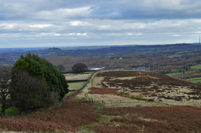
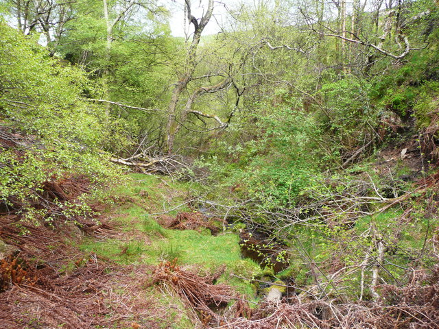
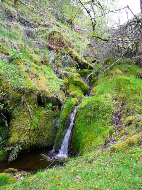
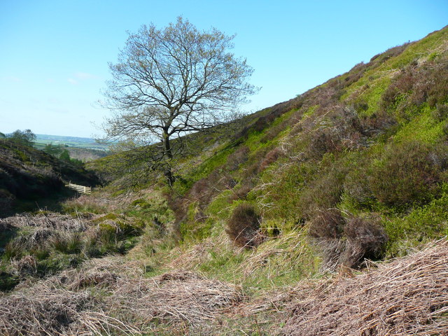
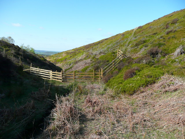
Thick Hollins Moor, located in Yorkshire, is a picturesque expanse of land characterized by its rolling hills, vast moorland, and stunning views. Situated within the Yorkshire Dales National Park, this area covers a considerable portion of the county and is renowned for its natural beauty and diverse wildlife.

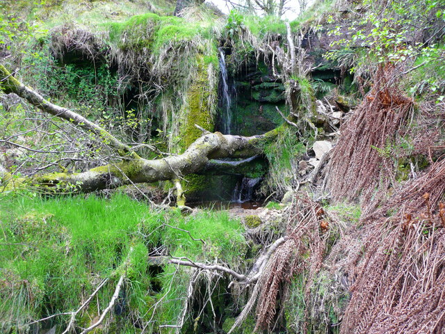
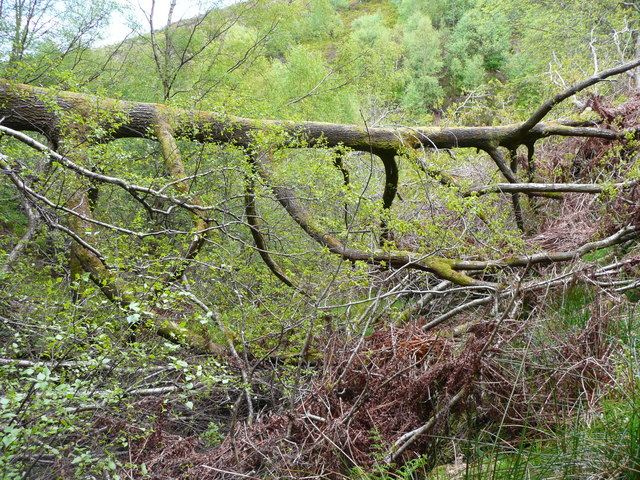
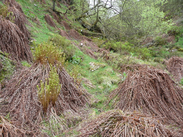
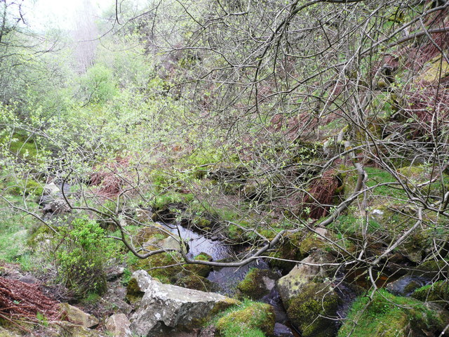
The moorland of Thick Hollins Moor is dominated by heather, which blooms with vibrant purple hues during the summer months, creating a stunning visual spectacle. The undulating landscape is dotted with scattered boulders and rocky outcrops, adding to its rugged charm. This area is home to a variety of flora and fauna, including curlews, lapwings, and red grouse, which thrive in the moorland habitat.

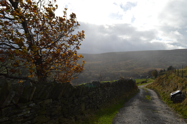
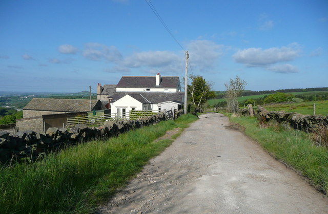
Visitors to Thick Hollins Moor can enjoy a range of activities, such as hiking, birdwatching, and photography. There are several well-marked trails that wind through the moorland, offering breathtaking views of the surrounding countryside. The tranquility and solitude found in this remote location make it an ideal destination for nature enthusiasts and those seeking an escape from the hustle and bustle of modern life.

In addition to its natural beauty, Thick Hollins Moor also has a rich cultural heritage. The area is scattered with remnants of its industrial past, including the remains of lead mines and lime kilns, providing a glimpse into the region's history. These historical features, combined with the stunning landscape, create a unique and captivating experience for visitors to Thick Hollins Moor, making it a must-visit destination for those exploring Yorkshire's Downs and Moorland.

If you have any feedback on the listing, please let us know in the comments section below.

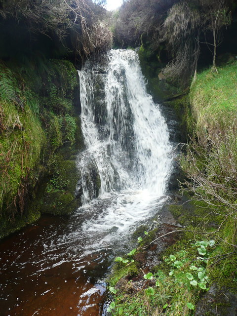
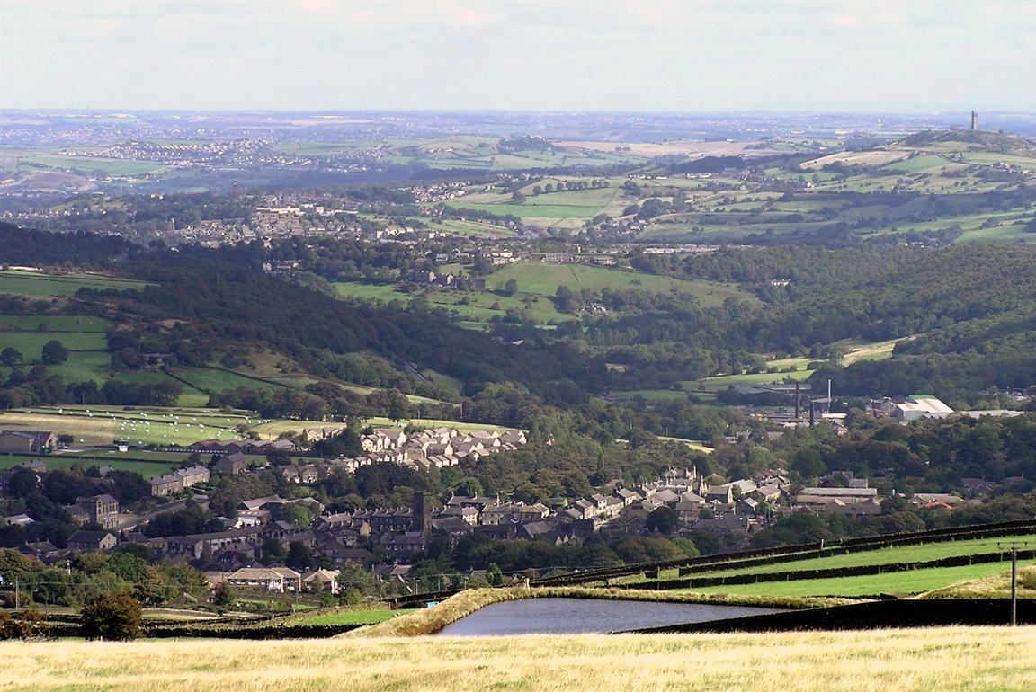
Thick Hollins Moor Images

Images are sourced within 2km of 53.580279/-1.8351053 or Grid Reference SE1109. Thanks to Geograph Open Source API. All images are credited.

Meltham to West Nab Looking back along the footpath towards Meltham, in the distance can be seen Victoria Tower (known locally as Castle Hill) and opposite it on the far right, just in shot, is Emley Moor mast.
Meltham to West Nab
Looking back along the footpath towards Meltham, in the distance can be seen Victoria Tower (known locally as Castle Hill) and opposite it on the far right, just in shot, is Emley Moor mast.
Sun Royd farm Meltham The track leading down to Sun Royd farm from where the footpath leads off, this track to the farm, a footpath off to the right going towards West Nab.
Sun Royd farm Meltham
The track leading down to Sun Royd farm from where the footpath leads off, this track to the farm, a footpath off to the right going towards West Nab.
Magdalen Road passing Royd Farm, Meltham Royd Farm is first shown on the 1906 1:2500 map. the house and bungalow were built later.
Magdalen Road passing Royd Farm, Meltham
Royd Farm is first shown on the 1906 1:2500 map. the house and bungalow were built later.
Waterfall in Middle Clough, Meltham This was taken a little further away than <a href="https://www.geograph.org.uk/photo/4475594">SE0908 : Middle Clough, Meltham, a big waterfall</a> to show the cliff face that has to be negotiated to continue further up the valley, or to come down. It is an awkward climb, and there are some loose stones on the way up.
Waterfall in Middle Clough, Meltham
This was taken a little further away than SE0908 : Middle Clough, Meltham, a big waterfall to show the cliff face that has to be negotiated to continue further up the valley, or to come down. It is an awkward climb, and there are some loose stones on the way up.
Middle Clough, below the tall waterfall, Meltham This is a wilderness. You have to pick your way carefully through the fallen trees and beware of slippery moss-covered boulders.
Middle Clough, below the tall waterfall, Meltham
This is a wilderness. You have to pick your way carefully through the fallen trees and beware of slippery moss-covered boulders.
Mossy waterfall, Middle Clough, Meltham
Fallen oak tree across Middle Clough, Meltham This is a difficult obstacle, but not impassable. Getting past it involves crossing the stream on branches of the tree, which is still alive despite being horizontal.
Fallen oak tree across Middle Clough, Meltham
This is a difficult obstacle, but not impassable. Getting past it involves crossing the stream on branches of the tree, which is still alive despite being horizontal.
Rams Clough at the Oak Tree, Meltham Spot the difference from <a href="https://www.geograph.org.uk/photo/4476782">SE0908 : Rams Clough at the oak tree, Meltham</a>. The tree hasn't grown much, however there is a new wooden fence across the valley floor in the distance.
Rams Clough at the Oak Tree, Meltham
Spot the difference from SE0908 : Rams Clough at the oak tree, Meltham. The tree hasn't grown much, however there is a new wooden fence across the valley floor in the distance.
New fence across Rams Clough This is presumably to stop sheep from going down the valley. It joins the stock-proof fence on each side. Perhaps it was considered that a more robust fence was needed across the valley floor.
New fence across Rams Clough
This is presumably to stop sheep from going down the valley. It joins the stock-proof fence on each side. Perhaps it was considered that a more robust fence was needed across the valley floor.
Ferns waking up in Rams Clough, Meltham See also <a href="https://www.geograph.org.uk/photo/4476758">SE0908 : Rams Clough, Meltham</a> and <a href="https://www.geograph.org.uk/photo/4033021">SE0908 : Ferns in Rams Clough</a>.
Ferns waking up in Rams Clough, Meltham
Tree in Rams Clough, Meltham This tree has long, slender branches that stretch out sideways close to the ground.
Tree in Rams Clough, Meltham
This tree has long, slender branches that stretch out sideways close to the ground.
Magdalen Road towards Meltham
Private lane towards Harden Moss Farm
A635 and a lone tree at Knowl Height
Waterfall on Middle Clough, Meltham This waterfall is on the side of the ravine; there is a sheer cliff across the valley on the right. Be warned that it is difficult to reach this viewpoint
Waterfall on Middle Clough, Meltham
This waterfall is on the side of the ravine; there is a sheer cliff across the valley on the right. Be warned that it is difficult to reach this viewpoint
Rams Clough, Meltham This is an attractive part of the valley where there are large clumps of fern (still dormant after the cold winter and early spring). Walking down this valley and back seems to get more difficult each time I visit.
Rams Clough, Meltham
This is an attractive part of the valley where there are large clumps of fern (still dormant after the cold winter and early spring). Walking down this valley and back seems to get more difficult each time I visit.
Waterfall on Rams Clough, Meltham This is the best waterfall on the stream. You have to climb well up through the heather to get past it - don't get near the edge!
Waterfall on Rams Clough, Meltham
This is the best waterfall on the stream. You have to climb well up through the heather to get past it - don't get near the edge!
Waterfall on Rams Clough, Meltham This is just below a wooden fence across the valley bottom, which prevents sheep from straying down the clough.
Waterfall on Rams Clough, Meltham
This is just below a wooden fence across the valley bottom, which prevents sheep from straying down the clough.
Show me another place!

Thick Hollins Moor is located at Grid Ref: SE1109 (Lat: 53.580279, Lng: -1.8351053)

Division: West Riding

Unitary Authority: Kirklees

Police Authority: West Yorkshire

What 3 Words

///snored.drops.incurring. Near Meltham Mills, West Yorkshire

Related Wikis

Meltham Town Hall

Meltham Town Hall is a municipal building in Carlile Street in Meltham, West Yorkshire, England. The building, which formerly operated as the offices of...

Meltham

Meltham is a town and civil parish within the Metropolitan Borough of Kirklees, in West Yorkshire, England. It lies in the Holme Valley, below Wessenden...

Meltham railway station (England)

Meltham railway station was the terminus of the Meltham branch line from Lockwood (Huddersfield) to Meltham, in the West Riding of Yorkshire, England....

Austonley

Austonley is a hamlet in the civil parish of Holme Valley, West Yorkshire, England, about 2 miles (3.2 km) west of Holmfirth.

Upperthong

Upperthong is a village approximately 807 feet (246 m) above sea level, near the town of Holmfirth in Holme Valley, approximately 7 miles (11 km) south...

Digley Reservoir

Digley Reservoir is a lake located downstream of Bilberry Reservoir, 2 miles (3.2 km) south west of Holmfirth, in West Yorkshire, England. The reservoir...

Holme Valley

Holme Valley, formerly Holmfirth is a large civil parish in the metropolitan borough of Kirklees in West Yorkshire, England. It has a population of 25...

Holmfirth floods

The Holmfirth floods were a number of instances when severe flooding had occurred in the Holme Valley, West Yorkshire, England affecting Holmfirth and...

Nearby Amenities

Located within 500m of 53.580279,-1.8351053
Burned Hill
Natural: peak
Note: approx location
Source: OS_OpenData_StreetView
Lat/Long: 53.5813776/-1.8311015
Source: OS_OpenData_StreetView
Lat/Long: 53.5794731/-1.837764
Power: pole
Lat/Long: 53.5846991/-1.835655
Power: pole
Lat/Long: 53.5844926/-1.8342983
Power: pole
Lat/Long: 53.5842985/-1.8329697
Power: pole
Lat/Long: 53.5842348/-1.8317298
Power: pole
Lat/Long: 53.5805015/-1.8280856
Power: pole
Lat/Long: 53.57982/-1.8285979
Power: pole
Lat/Long: 53.5791671/-1.829196
Power: pole
Lat/Long: 53.578503/-1.8297673
Power: pole
Lat/Long: 53.5778851/-1.8301241
Barrier: stile
Lat/Long: 53.5792672/-1.8419536
The data included in this document is from www.openstreetmap.org. The data is made available under ODbL.

Have you been to Thick Hollins Moor?

Leave your review of Thick Hollins Moor below (or comments, questions and feedback).