Brook's Plantation

Wood, Forest in Yorkshire

England

Brook's Plantation

Magdalen Road passing Royd Farm, Meltham Royd Farm is first shown on the 1906 1:2500 map. the house and bungalow were built later.
Magdalen Road passing Royd Farm, Meltham Credit: Humphrey Bolton

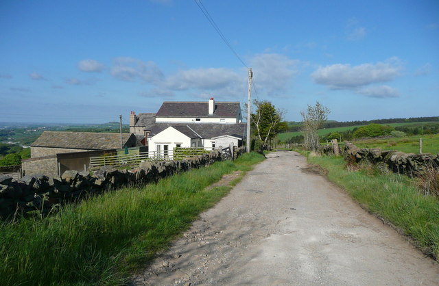
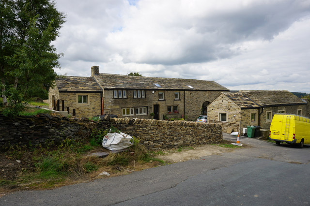
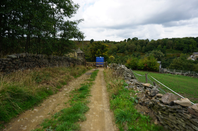
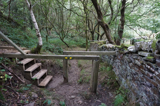
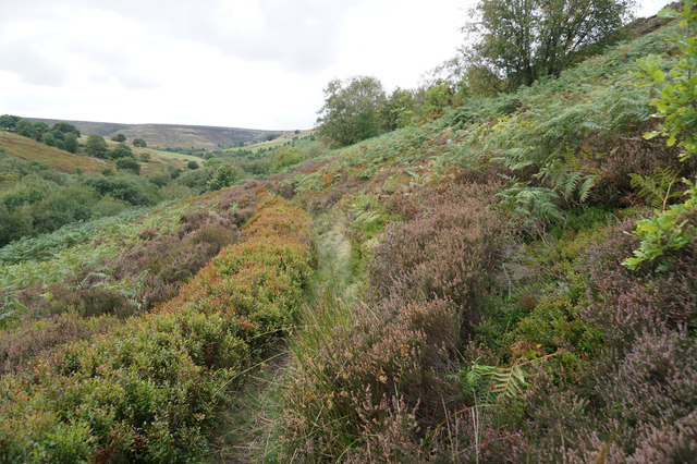
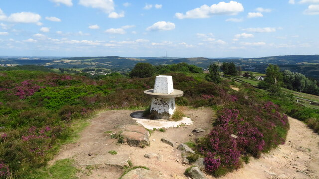
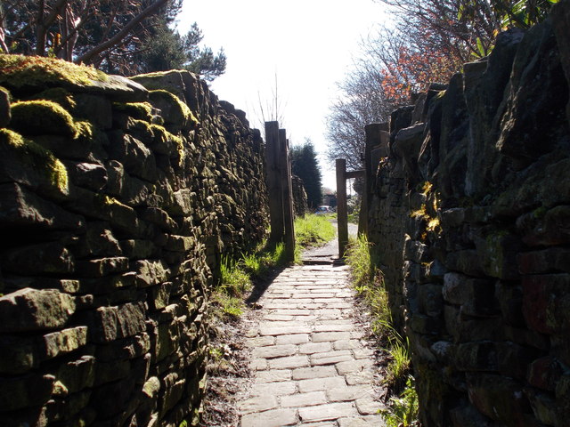
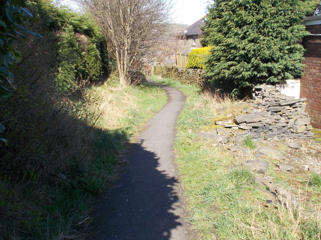
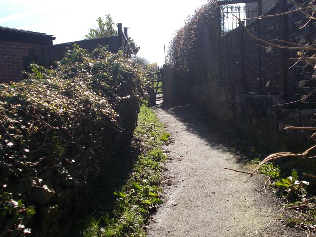
Brook's Plantation, Yorkshire (Wood, Forest) is a lush and sprawling wooded area located in the county of Yorkshire, England. Spanning across several acres, this picturesque plantation is known for its dense foliage, towering trees, and serene atmosphere.

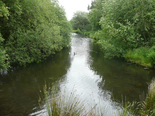
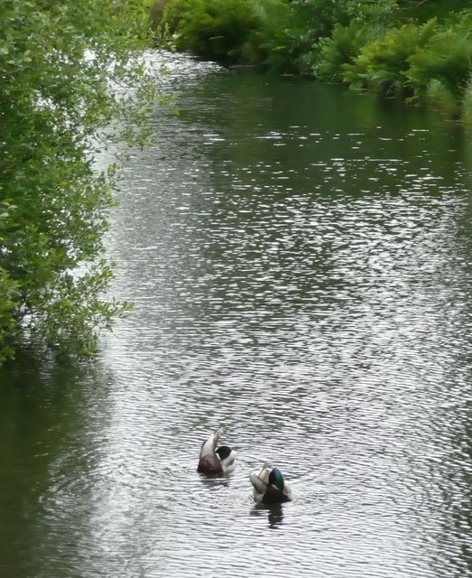
The plantation is home to a rich variety of flora and fauna, making it a popular destination for nature enthusiasts and wildlife lovers. The diverse range of tree species, including oak, beech, and birch, create a vibrant and evergreen landscape throughout the year. The forest floor is adorned with a tapestry of wildflowers, ferns, and moss, adding to its natural charm.

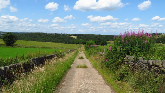
Visitors to Brook's Plantation can enjoy a peaceful stroll along the well-maintained trails that wind through the forest. The tranquil ambiance and the soothing sound of birdsong make it an ideal escape from the hustle and bustle of city life. The plantation also offers picnic spots and designated areas for outdoor activities, such as camping and birdwatching.

In addition to its natural beauty, Brook's Plantation holds historical significance. It is believed to have been used for timber production in the past, contributing to the region's economy. The remnants of old sawmills and logging equipment can still be found, reminding visitors of the plantation's rich history.

Overall, Brook's Plantation, Yorkshire (Wood, Forest) is a captivating destination that offers a harmonious blend of nature, history, and recreation. Whether one seeks solace amidst the trees or wishes to explore the remnants of the past, this enchanting plantation provides a memorable experience for all who visit.

If you have any feedback on the listing, please let us know in the comments section below.

Brook's Plantation Images

Images are sourced within 2km of 53.58006/-1.8261648 or Grid Reference SE1109. Thanks to Geograph Open Source API. All images are credited.

Magdalen Road passing Royd Farm, Meltham Royd Farm is first shown on the 1906 1:2500 map. the house and bungalow were built later.
Magdalen Road passing Royd Farm, Meltham
Royd Farm is first shown on the 1906 1:2500 map. the house and bungalow were built later.
House on Royd Road near Meltham
Hebble Lane towards Intake Farm
Path leading to Royd Edge
Path leading to Royd Edge The left hand path leads to Royd Farm.
Path leading to Royd Edge
The left hand path leads to Royd Farm.
Footbridge over Royd Edge Clough
Path below Royd Edge
Millpond, Royd Edge Clough, Meltham This is the upstream end of the millpond for Royd Edge Mill. This pond is of the long narrow type, parallel with the stream.
Millpond, Royd Edge Clough, Meltham
This is the upstream end of the millpond for Royd Edge Mill. This pond is of the long narrow type, parallel with the stream.
Ducks on the millpond Although the subject really is the ripples on the water.  It was a windy day.
Ducks on the millpond
Although the subject really is the ripples on the water. It was a windy day.
Old milestone This is one of three remaining roadside guidestones/milestones in the West Yorkshire area of the Dark Peak.  A fourth is in the Tolson Museum, Huddersfield.   It is at the SE corner of Wilshaw Road (B6107) with Thick Hollins Road.  On the right-hand face Penist/11 Mile can just be made out.   On the back a faint Holmfirth/2 Miles.   In 'Huddersfield Highways Down the Ages' by WB Crump (1949) a sketch shows the date 1761 on the Holmfirth face.  When first recorded for the Milestone Society in 2002 it was leaning considerably but by 2005 had been set upright.
Old milestone
This is one of three remaining roadside guidestones/milestones in the West Yorkshire area of the Dark Peak. A fourth is in the Tolson Museum, Huddersfield. It is at the SE corner of Wilshaw Road (B6107) with Thick Hollins Road. On the right-hand face Penist/11 Mile can just be made out. On the back a faint Holmfirth/2 Miles. In 'Huddersfield Highways Down the Ages' by WB Crump (1949) a sketch shows the date 1761 on the Holmfirth face. When first recorded for the Milestone Society in 2002 it was leaning considerably but by 2005 had been set upright.
Trig Point on Wolfstones Heights
Track leading down to Bank Dike from B6107
Old milestone Another of the original 615 mileposts set up by the family firm of Gill Stead & Son of Mirfield for the newly formed West Riding County Council in 1893/94.   The attachment was forged at the Brayshaw & Booth foundry in Liversedge.   A few years ago several milestones in the area were repainted and this one also set upright.   It is on the south side of the A635 just west of Green Gate Road.   This route was turnpiked in 1823 to the 1880s.   The milestone is Grade II listed 1313569.
Old milestone
Another of the original 615 mileposts set up by the family firm of Gill Stead & Son of Mirfield for the newly formed West Riding County Council in 1893/94. The attachment was forged at the Brayshaw & Booth foundry in Liversedge. A few years ago several milestones in the area were repainted and this one also set upright. It is on the south side of the A635 just west of Green Gate Road. This route was turnpiked in 1823 to the 1880s. The milestone is Grade II listed 1313569.
Old milestone Travelling towards Holmfirth the road is mostly downhill from here.   Luckily the verge cutter is only cutting a narrow strip so avoiding the milestone and the telegraph poles.
Old milestone
Travelling towards Holmfirth the road is mostly downhill from here. Luckily the verge cutter is only cutting a narrow strip so avoiding the milestone and the telegraph poles.
Old Milestone by the A635, Greenfield Road, west of Holmfirth Metal plate attached to stone post by the A635, in parish of Holme Valley (Kirklees District), Greenfield Road, Upperthorpe, Holmfirth, by electricity pylon 196, just above bus turning circle on opposite side of road, on North side of road. Brayshaw & Booth iron casting, erected by the County Council in the 19th century. An earlier photograph can be seen here <a title="https://www.geograph.org.uk/photo/6102142" href="https://www.geograph.org.uk/photo/6102142">Link</a>.

Inscription reads:-
: HOLMFIRTH / 1 MILE / BARNSLEY / 15 MILES : : GREENFIELD & SHEPLEY / LANE HEAD / ROAD / UPPERTHONG : : GREEN / FIELD / 9½ MILES / OLDHAM / 13¾ MILES :
Maker:-
: BRAYSHAW & BOOTH / MAKERS / LIVERSEDGE :

Grade II Listed.
List Entry Number: 1134872 <span class="nowrap"><a title="https://historicengland.org.uk/listing/the-list/list-entry/1134872" rel="nofollow ugc noopener" href="https://historicengland.org.uk/listing/the-list/list-entry/1134872">Link</a><img style="margin-left:2px;" alt="External link" title="External link - shift click to open in new window" src="https://s1.geograph.org.uk/img/external.png" width="10" height="10"/></span>

Milestone Society National ID: YW_GFSLH09
Old Milestone by the A635, Greenfield Road, west of Holmfirth
Metal plate attached to stone post by the A635, in parish of Holme Valley (Kirklees District), Greenfield Road, Upperthorpe, Holmfirth, by electricity pylon 196, just above bus turning circle on opposite side of road, on North side of road. Brayshaw & Booth iron casting, erected by the County Council in the 19th century. An earlier photograph can be seen here Link. Inscription reads:- : HOLMFIRTH / 1 MILE / BARNSLEY / 15 MILES : : GREENFIELD & SHEPLEY / LANE HEAD / ROAD / UPPERTHONG : : GREEN / FIELD / 9½ MILES / OLDHAM / 13¾ MILES : Maker:- : BRAYSHAW & BOOTH / MAKERS / LIVERSEDGE : Grade II Listed. List Entry Number: 1134872 LinkExternal link Milestone Society National ID: YW_GFSLH09
Footpath - Tinker Lane
Footpath - Heather Road
Show me another place!

Brook's Plantation is located at Grid Ref: SE1109 (Lat: 53.58006, Lng: -1.8261648)

Division: West Riding

Unitary Authority: Kirklees

Police Authority: West Yorkshire

What 3 Words

///automatic.flopping.benched. Near Meltham Mills, West Yorkshire

Related Wikis

Upperthong

Upperthong is a village approximately 807 feet (246 m) above sea level, near the town of Holmfirth in Holme Valley, approximately 7 miles (11 km) south...

Holme Valley

Holme Valley, formerly Holmfirth is a large civil parish in the metropolitan borough of Kirklees in West Yorkshire, England. It has a population of 25...

Austonley

Austonley is a hamlet in the civil parish of Holme Valley, West Yorkshire, England, about 2 miles (3.2 km) west of Holmfirth.

Meltham Town Hall

Meltham Town Hall is a municipal building in Carlile Street in Meltham, West Yorkshire, England. The building, which formerly operated as the offices of...

Nearby Amenities

Located within 500m of 53.58006,-1.8261648
Bus Stop
Wilshaw Road St Marys Court
Local Ref: 45019185
Naptan AtcoCode: 450019185
Naptan Bearing: E
Naptan CommonName: Wilshaw Road St Marys Court
Naptan Crossing: St Marys Court
Naptan Indicator: Stop 45019185
Naptan Landmark: Old Peoples Home
Naptan PlusbusZoneRef: LEEDS
Naptan ShortCommonName: St. Marys Court
Naptan Street: Wilshaw Road
Naptan Verified: no
Public Transport: platform
Source: naptan_import
Lat/Long: 53.5832304/-1.8208076
Bus Stop
Wilshaw Road St Marys Court
Local Ref: 45019186
Naptan AtcoCode: 450019186
Naptan Bearing: W
Naptan CommonName: Wilshaw Road St Marys Court
Naptan Crossing: St Marys Court
Naptan Indicator: Stop 45019186
Naptan Landmark: Wilshaw Croft School
Naptan PlusbusZoneRef: LEEDS
Naptan ShortCommonName: St. Marys Court
Naptan Street: Wilshaw Road
Naptan Verified: no
Public Transport: platform
Source: naptan_import
Lat/Long: 53.5836556/-1.8226486
Wilshaw Road Old Peoples Home
Local Ref: 45050770
Naptan AtcoCode: 450050770
Naptan Bearing: W
Naptan BusStopType: CUS
Naptan CommonName: Wilshaw Road Old Peoples Home
Naptan Indicator: Stop 45050770
Naptan PlusbusZoneRef: LEEDS
Naptan ShortCommonName: Wilshaw
Naptan Street: Wilshaw Road
Naptan Verified: no
Source: naptan_import
Lat/Long: 53.5831495/-1.8208533
Wilshaw Road Wilshaw Croft School
Local Ref: 45050771
Naptan AtcoCode: 450050771
Naptan Bearing: E
Naptan BusStopType: CUS
Naptan CommonName: Wilshaw Road Wilshaw Croft School
Naptan Indicator: Stop 45050771
Naptan PlusbusZoneRef: LEEDS
Naptan ShortCommonName: Lower Greave
Naptan Street: Wilshaw Road
Naptan Verified: no
Source: naptan_import
Lat/Long: 53.5837364/-1.822603
Burned Hill
Natural: peak
Note: approx location
Source: OS_OpenData_StreetView
Lat/Long: 53.5813776/-1.8311015
Community Centre
Wilshaw Village Hall
Addr City: Wilshaw
Community Centre: village_hall
Lat/Long: 53.5837083/-1.8232289
Bench
Lat/Long: 53.5790497/-1.8212007
Power: pole
Lat/Long: 53.5841516/-1.8292197
Power: pole
Lat/Long: 53.5839073/-1.8237381
Power: pole
Lat/Long: 53.5827524/-1.8249702
Power: pole
Lat/Long: 53.5822278/-1.8255392
Power: pole
Lat/Long: 53.5819965/-1.8263448
Power: pole
Lat/Long: 53.5818475/-1.8269098
Power: pole
Lat/Long: 53.5811848/-1.8274826
Power: pole
Lat/Long: 53.5805015/-1.8280856
Power: pole
Lat/Long: 53.57982/-1.8285979
Power: pole
Lat/Long: 53.5791671/-1.829196
Power: pole
Lat/Long: 53.578503/-1.8297673
Power: pole
Lat/Long: 53.5778851/-1.8301241
Power: pole
Lat/Long: 53.5827307/-1.8201665
Power: pole
Lat/Long: 53.5830591/-1.822394
Line Management: branch
Power: pole
Lat/Long: 53.583298/-1.8244035
The data included in this document is from www.openstreetmap.org. The data is made available under ODbL.

Have you been to Brook's Plantation?

Leave your review of Brook's Plantation below (or comments, questions and feedback).