Brand Green

Settlement in Herefordshire

England

Brand Green

Giant's Cave, Hangman's Hill, Malvern Hills
Giant's Cave, Hangman's Hill, Malvern Hills Credit: peter robinson

Brand Green is a small village located in the county of Herefordshire, England. Situated in the West Midlands region, it is nestled amidst the picturesque countryside, offering residents and visitors a tranquil and idyllic setting. The village is part of the Herefordshire Council and falls within the civil parish of Stretton Grandison.

With a population of around 200 residents, Brand Green exudes a strong sense of community and provides a peaceful retreat from the hustle and bustle of city life. The village is characterized by its charming cottages, traditional architecture, and well-maintained surroundings. The local church, St. Lawrence, stands as a prominent landmark, showcasing a beautiful architectural design and serving as a gathering place for religious events.

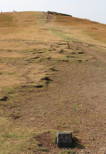
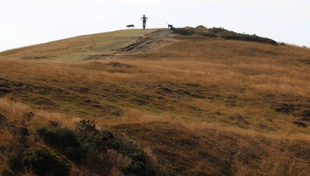
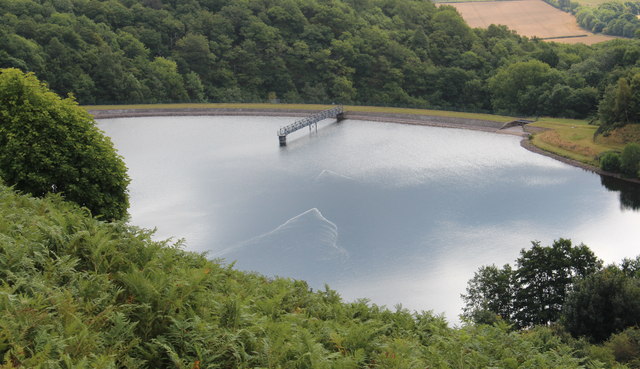
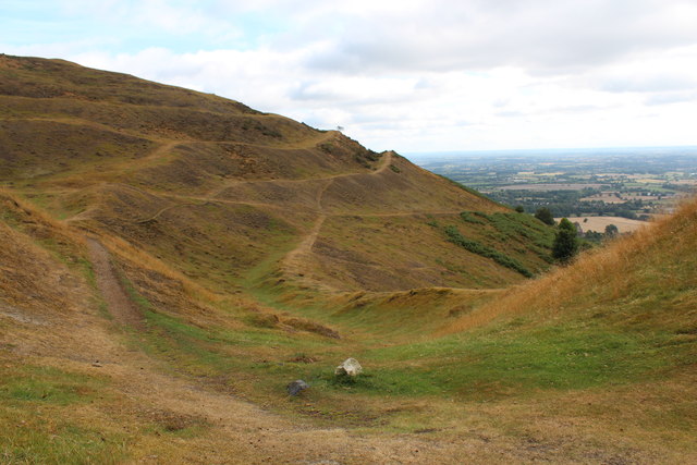
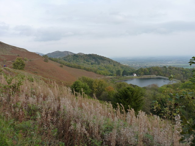
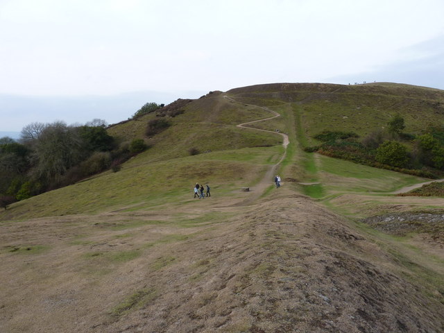
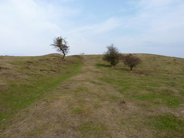
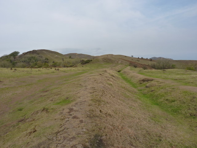
Nature enthusiasts will find themselves captivated by the stunning landscapes that surround Brand Green. The village is surrounded by rolling hills, lush green fields, and meandering streams, making it an ideal destination for outdoor activities such as hiking, cycling, and picnicking. The nearby Herefordshire Trail offers scenic walking routes, allowing visitors to explore the breathtaking countryside and enjoy panoramic views of the region.

Despite its rural setting, Brand Green benefits from its proximity to nearby towns and cities. Hereford, the county town, is approximately 8 miles away, offering a range of amenities including shops, supermarkets, schools, and healthcare facilities. The village is also well-connected by road, with the A4103 providing easy access to the wider region.

In conclusion, Brand Green is a charming and peaceful village in Herefordshire, providing a serene environment for residents and visitors to enjoy the beauty of the countryside and experience a close-knit community atmosphere.

If you have any feedback on the listing, please let us know in the comments section below.
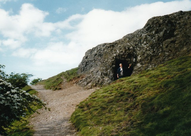
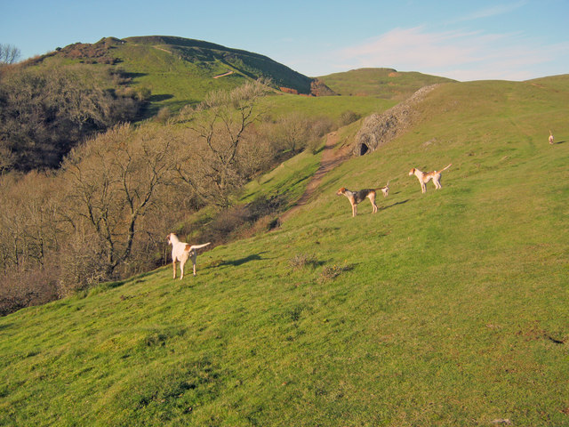
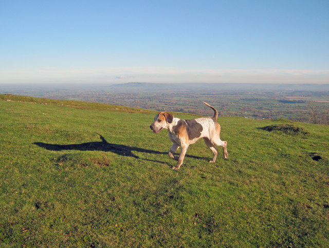
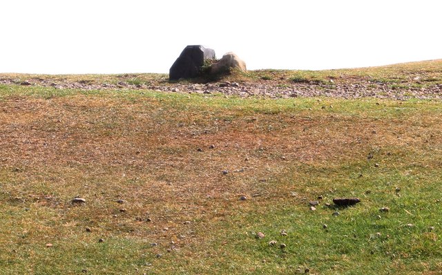
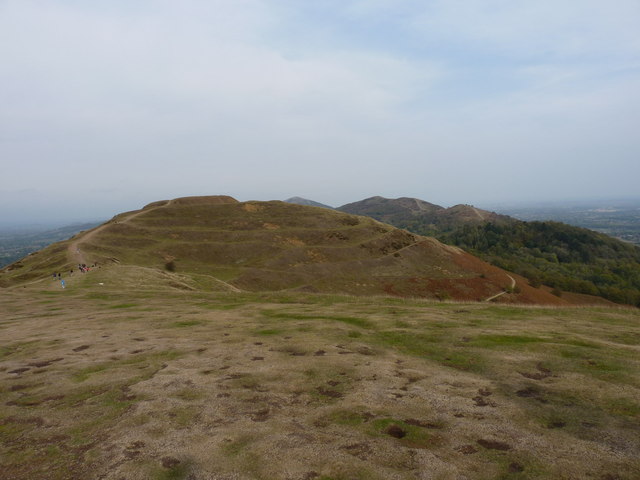
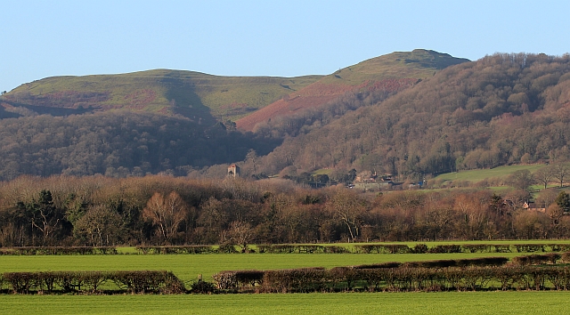
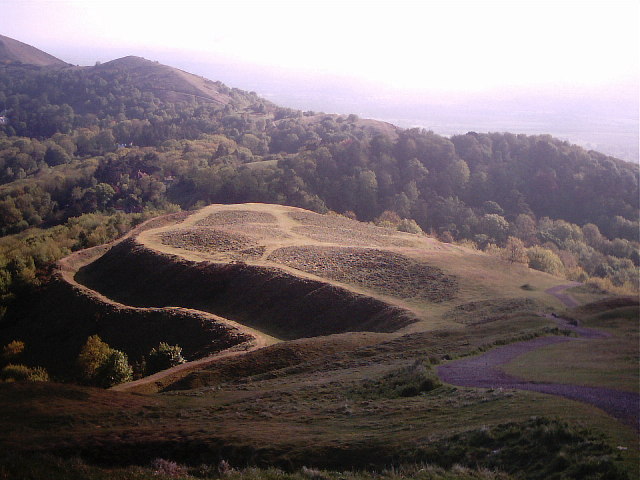
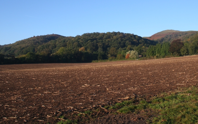
Brand Green Images

Images are sourced within 2km of 52.066847/-2.3515216 or Grid Reference SO7641. Thanks to Geograph Open Source API. All images are credited.

Giant's Cave, Hangman's Hill, Malvern Hills
Hounds on Broad Down View north to the Herefordshire Beacon with Clutter's Cave just ahead. The Ledbury Hunt is scouring the Eastnor estate off to the left and these hounds have come up to the hilltop to check things out.
Hounds on Broad Down
View north to the Herefordshire Beacon with Clutter's Cave just ahead. The Ledbury Hunt is scouring the Eastnor estate off to the left and these hounds have come up to the hilltop to check things out.
Hound on Broad Down A member of the Ledbury Hunt pack bounds across the top of the down. Bredon Hill and the Cotswold escarpment in the distance to the east.
Hound on Broad Down
A member of the Ledbury Hunt pack bounds across the top of the down. Bredon Hill and the Cotswold escarpment in the distance to the east.
Boundary Stones, British Camp, the Malvern Hills Two boundary markers: the right-hand one being a somewhat sunken stone and the other being a Malvern Hills Conservators' blue brick marker.
They are on the ridge of the Malvern hills in the saddle between Herefordshire Beacon and Millennium Hill. 
The iron-age hill fort known as British camp occupies both hill tops and these markers are close to the western gate to the fort.
Boundary Stones, British Camp, the Malvern Hills
Two boundary markers: the right-hand one being a somewhat sunken stone and the other being a Malvern Hills Conservators' blue brick marker. They are on the ridge of the Malvern hills in the saddle between Herefordshire Beacon and Millennium Hill. The iron-age hill fort known as British camp occupies both hill tops and these markers are close to the western gate to the fort.
Boundary marker, British Camp, Malvern The blue brick marker is bears the inscription MHC 159.
It was placed here by the Malvern Hills Conservators on the ridge of the hills in the saddle between Herefordshire Beacon and Millennium Hill.
The peak of the latter can be seen along the well worn ridge.
Just behind the marker and barely visible in this photo is a much older boundary stone in a somewhat sunken state.
If one looks carefully it is possible to see the levelled hut platforms of the iron-age town on the slopes of the hill side.
Boundary marker, British Camp, Malvern
The blue brick marker is bears the inscription MHC 159. It was placed here by the Malvern Hills Conservators on the ridge of the hills in the saddle between Herefordshire Beacon and Millennium Hill. The peak of the latter can be seen along the well worn ridge. Just behind the marker and barely visible in this photo is a much older boundary stone in a somewhat sunken state. If one looks carefully it is possible to see the levelled hut platforms of the iron-age town on the slopes of the hill side.
Millennium Hill, Malvern Hills The hill is the southern of two peaks included in the iron-age hill fort known as British Camp.
Almost all of the Malvern Hills is under the care of the Malvern Hills Conservators and is open to the public and very popular with dog walkers.
Millennium Hill, Malvern Hills
The hill is the southern of two peaks included in the iron-age hill fort known as British Camp. Almost all of the Malvern Hills is under the care of the Malvern Hills Conservators and is open to the public and very popular with dog walkers.
Wake detection, British Camp reservoir The ducks were almost invisible (to my eyes), but with the sun at the right angle the wake indicates their location.
The reservoir is no longer used as a water supply, but it remains as an iconic reminder of Victorian engineering and it is also a picturesque scene
Wake detection, British Camp reservoir
The ducks were almost invisible (to my eyes), but with the sun at the right angle the wake indicates their location. The reservoir is no longer used as a water supply, but it remains as an iconic reminder of Victorian engineering and it is also a picturesque scene
Boundary Stones, British Camp, the Malvern Hills The county boundary making use of the iron-age defensive ditch. The stone marker is older and the blue brick is a Malvern Hills Conservator marker.
Boundary Stones, British Camp, the Malvern Hills
The county boundary making use of the iron-age defensive ditch. The stone marker is older and the blue brick is a Malvern Hills Conservator marker.
British Camp reservoir from high above
Shire Ditch and the path onto Millennium Hill
Shire Ditch running south on Hangman's Hill
Shire Ditch running north Looking north from the ditch on Hangman's Hill, across Broad Down and up towards Millennium Hill
Shire Ditch running north
Looking north from the ditch on Hangman's Hill, across Broad Down and up towards Millennium Hill
Northwards from the summit of Millennium Hill Towards the earthworks and fort on the Herefordshire Beacon.
Northwards from the summit of Millennium Hill
Towards the earthworks and fort on the Herefordshire Beacon.
British Camp, Malvern Hills The iron-age hill-fort occupies Millennium Hill on the left and Herefordshire Beacon on the right.
Little Malvern with its Priory Church is nestled beneath the hills.
British Camp, Malvern Hills
The iron-age hill-fort occupies Millennium Hill on the left and Herefordshire Beacon on the right. Little Malvern with its Priory Church is nestled beneath the hills.
Iron- age defences, British Camp, the Malvern Hills The upper two defences are mostly flattened and may have become redundant after the third (lower) ditch and bank was constructed when the hill-fort was enlarged to include Millennium Hill to the south.
Beyond is the very fertile Severn Plain extending to the Cotswolds and the Vale of Evesham.
Iron- age defences, British Camp, the Malvern Hills
The upper two defences are mostly flattened and may have become redundant after the third (lower) ditch and bank was constructed when the hill-fort was enlarged to include Millennium Hill to the south. Beyond is the very fertile Severn Plain extending to the Cotswolds and the Vale of Evesham.
Clutter's Cave in Pillow Lava The exposed rock is said to be a good example of "pillow lava".
The rock is in the form of small pillows created by lava cooling quickly under the sea.
<span class="nowrap"><a title="http://en.wikipedia.org/wiki/Pillow_lavas" rel="nofollow ugc noopener" href="http://en.wikipedia.org/wiki/Pillow_lavas">Link</a><img style="margin-left:2px;" alt="External link" title="External link - shift click to open in new window" src="https://s1.geograph.org.uk/img/external.png" width="10" height="10"/></span>
The cave is also known as the Giant's Cave, but is far too small.
Clutter's Cave in Pillow Lava
The exposed rock is said to be a good example of "pillow lava". The rock is in the form of small pillows created by lava cooling quickly under the sea. LinkExternal link The cave is also known as the Giant's Cave, but is far too small.
Steps to British Camp The southern end of British Camp on Millennium Hill.
The route way is very popular so steps have had to be constructed to protect the hills from excessive erosion.
Steps to British Camp
The southern end of British Camp on Millennium Hill. The route way is very popular so steps have had to be constructed to protect the hills from excessive erosion.
The top of Millennium Hill Inside the Iron Age hill-fort known as British Camp.
Millennium Hill was one of the unnamed peaks until it was given the name in a short ceremony at mid-summer 2000.
The top of Millennium Hill
Inside the Iron Age hill-fort known as British Camp. Millennium Hill was one of the unnamed peaks until it was given the name in a short ceremony at mid-summer 2000.
Show me another place!

Brand Green is located at Grid Ref: SO7641 (Lat: 52.066847, Lng: -2.3515216)

Unitary Authority: County of Herefordshire

Police Authority: West Mercia

What 3 Words

///spreading.anchovies.juror. Near Great Malvern, Worcestershire

Related Wikis

Herefordshire Beacon

The Herefordshire Beacon is one of the highest peaks of the Malvern Hills. It is surrounded by a British Iron Age hill fort earthwork known as British...

British Camp

British Camp is an Iron Age hill fort located at the top of Herefordshire Beacon in the Malvern Hills. The hill fort is protected as a Scheduled Ancient...

Colwall Park Racecourse

Colwall Park Racecourse was a British horse racing venue which operated from 1900 to 1939. It was known as one of England’s prettiest racecourses.The course...

St Wulstan's Roman Catholic Church

St Wulstan's Roman Catholic Church, Little Malvern, Worcestershire, England is a Benedictine parish church administered by the monks of Downside Abbey...

Little Malvern

Little Malvern is a small village and civil parish in Worcestershire, England. It is situated on the lower slopes of the Malvern Hills, south of Malvern...

The Elms School, Colwall

The Elms School is a co-educational private boarding prep school located in Colwall, Herefordshire, England. Including the Early Years and Pre-Prep departments...

Tinkers Hill

Tinkers Hill is situated in the range of Malvern Hills that runs about 13 kilometres (8 mi) north-south along the Herefordshire-Worcestershire border....

Pinnacle Hill

Pinnacle Hill is situated in the range of Malvern Hills in England, running about 13 kilometres (8 mi) north-south along the Herefordshire-Worcestershire...

Nearby Amenities

Located within 500m of 52.066847,-2.3515216
Barrier: stile
Material: wood
Stile: stepover
Lat/Long: 52.0650539/-2.3514089
Barrier: stile
Lat/Long: 52.0657859/-2.3525957
Barrier: stile
Lat/Long: 52.0695315/-2.3559861
Barrier: stile
Lat/Long: 52.069611/-2.3560551
Post Box
Collection Plate: CP5
Collection Times: Mo-Fr 16:15; Sa 07:45
Post Box Type: wall
Ref: WR13 72
Royal Cypher: EVIIR
Royal Cypher Wikidata: Q33102324
Lat/Long: 52.0690109/-2.357009
Barrier: stile
Lat/Long: 52.0631459/-2.3488248
Evendine
Is In: Herefordshire
Place: hamlet
Source Name: OS_OpenData_StreetView
Lat/Long: 52.0696586/-2.3550741
Generator Method: photovoltaic
Generator Output Electricity: yes
Generator Source: solar
Generator Type: solar_photovoltaic_panel
Location: roof
Power: generator
Lat/Long: 52.0688346/-2.3574539
Generator Method: photovoltaic
Generator Output Electricity: yes
Generator Source: solar
Generator Type: solar_photovoltaic_panel
Location: roof
Power: generator
Lat/Long: 52.0680803/-2.3511668
The data included in this document is from www.openstreetmap.org. The data is made available under ODbL.

Have you been to Brand Green?

Leave your review of Brand Green below (or comments, questions and feedback).