Brand Green

Settlement in Gloucestershire Forest of Dean

England

Brand Green

Polytunnels by Hopyard Lane There is a lot of soft fruit grown in the Newent area.
Polytunnels by Hopyard Lane Credit: Jonathan Billinger

Brand Green is a small village located in the county of Gloucestershire, England. Situated in the southwestern part of the country, it falls within the administrative district of Tewkesbury Borough. The village is nestled amidst the picturesque countryside, surrounded by rolling hills and lush green fields.

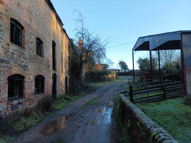
With a population of around 400 residents, Brand Green retains a close-knit and friendly community atmosphere. The village is primarily residential, characterized by traditional stone-built houses and cottages. The architectural style reflects the region's rural charm and history.

Despite its small size, Brand Green offers a range of amenities to its residents. The village boasts a local pub, providing a social hub for villagers and visitors alike. Additionally, there is a village hall that hosts various community events and gatherings throughout the year.

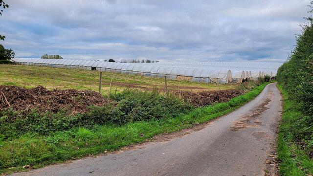
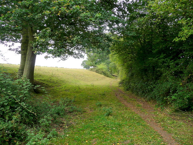
Nature lovers will appreciate the beautiful landscapes that surround Brand Green. The village is surrounded by scenic walking trails and footpaths, providing opportunities for outdoor activities and leisurely strolls. The nearby countryside offers stunning views and is a haven for wildlife enthusiasts.

Brand Green benefits from its proximity to larger towns and cities. The bustling market town of Tewkesbury is just a short drive away, offering a wider range of amenities including shops, supermarkets, and schools. The village is also well-connected to major transportation routes, with easy access to the M5 motorway and nearby railway stations.

In summary, Brand Green is a charming and idyllic village in the heart of Gloucestershire. Its rural setting, close-knit community, and access to amenities make it an attractive place to live for those seeking a peaceful and picturesque lifestyle.

If you have any feedback on the listing, please let us know in the comments section below.

Brand Green Images

Images are sourced within 2km of 51.950737/-2.380463 or Grid Reference SO7328. Thanks to Geograph Open Source API. All images are credited.

Polytunnels by Hopyard Lane There is a lot of soft fruit grown in the Newent area.
Polytunnels by Hopyard Lane
There is a lot of soft fruit grown in the Newent area.
Commercial crop of primroses Seed-raised plants at Trioscape's wholesale nursery.
Commercial crop of primroses
Seed-raised plants at Trioscape's wholesale nursery.
Durbridge Mill buildings Buildings alongside the track through Durbridge Mill Farm.
Durbridge Mill buildings
Buildings alongside the track through Durbridge Mill Farm.
Footpath to Three Ashes Pasture land in a shallow dry valley north of Newent.
Footpath to Three Ashes
Pasture land in a shallow dry valley north of Newent.
Stream Lane Stream Lane leading towards Okle Green and Highleadon.
Stream Lane
Stream Lane leading towards Okle Green and Highleadon.
Upleadon Crossroads Upleadon Crossroads, Gloucestershire. Note the Public telephone box. Most of these are disappearing due to the dominance of mobile phones.
Upleadon Crossroads
Upleadon Crossroads, Gloucestershire. Note the Public telephone box. Most of these are disappearing due to the dominance of mobile phones.
Footbridge over the River Leadon There are a number of footpaths in the area, this footbridge enables walkers to cross the River Leadon near Durbridge Farm.
Footbridge over the River Leadon
There are a number of footpaths in the area, this footbridge enables walkers to cross the River Leadon near Durbridge Farm.
River Leadon near Durbridge Mill Trees reflected in the River Leadon which is flowing at a very low level after a prolong period of low rainfall. Note the exposed tree roots on the riverbank.
River Leadon near Durbridge Mill
Trees reflected in the River Leadon which is flowing at a very low level after a prolong period of low rainfall. Note the exposed tree roots on the riverbank.
Bridge reflected in the River Leadon Bridge reflected in the River Leadon near Durbridge Mill.
Bridge reflected in the River Leadon
Bridge reflected in the River Leadon near Durbridge Mill.
Building at Durbridge Mill The remains of a round building at Durbridge Mill near Poolhill, not sure what its original purpose was.
Building at Durbridge Mill
The remains of a round building at Durbridge Mill near Poolhill, not sure what its original purpose was.
Former mill buildings Former mill buildings at Durbridge Mill beside the River Leadon.
Former mill buildings
Former mill buildings at Durbridge Mill beside the River Leadon.
Old millwheel, Durbridge Mill
Traditional farm buildings, Durbridge Mill Traditional red-brick farm buildings at Durbridge Mill.
Traditional farm buildings, Durbridge Mill
Traditional red-brick farm buildings at Durbridge Mill.
Road to Durbridge Mill Road to Durbridge Mill which appears now to be a farm.
Road to Durbridge Mill
Road to Durbridge Mill which appears now to be a farm.
Edge of pasture The public footpath from the Leadon to Upleadon follows the field edge here.
Edge of pasture
The public footpath from the Leadon to Upleadon follows the field edge here.
Collinpark Wood 1 Straight path through the wood looking north-east.
Collinpark Wood 1
Straight path through the wood looking north-east.
Collinpark Wood 2 The opposite view to <a href="https://www.geograph.org.uk/photo/2549365">SO7527 : Collinpark Wood 1</a>.
Collinpark Wood 2
The opposite view to SO7527 : Collinpark Wood 1.
Wheat field in the Vale of Leadon The footpath follows the field edge to the right.
In the distance is Chase End Hill - the southerly outpost of the Malvern Hills.
Wheat field in the Vale of Leadon
The footpath follows the field edge to the right. In the distance is Chase End Hill - the southerly outpost of the Malvern Hills.
Show me another place!

Brand Green is located at Grid Ref: SO7328 (Lat: 51.950737, Lng: -2.380463)

Administrative County: Gloucestershire

District: Forest of Dean

Police Authority: Gloucestershire

What 3 Words

///spice.goad.awestruck. Near Newent, Gloucestershire

Nearby Locations

Compton Green Brand Green

Related Wikis

Brand Green

Brand Green is a village in Gloucestershire, England. == References == == External links == Media related to Brand Green at Wikimedia Commons

Collinpark Wood SSSI

Collinpark Wood (grid reference SO750278) is a 66.69-hectare (164.8-acre) biological Site of Special Scientific Interest in Gloucestershire, notified in...

Upleadon

Upleadon is a village and civil parish situated 10.5 km north-west of Gloucester. Soon after the Norman conquest Upleadon became part of the estates of...

Malswick Halt railway station

Malswick Halt was a request stop on the former Ledbury and Gloucester Railway. It opened on 1st February 1938 and was closed in 1959 when the line was...

Nearby Amenities

Located within 500m of 51.950737,-2.380463
Brand Green
Is In: Gloucestershire, England, UK
Place: hamlet
Wikidata: Q4956494
Lat/Long: 51.9511881/-2.3783558
Bus Stop
Pauntley Village Hall
Naptan AtcoCode: 1600GLN085
Naptan Bearing: NW
Naptan CommonName: Pauntley Village Hall
Naptan NaptanCode: gloapawt
Naptan Street: Compton Green Rd
Naptan Verified: no
Source: naptan_import
Lat/Long: 51.9528245/-2.3799475
Bus Stop
Pauntley Village Hall
Naptan AtcoCode: 1600GLN086
Naptan Bearing: SE
Naptan CommonName: Pauntley Village Hall
Naptan NaptanCode: gloapdag
Naptan Street: Compton Green Rd
Naptan Verified: no
Source: naptan_import
Lat/Long: 51.9527088/-2.3795827
Post Box
Post Box Design: waggon_top
Post Box Mounting: telegraph_pole
Post Box Type: lamp
Ref: GL19 115
Royal Cypher: GVIR
Royal Cypher Wikidata: Q33102169
Lat/Long: 51.9505788/-2.3759331
Public Bookcase
Pauntley's Book Exchange
Booth: K6
Colour: red
Disused Amenity: telephone
Man Made: telephone_box
Public Bookcase Type: phone_box
Lat/Long: 51.9516448/-2.3783348
Sacklyn Roofing
Addr City: Redmarley
Addr Street: Brand Green
Craft: roofer
Currency XBT: yes
Description: Sacklyn Roofing is a family run roofing contractor based in Gloucestershire.
Payment Lightning: no
Payment Lightning Contactless: no
Payment Onchain: yes
Survey Date: 2023-03-14
Website: https://www.sacklynroofing.co.uk
Lat/Long: 51.9509008/-2.3787786
Power: pole
Lat/Long: 51.949014/-2.374671
Power: pole
Lat/Long: 51.9497249/-2.3751068
Power: pole
Lat/Long: 51.9500365/-2.3810573
The Grove Newent
Power: pole
Transformer: distribution
Voltage Primary: 11000
Lat/Long: 51.9502473/-2.3815388
Power: pole
Lat/Long: 51.9497786/-2.3804551
Power: pole
Lat/Long: 51.9494025/-2.3794895
Power: pole
Lat/Long: 51.9495976/-2.3785816
Power: pole
Lat/Long: 51.9498786/-2.3772747
Power: pole
Lat/Long: 51.9500836/-2.3763581
Power: pole
Lat/Long: 51.9502109/-2.3753911
Power: pole
Lat/Long: 51.9506494/-2.375772
Brand Green Pauntley
Power: pole
Transformer: distribution
Voltage Primary: 11000
Lat/Long: 51.9509589/-2.3762615
Power: pole
Lat/Long: 51.9515764/-2.3771614
Power: pole
Lat/Long: 51.952155/-2.3780371
Power: pole
Lat/Long: 51.9526344/-2.3788834
The Blue Cottages
Power: pole
Transformer: distribution
Voltage Primary: 11000
Lat/Long: 51.9518297/-2.3799596
Power: pole
Lat/Long: 51.9521942/-2.3802875
Power: pole
Lat/Long: 51.952572/-2.3806369
Brand Green North
Power: pole
Transformer: distribution
Voltage Primary: 11000
Lat/Long: 51.9528468/-2.3804853
Power: pole
Lat/Long: 51.9531113/-2.3797175
Power: pole
Lat/Long: 51.9535427/-2.3804645
Power: pole
Lat/Long: 51.9540353/-2.3806281
Brand Green Council Houses
Power: pole
Transformer: distribution
Voltage Primary: 11000
Lat/Long: 51.954723/-2.3818539
Power: pole
Lat/Long: 51.9546924/-2.3808011
The data included in this document is from www.openstreetmap.org. The data is made available under ODbL.

Have you been to Brand Green?

Leave your review of Brand Green below (or comments, questions and feedback).