West Blackdene

Settlement in Durham

England

West Blackdene

Grazing pasture at Newhouse Pastures This is an area of level pasture adjacent to the Weardale Way.
Grazing pasture at Newhouse Pastures Credit: Clive Nicholson

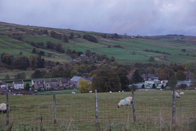
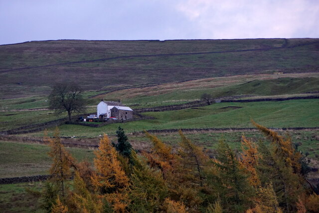
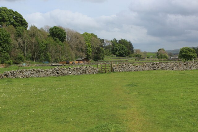
West Blackdene is a small village located in County Durham, in the northeast of England. Situated near the River Derwent, it is part of the larger civil parish of Consett. The village is nestled amidst picturesque countryside, with rolling hills and farmland surrounding it.

Although West Blackdene is a relatively small settlement, it has a strong sense of community and a rich history. The village dates back centuries and was once known for its coal mining industry, which played a vital role in the local economy. Today, remnants of this industrial heritage can still be seen in the form of old mine shafts and buildings.

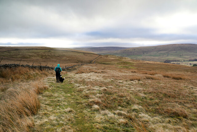
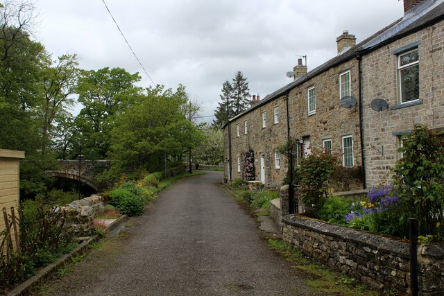
The village itself is primarily residential, with a mix of traditional stone cottages and more modern houses. It offers a peaceful and tranquil environment, away from the hustle and bustle of larger towns and cities. The surrounding countryside provides ample opportunities for outdoor activities such as hiking, cycling, and birdwatching.

While West Blackdene does not have its own amenities, the nearby town of Consett offers a range of services, including shops, supermarkets, schools, and healthcare facilities. Additionally, the village benefits from good transport links, with regular bus services connecting it to surrounding areas.

Overall, West Blackdene is a charming and quiet village, perfect for those seeking a peaceful rural lifestyle amidst the natural beauty of County Durham.

If you have any feedback on the listing, please let us know in the comments section below.

West Blackdene Images

Images are sourced within 2km of 54.747038/-2.2088628 or Grid Reference NY8639. Thanks to Geograph Open Source API. All images are credited.

Grazing pasture at Newhouse Pastures This is an area of level pasture adjacent to the Weardale Way.
Grazing pasture at Newhouse Pastures
This is an area of level pasture adjacent to the Weardale Way.
Farmland west of St John's Chapel
Farm west of St John's Chapel
Bridleway over Carr Brow Moor From Middlehope Bank (the minor road from Rookhope to Ireshopeburn) the bridleway gives good walking down towards Levelgate Sike and up over the shoulder of Bleak Laws on Carr Brow Moor. Just beyond the horizon, it passes through a gate and becomes a more substantial track, rather cut up by big tractor tyres, making the descent into Weardale a bit more wearing than the pleasant going on the moor.
Bridleway over Carr Brow Moor
From Middlehope Bank (the minor road from Rookhope to Ireshopeburn) the bridleway gives good walking down towards Levelgate Sike and up over the shoulder of Bleak Laws on Carr Brow Moor. Just beyond the horizon, it passes through a gate and becomes a more substantial track, rather cut up by big tractor tyres, making the descent into Weardale a bit more wearing than the pleasant going on the moor.
River Wear near Waterside Farm
Newfield The property at Newfield seen along its access road high on the northern side of Weardale.
Newfield
The property at Newfield seen along its access road high on the northern side of Weardale.
Trees on grazing land at West Blackdene Several deciduous trees in the field which has rough grazing; it's south of a minor road in Weardale.
Chapel Fell is the moorland hill in the distance.
Trees on grazing land at West Blackdene
Several deciduous trees in the field which has rough grazing; it's south of a minor road in Weardale. Chapel Fell is the moorland hill in the distance.
Trees in valley of Elmford Cleugh Elmford Cleugh is a tributary of the River Wear descending on the north side of the valley.
Trees in valley of Elmford Cleugh
Elmford Cleugh is a tributary of the River Wear descending on the north side of the valley.
Head of the River Wear The point where Killhope Burn and Burnhope Burn meet to become the River Wear - at the aptly named village of Wearhead.
Head of the River Wear
The point where Killhope Burn and Burnhope Burn meet to become the River Wear - at the aptly named village of Wearhead.
Wearhead The A689 running through the small village of Wearhead
Wearhead
The A689 running through the small village of Wearhead
West Blackdene Small community near Ireshopeburn in Weardale
West Blackdene
Small community near Ireshopeburn in Weardale
Weardale Way between Wearhead and West Blackdene Riverside path in pastures beside the Wear
Weardale Way between Wearhead and West Blackdene
Riverside path in pastures beside the Wear
River Wear at West Blackdene The Weardale Way crosses the river at this point, to reach West Blackdene
River Wear at West Blackdene
The Weardale Way crosses the river at this point, to reach West Blackdene
On the Weardale Way opposite Iresburnhope The long distance footpath on the banks of the Wear, opposite the small village of Iresburnhope
On the Weardale Way opposite Iresburnhope
The long distance footpath on the banks of the Wear, opposite the small village of Iresburnhope
Newhouse Pasture Green pasture on the valley floor of Weardale
Newhouse Pasture
Green pasture on the valley floor of Weardale
Footbridge across the River Wear A 77 mile route following the River Wear from the sea at the Lindesfarne Memorial, Sunderland to the headwaters in the east Pennines, keeping as close as is possible to the river. It visits Lumley Castle, Durham (where the Castle and Cathedral forms a World Heritage Site), Bishop Auckland and Stanhope. After Stanhope the Way makes a northward loop to Rookhope to take in part of a tributary, Rookhope Burn.
Footbridge across the River Wear
A 77 mile route following the River Wear from the sea at the Lindesfarne Memorial, Sunderland to the headwaters in the east Pennines, keeping as close as is possible to the river. It visits Lumley Castle, Durham (where the Castle and Cathedral forms a World Heritage Site), Bishop Auckland and Stanhope. After Stanhope the Way makes a northward loop to Rookhope to take in part of a tributary, Rookhope Burn.
Weardale Way crossing Pastures near St. John's Chapel A 77 mile route following the River Wear from the sea at the Lindesfarne Memorial, Sunderland to the headwaters in the east Pennines, keeping as close as is possible to the river. It visits Lumley Castle, Durham (where the Castle and Cathedral forms a World Heritage Site), Bishop Auckland and Stanhope. After Stanhope the Way makes a northward loop to Rookhope to take in part of a tributary, Rookhope Burn.
Weardale Way crossing Pastures near St. John's Chapel
A 77 mile route following the River Wear from the sea at the Lindesfarne Memorial, Sunderland to the headwaters in the east Pennines, keeping as close as is possible to the river. It visits Lumley Castle, Durham (where the Castle and Cathedral forms a World Heritage Site), Bishop Auckland and Stanhope. After Stanhope the Way makes a northward loop to Rookhope to take in part of a tributary, Rookhope Burn.
Show me another place!

West Blackdene is located at Grid Ref: NY8639 (Lat: 54.747038, Lng: -2.2088628)

Unitary Authority: County Durham

Police Authority: Durham

What 3 Words

///poodle.plantings.improve. Near Stanhope, Co. Durham

Related Wikis

West Blackdene

West Blackdene is a village in the civil parish of Stanhope, in County Durham, England. It is situated to the north of the River Wear, opposite Ireshopeburn...

Ireshopeburn

Ireshopeburn ( EYE-sup-burn ) is a village in the civil parish of Stanhope, in County Durham, England. It is situated on the south side of Weardale, between...

Wearhead railway station

Wearhead railway station served the village of Wearhead, County Durham, England, from 1895 to 1961 on the Weardale Railway. == History == The station opened...

New House, County Durham

New House or Newhouse is a hamlet in the civil parish of Stanhope, in County Durham, England. It lies on the north side of the River Wear, opposite Ireshopeburn...

Nearby Amenities

Located within 500m of 54.747038,-2.2088628
Bus Stop
Front Street
Naptan AtcoCode: 13004519C
Naptan Bearing: E
Naptan CommonName: Front Street
Naptan Indicator: east bound
Naptan Landmark: Landmark not known
Naptan NaptanCode: durdatat
Naptan Notes: Opposite 37 Front Street- Ireshopeburn.
Naptan Street: Front Street
Naptan Verified: no
Source: naptan_import
Lat/Long: 54.7426392/-2.2082564
Bus Stop
Lane End
Naptan AtcoCode: 13004530D
Naptan Bearing: SE
Naptan CommonName: Lane End
Naptan Indicator: south east bound
Naptan Landmark: Landmark not known
Naptan NaptanCode: durdatjm
Naptan Notes: Briar Hill and Carbank Way junction- Ireshopeburn
Naptan Street: A689
Naptan Verified: no
Source: naptan_import
Lat/Long: 54.7452243/-2.2100562
Bus Stop
Lane End
Naptan AtcoCode: 13004530H
Naptan Bearing: NW
Naptan CommonName: Lane End
Naptan Indicator: north west bound
Naptan Landmark: Landmark not known
Naptan NaptanCode: durdatjp
Naptan Notes: Briar Hill and Carbank Way junction- Ireshopeburn
Naptan Street: A689
Naptan Verified: no
Source: naptan_import
Lat/Long: 54.7452866/-2.2103982
Ireshopeburn
Place: village
Source: OS_OpenData_StreetView
Wikidata: Q6069401
Wikipedia: en:Ireshopeburn
Lat/Long: 54.7428937/-2.2077681
Barrier: stile
Lat/Long: 54.7484911/-2.2056102
Bench
Lat/Long: 54.7470234/-2.2088503
Power: pole
Lat/Long: 54.7480285/-2.205753
Power: pole
Lat/Long: 54.7474156/-2.206627
Power: pole
Lat/Long: 54.7466746/-2.2063745
Power: pole
Lat/Long: 54.7467814/-2.2064882
Power: pole
Lat/Long: 54.747201/-2.2069297
Power: pole
Lat/Long: 54.7477339/-2.2076054
Power: pole
Lat/Long: 54.7480518/-2.2079979
Power: pole
Lat/Long: 54.7487089/-2.2088966
Power: pole
Lat/Long: 54.7490062/-2.2099581
Power: pole
Lat/Long: 54.7492793/-2.2110198
Power: pole
Lat/Long: 54.7495024/-2.2119797
Power: pole
Lat/Long: 54.7498104/-2.2131526
Power: pole
Lat/Long: 54.7500678/-2.2141739
Post Box
Image: https://www.geograph.org.uk/photo/5519605
Ref: DL13 135
Lat/Long: 54.7427056/-2.2084125
West Blackdene
Place: hamlet
Wikidata: Q7984478
Wikipedia: en:West Blackdene
Lat/Long: 54.7468329/-2.2080749
Power: pole
Lat/Long: 54.7442768/-2.2032791
Power: pole
Lat/Long: 54.7489433/-2.2097336
Power: pole
Lat/Long: 54.7486519/-2.2104031
Power: pole
Lat/Long: 54.7486596/-2.2116892
Power: pole
Lat/Long: 54.7486674/-2.2129767
Power: pole
Lat/Long: 54.7485211/-2.213556
Power: pole
Lat/Long: 54.7482587/-2.2145109
Power: pole
Lat/Long: 54.7481735/-2.2148797
Power: pole
Lat/Long: 54.748364/-2.2159043
Power: pole
Lat/Long: 54.7480125/-2.2080468
Power: pole
Lat/Long: 54.7475202/-2.2088474
Information: guidepost
Listed Status: Grade II
Tourism: information
Wikidata: Q26525268
Wikimedia Commons: File:Guidepost At Junction Of A689 And Causeway Road.jpg
Lat/Long: 54.7425998/-2.2086885
Power: pole
Lat/Long: 54.7439756/-2.2078065
Power: pole
Lat/Long: 54.7434736/-2.207141
Power: pole
Lat/Long: 54.7429284/-2.2083585
Power: pole
Lat/Long: 54.7429437/-2.208274
Power: pole
Lat/Long: 54.7430585/-2.2076826
The data included in this document is from www.openstreetmap.org. The data is made available under ODbL.

Have you been to West Blackdene?

Leave your review of West Blackdene below (or comments, questions and feedback).