Washington

Settlement in Durham

England

Washington

Curly Wurly footbridge in Fatfield, Washington The iconic Curly Wurly footbridge was constructed in 1977 for the new town of Washington, Tyne and Wear in the village of Fatfield. It provides a safe crossing over Fallowfield Way for pupils on foot attending the secondary schools of St. Robert of Newminster RC, Biddick Secondary (now Biddick Academy) and members of the public. The track of the old mineral railway to Consett also ran below and this now forms  a section of the Coast to Coast cycleway.
Curly Wurly footbridge in Fatfield, Washington Credit: Roger Morris

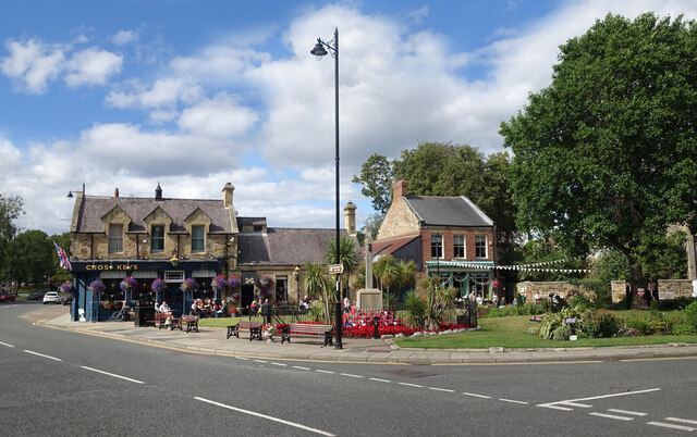
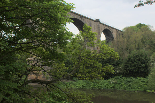
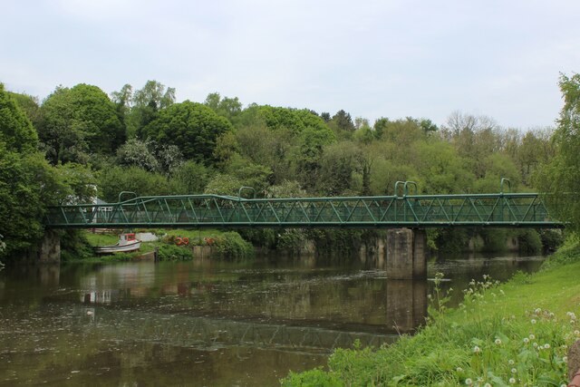
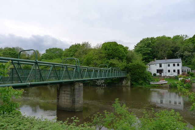
Washington is a small town located in County Durham, in the northeast of England. It is situated approximately 9 miles southwest of Newcastle upon Tyne and 8 miles north of Durham City. The town is positioned on the banks of the River Wear, which adds to its scenic beauty.

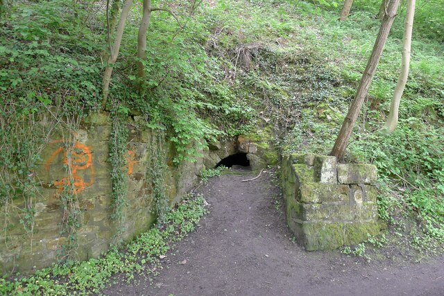
Washington has a rich history that dates back to the Anglo-Saxon period. It is believed to have been founded by the Saxon nobleman Wessington in the 7th century. The town played a significant role in the coal-mining industry during the 18th and 19th centuries, with several collieries being established in the area.

Today, Washington is a thriving residential area with a population of around 70,000 people. It offers a range of amenities, including schools, shops, and leisure facilities. The town is well-connected to other major cities in the region, with easy access to the A1(M) motorway and regular public transport services.

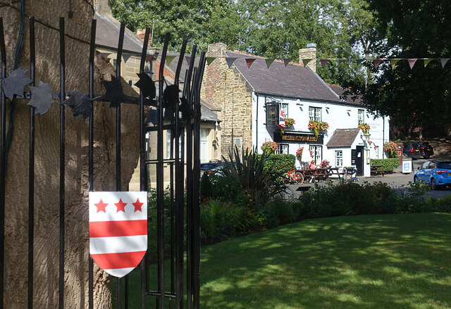
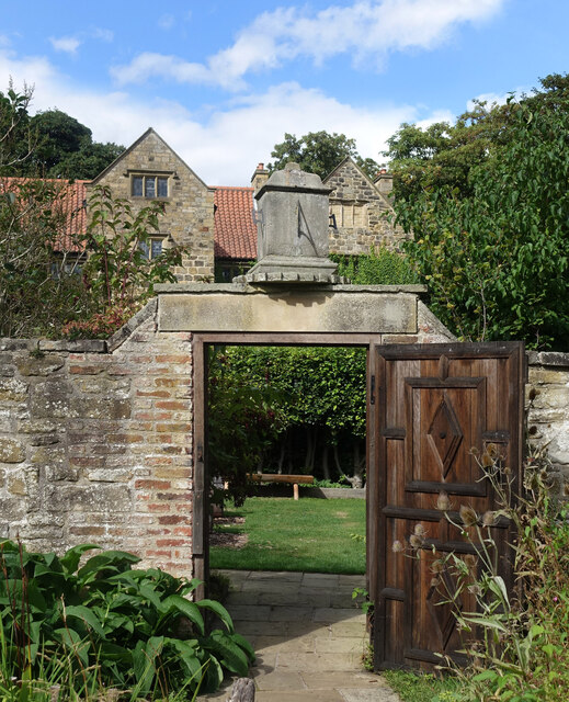
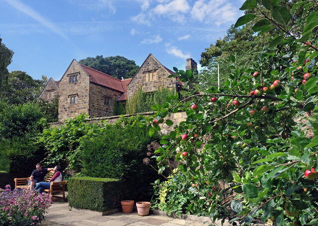
One of the town's most notable landmarks is the Washington Old Hall, a historic manor house that once belonged to the ancestors of George Washington, the first President of the United States. The hall is now a popular tourist attraction and is managed by the National Trust.

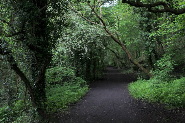
Washington also boasts several parks and green spaces, including the picturesque Princess Anne Park and the Wildfowl and Wetlands Trust, which is home to various species of birds and other wildlife. These natural areas offer opportunities for outdoor activities and relaxation.

In conclusion, Washington is a charming town with a rich history and a range of amenities. Its riverside location, historic sites, and natural beauty make it an attractive place to live or visit.

If you have any feedback on the listing, please let us know in the comments section below.
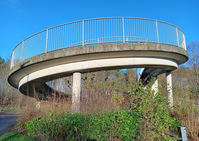
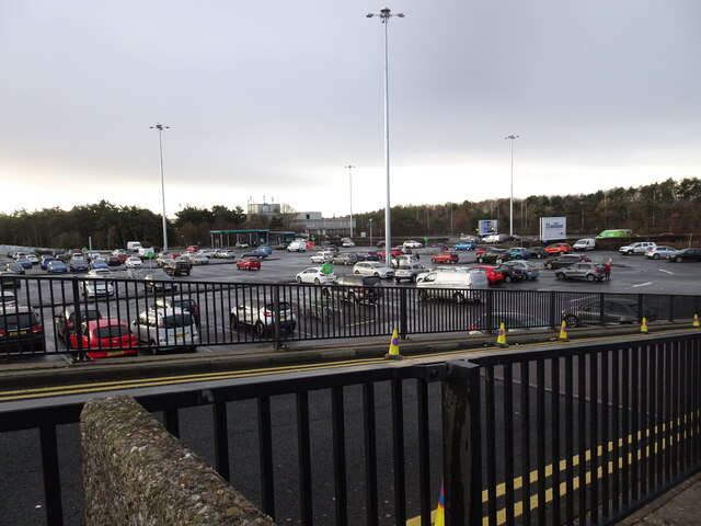
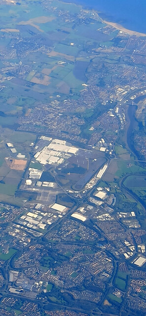
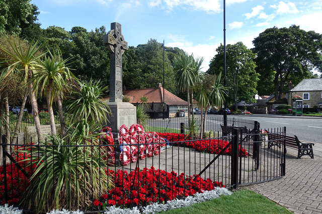
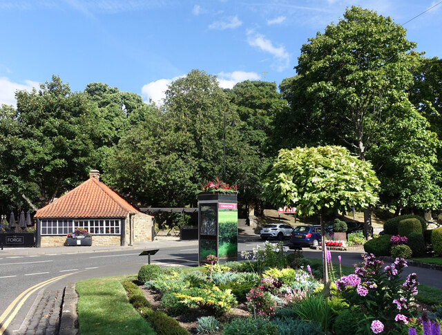
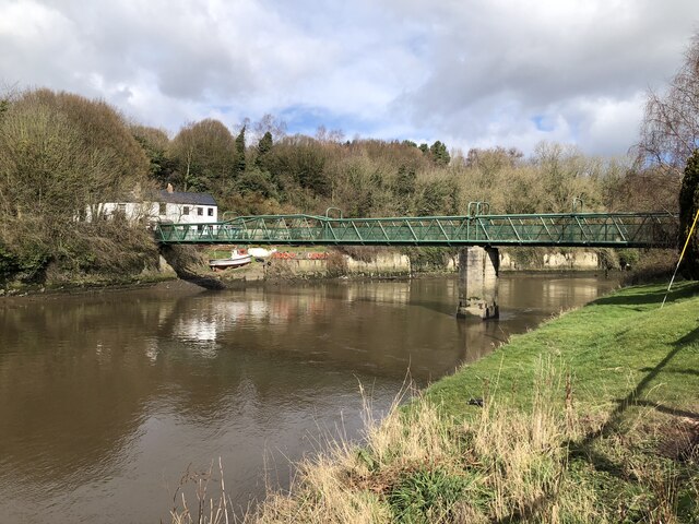
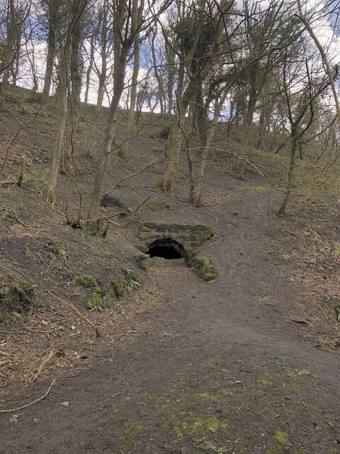
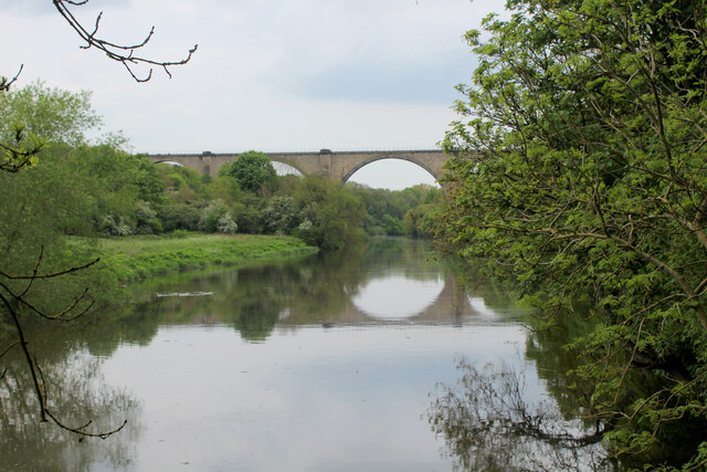
Washington Images

Images are sourced within 2km of 54.899919/-1.519037 or Grid Reference NZ3056. Thanks to Geograph Open Source API. All images are credited.

Curly Wurly footbridge in Fatfield, Washington The iconic Curly Wurly footbridge was constructed in 1977 for the new town of Washington, Tyne and Wear in the village of Fatfield. It provides a safe crossing over Fallowfield Way for pupils on foot attending the secondary schools of St. Robert of Newminster RC, Biddick Secondary (now Biddick Academy) and members of the public. The track of the old mineral railway to Consett also ran below and this now forms  a section of the Coast to Coast cycleway.
Curly Wurly footbridge in Fatfield, Washington
The iconic Curly Wurly footbridge was constructed in 1977 for the new town of Washington, Tyne and Wear in the village of Fatfield. It provides a safe crossing over Fallowfield Way for pupils on foot attending the secondary schools of St. Robert of Newminster RC, Biddick Secondary (now Biddick Academy) and members of the public. The track of the old mineral railway to Consett also ran below and this now forms a section of the Coast to Coast cycleway.
Washington Car Park The view of the Galleries Shopping Centre in Washington.
Washington Car Park
The view of the Galleries Shopping Centre in Washington.
Washington from the air The Nissan car factory dominates the scene.

Taken at around 37,000 feet by mobile phone, from a Prague bound flight from Edinburgh.
Washington from the air
The Nissan car factory dominates the scene. Taken at around 37,000 feet by mobile phone, from a Prague bound flight from Edinburgh.
Colourful Memorial, Washington Traditional poppy wreaths and very healthy geraniums round the war memorial in the centre of Washington Village.
Colourful Memorial, Washington
Traditional poppy wreaths and very healthy geraniums round the war memorial in the centre of Washington Village.
The Washington Arms Two versions of that title here.
The Old Hall in Washington Village was the medieval home of the Washington family, US President George Washington's ancestors.
Much is made of that connection, including a theory that the Washington crest, seen here on railings on the village green, influenced the design of the American flag.
It's also a good name for a pub.
The Washington Arms
Two versions of that title here. The Old Hall in Washington Village was the medieval home of the Washington family, US President George Washington's ancestors. Much is made of that connection, including a theory that the Washington crest, seen here on railings on the village green, influenced the design of the American flag. It's also a good name for a pub.
Sundial over the Gate In the garden at Washington Old Hall.
A sundial site which looks a bit odd, if not actually unsafe. I guess it's OK. Just don't slam the gate.
Sundial over the Gate
In the garden at Washington Old Hall. A sundial site which looks a bit odd, if not actually unsafe. I guess it's OK. Just don't slam the gate.
Washington Village Green
Apples at the Old Hall In the garden at Washington Old Hall.
Apples at the Old Hall
In the garden at Washington Old Hall.
Washington Village Centre Over the road from the very well tended and floral village green are some more flower beds.
Even the phone box has a garden on the roof.
Washington Village Centre
Over the road from the very well tended and floral village green are some more flower beds. Even the phone box has a garden on the roof.
Footbridge across River Wear at Cox Green
Adit in riverbank near Cox Green One of several adits in the vicinity of Cox Green. The tunnels were used to extract sandstone from beneath Penshaw Hill for loading onto boats moored on the adjacent River Wear,
Adit in riverbank near Cox Green
One of several adits in the vicinity of Cox Green. The tunnels were used to extract sandstone from beneath Penshaw Hill for loading onto boats moored on the adjacent River Wear,
Weardale Way approaching Victoria Viaduct A slightly misty scene looking down the River Wear towards the Victoria Viaduct.
Completed in 1836 on a design based on the Alcantara Bridge in Spain, as part of the Durham Junction Railway.
The Beeching axe fell in 1964, when passenger services ceased. 1991 saw the last freight crossing the viaduct, and it has been mothballed ever since.
Grade II Listed.
Weardale Way approaching Victoria Viaduct
A slightly misty scene looking down the River Wear towards the Victoria Viaduct. Completed in 1836 on a design based on the Alcantara Bridge in Spain, as part of the Durham Junction Railway. The Beeching axe fell in 1964, when passenger services ceased. 1991 saw the last freight crossing the viaduct, and it has been mothballed ever since. Grade II Listed.
Looking up to Victoria Viaduct A slightly misty scene looking down the River Wear towards the Victoria Viaduct.
Completed in 1836 on a design based on the Alcantara Bridge in Spain, as part of the Durham Junction Railway.
The Beeching axe fell in 1964, when passenger services ceased. 1991 saw the last freight crossing the viaduct, and it has been mothballed ever since.
Grade II Listed.
Looking up to Victoria Viaduct
A slightly misty scene looking down the River Wear towards the Victoria Viaduct. Completed in 1836 on a design based on the Alcantara Bridge in Spain, as part of the Durham Junction Railway. The Beeching axe fell in 1964, when passenger services ceased. 1991 saw the last freight crossing the viaduct, and it has been mothballed ever since. Grade II Listed.
Weardale Way heading towards Low Lambton and Cox Green The long distance footpath in woodland beside the River Wear
Weardale Way heading towards Low Lambton and Cox Green
The long distance footpath in woodland beside the River Wear
Footbridge across the River Wear at Cox Green Passing this structure on the Weardale Way - but not crossing it.
The footbridge replaced a ferry in 1958, which consisted of a solitary rowing boat.
Footbridge across the River Wear at Cox Green
Passing this structure on the Weardale Way - but not crossing it. The footbridge replaced a ferry in 1958, which consisted of a solitary rowing boat.
Barmston Ferry A rowing boat used to cross the River Wear at this point, until the footbridge was opened in 1958.
The scene photographed on the Weardale Way in Cox Green, upon the opposite bank.
Barmston Ferry
A rowing boat used to cross the River Wear at this point, until the footbridge was opened in 1958. The scene photographed on the Weardale Way in Cox Green, upon the opposite bank.
Disused quarry tunnel on the bank of the River Wear The tunnels connected the sandstone quarries at Lower Lambton with riverside wharves (ref. local notice board).
Disused quarry tunnel on the bank of the River Wear
The tunnels connected the sandstone quarries at Lower Lambton with riverside wharves (ref. local notice board).
Cox Green Footbridge Built in 1958 to replace a ferry service (a rowing boat aided by a wire rope-haul system) which closed in 1956 <span class="nowrap"><a title="https://www.bridgesonthetyne.co.uk/cox.html" rel="nofollow ugc noopener" href="https://www.bridgesonthetyne.co.uk/cox.html">Link</a><img style="margin-left:2px;" alt="External link" title="External link - shift click to open in new window" src="https://s1.geograph.org.uk/img/external.png" width="10" height="10"/></span> <span class="nowrap"><a title="https://sites.google.com/site/fatfieldsite/cox-green/ferry" rel="nofollow ugc noopener" href="https://sites.google.com/site/fatfieldsite/cox-green/ferry">Link</a><img style="margin-left:2px;" alt="External link" title="External link - shift click to open in new window" src="https://s1.geograph.org.uk/img/external.png" width="10" height="10"/></span> .
Cox Green Footbridge
Built in 1958 to replace a ferry service (a rowing boat aided by a wire rope-haul system) which closed in 1956 LinkExternal link LinkExternal link .
Show me another place!

Washington is located at Grid Ref: NZ3056 (Lat: 54.899919, Lng: -1.519037)

Unitary Authority: Sunderland

Police Authority: Northumbria

What 3 Words

///tone.giving.potato. Near Washington, Tyne & Wear

Related Wikis

Washington, Tyne and Wear

Washington is a town in the City of Sunderland district of Tyne and Wear, England. Historically part of County Durham, it is the ancestral settlement of...

Washington Old Hall

Washington Old Hall is a historic manor house in Washington, Tyne and Wear, England. It lies in the centre of Washington, being surrounded by other villages...

Columbia, Tyne and Wear

Columbia is one of the village subdivisions of the town of Washington, Tyne and Wear, England. == References == === Cross-reference === === Sources ===

Galleries Shopping Centre, Washington

Galleries Shopping Centre is a shopping centre located in Washington, City of Sunderland. == Shops == The shopping centre comprises over 200 retail units...

Nearby Amenities

Located within 500m of 54.899919,-1.519037
Bus Stop
JOHN F. KENNEDY PRIMARY SCHOOL
Bus: yes
Local Ref: SW
Naptan AtcoCode: 410000000071
Naptan Bearing: SW
Naptan CommonName: JOHN F. KENNEDY PRIMARY SCHOOL
Naptan Indicator: SW
Naptan Landmark: JOHN F. KENNEDY PRIMARY SCHOOL
Naptan NaptanCode: twrgtptj
Naptan Street: ON SCHOOL GROUNDS
Naptan Verified: no
Public Transport: platform
Source: naptan_import
Lat/Long: 54.8980473/-1.5126652
Bus Stop
ST. JOSEPH RC. PRIMARY SCHOOL
Local Ref: W
Naptan AtcoCode: 410000000078
Naptan Bearing: W
Naptan CommonName: ST. JOSEPH RC. PRIMARY SCHOOL
Naptan Indicator: W
Naptan Landmark: ST. JOSEPH RC. PRIMARY SCHOOL
Naptan NaptanCode: twrgtwja
Naptan Street: ABBEY ROAD
Naptan Verified: no
Source: naptan_import
Lat/Long: 54.9022237/-1.521114
Bus Stop
WASHINGTON VILLAGE
Bench: no
Covered: no
Local Ref: W
Naptan AtcoCode: 410000023091
Naptan Bearing: W
Naptan CommonName: WASHINGTON VILLAGE
Naptan Indicator: W
Naptan Landmark: OUTSIDE COUNCIL OFFICE AND THE LODGE
Naptan NaptanCode: twrdtjtj
Naptan Street: VILLAGE LANE
Naptan Verified: no
Shelter: no
Source: naptan_import
Lat/Long: 54.9029721/-1.5186753
Bus Stop
WASHINGTON VILLAGE
Local Ref: S
Naptan AtcoCode: 410000023092
Naptan Bearing: S
Naptan CommonName: WASHINGTON VILLAGE
Naptan Indicator: S
Naptan Landmark: OUTSIDE WASHINGTON OLD HALL (NATIONAL TRUST)
Naptan NaptanCode: twrdtjtm
Naptan Street: THE AVENUE
Naptan Verified: no
Source: naptan_import
Lat/Long: 54.9028647/-1.5173168
Bus Stop
ABBEY ROAD-N/B
Local Ref: N
Naptan AtcoCode: 410000023093
Naptan Bearing: N
Naptan CommonName: ABBEY ROAD-N/B
Naptan Indicator: N
Naptan Landmark: OPPOSITE WASHINGTON ST JOSEPH'S PRIMARY SCHOOL
Naptan NaptanCode: twrdtjtp
Naptan Street: ABBEY ROAD
Naptan Verified: no
Source: naptan_import
Lat/Long: 54.9025851/-1.5216088
Bus Stop
Abbey Road
Bench: no
Bus: yes
Covered: yes
Departures Board: timetable
Local Ref: S
Naptan AtcoCode: 410000023094
Naptan Bearing: S
Naptan CommonName: ABBEY ROAD-S/B
Naptan Indicator: S
Naptan Landmark: SOUTH OF ST JOSEPHS RC PRIMARY SCHOOL
Naptan NaptanCode: twrdtjtw
Naptan Street: ABBEY ROAD
Naptan Verified: no
Public Transport: platform
Shelter: yes
Source: naptan_import
Lat/Long: 54.9016895/-1.5216134
Bus Stop
THE AVENUE-PARK-N/B
Local Ref: N
Naptan AtcoCode: 410000023095
Naptan Bearing: N
Naptan CommonName: THE AVENUE-PARK-N/B
Naptan Indicator: N
Naptan Landmark: OPPOSITE DAME MARGARET HALL NURSING HOME
Naptan NaptanCode: twrdtjwa
Naptan Street: THE AVENUE
Naptan Verified: no
Source: naptan_import
Lat/Long: 54.9006818/-1.51753
Bus Stop
THE AVENUE-PARK-S/B
Local Ref: S
Naptan AtcoCode: 410000023096
Naptan Bearing: S
Naptan CommonName: THE AVENUE-PARK-S/B
Naptan Indicator: S
Naptan Landmark: SOUTH OF DAME MARGARET HALL NURSING HOME
Naptan NaptanCode: twrdtjwd
Naptan Street: THE AVENUE
Naptan Verified: no
Source: naptan_import
Lat/Long: 54.9002324/-1.5175198
Bus Stop
Glebe Crescent
Bench: no
Bin: no
Bus: yes
Departures Board: timetable
Local Ref: N
Naptan AtcoCode: 410000023097
Naptan Bearing: N
Naptan CommonName: GLEBE CRESCENT-JOHN F KENNEDY-N/B
Naptan Indicator: N
Naptan Landmark: OUTSIDE JOHN F KENNEDY ESTATE ENTRANCE
Naptan NaptanCode: twrdtjwg
Naptan Street: GLENBY CRESENT
Naptan Verified: no
Public Transport: platform
Shelter: no
Source: naptan_import
Lat/Long: 54.9012103/-1.5125958
Bus Stop
GLEBE CRESCENT-AVEBURY DRIVE-S/B
Local Ref: S
Naptan AtcoCode: 410000023098
Naptan Bearing: S
Naptan CommonName: GLEBE CRESCENT-AVEBURY DRIVE-S/B
Naptan Indicator: S
Naptan Landmark: OPPOSITE NO.91 GLEBE CRESCENT
Naptan NaptanCode: twrdtjwj
Naptan Street: GLEBE CRESENT
Naptan Verified: no
Source: naptan_import
Lat/Long: 54.9019022/-1.5125719
Bus Stop
GLEBE CRESCENT-NUMBER 29-N/B
Bus: yes
Local Ref: N
Naptan AtcoCode: 410000023099
Naptan Bearing: N
Naptan CommonName: GLEBE CRESCENT-NUMBER 29-N/B
Naptan Indicator: N
Naptan Landmark: OUTSIDE NO.29 GLEBE CRESCENT
Naptan NaptanCode: twrdtjwm
Naptan Street: GLEBE CRESENT
Naptan Verified: no
Public Transport: platform
Shelter: no
Source: naptan_import
Lat/Long: 54.8995562/-1.5124599
Bus Stop
Glebe Crescent
Bus: yes
Departures Board: timetable
Local Ref: S
Naptan AtcoCode: 410000023100
Naptan Bearing: S
Naptan CommonName: GLEBE CRESCENT-NUMBER 17-S/B
Naptan Indicator: S
Naptan Landmark: OPPOSITE NO.17 GLEBE CRESCENT
Naptan NaptanCode: twrdtjwp
Naptan Street: GLEBE CRESENT
Naptan Verified: no
Public Transport: platform
Shelter: no
Source: naptan_import
Lat/Long: 54.8990801/-1.5125124
Bus Stop
GLEBE
Bench: no
Covered: yes
Local Ref: W
Naptan AtcoCode: 410000023101
Naptan Bearing: W
Naptan CommonName: GLEBE
Naptan Indicator: W
Naptan Landmark: OUTSIDE VILLAGE CENTRE
Naptan NaptanCode: twrdtjwt
Naptan Street: NEWSTEAD COURT
Naptan Verified: no
Shelter: yes
Source: naptan_import
Lat/Long: 54.8993613/-1.5259981
Bus Stop
Glebe
Bench: no
Bus: yes
Covered: yes
Departures Board: timetable
Local Ref: E
Naptan AtcoCode: 410000023102
Naptan Bearing: E
Naptan CommonName: GLEBE
Naptan Indicator: E
Naptan Landmark: OPPOSITE VILLAGE CENTRE
Naptan NaptanCode: twrdtmad
Naptan Street: NEWSTEAD COURT
Naptan Verified: no
Public Transport: platform
Shelter: yes
Source: naptan_import
Lat/Long: 54.8994611/-1.5260151
Bus Stop
FATFIELD ROAD-METHODIST CHURCH-S/B
Bus: yes
Local Ref: S
Naptan AtcoCode: 410000023112
Naptan Bearing: S
Naptan CommonName: FATFIELD ROAD-METHODIST CHURCH-S/B
Naptan Indicator: S
Naptan Landmark: OPPOSITE GLEBE METHODIST CHURCH
Naptan NaptanCode: twrdtmat
Naptan Street: FATFIELD ROAD
Naptan Verified: no
Public Transport: platform
Source: naptan_import
Lat/Long: 54.8979475/-1.516939
Bus Stop
THE AVENUE-STATION ROAD-N/B
Bus: yes
Local Ref: N
Naptan AtcoCode: 410000023113
Naptan Bearing: N
Naptan CommonName: THE AVENUE-STATION ROAD-N/B
Naptan Indicator: N
Naptan Landmark: OUTSIDE GLEBE METHODIST CHURCH
Naptan NaptanCode: twrdtmaw
Naptan Street: THE AVENUE
Naptan Verified: no
Public Transport: platform
Source: naptan_import
Lat/Long: 54.8983615/-1.51709
Bus Stop
Parkway
Bus: yes
Departures Board: timetable
Local Ref: S
Naptan AtcoCode: 410000023114
Naptan Bearing: S
Naptan CommonName: PARKWAY-S/B
Naptan Indicator: S
Naptan Landmark: OPPOSITE BARRINGTON DRIVE JUNCTION
Naptan NaptanCode: twrdtmda
Naptan Street: PARKWAY
Naptan Verified: no
Public Transport: platform
Source: naptan_import
Lat/Long: 54.8976989/-1.517706
Bus Stop
Parkway
Bench: yes
Bin: no
Bus: yes
Departures Board: timetable
Local Ref: NW
Naptan AtcoCode: 410000023115
Naptan Bearing: NW
Naptan CommonName: PARKWAY-N/B
Naptan Indicator: NW
Naptan Landmark: N/W OF BARRINGTON DRIVE JUNCTION
Naptan NaptanCode: twrdtmdg
Naptan Street: PARKWAY
Naptan Verified: no
Public Transport: platform
Shelter: yes
Source: naptan_import
Lat/Long: 54.8979523/-1.5181552
Bus Stop
Oxclose Road-Fatfield Road
Bench: no
Bus: yes
Departures Board: timetable
Local Ref: SE
Naptan AtcoCode: 410000023116
Naptan Bearing: SE
Naptan Indicator: SE-Bound
Naptan Landmark: Opposite The Victoria Public House
Naptan NaptanCode: twrdtmdj
Naptan Street: Oxclose Road
Naptan Verified: no
Public Transport: platform
Shelter: yes
Source: naptan_import
Lat/Long: 54.8958433/-1.5168743
Bus Stop
FATFIELD ROAD-OXCLOSE ROAD-N/B
Bench: no
Bus: yes
Covered: yes
Local Ref: N
Naptan AtcoCode: 410000023117
Naptan Bearing: N
Naptan CommonName: FATFIELD ROAD-OXCLOSE ROAD-N/B
Naptan Indicator: N
Naptan Landmark: OPPOSITE THE VICTORIA PUBLIC HOUSE 40M NORTH
Naptan NaptanCode: twrdtmdm
Naptan Street: FATFIELD ROAD
Naptan Verified: no
Public Transport: platform
Shelter: no
Source: naptan_import
Lat/Long: 54.8960095/-1.5172731
Bus Stop
Oxclose Road-Fatfield Road
Bench: no
Bus: yes
Covered: yes
Local Ref: W
Naptan AtcoCode: 410000023118
Naptan Bearing: NW
Naptan Indicator: NW-Bound
Naptan Landmark: Outside The Victora Public House
Naptan NaptanCode: twrdtmdp
Naptan Street: Oxclose Road
Naptan Verified: no
Public Transport: platform
Shelter: no
Source: naptan_import
Lat/Long: 54.8956344/-1.5166709
Bus Stop
WASHINGTON VILLAGE
Local Ref: N
Naptan AtcoCode: 410000060117
Naptan Bearing: N
Naptan CommonName: WASHINGTON VILLAGE
Naptan Indicator: N
Naptan Landmark: OPPOSITE THE CROSS KEYS PUBLIC HOUSE
Naptan NaptanCode: twrgptwm
Naptan Street: SPOUT LANE
Naptan Verified: no
Source: naptan_import
Lat/Long: 54.9034549/-1.5188381
Crossing
Crossing: zebra
Crossing Island: no
Tactile Paving: yes
Lat/Long: 54.8956693/-1.5172568
Crossing
Crossing: unmarked
Crossing Island: yes
Tactile Paving: no
Lat/Long: 54.8978898/-1.518007
Direction: both
Surface: asphalt
Traffic Calming: choker
Lat/Long: 54.8993522/-1.5264015
Crossing
Crossing: uncontrolled
Crossing Ref: zebra
Source: Bing
Lat/Long: 54.8979772/-1.5132911
Barrier: bollard
Lat/Long: 54.8960245/-1.5169491
Noexit: yes
Lat/Long: 54.902843/-1.5134534
Telephone
Booth: KX100
Covered: booth
Lat/Long: 54.9030693/-1.5181084
Historic: memorial
Lat/Long: 54.9033696/-1.5182085
Pub
Cross Keys
Addr City: Washington
Addr Postcode: NE38 7AB
Addr Street: Spout Lane
Fhrs Id: 1244824
Source Addr: FHRS Open Data
Lat/Long: 54.9034818/-1.5185622
Bench
Backrest: yes
Lat/Long: 54.9033732/-1.518364
Bench
Backrest: yes
Lat/Long: 54.8997551/-1.5203959
Bench
Backrest: yes
Lat/Long: 54.9033285/-1.5182514
Waste Basket
Lat/Long: 54.9033886/-1.5183989
Waste Basket
Lat/Long: 54.9033161/-1.5181977
Veterinary
Croft Veterinary Surgery
Addr City: Washington
Addr Housenumber: 5
Addr Postcode: NE38 7HP
Addr Street: Spout Lane
Phone: +44 191 416 3427
Website: www.croftvets.co.uk
Lat/Long: 54.9036404/-1.5187587
Ye Olde Cop Shop Guest House
Addr City: Washington
Addr Housenumber: 6
Addr Postcode: NE38 7AB
Addr Street: The Green
Phone: +44 191 416 5333
Tourism: guest_house
Lat/Long: 54.9036721/-1.5178142
Cafe
Cellinis
Addr City: Washington
Addr Street: Spout Lane
Lat/Long: 54.9037708/-1.5189132
Impressions Forum
Addr City: Washington
Addr Street: Spout Lane
Shop: hairdresser
Lat/Long: 54.903834/-1.5189722
Bus Stop
Bench: no
Covered: no
Shelter: no
Lat/Long: 54.9041213/-1.5194235
Jill Moore Select Properties
Addr City: Washington
Addr Street: Spout Lane
Office: estate_agent
Lat/Long: 54.9043742/-1.5194074
Cafe
Olivia's
Addr City: Washington
Addr Housename: Former Aged Persons Shelter
Addr Postcode: NE38 7HS
Addr Street: Village Lane
Fhrs Id: 776255
Source Addr: FHRS Open Data
Lat/Long: 54.9032112/-1.5187435
Post Box
Post Box Type: pillar
Ref: NE38 309
Lat/Long: 54.9030208/-1.5190467
Village Lane Garage
Addr City: Washington
Addr Street: Village Lane
Phone: +44 191 415 0066
Shop: car
Lat/Long: 54.9031902/-1.5201899
The Kings Cuts
Addr City: Washington
Addr Street: Village Lane
Shop: hairdresser
Lat/Long: 54.9031572/-1.5204626
Fast Food
Washington Village Chippy
Addr City: Washington
Addr Street: Village Lane
Cuisine: fish_and_chips
Delivery: yes
Drive Through: no
Phone: +44 191 415 0827
Takeaway: only
Lat/Long: 54.9031678/-1.5205358
Premier
Addr City: Washington
Addr Housename: Washington Village Store
Addr Postcode: NE38 7HS
Addr Street: Village Lane
Brand: Premier
Brand Wikidata: Q7240340
Fhrs Id: 652091
Shop: convenience
Source Addr: FHRS Open Data
Website: https://www.premier-stores.co.uk/our-stores/village-lane-store
Lat/Long: 54.9031702/-1.5206405
Pub
The Black Bush
Addr City: Washington
Addr Postcode: NE38 7HY
Addr Street: Village Lane
Addr Suburb: Washington Village
Fhrs Id: 1494148
Source Addr: FHRS Open Data
Lat/Long: 54.9029983/-1.5230723
Post Box
Operator: Royal Mail
Operator Wikidata: Q638098
Post Box Type: lamp
Ref: NE38 444
Royal Cypher: EIIR
Lat/Long: 54.8995018/-1.5258873
Fixme: This point estimates the start of a 20 mph zone implemented in 2020, but the exact coordinates are not known.
Lat/Long: 54.8965906/-1.5171711
Waste Basket
Lat/Long: 54.8960728/-1.5172709
Thirlaway's
Addr City: Washington
Addr Housename: The Anchorage
Addr Postcode: NE38 7NB
Addr Street: Fatfield Road
Fhrs Id: 652076
Level: 0
Shop: convenience
Source Addr: FHRS Open Data
Lat/Long: 54.8959554/-1.5173472
Post Box
Drive Through: no
Operator: Royal Mail
Operator Wikidata: Q638098
Ref: NE38 198D
Lat/Long: 54.8961323/-1.5172866
Post Box
Ref: NE38 256
Lat/Long: 54.8979693/-1.5134398
Generator Method: photovoltaic
Generator Output Electricity: yes
Generator Source: solar
Generator Type: solar_photovoltaic_panel
Location: roof
Power: generator
Lat/Long: 54.8966034/-1.5236051
Generator Method: photovoltaic
Generator Output Electricity: yes
Generator Source: solar
Generator Type: solar_photovoltaic_panel
Location: roof
Power: generator
Lat/Long: 54.8979854/-1.5218858
Generator Method: photovoltaic
Generator Output Electricity: yes
Generator Source: solar
Generator Type: solar_photovoltaic_panel
Location: roof
Power: generator
Lat/Long: 54.8979391/-1.521808
Generator Method: photovoltaic
Generator Output Electricity: yes
Generator Source: solar
Generator Type: solar_photovoltaic_panel
Location: roof
Power: generator
Lat/Long: 54.8969998/-1.5225161
Generator Method: photovoltaic
Generator Output Electricity: yes
Generator Source: solar
Generator Type: solar_photovoltaic_panel
Location: roof
Power: generator
Lat/Long: 54.8962178/-1.5200726
Generator Method: photovoltaic
Generator Output Electricity: yes
Generator Source: solar
Generator Type: solar_photovoltaic_panel
Location: roof
Power: generator
Lat/Long: 54.8973005/-1.5197347
Generator Method: photovoltaic
Generator Output Electricity: yes
Generator Source: solar
Generator Type: solar_photovoltaic_panel
Location: roof
Power: generator
Lat/Long: 54.8971278/-1.5205876
Generator Method: photovoltaic
Generator Output Electricity: yes
Generator Source: solar
Generator Type: solar_photovoltaic_panel
Location: roof
Power: generator
Lat/Long: 54.9007862/-1.5117471
Generator Method: photovoltaic
Generator Output Electricity: yes
Generator Source: solar
Generator Type: solar_photovoltaic_panel
Location: roof
Power: generator
Lat/Long: 54.9007739/-1.5117954
Generator Method: photovoltaic
Generator Output Electricity: yes
Generator Source: solar
Generator Type: solar_photovoltaic_panel
Location: roof
Power: generator
Lat/Long: 54.901673/-1.5129433
Generator Method: photovoltaic
Generator Output Electricity: yes
Generator Source: solar
Generator Type: solar_photovoltaic_panel
Location: roof
Power: generator
Lat/Long: 54.9016668/-1.5130104
Generator Method: photovoltaic
Generator Output Electricity: yes
Generator Source: solar
Generator Type: solar_photovoltaic_panel
Location: roof
Power: generator
Lat/Long: 54.9011286/-1.5141664
Generator Method: photovoltaic
Generator Output Electricity: yes
Generator Source: solar
Generator Type: solar_photovoltaic_panel
Location: roof
Power: generator
Lat/Long: 54.9005101/-1.5156255
Generator Method: photovoltaic
Generator Output Electricity: yes
Generator Source: solar
Generator Type: solar_photovoltaic_panel
Location: roof
Power: generator
Lat/Long: 54.9022128/-1.5142174
Generator Method: photovoltaic
Generator Output Electricity: yes
Generator Source: solar
Generator Type: solar_photovoltaic_panel
Location: roof
Power: generator
Lat/Long: 54.9040942/-1.5186001
Generator Method: photovoltaic
Generator Output Electricity: yes
Generator Source: solar
Generator Type: solar_photovoltaic_panel
Location: roof
Power: generator
Lat/Long: 54.9040726/-1.5186994
Generator Method: photovoltaic
Generator Output Electricity: yes
Generator Source: solar
Generator Type: solar_photovoltaic_panel
Location: roof
Power: generator
Lat/Long: 54.8986341/-1.5134132
Generator Method: photovoltaic
Generator Output Electricity: yes
Generator Source: solar
Generator Type: solar_photovoltaic_panel
Location: roof
Power: generator
Lat/Long: 54.9003965/-1.52629
Generator Method: photovoltaic
Generator Output Electricity: yes
Generator Source: solar
Generator Type: solar_photovoltaic_panel
Location: roof
Power: generator
Lat/Long: 54.9040824/-1.5205393
Generator Method: photovoltaic
Generator Output Electricity: yes
Generator Source: solar
Generator Type: solar_photovoltaic_panel
Location: roof
Power: generator
Lat/Long: 54.9026451/-1.5224464
Generator Method: photovoltaic
Generator Output Electricity: yes
Generator Source: solar
Generator Type: solar_photovoltaic_panel
Location: roof
Power: generator
Lat/Long: 54.8976496/-1.5191338
Generator Method: photovoltaic
Generator Output Electricity: yes
Generator Source: solar
Generator Type: solar_photovoltaic_panel
Location: roof
Power: generator
Lat/Long: 54.8971807/-1.5159206
Generator Method: photovoltaic
Generator Output Electricity: yes
Generator Source: solar
Generator Type: solar_photovoltaic_panel
Location: roof
Power: generator
Lat/Long: 54.8973674/-1.5162666
Generator Method: photovoltaic
Generator Output Electricity: yes
Generator Source: solar
Generator Type: solar_photovoltaic_panel
Location: roof
Power: generator
Lat/Long: 54.8973165/-1.516178
Generator Method: photovoltaic
Generator Output Electricity: yes
Generator Source: solar
Generator Type: solar_photovoltaic_panel
Location: roof
Power: generator
Lat/Long: 54.8976404/-1.5161807
Generator Method: photovoltaic
Generator Output Electricity: yes
Generator Source: solar
Generator Type: solar_photovoltaic_panel
Location: roof
Power: generator
Lat/Long: 54.897645/-1.5162639
Generator Method: photovoltaic
Generator Output Electricity: yes
Generator Source: solar
Generator Type: solar_photovoltaic_panel
Location: roof
Power: generator
Lat/Long: 54.8976203/-1.5158428
Generator Method: photovoltaic
Generator Output Electricity: yes
Generator Source: solar
Generator Type: solar_photovoltaic_panel
Location: roof
Power: generator
Lat/Long: 54.8976157/-1.5157462
Generator Method: photovoltaic
Generator Output Electricity: yes
Generator Source: solar
Generator Type: solar_photovoltaic_panel
Location: roof
Power: generator
Lat/Long: 54.8964913/-1.5153224
Generator Method: photovoltaic
Generator Output Electricity: yes
Generator Source: solar
Generator Type: solar_photovoltaic_panel
Location: roof
Power: generator
Lat/Long: 54.8964281/-1.515309
Direction: both
Surface: asphalt
Traffic Calming: choker
Lat/Long: 54.8994427/-1.5258255
Defibrillator
Access: yes
Check Date: 2023-04-02
Defibrillator Location En: On the wall of The Cross Keys
Emergency: defibrillator
Indoor: no
Ref GB The Circuit: E04E3C75-281E-4849-A454-B12D00E27DCD
Lat/Long: 54.9034722/-1.5184607
Defibrillator
Check Date: 2023-04-02
Emergency: defibrillator
Lat/Long: 54.9015513/-1.5229209
Defibrillator
Access: yes
Check Date: 2023-04-02
Defibrillator Location En: St Joseph's Primary School
Emergency: defibrillator
Indoor: no
Lat/Long: 54.9022538/-1.5213007
The data included in this document is from www.openstreetmap.org. The data is made available under ODbL.

Have you been to Washington?

Leave your review of Washington below (or comments, questions and feedback).