Washingley

Settlement in Huntingdonshire Huntingdonshire

England

Washingley

Wheat field near Lutton
Wheat field near Lutton Credit: Jonathan Thacker

Washingley is a small village located in the county of Huntingdonshire, England. Situated approximately 4 miles west of Huntingdon, it falls within the civil parish of The Stukeleys. With a population of around 200 residents, it is a close-knit community that offers a peaceful and picturesque environment.

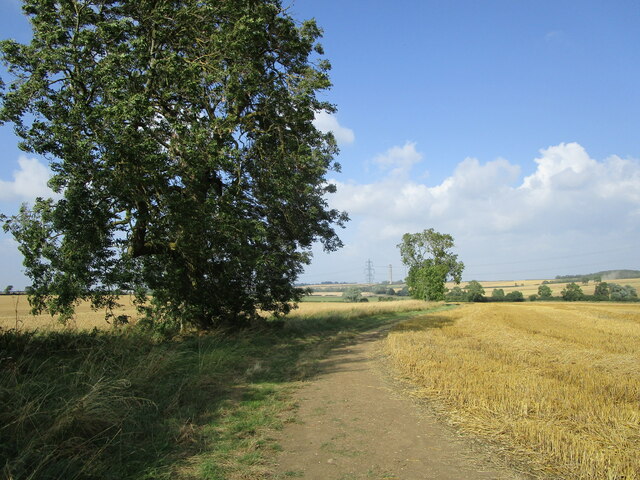
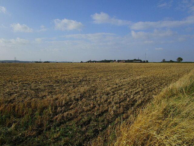
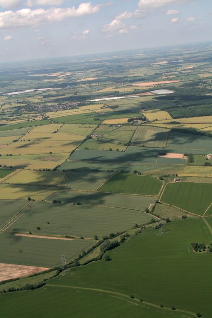
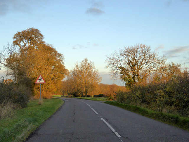
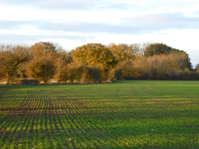
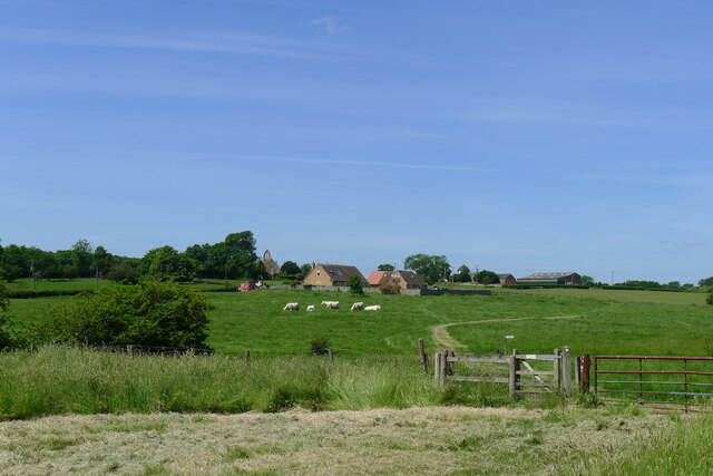
The village of Washingley is surrounded by beautiful countryside, characterized by rolling hills, lush green fields, and meandering streams. Its rural setting attracts nature enthusiasts and visitors seeking a tranquil retreat away from the hustle and bustle of city life.

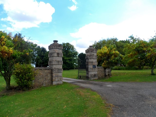
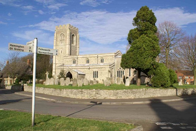
Historically, Washingley has roots dating back to the Anglo-Saxon period. The village is known for its charming thatched cottages and traditional architecture, providing a glimpse into its rich heritage. The St John the Baptist Church, a Grade II listed building, stands as a prominent landmark in the village and holds historical significance.

Amenities in Washingley are limited, with no shops or schools within the immediate vicinity. However, the village benefits from its proximity to Huntingdon, which offers a wide range of amenities including supermarkets, schools, and medical facilities.

The village is well-connected to the surrounding areas by road, with the A1 trunk road passing nearby, providing easy access to major towns and cities. The nearest railway station is Huntingdon, which offers regular services to London and other destinations.

In summary, Washingley is a picturesque village situated in the heart of Huntingdonshire. With its idyllic countryside, rich history, and peaceful atmosphere, it provides a charming escape for residents and visitors alike.

If you have any feedback on the listing, please let us know in the comments section below.

Washingley Images

Images are sourced within 2km of 52.487224/-0.3372731 or Grid Reference TL1389. Thanks to Geograph Open Source API. All images are credited.

Wheat field near Lutton
Bridleway near Lodge Farm
Wheat field and Ringmoor Spinney
Harrowed field and Ongutein Manor
Harvest time near to Lutton
Dead tree on a corner
Gates to Washingley Hall Farm A deserted medieval village and a mote and bailey castle are both marked on the map. Today, apart from this pair of gates, there isn't a lot happening here.
Gates to Washingley Hall Farm
A deserted medieval village and a mote and bailey castle are both marked on the map. Today, apart from this pair of gates, there isn't a lot happening here.
Billing Brook north of Lutton: aerial 2017
Beware of deer on Washingley Lane
A growing crop and a spinney Folksworth Spinney is across the field.
A growing crop and a spinney
Folksworth Spinney is across the field.
Washingley Lane at the end of Bullock Road
Bullock Road near Lutton
Redhill Road leading off Bullock Road Taking Cycle Route 12 to Caldecote
Redhill Road leading off Bullock Road
Taking Cycle Route 12 to Caldecote
Cycle Route 12 on Redhill Road
Kenny's Oak On Redhill Road, with a view down to Caldecote. The oak is marked on the OS 1887 map. But who was Kenny? An article in the Waterbeach Community Association's 'Beach News' of September 2012 suggests that the oak was "... reputed to have been used as a gallows by a young boy when he committed suicide." <span class="nowrap"><a title="http://www.waterbeach.org/Beach%20News/Publications/2012%20Spring.pdf" rel="nofollow ugc noopener" href="http://www.waterbeach.org/Beach%20News/Publications/2012%20Spring.pdf">Link</a><img style="margin-left:2px;" alt="External link" title="External link - shift click to open in new window" src="https://s1.geograph.org.uk/img/external.png" width="10" height="10"/></span>
Kenny's Oak
On Redhill Road, with a view down to Caldecote. The oak is marked on the OS 1887 map. But who was Kenny? An article in the Waterbeach Community Association's 'Beach News' of September 2012 suggests that the oak was "... reputed to have been used as a gallows by a young boy when he committed suicide." LinkExternal link
Entering Caldecote Caldecote: "a place name found in various counties, meaning ‘cold cottage(s)’, with reference to poor construction, exposed situation, or clay soil ..." [A Dictionary of British Place Names]. I don't know why clay soil would make somewhere cold, but this area's geology is dominated by the Oxford Clay mudstones.
Entering Caldecote
Caldecote: "a place name found in various counties, meaning ‘cold cottage(s)’, with reference to poor construction, exposed situation, or clay soil ..." [A Dictionary of British Place Names]. I don't know why clay soil would make somewhere cold, but this area's geology is dominated by the Oxford Clay mudstones.
Caldecote; area of deserted village Looking towards the former Church of St Mary Magdalene (bellcote on horizon); now a private house.
Caldecote; area of deserted village
Looking towards the former Church of St Mary Magdalene (bellcote on horizon); now a private house.
Sunset at Ongutein Manor The sun was setting behind the slightly sinister looking Ongutein Manor at the time this picture was taken. Ongutein Manor is marked as 'Ogerston' on old maps.  Ogerston was a property of the Knights Templar but there is nothing now left of it.
Sunset at Ongutein Manor
The sun was setting behind the slightly sinister looking Ongutein Manor at the time this picture was taken. Ongutein Manor is marked as 'Ogerston' on old maps. Ogerston was a property of the Knights Templar but there is nothing now left of it.
Show me another place!

Washingley is located at Grid Ref: TL1389 (Lat: 52.487224, Lng: -0.3372731)

Administrative County: Cambridgeshire

District: Huntingdonshire

Police Authority: Cambridgeshire

What 3 Words

///clouding.wage.connector. Near Stilton, Cambridgeshire

Related Wikis

Washingley

Washingley is a hamlet and former civil parish, now in the parish of Folksworth and Washingley, in Cambridgeshire, England. Washingley lies approximately...

Folksworth and Washingley

Folksworth and Washingley is a civil parish near Peterborough in Cambridgeshire, England, comprising the villages of Folksworth and Washingley.The parish...

Caldecote, Huntingdonshire

Caldecote is a village and former civil parish, now in the parish of Denton and Caldecote, in Cambridgeshire, England. Caldecote lies approximately 7 miles...

Denton and Caldecote

Denton and Caldecote – in Huntingdonshire (now part of Cambridgeshire), England – is a civil parish near Glatton south west of Yaxley. The parish was formed...

Morborne

Morborne is a village and civil parish in Cambridgeshire, England. Morborne lies approximately 5 miles (8 km) south-west of Peterborough, near Yaxley....

Lutton, Northamptonshire

Lutton is a village and civil parish in North Northamptonshire, England. The 2011 Census recorded its parish population as 186.The villages name means...

St Peter's Church, Lutton

St Peter's Church, Lutton is a Grade I Listed medieval church, which stands on the highest point in the village of Lutton, Northamptonshire, England. It...

Denton, Cambridgeshire

Denton is a hamlet and former civil parish, now in the parish of Denton and Caldecote, in Cambridgeshire, England. Denton lies approximately 11 miles...

Nearby Amenities

Located within 500m of 52.487224,-0.3372731
Barrier: stile
Foot: yes
Lat/Long: 52.4874833/-0.3316089
Washingley
Place: hamlet
Source Name: signpost near Folksworth
Wikidata: Q7971508
Lat/Long: 52.4875401/-0.3306131
Hall Farm
Landuse: farm
Note Retag: CS #48756035
Lat/Long: 52.4865875/-0.3320519
Power: pole
Lat/Long: 52.4856666/-0.3424242
Power: pole
Lat/Long: 52.4862284/-0.3412225
Power: pole
Lat/Long: 52.4878453/-0.3401362
Power: pole
Lat/Long: 52.4853154/-0.336153
Power: pole
Lat/Long: 52.4851324/-0.3437894
Power: pole
Lat/Long: 52.4855751/-0.3367672
Power: pole
Lat/Long: 52.4866432/-0.3383579
Power: pole
Lat/Long: 52.4871936/-0.3391384
Power: pole
Lat/Long: 52.4861157/-0.3375934
Power: pole
Lat/Long: 52.4866237/-0.3402891
Power: pole
Lat/Long: 52.4871218/-0.3391465
Power: pole
Lat/Long: 52.4891372/-0.3416704
Power: pole
Lat/Long: 52.4898722/-0.3425341
Washingley Village
Information: board
Operator: CCC
Tourism: information
Lat/Long: 52.4884739/-0.3340084
Washingley (abandoned village)
Historic: archaeological_site
Lat/Long: 52.4895894/-0.3342283
Washingley Castle
Information: board
Operator: CCC
Tourism: information
Lat/Long: 52.4872049/-0.3306288
Washingley Hall (site of)
Historic: archaeological_site
Lat/Long: 52.4877868/-0.3301205
The data included in this document is from www.openstreetmap.org. The data is made available under ODbL.

Have you been to Washingley?

Leave your review of Washingley below (or comments, questions and feedback).