Washington

Settlement in Sussex Horsham

England

Washington

Pressure Reducing Station The Southern Water site beside the South Downs Way near Washington.
Pressure Reducing Station Credit: Chris Thomas-Atkin

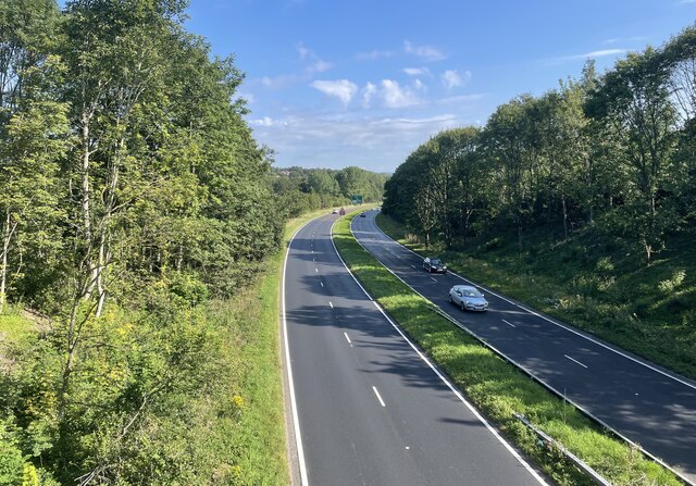
Washington is a small village located in the county of Sussex, England. Situated approximately 46 miles south of London, it lies within the district of Horsham. With a population of around 1,800 residents, Washington is a quintessential English village known for its picturesque scenery and historical significance.

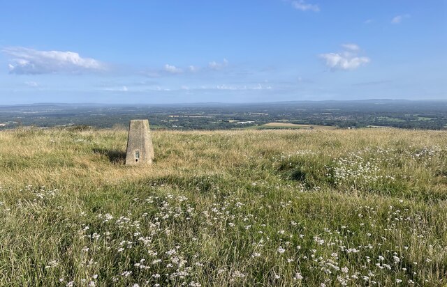
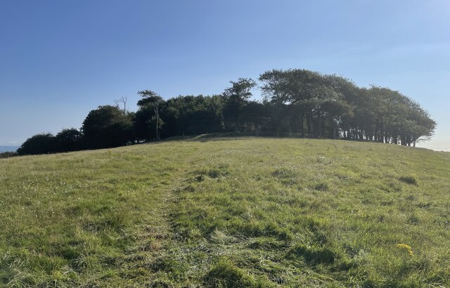
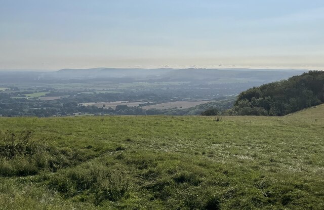
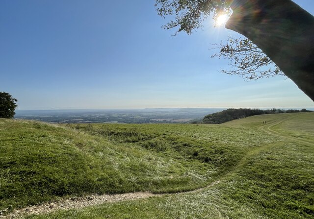
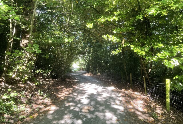
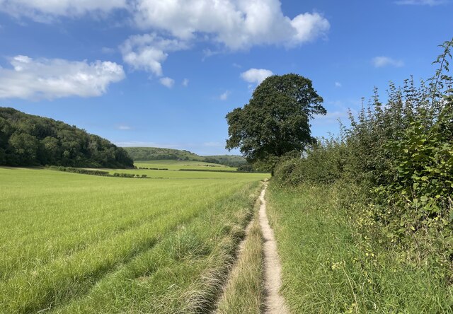
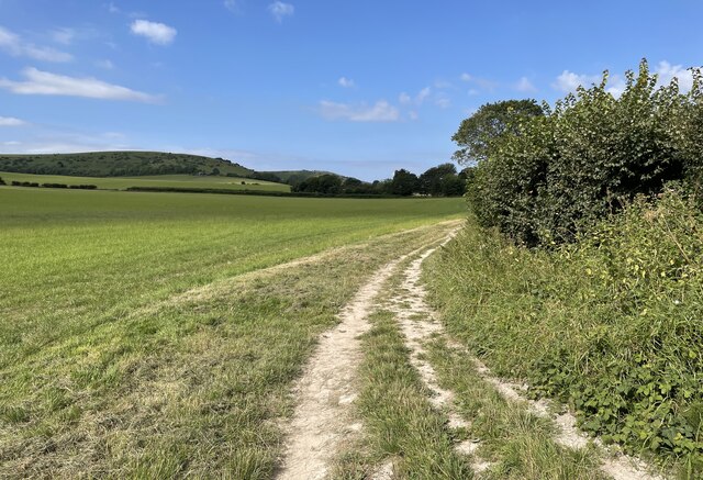
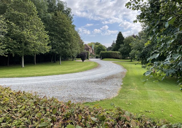
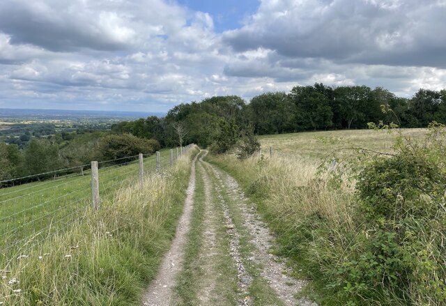
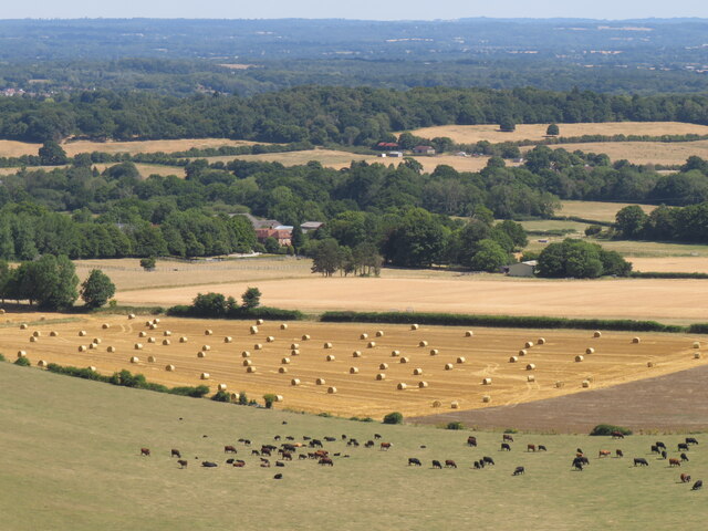
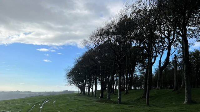
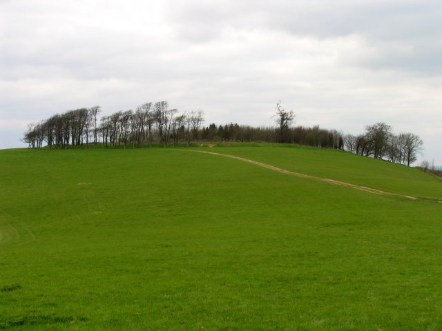
The village is nestled in the South Downs National Park, offering residents and visitors beautiful views of rolling hills and lush countryside. It is renowned for its charming thatched-roof cottages and traditional British architecture, which adds to its quaint and idyllic atmosphere.

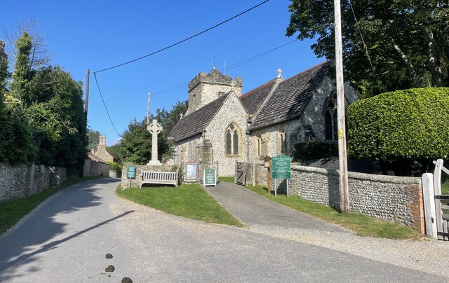
Washington boasts a rich history that dates back to the Roman period. The village's name originates from "Wassa", a Saxon chief, and "inga" meaning people. The historic St. Mary's Church, dating back to the 12th century, is a prominent landmark in Washington, attracting history enthusiasts and architectural admirers.

Despite its small size, Washington offers a range of amenities to its residents. The village has a local pub, The Frankland Arms, where locals and visitors can enjoy traditional British cuisine and ales. There is also a primary school, a village hall, and several recreational areas, including the popular Washington Village Green.

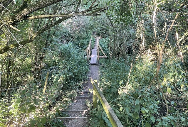
The surrounding area provides numerous opportunities for outdoor activities, such as hiking, cycling, and horseback riding. The nearby Chanctonbury Ring, an Iron Age hill fort, is a popular destination for walkers and nature enthusiasts.

Overall, Washington, Sussex is a charming village that combines natural beauty, historical significance, and a close-knit community, making it an attractive place to live or visit.

If you have any feedback on the listing, please let us know in the comments section below.
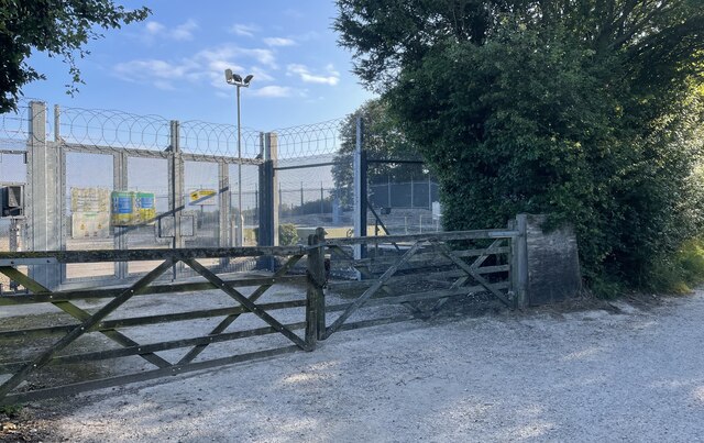
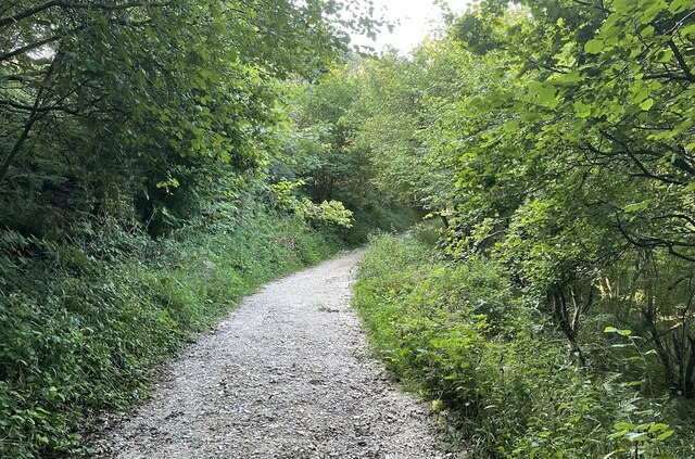
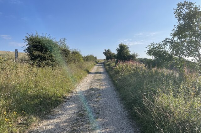
Washington Images

Images are sourced within 2km of 50.904214/-0.405293 or Grid Reference TQ1212. Thanks to Geograph Open Source API. All images are credited.

Pressure Reducing Station The Southern Water site beside the South Downs Way near Washington.
Pressure Reducing Station
The Southern Water site beside the South Downs Way near Washington.
South Downs Way Climbing towards Chanctonbury Ring on the South Downs Way.
South Downs Way
Climbing towards Chanctonbury Ring on the South Downs Way.
South Downs Way On the South Downs Way near Chanctonbury Hill.
South Downs Way
On the South Downs Way near Chanctonbury Hill.
Trig Point on Chanctonbury Hill The South Downs at this point provides extensive views across the Low Weald towards the distant North Downs and the Surrey Hills. The trig point marks a height of 238 metres above sea level.
Trig Point on Chanctonbury Hill
The South Downs at this point provides extensive views across the Low Weald towards the distant North Downs and the Surrey Hills. The trig point marks a height of 238 metres above sea level.
Approaching Chanctonbury Ring The site is a Scheduled Monument. It was used as a hill fort dating from the early Iron Age and was reused later on during the Roman period as a temple precinct. For more details see <span class="nowrap"><a title="https://historicengland.org.uk/listing/the-list/list-entry/1015114" rel="nofollow ugc noopener" href="https://historicengland.org.uk/listing/the-list/list-entry/1015114">Link</a><img style="margin-left:2px;" alt="External link" title="External link - shift click to open in new window" src="https://s1.geograph.org.uk/img/external.png" width="10" height="10"/></span>
Approaching Chanctonbury Ring
The site is a Scheduled Monument. It was used as a hill fort dating from the early Iron Age and was reused later on during the Roman period as a temple precinct. For more details see LinkExternal link
The view eastwards at Chanctonbury Ring Looking eastwards the South Downs dominate the skyline.
The view eastwards at Chanctonbury Ring
Looking eastwards the South Downs dominate the skyline.
Chanctonbury Ring The defensive remains of the Iron Age hill fort can be clearly seen.
Chanctonbury Ring
The defensive remains of the Iron Age hill fort can be clearly seen.
Footbridge near Washington Crossing a small unnamed stream public footpath number 2089_2 shortly meets Washington Bostal.
Footbridge near Washington
Crossing a small unnamed stream public footpath number 2089_2 shortly meets Washington Bostal.
The Parish Church of St Mary The church is a Grade II* (star) listed building. See <span class="nowrap"><a title="https://historicengland.org.uk/listing/the-list/list-entry/1027198" rel="nofollow ugc noopener" href="https://historicengland.org.uk/listing/the-list/list-entry/1027198">Link</a><img style="margin-left:2px;" alt="External link" title="External link - shift click to open in new window" src="https://s1.geograph.org.uk/img/external.png" width="10" height="10"/></span>
The Parish Church of St Mary
The church is a Grade II* (star) listed building. See LinkExternal link
The A24 Crossing the A24 on the bridge carrying public footpath number 2697.
The A24
Crossing the A24 on the bridge carrying public footpath number 2697.
Path near Rowdell The path descending from Rowdell is public footpath number 2697.
Path near Rowdell
The path descending from Rowdell is public footpath number 2697.
Path below the South Downs Heading west on path number 2665 towards Sullington.
Path below the South Downs
Heading west on path number 2665 towards Sullington.
Fields near Barns Farm Heading west towards Sullington on path number 2665.
Fields near Barns Farm
Heading west towards Sullington on path number 2665.
Barns Farm Barns Farm viewed from the passing public footpath.
Barns Farm
Barns Farm viewed from the passing public footpath.
Highden Hill On the South Downs Way approaching Biggen Holt.
Highden Hill
On the South Downs Way approaching Biggen Holt.
Harvest scene above Barns Farm View from bridleway climbing up from Sullington
Harvest scene above Barns Farm
View from bridleway climbing up from Sullington
Trees on the edge of Chanctonbury Ring The Great Storm of 1987 did a lot of damage to these trees and wrecked the cap-like shape of the clump. The Ring has recovered some of its former shape since then, however. This is a cross-grid shot. The camera was in the square to the south.
Trees on the edge of Chanctonbury Ring
The Great Storm of 1987 did a lot of damage to these trees and wrecked the cap-like shape of the clump. The Ring has recovered some of its former shape since then, however. This is a cross-grid shot. The camera was in the square to the south.
Chanctonbury Ring Fort: Off the South Downs Way This ring at the top of the hill, is situated in the  far south eastern corner of the grid square.
Chanctonbury Ring Fort: Off the South Downs Way
This ring at the top of the hill, is situated in the far south eastern corner of the grid square.
Show me another place!

Washington is located at Grid Ref: TQ1212 (Lat: 50.904214, Lng: -0.405293)

Administrative County: West Sussex

District: Horsham

Police Authority: Sussex

What 3 Words

///pines.brothers.screeches. Near Washington, West Sussex

Nearby Locations

Washington Washington

Related Wikis

Washington, West Sussex

Washington is a village and civil parish in the Horsham District of West Sussex, England. It is located five miles (eight kilometres) west of Steyning...

Rock Mill, Washington

Rock Mill is a Grade II listed smock mill at Washington, West Sussex, England, which has been converted to residential use. == History == Rock Mill was...

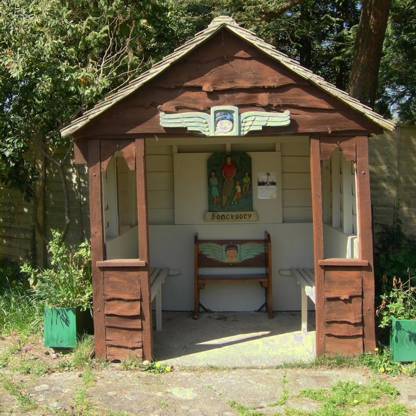
The Sanctuary (community)

The Sanctuary, near Storrington in West Sussex, England, was a utopian community which was founded in 1923 and lasted about a decade. == Founding and... ==

Windlesham House School

Windlesham House School is an independent boarding and day school for boys and girls aged 4 to 13 on the South Downs, in Pulborough, West Sussex, England...

Nearby Amenities

Located within 500m of 50.904214,-0.405293
Washington
Is In: West Sussex, England, UK
Place: village
Source: npe
Wikidata: Q1018557
Lat/Long: 50.9040266/-0.407885
Barrier: stile
Lat/Long: 50.9021115/-0.4065908
Barrier: stile
Lat/Long: 50.9044841/-0.4049295
Barrier: stile
Lat/Long: 50.9041618/-0.4047397
Barrier: stile
Lat/Long: 50.9039352/-0.4028139
Barrier: stile
Lat/Long: 50.9008359/-0.4058484
Bus Stop
Recreation Ground
Bus: yes
Naptan AtcoCode: 4400HR0463
Naptan Bearing: S
Naptan CommonName: Recreation Ground
Naptan Indicator: opp
Naptan Landmark: A283
Naptan NaptanCode: wsxawjwm
Naptan ShortCommonName: Washington Rec Grnd
Naptan Street: London Road
Naptan Verified: yes
Public Transport: platform
Source: naptan_import
Lat/Long: 50.9063919/-0.405156
Bus Stop
Recreation Ground
Bus: yes
Naptan AtcoCode: 4400HR0464
Naptan Bearing: N
Naptan CommonName: Recreation Ground
Naptan Indicator: adj
Naptan Landmark: A283
Naptan NaptanCode: wsxawjwp
Naptan ShortCommonName: Washington Rec Grnd
Naptan Street: London Road
Naptan Verified: yes
Public Transport: platform
Source: naptan_import
Lat/Long: 50.9063139/-0.4052994
Bus Stop
Stocks Mead
Bus: yes
Naptan AtcoCode: 4400HR1150
Naptan Bearing: S
Naptan CommonName: Stocks Mead
Naptan Indicator: opp
Naptan Landmark: Washington Bostal
Naptan NaptanCode: wsxgdwjp
Naptan Street: Washington Bostal
Naptan Verified: no
Public Transport: platform
Source: naptan_import
Lat/Long: 50.9020146/-0.4067768
Bus Stop
Stocks Mead
Bus: yes
Naptan AtcoCode: 4400HR1151
Naptan Bearing: N
Naptan CommonName: Stocks Mead
Naptan Indicator: adj
Naptan Landmark: Washington Bostal
Naptan NaptanCode: wsxgdwjt
Naptan Street: Washington Bostal
Naptan Verified: no
Public Transport: platform
Source: naptan_import
Lat/Long: 50.9023699/-0.4067784
Barrier: stile
Lat/Long: 50.9031757/-0.4043762
Post Box
Brand: Royal Mail
Brand Wikidata: Q638098
Operator: Royal Mail
Operator Wikidata: Q638098
Ref: RH20 124
Royal Cypher: EIIR
Royal Cypher Wikidata: Q33102113
Lat/Long: 50.9051138/-0.4050726
Post Box
Brand: Royal Mail
Brand Wikidata: Q638098
Operator: Royal Mail
Operator Wikidata: Q638098
Post Box Type: wall
Ref: RH20 80
Lat/Long: 50.9036031/-0.4074583
Barrier: stile
Lat/Long: 50.9035285/-0.4056828
Barrier: stile
Lat/Long: 50.905827/-0.4101043
Parking
Lat/Long: 50.9070166/-0.4054621
Telephone
Booth: K6
Covered: booth
Listed Status: Grade II
Lat/Long: 50.9038918/-0.4082049
Bench
Backrest: yes
Lat/Long: 50.9042607/-0.4099445
Barrier: stile
Lat/Long: 50.9042716/-0.4035432
Power: pole
Lat/Long: 50.9056519/-0.3987272
Power: pole
Lat/Long: 50.906326/-0.3990001
Power: pole
Lat/Long: 50.9003662/-0.407273
Power: pole
Lat/Long: 50.9036604/-0.401778
Power: pole
Lat/Long: 50.9036235/-0.4011672
Power: pole
Lat/Long: 50.9044349/-0.4004816
Power: pole
Lat/Long: 50.9035702/-0.4004816
Power: pole
Lat/Long: 50.9029494/-0.4005434
Power: pole
Lat/Long: 50.9026461/-0.4019275
Power: pole
Lat/Long: 50.9023941/-0.4031524
Power: pole
Lat/Long: 50.9020786/-0.4047022
Power: pole
Lat/Long: 50.9016401/-0.4067621
Power: pole
Lat/Long: 50.9051214/-0.3993386
Power: pole
Lat/Long: 50.9053432/-0.4004854
Power: pole
Lat/Long: 50.9053162/-0.401938
Power: pole
Lat/Long: 50.9053181/-0.4031276
Power: pole
Lat/Long: 50.9053124/-0.4041766
Barrier: stile
Lat/Long: 50.902993/-0.4025865
The data included in this document is from www.openstreetmap.org. The data is made available under ODbL.

Have you been to Washington?

Leave your review of Washington below (or comments, questions and feedback).