Warwick-on-Eden

Settlement in Cumberland Carlisle

England

Warwick-on-Eden

The Ninety Nine Steps This footpath leads from Wetheral Station down to the River Eden. The bridge carries the railway overhead. The signpost (not shown) calls them the Ninety Nine Steps, but I used them and I only counted 93!
The Ninety Nine Steps Credit: Danny P Robinson

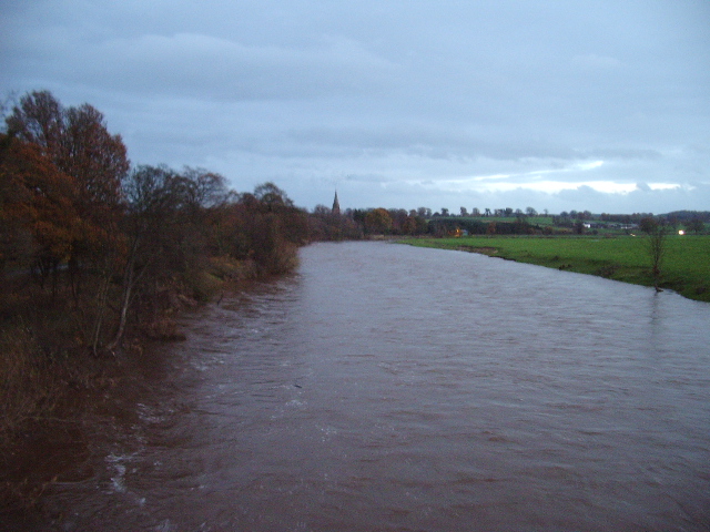
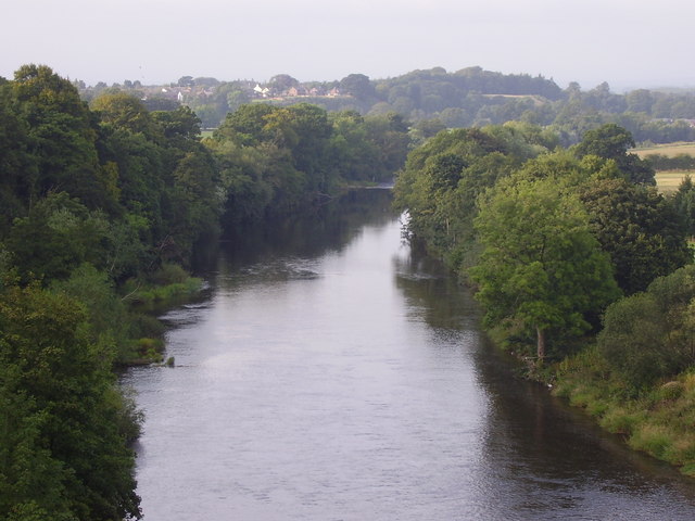
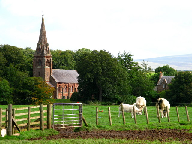
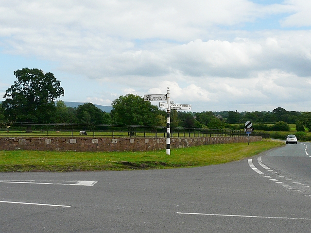
Warwick-on-Eden is a small village located in the county of Cumberland, England. Situated on the banks of the River Eden, it is surrounded by picturesque countryside and offers a charming rural setting. The village is approximately 4 miles east of the city of Carlisle, making it easily accessible for both residents and visitors.

Historically, Warwick-on-Eden has been a farming community, with agriculture playing a significant role in its economy. The village is known for its fertile land, which has supported a variety of crops and livestock over the years. Today, while farming remains an important aspect of the local economy, Warwick-on-Eden has also seen some residential development, attracting individuals seeking a peaceful and idyllic place to live.

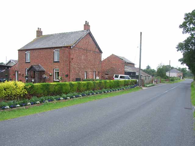
The village itself is characterized by its quaint houses, many of which showcase traditional Cumberland architecture. There are also a few small businesses, including a local pub and a village shop, providing essential services to the community. Warwick-on-Eden benefits from its proximity to the larger city of Carlisle, where residents can access a wider range of amenities, including schools, healthcare facilities, and shopping centers.

For outdoor enthusiasts, Warwick-on-Eden offers a range of recreational activities. The River Eden is a popular spot for fishing, and the surrounding countryside provides ample opportunities for walking, cycling, and exploring nature. The village also has a small park where locals and visitors can relax and enjoy the peaceful surroundings.

Overall, Warwick-on-Eden is a charming village that embraces its rural heritage while offering easy access to nearby amenities. Its idyllic setting, historical significance, and range of outdoor activities make it an attractive destination for those seeking a tranquil escape in the heart of Cumberland.

If you have any feedback on the listing, please let us know in the comments section below.

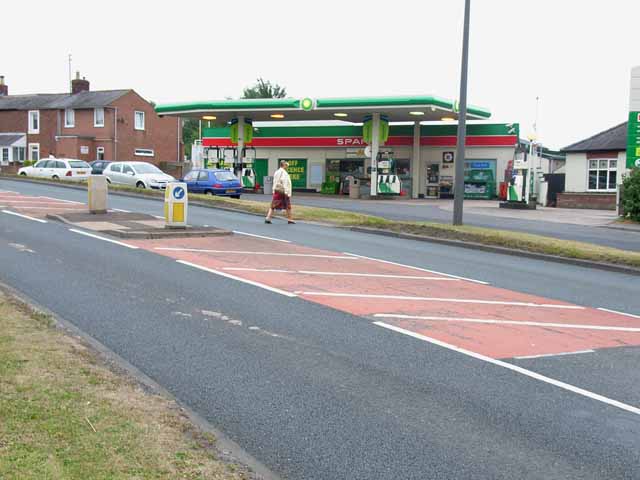
Warwick-on-Eden Images

Images are sourced within 2km of 54.90097/-2.8352787 or Grid Reference NY4656. Thanks to Geograph Open Source API. All images are credited.

The Ninety Nine Steps This footpath leads from Wetheral Station down to the River Eden. The bridge carries the railway overhead. The signpost (not shown) calls them the Ninety Nine Steps, but I used them and I only counted 93!
The Ninety Nine Steps
This footpath leads from Wetheral Station down to the River Eden. The bridge carries the railway overhead. The signpost (not shown) calls them the Ninety Nine Steps, but I used them and I only counted 93!
River Eden, Wetheral Photographer was standing on the footpath that runs along the railway bridge.
River Eden, Wetheral
Photographer was standing on the footpath that runs along the railway bridge.
Bridge across the River Eden This bridge carries the Carlisle to Newcastle line across the River Eden. The train is headed for Carlisle. Wetheral Station is just across the bridge.
Bridge across the River Eden
This bridge carries the Carlisle to Newcastle line across the River Eden. The train is headed for Carlisle. Wetheral Station is just across the bridge.
Livestock sheds at Holme Ends Farm, Newby East Not too sure what's being kept in these sheds. Chickens?
Livestock sheds at Holme Ends Farm, Newby East
Not too sure what's being kept in these sheds. Chickens?
A69, Warwick Bridge The village of Warwick Bridge is bisected by the very busy A69 Carlisle to Newcastle road
A69, Warwick Bridge
The village of Warwick Bridge is bisected by the very busy A69 Carlisle to Newcastle road
Spar shop and filling station, Warwick Bridge As is so often found now, the filling station on the busy A69 doubles up as the village shop.
Spar shop and filling station, Warwick Bridge
As is so often found now, the filling station on the busy A69 doubles up as the village shop.
Traffic lights, Corby Hill Where the road from Little Corby to Heads Nook crosses the busy A69 Carlisle to Newcastle road
Traffic lights, Corby Hill
Where the road from Little Corby to Heads Nook crosses the busy A69 Carlisle to Newcastle road
Little Corby The white house on the left is the Haywain public house
Little Corby
The white house on the left is the Haywain public house
River Irthing Looking upstream from the bridge at Newby East
River Irthing
Looking upstream from the bridge at Newby East
Applegarth Farm near Warwick Bridge Allengrove House in the distance
Applegarth Farm near Warwick Bridge
Allengrove House in the distance
Parkland at Corby Hill, Warwick Bridge
Warwick Bridge Carries the A69 Carlisle to Newcastle road over the River Eden, between Warwick Bridge and Warwick-on-Eden
Warwick Bridge
Carries the A69 Carlisle to Newcastle road over the River Eden, between Warwick Bridge and Warwick-on-Eden
Warwick Bridge Up-stream side of Warwick Bridge
Warwick Bridge
Up-stream side of Warwick Bridge
River Eden Looking down stream from Warwick Bridge, in the distance is Warwick Hall
River Eden
Looking down stream from Warwick Bridge, in the distance is Warwick Hall
River Eden Looking up stream from Warwick Bridge, the church in the distance is St Paul Church, Holme Eden
River Eden
Looking up stream from Warwick Bridge, the church in the distance is St Paul Church, Holme Eden
The Road to Myre Bank
The Road to Low Wood
River Eden from Railway Bridge at Wetheral
Show me another place!

Warwick-on-Eden is located at Grid Ref: NY4656 (Lat: 54.90097, Lng: -2.8352787)

Administrative County: Cumbria

District: Carlisle

Police Authority: Cumbria

What 3 Words

///major.defenders.tastings. Near Wetheral, Cumbria

Related Wikis

Warwick-on-Eden

Warwick-on-Eden is a small village and (as just Warwick) a former civil parish, now in the parish of Wetheral, in the Carlisle district of the county of...

Warwick Hall

Warwick Hall is a large country house located on the banks of the River Eden at Warwick-on-Eden in Cumbria, England, United Kingdom. == History == The...

Holme Eden Abbey

Holme Eden Abbey was an abbey in Cumbria, England. The current building (built 1833–37) is a Grade II* listed building. == History == It was designed in...

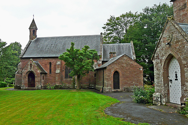
Our Lady and St Wilfrid's Church, Warwick Bridge

Our Lady and St Wilfrid's Church is a Roman Catholic church designed by Augustus Welby Northmore Pugin, completed in 1841. The church was designed for...

Warwick Bridge

Warwick Bridge is a village in the Cumberland area of the county of Cumbria, England. It forms part of a small urban area which includes the villages of...

Little Corby

Little Corby is a village in the county of Cumbria in the north of England. It is east of the city of Carlisle, alongside the River Eden and near to the...

Corby Hill

Corby Hill is a village in Cumbria, England. It is located 5.4 miles (8.7 km) by road east of the city centre of Carlisle. The Trout Beck stream passes...

Burnrigg

Burnrigg is a hamlet in Cumbria, England. It is located to the east of Carlisle. In 1887, The British Architect said "on a site particularly high and open...

Nearby Amenities

Located within 500m of 54.90097,-2.8352787
Crossing
Crossing: unmarked
Lat/Long: 54.9011387/-2.835777
Warwick-on-Eden
Place: village
Source: NPE
Wikidata: Q2973009
Lat/Long: 54.9025173/-2.8353127
Bus Stop
Tithebarn Hill
Naptan AtcoCode: 090033442850
Naptan Bearing: E
Naptan CommonName: Tithebarn Hill
Naptan Indicator: opp
Naptan Landmark: Warwick on Eden road end
Naptan NaptanCode: cumatjgj
Naptan Street: A69
Naptan Verified: no
Source: naptan_import
Lat/Long: 54.9011963/-2.8351961
Bus Stop
Warwick House
Naptan AtcoCode: 090033442872
Naptan Bearing: W
Naptan CommonName: Warwick House
Naptan Indicator: o/s
Naptan Landmark: Warwick House
Naptan NaptanCode: cumatjgp
Naptan Street: A69
Naptan Verified: no
Source: naptan_import
Lat/Long: 54.9010654/-2.8358655
Turning Circle
Lat/Long: 54.8995924/-2.838225
Turning Circle
Lat/Long: 54.9002844/-2.8384238
Post Box
Post Box Type: wall
Ref: CA4 12
Royal Cypher: EIIR
Royal Cypher Wikidata: Q33102113
Lat/Long: 54.9011108/-2.8351713
Warwick
Place: village
Lat/Long: 54.8995546/-2.8394208
Telephone
Booth: KX100
Covered: booth
Source: survey
Lat/Long: 54.9009228/-2.8353922
Parking
Source: survey
Lat/Long: 54.8999982/-2.8424313
Give Way
Direction: forward
Lat/Long: 54.9026939/-2.828498
Barrier: kissing_gate
Lat/Long: 54.8982543/-2.8384041
Street Lamp
Lat/Long: 54.9007211/-2.8368005
Stop
Direction: forward
Lat/Long: 54.9011612/-2.8352145
Traffic Calming: island
Lat/Long: 54.9011777/-2.835413
Power: pole
Lat/Long: 54.8968091/-2.8373087
Power: pole
Lat/Long: 54.8977264/-2.8377173
Power: pole
Lat/Long: 54.8981358/-2.8360781
Power: pole
Lat/Long: 54.8978417/-2.838872
The data included in this document is from www.openstreetmap.org. The data is made available under ODbL.

Have you been to Warwick-on-Eden?

Leave your review of Warwick-on-Eden below (or comments, questions and feedback).