Waltham

Settlement in Kent Canterbury

England

Waltham

Ansdore village Ansdore is a tiny farming community along this short dead end road. Behind this point is the private farm of Upper Ansdore which I did not venture into.
Ansdore village Credit: David Howard

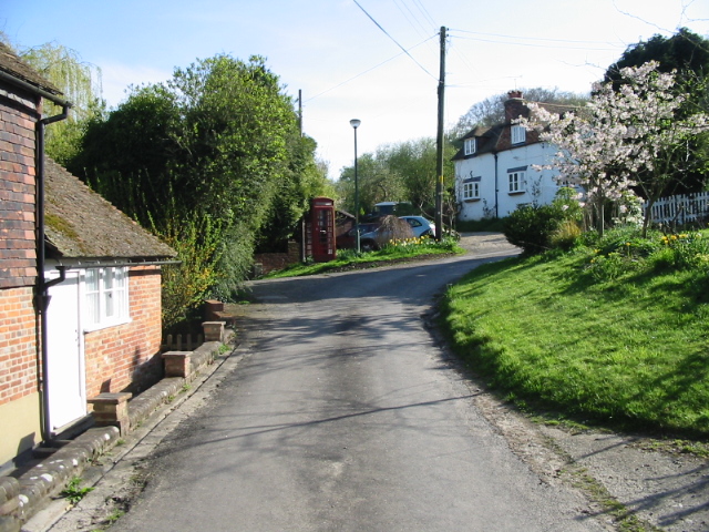
Waltham is a picturesque village located in the district of Gravesham, in the county of Kent, England. Situated approximately 30 miles southeast of London, Waltham offers a peaceful and rural setting amidst the bustling urban areas of the county.

The village is known for its historic charm, with several traditional Kentish-style houses lining its streets. Waltham also boasts a quaint parish church, St. Bartholomew's, which dates back to the 12th century and serves as a prominent landmark in the area. The church features stunning stained glass windows and a beautiful bell tower.

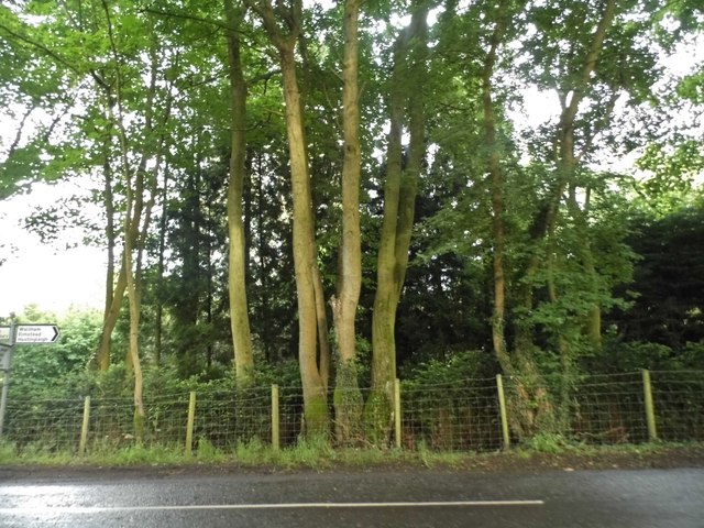
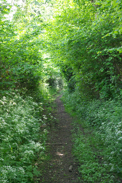
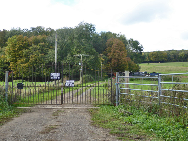
Surrounded by the scenic Kent countryside, Waltham offers a range of outdoor activities for nature enthusiasts. The nearby Shorne Woods Country Park provides ample opportunities for hiking, cycling, and picnicking. The park is home to diverse wildlife and boasts several well-maintained trails, making it a popular destination for locals and visitors alike.

Despite its tranquil setting, Waltham is conveniently located near major transportation routes. The village is easily accessible via the nearby A2 road, connecting it to the neighboring towns of Gravesend and Rochester, as well as the wider Kent region. Additionally, the nearby Gravesend railway station offers regular train services to London and other major cities, making Waltham an ideal place for commuters.

Waltham combines the charm of a traditional English village with convenient access to modern amenities, making it an attractive location for those seeking a peaceful and well-connected place to live or visit in Kent.

If you have any feedback on the listing, please let us know in the comments section below.

Waltham Images

Images are sourced within 2km of 51.198003/1.0164817 or Grid Reference TR1048. Thanks to Geograph Open Source API. All images are credited.

Ansdore village Ansdore is a tiny farming community along this short dead end road. Behind this point is the private farm of Upper Ansdore which I did not venture into.
Ansdore village
Ansdore is a tiny farming community along this short dead end road. Behind this point is the private farm of Upper Ansdore which I did not venture into.
The road to Ansdore Off Duckpit Lane, this short track leads to the small collection of farms in Ansdore.
The road to Ansdore
Off Duckpit Lane, this short track leads to the small collection of farms in Ansdore.
Field in Ansdore
Field in Ansdore
The entrance to Springfield Farm, Ansdore
Duckpit Road, Ansdore
Fields by Duckpit Road
Richdore Road, Sole Street Like Minster, there are also two Sole Streets in Kent. This one is barely discernible and unlike the other one has no station.
Richdore Road, Sole Street
Like Minster, there are also two Sole Streets in Kent. This one is barely discernible and unlike the other one has no station.
Woodland by Waltham Road
Field near Frogs Hall A public footpath from the foreground gate goes to and through Cox Hill Wood at the far side of the field.
Field near Frogs Hall
A public footpath from the foreground gate goes to and through Cox Hill Wood at the far side of the field.
Field between Frogs Hall and Yew Tree Farm Looking towards Yew Tree Farm.
Field between Frogs Hall and Yew Tree Farm
Looking towards Yew Tree Farm.
Bridleway running south from Whiteacre Lane
Whiteacre Lane Heading nowhere in particular, but serving rural premises such as Whiteacre Farm.
Whiteacre Lane
Heading nowhere in particular, but serving rural premises such as Whiteacre Farm.
Field by Anvil Green Road
Road to Grandacre Farm
Gate and track, Dene Meadows Apart from the impressive gates, the rest of the establishment looks rather impermanent.
Gate and track, Dene Meadows
Apart from the impressive gates, the rest of the establishment looks rather impermanent.
Duckpit Road Heading north.
Duckpit Road
Heading north.
Ruin opposite Yockletts Farm Presumably once some sort of farm building. Maps indicate it has a benchmark on the side facing the road.
Ruin opposite Yockletts Farm
Presumably once some sort of farm building. Maps indicate it has a benchmark on the side facing the road.
Show me another place!

Waltham is located at Grid Ref: TR1048 (Lat: 51.198003, Lng: 1.0164817)

Administrative County: Kent

District: Canterbury

Police Authority: Kent

What 3 Words

///anchovies.blotchy.yoga. Near Wye, Kent

Related Wikis

Waltham, Kent

Waltham is a village and civil parish 7 miles (11 km) southwest of Canterbury in Kent, England. == History == The village was once associated with the...

Anvil Green

Anvil Green is a small settlement located near Waltham in Kent, England, about nine miles (14.4 km) north east of Ashford. == External links == Media...

Yockletts Bank

Yockletts Bank is a 25.4-hectare (63-acre) biological Site of Special Scientific Interest west of Stelling Minnis in Kent. It is managed by KWT and is...

Denge Wood

Denge Wood is a wood located 8 miles southwest of Canterbury in Kent, England. The wood is owned by the Forestry Commission and the Woodland Trust. Part...

Shrub's Wood Long Barrow

Shrub's Wood Long Barrow is an unchambered long barrow located near to the village of Elmsted in the south-eastern English county of Kent. It was probably...

Park Gate Down

Park Gate Down or Parkgate Down is a 7-hectare (17-acre) biological Site of Special Scientific Interest south-east of Stelling Minnis in Kent. It is also...

Crundale, Kent

Crundale is a mostly rural village and civil parish in the Ashford District of Kent in southeast England. The village covers a section of one of the dual...

Stour Valley Walk

The Stour Valley Walk is a recreational walking route that follows the River Stour, through the Low Weald and Kent Downs, from its source at Lenham to...

Nearby Amenities

Located within 500m of 51.198003,1.0164817
Waltham
Is In: Kent, England, UK
Place: village
Source: survey
Wikidata: Q2166079
Lat/Long: 51.1981586/1.0165175
Post Box
Post Box Type: lamp
Postal Code: CT4
Ref: CT4 121
Source: survey
Lat/Long: 51.1979635/1.0167295
Townhall
Waltham Village Hall
Addr City: Canterbury
Addr Postcode: CT4 5SH
Addr Street: Richdore Road
Addr Suburb: Waltham
Not Addr Postcode: terbury
Note: FHRS postcode incorrect as of August 2017
Source Addr Postcode: FHRS Open Data
Lat/Long: 51.1981101/1.016146
Telephone
Booth: K6
Covered: booth
Man Made: telephone_box
Lat/Long: 51.197953/1.0160486
Bus Stop
Village Hall
Flag: no
Naptan AtcoCode: 2400A043140A
Naptan Bearing: NE
Naptan BusStopType: CUS
Naptan CommonName: Village Hall
Naptan Indicator: o/s
Naptan Landmark: Richdore Rd
Naptan NaptanCode: kntdtmwd
Naptan Street: Church Rd
Naptan Verified: no
Public Transport: platform
Source: naptan_import
Lat/Long: 51.1979347/1.016512
Generator Method: photovoltaic
Generator Orientation: 162
Generator Output Electricity: yes
Generator Source: solar
Generator Type: solar_photovoltaic_panel
Location: roof
Power: generator
Lat/Long: 51.1976762/1.0155731
Generator Method: photovoltaic
Generator Orientation: 112
Generator Output Electricity: yes
Generator Source: solar
Generator Type: solar_photovoltaic_panel
Location: roof
Power: generator
Lat/Long: 51.1991561/1.0179707
Generator Method: photovoltaic
Generator Output Electricity: yes
Generator Source: solar
Generator Type: solar_photovoltaic_panel
Location: roof
Power: generator
Lat/Long: 51.197171/1.0193858
Generator Method: photovoltaic
Generator Output Electricity: yes
Generator Source: solar
Generator Type: solar_photovoltaic_panel
Location: roof
Power: generator
Lat/Long: 51.1971897/1.0193198
Generator Method: photovoltaic
Generator Output Electricity: yes
Generator Source: solar
Generator Type: solar_photovoltaic_panel
Location: roof
Power: generator
Lat/Long: 51.197468/1.0176717
Generator Method: photovoltaic
Generator Output Electricity: yes
Generator Source: solar
Generator Type: solar_photovoltaic_panel
Location: roof
Power: generator
Lat/Long: 51.1979519/1.0150867
Barrier: stile
Lat/Long: 51.197725/1.0166212
Barrier: stile
Lat/Long: 51.1957582/1.0134161
Barrier: stile
Lat/Long: 51.1967979/1.0118053
Give Way
Direction: forward
Lat/Long: 51.1975305/1.0132172
Give Way
Direction: backward
Lat/Long: 51.1973783/1.0125381
The data included in this document is from www.openstreetmap.org. The data is made available under ODbL.

Have you been to Waltham?

Leave your review of Waltham below (or comments, questions and feedback).