Copington's Wood
Wood, Forest in Kent Canterbury
England
Copington's Wood

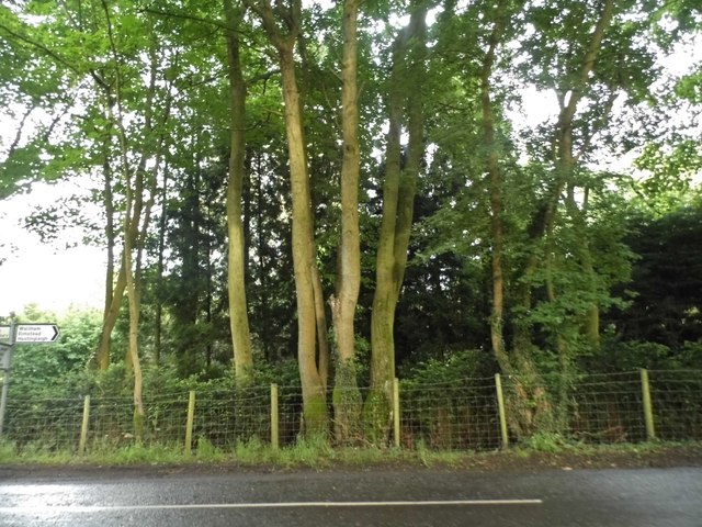
Copington's Wood is a beautiful forest located in the county of Kent, England. Covering an area of approximately 100 hectares, it is renowned for its diverse range of flora and fauna, making it a popular destination for nature enthusiasts and hikers alike.
The woodland is characterized by a mixture of broadleaf and coniferous trees, creating a stunning and varied landscape. Oak, beech, and birch trees dominate the area, providing a rich habitat for a wide array of wildlife. Visitors to Copington's Wood may encounter species such as deer, foxes, badgers, and an abundance of birdlife including woodpeckers, owls, and various songbirds.
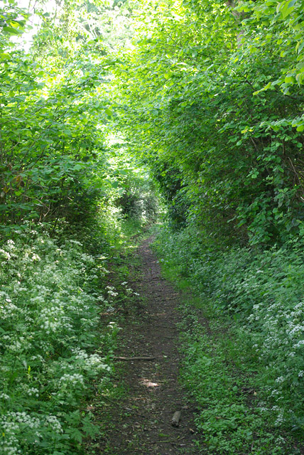
The forest is crisscrossed by a network of well-maintained walking paths and trails, allowing visitors to explore the wood at their own pace. These paths lead to picturesque clearings and viewpoints, providing breathtaking panoramic views of the surrounding countryside.
Copington's Wood also boasts a diverse range of plant life, with an impressive display of bluebells carpeting the forest floor in the spring. In addition to this, visitors may also spot rare orchids, ferns, and various wildflowers throughout the year.
The woodland is managed by the local council, ensuring that it is well-preserved and accessible to the public. Facilities such as picnic areas and information boards can be found at various points within the forest, enhancing the visitor experience and providing educational resources.
Overall, Copington's Wood is a tranquil and enchanting destination, offering a serene escape from the hustle and bustle of everyday life. Its natural beauty and biodiversity make it a true gem within the Kent countryside.
If you have any feedback on the listing, please let us know in the comments section below.
Copington's Wood Images
Images are sourced within 2km of 51.194033/1.0092939 or Grid Reference TR1048. Thanks to Geograph Open Source API. All images are credited.


Copington's Wood is located at Grid Ref: TR1048 (Lat: 51.194033, Lng: 1.0092939)
Administrative County: Kent
District: Canterbury
Police Authority: Kent
What 3 Words
///complains.residual.chitchat. Near Wye, Kent
Nearby Locations
Related Wikis

Waltham, Kent
Waltham is a village and civil parish 7 miles (11 km) southwest of Canterbury in Kent, England. == History == The village was once associated with the...

Anvil Green
Anvil Green is a small settlement located near Waltham in Kent, England, about nine miles (14.4 km) north east of Ashford. == External links == Media...

Yockletts Bank
Yockletts Bank is a 25.4-hectare (63-acre) biological Site of Special Scientific Interest west of Stelling Minnis in Kent. It is managed by KWT and is...

Shrub's Wood Long Barrow
Shrub's Wood Long Barrow is an unchambered long barrow located near to the village of Elmsted in the south-eastern English county of Kent. It was probably...

Park Gate Down
Park Gate Down or Parkgate Down is a 7-hectare (17-acre) biological Site of Special Scientific Interest south-east of Stelling Minnis in Kent. It is also...
Crundale, Kent
Crundale is a mostly rural village and civil parish in the Ashford District of Kent in southeast England. The village covers a section of one of the dual...

Stour Valley Walk
The Stour Valley Walk is a recreational walking route that follows the River Stour, through the Low Weald and Kent Downs, from its source at Lenham to...

Spong Wood
Spong Wood is a 18-hectare (44-acre) nature reserve west of Stelling Minnis in Kent. It is managed by Kent Wildlife Trust.Common trees in this coppiced...
Nearby Amenities
Located within 500m of 51.194033,1.0092939Have you been to Copington's Wood?
Leave your review of Copington's Wood below (or comments, questions and feedback).